Badlands National Park, SD
Day 2

Just as day 1 was dominated by Route 80, day 2 was all about Route 90.
A 4:30am alarm, for the second day in a row, with hopes of being on the road by 5-5:30 was tough, but we did it. Unlike the first 12 hour drive which felt like 6, the second day’s 13 hour drive through Indiana, Wisconsin, Minnesota and part of South Dakota certainly felt like 13 hours. There was a bit of excitement though.
Through Wisconsin we decided to take a “detour” through the “scenic route” where we wandered about through towns with more registered tractors than cars and more cows than people. Finally, after watching nothing but corn stalks go by through the window for about an hour we were back truckin’ on the hi-way towards the Badlands.
But after being back on the hi-way for a while John, who was driving at the time, decided it would be a good idea to not look at the gas gauge for a couple hours and when Tommy interjected, “Do we need gas soon?” everyone was informed that the you’re-almost-running-on-empty gas light was on. We scrambled to get the GPS and discovered that the nearest station was just over 13 miles away.
We pulled off the hi-way into another cornfield disguised as a town and searched to find the gas station. We stumbled upon an old building with a single gas pump in front that looked like it was built by Henry Ford himself. It took us a while to figure out how to use the thing and it seemed like we had been their only business in a while, especially because it looked like about 60 people lived in the town.
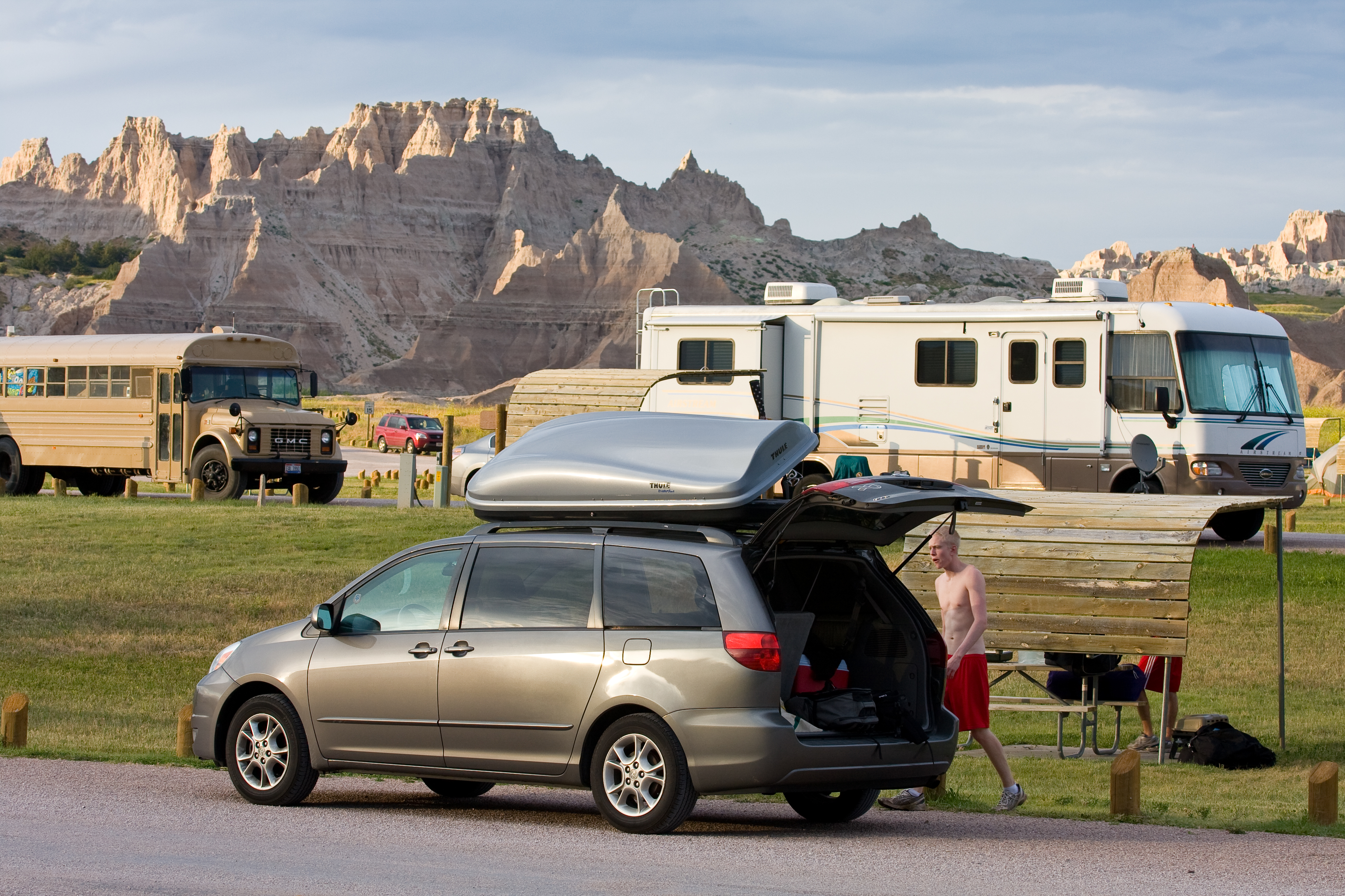
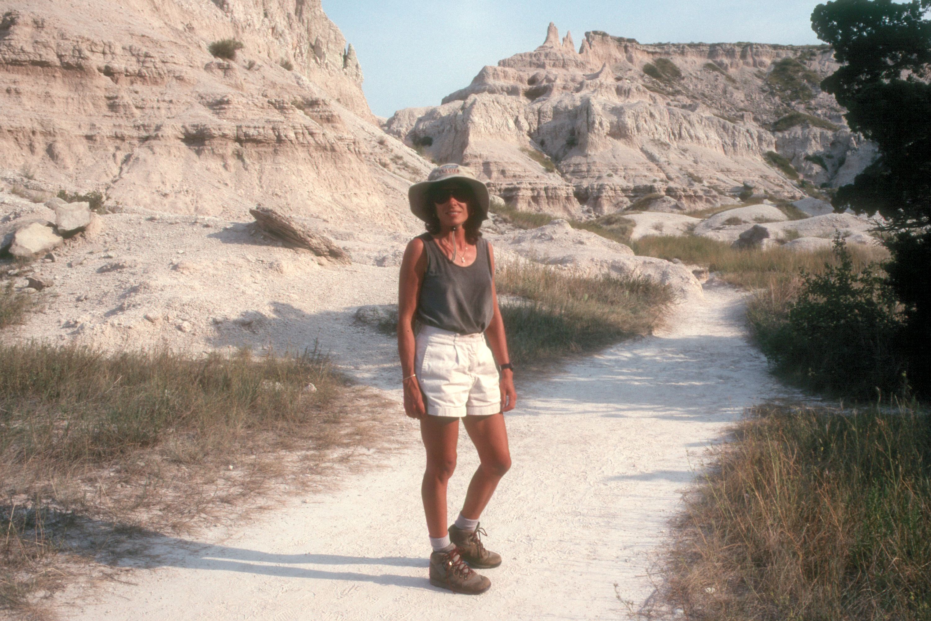
We arrived at the Badlands, a little late, to a severe thunderstorm warning. So we speedily set up camp and cooked some dinner. But much to our luck it didn’t rain until really late at night and we were able to enjoy a nice evening.
Day 3
We slept in a little bit on Day 3, which basically means we get up as the sun rises, not before it. We packed up and took an amazing 45 minute drive through the middle of the Badlands to our campsite for the next night, which was further into the Park.
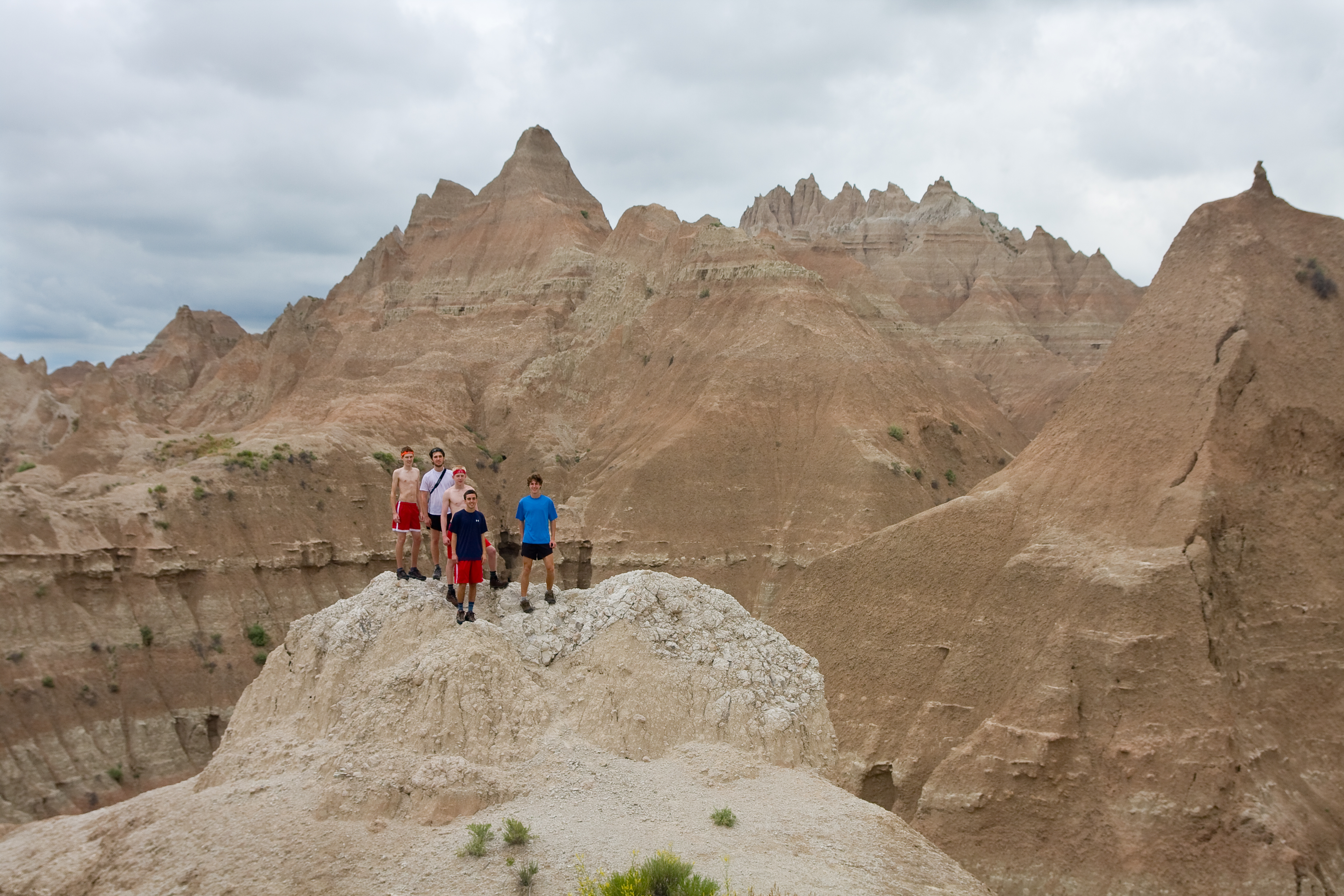
After driving through all the sandstone mountains, along with a few stops for pictures and short climbs, arriving at our prospective campsite for that night, Cedar Park, which was way past the “stereotypical” Badlands Mountains and surrounded by grassy fields as far as one could see, was a bit disappointing.
We looked at a map of the Park for a while and decided to head back a little bit into a spot where we could camp pretty much anywhere that wasn’t visible from a road. But as it started to rain on the drive to the new site, we decided to put hiking on hold for a little bit, and instead drove to the infamous tourist trap: Wall Drug. And that was fun for about five minutes. There are only so many Cowboy hat and leather jacket stores you can go into.
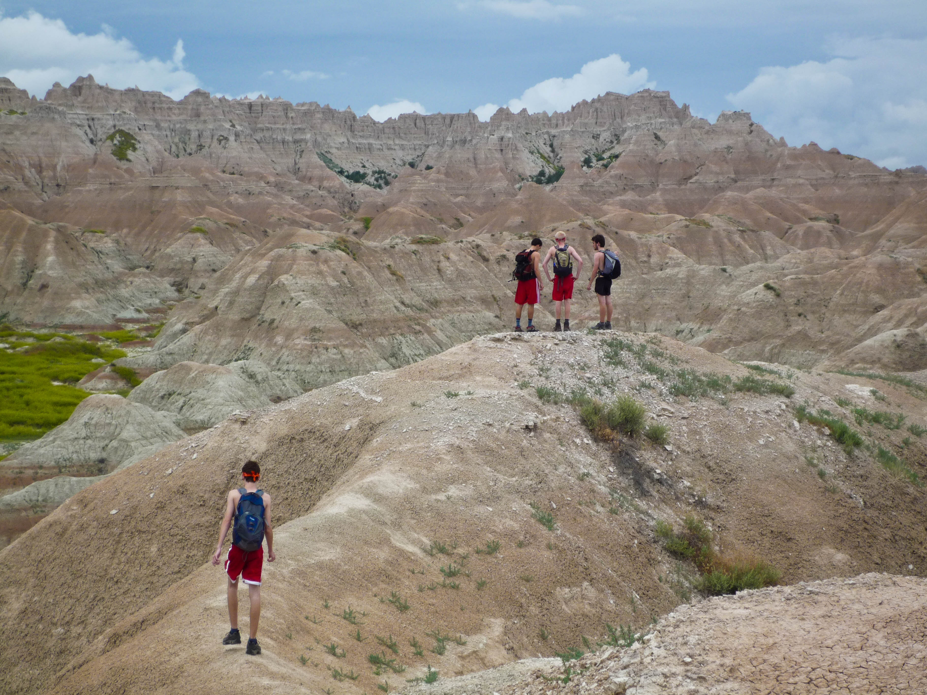
So we headed back to the new campsite and the rain stopped so we set off into the Badlands. The hiking was great. Unlike anything I have ever seen before. We climbed a bunch of mountains and didn’t really see another person the rest of the day, which was nice.
We headed back to the car to set up camp, and when we finished it started to rain. So instead of standing in a monsoon cooking a meal of Ramen noodles and pepperoni, we decided to leave the site and drive back towards Wall Drug and find somewhere to eat dinner. After driving around and passing up a few chain restaurant- looking places, we saw a giant sign that simply said “Restaurant” and decided that that was the place to eat so we could enjoy some “local flavor.”
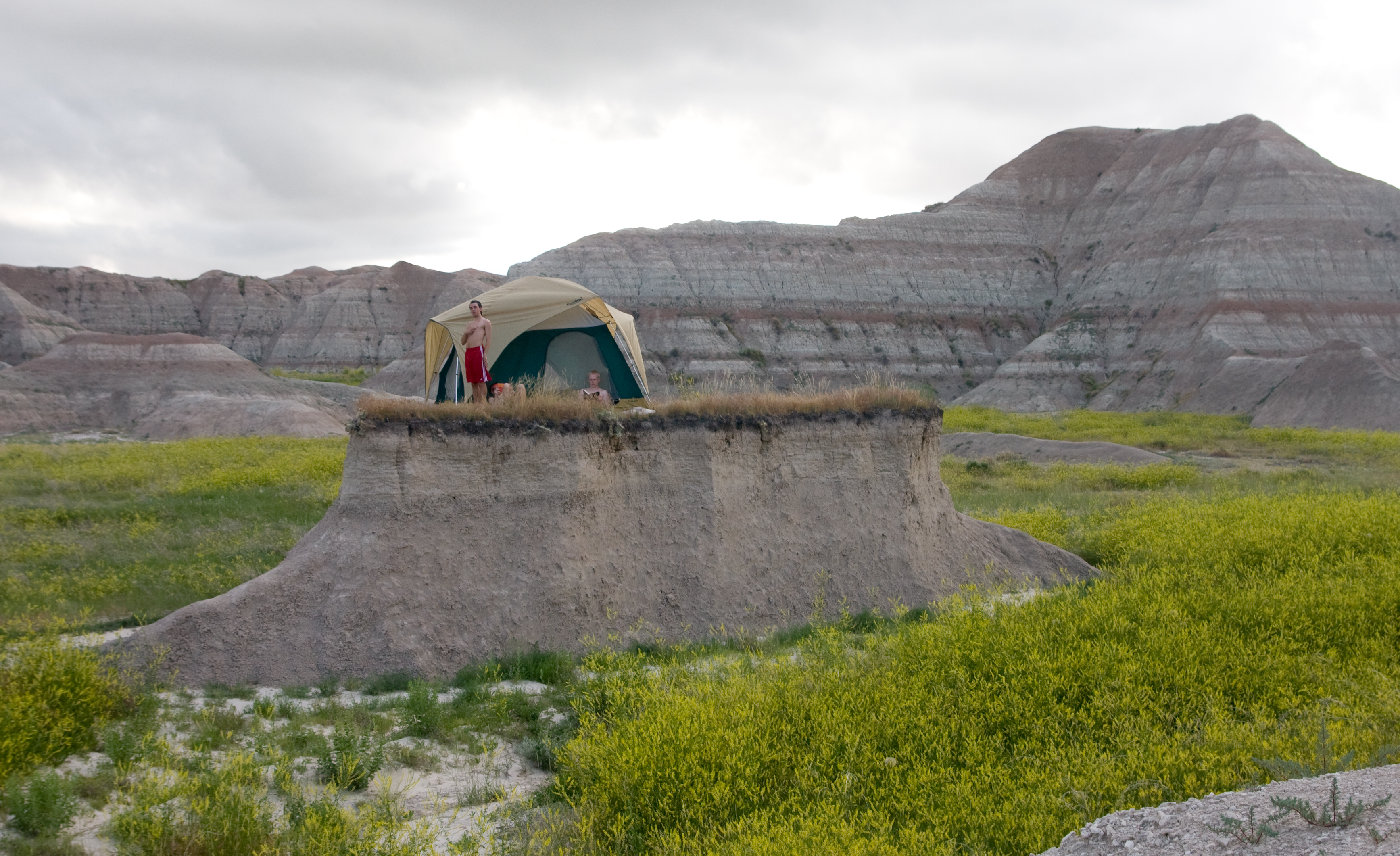
Dinner was good but when we got back to the tent we discovered that the monsoon blew it into a little ball (we have no stakes) so that the whole outside was soaked and the inside was just, a little wet. And as dry as the Badlands are during the day, rain instantly turns them into one giant slippery mud pit. So we had to fix our mud ball of a tent while trying to keep ourselves as clean and dry as possible so we could get some sleep. It was a great night!
- Jake

This barren yet beautiful landscape began forming more than 70 million years ago when the climate here was much warmer and wetter, and the Great Plains were covered by a shallow, inland sea. Over time, the land was pushed up, the sea receded, and the black mud of the sea floor hardened into shale, preserving the fossils of animals now long extinct. The area became a flood plain, receiving sediment deposits every time the rivers overflowed. Some of the sediment was mixed with volcanic ash, which together formed clay stone, the main material that makes up the Badlands buttes. Around half a million years ago, wind and water began cutting through the softer layers of sedimentary rock, carving buttes, gullies, and sawtoothed ridges out of the flat flood plains.
The result is the eerie moonscape you see today--jagged sawtoothed ridges and oddly-shaped spires, with their exposed ancient rock layers painted in shades of sand, gold, pink, and red. The erosion has also exposed the rich fossil beds from the ancient sea floor, drawing scientists from around the world to study the preserved remains of extinct animals, such as miniature camels and saber-toothed cats.
This erosion still continues today, with wind and water washing away an average of one inch of sediment from the buttes each year. At this rate, they will be completely gone in another half a million years.
An excellent way to see the beauty of the Badlands is to drive along the 32-mile Badlands Loop Road that crosses the North Unit of the park, stopping at the numerous scenic overlooks along the way. However, to truly experience the badlands, you have to get out of your car and take one of the hikes into The Wall. There are three excellent hikes that start from the Windows Overlook parking lot.
The ¾ mile, fairly strenuous Door Trail passes through a break in The Wall called "The Door" into a very rugged, eroded section of the badland that looks more like the surface of the moon than any place on Earth.
The ¼ mile easy Window Trail leads to a spectacular view of a deeply eroded canyon through an opening called "The Window."
The 1½ mile, fairly strenuous Notch Trail is not recommended for those with a fear of heights, as it requires you to climb a steep, shaky ladder and then climb along the side of a steep gully to a break in the wall called "The Notch" where there is a commanding view of the Cliff Shelf area and the White River Valley below.
- Lolo