Off Roading Activities
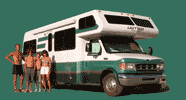
Showing 61 off roading activities logged during our motorhome cross-country adventures.
Deer Creek., Saint Johns
12.2-mile, intermediate level off-road trail with stunning scenery, historic buildings, and lots of jeeping excitement. Great chance of viewing mountain goats. Beginning in the town of Montezuma, the trail climbs steeply to an elevation of 12,500 feet.
Keystone Gulch
7.6 -mile (one way) relatively easy trail that follows a gulch along the west side of Keystone Ski Area, past beaver ponds, and up to a photogenic mine above the ski area
Cape Poge Wildlife Refuge
Seven miles of beach from Wasque Point on the south, past the Cape Poge Lighthouse, to Cape Poge Gut. An annual over-sand vehicle permit is required, which at the time of this writing was $80 for TTOR members and $200 for non-member, non-island residents
Fonts Point
7.8-mile (RT) drive on a relatively easy, but very sandy road, with a big reward at the end – spectacular view of the Borrego Badlands, the Salton Sea, and the Fish Creek Mountains in the distance
Fish Creek Wash
25-mile (RT) drive on a 4WD sandy road to Sandstone Canyon. Interesting stops along the way include: the anticlines on the canyon walls, the short hike to the Split Mountain Wind Caves, Layer Cake Rock, and Sandstone Canyon.
17 Palms Oasis
7.6-mile (RT) drive on a good dirt road to a beautiful palm oasis, which stood in stark contrast to the stark and barren desert around it. Besides being a source of water for inhabitants and travelers past, this particular oasis is also very important to the wildlife in Anza-Borrego, because it is the only year-round watering hole for many miles.
Pinyon /Nolina Canyon
Short drive along a manageable wash off of Route 78.
Oriflamme Canyon
Aborted 4WD trip into a canyon off of S2 near Blair Valley. Large rock and steep ascents caused us to wisely turn back after about 2 miles of risking the bottom of our Subaru.
Geology Tour Road
18-mile dirt road through some of the park’s most distinctive geological formations. There are 16 stops along the way, so allow approximately 2 hours for the round trip. RVs are not allowed, but two-wheel vehicles may go as far as Squaw Tank, stop #9. After that point, only 4-wheel drive vehicles are advised.
Covington Flats to Eureka Peak
25-mile dirt road past some of the park's largest and oldest Joshua Trees to a tremendous view atop 5,518-foot Eureka Peak.
Eureka Dunes
40-mile drive, the first 30 of which are on the well-maintained Death Valley / Big Pine Road and the last 10 along the sandy South Eureka Road. It ends at the Eureka Dunes primitive campground at the base of the dunes.
Saline Valley Road
Rough 40-mile drive from the Big Pine / Death Valley Road to the Saline Valley Warms Springs. 32.7 of the miles are along the Saline Valley Road and the last 7.3 are on the rougher Warm Springs Road. The end destination is a palm oasis paradise.
Masonic Road to Bodie
Rather than taking 395 south to the the paved 270 into Bodie, we headed north and turned onto Masonic Road. From here, we spent the next 32 miles driving up and down the rolling Bodie Hills, past old ghost towns and abandoned mines, with sweeping views of the Sierra and the Sweetwater Mountains all along the way. It was breathtaking.
Cottonwood Canyon Road
11-mile drive along a 4WD road from Bodie to the northern shore of Mono Lake
Coyote Flat
Intermediate 15-mile (each way) 4WD trail that climbs out of the Owens Valley, at about 4,400 feet, through a series of switchbacks to Coyote Flat, a gorgeous plateau at 10,000 feet, with grazing deer and awesome views of the Palisade Glacier. Since the road is quite steep and rough, our speed averaged about 8 mph.
Racetrack Road
27 miles from just past Ubehebe Crater along a rough dirt road to the remote and famous Death Valley Racetrack, where rocks mysteriously move across the dry lakebed on their own accord.
Racetrack to Saline Valley Warm Springs
70-mile 4WD from the Racetrack to Hidden Valley Road, up over Hunter Mountain and down to the Saline Valley Road, and then up to the springs. We also took a side trip to explore the old, abandoned Goldbelt mining camp.
Saline Valley Road
Rough 40-mile drive from the Saline Valley Warm springs back out to the paved Big Pine / Death Valley Road
Mojave Road
116-mile drive (east to west) across the Mojave National Preserve on bumpy and rocky dirt roads. There is much history to explore along the way. The Mojave Road was originally an Indian trade route, as the locations of watering holes situated about every 20 to 30 miles made for safe passage through this barren and harsh landscape. Later it served as a supply and U.S. route in the 1860s and 1870s.
Crowley Lake Columns
18-miles each way from the Hot Creek Geothermal Area along some asphalt and dirt roads towards the parking lot for the Crowley Lake Columns. Had to stop before a very steep hill with big gullies to hike the remaining 1.7 miles.
San Quintin
Along the hard sand beach by the Hotel Santa Maria San Quintin
Racetrack Road
27 miles from just past Ubehebe Crater along a rough dirt road to the remote and famous Death Valley Racetrack, where rocks mysteriously move across the dry lakebed on their own accord.
Narrows and Papoose Flat
25.5-mile, 3.5 hour drive along a beautiful 4WD dirt road loop (rated Easy) through narrow canyons and up to Papoose Flat, a unique and otherworldly landscape with granite spires somewhat randomly strewn throughout the desert scrub.
Oceano Dunes State Vehicle Recreation Area
Along the 5.5 mile stretch of the southern end of Pismo Beach that allows off-highway dune buggies to play in the huge sand dune complex.
Coyote and Sheep Canyon
28-mile round trip through Coyote and Sheep Canyons along a rough 4WD road
Fish Creek and Olla Wash
25-mile (RT) drive on a 4WD sandy road to Olla Canyon. Interesting stops along the way include: the anticlines on the canyon walls, the short hike to the Split Mountain Wind Caves, Layer Cake Rock, and the Mud Palisades
The Narrows and Papoose Flat 4WD Road
25.5-mile, 3.5 hour drive along a beautiful 4WD dirt road loop (rated Easy) through narrow canyons and up to Papoose Flat, a unique and otherworldly landscape with granite spires somewhat randomly strewn throughout the desert scrub.
Harry Wade Road
35-miles along a bumpy 4WD dirt road from Highway 127 to Badwater Road, with spur trips to Saratoga Springs and Ibex Dunes
Buttermilks and Sierra Foothills
About 25 miles of off-road motorcycling along the beautiful dirt roads of Bishop
Warm Springs
Long, bumpy and sandy 4WD from Warm Springs Road in Bishop to the actual warm springs in Big Pine where the Owens Valley pupfish reside
Buttermilks and Sierra Foothills
About 25 miles of off-road motorcycling along the beautiful dirt roads of Bishop
Silver Canyon
11.4-mile, High Clearance 4WD road that starts in Bishop and climbs from 4,200 feet to 10,400 feet up to the Ancient Bristlecone Pine Forest. Along the way there are tremendous views out over the Owens Valley and the Sierra.
Wyman Creek Road
25-mile 4WD Road from the White Mountain Road in the Ancient Bristlecones (elevation 10,500 feet) down through Wyman Canyon to Route 168 (elevation 5,200 feet) along an old mining and pole line road. There are several creek crossings along the way.
Shafer Trail Switchbacks / Potash Road
39-mile bumpy dirt road which starts near the Canyonlands Visitor Center, goes down the steep, twisty Shafer Switchbacks to the Colorado River, and along the Potash Road to Moab with many scenic views along the way.
Onion Creek Canyon
18-mile, out-and-back drive, crossing and recrossing the shallow creek about two dozen times, driving through the narrow canyon surrounded by red sandstone walls and tall spires, and out of the narrows to a lovely valley, the same one that we had looked out on from the end of our Fisher Towers hike.
White Rim Trail - Day 1
37 miles - down Shafer Trail Switchbacks, Side Trip to Lathrop Canyon, and on to Gooseberry A Campground for the night
White Rim Trail - Day 2
20 miles - from Gooseberry A Campground, to Monument Basin, side trip to White Crack Camp, up Murphy Hogback, and on to Murphy B Campground for the night
White Rim Trail - Day 3
49 miles - from Murphy Camp, down Murphy Hogback, to Black Crack, Holeman Slot, Hardscrabble Hill, Mineral Bottom Switchbacks, and back to civilization
Cathedral Valley Loop
59-mile driving tour through the northern part of Capitol Reef National Park and BLM lands, featuring stark landscapes, the Waterpocket Fold, and towering monoliths.
Notom Bullfrog Road
Well-graded 70-mile dirt road that runs south through the lovely Strike Valley along the eastern boundary of Capitol Reef National Park, between the Henry Mountains and the Waterpocket Fold, all the way to the Bullfrog Marina on Lake Powell. We would only be going as far as the turnoff for the Burr Trail switchbacks.
Burr Trail
Beautiful 40-mile highly scenic drive from the Notom Bullfrog Road, up the Burr Trail Switchbacks, with a side trip to the Strike Valley Overlook, and on to Boulder, passing through lovely Long Canyon. The first part of the road, which is in Capitol Reef National Park is unpaved, but the rest is a smooth asphalt.
Cottonwood Canyon Road
46-mile highly scenic drive along a dirt road from Escalante through the Grand Staircase-Escalante National Monument to Kanab.
Titus Canyon
27-mile 4WD drive from Beatty through Titus Canyon, a deep narrow gorge cut into the steep face of the Grapevine Mountains, twisting sharply around steep colorful rock walls. The most exciting part is near the end (mile 23.5), where the canyon narrows so much that you can practically reach your hands out your windows and touch both walls.
Fonts Point
7.8-mile (RT) drive on a relatively easy, but very sandy road, with a big reward at the end – spectacular view of the Borrego Badlands, the Salton Sea, and the Fish Creek Mountains in the distance
From Highway 78 to S22
50-mile trip along 4WD roads through Hawk Canyon, Hills of the Moon Badlands, Pumpkin Patch, 5 Palms Oasis, 17 Palms Oasis, and Vista del Malpais
Calcite Mine Road
6-mile steep, rough 4WD-Road up to the Calcite Slot Canyon and the Calcite Mine with a side trip on the way back up the South Fork Palm Wash to another slot canyon
North Algodones Dunes Wilderness area
40 miles on a very bumpy dirt road running along the east side of the North Algodones Dunes Wilderness area, but unfortunately with no access to it. Eventually we got back to asphalt on the eastern side of the Salton Sea
Covington Flats to Eureka Peak
25-mile dirt road past some of the park's largest and oldest Joshua Trees to a tremendous view atop 5,518-foot Eureka Peak.
Saline Valley Road
Rough 40-mile drive from the Big Pine / Death Valley Road to the Saline Valley Warms Springs. 32.7 of the miles are along the Saline Valley Road and the last 7.3 are on the rougher Warm Springs Road. The end destination is a palm oasis paradise.
Saline Valley Warm Springs to Hidden Valley
60-mile 4WD from the Saline Valley Warm Springs to Hidden Valley past the Saline Valley Sand Dunes, Salt Lake, and South Pass, to Hidden Valley
Hidden Valley to Ubehebe Crater
26-mile 4WD from Hidden Valley past Teakettle Junction to Ubehebe Crater (back to asphalt)
Saline Valley Road
Rough 40-mile drive from the Big Pine / Death Valley Road to the Saline Valley Warms Springs. 32.7 of the miles are along the Saline Valley Road and the last 7.3 are on the rougher Warm Springs Road. The end destination is a palm oasis paradise.
Saline Valley Warm Springs to Eureka Dunes
75-mile, 4-hour drive from the Saline Valley Warm Springs north on Saline Valley Road to Big Pine Road, then east on the Big Pine Road for 25 miles, and another 10 miles on the South Eureka Road to the Eureka Dunes
King Peak Road
Steep, twisty 4WD 18-mile bumpy dirt road which took us from Shelter Cove, up and over the King Range towards Honeydew. We took a side trip along Saddle Mountain Road for great vistas of the Pacific Ocean in one direction and King’s Peak in the other. Eventually we reached the paved Wilder Ridge Road, which took us to Mattole Road in the little town of Honeydew.
Mars Desert Research Station
22-miles out and back from Highway 24 along the Cow Dung Road to the Mars Desert Research Center and then onto the Painted Hills and back
Long Dong Silver
From Highway 24, 4 miles on Coal Mine Road (also called Factory Butte Road), then a right Factory Bench Road for an other 2 miles before another right.
Factory Butte
30-mile drive around the entire Butte, photographing it from every angle
Cathedral Valley Loop
60-miles (out-and-back) from Caineville to Temple of the Sun and Temple of the Moon, the Upper Cathedral Valley lookouts, and the Upper Cathedral Valley Campground with awesome scenery along the entire way.
Badlands Off-Road Adventures course
The mission of this 2-day course was to provide training clinics in which inexperienced SUV & 4-Wheel Drive (4WD) owners gain expertise required to safely and confidently negotiate their vehicle off-road. There was a half-day of classroom material and then another day and a half of practicing our techinical skllls at the Jawbone Canyon OHV area and El Paso Mountain area
Coral Pink Sand Dunes
Playing a bit driving on the deep-sand in the non-OHV area north of the state park.
Mars Desert Research Station
4-mile drive from Highway 24 along the Cow Dung Road to the Mars Desert Research Center