Cathedral Valley, UT
Cathedral Valley is a separate district of Capitol Reef National Park, located just north of Highway 24 between Torrey and Hanksville.
It is a scarcely visited, remote, rugged region of eroded colorful buttes and pinnacles that rise high above a flat desert plain - similar to Monument Valley.
The lack of crowds is probably due to the fact that driving the loop requires a 4WD with high ground clearance, and the road conditions are constantly changing based on the weather.
The park recommends that you drive the 57.6-mile loop in a clockwise direction, starting with the Fremont River crossing, so that you get that done at the very beginning, rather than drive the whole way around from the other direction, only to find you can’t cross the river at the end. That is what we did in 2021,
However, because of yesterday's heavy rain storm that closed down Highway 24 for several hours after the Fremont River overflowed its banks, we didn't think it was a good idea to cross the Fremont River at all.
Plus the section of the loop after the river crossing is the beautiful Bentonite Hills, but bentonite turns into a slippery, gooey mess when wet.
So, instead of doing a loop, we decided to go counter-clockwise, starting at Caineville Road, 12.7-miles east of the Fremont River crossing. Ironically, this was the road we came out on yesterday afternoon when fleeing from the thunderstorm that hit when we were climbing up on the west side of Factory Butte.
From the Whispering Sands Hotel, where we were staying, it was an 18-mile drive west on Highway 24 to Caineville Road and the start of the Cathedral Valley Loop.
Just when we turned onto Caineville Road, I realized we left a nice half bottle of Chardonnay and my yogurt in the hotel frig. Oh well, the cleaning person was going to be very happy.
We headed north for 2 miles before bearing left to continue on the Cathedral Valley loop. It was hard to not keep pulling over, because the scenery was beautiful.
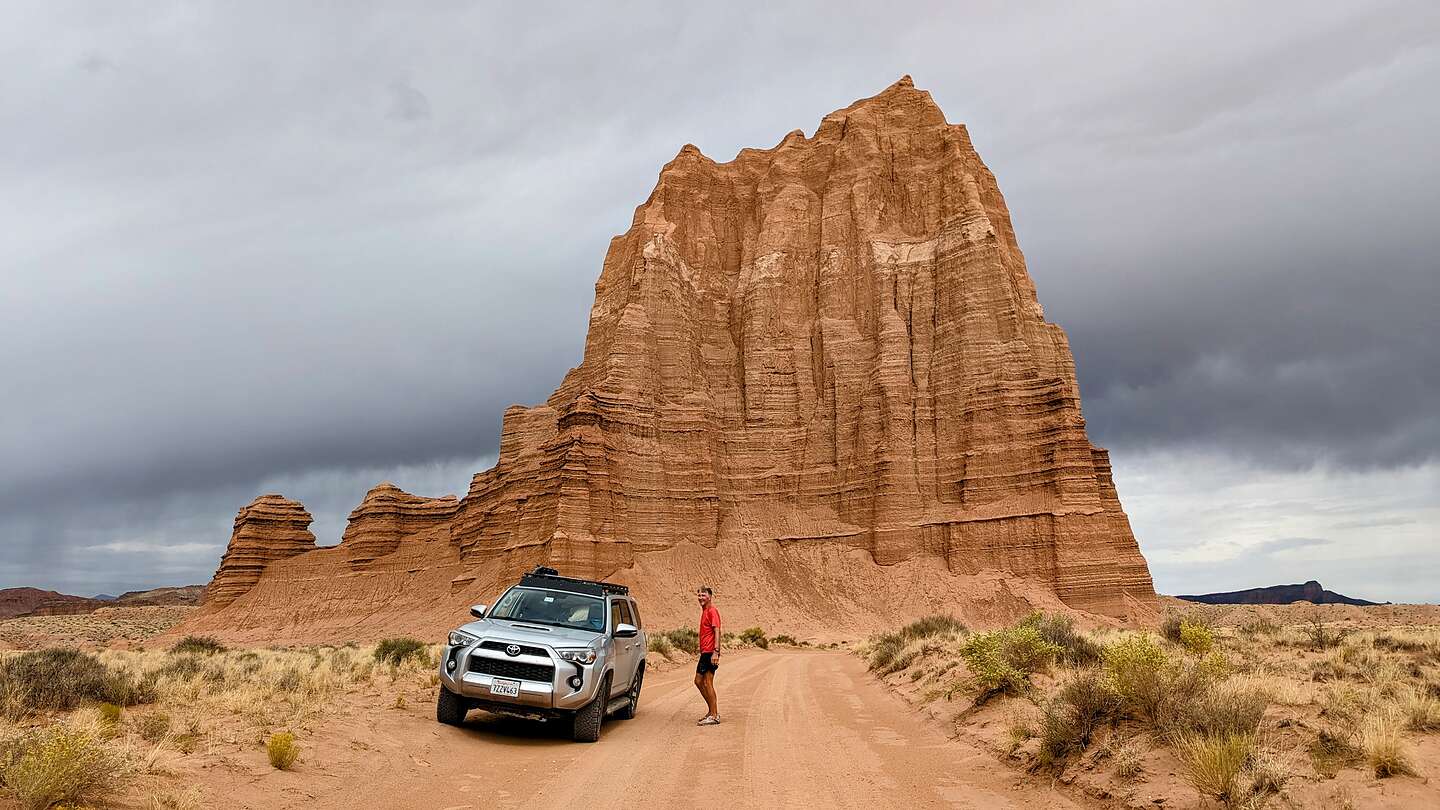
At about 17 miles, we turned left into the short spur road to the Temple of the Sun and the Temple of the Moon, probably Cathedral Valley’s most iconic monoliths.
Unlike the monoliths we would see in the rest of Cathedral Valley, these monoliths have lost their protective gray caps of Curtis Formation sandstone. This means that they are eroding pretty rapidly, in geological terms anyway. Up close, the face of them looks a bit like flowing mud. That’s because in some way, it actually is. When there is a heavy enough rainstorm, the surface actually turns into mud and oozes down, hardening again when things dry.
Both the Temple of the Sun and the Temple of the Moon consist of fine-grained sandstone and siltstone in shades of red to reddish-orange. The color is the result of tiny amounts of hematite (an iron oxide) and other iron-bearing minerals.
Before heading to the Glass Mountain parking lot, we stopped in the middle of the road to admire the Temple of the Sun up close. To really get a sense of their size, you need to get right up to their base. They are huge. The Temple of the Sun rises 422 feet and the Temple of the Moon 265 feet from the valley floor.
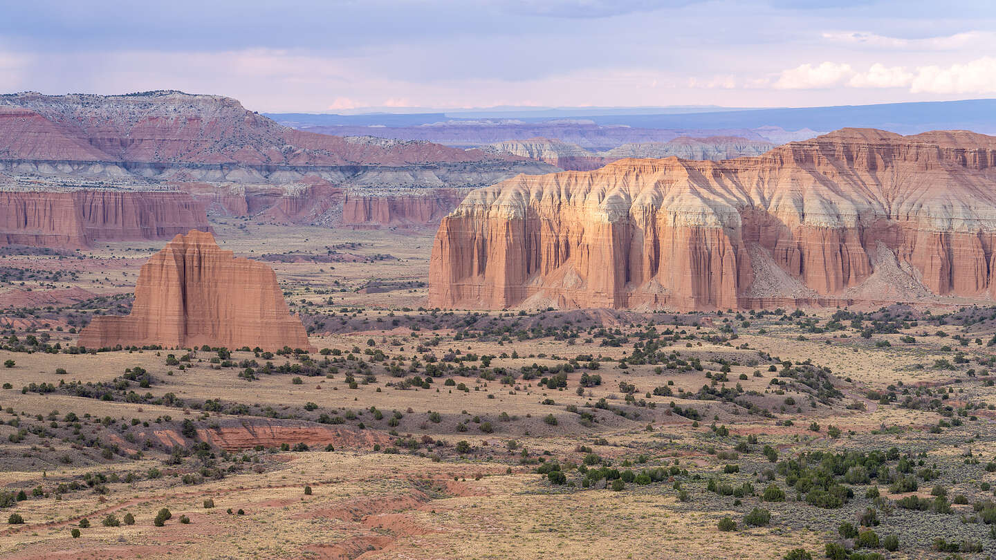
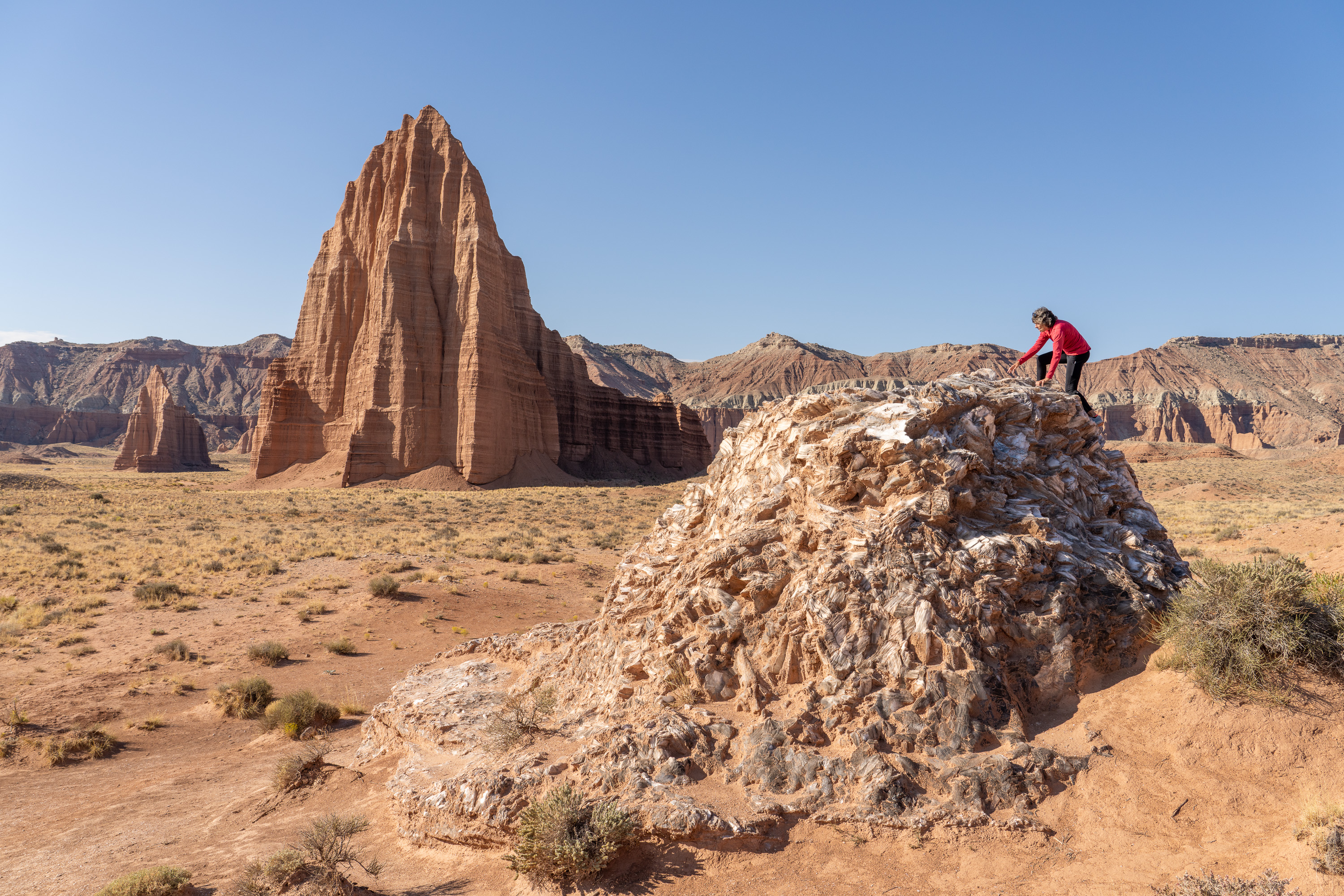
We continued on to the turnout for Glass Mountain, from which you can photograph all three mountains in a diagonal line.
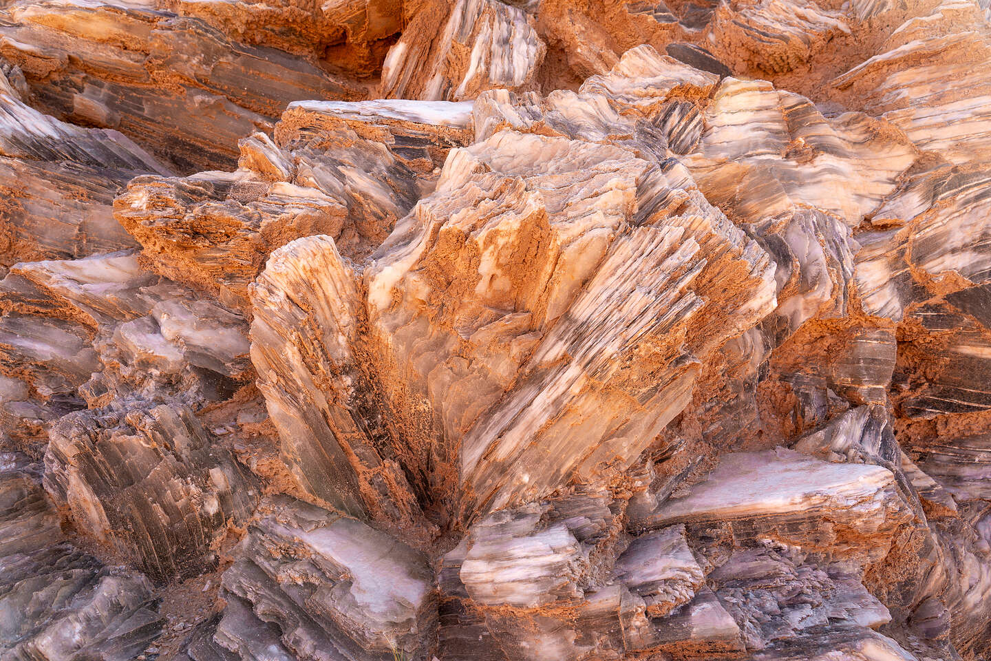
The Glass Mountain is a bit of a geological curiosity composed of large selenite (gypsum) crystals forming a mound, or plug, about 15 feet high. I overheard a guide explain to his group that it goes deep underground - I think he said about 60 meters.
I’m no geologist, but I tried to research how it formed. About 165 million years ago, the gypsum was deposited here from evaporating seawater. As it got buried by subsequent layers of sediment, the lower-density gypsum moved slowly upward along fractures in the sediment, forming small domes like Glass Mountain.
Since gypsum is a slightly soluble mineral, precipitation will eventually (over a very long time) dissolve Glass Mountain and create a sinkhole.
Pretty awesome. So I climbed to the top of it. It was really easy because the selenite crystals were easy to grab onto. I like to rock climb and I would grade this as a very easy climb. From the top, there was an awesome view of the Temple of the Sun and the Temple of the Moon with the selenite crystals in the foreground.
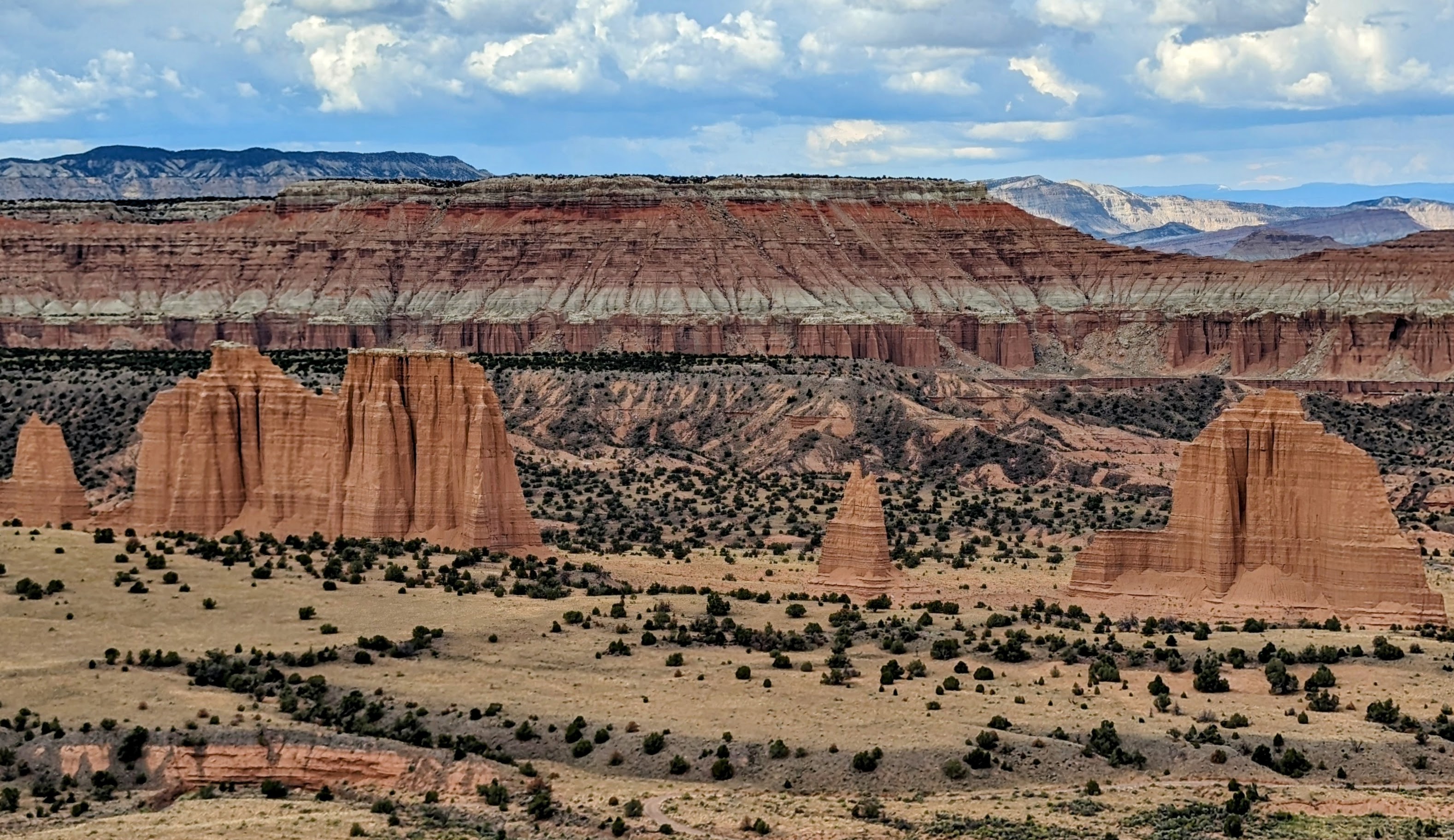
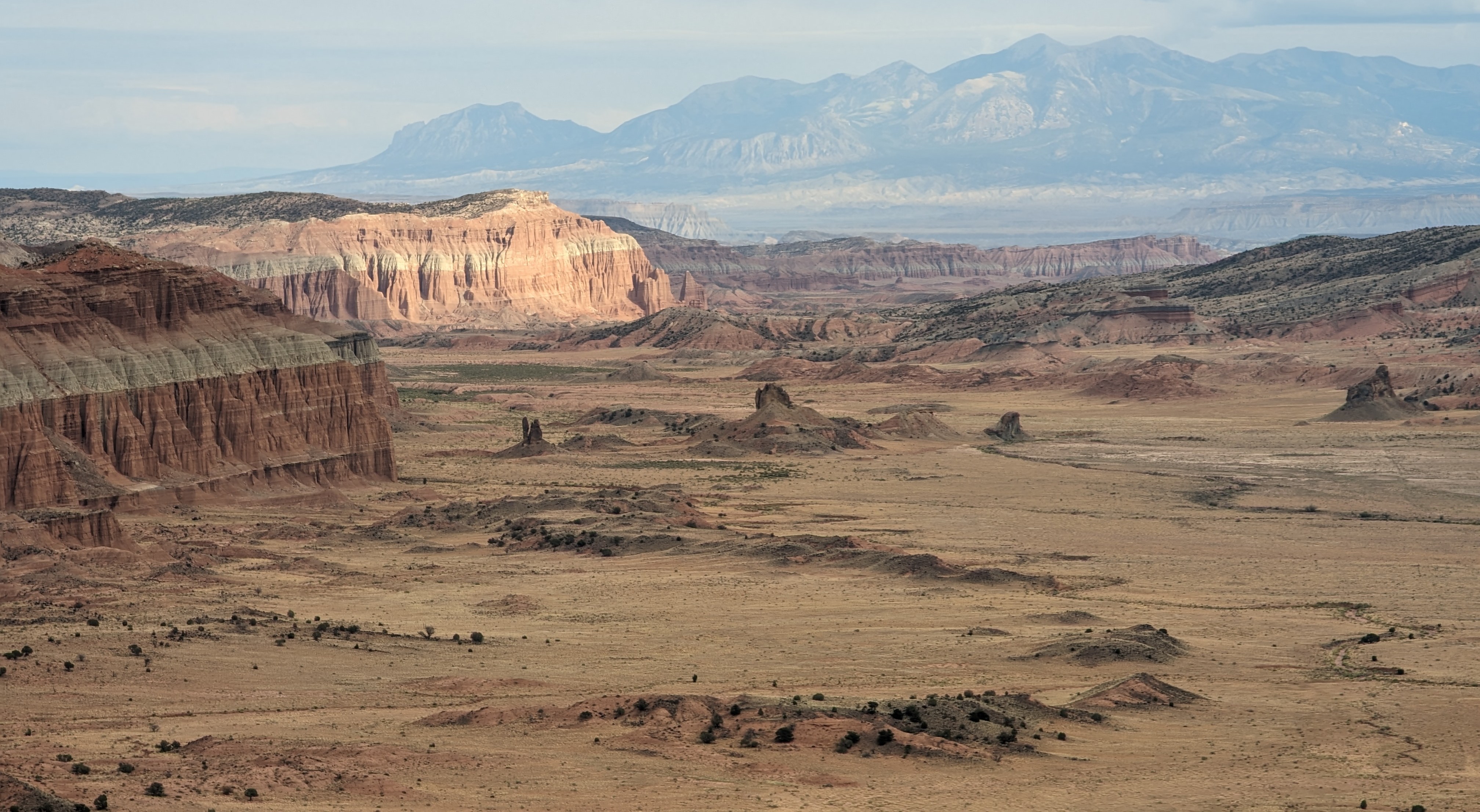
Within the bounds of Cathedral, camping is restricted to the one first-come, first-served primitive campground near Upper Cathedral Valley, which has only 6 campsites, so we needed to get there in time to secure one, so we could enjoy the valley lookouts during the golden hour, both in the evening and at sunrise. The Upper Cathedral Valley is considered one of the most beautiful spots in Utah, and that’s saying a lot.
When leaving the Temple of the Sun area, we pretty much drove the 15 miles to the campground without stopping much along the way, as tempting as it was.
Success! This time, for whatever reason, there was only one other person camping there, so we secured a site and just relaxed there for a while until the golden hour approached.
.jpg)
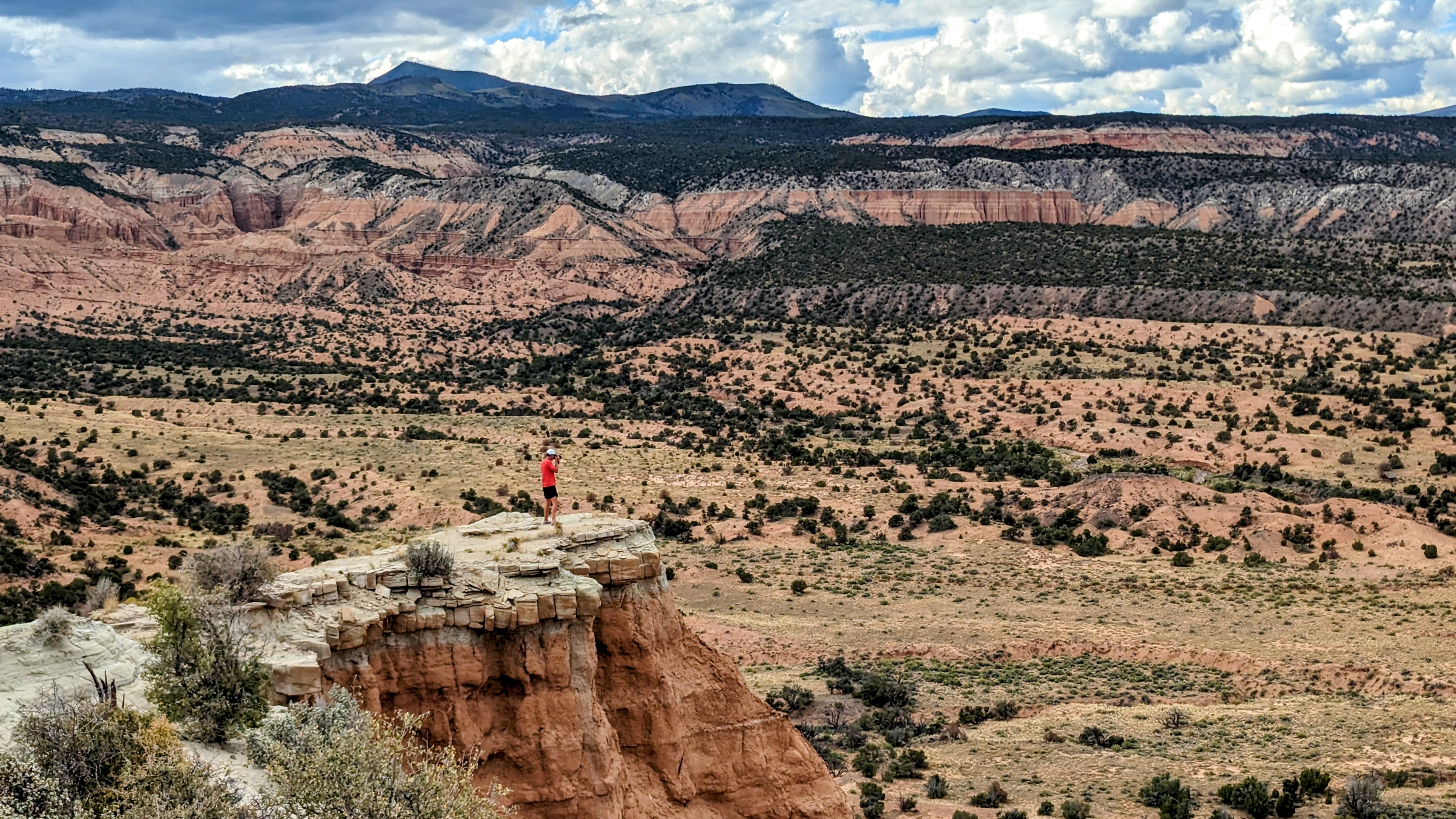
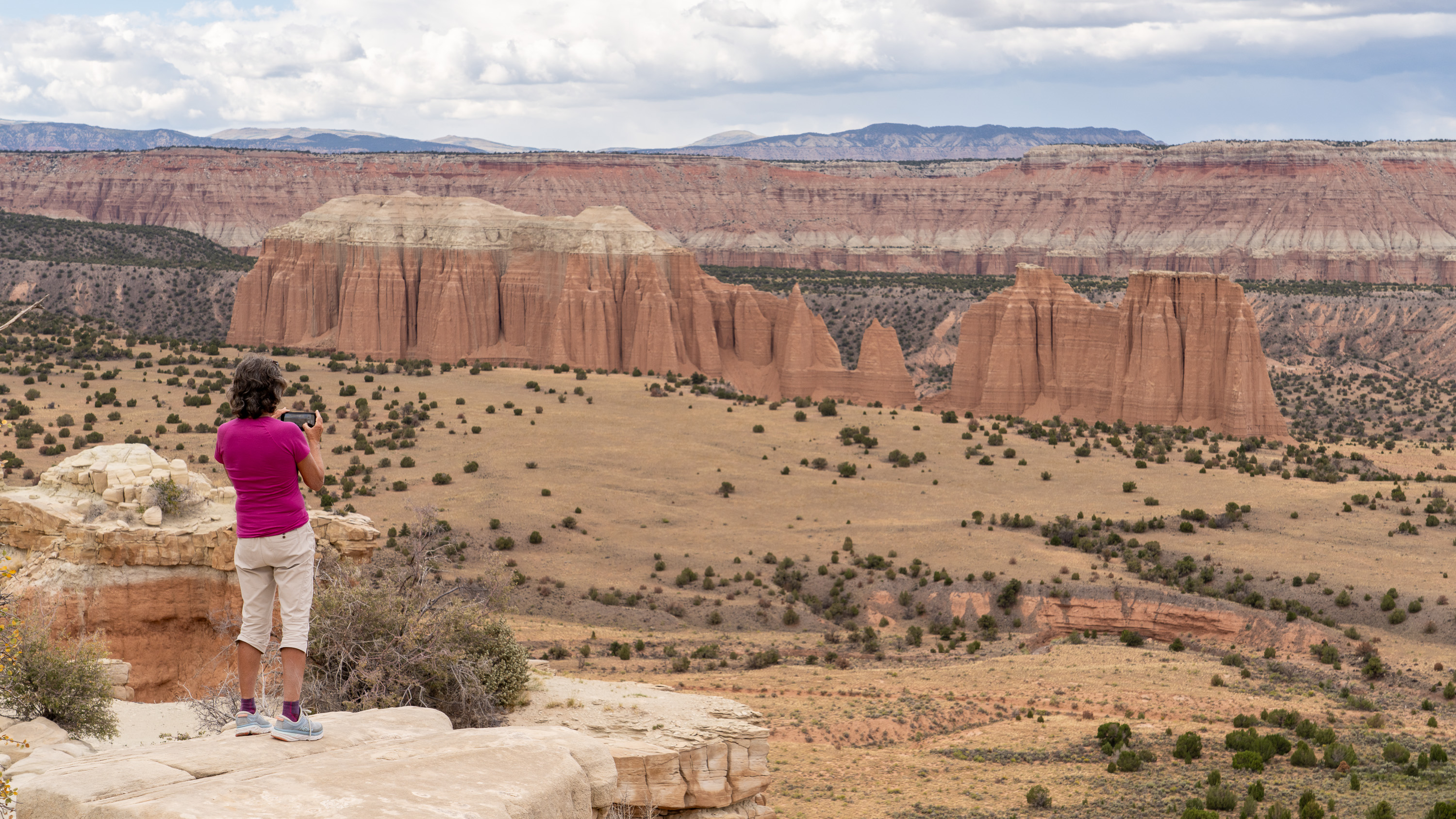
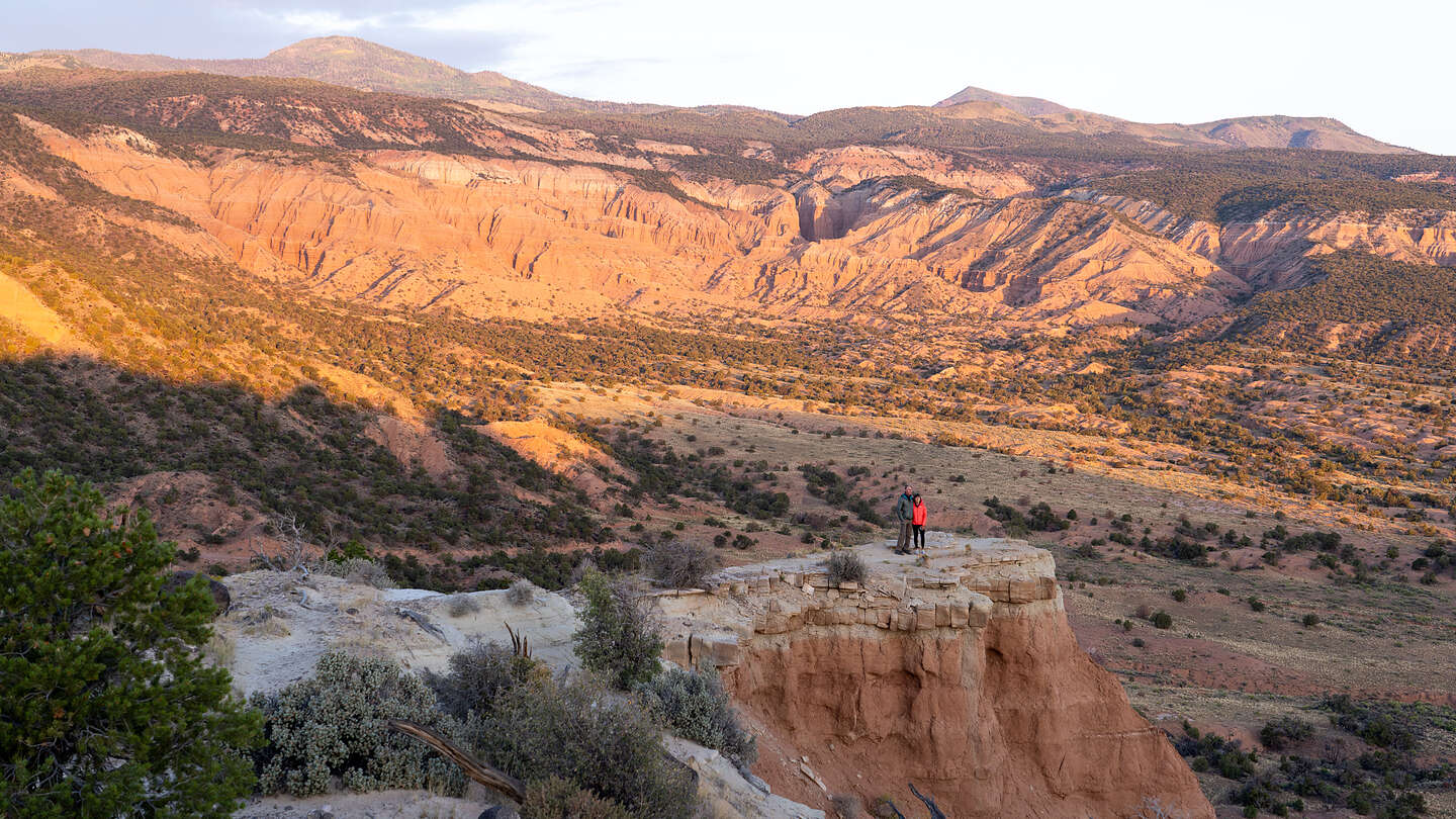
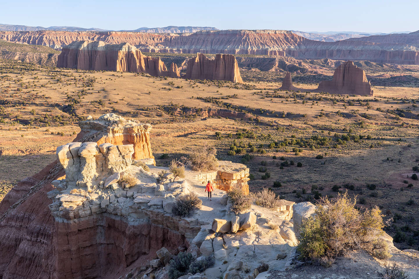
Around 4:00, we drove the short distance to the Upper Cathedral Valley Lookout where from the edge of the plateau we could look out over the entire Upper Cathedral Valley in all its splendor.
The monoliths in the Valley looked like the Temple of the Sun and the Temple of the Moon in that they were a reddish-orange sandstone, but these still had their gray-green caps of Curtis Formation sandstone, slowing down their erosion.
There was a very cool outcrop to walk out onto. Looking out at Herb on it, I could see that he was standing on the gray-green cap rock with the softer reddish-orange sandstone below. I was beginning to feel like a geologist.
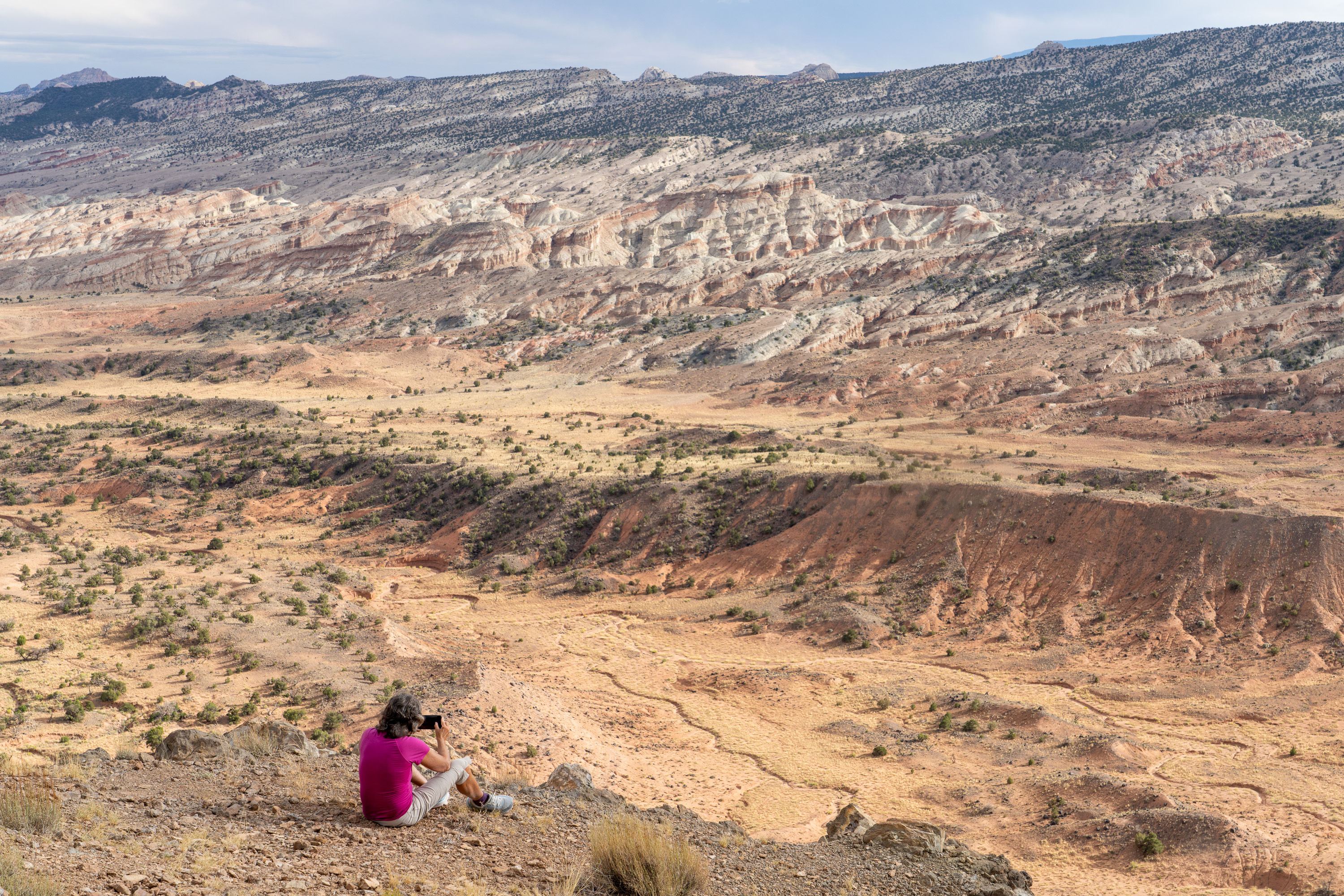
Afterwards we drove the short distance to the Upper South Desert Overlook for even more spectacular views, this time out over the Upper South Desert with its lovely greens and browns.
What a beautiful evening!
Back at the campsite, we had Thai food - Mountain House Pad Thai with chicken. It actually wasn’t bad.
The next morning, we arose before sunset and headed back out to the Upper Cathedral Valley Lookout for a spectacular sunrise that painted the surrounding cliffs a brilliant red.
I always complain to Herb that we never have photos of the both of us on our trips, so he went to the trouble of setting up a tripod to photograph both of us on an outcrop looking out over the valley. He had to run to get into the picture in time. There are some funny outtakes of the near misses.
It was pretty stunning.
From there we drove the 30 miles back from whence we came, stopping briefly at the Temple of the Sun and Moon, to Highway 24.
From there we would begin our journey south along the Notom Bullfrog Road to the Burr Trail.