Long Dong Silver (the Lone Spire), UT

Herb loves watching YouTube videos of places we are going to, and he often goes down a rabbit hole and finds new points of interest. This is how while watching videos about Factory Butte, he found out about the nearby Lone Spire (cleverly named “Long Dong Silver” by rock climbers).
With a name like that, we definitely had to see it. To drive to it requires a high-clearance 4WD, which fortunately is our means of travel these days for this very reason.
I’ll try to give directions, but it is much easier to simply put “Lone Spire” into Google Maps and it will navigate you there. Also, we use Gaia, which has a lot more details on remote 4wd trails.
In case you have no coverage, from Hanksville, drive west on Highway 24 for 10.6 miles and turn right onto Coal Mine Road (also called Factory Butte Road). From there we drove about 4 miles north and then turned right onto Factory Bench Road. After another 2 miles, we made another right.
If you don’t have a 4WD, you can hike directly there from Highway 24. We didn’t do this, but I think you can drive about 7.5 miles west on 24 from Hanksville and park on the side of the road. From there, I believe it is a 1.8-mile hike north up a wash to the spire.
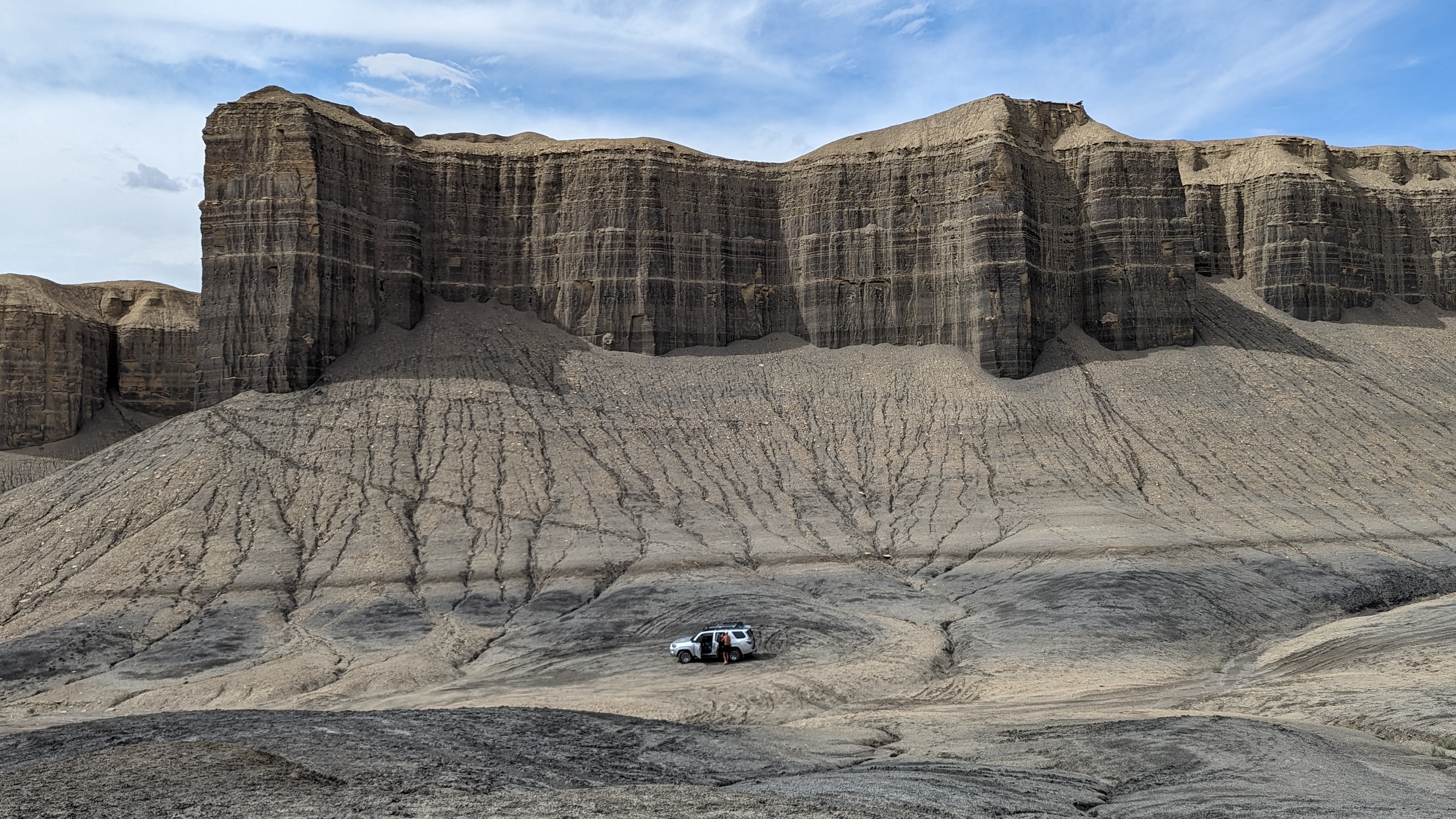
Along our drive, we stopped at another spire that Herb had learned about on YouTube, called Angel of Death, also named by rock climbers who are known to give very colorful names to rocks they climb.
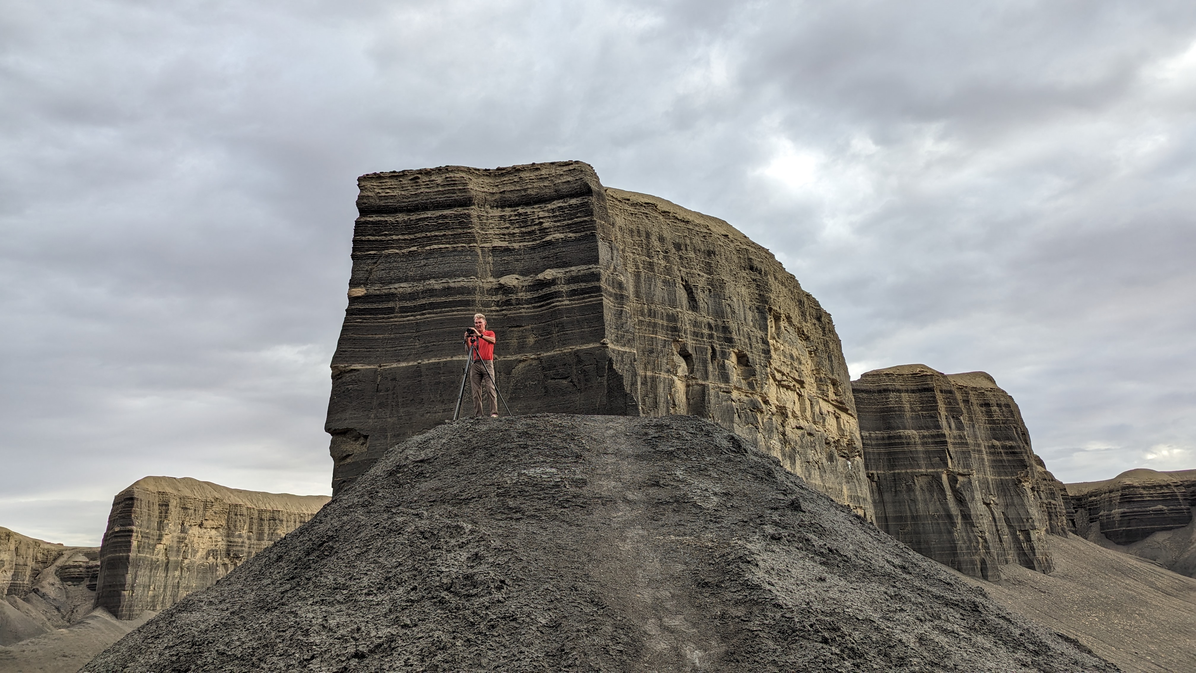
The Angel of Death rose 80 feet from a dirt mound. Behind it was a huge mass of rock colored in the same deep browns with lighter tan horizontal lines across it. I wish I knew geology better, but I do know that these lines are strata, and they tell the story of the rock. Each distinct layer shows a change in the landscape going back millions of years.
It definitely looked like the Angel of Death was once part of the massive block of rock behind it, but erosion must have separated it some time along the way, possibly millions of years ago.
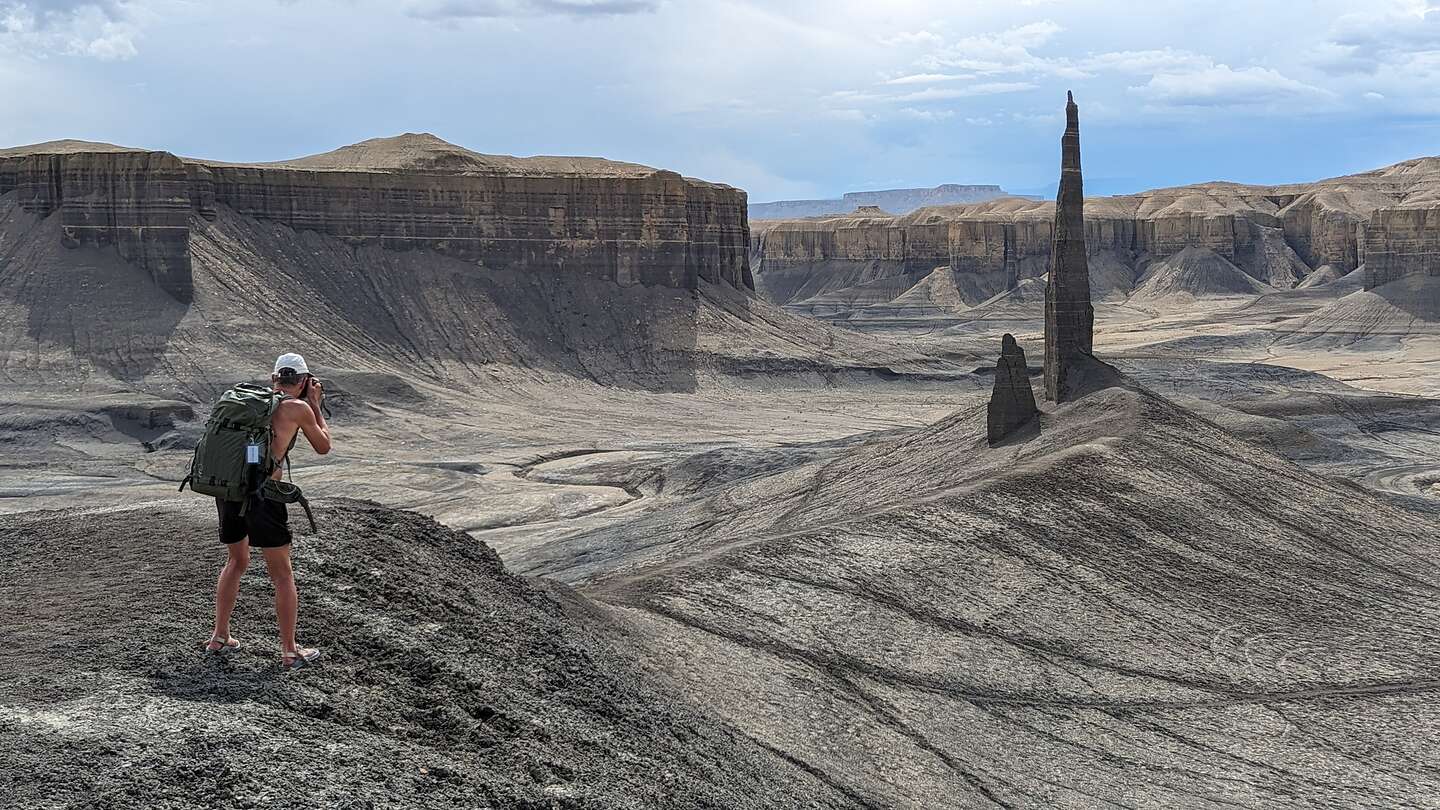
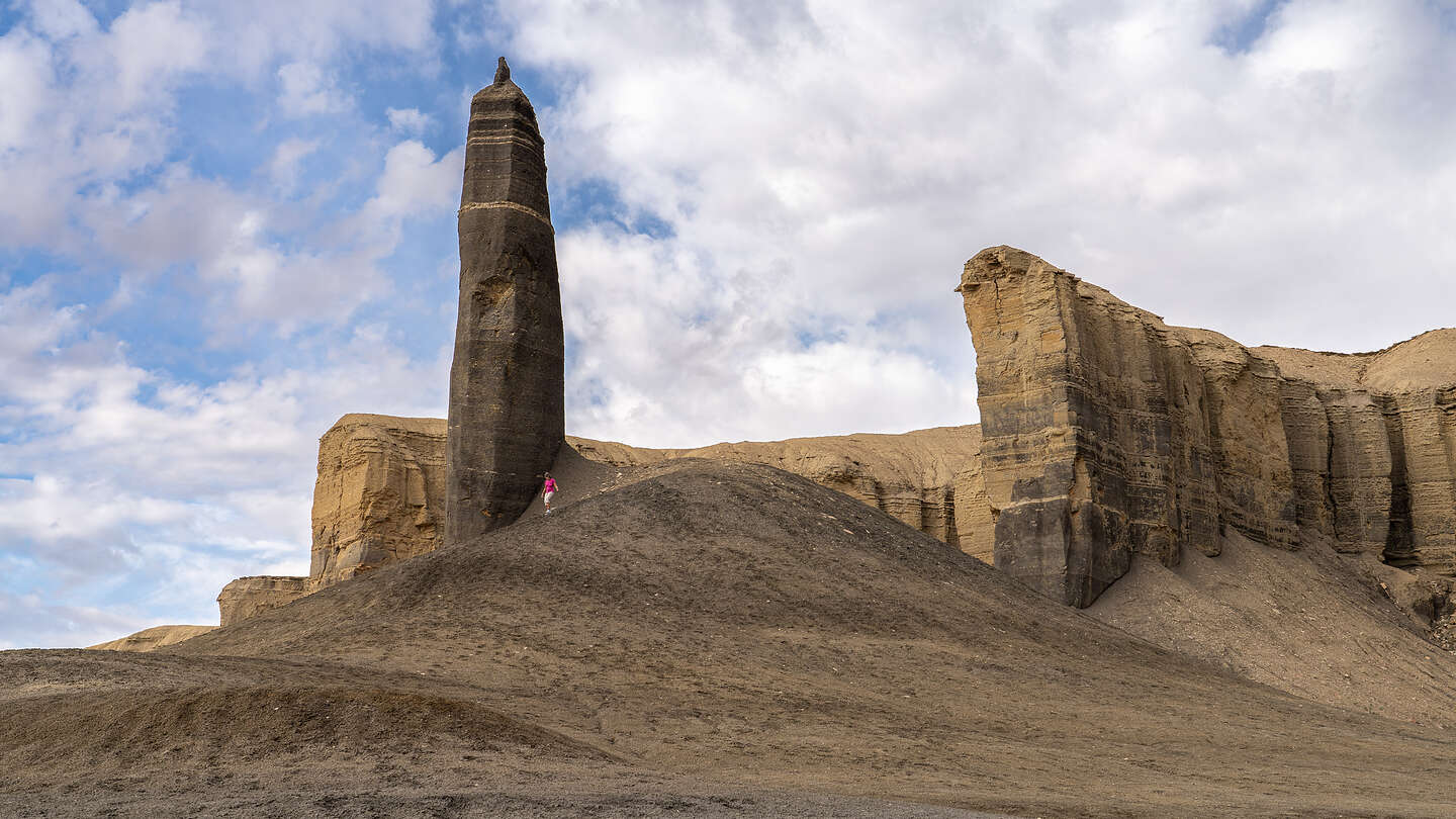
We continued onto Long Dong Silver and parked the 4Runner at the base of another massive brown with tan striped rock formation, similar to the one by Angel of Death.
Like Angel of Death, Long Dong Silver was located atop a dirt mound and had the same brown and tan strata lines.
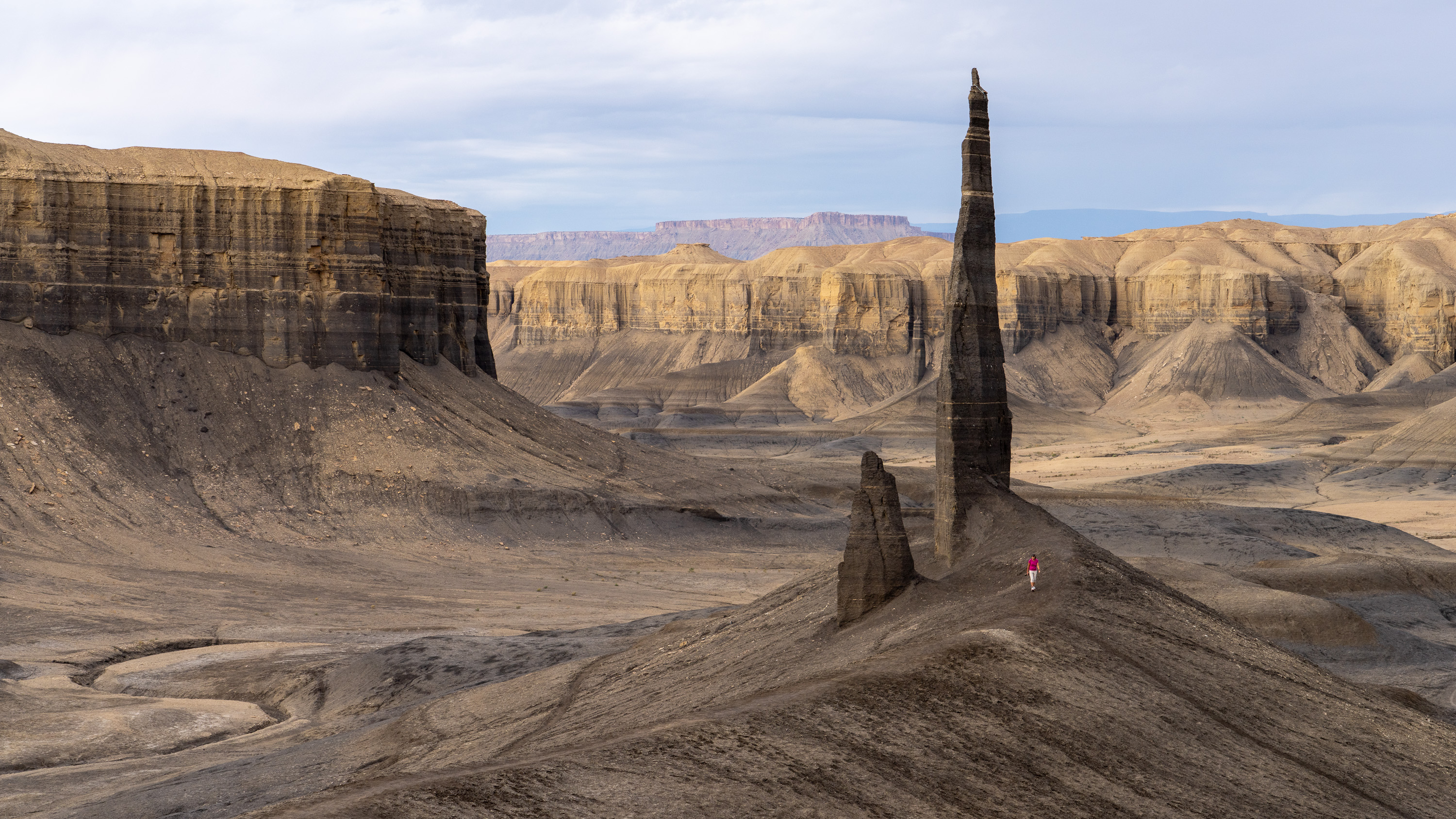
From the car, we walked up the hill, but rather than walk towards the spire, we went left and climbed up a very steep section of trail to another large block of the same kind of rock. From this vantage point, we could see that there were actually two spires, the 100-foot-high Long Dong, and its shorter side-kick (Short Dong Silver?), about a third the size.
In landscape photography, it is difficult to get a sense of scale of an object if there is nothing in the photo that you do know the size of. That’s where I come in. I appear in hundreds of Herb’s photos as a tiny little object, displaying my insignificance in nature. I don’t mind though - not the insignificant part but the exercise.
So, for the next hour I got a good workout, walking back and forth between the spire and the steep mound where Herb had set up a tripod. I am such a good wife.
After looking at the photos later that evening, Herb saw some missed opportunities, so we actually went back again two days later on our way to Cathedral Valley
On that return trip out here, I also got out of the car at Angel of Death and climbed up to its base, which wasn’t as easy as I thought it would be.
Herb calls me his supermodel - his very tiny supermodel.