- Home
- About
- Map
- Trips
- Bringing Boat West
- Migration West
- Solo Motorcycle Ride
- Final Family XC Trip
- Colorado Rockies
- Graduates' XC Trip
- Yosemite & Nevada
- Colorado & Utah
- Best of Utah
- Southern Loop
- Pacific Northwest
- Northern Loop
- Los Angeles to NYC
- East Coast Trips
- Martha's Vineyard
- 1 Week in Quebec
- Southeast Coast
- NH Backpacking
- Martha's Vineyard
- Canadian Maritimes
- Ocracoke Island
- Edisto Island
- First Landing '02
- Hunting Island '02
- Stowe in Winter
- Hunting Island '01
- Lake Placid
- Chesapeake
- Provincetown
- Hunting Island '00
- Acadia in Winter
- Boston Suburbs
- Niagara Falls
- First Landing '99
- Cape Hatteras
- West Coast Trips
- Burning Man
- Utah Off-Roading
- Maui
- Mojave 4WD Course
- Colorado River Rafting
- Bishop & Death Valley
- Kauai
- Yosemite Fall
- Utah Off-Road
- Lost Coast
- Yosemite Valley
- Arizona and New Mexico
- Pescadero & Capitola
- Bishop & Death Valley
- San Diego, Anza Borrego, Joshua Tree
- Carmel
- Death Valley in Fall
- Yosemite in the Fall
- Pacific Northwest
- Utah Off-Roading
- Southern CA Deserts
- Yosemite & Covid
- Lake Powell Covid
- Eastern Sierra & Covid
- Bishop & Death Valley
- Central & SE Oregon
- Mojave Road
- Eastern Sierra
- Trinity Alps
- Tuolumne Meadows
- Lake Powell Boating
- Eastern Sierra
- Yosemite Winter
- Hawaii
- 4WD Eastern Sierra
- 4WD Death Valley +
- Southern CA Deserts
- Christmas in Tahoe
- Yosemite & Pinnacles
- Totality
- Yosemite & Sierra
- Yosemite Christmas
- Yosemite, San Diego
- Yosemite & North CA
- Seattle to Sierra
- Southwest Deserts
- Yosemite & Sierra
- Pacific Northwest
- Yosemite & South CA
- Pacific Northwest
- Northern California
- Southern Alaska
- Vancouver Island
- International Trips
- Index
- Tips
- Books
- Photos/Videos
- Search
- Contact
Chappaquiddick , MA
Friday, July 4, 2008 - 11:15am by Lolo
0 miles and 0 hours from our last stop - 1 night stay
Travelogue
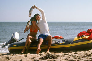 "Kissing Bluefish" on Avon Raft during HoneymoonFor a place so small, this tiny island off an island is so jam packed with wonderful memories that I don’t know where to start, so I guess I will start at the beginning.
The very first time I came to Martha’s Vineyard was in 1979, when Herb and I and another couple took our bikes on the Ferry and bicycled to Edgartown to spend a night at the very lovely Edgartown Inn. As we sat by the Wharf that evening, I became intrigued by the small ferry endlessly chugging back and forth across the 100 yard or so channel between Edgartown and a dark beach a stone’s throw away. Without knowing, nor for that matter caring, what lied on the other side, I turned to Herb and said, “Let’s get on the ferry.” Always the pragmatic engineer, Herb’s simple reply was, “Why?” I was very tempted to use the punch line from a chicken joke.
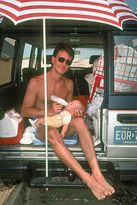 Herb and baby Andrew Tailgating in back of Isuzu TrooperI might not have gotten to ride the On Time Ferry that evening, but we’ve more than made up for it over the past three decades of Vineyard adventures. Also, somewhat ironically, 16 years after that first trip to the island, Herb and I got married in Edgartown and spent our first night as a married couple in that very same Edgartown Inn (more on the wedding in the Edgartown stop).
Before we bought the RV in 1999, our Suburban was our vehicle of choice, primarily because it is 4-wheel drive and can be driven on the Chappaquiddick beaches. The pass is not cheap though. Although it was probably under $100 for an annual over-sand pass back when we were buying it, it is now something like $180 for non-member, non-island residents. If you become a member of the Trustees of the Reservation, however, it is a bit cheaper. Whatever the cost, it is certainly worth it. Some of my fondest Vineyard memories are of cruising along the beach with Carly Simon waling on the stereo.
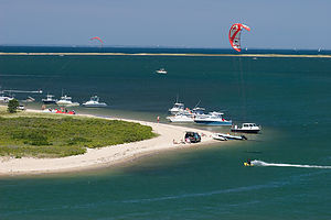 Kite Boarders at the GutAlthough four-wheel driving is the quickest and most convenient way to set up for a day of fishing at one of Chappaquiddick’s world-class fishing spots, it is not the only way. For years, I have chosen to do it on two wheels, because bicycling is also a great way to explore Chappaquiddick. Since we generally stayed at a house out on Katama (Edgartown), this involved about a 7 mile drive, over a mile of which is on sand. Now this might not seem like a big deal, but throw two small boys on Toys R Us bikes into the equation and things get a bit more interesting. Since it is nice to have all your stuff at the beach—coolers, fishing rods, beach chairs, toys, etc.—Herb would drive there in the Suburban and the boys and I would meet him later.
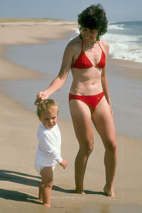 Lolo and Andrew on the BeachWhen the boys were little, I always tried to encourage them to bicycle everywhere we could on the island. We even bought them little speedometers so they could keep track of how far they went. They would reset them at the beginning of the vacation so that they could see how far they had ridden. Near the end of one two-week trip, we found Andrew obsessively driving round and round the circle of the cul-de-sac where we were staying so that he could reach 100 miles—a pretty impressive accomplishment for an 8 year old.
I also never hesitated to stoop to bribery to get through what the boys began referring to as “Mommy boot camp.” “Only two more miles to Mrs. Miller’s muffins,” was a common technique. “Just a little more till the Quarterdeck where I will buy you a frappe.” It wasn’t pretty, but it worked. I would have to say that when we finally arrived and greeted Herb and his fellow fishermen on the beach, the boys strutted a bit more proudly for having gotten there on their own power.
The beaches of Chappy are managed by the Trustees of Reservations, a non-profit, land conservation and historic preservation organization in Massachusetts. The Cape Poge Wildlife Refuge, as it is called, extends seven miles from Wasque Point on the south, all the way past the Cape Poge Lighthouse to the Cape Poge Gut. While a four-wheel drive vehicle allows you to go all the way from Wasque to the Gut—which is a very bumpy, but scenic drive, which we have done several times in the past—bicyclists must choose either East Beach or Wasque, as these are the only places that roads will take you.
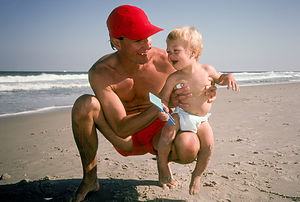 Herb Entertaining Tommy at East BeachThere is only one paved road on the island (Chappaquiddick Road), so when you get off the On Time Ferry there is not a whole lot of deciding where to go.
About 1.3 miles from the ferry, on the left, is North Neck Road, a dirt road leading 1.1 miles out to the trailhead for the North Neck Highlands Preserve, a property of the Martha’s Vineyard Land Bank. The trail leads to a tremendous view from the highlands out over Cape Poge Bay and “the Gut,” an area very popular for fishing, as well as windsurfing and kiteboarding. The only way back from this point, is to retrace your steps back to Chappaquiddick Road.
In 1999 (our last trip without RV), we rented a house with my brother’s family on these highlands overlooking Cape Poge Bay. It was a tremendous house with unparalleled views of “the Gut” and Edgartown in the distance. Each home on the bluff has a steep staircase leading down to a very narrow and somewhat rocky beach. We kept our kayaks on the beach and used them to make the short crossing over to the sandspit on the other side of “the Gut”. However, the winds were particularly strong, making what should have been a very easy paddle into something a bit more challenging.
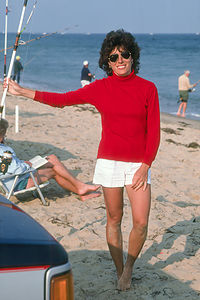 Lolo of Wasque in RedMy brother Jim is an early riser, and each morning before the rest of us awoke, he would head down the staircase to the beach with his coffee and fishing rod. One morning he proudly returned telling us of the fish he had caught while we were all slumbering. I really loved the views from that house. We even spent the 4th of July that summer watching the fireworks over Edgartown Harbor from our deck. Rumor has it that Lady Gaga has bought a vacation home right near to this one.
We have returned to “the Gut” several times since that year, sometimes on our Grady White and once by kayak. In fact, Andrew caught his first striper from our Grady in the churned up waters at the entrance to the Bay. Herb was convinced it was just the current tugging at his line, until he hauled a nice size striper onto the boat.
2012 was the first year that Herb and I had our new kayaks on the island. We decided to paddle from State Beach in Edgartown across the Harbor and into “the Gut,” about a 5 mile paddle each way. I never understand how wind can always be against you, because that is exactly what happened that day, and it was a strong one. The trip there wasn’t as bad, probably because I wasn’t completely exhausted yet, but the entrance to “the Gut” was pretty scary. There were these standing waves that kept churning and churning in place, and it is easy to get caught up in them. I must say I had to use a very significant chunk of my allotted energy for the day to just get through them. However, the rewards afterwards were great as we pulled over to the beach (just across the way from our wonderful rental house of 1999) and lounged on the beach for a few hours.
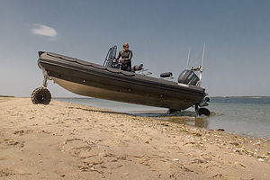 007 Inflatable Amphibious Boat at the GutA very unusual thing happened when we were on the beach. An all black rigid-hulled inflatable boat with a single man on board entered the Bay. As he approached us, he lowered a wheel at the front of the boat and two in back and proceeded to drive up onto the beach. We had never seen anything like it. Next, he set up a kiteboard—also all black—and started skillfully whipping around the bay. I felt like we were watching a James Bond movie. Herb later spoke to him and learned a bit more about amphibious rigid-hulled boats, of which this was one. They can even be driven on the road, which this guy does to get it from the marina in Edgartown to his home. Very cool.
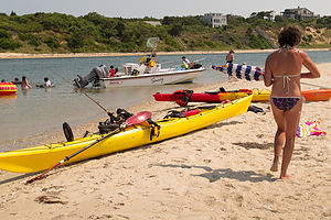 Lolo and Kayaks at the GutI was really hoping that the wind would die down a bit before we had to make the voyage back to State Beach, but it seemed to only be getting stronger. Although Herb tried to convince me to take the straight line—and thus the shortest distance—across the harbor to our destination, I was too scared to go back out in open water. I preferred to hug the shoreline, even if it meant going further. Also, I have noticed that when kayaking, the closer to shore you are, the faster it seems you are going, even if that isn’t true. You can kind of tick off distances—I just have to get to that dock, then just a little further to that boat, etc., etc. I remember almost crying at one point when my mini goal was to paddle from one dock to the next and I looked to my left only to find that dock wasn’t moving, or more correctly, I wasn’t moving in relation to it. I was just rowing in place, and if I stopped paddling for a minute, I would actually go backwards. The only way I could make progress was to paddle really, really hard—faster than the current and the winds against me. I admit to being a bit scared and a lot cranky. Herb was lucky he wasn’t to near me or he wouldn’t have like what I was calling him. Obviously, we did finally make it. I was never so happy to be at State Beach.
I got a bit off track, but I guess my point is no matter what means of transport, “the Gut” is definitely an interesting and worthwhile destination.
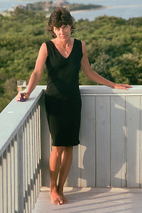 Lolo in Black Dress on Deck of "Gut House"Once back out on Chappaquiddick Road, another 0.3 miles (1.6 miles from the ferry) past North Neck Road brings you to the Brine’s Pond Preserve, a Martha’s Vineyard Land Bank property, located on the right side of the road, just past the Chappaquiddick Community Center. It’s a pretty little spot, nice for a rest and a brief stroll along the trail around the pond. The most notable feature of the Preserve is an island of beetlebung (tupelo) trees in the center of the pond. Early settlers used the dense wood from these trees to make wooden mallets, called “beetles,” which drove the corks, called “bungs,” that plugged barrel holes.
Continuing along the paved Chappaquiddick Road, in 0.6 miles (2.2 miles from the ferry) is the Chappy General Store, the only store on the island. I am embarrassed to say that in over 30 years we have never stopped in this store so I have no idea what it is like.
In another .3 miles (2.5 from ferry), the road takes a sharp bend to the right. The unpaved Dike Road to East Beach goes straight, while the paved road continues on to Wasque. For now, let’s go straight on the dirt road.
About a half mile down the sandy Dike Road is Mytoi, a 14-acre secluded Japanese-style garden. It is a lovely stop and one that we have made every year to the island. We even had photos taken here on our wedding day on the arched wooden bridge over the pond. The preserve features both native and non-native flowers and plants, including Japanese maple trees, dwarf white pine, Japanese cedar, birch, and golden bamboo. Like the beaches of Chappy, this preserve is a property of The Trustees of Reservation. Entrance to the garden is free.
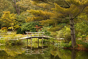 Mytoi Garden Arched Wooden BridgeIn addition to the garden paths, the ½-mile Salt Marsh trail, located across the street from the Mytoi parking lot, takes visitors through a pitch pine forest and along the salt marshes of Poucha Pond.
0.2 miles further down Dike Road is the infamous Dike Bridge, where in 1969 Teddy Kennedy lost all chances of becoming president when his car drove off the bridge, resulting in the death of Mary Jo Kopechne. For many years afterwards, the bridge was closed to all vehicles, but has long since reopened, allowing four-wheel drive vehicles to access the beach. This bridge was another stop on our wedding photo tour.
Poucha Pond lies to the right (south) of the bridge, and Cape Poge Bay to the north. It is a great spot for kayaking, and fortunately, we had brought t he boys’ kayaks and our canoe along this year. TheTTOR rents canoes and kayaks if you don’t have your own.
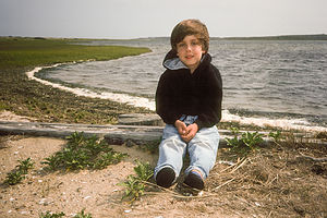 Andrew by Poucha PondCape Poge Bay is a bit larger (2.5 miles long) and more open, so we decided that the more sheltered Poucha Pond would be a better choice for novice paddlers such as ourselves. We had a lot of fun spending the afternoon exploring the pond and weaving in and out of the salt marsh. When we were finished, we had the boys haul their kayaks up onto the sand near the bridge. Andrew, however, left his a bit too much in the water and before we knew it, it had floated off the sand and out into Cape Poge Bay. Herb, who was putting the canoe on top of the Suburban at the time, feigned ignorance of what was going on, leaving it up to me to swim out after the loose kayak. I gave it back to Andrew who proceeded to repeat his half-ass job of kayak beach placement, forcing me to repeat my swim out into the Bay. Needless to say, I was aggravated with two out of the three Gaidus men. If Tommy didn’t stop laughing it would be three.
On the other side of the Dike Bridge is East Beach, a secluded barrier beach that is part of the Cape Poge Wildlife Refuge, managed by TTOR. At the time of this writing, admission for walkovers to the beach was $3 for adults and free for children under 15. We have come to this beach many, many times over the past three decades. The currents here are not as strong as those at Wasque Point, so it is a better place to swim.
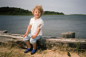 Tommy by Poucha PondAlthough Wasque is generally considered to be the best fishing spot on Chappy, Herb and I had our most prolific fishing day ever on East Beach. Way back in 1984, before we were even married, Herb and I came to Martha’s Vineyard for Columbus Day Weekend. The main draw for Herb, I am sorry to say, was not the romance of a cozy Victorian inn, but rather the incredible fishing that occurs on this island during the fall months. In fact, the Martha’s Vineyard Striped Bass and Bluefish Derby is held each year from mid-September through mid-October, a time when grown men become obsessed with the act of catching the “Big One”.
Well anyway, on this one particular day, Herb and I had set up shop on East Beach. We generally do not fish with bait, so rather than casting out and waiting for something to bite, ours is a much more active process where we continuously cast out a lure and slowly reel it in trying to tempt a poor unsuspecting fish. This can get tiring and boring after awhile if nothing is happening, so often we get lazy and just wait and see if anyone else is catching anything. Well, on this particular day, we were the only ones fishing on East Beach, so we had no one to do the dirty work for us.
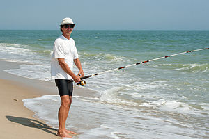 Herb Surf Fishing at Wasque - LEGAfter not too much wait, Herb pulled in the first blue—a nice, feisty 3 or 4 pounder. Blues put up a terrific fight and are really a lot of fun to catch. That got my attention, so I started casting too. Soon we were hauling them in one after the other. Before we knew it, we had over 50 bluefish lined up on the shore, more than half of which I would have to claim as mine. We were starting to attract quite a bit of attention from passersby.
I am not sure what possessed us to keep them all. My arms were already tired from hauling them in, and now we had to scale and fillet them. I was given the job of scaling as Herb usually assigns me the unskilled tasks. By the time I got to my 50th fish, my hands were bent like claws, set in place from holding the scaler too long. Now the question, which we should have asked ourselves hours ago, came to mind—What were we going to do with 50 fillets in our cozy little room at the Kelley House? And I don’t even like bluefish. Well, the answer was a large cooler and many, many trips to the ice machine. We managed to keep them cool and they traveled home with us on the Ferry. Herb’s rock climbing buddy Ed smoked them and they used them as snacks on their climbing trips—Yuck!!!
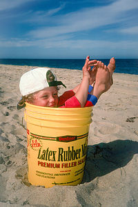 Tommy inside Bait BucketUsually, though when we want to fish, we head to Wasque Point, also part of the Cape Poge Wildlife Refuge and about a mile and a half south of East Beach. Wasque is so popular for fishing because of the Rip, a really strong current and undertow that is very dangerous for swimming, but very popular with stripers and blues. On any given day, but especially during the Derby, there are always dozens of four-wheel drives lined up along the water’s edge.
If you are fortunate enough to have a four-wheel drive vehicle and an annual pass, Wasque Point is a short, bumpy ride along the beach. However, those on two wheels must retrace their steps from East Beach back along the dirt Dike Road out to the paved Chappaquiddick Road. From there, make a left and follow Chappaquiddick Road for 0.8 miles to the junction with Wasque Road. Wasque Road is paved for about a half mile before turning into a stony, rutted sandy road. This sandy road goes on for about 1 mile before coming to the entrance to Wasque Reservation. I remember trying to peddle over this sandy road with a 2-year-old Tommy in a child seat on the back of my road bike. I didn’t even have a mountain bike at that time. I had to be nuts.
Right past the entrance there is a lovely trail to the left that leads through a pine forest and down to Pocha Pond. I have often left the beach when the fishing is slow to come here for a run.
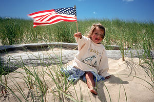 Madison waving US Flag at ChappyThe sandy road continues a short distance further before ending in a parking lot. Right next to the outhouse is a rack to lock your bikes before heading down to the beach. A short distance from the bike rack is a bluff overlooking the beach where you get your first glimpse of four-wheel drives lined up ready to catch the big one. Until recently, there was also a lovely small pond situated between the bluff and the beach, appropriately named Swan Pond due to its resident Swan who was often found leisurely floating along its surface.
I have always found this spot peaceful and comforting, so much so, that when I was going through a particularly rough time I chose it as my “happy place.” About 20 years back when I was undergoing chemotherapy for breast cancer, I was encouraged to relax and visualize a place where I felt safe and happy. Although I have been to some pretty spectacular places, this tranquil pond surrounded by tall reeds swaying in the breeze is what kept popping into my mind—and it stayed there for years whenever I needed a comforting place to hide.
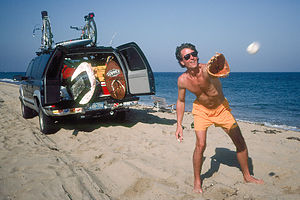 Herb playing catch on beachYou can imagine my reaction when we came here after Hurricane Irene struck in 2011 to find that the pond had been wiped out by the storm and completely filled in with sand. My sanctuary was now just part of the Wasque beach front. My first reaction was a rather self-centered one—“What does this mean for me? Is it some kind of ominous sign?” But then I realized that maybe I just didn’t need it anymore. Then I got sad for the swan.
The wooden staircase and the walkway to the beach had also taken a hit from the storm and was quite torn up. The beach looked entirely different, a reminder of the power of Mother Nature and its constant impact on this island. Just a few years back, in 2007, another storm breached the beach around the bend from Wasque, separating Chappy from the rest of Martha’s Vineyard once again. It was strange to think of how so many times over the past years we had driven our Suburban from South Beach in Edgartown to Wasque and how that was nowimpossible—at least until Mother Nature continued its work and filled the gap in with sand again.
I have so many fond memories of days spent at Wasque that I sure hope this place recovers from the devastation of the storm.
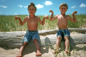 Boys Flexing on "Herb + Lolo" LogIronically, this fishing hot spot is also the site of one of Herb’s more romantic acts on the island. For many years a large log, which had been washed ashore, sat at the edge of where the dune grass meets the beach. When the kids were little, they used to climb up on its tall end and leap off into the sand. As years went by, more and more carvings appeared on the log as people continued to etch their initials into the wood. With a bit of pressure from myself and the kids, Herb sacrificed a few valuable fishing hours one afternoon, laboriously carving “Herb + Lolo” inside a heart with his Swiss Army knife. Years later, my brother was shamed into doing the same for him and his wife. He isn’t quite as handy with a knife, so his was a much greater and longer “labor” of love. It was nice to come here year after year and have that log looking over us.
However, a storm even earlier than Irene washed that log out to sea. Hmm…I wonder what that could possibly mean?
Description
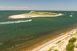 Gut View from the Rental House on the BluffChappaquiddick is a small island (sometimes) a stone’s throw away from Edgartown. The reason I say sometimes is that for years a sand spit has connect South Beach in Katama to Chappaquiddick but severe storms in 2007 breached the thin, south-facing Norton Point making it an island once again. In fact, the name Chappaquiddick comes from an Indian word "cheppiaquidne" meaning "separated island." It is technically a part of Edgartown, but I felt that it was unique and distinct enough to be given a separate description.
The On Time Ferry runs every 5 minutes during the summer, bringing passengers back and forth between Edgartown and Chappy. For a schedule and fees, see: http://www.chappyferry.net/. There is a lovely, little beach located besides the ferry landing that offers a small sandy beach, calm waters, and great views of the Edgartown Lighthouse as well as the hustle and bustle of boats coming into and out of the harbor.
Once you get off the ferry, there is only one road to take, Chappaquiddick Road, and it also happens to be the only paved road on the island.
About 1.3 miles from the ferry, on the left, is North Neck Road, a dirt road leading 1.1 miles out to the trailhead for the North Neck Highlands Preserve, a property of the Martha’s Vineyard Land Bank. The trail leads to a tremendous view from the highlands out over Cape Poge Bay and “the Gut,” an area very popular for fishing, as well as windsurfing and kiteboarding. The only way back from this point, is to retrace your steps back to Chappaquiddick Road.
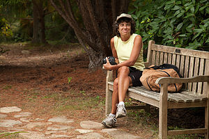 Lolo on Mytoi Garden BenchOnce back out on Chappaquiddick Road, another 0.3 miles (1.6 miles from the ferry) brings you to the Brine’s Pond Preserve, a Martha’s Vineyard Land Bank property, located on the right side of the road, just past the Chappaquiddick Community Center. During the 1700 and 1800s, this area was mostly grassland and used as pasture for sheep and cattle. When the livelihoods of the settlers shifted to whaling, the ungrazed land allowed for the growth of blueberry, bayberry and huckleberry bushes as well as red cedar trees and oaks. The most notable feature of the Preserve, however, is an island of beetlebung (tupelo) trees in the center of a small pond. A hiking trail encircles the pond. Early settlers used the dense wood from these trees to make wooden mallets, called “beetles,” which drove the corks, called “bungs,” that plugged barrel holes.
Continuing along the paved Chappaquiddick Road, in 0.6 miles (2.2 miles from the ferry) is the Chappy General Store, the only store on the island. In another .3 miles (2.5 from ferry), the road takes a sharp bend to the right. The unpaved Dike Road goes straight.
A half mile down the sandy Dike Road is Mytoi, a 14-acre secluded Japanese-style garden. Sheltered by a lovely pine grove, the preserve features both native and non-native flowers and plants, including Japanese maple trees, dwarf white pine, Japanese cedar, birch, and golden bamboo. Winding footpaths lead through the gardens to its focal point – an arched wooden bridge to a small island in a pond, where you are sure to spot turtles, goldfish, and frogs. A visit to Mytoi Gardens is a serene and contemplative respite from the hustle and bustle of summer activity on Martha’s Vineyard. Mytoi is a property of The Trustees of Reservations (TTOR), a non-profit, land conservation and historic preservation organization in Massachusetts. Entrance to the garden is free. In addition to the garden paths, the ½-mile Salt Marsh trail, located across the street from the Mytoi parking lot, takes visitors through a pitch pine forest and along the salt marshes of Poucha Pond.
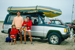 Family on beach with Isuzu Trooper and Avon Redshank0.2 miles further down Dike Road is the infamous Dike Bridge, where in 1969 Mary Jo Kopechne died when Senator Teddy Kennedy’s car drove off the bridge.
Poucha Pond lies to the right (south) of the bridge, and Cape Poge Bay to the north – both of which are very popular with kayakers. The TTOR offers naturalist-led tours as well as canoe and kayak rentals. Poucha Pond is smaller, shallower, and more sheltered, and therefore better for less experienced paddlers. One can either paddle in the open pond or weave in and out of the salt marsh. Cape Poge Bay is a bit larger – 2.5 miles long and 1.2 miles wide – and more open, but well worth the extra effort to reach the Cape Poge Gut.
On the other side of the Dike Bridge is East Beach, a secluded barrier beach, managed by The Trustees of Reservations. East Beach is part of the Cape Poge Wildlife Refuge, which extends seven miles from Wasque Point on the south, past the Cape Poge Lighthouse, to Cape Poge Gut. This beach is very popular with swimmers and fishermen. At the time of this writing, admission for walkovers to the beach is $3 for adults and free for children under 15. Annual over-sand vehicle permits are $80 for TTOR members and $200 for non-member, non-island residents.
Approximately a mile and a half south of East Beach is Wasque Point, also managed by The Trustees of Reservations. If traveling by over-sand vehicle, it is a short, bumpy ride along the beach. However, bicyclists must retrace their steps back along the dirt Dike Road out to the paved Chappaquiddick Road. Make a left and follow Chappaquiddick Road for 0.8 miles to the junction with Wasque Road. Wasque Road is paved for about a half mile before turning into a stony, rutted sandy road. Continue on this sandy road for about 1 mile to the entrance to Wasque Reservation. Admission during the summer is the same as that for East Beach.
The actual point, known as the Rip because of its strong undertow, is very dangerous for swimmers, but a great place for fishermen in search of striped bass and bluefish. On almost any day, dozens of four-wheel drive vehicles line the water’s edge, especially during the annual Striped Bass and Bluefish Derby held each year for several weeks in September and October. Wasque is also a great spot for birdwatching. Sandpipers, seagulls, and ospreys hover over the beach, while great blue herons, egrets, and other migrating shorebirds frequent nearby Poucha Pond.
Wasque Point is the end of the road, or at least until Mother Nature decides it’s time to close the gap between here and Norton Point again. The only way back is to retrace one steps back to the Chappy Ferry.
There is one very long public beach on Chappaquiddick:
- East Beach - part of the Cape Poge Wildlife Refuge, which extends seven miles from Wasque Point on the south, past the Cape Poge Lighthouse, to Cape Poge Gut
- Lighthouse Beach – located near the Edgartown lighthouse on Edgartown Harbor
Kayaking opportunities:
- Poucha Pond
- Cape Poge Bay
- ‹ previous
- 4 of 8
- next ›
Chappaquiddick location map in "high definition"
Javascript is required to view this map.
