Joshua Tree National Park, CA
Day 1 – Get two campsites in Jumbo Rocks Campground and 4WD the Geology Tour Road

The weather during our visit to Anza-Borrego had been beautifully warm and sunny, but the next two days (Friday and Saturday) were forecast to be miserable – cooler temperatures, heavy rain, and wind. There was even snow forecast in Death Valley.
Poor Herb. He loves the warmth of the desert and had been so looking forward to a lengthy desert tour with such stops as Joshua Tree, Mojave Preserve, and Death Valley.
Rather than just giving up and going home, I tried to figure out how best to salvage the trip. Rock climbing is better in cooler temperatures than in normal desert heat, so I texted the boys and asked them if they wanted to join us in Joshua Tree, a premier rock climbing destination, for the long Presidents’ Day weekend. I was going out a bit on a limb here, because we didn’t have a campsite in Joshua Tree, nor did we know if we could get one. However, Jumbo Rocks Campground’s first-come-first-served policy, our ability to arrive there on a Thursday, and the forecast of rain for the next two days gave me hope.
The boys immediately said yes, and asked us to grab a second campsite if we could, as their girlfriends and Celeste’s parents wanted to come as well. Oh boy, I had really set something in motion that lots of people were pretty excited about. I only hoped that I could deliver. Not only was I looking for one good campsite, but now I had to find two, preferably next to each other.
So, we set off from Anza-Borrego early Thursday morning and drove the 3 hours to the Jumbo Rocks Campground in Joshua Tree. We were able to get two sites next to each other, but the campground was much fuller than I expected. I am sure that if we had waited another day or even a few more hours, it would have been too late.
No rain yet, so we headed out in the Subaru to take a drive on the Geology Tour Road, an 18-mile dirt road through some of the park’s most distinctive geological formations. The first 5 miles of the drive, up until Squaw Tank, doesn’t required 4WD, the 8 mile loop around Pleasant Valley after that does.
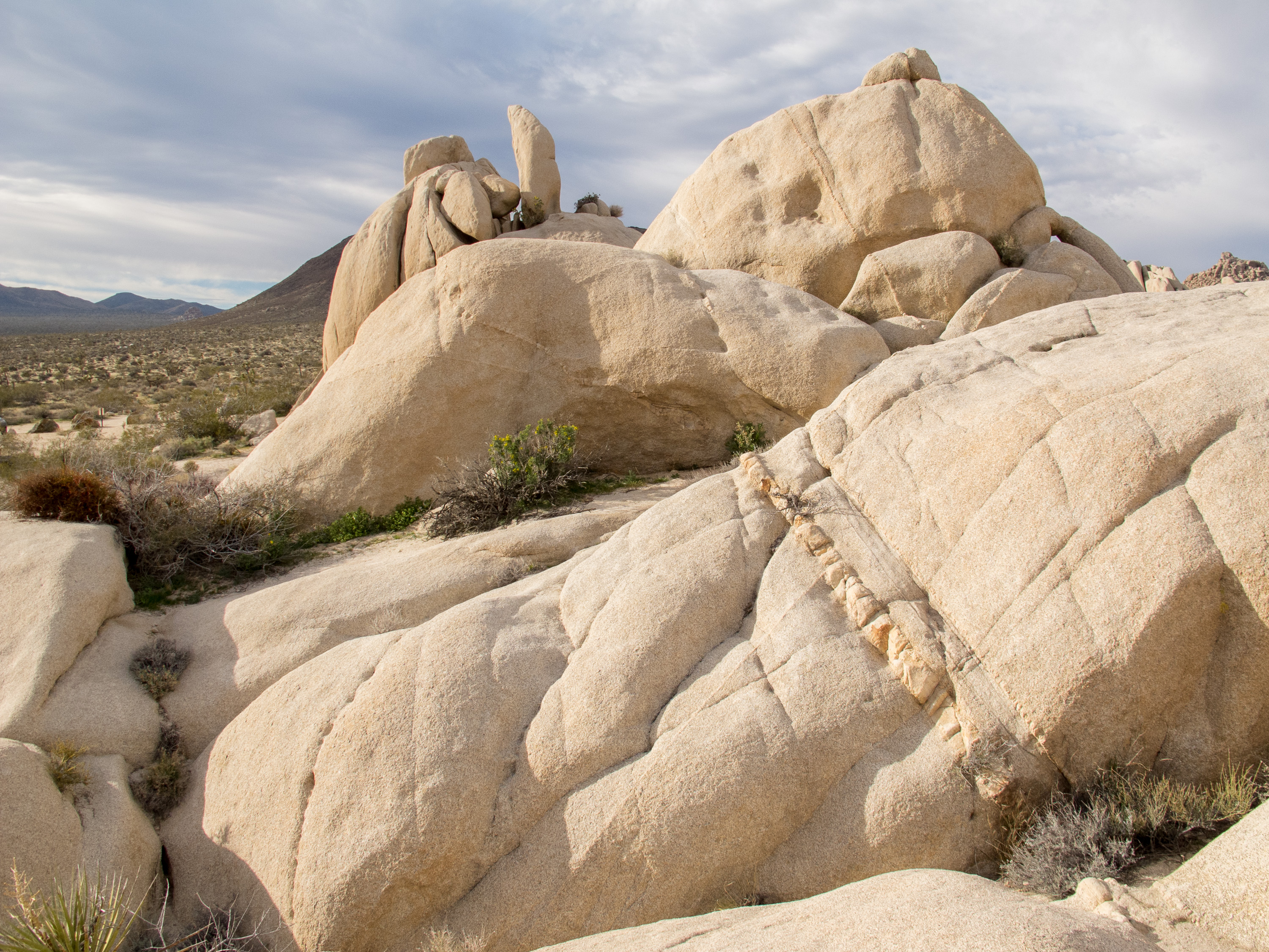
The drive is pure Joshua Tree scenery – jumbles of red rock boulder, hundreds of the name-sake Joshua trees, and the intriguing open expanse of the Pleasant Valley playa. On the way back, we stopped at Squaw Tank to see the small dam built by 19th century ranchers to collect rain water for their cattle. This was also an area used by nomadic Native Americans more than 1,000 years ago. The natural tanks were a great place to collect water and the openings in the rock could have been used for shelter. Stone mortars used for grinding see can be found in the bedrock.
Afterwards, we returned to the campground to settle in for the day. Jumbo Rocks is a beautiful destination in its own right, with huge boulders and interesting rock formations strewn throughout. It was nice to just sit in the back of the RV with a glass of wine, watching the rocks change colors in the evening light.
Day 2 – 4WD Covington Flats to Eureka Peak

We had company coming and not much food left after 10 days on the road, so needed to do a massive food shopping adventure at the Vons in Yucca Valley.
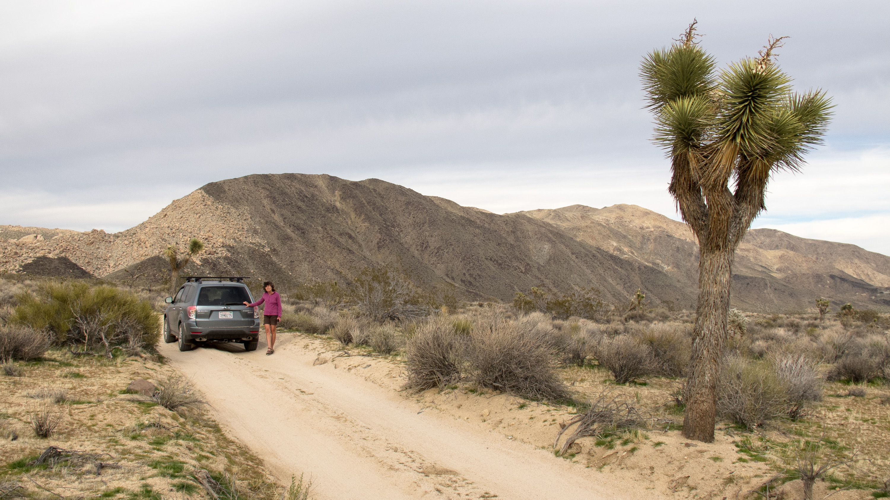
On the way out of the park, we stopped at the Visitor Center in Twentynine Palms to ask the ranger for an interesting 4WD road to take with a Subaru Forester. He told us that most of the off-roading in Joshua Tree is fairly hardcore and that the heavy winter rains had made conditions even more challenging, but that we should have no problem with Covington Flats to Eureka Peak in the northwestern corner of the park. Perfect. That was right near the Vons. We would do the drive first and then food shop afterwards.
The Covington Flats area was a great suggestion. The roads were good and we got to see some of the park’s largest and oldest Joshua trees. Some of them were more than 30 feet high. The weather started to change for the worse during our drive, and by the time we got to Eureka Peak, the wind was so strong that we couldn’t even get out of the car to enjoy the wonderful view. Still it was a really fun 25-mile drive.
The food shopping was a lot less fun, but it was kind of exciting to be getting ready for visitors.
Day 3 – Awaiting company and a cozy dinner for 8 in the motorhome

We awoke to the pitter patter of raindrops on our roof, which pretty much went on all day. Still, the view out the back window was nice and we had lots of good books to read.
Despite the lousy weather, the campground had totally filled up overnight. The forecast for Sunday and Monday was stellar, so I think people were willing to tough it out for one night in order to get a campsite.
Our whole gang arrived later that afternoon and since it was still raining, we all hung out in the motorhome. Amazing how much smaller it felt with eight people in it. Fortunately the mid-bath Lazy Daze has two couches in the back, between which you can set up a table. With that table and the dinette, we were able to fairly comfortably fit eight people for dinner. Let’s just say it was very cozy.
Day 4 – Rock Climbing – The Outbacks, The Blob, Bachar Boulder, and Barker Dam
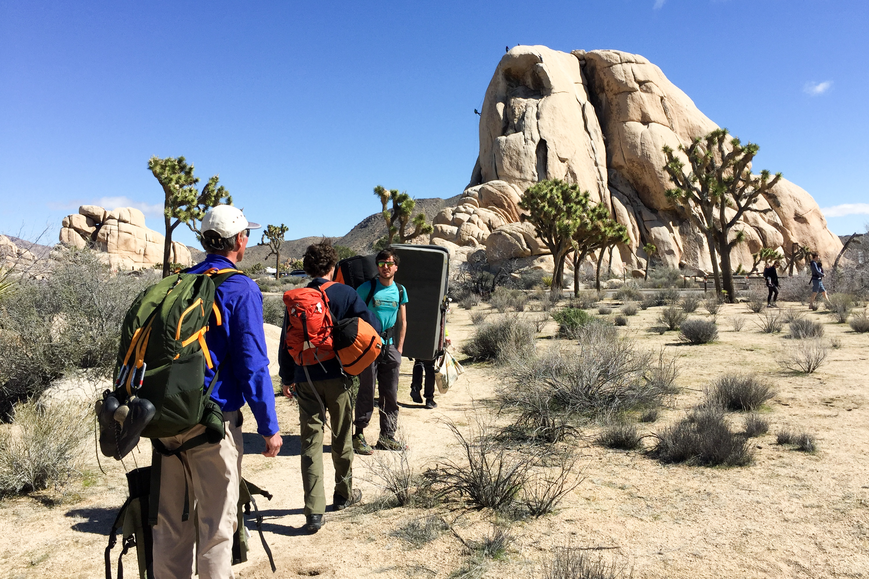
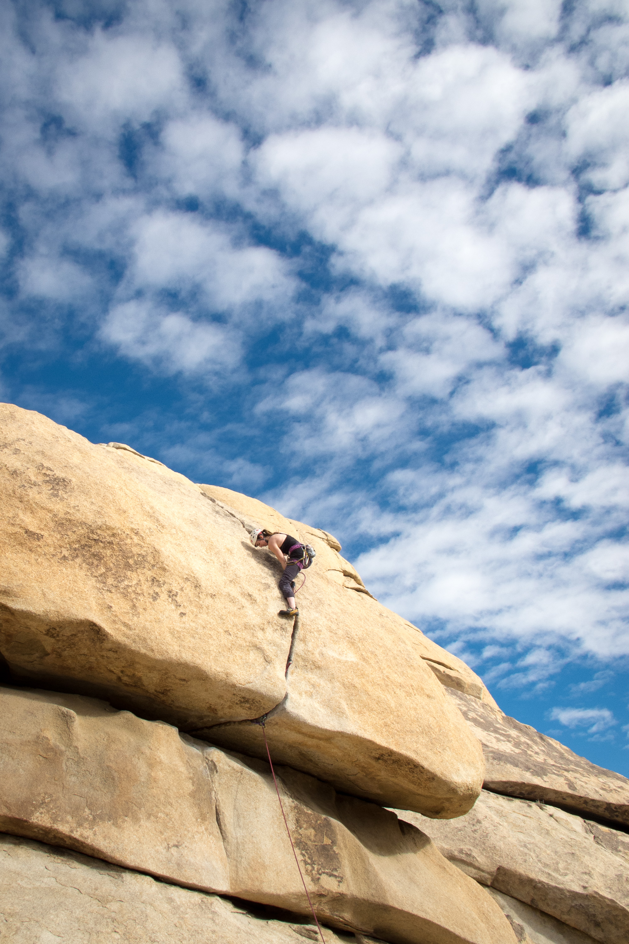
Joshua Tree is one of the most popular climbing areas in the country, especially in the winter where its relatively warm weather attracts climbers from around the world. I think we pretty much had hit it at its peak weekend. However, with over 8,000 climbing routes, Joshua Tree can accommodate a lot of climbers. The problem is finding a place to stay, or even park. Already by early morning, all the campgrounds were full and the day parking areas were overflowing.
Andrew and Celeste have different climbing preferences than Tommy and Erin. Andrew and Celeste tend to prefer bouldering and challenging sport routes while Tommy and Erin like trad, multi-pitch climbs. Fortunately, we could find both in the Hidden Valley Campground area, where we were early enough to find parking – even for the motorhome, which the kids insisted on bringing to that we could have a place make lunch. We shouldn’t have listened to them.

Herb and I followed Andrew and Celeste through the Hidden Valley Campground to a popular bouldering area called “The Outbacks.” Meanwhile, Tommy and Erin went to the North Face of “The Blob,” a huge amorphous formation on the northwest side of the campground.
After watching Andrew and Celeste boulder for awhile, Herb and I went to find Tommy and Erin on the Blob. I am definitely the weak link in this climbing family, but they are always so nice about trying to set me up on a climb that I can do, which usually means something in the 5.7 to 5.9 range. Erin led a 5.7 climb called the Hoblett so that I could follow her up. I found the bottom part fairly easy, but there was a really awkward off-width to get through the overhang. Eventually, I got it, but not without a lot of squealing.
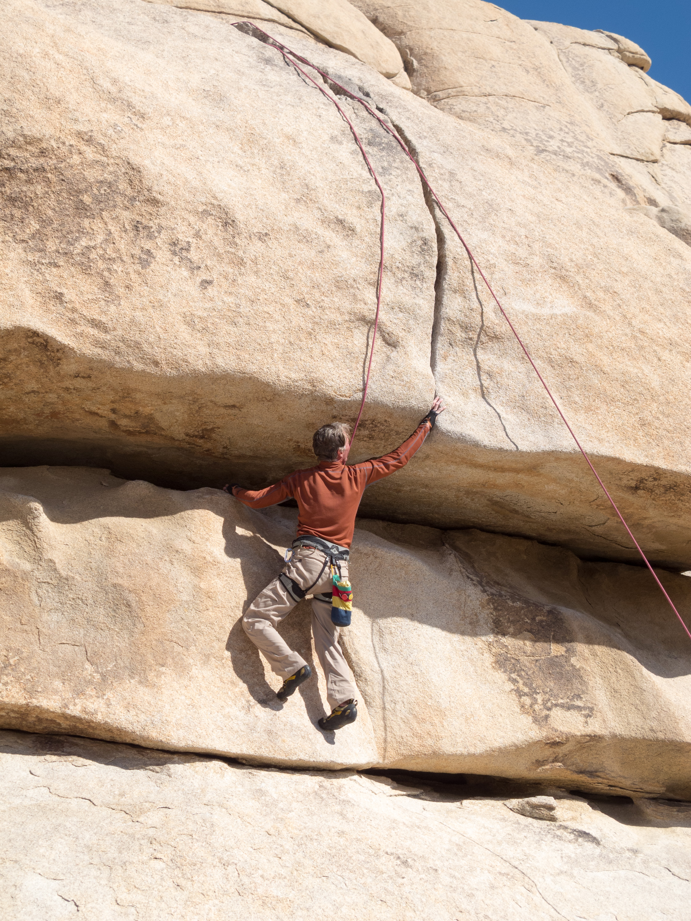
Next, we moved to the back side of the Blob, where Tommy and Erin took turns leading a 5.10d called Hobbit Roof. It was a very cool looking climb, with an intimidating roof dissected by a large crack. “Old Man Herb” (the boys’ affectionate term for their dad when he is climbing) did it as well. I passed, still licking my wounds from the Hoblett.
While we were finishing up on the Blob, Andrew and Celeste stopped by to say hello on their way to the “Bachar Boulder,” where Celeste had a date with destiny on the classic JBMFP (John Bachar Memorial Face Problem), a V5 boulder problem which she had worked on repeatedly and somewhat obsessively on their last visit to Joshua Tree.
Boulder routes are referred to as boulder problems, because figuring them out and completing them is very much like solving a problem – finding just the right moves and holds and putting the sequence together. Many climbers will work on a difficult boulder problem for weeks or even years. It is often quite elegant and beautiful to watch, and a cause for celebration when achieved.

Also, bouldering has its own difficulty grading system. Rather than the 5.0 – 5.14 grades used for trad and sport climbing, boulder routes are graded from V0 to V14. As far as difficulty, a V5 is about equivalent to a 5.12a/b trad/sport climb.
Although we didn’t get over to the Bachar Boulder in time to watch them, we heard later that Andrew flashed it the first time, and Celeste got to the very last move on three separate tries before falling.
Although I thought a lot of climbing had been done for the day, the kids were still ready for more. We decided to drive over to the Barker (not to be confused with Bachar) Dam to look for Gunsmoke, an 85 foot traverse rated V3.
Unfortunately, because we took the RV that morning, we were unable to get parking at the Dam, so Herb and I went back to the campground. However, they later reported that Andrew and Tommy simultaneously on-sighted Gunsmoke, while Celeste and Erin, too mentally drained from their previous efforts that day, wisely observed while drinking a beer.
Day 5 – Rock Climbing – The Outbacks, Intersection Rock, Bachar Boulder, and Tumbling Rainbow Formation
Another day in Joshua Tree with the kids meant another day of rock climbing. We headed back to the Hidden Valley Campground area and once again split up – Andrew and Celeste went back to the The Outbacks to play on the False Hueco Boulder and Tommy and Erin went to do a multi-pitch climb on Intersection Rock. It’s called Intersection Rock because it is literally at the intersection of Park Boulevard and Barker Dam road, rising like an island in the pavement. It’s sort of the center of the Joshua Tree climbing world.
Herb and I bouldered with Andrew and Celeste for awhile, and I even completed a boulder problem. Although it was easy by their standards, it was still scary for me, as it required me to climb about 10 or 12 feet off the ground without ropes.
From our boulder, we were actually able to spot Tommy and Erin climbing up the rightmost diagonal crack on Intersection. They were on a 5.10b route called Right Ski Track. When looking at it, you could easily see how it got its name.
Before meeting up with Tommy and Erin, Andrew made a few attempts on Caveman, a V6+ that actually started inside what felt like a cave.

Celeste was still pretty obsessed with completing the Bachar Boulder problem of yesterday, so we all walked over and watched her make a few more very noble and courageous attempts. She gathered quite an enthusiastic crowd to cheer her on, but as yesterday, she fell right at the very last move. It often takes climbers months, or even years, to complete a difficult bouldering problem, so she knew she still had lots of time to get it on future trips to JT.
The day was still young, so after consulting the climbing guidebooks, we walked along the Hidden Valley Nature Trail towards a climbing crag called Tumbling Rainbow Formation in the Real Hidden Valley Area.
When we came to the climber’s trail, Tommy and Erin went right to get to the base of Fisticuffs, a Yosemite-like 5.10b trad crack climb, while the rest of us went left towards the base of Run For Your Life, a classic 5.10b sport face route.
For me, the approach to the base of a climb is often an event in itself. This was certainly one of those instances. There was one section that was so steep, that I only made it up because three very friendly and helpful climbers took pity on me and set up a rope for me to pull my way up on. I probably reminded them of their mother.
They were so so nice and so entertaining to listen to. They were on the climb Andrew wanted to do, so we waited and watched them. The climb was rated as a 5.10b R, which means that the bolts are pretty spread out, so a fall at certain places would not be good. I was starting to get really worried. Fortunately, our new friends came to the rescue again and volunteered to take our rope up with them so that they could set up a top rope for us. I really, really liked them now.
While we waited, we watched Tommy and Erin on Fisticuffs around the corner to the right. After completing their climb, they came over to join us, just as our new climbing buddies were leaving.
All the kids, and Herb, were able to successfully climb Run for Your Life on top rope. They then each took a go on the more difficult Runaway, a 5.11b just to the left. Although none of them got it cleanly, they did have fun trying.
I was dreading my climb back down from the base, but the boys set up a rope for me to lower myself down through the bad section. Thank God. If not, I would still be there now.
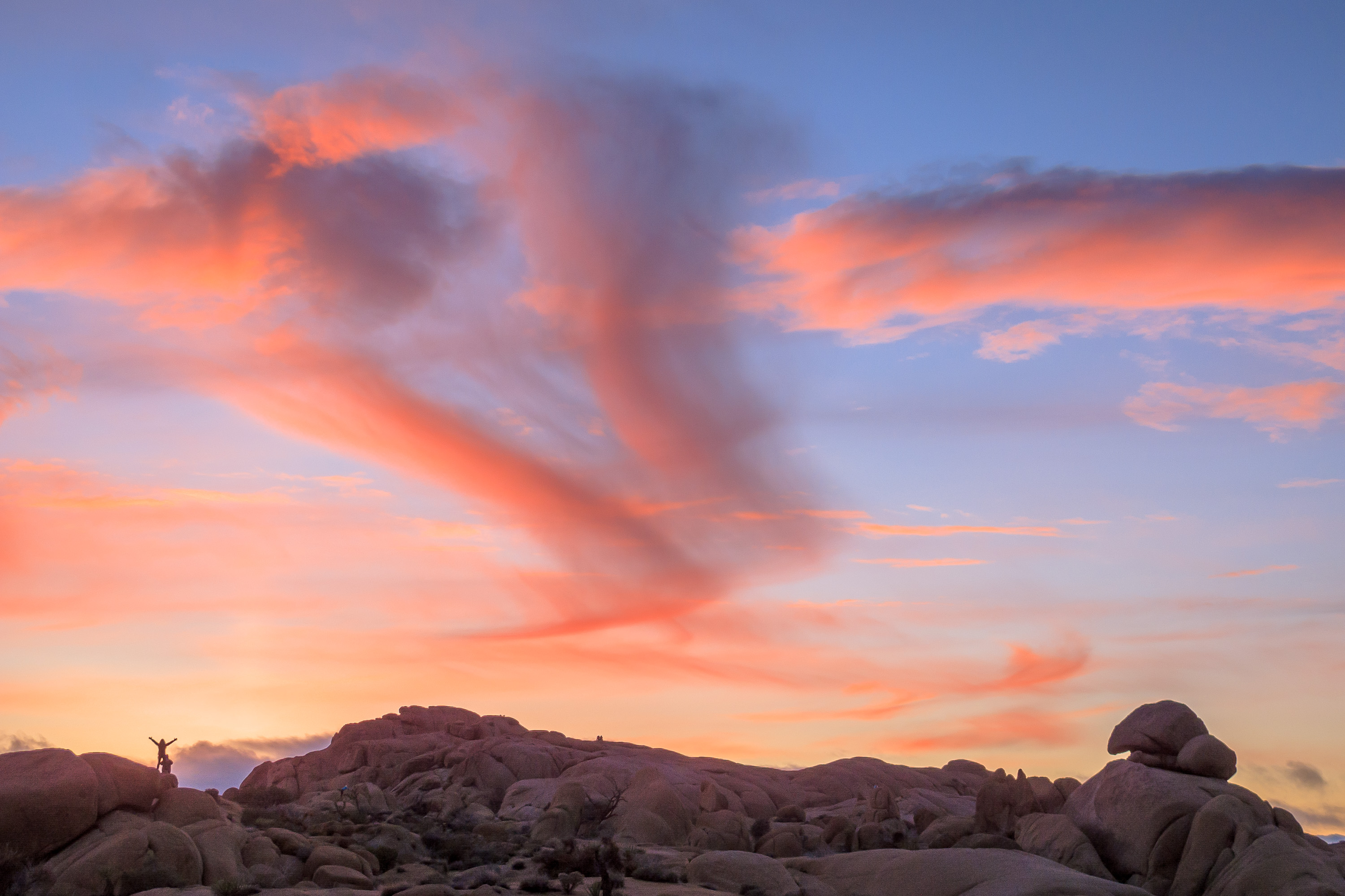
Another great day (our last in Joshua Tree) had been had by all - and another stunning sunset to enjoy.
That night Tommy and Erin drove to Palm Springs to have dinner with her grandmother, which made dinner for 6 seem almost spacious in the motorhome.
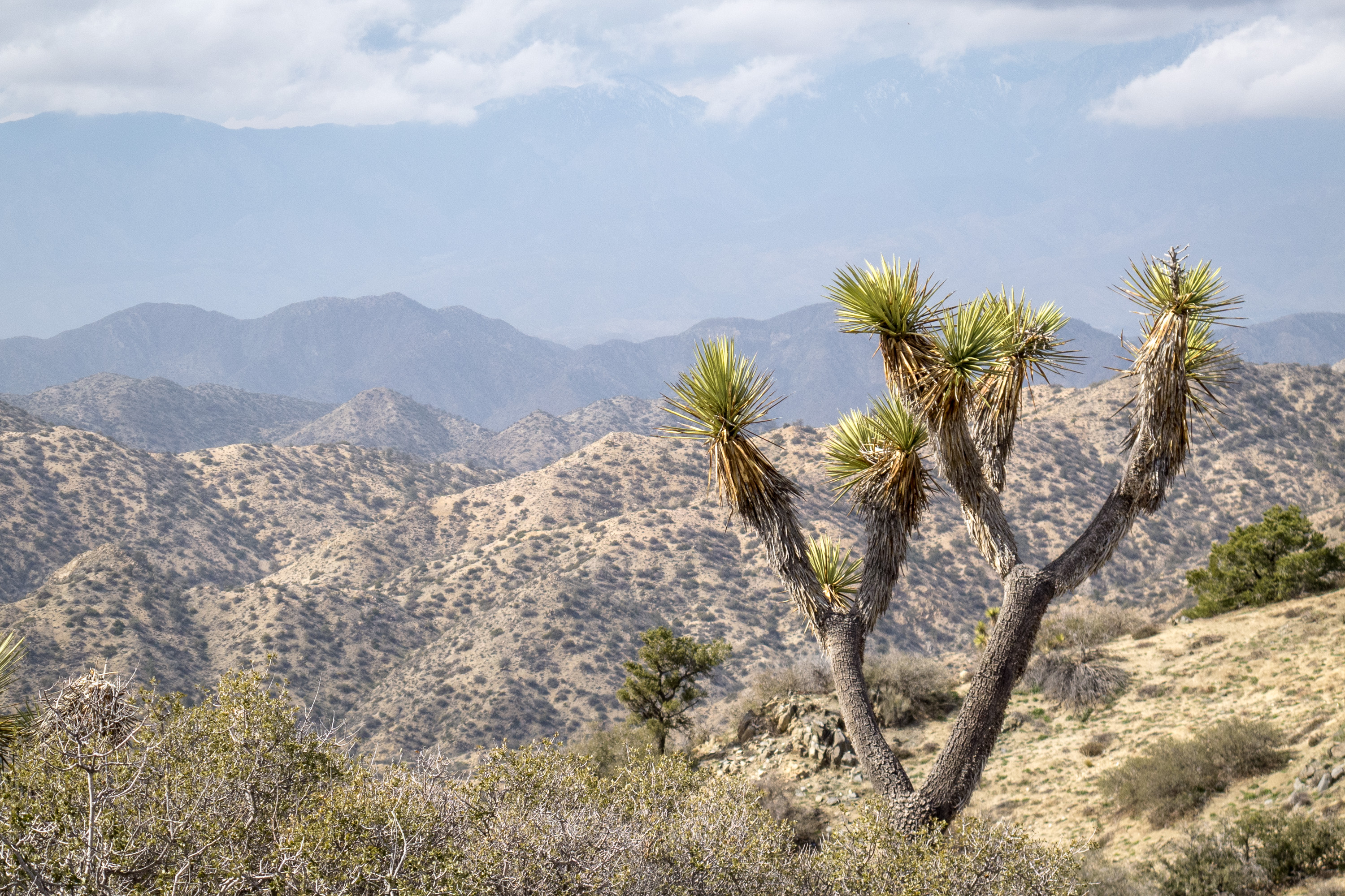
Joshua Tree, located 2 ½ hours east of Los Angeles and 2 ½ hours northeast of San Diego, encompasses 800,000 of pristine desert, one of the last great wilderness areas in the continental U.S. Two great desert systems meet within the boundaries of the park – the cooler, wetter, and higher Mojave Desert in the northwest and the hotter and drier Colorado Desert in the southeast.
The park’s namesake Joshua Trees are found in the Mojave section of the park, where they thrive on the cooler temperatures and higher elevation. They were named “Joshua” trees by early Mormon pioneers, who thought their thick, stubby branches resembled the arms of the prophet raised towards the heavens.
There are three visitor centers, one at each of the three entrances to the park: Joshua Tree (West Entrance), Oasis (North Entrance) and Cottonwood (South Entrance). Since there are no services (food, fuel, cell phone, etc.) within the park, visitors should stock up at one of the gateway towns just outside the park.
There are two major paved roads through the park:
- Park Boulevard – 45-minute drive through the northern section of the park, which traverses the most scenic portions of the park, including sweeping desert views, Joshua trees, and unique boulder formations.
- Pinto Basin Road - connects Park Boulevard with the southern portion of the park, passing from the higher Mojave Desert into the lower Colorado Desert.
Stops and activities along Park Boulevard include:
- Trailhead for the Boys Scout Trail (South) and the 7.1 mile round trip hike to Wonderland of Rocks, a maze of jumbled granite boulders with hidden groves of Joshua trees http://www.protrails.com/trail/160/joshua-tree-national-park-willow-hole-and-the-wonderland-of-rocks/Trail_Map
- Hidden Valley - 1-mile loop trail along the interior of a rock-enclosed valley. Rock climbing is popular in this area.
- Keys View – a short side trip (5 miles each way) to an overlook atop the Little San Bernardino Mountains (5,185 feet elevation) with panoramic views of the Coachella Valley and mountains beyond.
- Keys Ranch – a short side trip (2 miles each way) to a 150-acre ranch in a remote rocky canyon. Most of the original buildings – ranch house, schoolhouse, store, and workshop – have been restored to the way they were when William Keyes died in 1969. 90-minute walking tours of the ranch are offered daily.
- Trailhead for 3-mile round trip Ryan Mountain hike, a short but strenuous climb with one of the best panoramic views of Joshua Tree from its summit http://www.protrails.com/trail/155/joshua-tree-national-park-ryan-mountain
- Queen Valley – a side trip through a network of 13.4 miles of dirt roads through the park’s most impressive groves of Joshua trees. This is also the starting point for the Geology Tour Road.
- Geology Tour Road –18-mile dirt road through some of the park’s most distinctive geological formations. There are 16 stops along the way, so allow approximately 2 hours for the round trip. RVs are not allowed, but two-wheel vehicles may go as far as Squaw Tank, stop #9. After that point, only 4-wheel drive vehicles are advised.
- Jumbo Rocks – a wide plateau of boulders, buttes, and domes that glow with fiery hues at sunrise and sunset. The 1.7-mile Skull Rock Nature Loop passes through a maze of spectacular rock formations.
http://www.protrails.com/trail/349/joshua-tree-national-park-skull-rock-nature-loop - Junction with Pinto Basin Road – turn right for the Pinto Basin Road towards the southern portion of the park and left towards the North Entrance in the town of Twentynine Palms, where the Oasis Visitor Center is.
- Fortynine Palms Oasis - A short distance from the Oasis Visitor Center on Highway 62 is the turnoff for Canyon Road and the trailhead for the 3.3-mile (round trip) Fortynine Palms Oasis Trail. The moderately strenuous trail climbs up a ridge where barrel cacti grow and then descends a rocky canyon to a pool surrounded by fan palms. At dawn and dusk, bighorn sheep are often seen here.
http://www.protrails.com/trail/211/joshua-tree-national-park-forty-nine-palms-oasis
Stops and activities along Pinto Basin Road include:
- Trailhead for .3-mile Arch Rock Trail – this short trail leads through a boulder garden to a natural bridge nestled between two large boulders http://www.protrails.com/trail/213/joshua-tree-national-park-arch-rock-nature-trail
- Cholla Cactus Garden – a 1/4 -mile nature trail loops through a dense forest of Teddy Bear Cholla, Silver Cholla, and Creosote. The best time to visit is early morning and late afternoon when the cholla are backlit by the most dramatic lighting.
http://www.protrails.com/trail/265/joshua-tree-national-park-cholla-cactus-garden - Cottonwood Spring – located just 7 miles from the southern entrance to the park. In addition to a Visitor Center, several hikes begin from Cottonwood Spring:
The 3-mile loop trail to Mastodon Peak, a large rock formation that early miners thought looked like the head of a prehistoric Mastodon, with excellent views of the Eagle Mountains and the Salton Sea.
http://www.protrails.com/trail/162/joshua-tree-national-park-mastodon-peak-and-nature-loop-trailThe 7.2 miles roundtrip trail to the Lost Palms Oasis wherefan palms, large boulders and spring-fed pools line a deep and narrow canyon floor.
http://www.protrails.com/trail/161/joshua-tree-national-park-lost-palms-oasis
Activities in the park include:
- Hiking - There are more than 191 miles of hiking trails in Joshua Tree, ranging from ¼-mile nature trails to 35 mile multi-day trips. For a list of hikes see: http://www.protrails.com/area/24/joshua-tree-national-park#Trails
- Rock climbing - In addition to its namesake Joshua Trees, the park is also known for its granite boulders that attract rock climbers from around the world. There are more than 4,500 established routes in the park, ranging from bouldering for beginners in the Wonderland of Rocks to multiple pitch climbs at Saddle Rock and Echo Rock. The most famous climb is Hidden Valley’s Sport Challenge Rock.
- Mountain biking and 4-wheel driving - Check out this link for a listing of dirt roads in the park: http://www.gorp.com/parks-guide/travel-ta-joshua-tree-national-park-scenic-drives-california-sidwcmdev_067193.html#ixzz2vlCU5aj0
There are 9 campgrounds in the park (none of which have hookups)
- Black Rock Canyon Campground (reserveble) - located in the northwest corner of the park at the end of Joshua Lane, 5 miles south of the town of Yucca Valley. Campsites are located on a hillside at the mouth of a canyon surrounded by Joshua trees, cholla cactus, and various desert shrubs. Several hiking trails start from the campground. There are 100 sites for tents or RVs up to 35 feet.
- Indian Cove Campground (reservable) - located in the northern part of the park at the end of 3-mile long Indian Cove Road, 7 miles from the town of Twentynine Palms.The campground is very popular with rock climbers because it lies within the Wonderland of Rocks. There are 101 sites for tents or RVs up to 35 feet.
- Hidden Valley Campground (first-come-first-served) - located in the northern section of the park along Park Boulevard, about 14 miles south of the town of Joshua Tree. Two miles from the campground at Barker Dam is the trailhead for a one-mile loop through the Wonderland of Rocks and a small lake that reflects the rock formations. This campground is very popular with rock climbers. There are 45 sites for tents and RVs up to 25 feet (no hookups).
- Ryan Campground (first-come-first-served) - located on Park Boulevard a few miles south of Hidden Valley Campground. The best hike in the park – the three mile roundtrip to the summit of Ryan -- Mountain starts here. There are 31 sites for tents and RVs up to 25 feet (no hookups).
- Sheep Pass Group Camp (first-come-first-served) - located a few miles east of Ryan Campground. There are six group camps for tents or RVs up to 25 feet.
- Jumbo Rocks Campground (first-come-first-served) - located about 9 miles south of the town of Twentynine Palms on the Utah Trail. Its unique granite rock formations make it a very popular spot for rock climbers. At 4,400 feet, this campground is the highest campground in the park. There are 125 sites for tents and RVs up to 25 feet.
- Belle Campground (first-come-first-served) - located on the Pinto Basin Road about 1.5 miles south of the junction with the Utah Trail. There are 18 sites for tents and RVs up to 35 feet.
- White Tank Campground (first-come-first-served) - located on the Pinto Basin Road about 3 miles south of the junction with the Utah Trail. There are 15 sites for tents and RVs up to 25 feet.
- Cottonwood Campground (first-come-first-served) - located on the Pinto Basin Road about 7 miles north of the Southern Entrance. There are 62 sites for tents and RVs up to 35 feet.