- Home
- About
- Map
- Trips
- Bringing Boat West
- Migration West
- Solo Motorcycle Ride
- Final Family XC Trip
- Colorado Rockies
- Graduates' XC Trip
- Yosemite & Nevada
- Colorado & Utah
- Best of Utah
- Southern Loop
- Pacific Northwest
- Northern Loop
- Los Angeles to NYC
- East Coast Trips
- Martha's Vineyard
- 1 Week in Quebec
- Southeast Coast
- NH Backpacking
- Martha's Vineyard
- Canadian Maritimes
- Ocracoke Island
- Edisto Island
- First Landing '02
- Hunting Island '02
- Stowe in Winter
- Hunting Island '01
- Lake Placid
- Chesapeake
- Provincetown
- Hunting Island '00
- Acadia in Winter
- Boston Suburbs
- Niagara Falls
- First Landing '99
- Cape Hatteras
- West Coast Trips
- Burning Man
- Utah Off-Roading
- Maui
- Mojave 4WD Course
- Colorado River Rafting
- Bishop & Death Valley
- Kauai
- Yosemite Fall
- Utah Off-Road
- Lost Coast
- Yosemite Valley
- Arizona and New Mexico
- Pescadero & Capitola
- Bishop & Death Valley
- San Diego, Anza Borrego, Joshua Tree
- Carmel
- Death Valley in Fall
- Yosemite in the Fall
- Pacific Northwest
- Utah Off-Roading
- Southern CA Deserts
- Yosemite & Covid
- Lake Powell Covid
- Eastern Sierra & Covid
- Bishop & Death Valley
- Central & SE Oregon
- Mojave Road
- Eastern Sierra
- Trinity Alps
- Tuolumne Meadows
- Lake Powell Boating
- Eastern Sierra
- Yosemite Winter
- Hawaii
- 4WD Eastern Sierra
- 4WD Death Valley +
- Southern CA Deserts
- Christmas in Tahoe
- Yosemite & Pinnacles
- Totality
- Yosemite & Sierra
- Yosemite Christmas
- Yosemite, San Diego
- Yosemite & North CA
- Seattle to Sierra
- Southwest Deserts
- Yosemite & Sierra
- Pacific Northwest
- Yosemite & South CA
- Pacific Northwest
- Northern California
- Southern Alaska
- Vancouver Island
- International Trips
- Index
- Tips
- Books
- Photos/Videos
- Search
- Contact
The Loneliest Road through Nevada , NV
Saturday, September 9, 2023 - 8:15pm by Lolo
457 miles and 8 hours from our last stop - 1 night stay
Travelogue
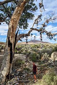 The Shoe TreeOur first planned destination for this trip was Goblin Valley State Park in Utah, 900 miles (15 hours) from home. I love Goblin Valley and was ecstatic that I was able to get the last available campsite.
To avoid turning this into a death march, we planned to spend 3 days getting, stopping to do some fun stuff along the way.
Our drive would take us all the way across Nevada (from Reno to Baker) on US 50, also known as “The Loneliest Road in America.” They weren’t kidding about the road being lonely. For close to 400 miles, we wound across the entire width of Nevada, passing through an occasional small town (some of which looked like they were left over from the gold rush), but otherwise just miles and miles of mountains, desert, and sagebrush. This road used to be a Pony Express Route.
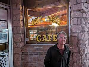 Night out on the townFor the purpose of this writeup, I will use miles from Reno to describe the location of stops.
The first place of note we passed through (mile 60) was the relatively large (for Nevada) town of Fallon, with 7,000 residents and plenty of shopping malls and food chains. Fallon is home to the U.S. Navy-Fighter Weapons School and is where the film Top Gun: Maverick was filmed.
30 miles after Fallon (mile 90), we passed a sign for Sand Mountain Recreation Area, an OHV area that allows dune buggies to whip around on a 2-mile-long, 600-foot-high sand dune.
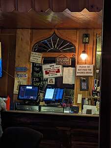 Nevada bar humorHerb has never met a dune he didn’t like, so we vowed to stop here on the way back home, especially when we learned that it is one of a rare group of “singing sand dunes.” There are only about 40 of them in the entire world. We have been to two of them - Kelso Dunes in the Mojave Preserve and Eureka Dunes in Death Valley.
Basically, when you run down the steep part of a dune, the sand avalanches in rivulets and begins to “sing.” The singing is caused by the friction of the sand grains sliding against each other. It sounds a bit like the bass note of a pipe organ or the distant drone of an airplane.
At mile 110, in the tiny town of Middlegate, Nevada, we were told by a friend to keep an eye out for the “Shoe Tree.” We didn’t have to try too hard to find it. All I needed to do was key in “Shoe Tree” in Google Maps. Sure enough, Google directed us to a lone cottonwood tree strung with hundreds of pairs of shoes, in the middle of nowhere set against a barren arid desert and mountains.
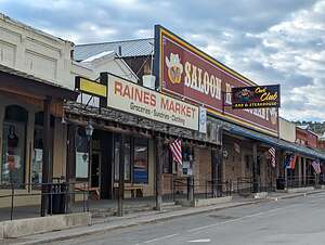 Eureka Main StreetOf course, there is a story behind this strange tree. Who knows if it’s actually true. Anyway, it goes like this: One night while camping under a large cottonwood tree, a newlywed couple got into an argument. When the woman threatened to leave, her newly-minted husband said, “Well, then you’ll have to go barefoot,” and proceeded to throw her shoes up into the tree and drive off to a nearby bar. The bartender, and probably a few beers, convinced the man to go back to the tree and reconcile with his wife, while he did, and they lived happily ever after. Several years later they returned to the tree with their first child and threw his shoes up into the tree under which they had fought and reunited.
A Lot of people must fight under this tree, because there were hundreds of them.
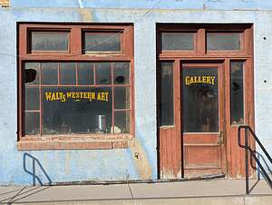 Eureka Art GalleryFor the next 60 miles or so there was pretty much nothing but sagebrush desert. The road began to climb to 6,000 feet as we approached the tiny town of Austin (population 300), on the northern slope of the Toiyabe Mountains at mile 170.
110 miles after Fallon, we climbed the steep Toiyabe Mountains and came to the tiny town of Austin (population 300), another one of Nevada’s silver mining boom towns gone bust. We didn’t stop, but just slowly drove along the steep Main Street through town. If we blinked, we would have missed it.
Leaving Austin, the road climbs steeply to Austin Summit (elevation 7,484) before descending to the longest and flattest stretch of the drive through miles and miles of Great Basin nothingness.
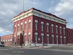 Eureka County Courthouse70 miles past Austin, we arrived in Eureka (mile 243), where we would spend the night. With a population of 480 it wasn’t much bigger than Austin.
Eureka is one of the best-preserved mining towns in Nevada. In fact, Eureka County is still mining gold and has one of the largest and productive mines in the country. Along its 4 blocks of franchise-free Main Street are some interesting historic buildings, including the 1879 Eureka County Courthouse (still in use), an old newspaper office (now a museum), and an 1880s opera house.
There weren’t many motel or dining options in towns, but fortunately the SureStay by Best Western and the Owl Cafe and Steakhouse were fine.
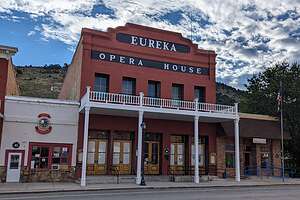 Eureka Opera HouseThe Owl Cafe was hopping, mostly filled with miners and construction workers still in their work clothes. Then it started to fill with tourists passing through. We recognized most of them from our hotel. They must have been short staffed that night because it took us two hours to get our hamburgers. We were just about to walk out (don’t know what we would do instead), when they finally arrived. The hostess was very apologetic and even gave us a 10% discount.
We had made a good dent in our drive to Goblin Valley today - about half of the 15 hours from home. That meant that we could slow the pace down over the next 2 days and stop and have some fun.
- 1 of 16
- next ›
The Loneliest Road through Nevada location map in "high definition"
Javascript is required to view this map.
