- Home
- About
- Map
- Trips
- Bringing Boat West
- Migration West
- Solo Motorcycle Ride
- Final Family XC Trip
- Colorado Rockies
- Graduates' XC Trip
- Yosemite & Nevada
- Colorado & Utah
- Best of Utah
- Southern Loop
- Pacific Northwest
- Northern Loop
- Los Angeles to NYC
- East Coast Trips
- Martha's Vineyard
- 1 Week in Quebec
- Southeast Coast
- NH Backpacking
- Martha's Vineyard
- Canadian Maritimes
- Ocracoke Island
- Edisto Island
- First Landing '02
- Hunting Island '02
- Stowe in Winter
- Hunting Island '01
- Lake Placid
- Chesapeake
- Provincetown
- Hunting Island '00
- Acadia in Winter
- Boston Suburbs
- Niagara Falls
- First Landing '99
- Cape Hatteras
- West Coast Trips
- Burning Man
- Utah Off-Roading
- Maui
- Mojave 4WD Course
- Colorado River Rafting
- Bishop & Death Valley
- Kauai
- Yosemite Fall
- Utah Off-Road
- Lost Coast
- Yosemite Valley
- Arizona and New Mexico
- Pescadero & Capitola
- Bishop & Death Valley
- San Diego, Anza Borrego, Joshua Tree
- Carmel
- Death Valley in Fall
- Yosemite in the Fall
- Pacific Northwest
- Utah Off-Roading
- Southern CA Deserts
- Yosemite & Covid
- Lake Powell Covid
- Eastern Sierra & Covid
- Bishop & Death Valley
- Central & SE Oregon
- Mojave Road
- Eastern Sierra
- Trinity Alps
- Tuolumne Meadows
- Lake Powell Boating
- Eastern Sierra
- Yosemite Winter
- Hawaii
- 4WD Eastern Sierra
- 4WD Death Valley +
- Southern CA Deserts
- Christmas in Tahoe
- Yosemite & Pinnacles
- Totality
- Yosemite & Sierra
- Yosemite Christmas
- Yosemite, San Diego
- Yosemite & North CA
- Seattle to Sierra
- Southwest Deserts
- Yosemite & Sierra
- Pacific Northwest
- Yosemite & South CA
- Pacific Northwest
- Northern California
- Southern Alaska
- Vancouver Island
- International Trips
- Index
- Tips
- Books
- Photos/Videos
- Search
- Contact
Auckland Airport Hotel
Monday, January 12, 2026 - 11:15am by Lolo33 miles and 1 hour from our last stop - 1 night stay
Travelogue
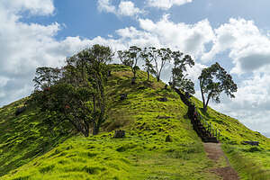 Mangere MountainAfter the Muriwai Grotto, we drove back to Auckland and dropped off the motorhome. Everything checked out perfectly - no damage of any sort, and they thanked Herb for rather creatively dealing with the problem of the gray water pipe bracket coming loose.
When we mentioned that we were looking for something to do from our airport hotel, he asked if we had been to the Mangere Volcano. A volcano in Auckland?
Well, yes. It turns out that Auckland, with its 53 distinct volcanic centers, has more volcanoes than any other city in the world, although the numerous ones in cities like Naples and Mexico City are much larger and more active.
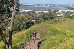 Hiking to the summitSo after being dropped off at our airport hotel, we set off through the suburban streets of Mangere to climb Mount Mangere, a dormant scoria cone volcano, part of Auckland's volcanic field, formed around 18,000 years ago.
When we got to where Google Maps told us that we were at the base of the Mangere Crater hike, I was surprised to see that it was a grassy hill. In fact, I think we had seen this hill on our first hike in Auckland two weeks ago, but never thought it was a volcano.
The walk began on a wide gravel path that gradually climbs up the hill. To reach the highest point, we climbed a series of 160 stone and wooden stairs, with views along the way of the Auckland city skyline, the Sky Tower, and Manukau Harbor.
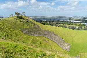 From the summitFrom the summit, we could see the walls of the crater. The crater and heavily terraced slopes were once home to thousands of the Tupuna Maunga tribe. It was the site of one of the largest and most strategic pā (fortified settlements) on the Auckland isthmus, and of deep cultural significance to the local Māori.
We didn’t notice at the time, but later learned that there are hundreds of small rectangular depressions in the grass along the crater rim. These were used to store kūmara (sweet potato) and other crops grown in the fertile volcanic soil.
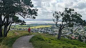 The way downFrom there we went down the other side of the mountain, this time with views of the lovely Mangere suburbs.
Rather than hike back through the suburbs, when we got to the bottom we took an Uber back to the hotel.
That evening, we returned to the Post Office Public House for a delicious Lamb Shank dinner.
Muriwai Gannet Colony
Thursday, December 11, 2025 - 5:15pm by Lolo34 miles and 1.25 hours from our last stop - 1 night stay
Travelogue
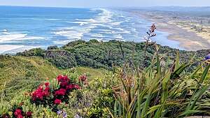 Muriwai Beach LookoutThe next, and final stop, of our campervan adventure was Muriwai Beach and its famous gannet colony.
Although the distance from Piha to Muriwai was probably only about 10 miles as the crow flies (or in this case, gannet), the rugged terrain of the Waitākere Ranges and steep coastal cliffs make a direct beachfront road impossible.
Instead we had to go back up the steep, windy Piha Road, across the Scenic West Coast Road, and then down Muriwai Road.
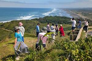 Tour bus joins us at Muriwai Beach LookoutLike Piha Beach, Muriwai Beach was another “wild” Tasman coast beach, with huge surf, black sand, and rugged cliffs, but instead of an iconic rock being the highlight, Murawai was all about the gannets, specifically its colony of 1,200 pairs
We got our first glimpse of Murawei Beach from a scenic roadside lookout along Waiteo Road. No gannets yet, just black sand and crashing waves. Very pretty.
We had to take a photo quickly though because it wasn't long before a large tour bus pulled behind us and about 30 excited tourists jumped out and started doing social media poses in front of our shot.
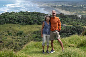 Quick shot before the next tour busI had to remember that even though it seemed like we were in a wild, remote part of the island, we were only a 40-minute drive from Auckland.
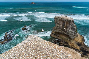
We waited for a while after the tour bus left before going down to the Upper Viewing Platform, where we got our first view of the entire gannet colony atop the massive cliffs at Otakamiro Point.
Wow! What a breathtaking sight!
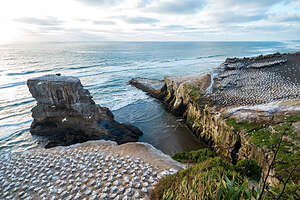 Muriwai CliffsThese cliffs would be worth a visit even when not covered in gannets. The fluffy, wavy “megapillow” lava formations at their base are so beautiful they seem unreal. This is what happens when an underwater volcano (17 million years ago) erupted deep underwater and cooled immediately upon contacting cold seawater. These formations are considered a world-class geological feature in their own right.
Just offshore are the Motutara and Oaia islands, two sheer-sided sea stacks rising out of the surf. We had to look closely to see that they too had a gannet colony on top, although much smaller than that on Otakamiro Point.
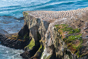 Muriwai CliffsThese two small islands were the feeder colonies for Muriwai and the only gannet colonies in the area before 1979 when overcrowding forced many of the birds to leave their island homes and colonize the mainland cliffs at Otakamiro Point, making it one of only three mainland colonies in New Zealand.
Gannets usually prefer islands because of the lack of predators, like ferrets and feral cats. However, the height and steepness of Otakamiro Point practically make it an island in terms of accessibility by predators.
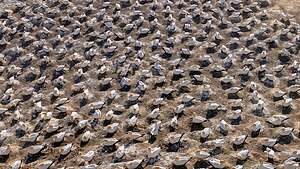 Honeycomb-like pattern of nestsThat’s what makes this place so special and unique - the ability to see them up close and personal (which we would later from the Lower Platform) rather than afar from a boat.
From the Upper Viewing Platform, we got a dramatic overall view of the entire colony, and the one on Motutara Island as well.
What was particularly striking from above was the beautiful, honeycomb-like pattern across the entire cliff face, formed by the precise placement of nesting sites when the gannets returned in August.
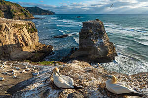 Best real estate in townEvery year from August to March, these clifftops are transformed into a dense city of birds with about 1,200 pairs, crowded together with barely an inch to spare.
But these birds have figured it out.
Because gannet colonies are so crowded, they have evolved a way to prevent fighting while still maximizing their nesting area. When a gannet sits on its nest, it reaches out its neck and beak in every direction to make sure it can’t reach its neighbor. It’s called “peck distance," and anything within that peck distance is their territory.
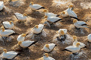 Urban living on pizza-size nestsThe result is a pattern of tiny pizza-size nests, where every nest is about 80 to 100 cm (31.5 to 39.5 in) apart, rather small for a bird with a 6-foot wing span.
This distance is slightly more than the combined length of two necks and beaks, providing a safety buffer and preventing unnecessary, energy-wasting squabbles. Not an inch of space is wasted.
The Upper Viewing Platform is also a great place to watch gannets in flight.
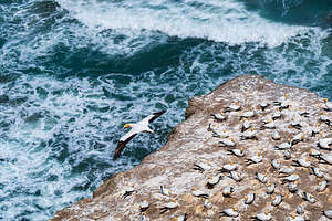 Gannet in flightThe prevailing south-westerly winds hit the cliff face and create powerful updrafts, so all these large birds need to do is shuffle to the edge of the cliff, wait for a gust, and simply tip forward into the air. Voila, flight!
Their return is not quite as graceful though, as their landing pad is the size of a pizza surrounded by cranky neighbors ready to peck at them if they don’t perfectly “stick” it.
As the gannet arrives back at the cliffs, it circles the colony and locks his eyes on his specific nest. As it gets closer, it tilts its long wings to catch the wind, and hovers for a moment while calculating his trajectory.
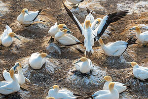 "Sticking" the landingIt then transforms its body into a sort of air brake, fanning out its tail feathers, splaying its large webbed feet forward to create maximum drag, and angling its 6-feet wings vertically to act as an air brake.
It has to position itself perfectly just above the nest, because it must drop down vertically so it won’t hit its neighbor, who will react quite swiftly and aggressively if his “airspace” is invaded.
It’s a bit like a masterly execution of a “controlled crash.”
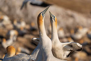 Sky-pointingBut it ain’t over yet, as the incoming mate must “authenticate” itself to its mate, which is done with a fencing ritual (also known as the mutual greeting ceremony).
The ritual begins with “sky-pointing,” where both birds stretch their necks to the sky, beaks pointed vertically.
Next comes the fencing part, where the birds bring their heads down, stand breast-to-breast, and clatter their long pale-blue beaks together like wooden swords.
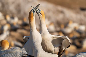 Fencing RitualWhile their beaks remain in contact, they move in a synchronized rhythm, swaying their heads from side to side.
The grand finale is mutual preening, where the birds nibble and preen the feathers on each other’s heads and necks, a sign of deep trust.
This fencing ritual helps to strengthen their life-long pair bond and survive the grueling task of raising a chick - something I can relate to. It was quite beautiful and touching to watch.
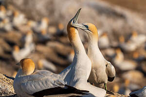 Mutual preeningWe would return to the Upper Viewing Platform this evening during golden hour, but for now we continued down the path as it winded around the cliff edge to the Lower Platform, where we got a much better closeup and intimate view of these intriguing birds, often from just a few feet away.
Up close, we could see that they are quite beautiful, although no bird will ever take the place that Icelandic puffins hold in my heart.
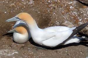 Pair bondingBut they definitely are more elegant, with their brilliant white feathers, golden-yellow plumage on their head and neck, and deep black along the edge of their wings.
They have very interesting faces as well, with a long pale blue-gray beak, and what looks like Egyptian eye liner around their pale blue eyes.
Down on the Lower Viewing Platform, we could see just how busy and chaotic the colony is. By December, the quiet, disciplined egg “incubation” phase has largely transitioned into the high-energy "nursery" phase, as this is the peak month for chicks to be growing rapidly.
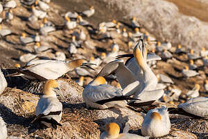 Busy, chaotic placeEgg hatching usually peaks in mid-November. However, since the colony is asynchronous, meaning the birds don't all lay their eggs at exactly the same time, it can occur as early as October or as late as January.
So being here in December had the major advantage of being able to observe both these stages of gannet parenting, from incubating the egg to tending to tiny, newly hatched chicks.
We were still able to see a few pairs in the incubation phase, where they took turns sitting on the nest for several days while their partner went out to sea hunting for food. Since gannets don’t have a “brood patch” (a featherless area of skin on their belly) like many other birds do, they keep their egg warm by wrapping their warm, webbed feet around the egg and resting their body on top.
 Incubation PhaseThe nests themselves look like miniature volcanoes made of kelp, grass, and guano. The guano acts as mortar, cementing the grass and kelp into a rock-hard structure. The center of the mound has a shallow depression where the single, pale-blue egg sits - like on a tiny throne.
Because of the tight real estate, each mound is only 12 inches across, just large enough to support a parent and one chick.
When the chick hatches, after 44 days of incubation, it is blind and featherless, looking more like a tiny dinosaur than the big beautiful bird he would become.
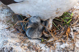 Little ugly dinosaur phaseMost of the pairs that we saw were already in the “nursery” phase, and their hatched chicks had already transformed from ugly little dinosaurs into cute little fluffy “snowballs” covered in thick white down.
Since the parents lay only one egg per season, they are fiercely protective. The parent must ensure the chick stays exactly on its nesting mound, because if it wanders even a few inches into a neighbor’s nest area, it will be attacked.
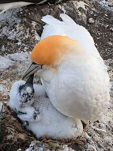 Cute little snowball phaseDuring the nursery phase, both parents take turns flying out to sea to hunt for food for their chicks. They eat things like anchovies and then regurgitate the semi-digested fish into the chicks mouths. We actually watched a young chick reach deep inside its parent’s throat to retrieve his “fish soup.”
This feeding process is so efficient that by 10 weeks the chick actually weighs more than its parents. The chick would need this extra fat for its upcoming 2,000 km migration to Australia.
The growing chick requires so much food, that one parent is almost always away hunting at sea. It’s hard to satisfy their growing appetites, and are often seen pecking at their parent’s beak, begging them to regurgitate more food for them to eat.
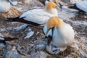 Lunch timeDecember is arguably the best time for photography because the colony is utter chaos with so much going on at once. We had observed a lot of different behaviors - incubating the egg, protecting and feeding the newborn chick, flight into and out of the colony, and the fencing ritual, but there were a few things going on that we didn’t understand until I got home and used our photos to do some research.
One of these behaviors, which was not that uncommon, was seeing three gannets tangled together in a noisy squabble. It was hard to tell where one gannet ended and the next one started.
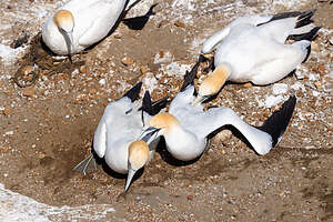 3 bird squabbleIt’s quite the neighborhood drama, mostly the result of their extremely close nesting sites, and one of them crossing into the personal space of its neighbor, intentional or not.
Because gannets have serrated, dagger-like beaks and powerful neck muscles, a three-way fight is a violent, noisy spectacle, often triggering a chain reaction in the colony where everyone starts jabbing at whoever is close by.
Unlike birds that just peck and retreat, gannets grab each other by the beak and hold on, often forming a daisy chain where Bird A grips the beak of Bird B, while Bird C is clamped onto the back of Bird A’s neck.
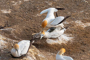 Mating Part 1We never saw one of these fights end. I think they go on for a pretty long time, eventually stopping when they just get too exhausted, or forget why they were fighting in the first place.
There was one more gannet activity that we observed, about which Herb and I came to different opinions as to its purpose.
We watched as one bird firmly grasped the back of the head of another gannet, right where the beautiful golden-yellow plumage is, and pulled on it with its beak. It didn’t look pleasant, but the one being pulled on remained still and had no real reaction.
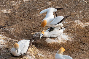 Mating Part 2 - BalancingTo me, it looked like a form of aggression and bullying, but to Herb it looked like mating. Of course it did.
As we continued to watch, the head pulling bird climbed up on the back of the other bird and placed his feet on her back and extended his wings, as if to maintain balance for some reason. He was still holding on to her head with its beak.
That only lasted for a few seconds before the male dismounted and they did their pair-bonding fencing ritual, clattering their beaks together and stretching their necks towards the sky.
Okay, Herb was right. This was their mating ritual.
.thumbnail.jpg) Post-coital snuggleI tried defending my naivety with the question of why they would possibly be mating in December when all the other pairs were already nursing their chicks.
Post-coital snuggleI tried defending my naivety with the question of why they would possibly be mating in December when all the other pairs were already nursing their chicks.
Just for fun? He suggested.
I hate to admit it, but once again he wasn’t completely wrong, although that was not the main reason you see this activity in December.
The most common reason for late-season mating is that the pair has lost their first egg in November and is trying for a “replacement egg.”
 Good luck in FebruaryThe second reason (Herb’s explanation) is that gannets, who are monogamous and mate for life, are constantly trying to reinforce their partnership and strengthen their “pair bond,” and this is a good (and fun) way to do so.
Wow! I think we had pretty much seen it all.
Too bad we wouldn’t be here in February though for the final and most dramatic phase of life as a gannet chick, when they would begin their migration to Australia. Having never flown before, they would take the ultimate leap of faith, walking to the edge of the Otakamiro Point cliffs and simply throwing themselves off and hoping for the best.
Just think what guts this takes. They have never flown before, their parents aren’t coming with them, and they will be completely on their own for an 8 to 14 day, 1,740-mile solo journey to Australia, not returning to Muriwai for several years.
 Off to find the Muriwai GrottoIt is considered one of the most remarkable journeys in the animal kingdom.
The next morning before leaving Muriwai to head back to Auckland to return our campervan, we parked in the lot at the very southern end of the beach, and set out to find the Muriwai Grotto.
The grotto is only safely reached at low tide, which it certainly looked like it was. I asked a surfer just to make sure, because you don’t want to mess around with the West Coast’s surf.
The wind was whipping as it so often does here. That’s why the gannets live here.
I had become so engrossed with the lives of gannets yesterday that I could picture them standing at the edge of the cliff above us and tipping into an updraft to get dinner for its family.
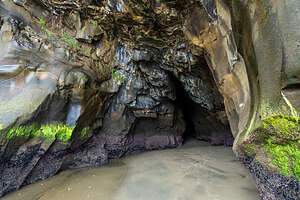 Muriwai GrottoWe walked south along the rocks from the main beach area and found the grotto hidden behind the first headland.
The entrance is a large, jagged opening in dark volcanic rock. This is the beautiful “megapillow” lava we had admired when looking down at the base of the cliffs from the Upper Viewing Platform yesterday.
These are considered some of the best-preserved and most significant examples of this phenomenon in the world, gaining international recognition as an IUGS Geological Heritage Site.
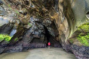 Muriwai GrottoThe grotto was formed over thousands of years, by the constant pounding of the Tasman Sea. The “pillows” have cracks in them that formed when they cooled 17 million years ago. As waves crashed over the cliffs, air got trapped in those tiny cracks. When the waves retreated the compressed air expanded explosively, popping out chucks of rock.
So, why here? Location, Location, Location. The rock at this grotto’s location was slightly more fractured and positioned at a specific angle to the waves, so the sea was able to eat away at it faster than at other places.
As soon as we entered the cave, the temperature dropped a few degrees, although we were now protected from those driving winds. The ceiling, which was probably only about 10-feet above, was made of lava pillows.
 BlokartingThe lower part of the wall was a beautiful purple color, painted by a natural chemical reaction. The volcanic rock is full of iron, so when the salt spray and oxygen hit it, the iron “rusts,” turning the surface into a beautiful plum-like, purple. Essentially the dark grey rock is being painted by the Tasman Sea.
Well, that was certainly worth the stop.
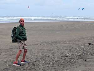
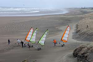
On our way back to the car, we got to see a group of beginners getting a “blokarting” lesson. Blokarting is essentially “land sailing,” using a three-wheeled cart powered by a sail. It was invented in Auckland in 1999 and has since become a global cult sport.
 BlokartingHowever, I’m going to have to defend my Hudson River roots and say that people have been “ice yachting” on the Hudson River since the 1800s - very similar to blokarting except it’s done on ice (with blades on the bottom of the kart) rather than on hard sand (with wheels on the bottom).
Muriwai Beach with its hard sand and strong winds is considered one of the best places in the world to try it.
It looked pretty fun, but scary as well.
Okay, time to return the campervan.
Piha Beach
Wednesday, December 10, 2025 - 1:30pm by Lolo130 miles and 3.25 hours from our last stop - 1 night stay
Travelogue
 My HeroWhen planning a trip, there is always the trade-off between reserving campgrounds ahead of time, and building some flexibility into the itinerary. On this trip, we did a little of both.
For the first 8 nights we had pretty much followed the itinerary we had mapped out at home, but had left the last two nights open.
To my surprise, Herb, who doesn’t usually do the planning, took it upon himself to find what turned out to be two really great destinations - places that hadn’t even come up on the radar when planning this trip.
 Lion RockThe first of those stops was Piha Beach, located on the rugged west coast of the North Island of New Zealand, about 25 miles west of downtown Auckland.
It is New Zealand’s most famous surfing beach, renowned for the powerful swells that roll in across the Tasman Sea from Australia, giving it its reputation as a world-class surfing beach, but also a very dangerous one with strong rip currents and heavy swells.
The beach is notorious for dangerous rip currents and heavy swells. Visitors are only allowed to swim between the red and yellow flags on the Lifeguards' trucks when they are on duty.
 Dangerous swimming warningsBut surfing was not what we were here for. Herb and I center many of our trips around dramatic photographic destinations, and Piha Beach seemed just what we were looking for.
With its black sand, rugged cliffs, huge surf, and the iconic Lion Rock, it couldn’t have been any more different than Hahei Beach with its lovely pink-white sand and calm waters.
The 3-hour drive there from Hahei was a bit intense: from the windy steep roads getting off the Coromandel Peninsula, to navigating our way through the heart of Auckland, and then worst of all, the very narrow and twisty Piha Road down to the coast.
 Kitekite FallsIronically, Herb’s least favorite part of the drive was getting through the Auckland suburbs where during this time of day, cars were allowed to park in one of the lanes, making it very narrow for a campervan as large as ours to squeeze through.
After that, things got a little better until we came to a road construction area where we could barely squeeze between the orange cones. As we were almost through, we heard a bumping sound from beneath. Oh shoot, we thought. We had hit a cone or two perhaps, and it was probably stuck under our camper.
 Lion RockWe pulled over as soon as we could and Herb peeked under the van. The good news was that there was no cone stuck there. The bad news was that the cone had knocked off the bracket that held the gray water pipe in place, and it was now dragging along the road.
I was in a panic as to what we could possibly do, but fortunately cooler heads (Herb’s) prevailed and he was able to kludge a fix. He found some parachute cord in his backpacking kit and was able to tie it to the pipe, keeping it in place, at least for a while.
My hero. Over the years I have come to assume that my engineer husband could fix anything.
Now we just had to get down twisty Piha Road without any further mishaps, which we did. We had booked a night at the Piha Domain Motor Camp, which was just a 2-minute walk to the beach and Lion Rock.
 Surfs UpThe campground, and especially the very entertaining woman proprietor, had a bit of a hippy feel to it, where campers were encouraged to listen to the surf and owls, rather than loud music.
After pulling into our campsite, we took a walk down to the beach to get the lay of the land and to see the famous Lion Rock, a massive volcanic plug that stands between North and South Piha beaches.
The Maori call it Te Piha, which means “bow wave,” because the pattern created by the waves as they split around the front of the rock is similar to the spray at the prow of a canoe.
.thumbnail.jpg) Hidden beach by TaitomoThe Europeans called it Lion Rock, because its silhouette resembles a male lion lying down in profile.
Hidden beach by TaitomoThe Europeans called it Lion Rock, because its silhouette resembles a male lion lying down in profile.
We didn’t stay long at the beach now, as we wanted to do a hike first and then come back this evening to photograph when the sun setting over the Tasman Sea would cast a golden glow on the rocks and the sand.
 Taitomo ReflectionBut that was tonight’s activity. Now we were going to hike to Kitekite Falls, a multi-tiered waterfall in a rainforest. The trailhead was about a 3/4 mile walk from our campsite.
At the start of the hike there was a shoe-cleaning station to protect the native Kauri trees from a deadly disease we might have on the bottom of our shoes. I had never seen anything like this before. The closest thing I can remember is having to thoroughly clean our shoes before being allowed to enter a bat cave in California, so that we would not spread White Nose Syndrome, which can kill bats.
.thumbnail.jpg) Back to the LionThe trail is a roughly 3km loop. There is a fork in the trail after about 20 minutes, where we had the choice to go an easy 10 minutes walk down to the base of the falls, or a steep 15-minute climb up to the top of the falls.
Back to the LionThe trail is a roughly 3km loop. There is a fork in the trail after about 20 minutes, where we had the choice to go an easy 10 minutes walk down to the base of the falls, or a steep 15-minute climb up to the top of the falls.
We decided to do both, but went up to the top first where people were hanging out in the small “infinity” pools at the top, called “infinity” because when sitting in one there is a view of the water spilling over the edge toward the valley below.
.thumbnail.jpg) Golden Hour on Piha BeachThen we hiked back down to the base of the falls for a lovely view of the 130-foot, three-tiered falls, with a deep emerald swimming hole below.
Golden Hour on Piha BeachThen we hiked back down to the base of the falls for a lovely view of the 130-foot, three-tiered falls, with a deep emerald swimming hole below.
All in all the hike was 3.7-miles, including back to the campground.
Later that evening, we took the short walk to Piha Beach to watch the sunset. We were delighted to see that it was low tide, because that way we could take reflection shots of Lion Rock in the wet black sand, which acted like a giant mirror.
As we often do when photographing, Herb and I each went our own way. Herb likes to focus on one particular subject and work on it for a long time, while I like to wander, just so I know I’m not missing anything.
.thumbnail.jpg) Sunset on Piha BeachSo, Herb took some beautiful photos of Lion Rock reflected in the wet, dark sand, while I took advantage of the low tide to scamper over the lava rocks at the southern end of the beach to a sort of hidden beach where I took some silhouettes and reflections of Taitomo Rock (also known as Camel Rock).
Sunset on Piha BeachSo, Herb took some beautiful photos of Lion Rock reflected in the wet, dark sand, while I took advantage of the low tide to scamper over the lava rocks at the southern end of the beach to a sort of hidden beach where I took some silhouettes and reflections of Taitomo Rock (also known as Camel Rock).
Afterwards, we found each other on the beach again and watched the sun set into the Tasman Sea.
Kudos to Herb for finding Piha Beach. Tomorrow we would head to his next selection - Murawai Beach and the Gannet Colony, which would be our final night in the camper van.
Hahei Beach and Cathedral Cove
Sunday, December 7, 2025 - 10:15am by Lolo35 miles and 1 hour from our last stop - 3 night stay
Travelogue
 Sunset walk along Hahei BeachAs with every trip I plan, Herb and I watch dozens of YouTube videos beforehand of our destination to see what excites us. Then we come up with a rough itinerary.
We had really enjoyed our first four nights exploring the Taupo Volcanic Zone, but we also love beautiful beaches, and the North Island certainly has their fair share of them. Our days of just sunning ourselves on a beach are long over, at least for me, so what we look for is photographic interest, whether that be crashing surf, interesting rock formations, caves, birds, etc.
 Sunset walk along Hahei BeachWhat consistently kept coming to the top of the list were the beaches of the Coromandel Peninsula, specifically Cathedral Cove Beach, featuring some of the most photographed coastal scenery in the country. And the best of the best was consistently Cathedral Cove, famous for its massive ignimbrite archway that connects two beautiful white-sand coves.
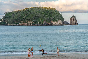
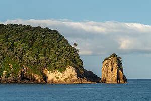
The best campground by far to stay in the area was the Hahei Beach Resort, which is directly on Hahei Beach. The entire length of this pink-tinted white sand beach is framed by ancient, red-blooming pōhutukawa trees and has lovely views of the Mercury Bay Islands off its shoreline.
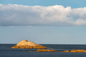 Sunset walk along Hahei BeachWe were really happy that we were able to get three nights on one of the powered, beach front sites. Our site was right next to a short path through the dunes to the beach and near the hot tub that we would take advantage of at some point.
Since it was already mid-afternoon when we arrived, I just took my beach chair and a book down to the beach and chilled for a while. Meanwhile, Herb stayed back at the campervan and did something very uncharacteristic of him - research possible destinations for the last 2 unplanned nights of our trip. Wow! I always did the planning, but it was kind of nice to have someone else do it for a change. I have to admit he came up with some really good ideas.
.thumbnail.jpg) Sunset walk along Hahei BeachThe other thing I loved about this resort was that it had on-site dining - nothing fancy, just burgers and pizza, but quite good. So that night, we just walked to The Deck where we had burgers and listened to live music.
Sunset walk along Hahei BeachThe other thing I loved about this resort was that it had on-site dining - nothing fancy, just burgers and pizza, but quite good. So that night, we just walked to The Deck where we had burgers and listened to live music.
After dinner we took a sunset walk along the beach taking photos of the beautiful Mercury Islands all aglow in the Golden Hour.
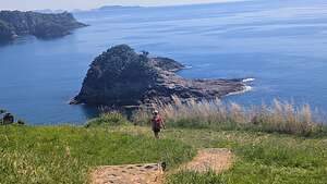 Te Pare ReserveThe next morning we set off on a hike to the nearby Te Pare Reserve. This was to be our first hike of two today, the second being the extremely popular Mautohe Cathedral Cove Track, which we would do later this afternoon. What was great about our campground was that we could start both of them right from our campsite, so there was no need to move the campervan.
The Reserve is located at the southern end of Hahei Beach. In fact we could see the grassy summit from our campsite.
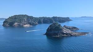 View from Te Pare Summit LookoutWhen the tide is low, you can access the trailhead by crossing the small stream at the end of the beach. However, since it was high tide, we had to take the longer way around to the end of Pa Road.
The trail started off through a grove of ancient pōhutukawa trees. They are called the "New Zealand Christmas Tree," because of their red flowers that bloom in December and January. Wow! Being in the Southern Hemisphere I almost forgot Christmas was coming soon.
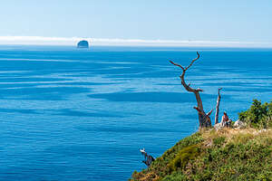 Ghost Tree Te Pare SummitFurther along there were some terraces carved into the hillside. These were the remains of two Ngāti Hei fortified villages (Pās). (For the local Māori tribe, Ngāti Hei,
Not much further (this is a short hike), we came to the Summit Lookout, atop a grassy headland. From there we could see the entire length of Hahei Beach and the white cliffs leading towards Cathedral Cove to the North and the Mercury Island and smaller sea stacks off the shore.
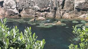 Hidden CoveFrom the Summit Lookout, we noticed a single, wind-swept dead tree at the end of a narrow, grassy spur trail leading out to the top of a cliff.
Of course, we had to follow it. At the end, we gazed down over the 80-meter cliffs, into a hidden, rocky cove below, filled with swaying kelp.
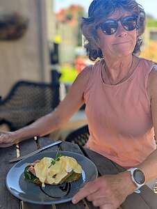 Yummy Eggs Benedict with SalmonOn our way back, rather than go back to the campground, we decided to get a late breakfast at the Hahei Village Cafe in the center of the tiny village of Hahei. I had looked at the menu yesterday and had been dreaming of the eggs benedict with salmon.
It was a really close call though. They stopped serving breakfast at 11:00 am, and we got there at 10:57 am. I think I would have cried if I had been denied my favorite New Zealand breakfast. It was delicious and perfectly paired with a decadent iced mocha with whip cream.
.thumbnail.jpg) He looks so innocentWhen we got back to the campervan, I had a trip highlight. Earlier that morning, Herb and I had a debate about whether it was smart to leave the campervan door open while we were sitting outside. I feared sandflies might get in.
He looks so innocentWhen we got back to the campervan, I had a trip highlight. Earlier that morning, Herb and I had a debate about whether it was smart to leave the campervan door open while we were sitting outside. I feared sandflies might get in.
He poo-pooed me on that (words that would come back to haunt him). Because a little house sparrow did fly in that morning and I had to scare him out. It was only when we got back that we noticed that the little bird had poo-pooed back and on Herb’s pillow. I couldn’t stop laughing.
Our next activity for the day, and the main reason we came to the Coromandel Peninsula, was to hike the Cathedral Cove Track, to see one of New Zealand's most iconic coastal landmarks.
.thumbnail.jpg) Cathedral Cove ArchAnother advantage to staying at Hahei Beach Resort was that we could walk to Cathedral Cove right from our campsite, although getting to the trailhead had become longer because of damage to parts of the trail from Cyclone Gabrielle in 2023, one of the worst storms in New Zealand’s history..
Cathedral Cove ArchAnother advantage to staying at Hahei Beach Resort was that we could walk to Cathedral Cove right from our campsite, although getting to the trailhead had become longer because of damage to parts of the trail from Cyclone Gabrielle in 2023, one of the worst storms in New Zealand’s history..
Apparently this storm had been a doozy, essentially cutting off the Coromandel Peninsula from the rest of the North Island.
The damage to the Cathedral Cove Track was particularly devastating. Massive landslides removed sections of the track and caused the cliffs to become unstable. The trail remained closed for nearly two years. The only way to get to the Cove during that time was by kayak or boat.
.thumbnail.jpg) Mossy GrottoAfter extensive rerouting and engineering, it reopened in December of 2024.
Mossy GrottoAfter extensive rerouting and engineering, it reopened in December of 2024.
However, the start of the track which connects the western end of Hahei Beach to the Grange Road entrance is still closed. That meant that we had to take the detour and hike inland, through Hahei Village where we had just had our eggs benedict, then right onto Grange Road. Once on Grange Road it was a fairly steep 25 minute uphill walk to the trailhead. We had already hiked 1.4 miles, and we were just getting to the trailhead.
.thumbnail.jpg) Smiling Sphinx RockFrom there we got on the main track to Cathedral Cove. All of the side tracks we passed to lookouts like Gemstone Cove and Stingray Bay were still closed due to damage from Cyclone Garbrielle.
Smiling Sphinx RockFrom there we got on the main track to Cathedral Cove. All of the side tracks we passed to lookouts like Gemstone Cove and Stingray Bay were still closed due to damage from Cyclone Garbrielle.
The walk from the trailhead to Cathedral Cove was about 2 miles. It was a lot easier than I expected, as most of the way was along paved or a gravel path. The side tracks to the closed viewpoints were probably a bit rougher.
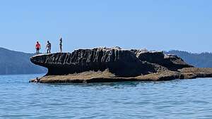 Jumping RockThe final descent to the beach was a long wooden staircase with about 150 steps that led directly from the cliffs down onto the golden sand of the cove.
At the top of these stairs, and directly above the famous Cathedral Arch, is the site of Te Mautohe Pa, a fortified village occupied by the Ngāti Hei people from the 14th century through the early 19th century.
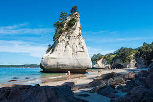 Te Hoho RockFrom these high cliffs, Ngāti Hei warriors would monitor the entire coastline, spotting incoming war canoes (waka taua) from many miles away.
Although we didn’t know enough to look for them at the time, there are still some remains of maioro (defensive ditches) on the headland.
So what to us is an incredibly scenic beach and a place to recreate was once, and still is, a sacred ancestral place, called Mautohe, for the Ngāti Hei tribe, for whom the waters and the rock formations on the beach are seen as living connections to their ancestors.
.thumbnail.jpg) Te Hoho RockThe most famous and iconic rock formation on the beach is the “Cathedral” Arch, a massive, 30-meter white ignimbrite archway that connects two secluded beaches: Mares Leg Cove, where the stairs down to the beach ended, and Cathedral (Mautohe) Cove, where the iconic Te Hoho Rock is located.
Te Hoho RockThe most famous and iconic rock formation on the beach is the “Cathedral” Arch, a massive, 30-meter white ignimbrite archway that connects two secluded beaches: Mares Leg Cove, where the stairs down to the beach ended, and Cathedral (Mautohe) Cove, where the iconic Te Hoho Rock is located.
This Arch was made famous for its role as the “Gateway to Narnia" in the 2008 film The Chronicles of Narnia: Prince Caspian. It was the spot where the Pevensie children first realize they have returned to Narnia.
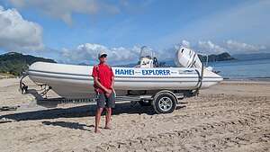 Time for our boat tourWhen reaching the bottom of the walkway, most people immediately head left to the Arch, so we went to the right to a lovely fern-lined, mossy grotto at the southern end of the beach - much more serene and peaceful.
Because water seeps through the porous ignimbrite rock rather than just tumbling over the edge, it creates a lush vertical garden inside the grotto. The contrast between the lush vibrant greens and the stark, dry white ignimbrite cliffs everywhere else was striking.
 Te Whanganui-o-Hei Marine ReserveAll the rocks and cliffs in the cove are made of ignimbrite, a soft, pink and white volcanic rock formed from pumice and ash during eruptions over 8 million years ago.
Probably my favorite rock formation was a sea stack just off the shoreline of Mares Leg Beach, called Smiling Sphinx Rock, also known as Whakadriqui Rock.
Although I didn’t quite see it, the rock got its name because at certain angles the top of the rock looks like a carved human head with an enigmatic smile (like the Egyptian Sphinx), sitting atop a lion-like body. Okay, maybe I see it a little bit.
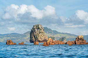 Te Whanganui-o-Hei Marine ReserveIt was low tide now, so it appeared to be standing atop a pedestal as if on display in a museum.
There was another long flat rock a bit further out that was a popular place for jumping into the water. While it didn’t look too high, I watched one man make over a dozen false starts to gain the courage to leap into the water. For all I know, he is still there trying to gain the courage to make the plunge.
From Mares Leg Cove, we joined the crowds and walked under Cathedral Arch, pausing to take the iconic photo of the Arch framing Te Hoho Rock, a pinnacle-shaped rock stack just off the shore of Cathedral Cove.
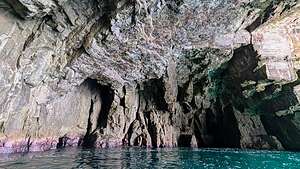 Orua Sea CaveThis one is described as looking like the prow of a giant ship or a jagged tooth rising from the turquoise water. Hmm…I’ll go with tooth.
I can understand why Cathedral Beach is considered one of the most beautiful beaches in the world.
From there we climbed the 150 steps back up to the headlands and retraced our steps back to the campground.
 Orua Sea Cave BlowholeBetween this hike and the one to the Te Pare Reserve this morning, we had hiked a little over 10 miles today.
The next morning, our last full day at Hahei Beach, we took a morning boat cruise with Hahei Explorer Cathedral Cove Boat Tours to get a perspective of Cathedral Beach from the water.
It couldn’t get any more convenient, as the boat left right from the southern end of Hahei Beach, just a short walk from our campsite.
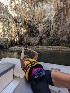 Lolo photographing the BlowholeI thought we had pretty much seen everything there was to see at Cathedral Cove, but this boat tour was so much more.
The boat was an open-air, rigid-hull inflatable that could fit 10–14 passengers, but fortunately this morning there was only one more couple joining us on our tour.
After wading out and climbing into the boat, we headed out directly into the heart of the Te Whanganui-o-Hei Marine Reserve, which was established in 1992 to protect the rich biodiversity of this volcanic coastline.
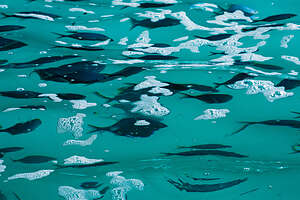 Fishies in the Orua Sea CaveThese waters were vital seasonal fishing grounds for the Ngāti Hei people, who occupied both the coastline and the offshore islands.
The Reserve has been a very successful partnership between the Department of Conservation (DOC) and the Ngāti Hei people, who have been guardians (kaitiaki) of this land and sea for over 26 generations.
The boat took us along about 9 miles of ancient volcanic coastline, as well as out to several islands. Along the way, our knowledgeable captain gave us a history of the significance of these waters to the Ngāti Hei people.
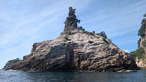 Champagne RockThe Hahei Explorer was small enough to be able to navigate into tight spaces that larger vessels can’t reach, giving us a perspective of the cliffs and caves that we couldn’t get from the land or even a larger boat.
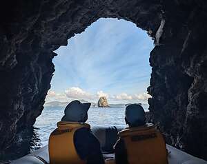
One of the main highlights was venturing into the Orua Sea Cave, the second largest sea cave in New Zealand, gazing up at the blowhole 80 feet above us and a school of fish swimming in the electric blue water below us.
Of course, we cruised along the shoreline of Cathedral Cove, but we were not allowed to disembark. Thankfully, we had spent plenty of time ashore there yesterday.
The boat tour lasted about an hour, which went very quickly.
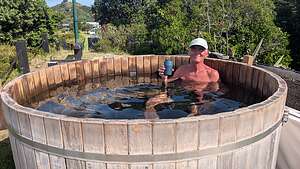 Nice way to end the dayNow we had the whole day with nothing else planned, so after another walk to the Hahei Village Cafe for Eggs Benedict with salmon, we spent the rest of the day relaxing on Hahei Beach and then relaxing some more in the campground’s hot tub which we had reserved for an hour starting at 5:00.
Hahei Beach had been a great stop and it definitely needed 3 nights to do everything we wanted to do.
Tomorrow we would head to one of those destinations Herb had researched - Piha Beach.
Opoutere Beach
Saturday, December 6, 2025 - 10:00pm by Lolo194 miles and 4.25 hours from our last stop - 1 night stay
Travelogue
 Opoutere BeachToday we would say goodbye to the amazing geothermal wonders of the Taupo Volcanic Zone and head north to the Coromandel Peninsula to experience some of the North Island’s beautiful white sand beaches.
Our first destination was Opoutere Beach, one of the Coromandel Peninsula’s hidden gems, known for its remote, untouched beauty and 3 miles of pristine white sand.
Our plan was to stay one or two nights at the Opoutere Coastal Campground and then move further north to the Hahei Beach Resort in the Cathedral Cove area of Coromandel.
 Opoutere BeachThe campground was rustic, but we were quite self-contained in our campervan. It was actually quite relaxing and peaceful, set in a forest which separated us from the beach.
After settling in, which basically means parking our camper on our site, we set out through the pine forest to see the beach.
We were a little taken aback at the signs that said “Danger, poison Pine Trees may fall at any time.” Well that was a little disconcerting. I had never heard of such a thing.
I later learned that these pines are an invasive species that outcompete native trees like pōhutukawa, kōwhai, and māhoe from growing, so the Department of Conservation is trying to eliminate them by poisoning them.
 Ohui InletThey do this by drilling small holes in their trunk and then injecting a herbicide into their vascular system. This causes the trees to die standing up.
The DOC monitors them, and when they become a “fall hazard,” they are cut down. The warning was so that we, and other unsuspecting beach goers, wouldn’t touch them and also keep an eye out to avoid falling branches.
.
Thousands of native seedlings were planted beneath the dying trees in the hope that someday it would transition back to a forest of native trees and shrubs.
 Opoutere Beach StrollOkay, that was unexpected danger number one. Danger number two was waiting for us out on the beach and was a bit more Hitchcockesque. Think “The Birds.”
Opoutere Beach is a breeding ground for two endangered species, the New Zealand Dotterel, and the Oystercatcher, who is only endangered because they put their nests, which are just small hollows in the sand, right in the path of people strolling on the beach.
While this might seem stupid, there actually is a fairly calculated survival strategy to this. If they put their nests too close to the water they could get washed away by a king tide. If they put them back against the forest, the babies could more easily get eaten by predators. Putting them in the middle between on the dry sand above the high tide line, but away from the forest, isn’t perfect because that is where humans like to walk and set up their beach chairs.
 Sunset strollApparently for the oystercatchers, option 3, is the least of the 3 dangers, both because predators stay away from humans, and secondly, oblivious beach walkers are easily frightened away by their rather effective divebombing, which we soon learned.
So, as we strolled along this lovely pristine beach, we were totally oblivious to the fact that an oystercatcher was staring us down and taking tiny steps towards us. Soon those tiny steps picked up speed, before taking flight and divebombing our heads.
Herb and I took two different approaches to dealing with this unexpected situation. Herb took off his hat and started swatting the bird away. I took the less dignified approach and screamed and did a tuck and roll onto the sand, while putting my hands over my head. My only regret is that Herb was doing busy swatting them to take a photo of this bizarre scene.
 Sunset strollHerb was quite amused and told me I should just swat them away.
Not wanting to let these birds spoil our beach stroll, we forged on. After two more divebombing experiences, I suggested we return to the campsite for a glass of wine, with my promise to return at sunset, but only with a swatting implement.
So, back we went through the poison forest (this was beginning to feel like a bad fairy tale) to our campsite where little children were delightfully playing, unaware of the evils that lurked beyond.
 Morning run to Ohui InletWe did return through the forest to the beach to watch the sunset, where the sky and waves turned a lovely pastel pink and blue. We stuck to the northern end of the beach where the oystercatchers didn’t nest.
The next morning, we decided to not let the oystercatchers control our lives and go for a run along the beach. I think we knew a little more now as to how to deal with them.
Glad we did, because it was a great run, all the way to the Ohui Inlet at the northern end of the beach. 5.5 miles in sometimes deep wet sand was a really good workout.
Although we had another night booked in this campsite, we decided we pretty much had seen it all and decided to move north to the Hahei Beach Resort which I had booked for three nights..
Tongariro National Park
Thursday, December 4, 2025 - 12:45pm by Lolo70 miles and 1.5 hours from our last stop - 2 night stay
Travelogue
 Tongariro Holiday ParkAfter leaving Orakei Korako, we drove about an hour and a half south, along the east shore of Lake Taupo to the Tongariro Holiday Park where we would be staying for the next two nights.
Tongariro lies at the southern terminus of the Taupo Volcanic Zone and is home to three active volcanoes: Mount Ruapehu, Mount Ngauruhoe, and Mount Tongariro.
One of the major impetuses for us to visit the North Island was to hike the Tongariro Alpine Crossing, considered the best one-day hike in New Zealand, and for many, one of the best in the world. It's a 12.6-mile long, with 2,800 feet elevation gain, point-to-point trek across a Martian-like landscape of active volcanic craters, bright emerald lakes, and ancient lava flows.
 Tongariro Alpine Crossing ForecastBecause the hike starts and ends at different locations, we needed to book a shuttle to drop us off at Mangatmost Carpark where the hike begins. From there we would hike to Ketetahi Carpark, where a shuttle would take us the short distance back to our campground.
We had originally booked the shuttle for tomorrow, but after seeing the forecast, we pushed it back a day. Back home, when planning for the day to do this hike, I had no idea how much the weather would be a safety issue. I had been following the rain forecast, but rain is not the issue; it's the winds - often 50+ mph gusts hat make it unsafe - or at the least, very unpleasant - to climb up and over the narrow ridge over the Red Crater.
Frequent white outs and visibility less than 10 meters are also frequently a safety issue, making it easy to lose the trail. Besides the safety considerations, I didn’t want to do all the work that this hike required without being able to see anything.
When we checked into our campground, the proprietor told us that conditions had been so windy on the Alpine Crossing that the shuttle had been canceled the last 3 days and very likely would be canceled tomorrow as well.
I admit, I was beginning to get cold feet, but we would have to just wait and see.
Since it was only 4:30 when we arrived at the Holiday Park, and it didn't get dark until 8:30, we figured we might as well go for a hike in nearby Tongariro National Park, so we headed over to the visitor center to see what the options were.
Silica Rapids Hike
 Punaruku FallsWe didn’t have enough time for a super long hike this late in the afternoon, so we chose the Silica Rapids Walk, which is a 4.3-mile, 1,000-foot elevation gain hike, which goes through several very distinct ecosystems.
The first section of the trail brought us through a very peaceful, lush beech forest alongside the Whakapapanui Stream.
In about a mile we arrived at Punaruku Falls where the Tawhainui Stream tumbles over the edge of an ancient lava flow.
 Golden RapidsAbout a mile further along we came to a portion of the stream with a stunning orange-gold section of shelves and boulders, stained by the iron-oxide (rust) from upstream swamps.
It is so bright that it looks unnatural, as if someone had painted the rocks. It was easy to see how it got its name Golden Rapids.
The rocks aren't just colored; they are often coated in a slightly fuzzy or velvety layer of mineral deposits, making the stream bed look soft rather than jagged.
At about 2 miles from the start, we came to a junction in the boardwalk near the top of the valley and turned right on a short spur to a viewpoint at the center of the Silica Rapids, where alabaster-colored water flows over a series of beautiful creamy-white terraces.
 Silica RapidsTheir stunning white appearance is the result of a chemical reaction that takes place in the rapids themselves.
The process starts upstream, deep beneath Mount Ruapehu where rain water and snowmelt percolate through the porous superheated volcanic rock, causing them to absorb high concentrations of aluminum and silica from the surrounding rocks.
As this superheated, mineral-rich water flows downstream and hits the rapids, it splashes over the rocks and becomes heavily aerated, causing it to release carbon dioxide, which then causes the dissolved minerals to turn back into a solid.
 Silica RapidsThese solid minerals settle on the rocks, building up layer after layer. Over time, they create a smooth, white "painted" crust that looks like porcelain over the flat terraces.
It was absolutely lovely, made even more so by one small tilted tree, stranded amidst the rushing water, still alive but looking like it was fighting for its life.
That tiny tree struggling against the rapids has become Herb’s favorite photo of the trip. Titled “Gold Rush,” It is now framed and hanging in our living room.
 Across the lava fieldsThis hike really was exceeding expectations. We had only hiked two miles and we had already seen a lovely waterful, and two sets of rapids formed by the same process, but with very different appearance because of the minerals in the water that flowed over them - iron-oxide over the Golden Rapids and silicates over the Silica Rapids.
After the Silica Rapids, the trail took a sharp left away from the stream into a dramatic shift in scenery, as we left the beech forest and rapids behind and entered a vast, open alpine meadow, covered by tall, golden-bronze grasses called Red Tussock, that swayed in the wind.
We were now in the heart of the Taupō Volcanic Zone with three major volcanoes visible along the route.
 Jagged Mount RuapehuAlthough we didn’t realize it, from the start of our hike, we were already on the lower slopes of Mount Ruapehu, the largest and highest volcano in New Zealand. We got our first peek of its jagged peaks when we crossed the long bridge over the Whakapapanui Stream.
It was the ancient lava flows from eruptions of Ruapehu that created the cliffs at Punaruku Falls and the terraces of the Silica Rapids.
Instead of one single summit, Ruapehu has a broad summit plateau with several distinct peaks that form a broken, jagged rim around its central crater. It’s the only place in the North Island with permanent glaciers.
 Through the Red TussockIt is the thousands of years of these glaciers grounding away at the volcanic rock that have made the summits much more jagged and torn looking than the younger smoother volcanoes, such as Mount Ngāuruhoe, which came into view next.
As we continued on the path through the lava fields, with the Red Tussock swaying in what was a pretty strong wind, we came to our first view of Mount Ngāuruhoe, a classic near-perfect, smooth cone volcano so different from its jagged neighbor. To make it even more dramatic, a large dark cloud was sitting atop its summit, like a large sombrero.
.thumbnail.jpg) Approaching Mt. NgāuruhoeThe contrast between the golden tussock and the dark Mt. Ngāuruhoe was stunning.
Approaching Mt. NgāuruhoeThe contrast between the golden tussock and the dark Mt. Ngāuruhoe was stunning.
Ngāuruhoe is probably one of the most recognizable volcanoes in the world, as it played the role of Mount Doom in The Lord of the Rings trilogy. It was the place where the One Ring was forged and ultimately destroyed.
Just behind and to the left of Ngāuruhoe, we could see parts of the Mount Tongariro range, a massive complex of 12 volcanic cones and craters.
 Herb meets Mt. NgāuruhoeIf the weather cooperated tomorrow, we would be crossing over this range on our Tongariro Alpine Crossing hike, but just based on the wind we were experiencing now made the likelihood of that less and less.
From there we descended fairly steeply down to Bruce Road and then back to our car at the visitor center. The hike, which was 4.75 miles with 1,017-foot elevation gain, had so many highlights along the way that it was hard to pick a favorite.
Back at the campground, we checked the weather forecast for the Tongariro Alpine Crossing and made the decision that it just wasn’t going to happen for us. Winds were just two strong to make it a fun and even safe hike, especially for me. So, I canceled our shuttle reservation.
Taranaki Falls and Tama Lakes Hike
 Lava field above Taranaki FallsWhen we woke up the next morning, I checked the official weather forecast for the Red Crater (the highest point and crux of the Tongariro Alpine Crossing), and had to admit to being somewhat pleased to find that the hike was not recommended for today because of strong winds. Otherwise, I would have felt bad that we had missed out on a chance to do this hike.
Now, I could be satisfied with the awesome alternative hike that we had planned for the day. It was even similar in mileage and elevation gain to the Tongariro Alpine Crossing, but with much easier terrain and less severe winds because of its lower elevation.
It was still going to be very windy, but not the “knock-me-off-the-summit of Red Crater” kind of windy.
 Lower Tama LakeStill, at over 12.3 miles with an elevation gain of over 3,000 feet it was going to be a challenging hike.
Instead of doing Tama Lakes as an out-and-back, we decided to use the Taranaki Falls loop to create a lollipop route. So, we were pretty much doing a hike within a hike.
We decided to take the recommended counter-clockwise direction, also known as the Upper Track, which almost immediately exposed us to big open views of the two volcanoes we had seen on our Silica Rapids hike yesterday - jagged Mount Ruapehu on our right and cone-shaped Mount Ngāuruhoe straight ahead, which unfortunately was quite obscured by clouds today.
 Closeup of Willy-WilliesAfter about 2 miles we crossed a wooden bridge at the top of Taranaki Falls, where we could hear, but not see, the thundering of the waterfalls below us.
The most impressive part of being at the top of the Falls was realizing that we were standing on a bridge above the terminal edge of a massive lava flow that erupted thousands of years ago from Mount Ruapehu, which was upstream from us.
We watched as the stream somewhat peacefully, meandered through the shallow rock bed before picking up speed as it slid over a smooth rock lip and disappeared into and became thundering Taranaki Falls.
 Steep climb up to the Upper Tama LakeRather than climb down the 135 wooden steps to the base of the falls now, we decided to save that for the way back, when we would complete the other half of the lollipop of the Taranaki Falls hike.
After leaving the Wairere Stream Bridge, we headed inland toward the “saddle” between Mount Ruapehu (to our right) and Mount Ngāuruhoe (to our left). Because this is a saddle, it acts like a giant wind tunnel, so we were beginning to feel some pretty strong winds, but nothing I am sure compared to the Red Crater along the Tongariro Alpine Crossing.
 Upper Tama LakeWe continued our steady, gradual climb towards Lower Tama Lake, nestled in a deep circular bowl, with Mount Ruapehu as a backdrop.
The bowl it sits in is actually a large explosion crater (called a maar) formed roughly 10,000 years ago by violent steam explosions when rising magma met groundwater.
What struck me the most about Tama Lake was its striking two-tone color - a milky greenish blue near the edges and a deep, dark indigo blue in the center. The reason for these differences is volcanic water chemistry.
 Very windy lunch spotBecause this lake is in an active volcanic zone, it is constantly being fed by fine particles of volcanic ash and rock dust washing down from Mount Ruapehu. These particles are known as “rock flour" and since they are so small and light, they don’t sink, but rather they stay suspended in the water. When sunlight hits the rock flour near the shore, they reflect the green and blue parts of the light spectrum, creating the milky green-blue color we see.
Meanwhile, the center of the lake is incredibly deep, so there is no bottom for the sunlight to bounce off. At this depth, the longer wavelengths of light (reds and yellows) are completely absorbed. Only the shortest, darkest blue wavelengths have enough energy to reflect back to the surface, where it appears as a dark indigo or navy blue.
 Heading down the steep screeThere wasn’t a gradual change between the two colors, but rather a distinct line where the crater floor vertically drops off abruptly and steeply from the shallow rim.
Once again, I wish I knew more about geology and chemistry to understand these phenomena. However, this did remind me of the explanation for the brilliant turquoise blue lakes on the South Island that are fed by “glacial flour” from melting glacial water. So the North Island has “rock flour” particles and the South Island has “glacial flour” particles.
The colors made this lake very photogenic, so we spent a lot of time photographing it from every angle. Herb especially tried to catch what we were calling dust devils swirling by the water’s edge.
 Back to Lower Toma LakeThey are quite common here because the lake sits on the saddle between Mt. Ruapehu and Mt. Ngāuruhoe, and this gap acts like a funnel for wind, creating vortexes of volcanic ash and rock flour, lifted from the hot barren ground along the shore.
New Zealanders call them “willy-willies,” which I think is a much better name.
Herb was taking far too much time photographing the “willy-willies,” so I started up the steep ascent to the Upper Tama Lake by myself. This was by far the most challenging part of the hike. There was no longer any sort of path to follow. Rather the ridgeline is composed of loose volcanic scree, which I hate. However, hiking up it is much better than the slipping and sliding down it which I had to look forward to.
 Almost downThere is no real trail and you pretty much go up any way you want, as long as it is up, but there are orange poles to follow that do guide you the best way.
About a quarter of the way up, I turned to see if Herb was behind me, but he was still down by the Lower Lake photographing the ‘willy-willies.” Herb has a tendency to lose track of all time and me when he finds a subject he likes.
The ridge to Upper Lake Tama was very exposed, with no protection from the strong westerly winds, so I kind of had to struggle a bit to stay upright. And, with each step I took, it got colder and colder.
 Can't get enough of this beautiful lakeAfter about 40 minutes of steep climbing, I reached a wide, flat rocky clearing at the summit of the ridge. I looked behind again, and finally Herb was making his way up the scree ridgeline. The wind was really blowing me around at this point.
When Herb finally joined me, we sought shelter from the wind behind a large rock where we had a great view of ink blue, horseshoe-shaped Upper Tama Lake. Like Lower Tama Lake, this too is an explosion crater. Actually it's two overlapping explosion craters, which is what gives it its unique horseshoe shape.
 Just a few more Willy-Willy shotsBecause there are two craters side-by-side, the bottom of the lake is much more uneven and drops off instantly from the shore, explaining why there is no second greenish-blue color near its edges. Instead the water becomes deep and a dramatic ink blue directly from its banks.
We decided to eat our lunch while huddling behind the rock we had claimed. The view wasn’t bad. Unfortunately Mt. Ngāuruhoe, which was right across from us, was pretty obscured by the clouds.
 Back to Taranaki FallsAfter lunch, we gave up our picnic shelter to others and took some photos from the top. The 360 degree view was pretty phenomenal: Mount Ngāuruhoe looming over the Upper Tama Lake in one direction and in the opposite direction, two-toned Lower Tama Lake with jagged, glacier-covered Mount Ruapehu as a backdrop.
Standing between those two massive volcanoes made us feel kind of small.
The hike back down to Lower Tama Lake was significantly faster but more challenging as we slipped and slid a bit on the steep slope of pea-sized volcanic stones (scree). The views were great though.
 Lovely Taranaki FallsI just had to get Herb past the willy-willies by the lower lake without another lengthy photo shoot. Okay, just a few more shots.
From there, we hiked back across the saddle between Mount Ruapehu and Mount Ngāuruhoe, eventually coming back to the bridge above Taranaki Falls. From here we would take the other half of the Taranaki Falls Loop (the Lower Track), which would bring us past lovely Taranaki Falls.
To get to the base of the falls, we descended a steep staircase of about 135 steps to a viewing platform, where we watched water cascading 66 feet down over the 15,000 year old lava flow that we had stood on earlier today, into a boulder-ringed pool.
The way back along the lower track felt like a completely different world. Unlike the exposed Upper Track, the Lower Track followed the Wairere Stream through a shady, lush mountain beech forest. We eventually emerged from the forest back to the Whakapapa Village.
What a fantastic hike it had been. In fact, both of our hikes in Tongariro had been really great. Tomorrow we would leave volcanoes behind and head to the Coromandel Peninsula to enjoy the beautiful beaches of the North Island..
Orakei Korako
Thursday, December 4, 2025 - 9:15am by Lolo23 miles and 0.5 hours from our last stop
Travelogue
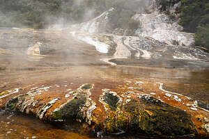 Orakei KorakoDuring the months leading up to this trip, Herb and I had watched dozens of YouTube videos of various destinations on the North Island to fine-tune our 11-day itinerary down to a select few must-dos.
As far as geothermal wonders, there are so many areas of geysers, steam vents, and bubbling pots on the North Island that it would take us weeks (or maybe months) to see them all.
The one that kept rising to the top of our list was Orakei Korako for several reasons: it was fairly remote and therefore less frequently visited, you are allowed to wander around on your own rather than be part of a guided tour, and most importantly, it is a photographer’s paradise with its creamy white, yellow, and orange colorful silica terraces.
.thumbnail.jpg) Orakei KorakoIn fact, the name Ōrākei Kōrako means place of adornment or decoration, referring to its striking mineral terraces. Lonely Planet describes it as "arguably the best geothermal area left in New Zealand."
Orakei KorakoIn fact, the name Ōrākei Kōrako means place of adornment or decoration, referring to its striking mineral terraces. Lonely Planet describes it as "arguably the best geothermal area left in New Zealand."
Like the Wairakei Terraces and the Craters of the Moon on our previous stop, Ōrakei Kōrako is located right in the heart of the Taupō Volcanic Zone (TVZ) between Rotorua and Taupo.
We originally were going to come here first after leaving Rotorua, but since it was one of the places we wanted to see most and the forecast was for rain, we decided to push it off for another day, even if it meant backtracking a little back towards Rotorua. It was only a 30 minute drive back from Taupo, and well worth the wait for clearer skies to explore this amazing area.
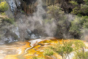 Orakei KorakoThe silica terraces are best photographed in soft morning light, allowing for a better capture of the vivid colors without them being washed out by midday sun. So, we got an early start and arrived at 8:00 am, in time to be the first and only ones on the little on-demand, 3-minute ferry that took us from the visitor center across Lake Ohakuri to the “Hidden Valley.”
From there, we followed the self-guided 1.5-mile loop through a "Hidden Valley" filled with some of the most active geothermal features in New Zealand. The walk is designed as a circular route, ensuring that we wouldn’t miss any of the distinct volcanic terraces or the famous cave.
.thumbnail.jpg) The colors of Orakei KorakoThe path was easy to navigate and very well maintained with a mix of wooden boardwalks and about 885 steps to climb up to get to the various levels.
The colors of Orakei KorakoThe path was easy to navigate and very well maintained with a mix of wooden boardwalks and about 885 steps to climb up to get to the various levels.
The little ferry dropped us off at a dock right next to the Emerald Terrace, a massive, colorful silica staircase that spills directly into the river. It’s quite an incredible sight. It is believed to be the largest active silica terrace in New Zealand.
From the name “Emerald” we would have expected to see a lot of green, but rather it is primarily burnt orange, mixed with creamy whites, browns, and yellows. Bright oranges thrive in hotter water, so where there is orange, you know the flow over them is very hot.
.thumbnail.jpg) Orakei KorakoFrom there, we continued on to the colorful Rainbow Terrace, considered the most colorful feature in the park, where various colors run in long vertical streaks down its side.
Orakei KorakoFrom there, we continued on to the colorful Rainbow Terrace, considered the most colorful feature in the park, where various colors run in long vertical streaks down its side.
While they might look like mineral stains, these colorful streaks are living microbial mats that act as a biological thermometer—the color you see tells you exactly how hot the water is in that specific spot.
Different algae and bacteria thrive in different water temperatures. The vivid oranges and yellow microbial mats are created by thermophilic (heat-loving) bacteria and algae.
.thumbnail.jpg) Ruatapu CaveThe emerald green color comes from blue-green algae, whose green chlorophyll pigments thrive in more temperate temperature zones.
Ruatapu CaveThe emerald green color comes from blue-green algae, whose green chlorophyll pigments thrive in more temperate temperature zones.
The deep browns and blacks thrive in cooler zones.
And finally, the brilliant whites lack microbial life of any sort, because its water is too hot for the colorful algae to survive.
.thumbnail.jpg) Orakei KoratoWe continued on and up, moving from the vibrant oranges, yellows, and greens of the Rainbow Terrace to the Golden Fleece, a spectacular 40-meter-long brilliantly white terrace.
Orakei KoratoWe continued on and up, moving from the vibrant oranges, yellows, and greens of the Rainbow Terrace to the Golden Fleece, a spectacular 40-meter-long brilliantly white terrace.
While the Emerald and Rainbow Terraces are relatively flat, the Golden Fleece is a vertical wall, glowing with creamy whites and golds as hot water flows over its edge.
The major difference between the Lower Terraces (Emerald and Rainbow) and the Golden Fleece is its colors.
.thumbnail.jpg) Orakei KoratoWhile the Rainbow and Emerald terraces are defined by their intense greens and oranges, the Golden Fleece is famous for its dazzling whiteness. It looks like a fluffy white cloud, which explains why the Māori named it Te Kapua, which means "The Cloud.”
Orakei KoratoWhile the Rainbow and Emerald terraces are defined by their intense greens and oranges, the Golden Fleece is famous for its dazzling whiteness. It looks like a fluffy white cloud, which explains why the Māori named it Te Kapua, which means "The Cloud.”
So rather than a type of bacteria or algae, the white is silica sinter, which lacks the colorful microbial life found on the lower terraces, because its water is too hot for the colorful algae to survive.
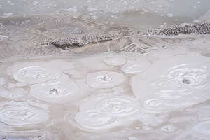 Orakei KoratoWe wondered why it wasn’t called the White Fleece, but I guess that is because we weren’t here during “Golden Hour” when the low-angled orange and yellow light causes it to glow like solid glow. I only wish we could have seen that, but you can’t be everywhere at sunset.
Above the Golden Fleece was the Artist’s Palette, a vast 10,000 square meter flat silica terrace with patches of vivid turquoise blue (clear pools), bright orange and gold (thermophilic bacteria) and deep green and black (algae that thrive in cooler temperatures).
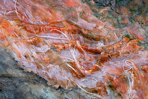 Orakei KoratoIt gets its name from its wide expanse of vibrant colors, reminiscent of an artist's canvas.
It is the highest point along the loop walk and the most open part of the park, with panoramic views of the geothermal landscape of Orakei Korako with its vibrant, colorful silica terraces, steam vents, boiling hot pools, and active geysers below.
Towards the end of the loop, the track leads to a viewing platform for Ruatapu Cave, New Zealand's only geothermal cave, and one of only two known in the world. It's a very rare natural phenomenon in that unlike typical limestone caves formed by rainwater, Ruatapu was formed through a combination of explosive volcanic force and slow chemical erosion.
.thumbnail.jpg) Orakei KorakoIts formation began thousands of years ago as a hydrothermal eruption vent, when high-pressure steam trapped underground exploded toward the surface, blasting a vertical shaft through the soft volcanic rock. Over time, rising geothermal gases (like hydrogen sulfide) mixed with water to create sulfuric acid. This acid slowly ate away at the volcanic walls, widening the vent into the large, 35-meter-deep cavern seen today.
Orakei KorakoIts formation began thousands of years ago as a hydrothermal eruption vent, when high-pressure steam trapped underground exploded toward the surface, blasting a vertical shaft through the soft volcanic rock. Over time, rising geothermal gases (like hydrogen sulfide) mixed with water to create sulfuric acid. This acid slowly ate away at the volcanic walls, widening the vent into the large, 35-meter-deep cavern seen today.
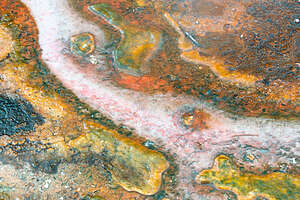 Orakei KorakoAt the bottom of the cave, there is a pool of steam-heated groundwater. Because the water is highly acidic, it remains crystal clear and still, creating the perfect reflection that gives the cave its nickname “Pool of Mirrors.” It is believed that Māori women used the crystal-clear, still water of the pool as a mirror to prepare themselves before special ceremonies.
From the viewing platform, we looked down and could make out the water, but I couldn’t see any reflection. Maybe it was the time of day.
Having seen the major features along the way, we went back to a section we particularly liked for its surreal colors and textures. Photographing abstract patterns has become Herb’s favorite subject for photos, and I am starting to play around with it myself, moving away from expansive landscapes and focusing more on microscopic details where the subject is harder to identify.
.thumbnail.jpg) Orakei KorakoIt's so interesting to think that these amazing colors are living organisms (microbial mats). The vibrant oranges and yellow are pigments of heat-loving bacteria, while the deep greens and blacks are those that thrive in cooler temperatures.
Orakei KorakoIt's so interesting to think that these amazing colors are living organisms (microbial mats). The vibrant oranges and yellow are pigments of heat-loving bacteria, while the deep greens and blacks are those that thrive in cooler temperatures.
We probably spent a good hour or so kneeling on the boardwalk to get down close to our microbial little friends. Herb loved it and he got some really interesting shots. I didn’t do too badly either.
Herb’s 2nd 70th birthday (today was his California one) was off to a good start. Now we would continue south to Tongariro National Park, where we hoped to hike the Tongariro Alpine Crossing.
Taupo Volcanic Zone - Wairakei Thermal Valley
Wednesday, December 3, 2025 - 9:00pm by Lolo50 miles and 1 hour from our last stop - 1 night stay
Travelogue
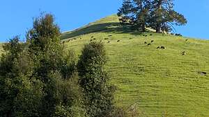 Scenery along the wayYesterday was pretty much just a preparation for the rest of our trip day, with the van pickup and a major food shopping extravaganza, so we were anxious to see some cool stuff and have some fun.
We would devote the first four days of our trip to the Taupo Volcanic Zone before moving on to the subtropical coastlines on the Coromandel Peninsula on the Pacific Ocean and the untamed beauty of the coastline west of Auckland on the Tasman Sea - a nice mix of Surf and (Hot) Turf.
The Taupo Volcanic Zone is a 350 km long, 50 km wide belt of volcanic activity, renowned for its frequency of eruptions and geothermal intensity, that runs from the cone volcanoes of the Central Plateau through Taupo and Rotorua and up to the Bay of Plenty.
It’s essentially a giant "rift" or crack in the Earth's crust where two tectonic plates are pulling apart, allowing magma to rise remarkably close to the surface.
.thumbnail.jpg) Wairakei Thermal ValleyWhen we drove from Rotorua to Taupo today, we were on SH5, also known as the Thermal Explorer Highway. This 80 km stretch runs directly through the most active geothermal fields.
Wairakei Thermal ValleyWhen we drove from Rotorua to Taupo today, we were on SH5, also known as the Thermal Explorer Highway. This 80 km stretch runs directly through the most active geothermal fields.
As we were driving along, we often saw steam rising from the pine forests and paddocks on either side of the road.
The Wairakei Thermal Valley, where we would spend our time today, is located in the central segment of the Taupo Volcanic Zone, about 10 km north of the Taupo town center. It is the most productive area for geothermal energy in the world.
We felt a bit bad about not having time to explore some of the geothermal wonders in Rotorua. There are so many areas of geysers, steam vents, and bubbling pots on the North Island, but we would have had to stay weeks to see them all. Instead, we just picked a few - mostly the less commercial and remote ones that we could explore on our own, rather than with a guide.
Wairakei Terraces & Thermal Health Spa
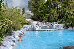 Wairakei Thermal PoolsOur first geothermal stop was the Wairakei Terraces & Thermal Health Spa, set in a lush geothermal valley in the Taupo volcanic zone.
For the local Māori iwi (tribe), Ngāti Tūwharetoa, the Wairakei area has long been a place of healing and spiritual significance. The hot thermal waters were traditionally used for their therapeutic properties, a practice that continues today. The ownership and operation of the Wairakei Terraces are deeply rooted in this cultural context. The site is managed by a local family who are committed to the principles of kaitiakitanga (guardianship) and manaakitanga (hospitality), ensuring that the cultural integrity of the area is preserved and shared with visitors.
.thumbnail.jpg) The hotter poolsThe main attraction is the series of outdoor thermal pools, fed by geothermal water drawn from 1.5 km underground, containing high concentrations of silica, magnesium, potassium, and sodium, which leaves your skin feeling silky. It reminded me of our experience in the Blue Lagoon in Iceland.
The hotter poolsThe main attraction is the series of outdoor thermal pools, fed by geothermal water drawn from 1.5 km underground, containing high concentrations of silica, magnesium, potassium, and sodium, which leaves your skin feeling silky. It reminded me of our experience in the Blue Lagoon in Iceland.
There are four distinct pools with temperatures typically ranging between 30°C and 40°C (86°F and 104°F), allowing you to choose the level of heat that is most comfortable.
The pools are positioned directly below stunning man-made silica terraces that recreate the look of the lost Pink and White Terraces of Tarawera, which were once considered the "eighth wonder of the world," before being destroyed by the 1886 Mount Tarawera eruption.
.thumbnail.jpg) Herb enjoying the thermal poolsThe building of these man-made terraces is done by drawing superheated water from 1.5 km underground and channeling it over a series of tiered structures. As the water cools, the dissolved silica crystallizes and settles, slowly forming the hard, white crust that creates the terrace shape. The silica-rich, turquoise-blue water cascading over them is striking.
Herb enjoying the thermal poolsThe building of these man-made terraces is done by drawing superheated water from 1.5 km underground and channeling it over a series of tiered structures. As the water cools, the dissolved silica crystallizes and settles, slowly forming the hard, white crust that creates the terrace shape. The silica-rich, turquoise-blue water cascading over them is striking.
Although the facility also offers massages and a self-guided Terrace Walk, we chose to spend our time in the thermal pools. The price for an entire day of soaking ws $27 NZ per person.
They were deeper than I expected, and often had to walk on tippy toes to keep my head above water. Fortunately I had my cell phone in a waterproof bag because I did get a bit surprised by a drop off in depth and it did get submerged.
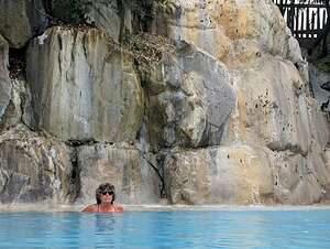 Me Too!!We walked from pool to pool, trying to find the one whose temperature was just right. They were all pretty good, but I preferred the warmest two.
Along our pool strolling, we talked to several people from around the world with whom we shared our travel experiences. We always find somewhere new to go when doing this - in this case, the nearby Craters of the Moon hike, which we would do.
Just as we got out of the pools, as the predicted rain began to come down hard.
We didn’t care though as we felt totally relaxed from our soaking. The heat triggered the release of endorphins and dopamine (your body’s natural feel-good chemicals) and gave us what they call a sense of "comatose bliss" or profound calm. I hoped it would last us for the next 10 days. We might have to find recharging stations along the way.
Also, our skin felt silky smooth from the high silica and magnesium content in the pools, and we had a sense of tingling from the increased circulation which brought blood to the surface of our skin.
Craters of the Moon
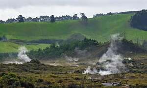 Craters of the MoonThe Craters of the Moon hike was a great recommendation - right up our alley, with lots of interesting geothermal features and no crowds.
Like the Wairakei Terraces we had just been too, this one also has been the result of human-induced geological changes. Unlike most natural wonders that take millions of years to form, the majority of the features we saw today appeared quite recently.
While there has been natural geothermal activity here for centuries—once centered around the massive Karapiti Blowhole—the dramatic shift to the "moon-like" landscape seen today occurred in the 1950s when the Wairakei Geothermal Power Station was built.
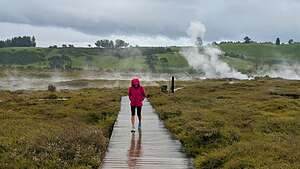 Craters of the MoonBefore the construction of the Power Station, the Karapiti Blowhole, also historically known as the "Devil's Trumpet," was once one of New Zealand's most famous geothermal wonders. Its steam plume was so tall that Māori used it as a landmark when navigating their waka across Lake Taupo. Other than the Blowhole itself, thermal activity near Karapiti was restricted to small areas of warm soils and mud pools.
In the early 20th century, guides would famously throw kerosene-soaked sacks into the vent. The superheated steam would then blast the sparks high into the air, creating a "fireworks" effect.
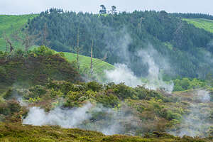 Craters of the MoonBut when the Power Station went live in the 1950s and began extracting massive amounts of hot water for electricity, the underground water pressure dropped significantly. As the water levels lowered, the remaining water began to boil more vigorously, creating pockets of high-pressure steam that rose toward the surface.
The buildup of pressurized steam beneath the earth's crust eventually forced its way out through hydrothermal eruptions. These eruptions ejected mud, steam, and pumice into the air, leaving behind the deep, colorful craters seen today.
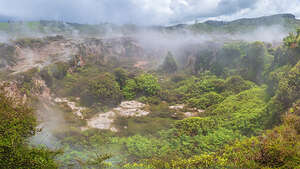 Craters of the MoonFrom 1965-2002 there were more than 20 steam eruptions, occurring roughly every two years, creating the mysterious landscape that led to the name “Craters of the Moon.”
In 1987, the intense thermal activity caused the ground around the Karapiti Blowhole to collapse and become inactive. While the original blowhole is gone, the most active steam vents and fumaroles migrated to nearby hillsides.
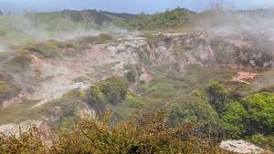 Craters of the MoonVisitor access became possible in the 1980’s when the Department of Conservation built boardwalks and facilities to allow safe access to view the hot thermal features.
So today, we spent a few hours wandering through this incredible “lunar” landscape. It was so interesting that we barely noticed we were being rained on.
Along the way, we saw a variety of geothermal features:
Eruption craters formed by the violent release of steam pressure (hydrothermal eruptions), some of them reaching up to 20 meters deep.
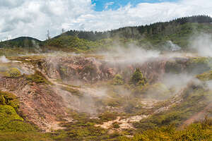 Craters of the MoonTheir bright red and orange walls, the result of condensed steam and acidic gases chemically altering the iron-rich pumice soil, were striking.
Fumaroles (Steam Vents) that hissed and roared at us as pressurized gases escaped through small cracks in the ground
Mudpools formed when acidic gases react with the surface rocks to turn them into clay, which, when mixed with water, form bubbling and burping grey mudpools.
Today, the landscape remains dynamic. Because steam is constantly shifting and new vents emerge, the boardwalks in the park must be moved regularly to protect visitors from the heated ground.
Huka Falls
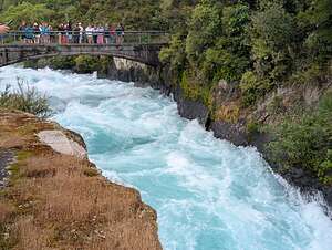 The Bridge over Huka FallsJust a few miles from Craters of the Moon, we stopped to see a bit of non-geothermal beauty - Huka Falls, one of New Zealand’s most visited natural wonders. Besides it being very dramatic and beautiful, it is extremely accessible.
From the main visitor car park, it was just a short walk to the Huka Falls Bridge, from which we gazed directly down into the churning, vibrant blue water of the Waikato River as it funneled through the narrow 15-meter gorge beneath us, creating a thunderous 11-meter drop. We could hear the thundering of the falls before we even got there.
.thumbnail.jpg) Looking down from the bridgeWhile most visitors get no further than the views from the bridge, we continued on for about a quarter of a mile to various viewpoints, where I felt the views were even better, as we watched the powerful force of the falls come towards us.
Looking down from the bridgeWhile most visitors get no further than the views from the bridge, we continued on for about a quarter of a mile to various viewpoints, where I felt the views were even better, as we watched the powerful force of the falls come towards us.
The electric blue color of the water is amazing, so much so that New Zealanders have named it “Huka Blue.” Because the color is so iconic, "Huka Blue" is often used as a descriptive name for paint colors or clothing shades in New Zealand that mimic the turquoise of the river.
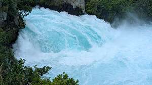 Huka FallsWe had seen similar stunning electric blue water in the lakes on the South Island, but that was caused by glacial particles in the water, while the blue of Huka falls is mostly caused by air bubbles.
When we got home, I delved deeper into the cause of the “Huka Blue” effect and learned the following.
The “Huka Blue” effect is created by three main factors.
Its source is Lake Taupo, which is fed by snowmelt filtered through volcanic rock. It is very low in organic matter, like algae and tannin, which would normally turn the water green or brown.
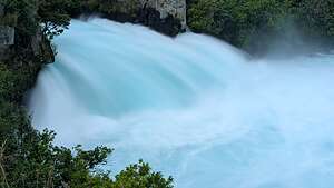 A softer long exposureDeep clear water absorbs red and yellow light wavelengths, which reflect back the blue end of the spectrum.
And lastly, as the water is forced through the narrow gorge, it becomes highly oxygenated, creating millions of tiny air bubbles that act like microscopic mirrors, reflecting and scattering the blue light even more intensely. It is this that creates the “milky” glowing turquoise look.
But blue isn’t the only color in the falls, as the thundering water is layered with frothy, white-capped water that looks like a thick foam at the base of the falls.
Perhaps that is why the Te Reo Māori named the falls huka, which means "foam" or "snow."
Taupo
 Lamb Shank at the Crafty Trout BreweryDuring our travels on the South Island earlier this year, we came to like the consistency and facilities of the Top 10 Holiday Park campgrounds, so we found one in Taupo to plant ourselves for the night.
Also, this one was within walking distance to the Crafty Trout Brewery, where I wanted to take Herb for his birthday dinner.
This was the big 70, which is why we were in New Zealand in the first place. Actually, this year Herb would have two 70th birthdays, because New Zealand is almost one full day ahead of California. Not sure if that makes him 140 tomorrow or not, but in any case he was going to milk birthday boy treatment for 2 days.
It looked like it might rain, so we put on our rain jackets and headed off on the 2 km walk into town to the Crafty Trout Brewery, with a contingency plan of calling an Uber if necessary.
The place was great with a very cozy atmosphere which was kind of a blend of an Austrian “Bier Kafe” and a Kiwi fishing and hunting lodge.
The Crafty Trout is well-known for its distinctive "Alpine Style" beers, which are brewed using pristine volcanic water from Lake Taupō, and creative names that pay homage to the region's trout fishing culture.
The brewery was pretty empty, as it was only 4:00 in the afternoon, so the owner/chef gave us plenty of attention as we perused the menu. He told us that he was just working on a recipe for pork belly which he planned to add to the menu soon, but if we wanted to try it, he would be happy to make it for us.
We love pork belly, and this generous plate of pork belly, mixed vegetables, and fries was awesome. So glad he suggested it.
By the time we finished it was pouring, so we got an Uber back to our campground.
I would have to say that Herb had a pretty damn good birthday, and just think, he was having another one tomorrow..
Description
-38.64654193840173, 176.0682692718479
Van Pickup and Rotorua Thermal Holiday Park
Tuesday, December 2, 2025 - 9:00pm by Lolo136 miles and 2.5 hours from our last stop - 1 night stay
Travelogue
 Van pickup dayThis was it. The big day where we'd pick up our camper van and begin our 11-day road trip around the North Island of New Zealand.
This was not our first time traveling abroad via camper van. We had traveled around the Alps (Germany, Austria, Northern Italy, and Switzerland), Spain, Iceland’s Ring Road, and the South Island of New Zealand.
However, most of those trips had been in a 6-meter van. This time the only van we could get was a 7.4-meter one that slept 4 people - much more space than we needed. That extra 5-feet was definitely going to make parking and driving a lot more stressful on the narrow, steep, windy roads of New Zealand. Plus, we had to get used to driving on the left side of the road.
 Interior of our vanIt was pretty spacious though and had a king-size bed and a separate toilet and shower. Still we would have gladly taken a smaller one.
One might think a camper is an inexpensive way to travel, but it’s really not. Our van cost $3,661 dollars for 11 days, which is $332 per day. Then there is the campground fees, which probably averaged about $30 per day. You can get a pretty nice Airbnb in New Zealand for that price.
Still, we like that mode of travel. We don’t have to pack and unpack every time we move to a new location, and we always have a refrigerator full of cold beer and wine. Also, the campgrounds in New Zealand are usually in very scenic locations.
 Scenery along the wayThe first destination of every campervan trip is a grocery store to stock up for a few days. Sometimes grocery stores in different countries are a bit challenging, but the Woolworth’s near the rental place felt pretty much like a U.S. grocery store.
After spending about $500 NZ on groceries, we set out towards our first planned stop in Rotorua, about 3 hours away (140 miles).
Rotorua is often called the "Sulphur City" due to its geothermal activity, but it’s equally famous for being the heart of Māori culture and a major hub for adventure.
However, it was already late in the day and we had other plans for less commercialized activities on our itinerary, so we just spent the night at the Rotorua Thermal Holiday Park before moving on towards Taupo.
Auckland Airport Hotel
Monday, December 1, 2025 - 9:00pm by Lolo miles and hours from our last stop - 1 night stay
Travelogue
 Land of the KiwiWe spent our first night on the North Island at the Holiday Inn Auckland Airport hotel, where we figured we could get some well-needed sleep before picking up our campervan the following morning.
Despite not sleeping that well on the plane, we tried to limit ourselves to just a short nap, so that we could better adjust to the new time zone. New Zealand is actually not that hard to adjust to because it is only 3 hours earlier than California. However, the confusing part is that it is one day later, so I was constantly panicking that my itinerary was off by a day.
After sitting for 13+ hours on the plane, we felt that a walk would do us good, but since the hotel was located in the fairly industrial suburb of Mangere, we didn’t think there would be any good options. However, we soon found out that Mangere sits on an ancient volcanic field and offers some of Auckland’s best nature walks:
 Horses where coats in NZMāngere Mountain (Te Pane o Mataoho): One of Auckland’s largest and best-preserved volcanic cones. It offers panoramic views of the Manukau Harbour and features ancient Māori earthworks like storage pits and fortified pā sites.
Ambury Regional Park: A working farm on the coast where you can see sheep and cows right next to the harbour.
Kiwi Esplanade: a scenic coastal stretch along the shores of Manukau Harbor, offering a mix of volcanic geology and rich birdlife
Today we decided to set off towards the Kiwi Esplanade, but we made some interesting diversions along the way.
.thumbnail.jpg) Magere Lagoon PathWe were hungry, so our first stop was the Mountain Road Takeaway. In New Zealand, a "takeaway" refers to what Americans call "takeout"—prepared food you buy to eat elsewhere. We had nowhere to “take it away” to, so they let us take two chairs outside their door, where we proceeded to eat our meat pies, spilling a bit of them while trying to balance them on our laps. That’s when we learned how hard it was to clean up meat pie from a sidewalk with a napkin.
Magere Lagoon PathWe were hungry, so our first stop was the Mountain Road Takeaway. In New Zealand, a "takeaway" refers to what Americans call "takeout"—prepared food you buy to eat elsewhere. We had nowhere to “take it away” to, so they let us take two chairs outside their door, where we proceeded to eat our meat pies, spilling a bit of them while trying to balance them on our laps. That’s when we learned how hard it was to clean up meat pie from a sidewalk with a napkin.
Somewhat satisfied with our ¾ of a meat pie, we continued a short distance before diverging from our planned route along the road when we saw horses in a field, all of which were wearing rugs over their backs.
This was curious I thought, so I did a bit of research as to why. New Zealand has very unpredictable weather, which can start off sunny and warm in the morning and end in a freezing rainstorm. Since most horses in NZ live outside in large grass paddocks rather than being kept in stables, when it rains, their natural coat, which is not waterproof, can get waterlogged. Hence the rugs to keep them warm and dry.
 Magere Lagoon Path,We continued past the horses and onto the Magere Lagoon Path, much nicer than just walking along the road.
The path followed the rim of a volcanic explosion crater formed about 70,000 years ago. About 7,000 years ago, rising sea levels breached the crater rim, turning it from a dry hole into a tidal lagoon connected to the Manukau Harbour.
In the 1950s, the lagoon was closed off from the sea and used as a huge oxidation pond for Auckland’s wastewater. From 1998 to 2005, Project Manukau conducted the largest marine restoration project in NZ history, removing the sewage sludge, reconnecting the lagoon to the tide, and planting over 300,000 native trees and shrubs. Now, the water is clean, the smell is gone, and the lagoon is a thriving saltwater wetland.
 Ambury Regional ParkToday it is an internationally significant habitat for shorebirds and one of the best places in Auckland to see Bar-Tailed Godwits, Wrybills, and Royal Spoonbills.
From the Māngere Lagoon Path, we continued on to the Watercare Coastal Walkway, which brought us to Ambury Regional Park, a unique working dairy and sheep farm situated on the shores of the Manukau Harbour.
 Post Office Public HouseFrom there we continued on to the Kiwi Esplanade, which brought us along the northern edge of the Manukau Harbour.
We had already walked close to 6 miles, and didn’t feel like walking back along the streets to the hotel, so we called an Uber to take us back - well worth the 6 bucks.
It has been a lovely hike, full of surprises and much more natural beauty than we had expected to find in an industrial suburb.
That evening, rather than partaking in the hotel buffet, which didn’t exactly get rave reviews on Trip Advisor, we walked to a popular local restaurant called the Post Office Public House where we had delicious salmon burgers and wine.
Then to bed for a good night’s rest before picking up the campervan..
