- Home
- About
- Map
- Trips
- Bringing Boat West
- Migration West
- Solo Motorcycle Ride
- Final Family XC Trip
- Colorado Rockies
- Graduates' XC Trip
- Yosemite & Nevada
- Colorado & Utah
- Best of Utah
- Southern Loop
- Pacific Northwest
- Northern Loop
- Los Angeles to NYC
- East Coast Trips
- Martha's Vineyard
- 1 Week in Quebec
- Southeast Coast
- NH Backpacking
- Martha's Vineyard
- Canadian Maritimes
- Ocracoke Island
- Edisto Island
- First Landing '02
- Hunting Island '02
- Stowe in Winter
- Hunting Island '01
- Lake Placid
- Chesapeake
- Provincetown
- Hunting Island '00
- Acadia in Winter
- Boston Suburbs
- Niagara Falls
- First Landing '99
- Cape Hatteras
- West Coast Trips
- Burning Man
- Utah Off-Roading
- Maui
- Mojave 4WD Course
- Colorado River Rafting
- Bishop & Death Valley
- Kauai
- Yosemite Fall
- Utah Off-Road
- Lost Coast
- Yosemite Valley
- Arizona and New Mexico
- Pescadero & Capitola
- Bishop & Death Valley
- San Diego, Anza Borrego, Joshua Tree
- Carmel
- Death Valley in Fall
- Yosemite in the Fall
- Pacific Northwest
- Utah Off-Roading
- Southern CA Deserts
- Yosemite & Covid
- Lake Powell Covid
- Eastern Sierra & Covid
- Bishop & Death Valley
- Central & SE Oregon
- Mojave Road
- Eastern Sierra
- Trinity Alps
- Tuolumne Meadows
- Lake Powell Boating
- Eastern Sierra
- Yosemite Winter
- Hawaii
- 4WD Eastern Sierra
- 4WD Death Valley +
- Southern CA Deserts
- Christmas in Tahoe
- Yosemite & Pinnacles
- Totality
- Yosemite & Sierra
- Yosemite Christmas
- Yosemite, San Diego
- Yosemite & North CA
- Seattle to Sierra
- Southwest Deserts
- Yosemite & Sierra
- Pacific Northwest
- Yosemite & South CA
- Pacific Northwest
- Northern California
- Southern Alaska
- Vancouver Island
- International Trips
- Index
- Tips
- Books
- Photos/Videos
- Search
- Contact
Carmel, CA
Wednesday, October 9, 2024 - 3:15pm by Lolo
182 miles and 3.5 hours from our last stop - 2 night stay
Travelogue
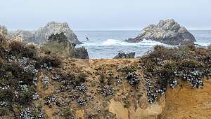
 Point LobosThe main reason we wanted to stay in Carmel was to revisit the Point Lobos State Natural Reserve, probably the most beautiful and photogenic section of the California coast, which is saying a lot. The
Before getting to Carmel, we stopped for lunch at the Alta Bakery and Cafe located in downtown Monterey at the Historic Cooper Molera Adobe. We had stopped here on our last trip to Carmel and liked it so much, we thought it deserved a return visit.
 Point LobosManaging to bypass its beautiful display of pastries and assorted treats, we ordered a Cavolo Nero pizza (Kale, red onion, kalamata olive, marinara, and mozzarella) and happily ate it out on the lovely patio. The pizza was delicious and Herb discovered that he actually does like olives.
Unfortunately clouds were starting to move in, so we decided to check into our room at the Carmel Bay View Inn first before heading out to Point Lobos. As with the Alta Bakery and Cafe, the Carmel Bay View Inn was another repeat from our previous visit to the area.
 Pelicans of Bird IslandWe liked this hotel mainly because of it's location right in the heart of Carmel, in walking distance to everything. Plus it had a cozy gas fireplace.
Despite the questionable weather, we headed to the Point Lobos State Natural Preserve, just 4 miles south of us. Hopefully, things would clear before sunset, which is absolutely stunning at Weston Beach.
The reserve contains 550-acres of dramatic rocky coastline, coves, and rolling meadows.
 Point LobosThe offshore area forms one of the richest underwater habitats in the world, with seals, sea lions, sea otters and migrating gray whales that visit these waters from December to May.
In fact, the name Point Lobos is short for Punta de los Lobos Marinos, which means Point of the Sea Wolves, referring to the sea lions you can find resting on its rocky points and nearby islands.
 Weston BeachSince it was already close to 4:00, meaning we had only about 2 more hours left before sunset, we headed directly to our favorite spot in Point Lobos - lovely Weston Beach, named after Ed Weston, the famous early to mid-20th century photographer, best known for his beautiful landscapes.
He was a friend of Ansel Adams and with him, one of the founders of the f/64 club, a group of 11 San Francisco Bay Area-based photographers that shared a common photographic style, based on precisely exposed, sharply detailed, un-manipulated images of natural forms.
 Weston BeachEd Weston lived (and died) in Carmel and spent much of his time photographing this beach.
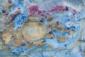
While not as dramatically beautiful as sandy, emerald-green China Cove, it has lots of texture and plenty of opportunities for the sharply detailed images of natural forms that Edward Weston loved.
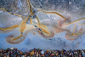
.thumbnail.jpg) Weston BeachThere is no sand on this beach, but rather very unique rock textures that provide for very interesting foregrounds. It is also known for its tide pools.
Weston BeachThere is no sand on this beach, but rather very unique rock textures that provide for very interesting foregrounds. It is also known for its tide pools.
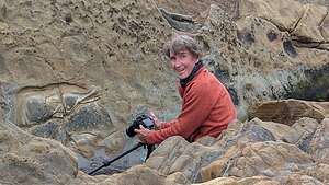
It was perfect for Herb’s new-found love for photographing detailed shots of various rock textures, colors, moss, and reflections.
Plus, it was a great base camp for me to wander along the beautiful rocky coastline looking for landscape compositions of my own.
 Weston BeachSo, I left Herb happily bent over photographing pebbles and moss, and headed off on the South Shore Trail towards Bird Island, the trail for which began from the parking lot at the end of the road.
From the parking lot the Bird Island Trail loops out onto a peninsula between China and Gibson coves on its way to Pelican Point.
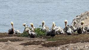
Halfway around the loop is Pelican Point, where I got a close look at the large colony of pelicans on Bird Island. There were even several pelicans along the path. It was amazing!
 Weston BeachAfter finishing the Bird Island Loop, I headed back north on the South Shore trail, going right past Weston Beach, where I saw a happy Herb with his camera and tripod, and continued north to the Sea Lion Loop before heading back to Weston Beach to join Herb for sunset.
The rock formations on Weston Beach brilliantly light up during the golden hour in vibrant blues, yellows, greens, and yellows. It was beautiful. I could understand Herb’s attraction to photographing the details of the lovely textures and colors of these rocks.
We spent the rest of the remaining daylight scampering around its rocks looking for interesting compositions and waiting for sunset, which never came because of the cloud cover. However, it was still very lovely and photogenic.
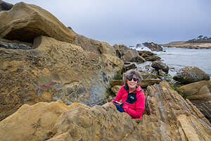 Lolo having fun at Weston BeachBack in our hotel room, we ate the salads I had brought from home on the table by the fireplace. It was very cozy.
The next morning we awoke to blue skies - much better weather than we expected. Great morning for a run, so I set off from the hotel and ran down Ocean Avenue, past the quaint homes ranging from Spanish colonial homes to Tudor-like cottages to fairy-tale gingerbread houses with stone chimneys and pitched roofs.
In less than a mile I arrived at Carmel Beach and the Scenic Bluff Path that runs along scenic drive, starting at Carmel Beach’s northern end and winding along the ocean around Carmel Point all the way to Carmel River State Beach.
 Along my running routeAs pretty as the beach was, the houses along Scenic Drive were the real points of interest, including one near Carmel Point that was designed by Frank Lloyd Wright in the 1950s.
After rounding Carmel Point, I headed inland past the Tor House, the historic house and tower built of sea-tossed granite of the famous poet Robinson Jeffers, known for his work about the central California coast as well as being an icon of the environmental movement.
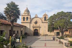 Carmel MissionFrom there I continued away from the beach up 15th Street and Deloros towards the Carmel Mission, passing Clint Eastwood’s Mission Ranch Hotel and Restaurant, which he bought and rescued from condo developers, along the way.
No tour for us today, just a quick photo through the bars of the locked gate. However, we had taken a tour the last time we were here, and it was definitely worth it.
 Lunch at the Treehouse CafeOf the half dozen or so missions that we have visited along El Camino Real, this is probably my favorite.
From the Mission, I ran straight back to the Carmel Bay View Inn.
Before heading back out to Point Lobos for the afternoon, we went for lunch at the Treehouse Cafe, a very highly rated restaurant that we had eaten dinner at on our last visit. It was bustling, but we managed to get there just in time to grab one of its last remaining tables on its lovely outdoor patio.
The setting was lovely and the food was delicious. Herb had a Gyros Platter and I had a Salmon Burger. We skipped the wine this time, as they serve such a generous pour that we would have been done for the day, and we wanted to go back to Weston Beach, since the weather was a lot better today than yesterday.
 Cypress Grove TrailWe had about 2 hours before we needed to be at Weston Beach for the golden hour, so we parked at the Sea Lion Point parking area where the Cypress Grove Trail begins.
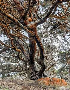
With its old-growth cypress trees, bright orange/red moss, and stunning coastal views, it is considered one of the most beautiful trails in the park - and that is saying a lot.
 Cypress Grove TrailWhen we came to the beginning of the loop in the trail, we went left which took us into the cypress trees, one of the last of two naturally growing stands of Monterey cypress trees on Earth. The other grove is across Carmel Bay at Cypress Point.
Thousands of years ago, these cypresses extended over a much wider range, but climate change has forced these trees to withdraw to these fog-shrouded headlands.
 Cypress Grove TrailFearful that they would be lost forever, the Point Lobos State Natural Reserve was created to protect them.
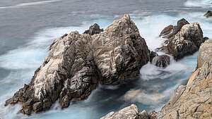
After hiking through the trees, the path opened up to a stunning view of coastal rocks - my kind of view!!! We spent a bit of time photographing there, trying to do it justice.
Tearing ourselves away from the coastal view, we re-entered a grove of trees, noticing that many of them were covered in a velvety orange-colored moss. Ah yes, we were on the north-facing side of the loop.
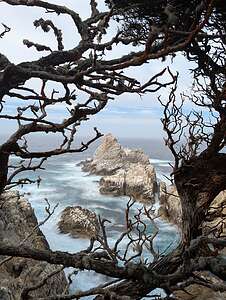 Cypress Grove TrailI later found out that this colorful moss isTrentepohlia, an algae whose orange color comes from carotene, a pigment which also occurs in carrots. Like Spanish moss, its growth does not harm the trees. It just makes them look prettier.
We were now hiking above Pinnacle Cove. Across the cove there was a beautiful cliff, with half a dozen tiny waterfalls popping up and disappearing with each wave that entered the cove.
Before we knew it, we were back at the parking lot. That one-mile loop gave us quite a lot of bang for our buck.
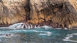 Cypress Grove TrailNext, on to Weston Beach for the Golden Hour when what looked like fairly ordinary rocks during the day lit up in brilliant hues of blue, yellow, green, and orange as the sun began to set.
I made Herb walk to Weston Beach along the North Trail, which I had done yesterday, while I drove the car, so he could see this beautiful section of the coastline too.
Weston Beach did not disappoint, and unlike last night, we actually had a good sunset.
 Point LobosWhile watching the sunset, we noticed a couple that had scrambled across and up the rocky beach to a high point overlooking the sea. It looked like a great photo op, so as soon as they left, I charged up there, not realizing how difficult and precarious it was - and sometimes the waves were almost coming over the top.
Once on top, I stopped very briefly (it was pretty scary), and Herb took a few shots. He likes when I pose like a puffin - long story from our Iceland trip.
Then it was back to the hotel to eat our sandwiches by the cozy fireplace in our room.
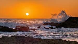 Sunset at Weston BeachI think Herb was pretty happy that I crashed his 4WD Offroading Course getaway or he would be sleeping in his truck in the Mojave Desert somewhere without his “puffin.”
Now onto Herb’s event - an off-road training clinic with Badlands Off-Road Adventures in the town of Mojave, California.
Since we knew that a lot of these desert towns were “food deserts” as well, we decided to have a last meal (lunch) in Paso Robles at Buona Tavola that served Northern Italian Cuisine, something we were pretty sure we wouldn’t find in Mojave.
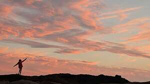 Lolo thinking thinking she's a puffinIt was very elegant with great service and food. We both had the pasta with veal, duck, beef, chicken. It was very delicious. I saved half of mine so that I could have Northern Italian Cuisine later in my hotel in Mojave.
On the way to Mojave, I realized that I had forgotten to pack a bathing suit, which was bad because we had some hot springs planned for later in the trip. After some googline, I found that there was a Dick’s sporting goods store in Bakersfield, right on route.
 Sunset at Weston BeachWhen we got there, we grabbed about eight “comp” suits and brought them (and Herb) into the dressing room. For the next 20 minutes, Herb helped me squeeze into various suits, noting that there were things sticking out of them. I thought he meant tags, but then realized he meant my back fat. Finally, we found where the fat was only slightly oozing and purchased it. I sincerely doubt that this suit will ever see the light of day.
Okay, on to Mojave.
- 1 of 3
- next ›
Carmel location map in "high definition"
Javascript is required to view this map.
