- Home
- About
- Map
- Trips
- Bringing Boat West
- Migration West
- Solo Motorcycle Ride
- Final Family XC Trip
- Colorado Rockies
- Graduates' XC Trip
- Yosemite & Nevada
- Colorado & Utah
- Best of Utah
- Southern Loop
- Pacific Northwest
- Northern Loop
- Los Angeles to NYC
- East Coast Trips
- Martha's Vineyard
- 1 Week in Quebec
- Southeast Coast
- NH Backpacking
- Martha's Vineyard
- Canadian Maritimes
- Ocracoke Island
- Edisto Island
- First Landing '02
- Hunting Island '02
- Stowe in Winter
- Hunting Island '01
- Lake Placid
- Chesapeake
- Provincetown
- Hunting Island '00
- Acadia in Winter
- Boston Suburbs
- Niagara Falls
- First Landing '99
- Cape Hatteras
- West Coast Trips
- Burning Man
- Utah Off-Roading
- Maui
- Mojave 4WD Course
- Colorado River Rafting
- Bishop & Death Valley
- Kauai
- Yosemite Fall
- Utah Off-Road
- Lost Coast
- Yosemite Valley
- Arizona and New Mexico
- Pescadero & Capitola
- Bishop & Death Valley
- San Diego, Anza Borrego, Joshua Tree
- Carmel
- Death Valley in Fall
- Yosemite in the Fall
- Pacific Northwest
- Utah Off-Roading
- Southern CA Deserts
- Yosemite & Covid
- Lake Powell Covid
- Eastern Sierra & Covid
- Bishop & Death Valley
- Central & SE Oregon
- Mojave Road
- Eastern Sierra
- Trinity Alps
- Tuolumne Meadows
- Lake Powell Boating
- Eastern Sierra
- Yosemite Winter
- Hawaii
- 4WD Eastern Sierra
- 4WD Death Valley +
- Southern CA Deserts
- Christmas in Tahoe
- Yosemite & Pinnacles
- Totality
- Yosemite & Sierra
- Yosemite Christmas
- Yosemite, San Diego
- Yosemite & North CA
- Seattle to Sierra
- Southwest Deserts
- Yosemite & Sierra
- Pacific Northwest
- Yosemite & South CA
- Pacific Northwest
- Northern California
- Southern Alaska
- Vancouver Island
- International Trips
- Index
- Tips
- Books
- Photos/Videos
- Search
- Contact
Death Valley National Park, CA
Monday, October 14, 2024 - 6:15pm by Lolo
360 miles and 8 hours from our last stop - 3 night stay
Travelogue
Day 1 - Along the Harry Wade Road - Saratoga Springs Marshland and Ibex Dunes
 Along the Saratoga Springs RoadAfter Mojave, we headed towards Ibex Dunes in the remote and scarcely visited southeastern corner of Death Valley. Since Ibex was a literal food desert, we stopped in Barstow along the way to pick up sandwiches at Jersey Mike’s and some healthy salads to eat for dinner at Staters Grocery Story.
From Barstow, we continued north on I15, and then in the town of Baker, we took Route 127 north for 30 miles to the barely obvious Harry Wade Historical Monument, and the start of the Harry Wade Road.
 Saratoga SpringsWe stopped at the historical marker to read the tale of Harry Wade, who with his family and 100 other wagons, was part of the Death Valley ‘49ers, a group of pioneers from the East who foolishly tried to take a short cut through Death Valley to get to the Sutter’s Fort gold prospecting area in the Central Valley.
Well, things didn’t go so well for the party in Death Valley, which is often the case, so Harry set out and found an exit route for his ox-drawn wagon, saving his and his family’s lives. Today that exit route is known as the Harry Wade Road. It was designated a California Historic Landmark in 1957.
 Ibex DunesWell, if it was good enough for Harry, it was good enough for us, so we turned left on Harry Wade Road and drove along a well-graded road with lovely views of colorful rocks to our right. I named them “Charlie Brown” rocks because of the zig-zagging pattern of their colorful layers, similar to the shirt Charlie Brown always wore.
At 2.7 miles, we passed the turnoff for the Ibex Dunes (for now) and continued on to the turnoff for the Saratoga Springs marshland at mile 5.8, another lesser-known Death Valley destination that we had read about in our “The Explorer’s Guide to Death Valley National Park.” From there it was a 3.9 mile drive to the parking area.
 Lolo on Ibex DunesI assume this area was named for the more famous Saratoga Springs in New York, but the similarities ends with the fact that they both have springs. The New York version doesn’t even have any pupfish inhabiting its spring.
The Death Valley version is an extremely isolated and lovely marshland, set at the base of a colorful brown, tan, and white rock formation. It is home to the Saratoga Springs pupfish, or Cyprinodon nevadensis to be exact, one of nine pupfish species that have evolved separately in the springs of Death Valley and the Owens Valley, and the first to have been discovered.
.thumbnail.jpg) Lolo atop Ibex DunesAfter parking the car, Herb and I set off on separate hikes, as we had different photographic interests. Herb, who has come to enjoy more detail and abstract shots, took off for the marsh, while I, who am more interested in landscape subjects, headed up the road leading up the side of the interesting, colorful rock formation to the right of the marsh.
Lolo atop Ibex DunesAfter parking the car, Herb and I set off on separate hikes, as we had different photographic interests. Herb, who has come to enjoy more detail and abstract shots, took off for the marsh, while I, who am more interested in landscape subjects, headed up the road leading up the side of the interesting, colorful rock formation to the right of the marsh.
Once we convened back at the car, we drove back out to the Harry Wade Road and retraced our route back for about 3 miles to the Ibex Junction and turned left onto a rocky but very passable road to get to the Ibex Dunes.
 MoonriseThe last time we were here, we actually drove too far on the Ibex Dunes road and missed the dunes, which are actually quite small. This time we knew exactly where to find them.
We found a good spot to camp for the night from which we could hike to the dunes. There really is no set trail to the dunes, but rather we just found good terrain, weaving amongst the sagebrush and across some shallow washes, and set our sights on an easily visible goal - the dunes.
 Golden Hour on IbexHowever, the dunes are a couple miles long, so we had to pick which section we wanted to visit, as there was not enough time, or desire, to do the whole thing.
There are two distinct sections to the dunes. The ones on the left (north) are higher, while those on the left have a scattering of smaller ones leading more gently along the ridge to the top.
We hiked in the direction of the one at the very right end, which was also the most brightly lit, but switched directions when the one to the left of it assumed that honor. It felt like we were racing the ever changing light.
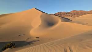 Golden hour on IbexAn added bonus was that these dunes are so pristine and remote that there was not another footprint on them, and there probably hadn’t been any in days. We had this amazing landscape all to ourselves.
As the golden hour approached, the dunes began to put on their evening show, as their dull monotone tans turned to bright beige with deep shadows in their nooks and crannies.
A surprise treat was the rising of a full moon rising over the Saddle Peak Hills behind the dunes, which were now taking on a reddish glow.
 Moonrise at IbexWe got so wrapped up taking photos of the moonrise that by the time we got back to the car the sun had already dipped behind the hills and the dunes reverted to their flatter monotone tan.
Ibex Dunes might not be the tallest in Death Valley - that honor goes to the Eureka dunes - but I do think they very well might be the most stunning.
Oh, one thing that was very different from our last visit here, was the traffic along the Ibex Dune road. Last time, we probably only saw a vehicle or two all day, but this time there was a fairly steady stream of 4WD vehicles decorated with stickers and banners, coming towards us from the mountains to the north.
 Moonrise at IbexAs they passed us, we waved and noticed that each vehicle was driven by a woman, and the co-pilot in the passenger seat was also a woman.
Only later did we find out that we were right along the route of the 2024 Rebelle Rally, an all-women annual off-road rally that is not focused on speed, but rather on navigating precisely using maps, compasses, and road books over 8 grueling days.
It is the longest competitive off-road rally in America, and it just happens to be for women.
Wow! First the Badlands Off-Road Adventures 4WD course, which was dominated by women, and now this! Women Rule!!
Day 2 - Ibex Dunes to Stovepipe Wells
 Morning view from my bedOne of my favorite things about sleeping in the 4Runner is looking out the window in the morning and trying to remember where the heck I am.
The next morning the early morning commute of the Rebelle Rally girls began, and we watched and waved at a steady stream of 4WD vehicles came down from the mountains to the north of us. I wonder where they were headed next? They probably have already spent a few hours plotting their course, as the checkpoints for each day's destination are released every morning at 4:30 am.
 Dumont Dunes OHV AreaPlotting our day was a bit easier - we had Google Maps and a reservation at the Stovepipe Wells Village Motel that night. Since it was only a 3-hour drive, we might even be wild and crazy and take a side trip through Tacopa.
Back on Highway 127, we made a quick detour into the Dumont Dunes Off-Highway Vehicle (OHV) Area, a sand dune system with 7,620 acres of public land in the Mojave Desert for motorized recreation. These OHV areas are very popular in this area of the country.
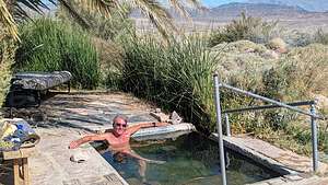 Tecopa natural springWe were thinking that this might be the Rebelle Rally girls home for the night?
This one was very different than the Jawbone Canyon OHV Area that we had played in during our Badlands Adventure off-roading course in that it was entirely sand dunes, and lots of them.
From there we continued on to the tiny town of Tecopa, which we had heard a lot about, both on YouTube and from our son. It’s just a funky little desert town (population 150), with natural hot springs and hot spring resorts, located just outside Death Valley National Park near the village of Shoshone.
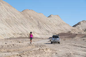 Twenty Mule Team Canyon RoadOur son and daughter-in-law had recently been there and told us how much they enjoyed the brewery there.
Unfortunately for us, we didn’t realize that this tiny town had two breweries and we went to the one that was permanently closed. When I later found out that we should have actually gone to the Death Valley Brewing Company rather than the defunct Tecopa Brewing Company, I wanted to cry.
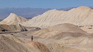 View along 20 Mule Team RoadI really was in the mood for pizza and beer. It’s supposed to be a really cool place with great wood-fired pizza and a tasty selection of craft beers.
Before leaving town though, we did find a natural hot spring to take a soak in. It kind of seemed like someone might use this place as their home, as there was a lawn chair and a cot. Well, if they did, they were out for now, so we took advantage of having the spring to ourselves.
 Lolo atop the ridgeAfter about a half hour, a car came, and a guy just sat in his car. Ok, time to move on.
Then it was on to the main part of Death Valley. We entered the park at the Death Valley Junction and turned left onto Highway 190, which is the main road through the park.
.
After about 20 miles on Highway 190, we decided to take the Twenty Mule Team Canyon Loop, a 2.7-mile well-maintained dirt road that twists and winds its way between, around, and over beautiful yellow hills. The landscape is incredible.
 Hiking on Mesquite DunesBesides its scenic beauity, this road also has a lot of human history, as it played a large part in the mining history of Death Valley. It is named for the teams of mules that back in the 1880s used to pull wagons loaded with borax mined in these canyons from Death Valley 165 miles away to Mojave CA, where we had just been 2 days ago. So we were doing the Borax route in reverse just like the old wagon drivers - minus the Borax and the mules.
Borax was big business in Death Valley at that time. Death Valley has a rich mining history that went on from the 1850s through 1915, and in some cases even later. Of all the minerals and dreams of riches, borax and talc, rather than the more glamorous gold and talc, produced the most wealth.
 Mesquite Sand DunesBack out on 190, we continued north. We didn’t stop at Zabriskie Point, which has one of the best views of Death Valley, because we wanted to get to Stovepipe Wells in time to do a sunset hike on the Mesquite Dunes. Besides, we had been to Zabriskie Point at sunrise so many times in the past, that the lighting at midday just wouldn’t be able to compare. I guess we are getting to be a bit of “good lighting” snobs.
Then it was on to the Stovepipe Wells Village Hotel, which we like because of its location right across from the Mesquite Sand Dunes.
 Mesquite DunesPlus, for being smack in the middle of a desert, it has a good restaurant on site called the Badwater Saloon, and we needed it because we were starving since we couldn't find the Tecopa brewery with the great wood-fired pizza.
After our late lunch we set out for a late afternoon hike on the Mesquite Sand Dunes. The lighting on the dunes is dependent on the season. In the winter time, which we were now closest to, sunrise is best on the front side of the dunes (by the main parking lot), but sunset is best on the back side, reached via a longer walk from the Historic Stovepipe Well, just off Scotty’s Castle Road, a few miles north of the junction with 190.
 Golden Hour on MesquiteSo to the back side we would go. After parking near the Historic Stovepipe well, we started walking out towards the dunes which were much lower than the ones seen from the main parking lot.
It was close to a one-mile walk just to get to the beginning of the back side of the dunes. Walking was easy however, as much of the surface was hard packed dirt rather than deep sand. We could pick and choose whenever we wanted to go up and over a small dune.
 View of Mesquite DunesThe sand dunes stretch over 7 miles long, so we knew we were not going to get to the main dune area and the tallest “Star Dune.”
However, these smaller dunes are beautiful in their own way - less dramatic, but more intimate and peaceful. There wasn’t another soul to be seen for miles. I think very few people explore this section of the dunes.
After about 2 miles of wandering around the dunes, we turned around so we could get back before dark.
 Stovepipe Wells General StoreAnother thing about hiking in dunes is that it is easy to get lost if you don’t have a specific landmark in mind to head for. We were also assisted by Strava and Gaia, which we were using to record our hike. Both of these apps provide tracks which allow you to sort of follow the breadcrumbs back home.
It was a great hike. We felt like we were the only people in the world, or at least our small part of it.
Back at Stovepipe Wells, we headed back to the Badwater Saloon for dinner, as it was the only game in town - but at least it was a good one.
Day 3 - Wildrose Charcoal Kilns and the Eureka Dunes
 Falcon with BreakfastThis morning before heading to Eureka Dunes to camp, we decided to take a drive to the Wildrose Charcoal Kilns, a remnant from Death Valley’s mining past.
Yesterday, on the Twenty Mule Team Canyon Road, we learned about the back end of mining - the delivery of product (Borax) to Mojave. Today, at the kilns we would learn about one of the steps in the mining process itself.
.thumbnail.jpg) Wildrose Charcoal KilnsThis was one of the few places in Death Valley that we had never seen, but always heard about, so we figured it was worth the one hour drive from Stovepipe wells to finally check it out.
Wildrose Charcoal KilnsThis was one of the few places in Death Valley that we had never seen, but always heard about, so we figured it was worth the one hour drive from Stovepipe wells to finally check it out.
To get to the kilns, we drove West on Highway 190 and then took a left onto Emigrant Canyon Road. The scenery along the way is spectacular, and we even saw a falcon high above us with a big snake dangling from its talons.
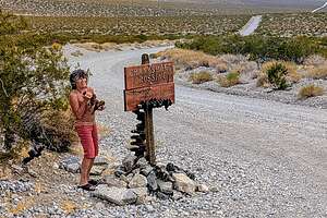 Crankshaft JunctionThe last 2 miles to the kilns is on gravel road, suitable for all vehicles.
Wow! The kilns looked like a well-curated outdoor art exhibit. There were ten of them, laid out in a perfect line, oriented northwest to southeast. They were built in 1877 from local stone, with a mortar made from a lime, sand, and gravel mix.
They looked like giant upside-down beehives, and were quite beautiful.
.thumbnail.jpg) Flat monotone dunesThe kilns were built to supply charcoal for smelters for nearby lead-silver mines.
Flat monotone dunesThe kilns were built to supply charcoal for smelters for nearby lead-silver mines.
During their short two years in operation, pinion pines were harvested from the surrounding hillside and loaded into the kilns, Then they were burned to produce charcoal.
Charcoal was the preferred fuel source for use in mining furnaces because it burns more slowly than wood and produces much greater heat, which is essential for refining ores.
.thumbnail.jpg) Settled in waiting for the sunThen the charcoal was transported by pack animals, and possibly wagons to be used in smelters for lead-silver mines.
Settled in waiting for the sunThen the charcoal was transported by pack animals, and possibly wagons to be used in smelters for lead-silver mines.
Besides its rich history, it is also a popular photography destination, especially at night when there is a crescent moon.
We, unfortunately, were there in the morning, but it was still fun to wander around them. There is a faint photographer’s trail starting up the hill that leads behind the kilns.
.thumbnail.jpg) Ok, good ideaOn the way to Eureka Dunes we had to drive through Stovepipe Wells, so we stopped for the third time this trip for a meal at the Badwater Saloon. I fully expected for them to start greeting us by name, like in the old TV Series Cheers.
Ok, good ideaOn the way to Eureka Dunes we had to drive through Stovepipe Wells, so we stopped for the third time this trip for a meal at the Badwater Saloon. I fully expected for them to start greeting us by name, like in the old TV Series Cheers.
From there we headed north on Scotty’s Castle Road and at the junction for Scotty’s Castle/Ubehebe Crater, we took a left towards the crater. Then, rather than going all the way to the crater, at about 2.8 miles after the junction we turned right onto the Death Valley / Big Pine Road, a well-maintained, dirt and gravel road, suitable for 2WD vehicles.
.thumbnail.jpg) Entertaining ourselvesAt about the 18 mile point, we came to our first landmark – Crankshaft Junction, named for the castoff engine parts that less-fortunate travelers left at this remote site. Presumably, someone once had serious engine trouble here and started the tradition of leaving broken car parts. Thankfully, we didn’t have any donations to make today.
Entertaining ourselvesAt about the 18 mile point, we came to our first landmark – Crankshaft Junction, named for the castoff engine parts that less-fortunate travelers left at this remote site. Presumably, someone once had serious engine trouble here and started the tradition of leaving broken car parts. Thankfully, we didn’t have any donations to make today.
We continued on for another 12 miles before turning left onto the South Eureka Road to the dunes. From there, it was another 10 miles along the 4WD South Eureka Road to the primitive campground near the base of the impressive Eureka Dunes. At 700 feet, it is the largest dune in California and the second largest in the entire U.S.
.thumbnail.jpg) Some light!The campground was dry (no water or flush toilets) and had only four designated sites, all of which were already taken.
Some light!The campground was dry (no water or flush toilets) and had only four designated sites, all of which were already taken.
Thankfully, further down the road there were more dispersed campsites, so we grabbed one not far past the official primitive one, with the outhouse. Last time we were here, there were 3 other campers here, but this time we had the area to ourselves.
Unfortunately though, there was a very thick cloud cover making for less than ideal lighting conditions. Without the shadows, everything just looks kind of flat.
.thumbnail.jpg) Stripes of Last Chance MountainsI decided to go for a walk anyway, but not my usual scrambling up the dunes so Herb could use me as a sense of scale in a dramatic dune photo. Today just wasn’t the day for that.
Stripes of Last Chance MountainsI decided to go for a walk anyway, but not my usual scrambling up the dunes so Herb could use me as a sense of scale in a dramatic dune photo. Today just wasn’t the day for that.
Instead, I headed west alongside the base of the dunes and in about a half mile, I rounded a turn and started heading south along the dune’s edge, occasionally climbing up a bit onto them.
.thumbnail.jpg) Last Chance Mountains at SunsetAt this point, I foolishly thought that I could walk around the entire dune back to our campsite, but it seemed to go on and on forever - well, maybe not forever, but far too long for an evening hike. Herb later laughed when I told him my intentions as he knew that circumnavigating the entire dune is about 8 miles, as it is 3 miles long and 1 mile wide.
Last Chance Mountains at SunsetAt this point, I foolishly thought that I could walk around the entire dune back to our campsite, but it seemed to go on and on forever - well, maybe not forever, but far too long for an evening hike. Herb later laughed when I told him my intentions as he knew that circumnavigating the entire dune is about 8 miles, as it is 3 miles long and 1 mile wide.
So instead, I walked about a mile and a half out and a mile and a half back. Well, at least it was more than he did. When I got back to the campsite, I found him happily perched in a beach chair on top of our picnic table with beer in hand, with the mpressive colorfully striped limestone walls of 4,000-foot high Last Chance Mountains rising above him. Nice backdrop.
.thumbnail.jpg) Morning trail maintenanceIt looked pretty fun up there, so I joined him. We had quite an enjoyable time up there until the weather began to take an ugly turn. First, some pretty serious winds, and then it began to drizzle.
Morning trail maintenanceIt looked pretty fun up there, so I joined him. We had quite an enjoyable time up there until the weather began to take an ugly turn. First, some pretty serious winds, and then it began to drizzle.
We gathered our stuff as fast as we could and loaded it and us in the back of the truck for the night.
Herb built out the 4Runner with two cozy beds in the back, so we were very safe and comfy for the night.
.thumbnail.jpg) Here comes the sun!During the night, the wind was really howling. I was very glad we were not camping in a tent tonight.
Here comes the sun!During the night, the wind was really howling. I was very glad we were not camping in a tent tonight.
We woke up to clear skies, so we took a drive around the southern end of the dunes where the lighting is best in the morning.
Mornings have their golden hour too, as the dull monotone tans turn to bright beige with deep shadows in their nooks and crannies.
The road on the southern end of the dune eventually comes to a dead end, except for the most hardy 4WD vehicles that take on the challenge of Steele Pass.
 Morning lightWe wanted to at least see the start of Steel Pass (after all we had just come for a 4WD-offroading class in Mojave), so we continued driving along the sandy road, which was now covered with tumbleweed from last night's winds.
Tumbleweed can be pretty prickly, so Herb donned a pair of gloves and went to work hurling big bundles of it off of the road. It was quite entertaining to watch.
After pruning the tumbleweed, we proceeded on to Dedeckera Canyon, which is the beginning of a classic and extremely challenging 36-miles 4WD route from the Eureka Dunes over Steele Pass and into Saline Valley.
 And more lightIt is definitely not for the feint of heart.
The first half mile through Dedeckera Canyon is the most challenging. There are four “stairs” to climb, and I don’t mean the kind of stairs in your house, but rocky stairs two-feet high or more.
The 4WD books recommend walking it first to determine the best lines for your vehicle to take. Having just come from a 4WD course it was actually interesting to try to visualize how, if we were crazy enough and had high enough clearance, we would navigate up the series of steps.
 Dedeckera Canyon (Steele Pass)Wow! Well, that wasn’t happening today, or probably any time in my future, but kudos to those that have the vehicle and the skills to do so. It must be quite an adrenaline rush.
For us, driving off-road is about being able to get to beautiful remote locations rather than the rock crawling over trails such as Dedeckera Canyon. To each his own, but the most important thing is just getting out in the wilderness and enjoying these wonderful spaces.
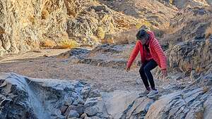 I can't even walk down this thingNow it was on to Bishop to visit our adorable little 2 ½-month old grandson.
Bishop is actually not that far from Eureka Dunes, so it is often our last Death Valley stop before visiting our son. The Death Valley / Big Pine Road takes you right from the South Eureka Road into the town of Big Pine, just 15 minutes south of Bishop.
.thumbnail.jpg) Bye for now Eureka DunesThe ride is quite scenic. This time we noticed something strange along the Death Valley / Big Pine Road - a series of probably a dozen high dirt and rock mounds spaced about a ¼-mile apart along the north side of the road.
Bye for now Eureka DunesThe ride is quite scenic. This time we noticed something strange along the Death Valley / Big Pine Road - a series of probably a dozen high dirt and rock mounds spaced about a ¼-mile apart along the north side of the road.
Of course we had to stop and climb one. We tried to figure out what they might be and the best guess we could come up with was that they were old mining shafts covered over for safety.
Back in Big Pine, we headed north on 395 towards Bishop. We were very, very excited to see little Walker Gaidus again. Now this, rather than Dedeckera Canyon is the kind of adrenaline rush I’m looking for.
- ‹ previous
- 3 of 3
Death Valley National Park location map in "high definition"
Javascript is required to view this map.
