- Home
- About
- Map
- Trips
- Bringing Boat West
- Migration West
- Solo Motorcycle Ride
- Final Family XC Trip
- Colorado Rockies
- Graduates' XC Trip
- Yosemite & Nevada
- Colorado & Utah
- Best of Utah
- Southern Loop
- Pacific Northwest
- Northern Loop
- Los Angeles to NYC
- East Coast Trips
- 1 Week in Quebec
- Southeast Coast
- NH Backpacking
- Martha's Vineyard
- Canadian Maritimes
- Ocracoke Island
- Edisto Island
- First Landing '02
- Hunting Island '02
- Stowe in Winter
- Hunting Island '01
- Lake Placid
- Chesapeake
- Provincetown
- Hunting Island '00
- Acadia in Winter
- Boston Suburbs
- Niagara Falls
- First Landing '99
- Cape Hatteras
- West Coast Trips
- Maui
- Mojave 4WD Course
- Colorado River Rafting
- Bishop & Death Valley
- Kauai
- Yosemite Fall
- Utah Off-Road
- Lost Coast
- Yosemite Valley
- Arizona and New Mexico
- Pescadero & Capitola
- Bishop & Death Valley
- San Diego, Anza Borrego, Joshua Tree
- Carmel
- Death Valley in Fall
- Yosemite in the Fall
- Pacific Northwest
- Utah Off-Roading
- Southern CA Deserts
- Yosemite & Covid
- Lake Powell Covid
- Eastern Sierra & Covid
- Bishop & Death Valley
- Central & SE Oregon
- Mojave Road
- Eastern Sierra
- Trinity Alps
- Tuolumne Meadows
- Lake Powell Boating
- Eastern Sierra
- Yosemite Winter
- Hawaii
- 4WD Eastern Sierra
- 4WD Death Valley +
- Southern CA Deserts
- Christmas in Tahoe
- Yosemite & Pinnacles
- Totality
- Yosemite & Sierra
- Yosemite Christmas
- Yosemite, San Diego
- Yosemite & North CA
- Seattle to Sierra
- Southwest Deserts
- Yosemite & Sierra
- Pacific Northwest
- Yosemite & South CA
- Pacific Northwest
- Northern California
- Southern Alaska
- Vancouver Island
- International Trips
- Index
- Tips
- Books
- Photos/Videos
- Search
- Contact
Monroe's Shiloh Campground
Monday, July 29, 2002 - 8:30am by Lolo80 miles and 1.5 hours from our last stop - 1 night stay
Travelogue
After crossing the Mississippi River, we continued west on I20 to Monroe, Louisiana, where we chose to spend the night at the Shiloh Campground. Upon checking in, we were handed a flier warning us of Encephalitis and West Nile Virus from mosquitoes. This was a great start. Immediately, Tommy declared that he wasn't going to step out of the RV.
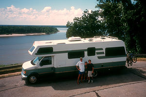 RV poised to cross the mighty Mississippi RiverWe managed to coax the kids out of the RV and we swam in a pretty nice campground pool, complete with slide. We also spent some time relaxing in the adjacent hot tub. Afterwards, the kids did do a little fishing in the lake, but unfortunately the only thing biting was the mosquitoes. So we called it an early evening and retired to the RV to watch a movie. We briefly left the safety of the RV again to do our ceremony of the placing of Louisiana on our U.S. map.
We were anxious to leave the mosquitoes and humidity of Louisiana behind the next day and head to the drier climate of Texas. I'm afraid we really didn't do Louisiana justice.
Description
The Monroe's Shiloh Campground was just a stopover on our way across Louisiana on I-20. The campground has a pool, hot tub, and small lake for fishing.
Vicksburg National Military Park
Monday, July 29, 2002 - 7:30am by Lolo280 miles and 6 hours from our last stop
Travelogue
We left the Trace in Jackson, Mississippi, and began our trek west on I20. Before crossing the Mississippi River into Louisiana, we made a brief stop at Vicksburg National Military Park. After our customary stop in the Visitor Center and the bagging of yet another collector hat pin, we went outside to watch the cannon demonstration. The soldiers loading the cannon joked that they needed a target and glanced over at Tommy who was wearing a Yankee baseball cap. Apparently, we were the only northerners in the group and we were on enemy territory. It was strange to think of it that way.
After the cannon demonstration, we drove the 16-mile auto drive through the Civil War cemetery and memorials. It was thought provoking to look at the endless lines of white gravestones and to think of how many American lives were wasted during that war.
Description
Vicksburg, which sits high on a bluff overlooking the Mississippi River, was the site of one of the most decisive battles in the Civil War. Its surrender on July 4, 1863, divided the South, and gave the North control of the Mississippi River. In 1899, Congress established Vicksburg National Military Park to commemorate its significance in the American Civil War.
The Military Park includes a 16-mile auto tour road, Vicksburg National Cemetery, 1,325 historic monuments and markers, 20 miles of reconstructed trenches and earthworks, an antebellum home, 144 cannon, and the restored Union gunboat-USS Cairo.
Wal-Mart - Belle Vernon
Friday, July 26, 2002 - 2:00pm by Lolo366 miles and 6 hours from our last stop - 1 night stay
Travelogue
There is always a great feeling of excitement and anticipation as we head out on a road trip, unsure of what the next few weeks will bring. This year was no different. We set out in the mid-afternoon to try to get some miles under our belt before nightfall. Our first planned destination was Mammoth Cave National Park in Kentucky. Since 14 hours is too much to do in one day, we drove about 6 hours the first day and stopped around 9:00 in a Wal-Mart Super Center in Belle Vernon, PA.
On just pure driving days, we often select a Wal-Mart to spend the night at rather than pulling in late into a commercial campground. All we need to do is sleep, and once you pull the shades in the RV down, you can imagine that you're anywhere, so a Wal-Mart is just as good a place as anywhere else. However, we only select Wal-Mart's when we feel we are in a safe area. We spent one rather restless night in a Wal-Mart parking lot outside Richmond, Virginia, where we had to listen to drag racing in the parking lot all night.
Description
Many Wal-Mart Supercenters allow RVs to park in their parking lots over night since they are open 24 hours.
Home
Sunday, August 5, 2001 - 9:00am by Lolo435 miles and 8 hours from our last stop - 1 night stay
Travelogue
We'd covered a lot of ground over the last 3 1/2 weeks -- probably too much ground--and learned a lot--sometimes the hard way. Too many miles with too few multi-day stops is a sure recipe for trip fatigue. Still, the trip was great and we'd gotten to visit some truly spectacular places. However, next time we'll slow down and stop to sniff the roses.
Description
Our home in Upper Saddle River, a suburb of New York City.
Streetsboro - Mar-Lynn Campground
Saturday, August 4, 2001 - 12:00pm by Lolo565 miles and 11 hours from our last stop - 1 night stay
Travelogue
Although this looked like a very nice campground, after 10 hours of driving, we didn't have the time or energy to enjoy it very much. The kids, however, did take a quick dip in the small lake in the campground..
Description
250-site campground in Streetsboro, Ohio, near such attractions as Six Flags, the Cuyahoga Valley National Forest, and the Rock n' Roll Hall of Fame. Facilities include a game room, spring-fed lake, fishing and swimming, propane, and laundry. Home-made fudge and hand-dipped ice cream are featured treats!
Devils Lake State Park
Friday, August 3, 2001 - 4:00am by Lolo144 miles and 2.5 hours from our last stop - 1 night stay
Travelogue
Too bad we hit Devil's Lake State Park on a Friday when the campgrounds were full because it would have been a great place to spend the night. The lake was very pretty--crystal clear water with 500-foot cliffs surrounding it and more than 30 miles of hiking trails to enjoy.
 Boys holding up Balance RockThe park looked great, and after having driven more than 1,700 miles in the last 3 days, we really needed a day to just relax. So we grabbed our beach chairs and towels and settled down on the grassy beach at the north end of the lake. The sandy beach that is normally there was completely under water as a result of some recent heavy rains. The beach was a little more crowded than we like, but the water was great and it was good to just stay in one spot for a few hours.
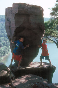
After lunch, we set off on a hike along the West Bluff Trail, which went along the rocky bluffs and cliffs on the western shore of the lake. About 2 miles into the hike, we arrived at the sandy beach on the opposite end of the lake and took a dip before continuing our circumnavigation of the lake on the East Bluff Trail. Along the bluffs on the eastern shore, we came upon Balance Rock, a mammoth 12-foot high, arrowhead-shaped rock, teetering precariously on top of a flat rock. We took the obligatory photo of the boys pretending they were holding up the rock, which actually moved a bit when they leaned on it. Then back to the north beach, another quick dip, and we were on our way to find a place to stay for the night.
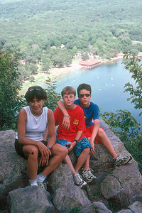 Lolo and boys on East Bluff Trail overlookWe called Baraboo Hills Campground and found that they had a few sites open. The boys were pretty excited because the Campground Guide listed all kinds of great recreational opportunities, like mini-golf, rental carts, etc. We got there at 7:55, just in time to watch the campground staff closing up all the recreational equipment. Great. Undaunted, we headed to the heated pool which was open until 10:00. I've never seen a more crowded swimming pool in my life--people standing in the water shoulder to shoulder. In the midst of this mass of humanity, some guys were actually attempting a game of football. The kids found this very amusing and spent their time lying on their backs on the bottom of the pool with their face masks on watching the chaos going on above them.
A good time was had by all. We were relaxed and refreshed and ready for the final push home.
Description
Devil's Lake State Park is in Baraboo, Wisconsin, 14 miles south of the Wisconsin Dells. It is located along the Ice Age Trail, which traces the glacial ridges of Wisconsin for hundreds of miles.
Back in the late 1800s, train tracks ran along the shores of the lake bringing guests to the elegant hotels lining the shore. The hotel era ended in 1904 and few traces of it remain. Now people come to enjoy the natural beauty--the 360-acre, crystal clear Devil's Lake and the beautiful 500-foot cliffs that surround it.
Today the park is popular for many outdoor activities, such as swimming, boating, scuba diving, fishing, hiking, mountain biking, and even rock climbing. There are two large, sandy beaches, one at either end of the lake. There are more than 29 miles of hiking trails, including the West Bluff Trail and East Bluff Trail, which go along the rocky bluffs and cliffs around the entire lake. There are many interesting rock formations to explore, including Balanced Rock and the Devil's Doorway.
The park is extremely popular, so the 406 campsites in the park fill up quickly during the summer.
St. Paul - KOA
Thursday, August 2, 2001 - 12:30pm by Lolo605 miles and 11 hours from our last stop - 1 night stay
Travelogue
After leaving Manitoba, we headed south and back into the States. Nothing fun today--just one of those long days of driving that come at the end of a cross country trip. 11 hours was just too much today. Tomorrow we need to find some fun.
Description
71-site campground with a heated pool right off I94
Saskatchewan
Tuesday, July 31, 2001 - 11:45am by Lolo561 miles and 11 hours from our last stop - 1 night stay
Travelogue
We left the Rocky Mountains in Jasper and headed east across the prairies of central Canada on our long trek home, a little sad that the last of our planned highlights was over.
Not having much information on Saskatchewan, Herb and I stopped in a Visitor Center to see what recreational opportunities the province had to offer--biking, hiking, rafting, etc. To our surprise, the Visitor Center was manned by two old woman who had to be pushing ninety. Undaunted, I approached them and asked my planned question about recreational opportunities. They stared blankly at me. At this point, Herb started to crack up and had to walk away and bury himself in the pamphlet rack. "Sign the book!" one of the ladies responded quite emphatically. I glanced over to where she was pointing and saw that she wanted me to sign the guest log. I complied and asked my question once again to which the other one responded, "Where are you from?" "New Jersey," I replied. "Oh, Saskatchewan," she nodded and smiled. At that point, Herb could not control himself any longer and quickly left the Visitor Center. After a few more questions and random responses, I smiled politely at them and got out of there as quick as I could. Herb was still laughing when I got to the RV.
Still not having the slightest idea as to what to do in Saskatchewan, we drove about 10 hours to Saskatoon and stopped at a pretty campground overlooking a park and some ball fields. It was a lovely evening, so we sat in our beach chairs on the bluff watching the baseball games going on below. This was the first time the entire trip that I got homesick. Both our boys love baseball and if we hadn't been traveling, this is what they would have been doing. Most of our stops prior to this one had been tourist destinations, but what we were seeing now were people living their normal daily lives. Traveling is great, but I like my normal life too. I guess it's time to go home.
Description
Saskatchewan, located in central Canada just east of Alberta, is one of the least visited provinces in Canada, having neither mountains or seacoast to draw visitors. Rather than a tourist destination, Saskatchewan, which is part of the great prairies, serves as the breadbasket of Canada producing 60% of its wheat.
The Trans-Canada Highway (Highway 1) and Highway 16 pass through the southern part of the province, which is the more populated part. The entire province, which is 5 times the size of New York State has only 1 million people living in it. The less populated northern part of the province is mostly forest and lakes and is considered a hunting and fishing paradise with other 30,000 square miles of lakes.
Prince Albert National Park, 150 miles north of Saskatoon, is the province's only national park. In the forests and lakes of this pristine million-acre wilderness area, there is canoeing, swimming, hiking, and great wildlife viewing. There are 31 provincial parks in Saskatchewan as well.
Jasper National Park
Sunday, July 29, 2001 - 10:00am by Lolo145 miles and 3.5 hours from our last stop - 2 night stay
Travelogue
Like Whistler and Moab, Jasper was another one of those towns we fell in love with--the kind of place outdoor enthusiasts flock to. Although it was similar to Banff Townsite in some ways--like the fact that it was surrounded by some incredible scenery--it was a lot less glitzy and touristy and seemed more real. Rather than fancy boutiques and restaurants along its Main Street, there were pubs and stores selling outdoor gear and clothing. Even the people seemed different, like they had just come off the trail or mountain. Banff might have been a great place to visit, but Jasper was the type of place I could picture living in.
 Maligne Canyon hikeWe arrived in Jasper late afternoon after our drive along the Icefields Parkway, and as we were traveling with friends, we were lucky to get two campsites together in the Whistlers Campground just 2 miles south of Jasper Townsite. Our plan was to spend two nights in Jasper before the Kalchbrenners had to leave us and head back to Calgary to return their rental RV and fly home. That gave us a full day to try to see as much of Jasper as we could.
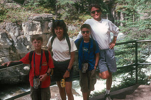
In the morning we headed out early to do the Maligne Canyon hike, which is considered to be one of Canada's best. This trail follows the Maligne River as it cascades down through a narrow, deep chasm to join up with the Athabasca River. During our hike, we crossed six footbridges which spanned the sides of the narrow canyon, which was only 10 feet across, and gazed down at the cascading river more than 150 feet below. It really was a great hike.
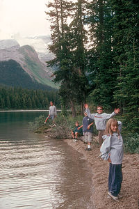 Gang fishingAfter the hike, we headed out to Maligne Lake to do some fishing. Along the road to the lake, we noticed that some cars were pulling over. Not wanting to miss anything, we pulled over as well. It was unbelievable. The road was full of big horned sheep, some of them quite aggressive, wandering along the road towards cars and then licking their tires. It was bizarre. I'm not sure what it was about the tires that attracted them, but they sure loved them. Herb was getting a little nervous about what they might do to the RV. When they moved away from us to try tasting a new set of tires that pulled up, we took the opportunity to continue on to the lake.
 Herb fishingWe parked at the Maligne Lake Lodge, got our fishing gear, and hiked along the lakeshore to what we hoped would be a good fishing spot. The lake was quite beautiful, with that color that only glacier-fed lakes seem to have, and was surrounded by jagged, snow-capped mountains. It was so nice just sitting by the lake that I don't think anyone really cared that we weren't catching any fish. The fish might not have been interested in us that day, but the birds certainly were. Small birds would swoop down and take pretzels right out of our hands. The kids even got the birds to land on their heads by placing tiny pretzel pieces there. So far the wildlife in this park certainly seemed quite comfortable with people.
That evening, our final together with the Kalchbrenners, we spent in Jasper Townsite strolling along Main Street and browsing in the shops. Jasper really is a great town--good restaurants, great outdoor gear shops, and breathtaking views of the surrounding mountains right from the center of town. We had a fun dinner that night at the Jasper Pizza Place, which had a nice pub atmosphere and served every possible pizza combination imaginable.
The next morning, we parted with our friends and started heading east across the plains of central Canada.
Description
Jasper is located along the eastern slopes of the Rocky Mountains in western Alberta, about 200 miles north of Banff National Park via the spectacular Icefields Parkway. Jasper is Canada's largest mountain park, encompassing 4,200 square miles of rugged mountains, glaciers, alpine meadows, and glacier-fed rivers and lakes.
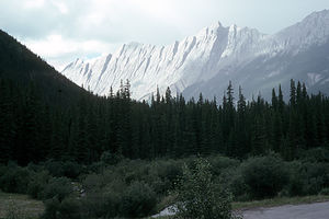 Jasper RockiesLike Banff Townsite, Jasper Townsite serves as a base for the recreational activities in the park. However, Jasper is much less glitzy and touristy than Banff and the streets are filled with hikers, bikers, and climbers rather than shoppers. As in Banff, there are numerous restaurants and shops, but they tend to be less trendy and expensive.
The park is a mecca for outdoor enthusiasts. Summer recreational activities in the park include:
- hiking along the 660 miles of hiking trails
- floating along the mild rapids (Class II and III) of the Athabasca River
- more extreme whitewater rafting down the Maligne River (Class III)
- rock climbing with the Jasper Climbing School
- fishing in Maligne Lake
- horseback riding into some of the more remote areas of the park
- golfing at the Jasper Park Lodge
- wildlife viewing for bighorn sheep, mountain goats, elk, deer, moose, mountain lions, wolves, black bears, grizzly bears, and even caribou.
A good way to get an overview of Jasper is to take the breathtaking ride on the Jasper Tramway 1 ¼ miles up to the summit of Whistler's Mountain. The views from the top of the mountain are fabulous.
There are many hiking opportunities in Jasper, but one of the best in all of Canada is the Maligne Canyon hike, which follows the Maligne River as it cascades downstream to meet the Athabasca River. Along the way, the trail crosses six footbridges that span the deep, narrow canyon, which is only 10 feet across and as much as 150 feet deep.
45 miles east of Jasper Townsite lies the beautiful 13-mile long, glacier-fed Maligne Lake, the second largest glacier-fed lake in the world. There is much wildlife to see along the drive, especially bighorn sheep. From the Maligne Lake Lodge, a 90-minute boat cruise goes to Spirit Island in the middle of the lake several times a day. Boat and kayak rentals are also available. Maligne Lake is also popular with fisherman, who comes here for the rainbow and eastern brook trout.
Maligne Lake flows into Medicine Lake just to the north of it. The interesting thing about Medicine Lake is that it disappears each fall into an underground drainage system and then reappears each spring and grows to 5 miles long and 60 feet deep.
Off Highway 16 about 37 miles northeast of Jasper is the Miette Hot Springs, a beautiful hot, spring-fed swimming pool surrounded by outstanding scenery.
There are 10 campgrounds in the park. The largest one, as well as the one closest to Jasper Townsite is Whistlers, with 700 sites.
Icefields Parkway / Columbia Icefields
Sunday, July 29, 2001 - 4:30am by Lolo140 miles and 3.5 hours from our last stop
Travelogue
Today's drive was hopefully going to be an event in itself--the 178-mile Icefields Parkway, one of the most spectacular mountain roads in the world. Unfortunately, the weather was pretty damp and dreary so I'm sure we weren't seeing it at its best. Still the scenery was quite awesome--pristine river valleys, alpine meadows, emerald-green glacial lakes, waterfalls, and glacier-covered mountains.
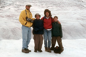 Family at the IcefieldsHowever, the highlight came about halfway along the drive when we reached the Columbia Icefields Visitor Center at the base of the Athabasca Glacier, one of the 8 glaciers that make up the Columbia Icefields, the largest nonpolar ice cap in the world. The glaciers are more than 2,500 feet thick and cover a 200 square mile area. Since the Icefields are located on the Continental Divide, their melt water feeds streams and rivers that pour into three different oceans--the Arctic, the Atlantic, and the Pacific. It truly was an incredible sight.
We had two choices for experiencing the glacier. One was to just walk out onto the foot of the glacier on our own. The other far more expensive choice (it cost $162 Canadian for 2 adults and 2 kids) was to take the Brewster Ice Age Adventure, a 90-minute excursion onto the face of the glacier in specially designed, balloon-tired buses. Normally, we shy away from touristy, expensive, big group tours like this, but in this case it seemed like the best way to truly experience the glacier. Also, afterwards we heard a story about a tragedy that occurred here the previous week. A 10-year-old boy who was out on the foot of the glacier with his family, fell into a crevasse and couldn't be recovered. What an absolute nightmare. The thought of that boy still haunts me to this day. On the Brewster Snocoach tours, the parts of the glacier they let you out onto have been carefully checked for crevasses so a tragedy such as this one can't occur.
The tour really was fun. We were jostled and bounced along the ice and climbed some inclines so steep that you would never expect a vehicle to be able to get up. We were let out of the coach onto the glacier on an area that had been tested for safety. Our tour guide explained to us how glaciers were formed and pointed out some interesting geological features along the way. He was so cute that Michelle and I definitely developed an appreciation for geology, or at least pretended we did.
Further north on the Icefields Parkway, we stopped to see the very impressive Athabasca Falls. From the parking area, we took a short hike to a bridge over the chasm where we got a great view of the 82-foot-high waterfall dropping into a narrow canyon below.
Description
The 178-mile long Icefields Parkway, which connects Lake Louise and Jasper, is perhaps one of the most spectacular mountain roads in the world. The road climbs through three river valleys past deep-green lakes, waterfalls, glacier-covered mountains, and dozens of permanent snowfields.
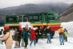 SnocoachAbout halfway along the 3-hour drive is the Columbia Icefields, the largest nonpolar ice cap in the world, covering 200 square miles and more than 2,500 feet thick. It also happens to be the hydrographic apex of North America where water flows to three different oceans (Atlantic, Pacific and Arctic) from one point.
Brewster Snocoach offers 90-minute excursions onto the face of the glacier in their balloon-tired buses. The tour allows you to walk out on the glacier in an area that has been tested for safety. For those not taking the tour, you can drive your car to the foot of the glacier and then walk out on the surface. Extreme caution must be used to avoid falling in a crevasse.
Further north on the Parkway towards Jasper are several waterfalls. Perhaps the most impressive is Athabasca Falls, which drops 82 feet into a narrow canyon. A short hike to a bridge over the chasm provides great views of the falls.
