Sisters, OR
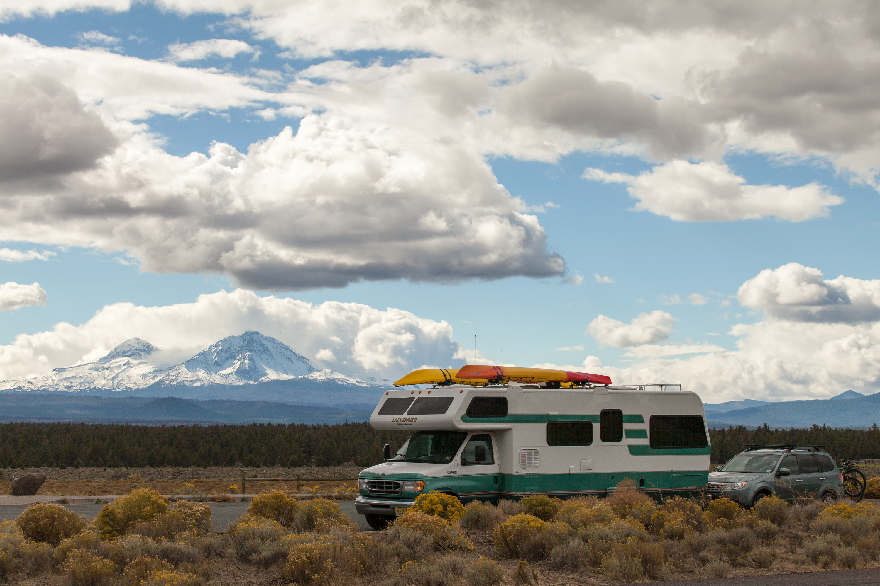
During our visit to Bend and Smith Rock State Park earlier this summer, we had taken notice of the beautiful, snow-covered Three Sisters peaks looming majestically to the West. Also, a couple we met in the Crown Villa campground couldn’t stop raving about how great the Sisters area was. So, rather than repeat a visit to Bend on our drive south through the Oregon Cascades, which wouldn’t have been a bad idea either, we decided to stop in Sisters instead.
Since we wanted to hike the next day, we stopped at the National Forest office right in the heart of town to get trail maps and recommendations. I usually do some research first and then try to get confirmation on my choices, and that is exactly what happened. We all agreed that the 3.8 loop hike to the summit of Black Butte would be our best bet. Also, they told us that we could park the RV in their parking lot in the morning, which would allow us to not have to camp another night in Sisters if we wanted to continue driving south after the hike.
The town was really cute. It had a real old Western Cow Town type of feel to it. Many of the buildings had old-fashioned facades and covered sidewalks. I made it quite clear to Herb that it would be a very good idea for us to come back here for dinner later.
The next order of business was finding a campground for the night. We toyed with staying at Tumelo State Park, because generally we prefer state parks over commercial campgrounds, but that one was 17 miles away in Bend. We even drove down there to look at it, but although it was nice enough, it wasn't nice enough for us to want to be so far from town and the start of our hike in the morning.
So we drove back up Route 20, taking note of the scenic viewpoint of the Three Sisters along the way, and camped instead at the Garden RV Park, just 4 miles south of town. It was a very nice campground and much more conveniently located to Sisters. This way me and my cowpoke could easily go to town later.
But first, the lighting was getting low and the Three Sisters were strutting their stuff, so after checking in, we drove back down to the scenic viewpoint a few miles down Route 20 to photograph sunset over the Sisters. Unfortunately, clouds had moved in, obstructing the view.
Back at the campground, we used the Yelp app on the phone to look at restaurant reviews. We really find this very helpful when in a place we know little about, and it has rarely steered us wrong. The Open Door restaurant had by far the best reviews, so I called and made a reservation for 2. I felt kind of silly later about the reservation, because the restaurant was empty except for one other table. It was no reflection on the restaurant though. The whole town was like a ghost town. Where was everybody? When we asked our waitress, she told us that things are really busy on the weekends, but quiet during the week this time of year. Well, we got lots of attention and great service, and the Grilled Salmon was absolutely delicious.
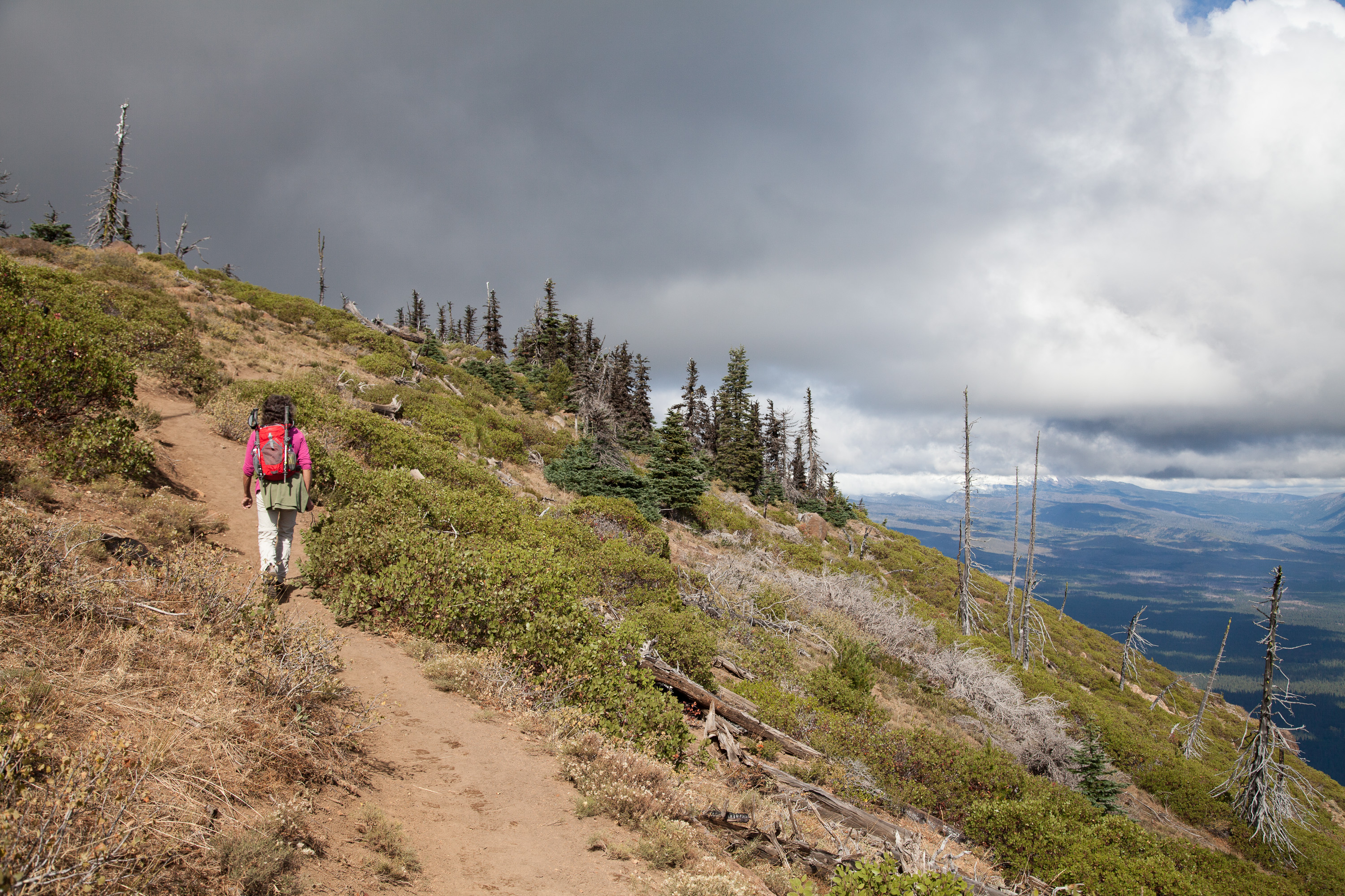
The next morning was a chilly 28 degrees, so we dressed in layers hoping to discard most of them as the day went on. The drive to the Black Butte trailhead was not trivial – Highway 22 west of Sisters for 5 ½ miles to the Indian Ford Campground, then north on Green Ridge Road 11 for 3.8 miles, and then left on gravel road 1110 for another 5.1 miles to the road’s end. There were not many cars in the parking lot, so we would pretty much have the trail to ourselves.
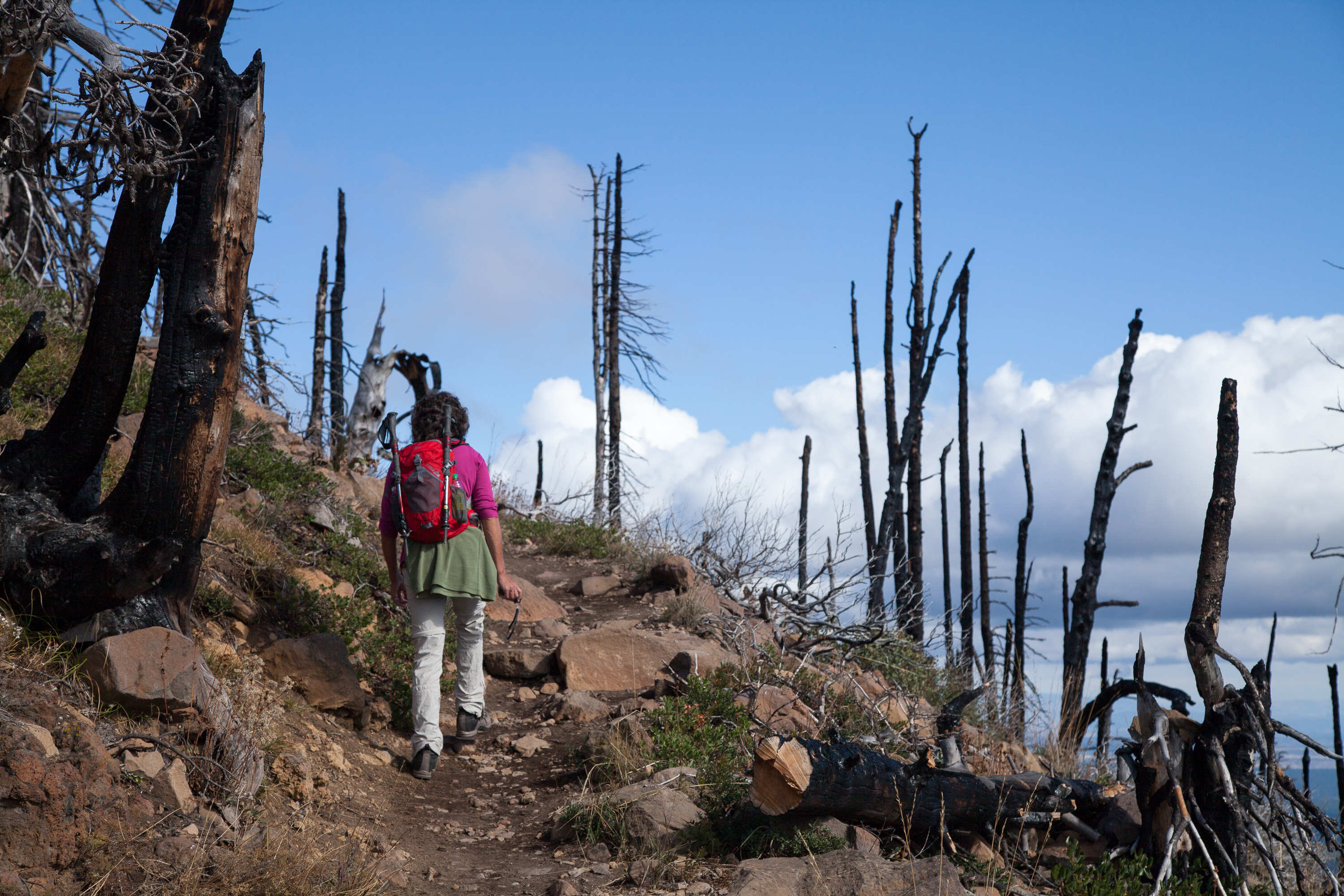
The trail began climbing right from the very beginning, steadily up through of forest of ponderosa pine. After about a mile, we came out of the trees and crossed a treeless slope. Then the trail really began to climb even more steeply along the eastern ridge of the butte. The trees now were of the wind-stunted variety. Finally, after an elevation gain of about 900 feet, we reached the summit.
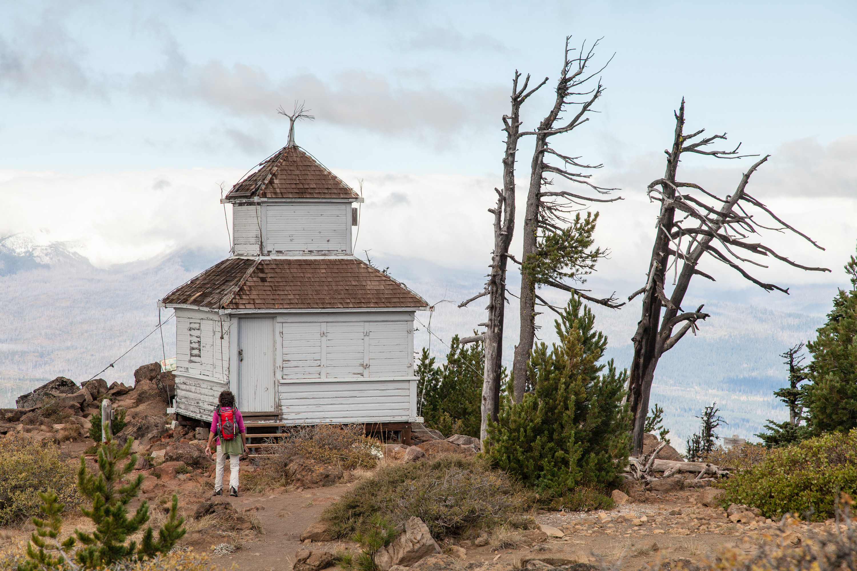
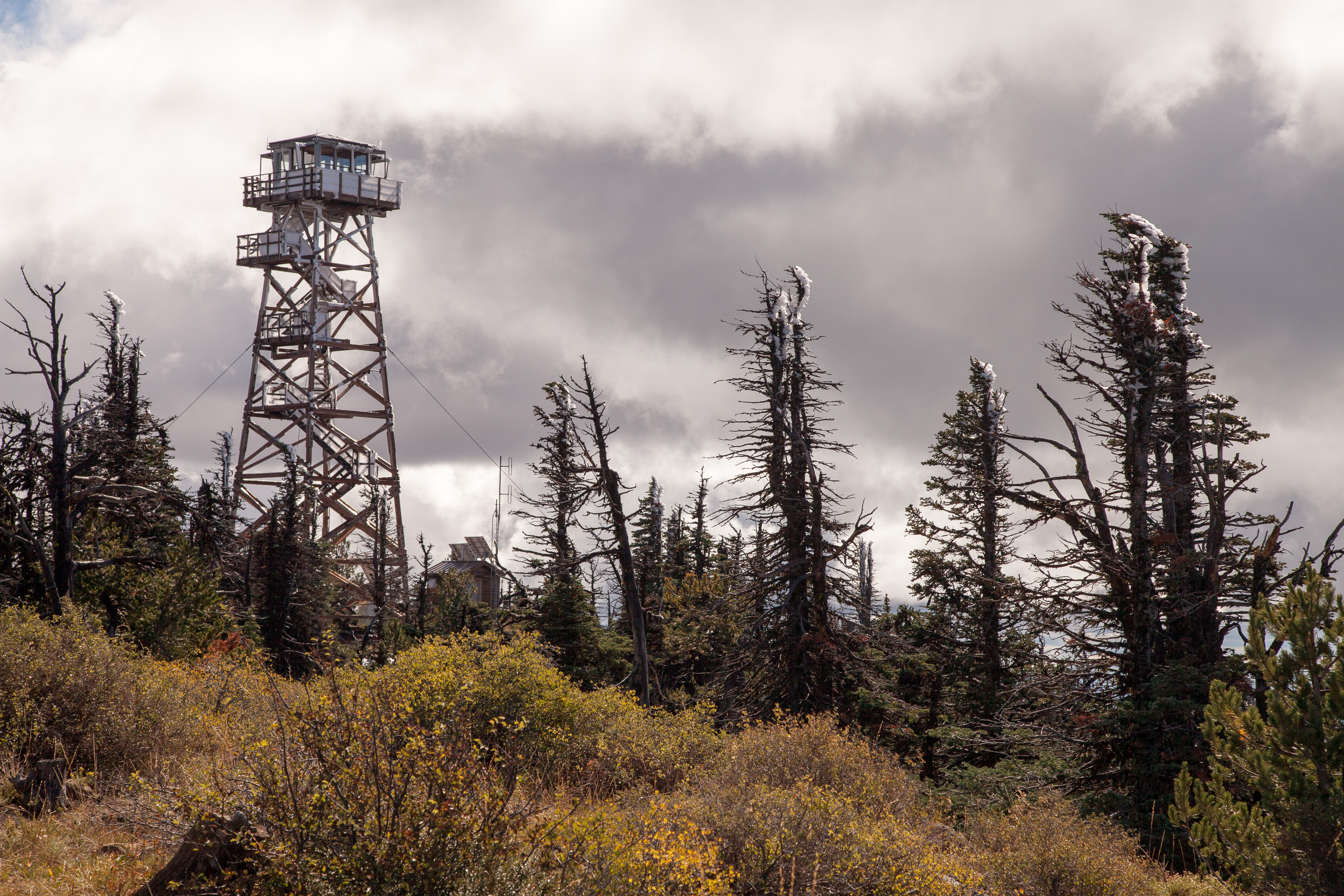
Black Butte is actually a volcano that erupted about 20,000 years ago (recent in geological terms), forming a 3,000-foot high symmetrical cinder cone, one of the tallest in the state.
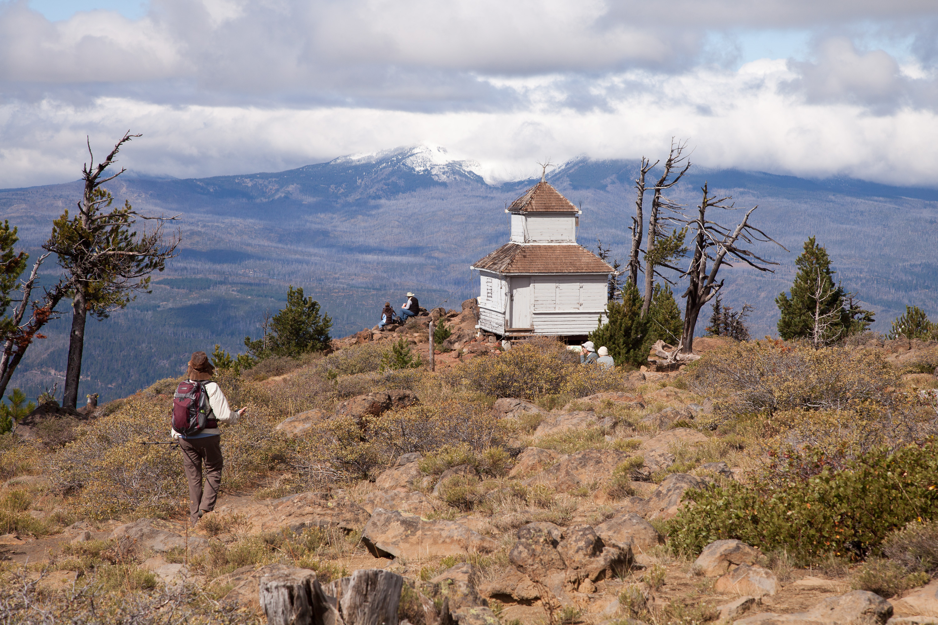
Its location and panoramic views of the surrounding forests make it a perfect place for a fire lookout site, and it has played that role in one capacity or another since 1910. The summit is also a perfect place for weary hikers, such as ourselves, to enjoy a rest and the tremendous views. However, you are not allowed to climb the 62-foot fire tower and are strongly discouraged from invading the privacy of the fire lookout staff, who live in the tiny, one-room log cabin, perched at the absolute best viewpoint on the summit. I guess there’s a reason for that, as it is, after all, their job to look for fires. The cabin looked so cute and cozy. There was even smoke coming out of its chimney. It definitely was very photogenic and served as an excellent subject in many of our photos. The whole time we were there, we never saw anyone come out of the cabin.
As we often do when exploring a new place, Herb checked the geocaching app on his phone to see if any were hidden nearby, and we struck gold. There were at least 10 of them we could hunt for, both on top of the summit and along the way down.
For those of you fellow travelers unfamiliar with geocaching, I seriously recommend learning more about it (see www.geocaching.com). It can be a life-changing event. No seriously, it is a very interesting concept that has brought us to some very interesting and out-of-the way places. Very briefly, geocaching is sort of a treasure hunt, sans the treasures. Geocaches are waterproof containers (ranging from tiny little containers to ammo boxes) that contain little trinkets for trading—items that you would just throw away if you found them in your house, but for some reason feel like treasures after having gone through so much trouble trying to find them. There are over a million geocaches hidden in over 100 countries throughout the world. People searching for them use a GPS to guide them to usually within 30 feet of the hidden cache. From there, clues help the seeker zero in on the find. I know it sounds a bit silly, but it is actually a lot of fun and has exposed us to a lot of great places that we would never have found on our own, or in this case, getting us to slow down and look a little deeper at a place we had already discovered.
Sometimes one person hides a series of geocaches with a unifying theme, in terms of the name of the cache, not its contents. In this case the theme was veggies, and we had a great time searching for Tomatoes, Corn, Kohlrabi, Lettuce, and Spinach.
Our next destination after Sisters was Lava Beds National Monument, about 220 miles away. Since it was already mid-afternoon, we knew we wouldn’t get there today, but at least if we started driving we could get closer, so we could spend a full day there tomorrow.
The town gets its name from the nearby majestic Three Sisters Mountains. Many of the buildings along the main drag through town have old-fashioned false fronts and covered sidewalks, giving the town a distinctive Western Cow Town feel.
Excellent hiking opportunities abound in the nearby Mount Washington, Mount Jefferson, and Three Sisters wilderness areas. Near Camp Sherman is the trail to the summit of Black Butte, where one is treated to a 360 degree view of the surrounding mountains.