- Home
- About
- Map
- Trips
- Bringing Boat West
- Migration West
- Solo Motorcycle Ride
- Final Family XC Trip
- Colorado Rockies
- Graduates' XC Trip
- Yosemite & Nevada
- Colorado & Utah
- Best of Utah
- Southern Loop
- Pacific Northwest
- Northern Loop
- Los Angeles to NYC
- East Coast Trips
- Martha's Vineyard
- 1 Week in Quebec
- Southeast Coast
- NH Backpacking
- Martha's Vineyard
- Canadian Maritimes
- Ocracoke Island
- Edisto Island
- First Landing '02
- Hunting Island '02
- Stowe in Winter
- Hunting Island '01
- Lake Placid
- Chesapeake
- Provincetown
- Hunting Island '00
- Acadia in Winter
- Boston Suburbs
- Niagara Falls
- First Landing '99
- Cape Hatteras
- West Coast Trips
- Burning Man
- Utah Off-Roading
- Maui
- Mojave 4WD Course
- Colorado River Rafting
- Bishop & Death Valley
- Kauai
- Yosemite Fall
- Utah Off-Road
- Lost Coast
- Yosemite Valley
- Arizona and New Mexico
- Pescadero & Capitola
- Bishop & Death Valley
- San Diego, Anza Borrego, Joshua Tree
- Carmel
- Death Valley in Fall
- Yosemite in the Fall
- Pacific Northwest
- Utah Off-Roading
- Southern CA Deserts
- Yosemite & Covid
- Lake Powell Covid
- Eastern Sierra & Covid
- Bishop & Death Valley
- Central & SE Oregon
- Mojave Road
- Eastern Sierra
- Trinity Alps
- Tuolumne Meadows
- Lake Powell Boating
- Eastern Sierra
- Yosemite Winter
- Hawaii
- 4WD Eastern Sierra
- 4WD Death Valley +
- Southern CA Deserts
- Christmas in Tahoe
- Yosemite & Pinnacles
- Totality
- Yosemite & Sierra
- Yosemite Christmas
- Yosemite, San Diego
- Yosemite & North CA
- Seattle to Sierra
- Southwest Deserts
- Yosemite & Sierra
- Pacific Northwest
- Yosemite & South CA
- Pacific Northwest
- Northern California
- Southern Alaska
- Vancouver Island
- International Trips
- Index
- Tips
- Books
- Photos/Videos
- Search
- Contact
Yosemite Valley
Friday, December 25, 2015 - 5:30pm by Lolo245 miles and 5 hours from our last stop - 2 night stay
Travelogue
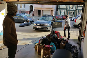 Packing for YosemiteAlthough we were pretty much packed beforehand, the final loading of the car on Christmas morning did not go smoothly. Each of us had two pairs of skis and ski boots (downhill and cross country), plus all our other stuff. When we laid everything out on the sidewalk in front of Andrew’s apartment, it was a spectacle.
I thought we were going to have to take two cars, but everyone immediately objected to that and gave me negative Fezziwig points for even suggesting it.
Since Tommy’s Subaru Imprezza had roof racks that would accommodate two Thule car-top boxes, we moved everything from our car to his, took the Thule box from Andrew’s car and put it up next to Tommy’s, loaded all 8 pairs of skis and poles in the two boxes, and then squeezed in. Andrew and I sat in the back practically buried in luggage. It was very cozy.
Despite the cramped conditions, spirits were high and much caroling was taking place. Then, when we were about an hour away from Yosemite, Andrew blurted out, “I am such an idiot!” I looked at him over the pile of luggage between us, and saw that his face had gone completely white. He looked like he was having a heart attack.
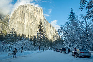 Arriving in Snow-Covered Yosemite Valley“I forgot the key to my Thule box,” he confessed.
Despite us all thinking to ourselves, “Yes, you are truly an idiot,” we didn’t have the heart to make him feel any worse than he obviously did already – especially on Christmas. So instead, we pretty much all said, “Don’t worry about it. We’ll figure something out. Maybe we can break into it, or if not, rent skis.” We all tried to forget about it for the time being.
Other than Andrew’s outburst, the drive had gone very smoothly and we were making great time, or at least until we got to within 5 miles of the El Portal entrance to the park, where traffic came to a complete halt. We spent the next hour inching our way along, not having any idea what the problem could possibly be. When we finally got to the entrance gate, we learned that rangers were only letting cars with chains or all-wheel drive through, since the park roads were covered in snow. All others had to either turn back or pull over into a lot where they could rent chains and have them installed. Having both all-wheel drive and chains in the trunk, we were waved on through and finally able to drive at a speed faster than 3 mph.
They weren’t kidding about the roads being treacherous. As we drove through the Valley along Southside Drive, we passed several vehicles that had slid off the road that were in the process of being towed out. Fortunately, Tommy’s car handled great in the snow and we had no problem.
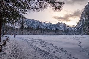 Christmas Evening Walk to Swinging BridgeBefore going to Yosemite Lodge, we stopped at the Yosemite Village Garage, where they do auto repairs and towing, to see if they could help us break into our locked Thule box. With all the chaos going on with cars driving off the roads in the Valley, we felt a little silly bothering them with an issue that was far less serious than most they were dealing with. However, they were very nice about it and suggested that we come back tomorrow morning around 7 am, when Jason, a tow truck driver that doubles as their locksmith, would be in. That sounded promising, so we were all somewhat hopeful that we would be able to get at our skis.
We checked in at the Yosemite Lodge and were very pleased with the coziness of our rustic little cabin. There were two double beds, a small table by the window to play cards at, and a large counter top area outside the bathroom, where we set up Andrew’s camping stove.
While Herb and Andrew unpacked, Tommy and I went for a walk to see what our dining options for the evening might be. There were two: the Mountain Room, where we had eaten our Thanksgiving dinner, which at $55 a head, was not what we were looking for this evening; and the Food Court, which was cafeteria style and closed at 8 pm. Not thrilled with either, we came up with a third option – reheating the leftover kale Christmas Eve dinner in our room later on and playing cards.
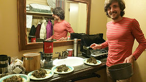 Leftovers in Yosemite Valley Lodge RoomNow that we didn’t have to get to dinner by 8:00, we all grabbed our cameras and headlamps and went out for an evening walk in the snow. From the back of Yosemite Lodge, we walked along the Merced River towards Swinging Bridge. It was so very pristine. The only sound we heard was the crunching of our boots in the snow.
At least that was until we got to the Bridge and heard a buzzing sound, which turned out to be a family on the beach below flying a toy drone. Technically drones are banned in national parks, but this one, obviously from Santa, did not seem much of a threat to national security.
There was going to be a full moon tonight, just like Thanksgiving, but since it would be quite late before it made its way above Half Dome, we turned on our headlamps and made our way back to our cozy little cabin, for an evening of leftovers and playing Hearts.
Breaking into the Thule Box and Cross Country Skiing to Glacier Point
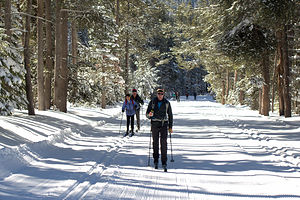 The Epic BeginsWhile Tommy and I slept in, Herb and Andrew were off to the Yosemite Valley Garage by 6:45 to meet with Jason, the lock man and our best, in fact only, hope for getting at our skis.
About a half hour later, I received a text message, which read, “Jason is a hero!!” Woo Hoo! Looked like we were going skiing!
Not only was he able to get into the Thule box, but he did so without breaking the lock – and at no charge! We unanimously chose Jason as the winner of the 2015 Gaidus Fezziwig contest!
Although there was enough snow in the Valley to play around on our cross country skis, there really aren’t many trails, and definitely no groomed ones. The real world-class cross country skiing is up above the Valley along Glacier Point Road.
From about late May to early November, the Glacier Point Road is open, providing easy access to Glacier Point, an overlook with incredible views of Yosemite Valley, Yosemite Falls, Half Dome, and the high country. It is so stunning a location that we honored it as the photo on one of our annual Christmas cards.
However, from November through May, the road is closed from the Badger Ski area on. That’s the bad news. The good news is that all 11 miles from Badger Pass to Glacier Point are groomed for cross country skiing. Since that is a very long distance to ski (the average skier takes 4 to 5 hours), there is a Ski Hut at Glacier Point that provides overnight accommodations, plus meals. It fills up quickly, so reservations well in advance are recommended. At $138 per person per night, it is pretty pricey. I did a quick calculation in my head – that would cost the four of us $552. If we wanted a guide to accompany us, it would be $350 per person - $1,400 in total. Wow!
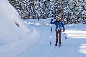 Andrew Leaving Mom BehindBesides skiing along Glacier Point Road, there are several side trails branching off from it, allowing for several options for loop trips of varying distance and difficulty levels. The following is a link to the map we used: http://www.nps.gov/yose/planyourvisit/upload/badger-winter.pdf. From that we figured we would pick out a good 8 to 10-mile loop trip.
The drive from Yosemite Valley to the Badger Pass Ski Area is a twisting, car-sick provoking 20 miles. We parked in the Ski Area lot, bought a trail map in the Nordic shop, and set off on Glacier Point Road, thinking we would either do the 8-mile out and back to Dewey Point, or if we were feeling really ambitious, the 11.5-mile Ghost Forest Loop.
Conditions were excellent thanks to the Christmas Eve snow storm. As usual, I was the slowest, but I didn’t mind. Every so often they would stop and wait for me to catch up, and then we would continue – which basically meant, that I got no rest while they did.
As we came to various trailheads for the loop trails off Glacier Point Road, we realized that they had not been groomed and were pretty impassable. That meant that we would have to stay on the main road. Too bad. We would have much preferred a loop to an out-and-back.
With an out-and-back, you still need some destination to be your turnaround point. We pulled out the map and agreed that the Clark Range Viewpoint at the 5.7 mile point would be it. That would make it a very respectable 11.4-mile trek.
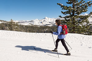 Lolo with Clark Range in BackgroundHowever, when we reached it, although the view was nice, we felt a bit of a let-down as to our trek haven been anything truly special. Most of our journey so far had just been along a road with forest on either side – we could have been anywhere, but we weren’t just anywhere. We were in Yosemite.
That’s when we unanimously, and probably somewhat foolishly, decided to go the whole distance to Glacier Point. That would mean a total of 22 miles (both ways) – further than any of us had ever cross country skied before. My main worry – and believe me there were plenty more -- was the sun setting before we got back, but Herb and the boys assured me that the trail would be lit from the almost full moon plus the headlamps they had smartly packed.
We trudged on. For the next 4 miles, the road began to climb and just kept on climbing. Psychologically, I didn’t mind though. This meant that the way back, which I was more worried about, would be mostly downhill. However, when we got close to mile 10, the trail started to descend steeply along switchbacks through a forest. I was not happy about this. Every tenth of a mile I flew down now meant some serious uphill later. However, when Half Dome came into view, it was so incredibly awesome that I forgot to worry, at least for the time being.
Finally, the downhills finished and we arrived at the Ski Hut, a beautiful stone and log building with views of Half Dome – it looked so welcoming and cozy. We peeked inside and the caretaker asked us if we were staying the night. When we told him that we were doing this as a daytrip, I think he was quite impressed. Possibly, he thought we were crazy. He said he had extra room that night in case we changed our minds, as it was already 2:00 in the afternoon. Not being prepared for an overnighter, nor willing to shell out $552, we graciously declined.
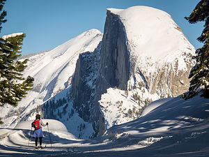 Lolo Finally Sees Half DomeAlthough I was very anxious to get started on our return, we quickly ate our lunch sitting on a rock outside the Hut. All we had eaten along the way was a Cliff Bar. We hadn’t brought nearly enough food along, as we hadn’t planned to go this far.
Also, we still hadn’t gotten to the iconic viewpoint of Half Dome. We hadn’t come all this way to not get a family photo to memorialize our insanity, so we continued on up the steep, narrow path to the overlook. Thinking walking would be easier, I took off my skis, but the snow was so deep that I immediately postholed up to my thighs – back on went the skis.
When I caught up to the rest of them, Herb had already set up his portable tripod, and they were waiting for me to ski into my proper position in the family photo. We lined ourselves up with a perfect view of Half Dome in the background.
Tommy was in charge of pressing the shutter, which had been set on a timer, and then quickly skiing back into his assigned place. When I glanced over at Andrew, who was on the end closest to the edge, I noticed that beyond the snow-covered stone wall that came up to just below his knees, there was a 3,000 foot dropoff. I held onto his backpack strap for dear life. When I looked at the photo later, I saw that Herb had a death grip on his shoulder strap as well.
By the time our photo shoot was over, it was already 3:00. There was no way we were going to get back in daylight – and I didn’t even have a headlamp. They reassured me that they would not ski ahead of me this time and that their headlamps would suffice.
When we were skiing up the steep switchbacks through the forest at the beginning of our return, it was pretty dark, which freaked me out a bit, but when we got back up to the ridge, it was more open and seemed like there was at least a few hours of daylight left. Even when it did get dark, we were not in any danger of losing our way, as we were on a road with very well defined tracks groomed in the snow.
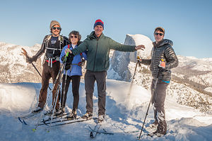 Almost a Self-Timed Family ShotA definite family role reversal took place on that epic journey back. As usual, I was the slow one, but this time, Andrew stayed by my side to keep an eye on me and to keep morale from sinking. Herb went up ahead with Tommy. They would wait periodically for us to catch up. Then they switched and Andrew went with Herb, and Tommy got stuck with me.
One time when we were just catching up, I saw a dark blob lying in the middle of the trail ahead, which turned out to be my exhausted husband taking a little rest. This was not an encouraging sign and for the first time, I became seriously concerned about us making it back. Fortunately, a Cliff Bar and some candy perked him up enough to continue. From that point on, I was more worried about him than me, which distracted me from how tired I was.
We all had our Strava apps running, which tracked our distance and time, so we knew exactly how many miles we had left to go all along the way. I kept looking at mine every 15 minutes or so to see how much progress we had made, but became discouraged at the result. Finally, Tommy told me to stop doing that and just enjoy the moment.
Darkness fell when we had about 5 miles to go, which at our current pace meant about 1 ½ more hours. Tommy and Andrew each had a walkie talkie, so they could provide each other updates on the status of their respective parent.
Tommy was great, and I am sure Andrew was the same with Herb. I just kept moving one ski in front of the other, over and over again, while he cheerily chatted away, trying to distract me. It was pretty eerie skiing in the dark, and I started thinking about bears and other creatures in the woods alongside the road. It’s very easy to start imagining things behind the trees when it is dark, completely silent, and you are near delirium with exhaustion.
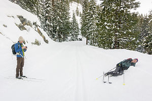 Herb Resting Along the Trail“Oh look, Tommy, doesn’t that look like a nativity scene,” I said, pointing towards the wood to the left. “Oh boy,” he said and continued moving me along.
Finally, Tommy got the walkie talkie call I had been waiting for. Andrew announced that they had made it back at the car. That meant that we couldn’t be too far behind. About 10 minutes later we caught up. I was never so happy to see the car.
By the time we drove back to the Valley, it was too late to shower and go out to eat, so we stopped at the Village Market to pick up some stuff to cook in our room. When we tried to get out of the car at the market, our legs were so tired that we could barely walk – and that just wasn’t the old ones, but Andrew and Tommy’s as well. I’m sure we looked ridiculous hobbling through the aisles.
The room seemed cozier than ever. I had been longing to see it again for many hours on the trail. In hindsight, now that I knew everything turned out okay, I would have to say that I was very, very proud of our achievement. I don’t think many people, even half our age, do an out-and-back ski to Glacier Point. The boys were pretty amazed with us as well.
Downhill Skiing at Badger Pass and back to San Francisco
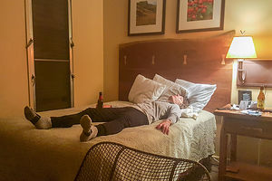 Lolo Passed Out (with Beer) After Epic SkiNone of us knew how we were going to feel getting out of bed after our epic yesterday, so I think we were pleasantly surprised that we could walk without too much pain – maybe downhill skiing would be possible.
Also, I hate giving up a freebie, so I wanted to use my two free lift tickets to Badger Pass even if meant sending me down the slope in a wheelchair. Fortunately, that was not necessary.
Badger Pass is noted for being a rather tame beginner mountain, so I was hoping that the boys wouldn’t be too bored, but they were sweet and said it would be fun to ski as a family. Plus, the lift tickets were a very reasonable $49, which meant that with our two free passes the entire family skied for only $98.
It was a beautiful day and conditions were great. We stayed together the first couple of runs, but then Herb and the boys went off to do a few black diamonds, while I stuck to my blue squares. The mountain was small enough to easily find each other at the bottom, so we could ride back up on the lift together.
We still had to drive back to San Francisco that night, so after about 10 very nice runs, we called it quits and headed back to the city.
Description
In my past Yosemite trip stop descriptions, I have focused on Yosemite Valley and Toulumne Meadows. However, this time our foray into Yosemite was limited to cross country and downhill skiing at Badger Pass.
Badger Pass Ski Area
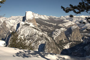 Half Dome SightingThe Badger Pass Ski Area is a small ski area located along Glacier Point Road in Yosemite National Park. It is California’s oldest ski resort, having installed its first ski lift in 1936. Called the Upski and nicknamed the “Queen Mary,” the lift was a large sled that carried six skiers at a time along a cable to the summit. By the end of that first season, more than 25,000 skiers had swooshed down the slopes of Badger Pass. Generations later, Badger Pass is still a favorite winter destination for California families who come to downhill ski, snowboard, cross country ski, and snowshoe.
Cross Country Skiing
With 90 miles of marked trails and 25 miles of groom track – including the 10.5 mile track to scenic Glacier Point, Yosemite is home to some of the most beautiful cross country ski trails in the world.
The trip to Glacier Point is very popular. However, novice skiers should not attempt to make the 21-mile out-and-back trek to Glacier Point, which takes about 8 to 10 hours, in one day, but rather stay overnight at the rustic Glacier Point Ski Hut, which accommodates up to 20 skiers. Reservations should be made well in advance.
The cost for a one-night guided Ski Hut Trip is $350 per person, while unguided overnight stays are $146 per person. The price includes dinner, an evening in front of the fire, a bunk bed, breakfast, and a packed lunch.
Alpine Skiing and Snowboarding
The Badger Pass Ski Area, which has a vertical drop of 800 feet, is a great place for beginners and novices, with 10 ski runs: 35% beginner, 50% intermediate, and 15% advanced.
Lift ticket prices are extremely reasonable: Adults ski for $48.50, seniors and teens for $43, and children under 13 for $25. On weekdays and holidays, seniors ski for free.
San Francisco North / Petaluma KOA
Tuesday, December 8, 2015 - 5:15pm by Lolo150 miles and 3 hours from our last stop - 1 night stay
Travelogue
 Herb in RV with XMAS LightsHome Sweet Home - or at least for awhile. Since we sold our home in New Jersey, this was pretty much it for awhile. Oh Boy!
How was I going to decorate for Christmas? Where would the tree go? I had been on such an incredible Christmas high in Yosemite when it snowed, but almost totally lost it with the palm trees in San Diego. I had to rally.
I ran out to CVS and bought a strand of colored lights for $3.99, and Herb put on Christmas music and hung them up in the back living room/bedroom area of the motorhome. What a difference it made!! Thank you Herb, Bing Crosby, and Nat King Cole.
Description
The Petaluma KOA is an award winning camping resort located within an hour’s drive of San Francisco, Napa and Sonoma Valley Wineries, giant redwoods, and Sonoma County and California Coastal Beaches. It is considered to be the RV resort in the San Francisco Bay area.
On its 70 acres, there are 312 spacious RV sites, 32 camping cabins, and 10 Wine Country lodges.
Other amenities include:
• Guided tours of San Francisco (from May through October)
• Huge heated pool and spa
• Inflatable waterslide
• Rock climbing wall
• Huge playground
• Petting zoo
• Karaoke
• Hayrides and live weekend entertainment
The campground is open all year.
Los Banos KOA
Monday, December 7, 2015 - 5:00pm by Lolo384 miles and 7 hours from our last stop - 1 night stay
Travelogue
I couldn't believe how devoid of services I5 was once we got north of Bakersfield. I thought I would have my pick of places to stay -- Walmart Supercenters, Flying J Travel Plazas, etc., but there was nothing but ranches, farms, and wide open spaces. So much for a freeby night of camping. In fact, I hoped we would just find something.
Thanks to the Internet - I don't know how people ever survived without it -- I found a KOA in Los Banos that was just 3 miles off I5. I have come to trust that KOAs will provide a nice place to hookup for the night.
Description
KOA campground located just 3 miles west of I5, near the San Luis Reservoir State Recreation Area.
Campland on the Bay and San Diego Side Trips
Tuesday, December 1, 2015 - 2:15pm by Lolo452 miles and 8 hours from our last stop - 6 night stay
Travelogue
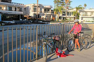 Bicycling around Mission BayAfter freezing our butts off in Yosemite for the last 5 days, we were very much looking forward to the warmth and the sun of San Diego. We had been to San Diego two Decembers ago, but it had rained practically the whole time. This time the forecast for the next week looked perfect.
We returned to Campland on the Bay, a premier RV resort right on beautiful Mission Bay, which we had discovered in 2013. The campground is huge – over 550 campsites, two pools and Jacuzzis, and a fitness room with top-notch exercise equipment. Plus, they have their own sandy beach on Mission Bay and a marina that rents powerboats, jet skis, and kayaks.
It was late afternoon when we arrived, but still early enough to hop on our bikes and set off counterclockwise on the 14-mile bike path that goes along the shores of Mission Bay. The bike path, which passes through several public parks and wildlife reserves, is an easy, flat ride with things to look at all along the way. My favorite part of the ride was looking at the beautiful beach houses along the bayside on Riviera Drive near Mission Beach.
Torrey Pines State Park – Black’s Beach
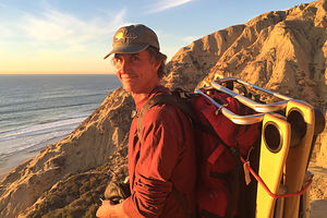 Herb over Black's BeachOur purpose for coming to San Diego was for Herb to soak up the sun he so craved, so we set off to spend the day at Black’s Beach, on the southern end of Torrey Pines State Park. While the beaches on the northern end of the park are accessible by car, this one required walking down a very steep and somewhat precarious trail that switchbacks its way down from the Glider Port parking lot to a beautiful 2.5-mile long sandy beach. The trail is only 1,000 feet long, but its 320 foot descent in that short distance, makes it feel much longer. However, the trail is well maintained and there are steps and handrails in the steeper sections.
There are basically two types that frequent this difficult-to-get-to-beach: surfers looking to enjoy the huge winter swells, and nudists looking to enjoy some privacy. The nudists tend to hang out north of the Glider Port, while the surfers head to the south. And then there is a third type – me, who doesn’t mind a hike to get to a spectacular beach at the base of a cliff.
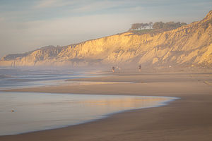 Black's Beach at Torrey PinesThe beach was lovely and not at all crowded, perhaps because it was a Wednesday. The sand, especially along the water' edge, was packed hard enough to run on, so while Herb relaxed and read, I put on my sneakers and set off on a run, going first as far north as I could before being blocked by rocks extending into the water, and then south as far as the pier. It was a perfect 5-mile run.
Having lived our entire lives on the East Coast, Herb and I couldn’t get over the fact that we were sitting comfortably on a beach in December. What made it even more amazing was that we had been playing in the snow just 3 days ago. That’s the way snow should be – a nice place to visit, but you wouldn’t want to live there. I think West Coast life was going to suit us just fine.
Balboa Park
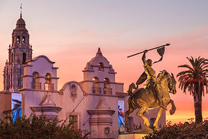 Museum of ManIt was Herb’s 60th birthday! Wow, I couldn’t believe I was hanging out with a 60-year-old man. We decided to celebrate it visiting the museums in Balboa Park.
I think that one of the qualifications for being a great city is having a great park -- one that serves as an extended backyard for its residents and yet can still attract visitors from around the world. San Diego’s Balboa Park is such a park, right up there with Central Park in New York City and Golden Gate Park in San Francisco.
Everyone knows about the famous San Diego Zoo, but the park also has more than a dozen art, cultural, and science museums, as well as a replica of the Old Globe Theater where Shakespeare plays are performed.
The park was bustling with park staff and vendors busily setting up for December Nights, San Diego’s two-night holiday festival and Christmas Tree lighting, which started tomorrow night. The event attracts more than 350,000 visitors, so it was good that we got here a day earlier to have the park a little more to ourselves.
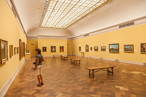 San Diego Museum of ArtThere is so much to see and do that we weren’t sure where to start, so we wisely made our first stop the Visitor Center on El Prado, the main avenue through the park, to get their advice on a plan of attack. We wound up buying the Multi-Day Explorer Zoo Combo for $92 each, which gave us admission to the Zoo plus 17 museums. This would keep us occupied for a few days.
One thing I will mention ahead of time that we didn’t think about when we bought the pass is that, you know all those big banners on the facades of museums announcing their Special Exhibits? – well they are not included in the Combo Pass, and each of them costs an additional $20 or more per person. However, we still felt that our passes were a very good value.
Ironically, after paying for our combo tickets, we started our tour at the “admission free” Timken Museum of Art, which housed a wonderful collection of paintings by Rembrandt, Rubens, El Greco, Cezanne, Pissarro, Bierstadt, and more.
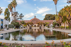 Botanical GardenRight next to the Timken is the San Diego Museum of Art, the oldest and largest art museum in San Diego. We strolled through its galleries, admiring its collection of European old masters and 19th and 20th century American art. I was so glad that they charged admission, so that I could start amortizing my Combo Pass.
From there, we walked to the Botanical Garden, which were unfortunately closed for the day. However, the building itself, with its redwood lath-covered central dome and two wings was a worthy destination in itself. Built for the Panama-California Exposition of 1915-16, this building, with the Lily Pond and Lagoon in the foreground, is one of the most photographed scenes in the park.
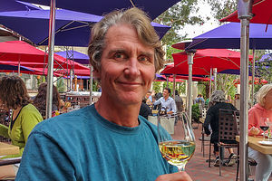 Herb's Birthday lunch at the PradoWe were getting hungry, but decided to squeeze in just one more museum before lunch. I was going to get my money’s worth out of this Combo Pass, even if we had to starve in the process. Having been lucky enough to have visited the New York City Museum of Natural History on several occasions, we are a bit spoiled, but this is a very nice natural history museum with enough fossils, dinosaur bones, and taxidermied animals to keep any natural history fan happy.
I wanted Herb’s 60th birthday to be special, so we got a table on the Outdoor Terrace of The Prado Restaurant, overlooking the Japanese Friendship Garden, and had a delicious lunch. We were so tired already from our busy, museum-filled morning that we took our time lingering over our glasses of wine. I certainly was enjoying myself, and I am pretty sure Herb was as well.
Rejuvenated from our lunch, we charged on to two more museums. Our first stop was the Museum of Photographic Arts, which has a collection of more than 7,000 images, representing the entire history of photography, with a particular focus on photojournalism.
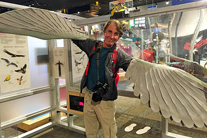 Herb Flying at the Fleet Science CenterThe last museum of the day, and probably my favorite, was the Reuben H Fleet Space Theater & Science Center. It was fun because it had so many interactive exhibits to play with. At one exhibit, Herb donned a pair of condor wings and tried to see how fast he could flap. Let’s just say that he did not exactly soar. In another room we made paper airplanes and tried to fly them through hoops placed at various distances, which turned out to be a lot harder than we thought. Then there was an exhibit dedicated to illustrating and explaining the process of aging – I’m sure a real hoot for a man who had just turned 60. Based on the smile on his face, I don’t think Herb realized that I took his picture under an exhibit with the word “Aging” in large lettering above his head.
We were getting tired, and since we did have a multi-day pass, we decided to call it quits for the day and finish visiting the rest of the museums another day. As we walked back to the car, we passed the Spreckels Organ Pavilion, where park staff were busily running around, setting up for December Nights and the tree lighting ceremony scheduled for tomorrow night.
I absolutely love Christmas and was having a little trouble getting in the spirit when surrounded by palm trees and people in shorts. I think I might have peaked too early in snowy Yosemite last week. Herb agreed to come back tomorrow night for the tree lighting to help me kick start my holiday mood again.
Balboa Park – San Diego Zoo, more Museums, and December Nights
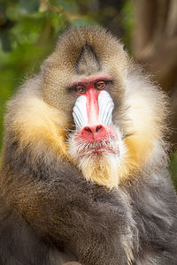 MandrillFrom everything we heard, December Nights, the two-night holiday celebration in the park, was going to be extremely crowded and parking would be next to impossible.
Since the holiday events didn’t start until evening, we decided to go to the Zoo in the morning, when there should be plenty of free parking, and then spend the entire day exploring the Zoo, some more museums, and watching the tree lighting that night.
We got to the Zoo just after it opened, and following the advice of the ranger in the Visitor Center yesterday, we immediately jumped on the line for the double-decker bus tour, which I was happy to see was included in our admission price. The 35-minute tour, narrated by a very informative and amusing guide, took us on a loop throughout the entire zoo, giving us a great overview of the various habitats and helping us determine where we wanted to focus our attention when we got off. I wanted to do it all, not a trivial goal, considering that the Zoo is home to more than 4,000 rare and endangered animals, representing more than 800 species.
Second piece of advice from the Visitor Center ranger – after you get off the double-decker bus, take the Skyfari aerial tram (also included in admission price) to get to the far side of the Zoo early, and then spend the day working your way back on foot. Also, it was fun peering down at the animals below from the tram.
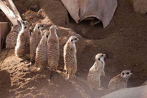 Meerkats on GuardWe saw so many beautiful and majestic animals -- tigers, polar bears, elephants, giraffes, pandas, koala beers, baboons, gorillas, and more, but the three that left the biggest impression on me were the meerkats, one particular hippo, and the orangutans.
The meerkats were probably the most sociable and gregarious of the animals we saw today – and also the cutest. We saw a whole group of them, many of which were nursing their young, while others stood up as high as they could on their hind leg tippy toes (if they have tippy toes), alertly gazing in all directions, keeping guard over the others. It was such a busy little community.
In stark contrast to the meerkats was the mighty hippo that I spent a good 20 minutes staring at through the glass of a water tank. I had no idea that hippos spent so much time underwater, which I later learned they do during the day to keep cool. The only movement I saw over the whole time I watched him was a slight upward tilt of his massive head to expose his tiny little nostrils above water to breath. I would hate to have been an unsuspecting passerby above.
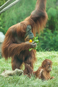 OrangutanAnd then there were the orangutans effortlessly using their long arms to swing from limb to limb through the trees. While males tend to be loners, the females are much more nurturing and stay with their young for as long as six or seven years. We watched one mother and its adorable toddler in action. The little one clutched onto its mother’s long hair while she went about her business of eating bananas, climbing trees, etc. All the while the mother clutched a piece of burlap with her toes. When we asked a park employee why she was doing that, she said they all do – it’s kind of like a security blanket. That was sad. Why should such a majestic beast need a security blanket if it felt secure in its home? This is not something they do in the wild, and that is not just due to a lack of burlap. It made me question whether it is really fair to keep large, wild animals like these in zoos, but I guess that in many cases that is the only way they can survive.
After the Zoo, we headed over to El Prado, where the December Nights activities were already under full swing. The streets were crowded with holiday revelers and vendors hawking their wares. What a difference from yesterday.
We walked over to the Museum of Man, where a large banner read, “Instruments of Torture.” That sounded like fun, but when I found out they wanted to charge another $20 on top of my Combo Pass, I said forget it. Instead we wandered around and enjoyed their free exhibits. In fact, pretty much everything was extra, except for a really cool exhibit called BEERology, where we learned how beer was pretty much the basis for civilization – well not quite, but almost. Apparently, craft brewing has been going on for millenniums, with such notable brewers as the Ancient Egyptians, Sumerians, Chinese, and even Amazon headhunters (which gives all new meaning to the concept of a head on your beer). It seems everyone enjoys a good beer.
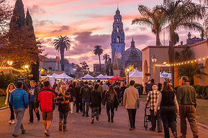 December Nights PromenadeIt was beginning to get dark, but still too early for the tree lighting, so we walked through the Panama International Plaza where an entire carnival, complete with rides and vendors selling such delicacies as bacon wrapped hot dogs, had been set up. We avoided the temptation of both and entered the Air and Space Museum, which for tonight was free for everyone. In fact, all the museums were free for both nights of December nights.
I can see why this is one of the most popular museums in the park. It has some very cool historic aircraft and spacecraft from all over the world, including a working flying replica of Lindbergh's Spirit of St. Louis, the actual Apollo 9 Command Module spacecraft, and artifacts from the Wright Brothers, Charles Lindbergh, Amelia Earhart, Neil Armstrong, Buzz Aldrin and other aviation and space pioneers.
It was still about an hour before tree lighting, but we walked back to the Spreckel’s Pavilion anyway to see if we had to grab seats yet. There were still plenty, so we went to the indoor fountain area right outside The Prado Restaurant, where they had set up a bar, bought two glasses of wine, and sat on a nearby bench watching the crowds go by.
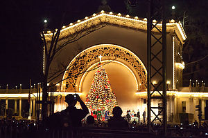 December Nights Tree LightingAbout 15 minutes before the scheduled tree lighting, we went back to Spreckel’s and managed to find two seats in the back. I was really anxious to get back into the holiday spirit and thought this ceremony would be just the thing.
However, I am sorry to report that it just didn’t do it for me – maybe because I grew up watching the NYC Rockefeller Center Tree lighting.
I was hoping for some uplifting speeches and stirring Christmas carols, but instead it began with mundane speeches from the mayor and a councilman, followed by the tree lighting, and concluded with four people on stage singing jingle bells without any accompaniment. I had heard so much about the magnificent 4,725 pipe organ that was literally about 20 feet from the Christmas tree, but it made no appearance for this supposedly huge holiday event.
What finally put me over the top was the announcement that they hoped everyone would enjoy this beautiful tree, which would be up for another week. Why would they possibly take down the tree down before Christmas? It wasn’t as if this was a real tree cut in the pristine forests of northern Oregon that wouldn’t last through the New Year. I knew, because I walked around the side of the Pavilion and saw that the emperor had no clothes.
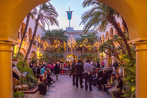 Plaza by The PradoBut who am I to use my East Coast Christmas traditions and expectations to judge others? My apologies to the city of San Diego for not understanding your holiday customs.
It was dinner time, and although there were numerous tempting food vendors, we wanted to rest our feet and sit down somewhere, so we went to Panama 66, a restaurant that occupies the open-air setting of the San Diego Museum of Art’s Sculpture Garden. Although it was bustling, Herb managed to grab a table, while I got on line to order our food and some locally crafted beers.
The night should have been over – we were exhausted -- but we actually visited three more museums before going back to our car, which was parked in the Zoo parking lot. Visiting the Zoo seemed like days ago – hard to believe it was just this morning.
Right near Panama 66 was the Mingei International Museum, which is dedicated to contemporary folk art and crafts from all eras and cultures around the world. A bit closer to home, they had a special exhibit when we were there called “Craft Icons of the 50 States,” which celebrated the variety of craft found throughout America. Each state had a representative piece of art, which expressed its unique contribution to the richness of the American experience.
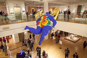 Mingei International MuseumWe walked back through Panama International Plaza to the Automotive Museum, where we saw more than 80 historic autos and motorcycles. I thought the most interesting exhibit was the one which traced the evolution of motorcycles from the motorized bicycles made by Indian Motorcycle Company and Harley Davidson in the early 1900s to the present day.
Our final stop on the way back to the car was the Model Railroad Museum, the largest operating model railroad museum in the world. I have fond memories of the model train set we had in our basement when I was a kid. I still remember putting a little white tablet in the chimney of the engine to make smoke come out as it circled the track. I thought that was so cool. The museum’s setup was a bit more impressive. They had four working models of actual Southern California railroads, which traveled through cute little towns and villages, both historical and contemporary.
Let’s just say that it had been a very fun and full day.
Back to Black’s Beach at Torrey Pines State Park
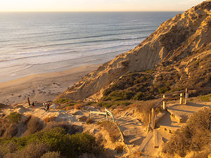 Climb up from Black's BeachIt was another beautiful day in San Diego, as we headed once more down the steep steps to Black’s Beach. As I mentioned in my write-up from a few days ago, this beach is frequented by basically two types – surfers to the left and naturists to the right. Today I had some memorable contacts with both.
I was a bit slow going down the steps, so whenever I heard footsteps behind me, I would step aside to let faster people go by. Herb was way ahead of me, and practically at the beach already, when I stepped aside to let a young guy carrying a surfboard go by. He looked like he had just walked out of a model shoot for a surfing magazine. – the surfer that is, not Herb. “Thank you,” he said in an accent that sounded vaguely familiar from my past.
When I asked where he was from, he said Finland, but he was currently studying at UCSD, which is right nearby. “I’m part Finnish too” I piped up, which was technically true in that my grandparents came from a Swedish settlement in Finland. “Do you speak any?” he inquired. I tried to pull out something I remembered from my childhood and said, “Jag alskar dig.” Soon as the words left my mouth, I realized that I had just told a young beefcake that I loved him. Herb was going to love this story. That’s what he gets for leaving me behind.
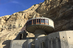 House on South End of Black's BeachOnce at the bottom of the steps, we headed north along the beach towards the clothing optional end, which leads me to my second story.
I had had such a nice run on this hard sandy beach the other day that I decided to go for another one. As I was running along, peacefully minding my own business, I saw something that boosted my Christmas spirit to new heights – five young, jacked college guys posing for what was obviously their Christmas photo, wearing nothing but Santa hats. Unfortunately, I do not have a photo to post that memorable experience.
I was having quite a day!
Back to Balboa Park and Indoor Rock Climbing at Mesa Rim
Despite having already spent two full days in the Park, we still hadn’t seen two of the major attractions – the Japanese Friendship Garden and the Botanical Garden. Also, every Sunday afternoon at 2 pm there is a free organ concert at the Spreckel’s Pavilion, so there was good reason to return to Balboa Park once more.
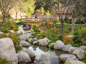 Japanese Friendship GardenI had read that the Park has lots of hiking trails, some of which are quite wild and lead down into canyons. Well, on our walk through the park, we saw the trailhead for one and took it. It was amazing. It felt like we out in the wild rather than smack in the middle of an urban park.
We re-emerged from the wilds in time to take our seats at the Spreckel’s Pavilion Christmas concert. I was really excited about finally hearing this organ play and getting into the holiday spirit with some rousing carols. What I learned is that a 4,725-pipe organ is impressive, but not very conducive to singing along with. Plus the organist’s improvisational approach to the classics and rather interesting tempo made it difficult at times to even recognize what she was playing. Here I go again, passing judgment – the concert probably wasn’t meant for us to sing along to. However, it really did make me miss Andrew and Tommy and their Bluetooth speakers, blasting Bing Crosby and us singing along out of tune.
After three or four songs we politely got up and walked over to the nearby Japanese Friendship Garden, which was originally designed as a teahouse for the 1915-16 Panama-California Exposition, as were so many other attractions in the Park. I love Japanese gardens. Just wandering along its winding paths was so very peaceful and serene – a very nice break from the somewhat frenetic schedule we had set for ourselves.
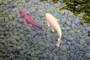 Koi in Japanese Friendship GardenThe Japanese Friendship Garden is just one out of more than a dozen gardens in the Park, each reflecting a different horticultural style and environment. We could easily have spent the entire day just going from garden to garden, which is something I definitely like to do on a future trip to San Diego.
However, today we decided to do just one more – the fabulous Botanical Gardens, which, like the Japanese Friendship Garden, were also designed and built for the Panama-California Exposition.
When we were here the other day, it had been closed to prepare for December Nights, but today it was open for all to enjoy its marvelous collection of 2,100 tropical plans and palms. The beautiful redwood laths that cover the building and make it so aesthetically pleasing also serve the very important function of allowing natural light to filter into the building. I only wish I knew more about plants so that I could better appreciate what I was seeing.
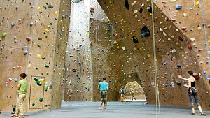 Mesa Rim Rock Climbing GymThis was our last full day in San Diego before heading back up north to our temporary home in the Petaluma KOA. Since the next two days would just be sitting in a car, we decided to get some physical activity in at the Mesa Rim Indoor Climbing Gym. I really love visiting new climbing gyms. Each of them has its own personality. I think was actually our 8th!
That pretty much wraps up our action-packed visit to beautiful San Diego.
Description
Campland on the Bay
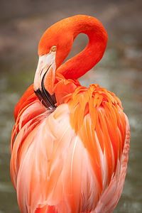 FlamingoCampland on the Bay is one of the largest campgrounds in California, or for that matter, the entire country. Its popularity stems from its prime location on beautiful Mission Bay and its many water activities: power boating, jet skiing, kayaking, waterskiing, deep-sea fishing, and swimming on its private beach.
For those birding enthusiasts, Campland overlooks the Kendall Frost Wildlife Preserve–home to egrets, black-crowned night herons, least terns, and the endangered clapper rail.
Other amenities include: 2 swimming pools and jacuzzis, a world class fitness room, a 124-slip marina, power boat and kayak rentals, bike rentals, the Hungry Wolf BBQ and Ice Cream Parlor, and lots of planned activities on the weekends.
The campground has 558 sites, most with full or partial hookups. There is even one Super Site, complete with private patio, jacuzzi, and grill.
Side Trips from Campland on the Bay
The following is in no way intended to be a complete listing of sights to see in the San Diego area, but just those that we chose to visit during our all too short 2 day stay.
Torrey Pine State Beach
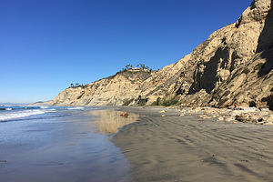 Black's Beach at Torrey PinesTorrey Pines State Beach in La Jolla extends for three miles from Carmel Valley Road in the north to the Glider Port at Torrey Pines Scenic Drive.
The north section of the beach is more easily accessible by car and is the choice for families.
Black’s Beach on the southern end is only accessible via two steep trails from the top of the cliff, where the parking lots are. This difficult-to-get-to beach is mostly frequented by two types: surfers looking to enjoy the huge winter swells, and nudists looking to enjoy some privacy. The nudists tend to hang out north of the Glider Port, while the surfers head to the south.
The south trail, which begins just south of the Glider Port, is easier and better maintained than the north trail, in that it has steps and handrails in the steeper segments. The north trail is much steeper and should be avoided if you are subject to vertigo. Both trails are about 1,000 feet long and have an elevation loss of about 320 feet.
It’s also fun to watch the hang gliders and paragliders soar from the Glider Port, atop the cliffs above Black Beach.
Balboa Park and the San Diego Zoo
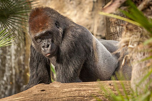 GorillaBalboa Park is right up there with Central Park in New York City and Golden Gate Park in San Francisco as one of America’s great urban parks.
It is the place San Diegans go to play and visitors to the area can tour more than a dozen art, cultural, and science museums, take in a Shakespeare play at the Old Globe Theater, or say hello to the amazing animals at the world-famous San Diego Zoo.
The first stop in the park should be the Visitor Center at 1549 El Prado, where they can explain the various ticket options for visiting multiple attractions within the park. There are far too many to see in just one day.
The major attraction in the park is the Zoo, located in the northern part of Balboa Park. There is a large free parking lot, but visitors should plan to arrive in the morning, because the parking lot fills up early on weekends – plus, the animals are much more active in the earlier part of the day
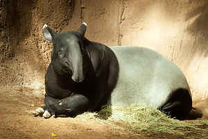 Malay TapirThe San Diego Zoo is home to more than 4,000 rare and endangered animals representing more than 800 species in a beautifully landscaped setting that replicates their natural habitats. Some of the most popular animals include: koalas, giant pandas, elephants, tigers, hippos, and apes, just to name a few.
A great way to get an overview of the park is to take the 35-minute narrated double-decker bus tour, which is included with the admission price. Once you’ve made the loop, you’ll know where you want to go back to. The Skyfari aerial tram goes right across the park and can save some walking time, as well as provide an awesome view of the animals from above.
In addition to the Zoo, there are more than a dozen museums to visit, many of which are included as part of the various Combo tickets. Some of the more popular ones include:
- Timken Museum of Art (admission free) – houses paintings by Rembrandt, Rubens, El Greco, Cezanne, Pissarro, Bierstadt, and more
- San Diego Museum of Art – the oldest and largest art museum in San Diego. renowned Its works include a fine selection of European old masters, 19th and 20th century American art, an encyclopedic Asian collection, and growing collections of contemporary and Latin American art.
- Museum of Photographic Arts – collection of more than 7,000 images, representing the entire history of photography, its aesthetic movements, and technological advancements. The particular focus of the museum is social documentary photography and photojournalism.
- Museum of Man – anthropological museum containing artifacts, folk art, and archaeological finds. The building was originally constructed for the 1915-16 Panama-California Exposition.
- Natural History Museum – with a focus on the natural world, this museum houses .5 million speciments, including rocks, fossils, taxidermied animals, a dinosaur skeleton, and a California fault-line exhibit. There is also a giant 3D-screen theater showing films with a focus on the natural world.
- Reuben H Fleet Space Theater & Science Center – hands-on science museum with over 100 interactive exhibits. The Fleet is also home to Southern California’s only IMAX Dome Theater.
- Air and Space Museum - houses a collection of historic aircraft and spacecraft from all over the world, including a working flying replica of Lindbergh's Spirit of St. Louis, the actual Apollo 9 Command Module spacecraft, and artifacts from the Wright Brothers, Charles Lindbergh, Amelia Earhart, Neil Armstrong, Buzz Aldrin and other aviation and space pioneers.
- Mingei International Museum - dedicated to art of the people (mingei) from all eras and cultures of the world, this museum features dynamic, changing exhibitions of historical and contemporary folk art, craft and design.
- Automotive Museum - features more than 80 historic autos and motorcycles, including Frank Sinatra’s 1967 Austin Petrol Hire Car and Louie Mattar’s Fabulous $75,000 Car.
- Model Railroad Museum - world's largest operating model railroad museum, with four landscaped working models of actual Souterhn California railroads, both historical and contemporary.
Balboa Park also has well over a dozen gardens, reflecting various horticultural styles and environments. Two of the more prominent ones we were fortunate to visit include:
- The Japanese Friendship Garden – originally a teahouse during the 1915–16 Panama-California Exposition, today the two-acre garden contains winding paths that lead visitors past a Zen garden for meditation, an exhibit house, koi pond, bonsai exhibit, ceremonial gate, and a Fujidana (wisteria arbor).
- The Botanical Garden – also built for the Panama-California Exposition of 1915-16, this building, with a Lily Pond and Lagoon in the foreground, is one of the most photographed scenes in the Park. The building’s central dome and two wings are covered with redwood laths, allowing natural sunlight to filter in on its collection of more than 2,100 tropical plants and palms.
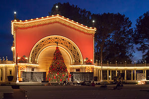 Practice Tree Lighting at the Spreckels Organ PavilionAnother attraction in Balboa Park is the Spreckels Organ Pavilion, an ornate vaulted structure that houses one of the world’s largest outdoor pipe organs. It was donated to the city by John D. and Adolph Spreckels for the 1915-16 Panama-California Exposition.
In 1915, Teddy Roosevelt gave a speech at the organ pavilion calling for world peace. He also requested that the people of San Diego keep the exposition’s temporary buildings up permanently.
This magnificent organ contains 4,725 pipes, ranging in length from the size of a pencil to 32 feet.
Free concerts are given each Sunday at 2 pm, sponsored by San Diego Parks and Recreation Department. The Pavilion is also the site of the annual December Nights Christmas Tree lighting.
Mission Bay
Mission Bay is the largest water park of its kind in the world, with 4,200 acres of land and water. The bay, which surrounded by 27 miles of meandering shoreline, is best explored by boat or bike.
The recommended bike route is a 12-mile paved path, which goes th past more than 10 public parks and two wildlife reserves. The route can be extended by biking around Fiesta Island, further along the San Diego River, or along the Mission Beach boardwalk.
Walmart Supercenter in Chino, California
Monday, November 30, 2015 - 2:15pm by Lolo344 miles and 7 hours from our last stop - 1 night stay
Travelogue
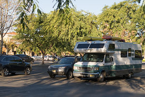 Walmart in ChinoOn long driving days, I hate having to pay for a campsite just to sleep, and since Walmart Supercenters and Flying J Truck Stops allow RVs to park overnight, they are a good choice to just bed down for the night.
Herb wanted to stop at the Lazy Daze factory in Montclair on the way down to San Diego to pick up a new vent cover to stop a leak, so we wanted to position ourselves somewhere near, so we could stop there first thing in the morning.
The Walmart Supercenter in Chino was perfect - 10 minutes from Lazy Daze and in a very nice, safe neighborhood.
Description
Many Walmart Supercenters allow RVs to park in their parking lots over night since they are open 24 hours. It is a good idea, however, to call ahead and speak to a manager to confirm.
Yosemite National Park
Tuesday, November 24, 2015 - 2:00pm by Lolo245 miles and 5 hours from our last stop - 6 night stay
Travelogue
 Veiled Half DomeThanksgiving in Yosemite was definitely becoming somewhat of a family tradition. It began in 2013 when the boys moved West, and we wanted to save them the trouble and expense of flying home for Thanksgiving.
We had had so much fun in 2013 that that we returned in 2014, upping our game to Thanksgiving dinner in the elegant and quite-expensive Ahwahnee Dining Room.
Now that Herb and I were living on the West Coast, we decided to drive our home on wheels back to Yosemite for our third annual Gaidus Thanksgiving. You can never have too much Yosemite, so the boys were more than happy with the plan.
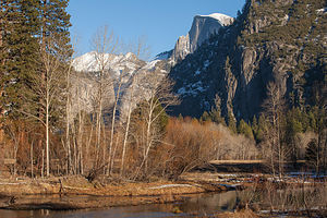 Last Day in YosemiteBeing a veteran of the stress of reserving a Yosemite campsite, I made sure I nabbed an Upper Pines site as soon as the November booking window became available. Upper Pines is the only campground open all year round, so although there are less people visiting the park in November, there are also less campsites. I booked it for the Tuesday before Thanksgiving through Sunday night, which would give me and Herb a little extra time on either end of the boys stay with us.
I also made Thanksgiving dinner reservations well in advance. We decided to return to the Yosemite Lodge Mountain Room, where we had eaten in 2013. The Ahwahnee was so awesome, but quite extravagant, so we decided that we would alternate years between the two venues.
Herb and I drove out on Tuesday and tucked ourselves into our campsite just in time before the snow began to fall. Hopefully, it would stop before the boys joined us tomorrow evening.
Valley Loop Photography, Boys Arrival, and Ice Skating
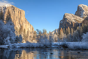 El Cap in ProfileThe next morning we looked out the window and saw that about 3 inches of snow had fallen. Already there were kids – some still in their pajamas – running around the campground, throwing snowballs, building snowman, and just plain old having fun. It was a winter wonderland – our first time seeing Yosemite under a blanket of snow!!
We decided to spend the day driving the Valley Loop, stopping to take photos along the way. Fortunately, we had an all-wheel drive Subaru Forester, because the roads were snow-covered and quite slippery. Although we have driven around this valley dozens of times, with the snow, it was like seeing it for the very first time.
Our first stop was the beautiful Ahwahnee Hotel, which never ceases to awe me. We walked through the lobby and out the back door into the yard where there were dozens of boisterous families, dressed in colorful hats and scarves, making snow angels and building snowmen. It was like we had stumbled into a Currier and Ives Christmas card. Usually I take my time easing into the holiday spirit, but this festive scene thrust me there in one fell swoop.
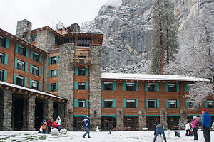 Ahwahnee Fun in the SnowHerb had to drag me away to continue our tour. Since the roads around the Valley are one way, we started off along Northside Drive, stopping first to walk to and photograph Lower Yosemite Falls. This walk is always crowded, in that it requires very little effort for an awesome view from the base of the 2,425-feet Yosemite Falls, the highest waterfall in North America. It is actually three waterfalls in one, with an upper, middle and lower section.
Continuing west, we passed Yosemite Lodge where we would be having Thanksgiving dinner tomorrow and then Camp 4, which the most renowned climbers in the world have used as their base camp for the last 50 years. Not many were camping there now, probably because of the snow.
By El Capitan Bridge, you can either turn left, to circle back east through the Valley, or continue on out towards the Park Exit. We continued on, stopping first at El Capitan Meadow, where there is a terrific view of this amazing 3,000-foot high granite monolith, the largest single piece of exposed granite in the world. . During certain times of the year you can see tiny little climbers clinging to its granite face – however, none today, as far as we could see.
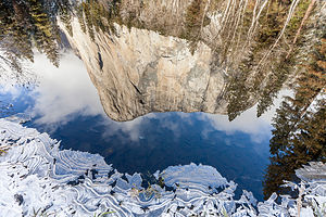 Rock and IceWe continued on to one of our favorite viewpoints at Valley View, where El Capitan, on the left, and Cathedral Rocks, on the right, frame a magnificent valley view.
From there, rather than exiting the park, we turned left, parked in the Bridalveil Falls parking lot, and took the short hike up to see the 620-foot falls, which flows down from a hanging valley. It was still snowing, and the trail was very slippery, so we pretty much had the trail to ourselves, which was quite nice.
Continuing east on the Southside Drive, we stopped at Sentinel Beach for Herb to take his classic shot of El Capitan reflected in the river – except this time with a snow-covered foreground.
Our last stop before heading back to await the boys’ arrival was Swinging Bridge, another picnic area and beach. As we walked across the bridge into a lovely meadow, I looked down instead of up for a change and noticed a lone snowman in the meadow, his only companion being a small gray fox stalking its prey in the snow. There is beauty to be found at every scale in this incredible Valley.
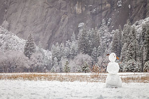 Lonely Snowman in the MeadowCompleting our loop, we returned to the motorhome and began preparing dinner so that it would be ready when the boys arrived. That way we could get to Curry Village in time to ice skate that evening.
I love the fact that these Yosemite Thanksgivings have brought ice skating back into my life after a 10 year hiatus. Plus, I admit that I love surprising the boys with some level of physical competency. I was actually pretty good in my day, and can still skate backwards while doing crossovers and even spin around a little. They were shocked the first time they saw me do this.
So, now it has become expected that I will be the crazy lady spinning around out in the middle of the ice. We weren’t there 10 minutes before I went into one of my spins, which Andrew said was quite impressive, or at least, that is, until I flew on my back and hit my head on the ice. Fortunately, I didn’t hit it too hard, but hard enough to make me think twice about doing that again.
Why the heck don’t people wear helmets while ice skating? It’s a really hard surface to hit. Or maybe the more relevant question is why do ladies pushing 60, who think they are Peggy Fleming, not wear helmets while skating?
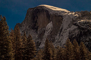 Moonlit Half DomeNot quite ready to get back on the horse again so soon, I contented myself with gliding counterclockwise around the rink with everyone else, making sure I kept both skates firmly on the ground.
I give Herb credit for being a good sport about the skating, as he definitely wanted to be photographing the full moon rising over Half Dome instead. He did leave the session a little earlier than the rest of us to set up his tripod in the parking lot, but the moon had already risen too high in the sky to capture it in the same frame as Half Dome. Still, the moon's indirect presence was very much felt.
When we finished skating, Herb volunteered to drive us back to the motorhome and then come back out by himself to photograph, but we told him that “we were in this together” -- our family mantra for good times and bad.
 Curry Village by Moon LightWe moved our operation out to the road, and set up the two tripods we had. It was truly magical. The moon and the stars were illuminating the Valley, and it was so eerily quiet and still, in the way that only happens after a snowfall.
The boys, who were taking turns with one of the tripods, noticed that Herb was aiming his camera not at Half Dome, but back towards the lights of Curry Village. When we got back to the motorhome and looked at the photos we had taken, we saw that they each had taken the identical awesome photo of Glacier Point Apron with the lights of the Curry Village skating rink in the foreground. What a coincidence! Herb cried “copyright infringement” when Andrew posted his version on Facebook first, almost immediately getting 100 Likes for his incredible photo. In the world of Social Media, he who posts first wins.
What a great first day in the Valley it had been, and to think we had four more!
Valley Loop Photo Tour again, Cross Country Skiing in El Cap Meadow, Thanksgiving Dinner in Mountain Room, and the Ahwahnee Great Lounge
 Over the River and thru the Woods...Thanksgiving dinner wasn’t until 4:00, so we had plenty of time to explore before then. This was the first time the boys had seen the Valley covered in snow as well, so we pretty much did a repeat of yesterday’s photo tour, adding a few extras in as well.
Our hope was to find a place to cross country ski along the way, so we had to take two cars to fit the four of us plus all the ski equipment.
We parked at Yosemite Lodge, and walked to the Swan Slab climbing wall, where we had climbed so many times before and probably would again later this weekend. From there, we took the slippery, snow-covered trail to Lower Yosemite Falls and got our first and only family shot of the trip.
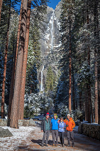 Family with Yosemite FallsBack in the car, we continued west along Northside Drive, stopping next at El Cap Meadow where there were a few snow-covered walking trails crisscrossing the meadow. Looked like as good a place as any to try out our XC skis – at least the boys and I thought so. Herb was a bit more skeptical. Besides he was like a kid in a candy shop with all the photo opportunities of a snow-covered Valley to tempt him. That’s when we decided to split up for now and meet up further along the Valley Loop.
The conditions were not ideal, and we did have to scramble over the occasional log or two, but the views of El Cap were awesome and playing with the boys in the snow is always a blast. After about 2 miles of looping around the meadow, we packed the skis back in the car and headed off in search of Herb.
He mentioned wanting to go to the Wawona Tunnel Viewpoint, where there is an incredible view of El Capitan, Half Dome, and Yosemite Valley in between, so we went there, but no Herb. There was, however, the usual bus tour crowd of about 100 people jockeying for position to take a selfie with this iconic backdrop.
We continued back into the Valley along the Southside Drive where we eventually caught up with Herb at Sentinel Beach, once again taking his favorite reflection shot of El Cap in the Merced River.
It had been a pretty full day already, and we hadn’t even gotten to the main event – Thanksgiving Dinner in the Mountain Room at Yosemite Lodge. Although not as elegant as the Ahwahnee, the dining room is very cozy and warm and has wonderful views out its floor-to-ceiling windows.
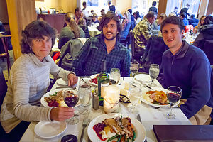 Thanksgiving DinnerThey seated us at our table at 4:00 on the dot, and within 5 minutes there was bread and water on the table and the waiter took our order. Before another 5 minutes passed, our soup and salad had arrived. Now, normally I like quick service, but this was Thanksgiving and I was beginning to feel like I was on an assembly line with courses passing in front of me before I could finish the last. It wasn’t like this when we dined here two Thanksgivings ago. They must be trying to make the seatings shorter so they could push more people through.
What a difference from the calm elegance of the Ahwahnee dining experience. We would seriously have to consider switching back next year. It was definitely worth the extra dollars to be able to linger over what is supposed to be the most celebrated meal of the year. By 4:45 we were out of there and the next group was being seated.
To regain our serenity, after dinner we went for a walk by the Ahwahnee Meadow and then settled into the Ahwahnee Great Lounge with our kindles and a deck of cards. Although the Great Lounge is huge, there are so many nooks and crannies and side rooms that we were able to find our own private cozy spot on the second floor looking down over the lounge. What could be better than sharing this magical place with the people I love most? Then Tommy pulled out a small Bluetooth speaker from his backpack and began softly playing Christmas music while we played hearts. I was so content I never wanted this moment to end.
On the drive back to the campground, Tommy cranked up the volume and we sang Christmas carols the whole way.
Yosemite Falls Hike and Ahwahnee Great Lounge
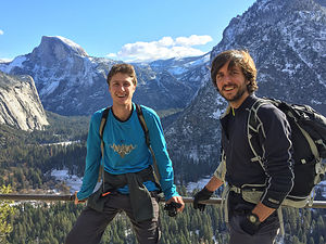 Yosemite Falls TrailUsually during the Thanksgiving holiday weekend we rock climb, but this time it was much colder and the rock was still wet from the snow storm. Hopefully, it would dry out enough for tomorrow.
The snow was already beginning to melt in the Valley, drying out the trails, so we decided that a robust hike to the top of Yosemite Falls would be a great way to spend the day. Herb and I had already done this hike twice – once when we were about 29 years old and then again in 2012. I remember it being one of the most exhausting hikes I have ever done, but also one of the most rewarding.
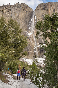 Approaching the FallsJust looking up at the top of the falls, and thinking about getting there on foot from the Valley Floor, is pretty daunting. It’s 3.6 miles each way, and over that distance it climbs over 2,700 feet – that’s over a half a mile of vertical gain.
But, the boys had never done this hike, so I was not about to be the pooper holding us all back. So, I put on a cheery face and a skip in my step, and we set off on the trail, which begins next to Sunnyside Campground (Camp 4), the rock climbers’ campground behind Yosemite Lodge.
This hike doesn’t fool around. In the first half mile, it climbs steeply along a series of over three dozen switchbacks. At least the snow had melted, so the trail wasn’t slippery. By the time we reached one mile, we had already gained 1,000 feet in elevation.
A thousand or two feet really makes a difference in temperature. Soon we were hiking across a few patches of snow and had to stop to put our jackets and gloves on. At about the halfway point, the trail became almost completely covered with snow and a lot slipperier. We stopped to have lunch and to discuss whether we should turn back or press on. I knew the boys really wanted to get to the top, but they were worried about me falling. I suggested that I could turn back while they went on, but they repeated our family vacation refrain, used in both good times and bad, “Oh no, we’re in this together.”
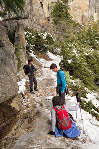 The Trail Gets SlipperyThat’s when Tommy realized he had a pair of Yaktrax in his backpack that would probably fit over my hiking shoes. The little cleats on the bottom keep you from slipping and sliding on the snow and ice. Soon, to the annoyance of the rest of them, I was practically dancing up the trail. These things were great!
The last quarter mile before reaching the top is a series of torturous, seemingly endless switchbacks, even under the best of conditions. Without the Yaktrax I would be lying face down in the snow by now.
Finally, we reached the top, but it wasn’t time to celebrate yet. The Overlook was actually below us, down a short, but intimidating, series of steps cut into the rockface. Thankfully, there was a guard rail to hang onto for dear life. I tried not to look out over the steep drop below. From the overlook we looked down from above at the falls cascading over the edge.
By the time we got back up the steep, slippery steps, it was snowing very hard. It was a winter wonderland. For a brief moment, I was so lost in the sublimity of the scene that I forgot to worry about how I was going to make it back down to the Valley.
I guess it was just going to have to be one slippery step at a time. At least I had the Yaktrax to give me some traction. I don’t know how they did it without them. I made a mental note to get Yaktrax for the entire family for Christmas.
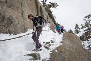 Precarious Descent to the OverlookI was so grateful when we reached dry trail again, and even more so when we got back to Camp 4. For some reason that I will never understand, I was less exhausted this time than when I did this hike in better conditions when I was three years younger. I think the boys’ confidence that I can do challenging things, and the distraction from all the laughter when we are together, make life in general a little easier, and a whole lot more fun.
I did have enough sense, however, to reject their suggestion of ice skating at Curry Village that evening, and persuaded them instead to return to the warmth of the Ahwahnee Great Lounge for more reading and cards, and, of course, the caroling on the way home. I have never been in such high Christmas spirits this early in the season. I hoped I wasn’t going to peak too soon.
Rock Climbing at Swan Slab and Sunnyside Bench and the Ahwahnee Great Lounge
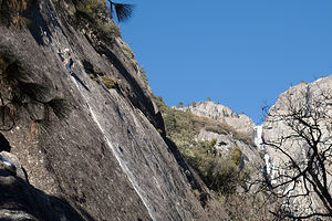 Tommy on Swan SlabToday was Saturday, our last full day together, and the snow had melted enough to make climbing somewhat viable, if not exactly ideal.
Over the last few years, we had gotten much more familiar with climbing areas in the Valley. One of our favorites is Swan Slab, a very popular climbing area on the north (sunny) side of the Valley, between Camp 4 and Yosemite Falls. I personally like it, mainly because it has some climbs at an easy enough grade for me to try, but also because it is a great spectating spot – the approach is short, the base is sunny, and there is even a bench to sit on.
They selected a 5.11b “aid” climb, appropriately named Aid Route, which eventually led to a nice 5.8 crack. An aid climb kind of looks like cheating, but it’s not. Rather, it’s a method of getting past the “unclimbable” (at least for most climbers) parts of a route. It was the method used for the first ascents of El Cap, and is still used in ascending many “big wall” routes today.
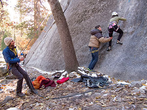 Lolo getting a Little BoostTommy volunteered to lead it. Unlike the elegant moves I usually see him do, this wasn’t pretty. It involved him placing a piece of gear as high as he could, clipping a quickdraw to it, and then hauling himself up on the draw to reach better holds. When that didn’t work, he clipped a full-length sling to the piece, put his foot in the loop of the sling, and then stood up on it. This act was repeated over and over until he reached the point where he could “free” climb. At the top, he set up a top rope, so that Andrew and Herb could climb it without having to place protective gear.
“Okay, you’re up next Mom,” he said after being lowered back down. At first I thought he was kidding, but then I realized that he was dead serious. I didn’t know whether to make a run for it, or be proud that he actually through I could make some upward progress on this wall. I went with pride and began putting on my harness, helmet, and shoes.
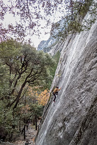 Andrew on Sunnyside Bench WallIt was ridiculous and so tiring. To even get started, Tommy had to make a cup with his hands for me to step up into and reach the first supposed hold. From there, I did a combination of hauling myself up on the rope, whimpering, pulling on quickdraws, begging for mercy to be let down, stepping into slings that tried to swing away from me, sobbing, etc., until I finally reached the 5.8 crack.
By this time, my heart was pounding so hard and my arms were so pumped that I didn’t know how I could go on. Then I looked down at their smiling, proud faces and the small crowd of people that had gathered to watch this spectacle, and decided that I had no choice but to surge on. Working on pure adrenaline, to my utter amazement, I actually completed the rest of the climb.
Herb and Andrew took turns on it as well, and agreed that it was probably my biggest outdoor climbing accomplishment to date. I was ready to retire on the top of my game..
I thought we were done climbing for the day, but I was wrong. We moved our operation to another climbing area called Sunnyside Bench, just a little ways to the right of Lower Yosemite Falls. Our “solo” climbing friend Charlie, who we met last Thanksgiving by Swan Slab, had shown us this area, and in particular, a classic 5.9 climb called Jamcrack.
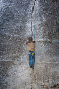 Tommy's First Crack Climb Wearing MittensUnlike Charlie, Andrew used ropes and led the first pitch of the climb, a noteworthy event in that it was his first lead in Yosemite Valley. He set up a top rope so that Herb and Tommy could do this climb, as well as Lazy Bum, the 5.10d next to it.
There was one other first I would like to mention regarding Andrew’s climb. We believe it was the first ascent of Jamcrack accompanied by “Der Bingle” singing Christmas carols. That’s right. Tommy had brought along his Blue Tooth speaker for this very reason. Need I say that Christmas spirits were incredibly high.
Actually, I think there might have been another first. It was getting so cold that Tommy didn’t bother to take off his puffy down parka and mittens to climb. I don’t think anyone has ever documented completing a crack climb while wearing mittens. He looked more like an astronaut about to walk on the moon, than a climber about to ascend a crack.
It was dark by the time we finished and hiked back to the car in the Yosemite Lodge parking lot.
Ahwahnee Brunch and more Valley Photography
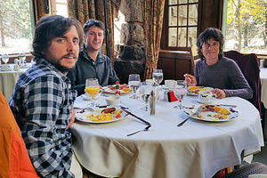 Ahwahnee BrunchIt has become something of a Gaidus Family tradition to wrap up every visit to the Valley with Sunday Brunch in the Ahwahnee Dining Room.
As usual, we requested the “Queen’s Table” in the alcove at the back of the dining room, where Queen Elizabeth sat during one of her visits here. We have made this request probably a half a dozen times over the years, but someone has always beaten us to it. Well, this year we finally nabbed it. Although the Gaidus men always treat me like a queen, this was really special.
The Ahwahnee Dining Room, with its 34-foot-high beamed ceilings, granite pillars, chandeliers, and floor-to-ceiling windows, is the perfect venue for a memorable dining experience and the perfect way to end a wonderful holiday weekend.
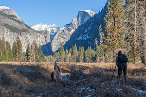 The Young AnselIt was time for the boys to head back to real life in San Francisco. After they left, Herb and I spent the day wandering around the valley, taking more photos, and discussing where to go next.
After years of winter backpacking and ice climbing, somehow Herb has developed a distaste for the cold. So, after his supposed “suffering” in beautiful, snow-covered Yosemite for the past few days, he decided that he should reward himself with a trip down to sunny San Diego.
Sounded good to me!
Description
 Snowy MeadowYosemite National Park lies near the eastern border of California in the heart of the Sierra Nevada Mountains. Its spectacular waterfalls, soaring granite cliffs, and lush meadows are just a few of the reasons it is considered by many to be nature’s ultimate masterpiece. In the words of John Muir, “it is surely the brightest and the best of all the Lord has built.”
This description will focus on Yosemite Valley, which is the section of the park we visited. Although the Yosemite Valley is just a small portion of Yosemite’s 761,268 acres, it is part receives 95% of its visitors. In fact, an estimated 4.1 million people visit the Valley each year, making it extremely crowded.
Two one-way roads traverse Yosemite Valley: the east-bound Southside Drive and the west-bound Northside Drive, which wind through woodlands and meadows along the base of the 3,000-foot-high granite cliffs. As of today, cars are still allowed to enter and drive through the valley, but visitors are highly encouraged to park their vehicles and use the park’s free shuttle bus, which stops at the major attractions in the valley.
Virtual Tour of Yosemite Valley Highlights
- As you enter the valley, the first sight you’ll see is the 620-foot Bridalveil Falls flowing down from a hanging valley to the valley floor. From the parking area, a short paved path leads to the base of the falls. This is one of the few falls in Yosemite that does not completely dry up in the summer.
- Just past the Bridalveil Fall parking area, the Southside Drive begins to trace the Merced River. Soon El Capitan comes fully into view. This 3,000 foot high granite cliff is the largest single piece of exposed granite in the world and one of the most famous landmarks in Yosemite. If you look closely, you might see small dots that are actually rock climbers along its face.
- Continuing east on the Southside Drive are two riverside picnic areas and beaches: Cathedral Beach and Sentinel Beach.
- Right after the Sentinel Beach parking area is the trailhead for the 4-Mile trail, which ascends more than 3,200 feet from the valley floor to Glacier Point and one of the most spectacular views of the valley.
- A short distance further is Swinging Bridge, another picnic and swimming area. This area is also the westernmost point of the 8-mile bicycle loop that goes through the eastern part of the valley. From this point on, the bike path parallels the road.
- Next stop is the picturesque tiny Yosemite Chapel where many outdoor enthusiasts choose to exchange wedding vows.
- Now you enter the congested and developed portion of the valley.
- Right past the chapel, you can either take a left onto Sentinel Bridge towards Yosemite Village and the park exit, or you can continue straight towards Curry Village, the campgrounds, and Happy Isles Nature Center. For now, let’s stop at Sentinel Bridge for what is probably the most spectacular Half Dome viewpoint in the park. It’s a great spot for a photograph of Half Dome with the Merced River in the foreground.
- Continuing east on the Southside Drive, you pass Housekeeping Camp and Curry Village. Curry Village has lodging, restaurants, bicycle and raft rentals, a grocery store, and other shops. Curry Village is also one of the main parking areas in the valley.
- From Curry Village you can either take Northside Drive across the Ahwahnee Bridge back to Yosemite Village and the park exit, or continue east to the campgrounds. The Happy Isles Nature Center is also this way, but only shuttle buses are allowed on the road to it.
- The Happy Isles Nature Center features exhibits on the natural history of the park. It also serves as the trailhead for some of the best hikes in Yosemite. 1.5 mile trail leads to the top of Vernal Falls and then continues another 1.5 miles to the top of Nevada Falls (two waterfalls that flow even in the summer time). From there you can continue even further into the backcountry of Yosemite, including the cable route up the back of Half Dome.
- From Curry Village, the Northside Drive crosses the Ahwahnee Meadow, a wonderful spot to gaze at Half Dome during sunset, and enters Yosemite Village, the main center of visitor services in the park. Here you’ll find the park’s main Visitor Center, restaurants, lodging, shops, a grocery store, a post office, a medical clinic, the Ansel Adams Gallery, an Indian Cultural Exhibit and more. It’s also a good place to park your car and jump on the shuttle.
- A short dead end road from Yosemite Village leads to the majestic old Ahwahnee Hotel, which has played host to Queen Elizabeth, President John F. Kennedy, and Clint Eastwood, to name a few. This beautiful six-story rock structure offers tremendous views from every room. Within the hotel is the elegant and quite expensive Ahwahnee Dining Room (jackets required for dinner).
- Back on the Northside Drive heading west from Yosemite Village, the next stop is the Yosemite Falls parking area. At 2,425 feet, Yosemite Falls is the highest waterfall in North America. It is actually three waterfalls in one, with an upper, middle and lower section. A short walk from the parking lot along a paved walk leads to the base of Lower Yosemite Falls. This is the most visited landmark in the valley. Except in summer when the fall temporarily dries up, you’ll be sure to be covered in spray.
- A little further west on the Northside Drive is Yosemite Lodge, which marks the end of the developed area of the park going west.
- Right after Yosemite Lodge is Sunnyside Campground/Camp 4, a place where most rock climbers choose to congregate. From this campground begins the popular and strenuous Yosemite Falls hike, which ascends 2,600 feet from the valley floor to the top of the Upper Falls. The views from the top are incredible.
- Continuing west, there is nothing but woods and meadows from which to enjoy the views. Along the road there are several pullouts where you can stop and walk down to the Merced River for a swim. Just after the El Capitan Bridge, you’ll come to the El Capitan Meadow where you’re sure to find people looking through binoculars at the miniscule rock climbers clinging to the granite face.
- Just to the west of El Capitan, Ribbon Falls plunges over 1,600 feet down to the valley floor. It is the seventh highest waterfall in the world. However, it too dries up in the summer time.
- Finally the road nears the end of the Northside Drive at Valley View where El Capitan, on the left, and Cathedral Rocks, on the right, frame a magnificent valley view.
Several guided bus tours are also available. The 2-hour Valley Floor Tour is a great way to get acclimated. Visitors ride through the valley in an open tram while a guide leads a informative discussion of Yosemite’s history and geology. There are many photo stops along the way. In addition, there are bus tours out of the valley to Glacier Point, the Mariposa Grove of sequoia trees, and Tuolumne Meadows.
Although much of Yosemite can be enjoyed from the comforts of your car or a shuttle, the best way to truly experience Yosemite is do get out and experience it more directly..
Things to do in Yosemite
- Hike one of the many trails around the valley, ranging from an easy walk to the base of Lower Yosemite Falls to the strenuous 16-mile round trip hike up the back of Half Dome via cables
- Take an overnight backpacking trip
- Bike along the 12 miles of bicycle paths that loop through the Valley. Rentals are available at Curry Village and Yosemite Lodge.
- Rock climb in one of the premier climbing places in the world
- Raft down the calm waters of the Merced River through the valley. Rentals are available at Curry Village.
- Swim or tube in the Merced River. Besides the designated beaches, there are many pullouts along the road from which you can walk down to the river.
- Join one of the many ranger walks, which are offered daily
- Take a free art class at the Yosemite Art and Education Center
- Photograph the amazing scenery of the valley and surrounding granite cliffs
- Browse the Ansel Adams Gallery and see some of the photographs that first made Yosemite famous
- Relax in the meadow while gazing up at Half Dome or El Capitan
- Dine at the 5-star Ahwahnee Hotel, where presidents and royalty have stayed
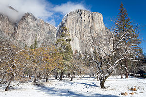 More El CapAlthough many try to see Yosemite in a day, it is best to devote several days to seeing all the park has to offer. Besides the numerous hotels, lodges, and cabins in the Valley, there are three RV campgrounds: Upper Pines (238 sites), Lower Pines (60 sites), and North Pines (81 sites). That’s less than 400 campsites to accommodate all the people that want to camp here.
Since these campgrounds usually fill-up within the first hour they become available, it is essential to make your reservations as soon as possible. Campground reservations are available in blocks of one month at a time, up to five months in advance, on the 15th of each month at 7 am Pacific time. For example, if your arrival date is July 15 through August 14, the first day you can make reservations is March 15. The National Park Reservation System can be found at www.recreation.gov. Good luck!
San Francisco North / Petaluma KOA
Friday, November 13, 2015 - 2:15pm by Lolo150 miles and 3.5 hours from our last stop - 1 night stay
Travelogue
The next morning we drove the remaining 150 miles to the Petaluma KOA, where we had our motorhome stored for the past 2 years. We took it out of storage and prepped it for being our new “home” until we found one that wasn’t on wheels.
Description
The Petaluma KOA is an award winning camping resort located within an hour’s drive of San Francisco, Napa and Sonoma Valley Wineries, giant redwoods, and Sonoma County and California Coastal Beaches. It is considered to be the RV resort in the San Francisco Bay area.
On its 70 acres, there are 312 spacious RV sites, 32 camping cabins, and 10 Wine Country lodges.
Other amenities include:
• Guided tours of San Francisco (from May through October)
• Huge heated pool and spa
• Inflatable waterslide
• Rock climbing wall
• Huge playground
• Petting zoo
• Karaoke
• Hayrides and live weekend entertainment
The campground is open all year.
Utah to California
Thursday, November 12, 2015 - 2:00pm by Lolo523 miles and 8 hours from our last stop - 1 night stay
Travelogue
Less than 700 miles to go – Woo Hoo! Reno was about 430 miles away, so stopping there for the night would put us in striking distance to make the final push the next day.
Also, there is an excellent art museum there that currently had a special exhibit called “Tahoe: A Visual History,” which surveyed historical art of Lake Tahoe and Donner Pass, two areas that we have grown to love in our recent travels.
The exhibit was arranged chronologically and covered over 200 years of the culture and history of the Lake Tahoe area – the Native Americans who first populated this region, the infamous and tragic story of the Donner Party, the laying of the Transcontinental Railroad by Chinese laborers, the logging and mining boom, the shift to tourism and the rise of resorts in the early 20th century, and the impact of climate change on the lake’s ecosystem.
I looked on Priceline for inexpensive hotels to stay in Reno. We stopped in one that advertised a $100 price, but had so many hidden service charges and fees that the total would have been more like $180. I only knew this before being suckered in, because there was a gentleman next to me at the hotel desk screaming about his final bill. We walked out and continued driving west.
After leaving Reno, we drove for another 100 miles before finding a place to stay in Auburn, California. We were almost home – or whatever home might mean these days.
We stayed at a Quality Inn, right next to a very highly rated restaurant called Joe Caribe Caribbean Bistro and Café. It was excellent – in fact, so much so that Herb wrote his first restaurant review on Trip Advisor, raving about their fish tacos. He gave it 5 stars.
Description
Drive from Wendover, Utah to Auburn, California
Wyoming to Utah
Wednesday, November 11, 2015 - 1:45pm by Lolo310 miles and 5 hours from our last stop - 1 night stay
Travelogue
 Momentum Rock Climbing GymYesterday was the long driving day, so that meant that today we could schedule in some fun. We picked out two very different types of activities in Salt Lake City: rock climbing at the indoor Momentum Gym and touring the Mormon Temple Square.
I have rarely made a climbing gym I didn’t like, and Momentum was no exception. The only down side to visiting new gyms is that you have to get belay tested in each one to make sure you know what you’re doing and won’t let your partner fall to the ground. I definitely agree that checking one’s competency is a necessity, but I wish there was some kind of nationally recognized belay certification so that you didn’t have to waste an hour every time you visit a new gym.
When I think of Salt Lake City, I think Mormons, so we couldn’t just pass through without visiting Temple Square.
 Salt Lake TempleWe started our visit at the South Visitor Center and asked if we could take a tour. They said we could and that it was free, and then had us wait for our tour guides in a sitting area with a video screen full of smiling, wholesome faces of various ethnicities upon which you could click to hear their story about how and why they became a Mormon. I think the goal of the “I’m a Mormon” program was to make people feel more comfortable that Mormons were normal people that lead normal lives, and therefore, you could and should become one too.
After getting through about three stories of Mormon conversions, our two tour guides arrived. They were young women – one from Paris and one from Italy – very courteous and very plainly dressed. They were also very, very passionate about the Church of Latter Day Saints.
They took us first to a model of the Temple in the Visitor Center, which was placed before a window opening out to the real thing. Since non-Mormons are not allowed to enter the Temple, this was about as close as we were going to get. I think the lack of access to the public adds to the belief that non-Mormons, such as us, have that secret cult-like stuff is going on in there. In any case, the architecture of the Temple is absolutely stunning.
 Large Mormon OrganOur guides were, however, able to take us into both the Tabernacle, home of the world-renowned Mormon Tabernacle Choir, and the Chapel, where weekly Sunday services take place.
Rather than stay overnight in Salt Lake City, we continued driving on I80 through Utah. As we did, I continued to play with the “Things to Do Nearby” function on the Trip Advisor app. Up came the “Tree of Utah,” an 87-foot high abstract sculpture of a tree on the edge of I80 on the barren Bonneville Salt Flats. Sounded pretty cool, but traffic was traveling at 70 mph, and there was no place to pullover. I rolled down the window and got my iPhone ready. I actually managed to capture it. It definitely did not look like a real tree, but more like 6 bowling balls protruding from a telephone pole. I have a problem with abstract art.
 Karl Momen's "Metaphor: The Tree of Utah"To give it the respect it deserved, I googled it and found that the tree is supposed to be a metaphor, and it is also called the “Tree of Life.” It was created by the Swedish artist Karl Momen in 1982. The inscription on the trunk of the tree is Schiller's Ode to Joy, as sung in the choral climax of Beethoven's Ninth Symphony.
We continued on a few miles to the Best Western in the town of Wendover, the last town in Utah before the Nevada border. – in fact, we were so close to Nevada that we could see the lights of the casinos just 100 yards down the road from our motel.
 Pancho Special at the Salt Flats CafeWe checked on Trip Advisor for a place to eat (I was getting obsessed with this app), and selected the Salt Flats Café, a Mexican restaurant located in a Sinclair station truck stop back near the entrance to the Bonneville Salt Flats.
The ambience was just what we were looking for – rustic, casual, with photos of Salt Flats racers covering the walls. The colorful chairs with Mexican motifs were really cool as well. Everyone in the place knew each other, which is always a good sign. They only take cash, which was fine, because you didn’t need much of it. Herb and I both ordered the Pancho Special, which featured a chile verde burrito, steak tostada, steak enchilada, rice and beans – all for $6.95. One of them would have been enough for the both of us.
The next morning, before leaving Utah, we drove back out to the Bonneville Salt Flats to photograph this amazing place in the morning light. The salt flats are about 12 miles long and 5 miles wide and are comprised of approximately 90% common table salt. Near the center of the flats, the salt crust is almost 5 feet thick, but it tapers off to about 1 inch along the edges. .
 Truck on Bonneville Salt Flats with CoupleBonneville is on the National Register of Historic Landmarks because of its contribution to land speed racing, which has been going on since 1914. It was on the Bonneville Speedway that the 300, 400, 500, and 600 mile-per-hour land speed barriers were broken.
We were surprised to see that there was a shallow layer of water covering much of the flats, since we thought that the West was undergoing a severe drought. Maybe that was just California. In fact, the August racing events had been canceled for two years in a row because of heavy rains swamping the flats. I can imagine that wasn’t very good for the local economy.
Nebraska to Wyoming
Tuesday, November 10, 2015 - 1:45pm by Lolo660 miles and 10 hours from our last stop - 1 night stay
Travelogue
 Lolo with Abe Lincoln's Head on a PedestalWe figured that we had to get some physical activity at least every other day, so since we climbed at Climb Iowa yesterday, this would be our long driving day.
To pass the time, Herb suggested I play with the Trip Advisor app to look for Things to Do “Near Me Now,” which is actually very useful when crossing the country with no particular plan in mind.
That’s how I discovered Happy Jack Road (Wyoming Highway 210), a 40-mile scenic alternative to I80 that connects the towns of Cheyenne and Laramie, Wyoming. After 400 miles of driving, we were about ready for Happy Jack.
It was great. We went from the streaming traffic of 80 to feeling like we were out in the middle of nowhere – just prairie and ranches and rocky plateaus.
Just before we got back to I80, we stopped at a Visitor Center – mainly to find a restroom -- and were surprised to find a giant 13 ½ foot statue of Abraham Lincoln’s head atop a 30-foot granite pedestal, obviously made to be visible from Route 80. It was built to commemorate Lincoln’s 150th birthday.
Why a bust of Lincoln in Wyoming you might ask, as I did? Well, before there ever was an I80, connecting New York City with San Francisco, in the early 1900s the old Lincoln Highway did the job. The statue originally stood alongside the highest point of the old highway, at Sherman Point (8,878 feet above sea level), but was moved to this location in 1969 when I80 was completed.
 Lolo in Happy Jack Road Visitor CenterHappy Jack Road was a good diversion, and we were recharged to forge on. As we continued west through Wyoming, we began hearing forecasts for heavy snow in the higher elevations, which we had now officially entered.
Sure enough, shortly after dark it started to flurry. We needed to find a place to stay soon, but the next major town, Rock Springs, was about an hour away. I consulted the Trip Advisor app to find something highly rated (as we might be snowed in for a day), but reasonably priced. I found an extended stay hotel – hopefully our stay wouldn’t be that extended – called My Place. It even had a small kitchenette. We got there just in time before it started snowing more heavily.
We quickly went out to get takeout Chinese food at nearby Wonderful House, brought it back to eat in our room, and settled in for what we hoped would only be one night. It was kind of cozy. I was getting used to the life of a nomad.
The next morning we awoke to find that the forecasted snowstorm was thankfully a bomb. I reheated the leftover Chinese food for breakfast, and we surged on westward.

