- Home
- About
- Map
- Trips
- Bringing Boat West
- Migration West
- Solo Motorcycle Ride
- Final Family XC Trip
- Colorado Rockies
- Graduates' XC Trip
- Yosemite & Nevada
- Colorado & Utah
- Best of Utah
- Southern Loop
- Pacific Northwest
- Northern Loop
- Los Angeles to NYC
- East Coast Trips
- Martha's Vineyard
- 1 Week in Quebec
- Southeast Coast
- NH Backpacking
- Martha's Vineyard
- Canadian Maritimes
- Ocracoke Island
- Edisto Island
- First Landing '02
- Hunting Island '02
- Stowe in Winter
- Hunting Island '01
- Lake Placid
- Chesapeake
- Provincetown
- Hunting Island '00
- Acadia in Winter
- Boston Suburbs
- Niagara Falls
- First Landing '99
- Cape Hatteras
- West Coast Trips
- Burning Man
- Utah Off-Roading
- Maui
- Mojave 4WD Course
- Colorado River Rafting
- Bishop & Death Valley
- Kauai
- Yosemite Fall
- Utah Off-Road
- Lost Coast
- Yosemite Valley
- Arizona and New Mexico
- Pescadero & Capitola
- Bishop & Death Valley
- San Diego, Anza Borrego, Joshua Tree
- Carmel
- Death Valley in Fall
- Yosemite in the Fall
- Pacific Northwest
- Utah Off-Roading
- Southern CA Deserts
- Yosemite & Covid
- Lake Powell Covid
- Eastern Sierra & Covid
- Bishop & Death Valley
- Central & SE Oregon
- Mojave Road
- Eastern Sierra
- Trinity Alps
- Tuolumne Meadows
- Lake Powell Boating
- Eastern Sierra
- Yosemite Winter
- Hawaii
- 4WD Eastern Sierra
- 4WD Death Valley +
- Southern CA Deserts
- Christmas in Tahoe
- Yosemite & Pinnacles
- Totality
- Yosemite & Sierra
- Yosemite Christmas
- Yosemite, San Diego
- Yosemite & North CA
- Seattle to Sierra
- Southwest Deserts
- Yosemite & Sierra
- Pacific Northwest
- Yosemite & South CA
- Pacific Northwest
- Northern California
- Southern Alaska
- Vancouver Island
- International Trips
- Index
- Tips
- Books
- Photos/Videos
- Search
- Contact
Iowa to Nebraska
Monday, November 9, 2015 - 1:30pm by Lolo393 miles and 6.5 hours from our last stop - 1 night stay
Travelogue
 Lolo enjoying Dinner at "The Kitchen"After being humbled by Kitty in the Climb Iowa gym, we continued driving on I80 West, eventually stopping for the night at the New Victorian Inn in York, Nebraska.
Despite the rather less than satisfactory experience with the last restaurant recommendation we received from a motel clerk in Iowa, we asked the girl behind the check-in desk for a good place to get a bite to eat. Without hesitation, she recommended The Kitchen, just a short walk up the road.
Our faith in local recommendations was restored. The Kitchen had a diner like setting, good service, an ample salad bar, and served breakfast all day. It was just what we were looking for.
Description
Drive from Davenport, Iowa to York, Nebraska
Ohio to Iowa
Sunday, November 8, 2015 - 12:45pm by Lolo515 miles and 8 hours from our last stop - 1 night stay
Travelogue
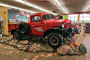
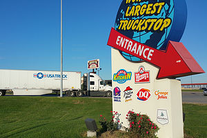 Entrance to Iowa 80 Truck StopAfter leaving my brother Jim’s house in Ohio, we still had over 2,400 miles to go to reach our new temporary home, our RV, which was stored in Petaluma, California. We had somewhat of a time constraint as well, since we had to beat the moving truck with our entire life’s possessions to our reserved storage unit in Santa Rosa, CA.
However, we needed some way to break up the trip and get some physical exercise along the way. Then it hit me – a tour of rock climbing gyms across the country. I quickly googled Iowa rock climbing gyms and looked for matches not too far from I80. Bingo! – Climb Iowa in Grimes, the largest climbing gym in Iowa, and less than a mile off of 80.
It was too far to get to today (about 670 miles), so we stopped at a Days Inn in Walcott, Iowa, right near Iowa 80, the largest truck stop in America. We would save that treat for tomorrow morning. In the meantime, it was time to get some dinner, so after asking the hotel clerk for a recommendation, we headed over to Gramma’s Kitchen for some Iowa homestyle cooking.
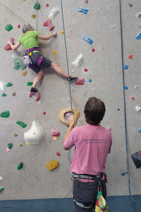 Herb belaying Kitty at Climb IowaWhat we learned at Gramma’s is that Iowans very much love their gravy, so much so that you can barely find your entrée beneath it. My turkey dinner was covered with a gelatinous brown blob, so salty that I could barely finish it. Meanwhile, at the table next to us, a man was asking for extra gravy for his steak. Our goal now was to get out of Iowa before our arteries clogged.
We couldn’t be so close to the largest truck stop in America and visit, so we stopped in for some Caribou coffee before continuing on 80 West. As one would expect at the largest truck stop, there was a Trucking Museum dedicated to the restoration and preservation of antique trucks and trucking artifacts. Maybe next time, but today I had climbing on my mind.
We arrived at Climb Iowa about 5 minutes before it opened. As we sat in the car, we noticed an elderly gray-haired woman, perhaps in her 70s, anxiously waiting by the door for it to open. Was she going to climb? I’m used to being the old lady in a climbing gym.
 Lolo and Kitty at Climb IowaLet’s just say that Kitty – that was her name; it was even embroidered on her harness – was the real deal. She was awesome, and so was the gym. I take back all my narrow-minded preconceptions that Iowa was such a flat state that it couldn’t possibly produce climbers.
Since that day, I have friended Kitty on Facebook and followed her achievements. She recently ice climbed a silo. That’s right. The people of Iowa have figured out a way to ice the sides of silos so that they can climb them, and Kitty was right there with her ice ax and crampons to show how it’s done. I hope that I will be like Kitty when I am 71. In fact, I wish I was like Kitty now.
New Jersey to Ohio
Friday, November 6, 2015 - 12:45pm by Lolo530 miles and 8 hours from our last stop - 2 night stay
Travelogue
 Jim and Charlie the BeaglePulling out of our driveway at the start of a cross country adventure has always filled me with anticipation and excitement about the adventures before us. This time, however, was a bit more emotional. We were leaving our home of 30 years for the final time and migrating West to start a new life. I couldn’t look back. From here on, it was forward – or else I would cry.
A visit with my brother Jim and his family is always a treat, so we made our first diversion off our planned I80 route to dip down to his home in New Albany, Ohio, voted, as he proudly states, the “Best Suburb in America” for two years in a row.
We were greeted enthusiastically by his very exuberant new Beagle pup, “Charlie,” who we had never met, but felt we knew from the dozens of posts my brother has made on Facebook of his new best friend. He was adorable, but not exactly the best watch dog, as he loves everyone he meets.
 Jim and BevNew Albany is a very walkable community, so later that evening, instead of getting in our car to drive to dinner, we strolled to the center of town and had dinner at the Rusty Busket, a cozy tavern about a quarter mile from his house. What a nice change to be able to walk to restaurants.
After dinner, we spent the rest of the evening sipping wine around my brother’s firepit, catching up and laughing about old times.
The next morning we accompanied Jim on his morning constitutional with Charlie. Walking Charlie was quite a unique experience. He was so interested in sniffing everything along the way that he actually walked sideways, sort of like a crab, while my brother dragged him along. I had never seen anything like it. When we asked Jim if Charlie had been trained at all, he said “No, that would take away his personality.” Ok good. At least he hadn’t been ripped off by a dog trainer.
 Jim and Herb with 32oz. BeersLater that day, we drove to the historic German Village in Columbus to have lunch at the famous Schmidt’s Sausage Haus. Herb is 100% German and loves a good “wurst,” so I think he was quite excited – or as excited as a German gets.
The place was mobbed, and we had to wait well over an hour to finally get a table. However, as promised by Jim, it was well worth the wait. Following Jim’s advice, Herb had a 32 oz. beer and the “Bahama Mama,” a huge platter of beef and port, hickory-smoked sausage. As if that was decadent enough, we had their famous Jumbo Cream Puffs for dessert. I was pretty sure we wouldn’t need to eat again until we got to the West Coast.
A stroll around the historic German Village helped get the digestion process started, but it had its work cut out for it.
The next morning it was time to say our goodbyes and hit the road – next stop Iowa.
San Francisco North / Petaluma KOA and Flight Home
Tuesday, September 8, 2015 - 11:00am by Lolo196 miles and 4 hours from our last stop - 2 night stay
Travelogue
Not much to report here -- just a full day of cleaning the RV and prepping it for storage once again.
We did manage to squeeze in an afternoon of climbing at Vertex, a gym in Santa Rosa. It is a much smaller gym than Planet Granite in San Francisco, and the climbs are graded much harder. I just had to adjust my mindset to the new gradings. Nothing was really that easy though, so we certainly got a good workout.
Time to go home. As we took the Sonoma County Airport Express to the airport, we wondered if this would be the last time we had to fly home to New Jersey. Hopefully, before we returned to California again, our house would be sold and we would be coming out west permanently.
I guess we will just have to wait and see.
Description
The Petaluma KOA is an award winning camping resort located within an hour’s drive of San Francisco, Napa and Sonoma Valley Wineries, giant redwoods, and Sonoma County and California Coastal Beaches. It is considered to be the RV resort in the San Francisco Bay area.
On its 70 acres, there are 312 spacious RV sites, 32 camping cabins, and 10 Wine Country lodges.
Other amenities include:
• Guided tours of San Francisco (from May through October)
• Huge heated pool and spa
• Inflatable waterslide
• Rock climbing wall
• Huge playground
• Petting zoo
• Karaoke
• Hayrides and live weekend entertainment
The campground is open all year.
Truckee
Thursday, September 3, 2015 - 9:15am by Lolo200 miles and 4 hours from our last stop - 5 night stay
Travelogue
The second pre-planned stop on our five-week long trip (the first being Tuolumne Meadows) was meeting Andrew, Tommy, and Celeste in Truckee for a long Labor Day weekend of climbing.
Since Labor Day weekend is an especially busy time in climbing areas, we had made our reservations at the Prosser Reservoir Campground, about 6 miles north of Truckee, well in advance.
Donner Memorial State Park, Rainbow Bridge, and Snowshed Tunnels
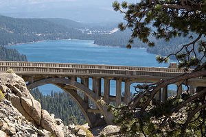 Rainbow Bridge and Donner LakeThe kids had been to Truckee before, but we hadn’t, so we were excited, as always, to see something new. Since they wouldn’t be arriving until late Friday night, we had all day Friday to explore the area on our own, and, as per Andrew’s instructions, to scout out climbing areas they hadn’t been to as yet.
We started out day at the Emigrant Museum in Donner Memorial State Park, on the eastern end of Donner Lake just south of I80 and 3 miles west of downtown Truckee. The park is named for the infamous Donner Party, a group of pioneers that met a tragic end on their 1846 journey west in this very spot of the eastern Sierras.
When the boys were little, they (and me) used to love playing a computer game called The Oregon Trail, where we took on the role of covered wagon leader, with all the responsibilities and difficult decisions that involved – how much and what type of food to bring, where and how to ford a stream, whether you should eat one of your oxen or have it pull your wagon, etc. I was usually lucky if my party made it out of Missouri.
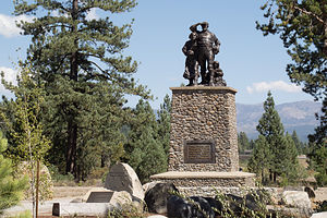 Donner Party MemorialThe game was very realistic and showed just how courageous and adventurous these pioneer families were. They left their old lives and most of their possessions behind them and entrusted their safe passage to their wagon leaders and trail guides. All along the way, they had critical decisions to make – having played the Oregon Trail game from the safety of my den, I felt for them.
One of the major decisions the Donner Party had to make was whether or not to take a recently discovered shortcut to California, which crossed Utah's Wasatch Mountains and Great Salt Lake Desert. It was advertised as saving 350 – 400 miles on easy terrain. Unfortunately, the route had never been tested.
Instead of quickening their passage, the difficult journey through the mountains and desert delayed them and depleted their supplies. Things just got worse and worse. When they finally reached Donner Lake in late October, a storm dropped 5 feet of snow. They were 12 miles shy of the Sierra Pass. They tried to make the pass through the snow, but had to retreat back to the eastern end of Donner Lake and hope that conditions would change.
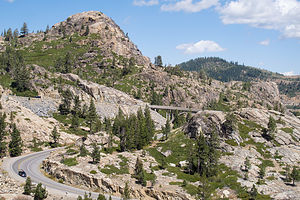 Rainbow Bridge and School RockTwo more attempts were made to get over the pass in 20 feet of snow, but they finally realized that they had to hunker down for the winter. Over the next four months they huddled together in cabins, make shift lean-tos, and tents. On November 29th, they killed the last of their oxen for food.
By the end of the winter, 40 members of the party had died, and 49 survived, many by resorting to cannibalism of their less fortunate family and friends.
The Emigrant Museum, which is on the very spot where these horrible events occurred, does a great job of telling their story, through compelling exhibits and an excellent movie.
Just outside the Visitor Center there is a stone pedestal commemorating the tragedy of the Donner Party. The stone marker is 22 feet tall, marking the height of the amount of snowfall during that fateful winter. Atop the pedestal stands a family of pioneers gazing west towards Donner Pass.
Besides preserving the emigrant experience, the museum also has exhibits that tell the story of the monumental challenge of the construction of the transcontinental railroad through Donner Pass. In 1868, after five years of a grueling construction effort by mostly Chinese laborers, the Sierra Nevadas were finally conquered by the Central Pacific Railroad when 1,659-foot Tunnel #6 through Donner Pass was completed.
All in all four tunnels, several miles of snowsheds, and two “Chinese Walls” were necessary to breach Donner Summit. Conquering Donner Summit was by far the most difficult challenge of the entire Sacramento to Ogden Central Pacific Railroad route.
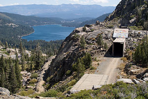 Snowshed Tunnel and Donner LakeI had always known that tunnels were needed to cut through the mountains, but I had never heard of snowsheds before, perhaps because on the East Coast, railroads don’t have to deal with avalanches and 20 feet of snow falling on their tracks.
We spent the rest of our day exploring the tunnels and snowsheds located along Donner Pass Road, west of Donner Lake, many of which we could walk through. There was a lot of brightly painted (obscenity-free) graffiti on much of them, but I would have to surprisingly say that that made them even more interesting.
A third topic of historical interest commemorated in Donner Memorial State Park is early motorcar travel and the construction of the Lincoln Highway (historic Route 40), which passed over Donner Summit on its route between Atlantic City and San Francisco. During the 1920s, the beautiful concrete-arched Rainbow Bridge was built to allow motorcars to get over the Pass without having to drive up and down steep 18% grades.
I am not sure which was more beautiful – the bridge itself or the views of Donner Lake and the surrounding mountains from it. Herb found a spot along the road above the bridge where he could get both in one frame, with the bridge nicely framing the lake in the background.
As we promised Andrew, we checked out two potential rock climbing areas: School Rock right near Rainbow Bridge and Snowshed Wall, located as you would expect, near a railroad snowshed, a short distance below the bridge. Both looked good, both in terms of climbing, ease of access, and tremendous views.
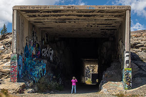 Lolo Photographing Snowshed TunnelWhen we got back to Prosser Reservoir Campground, I decided to go for a run on the dirt trails that veered off to and around the reservoir. Herb didn’t want to come, so I set off on my own and managed to get pretty lost – which I would have thought was impossible, except for the fact that I am very definitely spatially impaired. If I had only brought my phone, I could have looked on Google Maps where I was.
It wouldn’t have been so bad if it wasn’t starting to get dark. With my adrenaline pumping, I think I was running 4-minute miles in my attempt to get back to Herb and the motorhome in daylight – well, maybe that’s a little bit of an exaggeration. Anyway, I made it back, just as he was starting to worry about why I was gone so long.
Andrew, Tommy, and Celeste arrived around 11 pm. Usually they stay with us in the motorhome, but since they had other friends along this time, they camped in tents with them on the other sides of the campground. It was going to be a pretty chilly night for them – down around freezing. Nights like that really make me appreciate the motorhome even more.
Rock Climbing at Big Chief
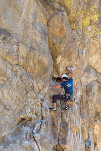 Andrew Leading Pow WowTommy knocked on our door early the next morning, sent by his brother on a mission to borrow a coffee mug. “I forgot how nice and toasty it is in here,” he said breathing out smoke from the cold air. He proceeded to sit down on the back couch, pretending to be interested in the educational video we were watching, totally forgetting about the purpose of his visit.
“Don’t you have somewhere else you’re supposed to be,” I finally said, and off he reluctantly went back out into the cold.
Later that morning, their friends left to go mountain biking, and we went with Andrew, Tommy, and Celeste to a climbing area called Big Chief, about 9 miles south of Truckee. Andrew suggested we take the Subaru Forester, because the last time he drove there in his Honda Civic, it almost bottomed it out several times on the bumpy dirt Forest Road that you have to go on for 5 miles to get to the trailhead.
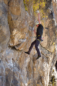 Tommy Leading Pow WowThere are several crags in the Big Chief Area, but they like the Center Wall, because it has climbs for climbers of all abilities, from 5.7 to 5.13+, most of which are sport routes. They thought this would be perfect place for all of us – even me – to have some fun. The other great thing about this wall is that it is in the sun for most of the day, so they would be able to thaw out from their chilly sleeping conditions.
There were so many good climbs that we spent the entire day there. I even managed to complete two 5.9s called War Path and War Paint. They did some more difficult ones, including a 5.11a called Pow Wow. I was starting to notice a theme here.
I really like climbing on volcanic rock because it tends to have a lot of features to hold onto. However, climbing outdoors does still intimidate me a bit, so I have to admit that I am happy when I am done for the day – especially after successfully completing a challenging climb.
I could very much understand why they liked this climbing area so much – volcanic rock, plenty of sport routes, a wide range of grades, afternoon sun, and great views.
Rock Climbing at Snowshed Wall
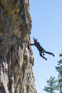 Herb Flailing on Pow WowAlthough tempted to go back to Big Chief for another day of climbing, we decided to explore one of the climbing areas near Donner Pass that we had scouted out the day before they arrived. Plus, I thought that they would be interested in seeing Rainbow Bridge and the tunnels and snowsheds along the old Transcontinental Railroad line.
The area we selected was called Snowshed Wall, appropriately named because of its location just beneath one of the snowsheds.
The approach was much easier than Big Chief – both the drive and hike in. Not that the Big Chief approach was a big deal. In fact, the hike in was quite nice. However, Snowshed Wall was visible from the parking access on Donner Pass Road and the walk in was less than 5 minutes.
Although they (not me) got a few climbs in, I would have to say that they very much preferred Big Chief.
After climbing, we parted ways – the kids drove down to King’s beach on Lake Tahoe to play beach volleyball with their friends, and Herb and I went back to Prosser Reservoir Campground to go for a run.
I tried to repeat the run that I got lost on, so I could figure out how I got so screwed up. Funny,
I didn’t realize how hilly it was at the time – probably because I was too worried about finding my way back to think about it. Maybe that’s a good training tip.
Secret Cove Beach
 Lolo Chilling at Secret CoveHere we were again – back at our favorite Tahoe Beach. We were starting to feel like one of the regulars that we see every time we come here. Practically everyone had just come back from Burning Man, so it was interesting listening to them share tales of their experiences at this rather unique annual gathering in the desert.
However, the highlight of my day occurred when Herb struck up a conversation with someone we had met the last time we had been here. “Do you like Smashball?” he asked Herb. Before Herb even got a chance to answer, he handed Herb a paddle and started hitting a ball at him. I don’t think this was exactly how Herb planned on spending his time at the beach, but darn if he wasn’t pretty good at it. I was so proud.
Around 2:00 pm, just like last time, the winds picked up and the water that had been like glass all morning, got rough and choppy. They even have a name for this wind – the Tahoe Zephyr, and it appears every day like clockwork. No more dips for me.
Before leaving, Herb got roped into one more Smashball session, breaking their previous record of 50 consecutive hits. I think he is ready to go pro.
After such an active weekend with the kids, it was so relaxing to just hang out at this pristine beach – reading, taking a dip in the chilly water, chatting it up with the locals, reading some more, etc.
From here the trip was pretty much done – just the drive back to the Petaluma KOA and then prepping the RV for storage and flying home.
Description
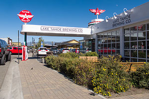 Downtown Truckee Flying A Service StationThe town of Truckee is located about 100 miles east of Sacramento just off I 80 and 11 miles north of Lake Tahoe. The historic downtown is steeped in Old West history. Back in the 1800s, railroad workers and lumberjacks frequented its many saloons, brothels, and gambling hall's. Although replaced today by trendy restaurants and boutiques, the downtown area is still fun to walk though.
Truckee is an outdoor enthusiast’s paradise with abundant recreational opportunities, such as skiing, hiking, and rockclimbing. Donner Memorial State Park is a wonderful place to learn more about this area’s fascinating history.
Nearby Prosser Reservoir Campground, just 6.5 miles north of Truckee, is a great place to camp. The 29-site campground is located at 5,800 feet on the west shore peninsula of the reservoir. There are no hookups.
Donner Memorial State Park
The park, which is located just south of I80 3 miles west of downtown Truckee, preserves the history of the area and the people who came to this part of the Sierra, including the infamous Donner Party and the Chinese builders of the transcontinental railroad.
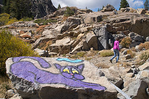 Lolo Hiking by the Snowsheds with Purple CatThings to see and do:
- Visitor Center and Emigrant Trail Museum
This interesting museum features compelling exhibits that tell the stories of the Emigrant Experience, the Donner Party, and the Chinese construction of the transcontinental railroad, as well as early motoring adventures over Donner Pass.
- Pioneer Monument
Adjacent to the Visitor Center stands a stone pedestal commemorating one of the darkest moments in American pioneering. In the winter of 1846-47, a group of 89 pioneers were en route to California when they encountered a severe snowstorm near Donner Pass, forcing them to spend the winter on the east side of the mountains. All but 49 of the party perished, and some of those that survived did so by resorting to cannibalism. The stone marker is 22 feet tall, marking the height of the amount of snowfall during that fateful winter. Atop the pedestal stands a family of pioneers gazing west towards Donner Pass.
- Tunnels and Snowsheds ot the Transcontinental Railroad
In 1868, after five years of a grueling construction effort by mostly Chinese laborers, 1,659-foot Tunnel #6 through Donner Pass was completed. The Sierra Nevadas had finally been conquered by the Central Pacific Railroad. All in all four tunnels, several miles of snowsheds, and two “Chinese Walls” were necessary to breach Donner Summit. Conquering Donner Summit was by far the most difficult challenge of the entire Sacramento to Ogden Central Pacific Railroad route.
Today, these tunnels and snowsheds can be explored by visitors. They are located along Donner Pass Road, west of Donner Lake.
- Rainbow Bridge
During the 1920s, this concrete-arched bridge near Donner Summit was built as part of historic Route 40, the primary highway for motorists traveling between Atlantic City, NJ and San Francisco before the construction of I80 in 1964. From the bridge the views of Donner Lake, the surrounding mountains, and the town of Truckee are spectacular.
- Donner Lake
Beautiful 2.7-mile long, 1-mile wide Donner Lake is popular for power boating, water skiing, sailing, kayaking, swimming, and fishing. From the lake, you can look up at rugged Donner Pass with the ill-fated party struggled to haul their wagons up the granite cliffs.
Sebastopol and Side Trips to San Francisco, Sonoma, Napa, and Marin Counties
Wednesday, August 26, 2015 - 9:00am by Lolo285 miles and 5.5 hours from our last stop - 8 night stay
Travelogue
Sonoma County is such a beautiful place with so many things to do, so we decided to head back to our base camp at the Petaluma KOA, where we would be in striking distance to the boys and lots of great activities.
Baker Beach, Planet Granite, and Pizzetta 211
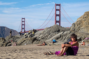 Lolo at Baker BeachWe had made arrangements with Andrew, Tommy, and Celeste to meet them at Planet Granite after they got out of work, but it was such a beautiful day that we decided to head down to San Francisco early and take a walk along the beach.
It is still so amazing to me that there can be such a beautiful beach within the limits of a major city. Being from New Jersey, we still have an issue with the Pacific Ocean water being so cold compared to the Atlantic, but the views definitely compensate. Its setting alone beneath the eucalyptus-covered rugged cliffs of the Presidio would be incredible enough, but the views of the Golden Gate Bridge and the Marin Headlands beyond it make it truly astounding.
Unlike our last time here, it was very warm, so people were actually frolicking in the water. It was such a lovely sunny day that it seemed like much of the city was out enjoying the beach in their own way – children frolicking in the water, couples walking hand in hand along the shoreline, nude volleyball players leaping around the sand – this is San Francisco after all.
Herb and I spent a pleasant hour soaking up the sun and the activity on the beach before heading out to Planet Granite.
Herb has been an avid rock climber for decades, but I am a rather recent and reluctant convert to the sport. However, now I absolutely love it and am usually the driving force for getting down to Planet Granite as often as possible when we are in the San Francisco area. It is an absolutely beautiful gym, with 50-foot high, floor-to-ceiling windows overlooking the Golden Gate Bridge, Alcatraz, and Crissy Fields. Plus, there are so many climbing routes of various difficulty levels that I could climb here for a week and never repeat a climb. It’s like a giant jungle gym for adults.
After a really fun and challenging two hours of climbing, we decided that 8:00 was about the time to quit and find some dinner. Rather than go out and sit in a restaurant when we were all sweaty, we picked up several pizzas from Pizzetta 211, one of their favorite pizza establishments in the Richmond district. I used to think that New York City had a monopoly on great pizza, but the artisan, thin-crusted pies with so many creative toppings at this place and so many others in San Francisco are truly amazing. For example, one of the pies we ordered was Farm Egg, Shiitake Mushrooms, Butter Braised Leeks, Truffled Pecorino, and Hazelnut Picada. A far cry from the pepperoni and peppers we normally add to our pie back in New Jersey.
Lake Berryessa and Napa Valley
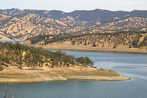 Lake Berryessa in DroughtAs I mentioned, we plan to move to Sonoma County once our house in New Jersey sells, so we are always on the lookout for how we can transition our old lives into new surroundings. One of the challenges in that transition is what to do about our 20-foot Grady White. Currently, we store it in our backyard and trailer it to destinations such as the Hudson River, Long Island Sound, the Connecticut River, Martha’s Vineyard, etc. The East Coast has so many great nooks and crannies that it is truly a boater’s paradise, and we were concerned about losing that when we move west, especially when California is in such an historic drought. We had seen firsthand just how devastating the drought was when we hiked near Lake Sonoma last year and saw how low the lake had become.
I had been told that Lake Berryessa in Napa County was one of the best places to boat, so we decided to take a drive to check it out – besides, I wanted an excuse to drive through Napa Valley.
However, although Sonoma and Napa Valleys are near each other as the crow flies, they are separated by the Mayacamas Mountains, so there are not many roads connecting the two, and those that do are usually quite steep and windy. However, at the southern end of the valleys, relatively flat Route 12 connects the two, so we began our drive north through Napa Valley in the town of Napa.
Another factor in our transitioning to a new home is proximity to a climbing gym. Strangely enough, at this point in my life, climbing a few times a week has become not just a luxury, but more of a necessity for my mental and physical well-being. So, just in case we expanded our eventual house search to Napa Valley, we stopped in the appropriately named Rockzilla gym in the town of Napa to make sure it would fit our needs. It was a really good gym, and the only one we have ever been to that has indoor chimney routes.
From there, instead of taking Route 29 through the Valley – we would save our vineyard tour for later -- we drove northeast on Highway 121 towards Lake Berryessa. The road got steep quite quickly and we climbed about 1,200 feet in the first 5 milea. For the next 40 miles it was pretty much up and down the whole way. I knew exactly what Herb was thinking – would we really want to trailer our Grady up and down this road?
When we got to our first view point of the lake near the Soda Creek Inlet, we were shocked. The Inlet was completely dry from the drought. Despite that, we could envision just how beautiful this lake would be, if only it had water.
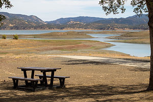 Lake Berryessa Dry Boat Launch RampWe continued driving on the Berryessa Knoxville Road, which traced the western shore of the lake, stopping first at the Bureau of Reclamation Field Office where we spoke to a ranger about the condition of the lake. It was, as she said, pretty dire and desperately in need of rainfall. At full capacity it is 23 miles long, 3 miles wide, and has 165 miles of shoreline. With such beautiful surroundings, this lake had such potential for some very awesome boating. Hopefully, the rains would come.
After this depressing stop, we continued on to the Oak Shores Day Use Area to have a picnic lunch. Once again, we could envision what a great place this would be to swim or launch or kayak, but the water was just too far away.
Spirits were a little low, as we seriously doubted this would be a good place for our boat – both in terms of the drive to get to it and the lack of water. We drove back down along the western shore, but instead of heading back towards the town of Napa, we took Route 128 west towards the town of Calistoga at the northern end of Napa Valley.
When we came to it, we took the alternative Silverado Trail, which parallels the section of 128 which goes through the valley, but is higher up and has much better views.
Calistoga is a very cute town, as our most of the towns in both Sonoma and Napa Valleys. Many of the names of the towns definitely let you know that you are in wine country – like Zinfandel and Kenwood.
From Calistoga, we could have taken one of the windy roads over the Mayacamas Mountains back to Petaluma – as was recommended as the shortest route by Google Maps – but we wanted to do the entire drive from Calistoga to Napa through the Valley. Also, we were pretty much done with roads that looked like intestines on the map and preferred using the flat Route 12 to get back to Sonoma.
So we spent an enjoyable 45 minutes driving past vineyards as far as the eye could see, avoiding the temptation – at least for now – of stopping in for a tasting.
My first Sonoma running club race and chillin’ in Sebastopol
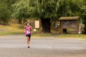 Lolo Racing with Empire RunnersWe are pretty much a family of runners. The boys ran cross country and track in both high school and college, and Herb and I run at least 3 or 4 times a week and compete in an occasional 5 or 10K race. However, my biggest love in recent years has been watching them run rather than participating myself, with the exception of an annual Turkey Trot.
When Andrew moved to San Francisco two years ago, he joined the running club that Celeste and her dad belonged to, which runs cross country and track races throughout the year. Tommy joined it as well when he moved there in August. Now that we were talking about moving to the area, they were very much pushing for us to join as well. I have been pretty competitive at the local level in the past, so they had high hopes of me running really fast – at least in the old lady class. Great.
So, I agreed to run in a 6K Empire Runners Club race in Spring Lake Park. This would be the first cross country race (as opposed to road race) of my life. I am not sure why at the tender age of 59 I am taking up rock climbing and cross country racing, but what the heck.
Not to make excuses, but my training had been rather light the last few months because of an ankle which I rolled while running behind Herb on the edge of a road. This happened the day after Andrew convinced me to register for the famous, and expensive, Bay to Breakers race in San Francisco on my upcoming visit.
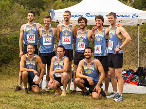 Andrew and Tommy with Empire Runners Club MensPushed by my rather obsessively competitive spirit, coupled with Andrew’s rather unrealistic faith in me being able to run 7 minute miles (which I hadn’t done in some time), I jumped back into training before the swelling even went down, and proceeded to sprain it again about a month ago.
Okay, enough with the excuses. Needless to say, it wasn’t my finest race, but it was fun nonetheless and made me want to train harder to get back to where I once was, and to not have Andrew ask me questions at the end of the race like, “What the heck happened to you? You looked like you were out for an afternoon jog.” Next time, I would show him.
The best part about racing is when it’s over, especially when followed by a big, delicious breakfast, which we had at the very popular Parkside Café in Santa Rosa.
Andrew, Tommy, Celeste, and Paul had raced very well, so they were rather uncharacteristically ready for a day of just relaxing and eating throughout the day. Great way to spend a day – if only we didn’t have to do that racing stuff first to earn it.
Point Reyes National Seashore
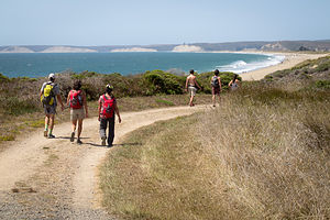 Hiking at Point ReyesThe Point Reyes National Seashore is an unbelievable treasure to have so close by. Just 40 miles north of San Francisco and 55 miles south of Sebastopol, it is an easy daytrip from either. Within its 71,000 acres, it has 110 miles of sandy beaches, over 150 miles of hiking trails, viewpoints for watching migrating whales and elephant seals breeding, and even a Tule Elk Reserve. Herb was especially excited about watching the elephant seals breed, but he was just going to have to wait until next winter.
On our last visit to Point Reyes, we had hiked in the Tule Elk Reserve, on sandstone cliffs high above the sea, but this time we (meaning our family and Celeste’s) chose to do the 5.5-mile Laguna Loop Trail, which would bring us out onto beautiful Limantour Beach.
After stopping briefly at the informative Bear Valley Visitor Center, we continued on to the trailhead, which was located right near the Hostel, just off Limantour Road.
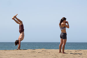 Andrew and Celeste at Point ReyesWe set off on the Laguna Trail which immediately began to climb for the next mile through coastal scrub and grassland before descending to the Fire Lane Trail. From here the trail remained pretty flat and at about the 2 ½ mile point, we found ourselves on a beautiful south-facing beach on Drakes Bay.
One of Herb and my fears of moving from New Jersey is replacing the beautiful beaches along the Jersey shore that we frequent so often, so we were delighted to find such a lovely one not too far from where we intended to move. A major difference though is that the Pacific is just too cold to swim in comfortably without wetsuits, so I don’t think we would be frolicking in the waves like we do back east. However, the incredible aesthetics certainly make up for it.
We made a note to return soon with beach chairs and books to spend a leisurely day in the sun. In fact, if you continue reading, you’ll see that we actually come back the very next day. Fortunately, there is a road and parking lot at the beach, so a 2 ½-mile hike laden with beach paraphernalia is not required.
This section of beach is part of the 16-mile Coast Trail, Point Reyes longest trail, which extends for 16 miles to the east to Palomarin Beach, near the southern tip of Point Reyes. However, we headed west along the Coast Trail, tracing the shoreline before it veered north back towards our cars.
Back at the trailhead, we played good Samaritans to a confused looking couple who had inadvertently hiked here rather than to where their car was parked back at Limantour Beach. Paul and Hilda kindly gave them a ride to their car before we proceeded to a late lunch at the Station House Café in the quaint town of Point Reyes Station, population 350.
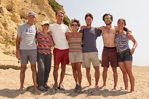 Happy Hikers at Point ReyesPoint Reyes Station is one of the many picturesque towns along the Northern California coast that cater to the crowds that leave the city and make the exodus up the coast each weekend to hike, bike, beach, shop, dine, and drink at these idyllic towns.
Although there were inside tables at the Station House Café, we decided to take one in their lovely patio garden, despite the warning that there might be some issues with bees. Fortunately, we didn’t encounter any, and we had a lovely, delicious lunch al fresco.
After lunch we said our goodbyes to Andrew, Tommy, and Celeste who headed down the coast back to the city where they went back to work the next day. They grumbled a bit about wanting to retire like we were, so they could do this kind of fun stuff every day, but we reminded them that they had a few more years of working life ahead of them before they got to that point.
Back to Limantour Beach
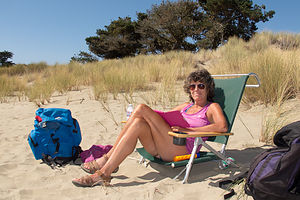 Lolo at Limantour BeachThis time we drove to the beach rather than hike and Herb loaded up his “system,” which consists of a large red backpack, stuffed with towels, books, and cooler and two wind guards attached to each of its sides, with the beach chairs draped over the poles. In all our times to various beaches, we have never seen this “system” duplicated. I am not sure if that is a good or bad thing.
Well, there’s not much to say about a day of sunning and reading at the beach, but let’s just say that it was really, really good.
I was just so happy that my sun-worshipping husband had found a place that made him happy.
North Sonoma Mountain Hike
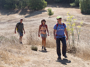 North Sonoma Mountain HikersSonoma County encompasses such an extraordinary geographical diversity – oceans, rivers, lakes, beaches and coastal cliffs, mountains and valleys, redwood forests, and more – and thankfully it has been blessed with some very forward-thinking land-use planning and conservation efforts, which have resulted in a majority of its acreage being preserved as open space for the public to enjoy.
There are 11 state parks in Sonoma County, ranging from beaches to mountains to redwood forests and historical sites, and I am proud to say that we have already been to 5 of them. It's nice to know that there are 6 more out there waiting for us to explore.
In addition to the state parks, there are 49 Sonoma County Regional Parks running the length of the county from Bodega Bay to Gualala on the coast, and from the Pacific to Sonoma Valley wine country. The parks encompass nearly 60,000 acres and have over 140 miles of hiking trails. We have already been to many of them, but it is nice to know that there are so many more to see.
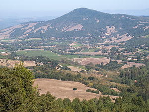 View from North Sonoma Mountain Regional ParkCeleste’s parents (Paul and Hilda) know the Sonoma area so very well, that they have pretty much been to all its park and hiked all its trails. That is why it was so nice to accompany them on a hike they had never been on before in the newly created North Sonoma Mountain Regional Park.
The vision for this park’s creation was connecting Sonoma Mountain with Jack London State Historic Park via a 4.5-mile multi-use trail. However, due to time constraints, we turned around after 3.3 miles and an elevation gain of 1,000 feet, with the promise of returning in the future to make the entire 9-mile, out-and-back trek to and from Jack London State Park.
Sonoma Plaza and Sonoma State Historic Park
We are quite enthusiastic history buffs, and being from the East Coast, we know our American Revolutionary War and Civil War history well, as there as so many wonderful historic sites to visit. However, we have a lot to learn about California’s history – from its period of Mexican influence to its brief independence to statehood.
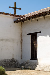 Mission San Francisco Solano de SonomaThe Sonoma State Historic Park, the site of the last of the 21 Spanish missions to be established and the place where the Bear Flag Revolt occurred, seemed as good a place as any to get up to speed on our California history.
We began our tour at the Visitor Center in the Sonoma Plaza, which was designed in the 1830s by Mexican Governor Mariano Guadalupe Vallejo. It is the largest Plaza in California and still serves as the town’s focal point today.
Our first stop was the Bear Flag Revolt monument in the northeast corner of the plaza, commemorating California’s short-lived history as an independent nation – in fact, it lasted less than a month. Briefly, this is how it went down.
During the early 1840s, many American settlers came to Alta Vista, but were prohibited by the Mexican government from owning land or holding office. Finally fed up, on June 14, 1846 they rode into Sonoma, arrested General Vallejo, and hoisted a hastily made Bear Flag right on this very spot in the Plaza. Without firing a single shot, they declared California an independent republic. However, less than a month later, an American naval vessel captured the Mexican capital at Monterey and claimed California for the United States. The Bear Flag was lowered from the Plaza and the Stars and Stripes rose in its place. Not completely forgotten though, the Bear Flag is the still the official flag of the state of California.
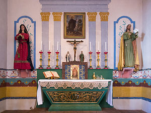 Mission San Francisco Solano de Sonoma AltarFrom there, we crossed the street to the Mission San Francisco Solano de Sonoma, founded in 1823 by Father Jose Altimira, This mission, which is the last and northernmost of the 21 missions in Alta California, was the only one to be built after Mexico had gained its independence from Spain. Like the other missions, its purpose was to convert Native Americans to Christianity. Unfortunately, this also seemed to involve using them as a cheap labor source.
The exterior of the Mission is made of white adobe with a plain wooden cross at the apex of its roof. There is a small museum inside with exhibits of mission life, religious paintings, and watercolors off all the California missions.
After viewing the exhibits, we entered the Mission’s most splendid room – the simplistically beautiful chapel. The long, narrow room, with white adobe walls like the exterior, is mostly empty, except for the raised colorfully painted wooden pulpit at the far end. A brightly painted green gate prevents visitors from entering the altar area. The soft choir music, sung in Latin, in the background added to the solemnity of the experience.
Our next stop was the Sonoma Barracks (or Presidio of Sonoma). In the 1830s, Mexican Governor Mariano Vallejo began construction of the Presidio of Sonoma as a way of countering the presence of Russians at Fort Ross. After its completion, Mexican soldiers were transferred from San Francisco to Sonoma and housed in this two-store, adobe building. Later in 1846 after the successful Bear Flag Revolt, the Barracks became the headquarters of the short-lived California Republic.
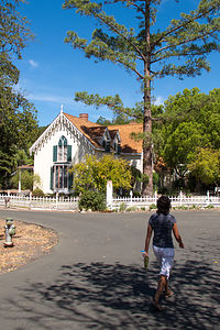 Lolo Approaching Lachyrma MontisOur final stop in Sonoma State Historic Park required a pleasant half-mile walk along a bike path northwest of the Plaza. The lovely path led us to Lachyrma Montis, the home of General Vallejo, whom you might remember as the Mexican Governor before the Bear Flag Revolt. Well, he stayed around afterwards and became both a U.S. General and a California State Senator. He embraced the American way of life and built a classic, Yankee-style, two-story Gothic home beside a spring. He named in Lachryma Montis (mountain tear), which is the Latin translation for Chiucuyem (crying mountain), the name of the free-flowing spring on the property. Vallejo and his family live in Lachryma Montis for 35 years.
On your way back to the Plaza, be sure to peek into the Toscano Hotel, an 1850s hotel and bar. We missed it on our way to Lachryma Montis. It is furnished with beautiful 19th-century period furniture. The bar downstairs is set up with old card tables and chairs, with antique photos and memorabilia on the walls. The kitchen and dining room, which are in a separate building behind this one, have blue-and-white checked tablecloths and a menu board listing the day’s specials.
The whole afternoon was an incredible, and very educational, trip back in time.
Description
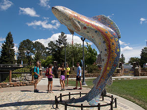 Santa Rosa Trout SculptureSebastopol is a charming town in Sonoma County, 52 miles north of San Francisco and about a 20-minute drive to the coast. Sebastopol is known for its apples and hosts an annual Apple Blossom Festival in April and the Gravenstein Apple Fair in August. Today, however, the apple orchards are becoming vineyards as wine-making moves more and more into the region.
Every Sunday, from April to mid-December, there is a Farmers market in the downtown plaza,
where people congregate to enjoy delicious fresh regional food, live music, and dancing.
Sebastopol is home to the artist, Patrick Amiot, known for his whimsical, cartoon-like, junk-art sculptures. There are over 200 of his wacky, found-object works scattered throughout Sebastopol, especially on Florence Street.
Two interesting side trips we took from Sebastopol:
Point Reyes National Seashore
The Point Reyes National Seashore is a 71,000-acre park preserve located on the Point Reyes Peninsula, about 40 miles north of San Francisco. It has 110 square miles of sandy beaches and over 150 miles of hiking trails.
Some interesting things to do within the park include:
- Bear Valley Visitor Center – exhibits and ranger-led programs
- Point Reyes Beach (Great Beach) – 11 mile expanse of Pacific shoreline
- Limantour Beach = sheltered beach with great birdwatching
- Mission Vision Overlook – panoramic view of Point Reyes Peninsula
- Point Reyes Lighthouse – great place to spot migrating gray whales in winter
- Chimney Rock – great viewing spot to watch elephant seals as they breed and molt
- Drakes Beach – sheltered beach beneath sandstone cliffs
- Abbotts Lagoon – 1.5-mile trail to diverse bird habitat and nesting area of snowy plover
- Tule Elk Reserve – hunted to near extinction in the 1800s, Tule elk were reintroduced in 1978 to this designated wilderness
Historic Sonoma Plaza
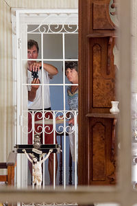 Herb and Lolo in Lachyrma MontisIn the 1830s, Mexican Governor Mariano Vallejo began construction of the Presidio of Sonoma as a way of countering the presence of Russians at Fort Ross. After its completion, soldiers were transferred to Sonoma from San Francisco. Vallejo also designed the Sonoma Plaza, which today is the largest Plaza in California. Today the plaza is a National Historic Landmark and still serves as the town’s focal point.
The eight-acre park is surrounded by many historical buildings and sites, including:
- The Mission San Francisco Solano de Sonoma
Founded in 1823 by Father Jose Altimira, this mission was the last and the northernmost mission in Alta California. It was the only mission built after Mexico had gained its independence from Spain.
- The Sonoma Barracks (or Presidio of Sonoma)
Mexican Governor Mariano Guadalupe Vallejo had this two-story, adobe building facing the central plaza built to house the Mexican soldiers transferred from San Francisco.
After the successful Bear Flag Revolt of 1846, in which a group of American immigrants took over the Pueblo of Sonoma and established their own California Republic, the Barracks became the headquarters of this short-lived insurrection.
- Site of the Bear Flag Revolt
During the early 1840s, many American settlers came to Alta Vista, but were prohibited by the Mexican government from owning land or holding office. Finally fed up, on June 14, 1846 they rode into Sonoma, arrested General Vallejo, and hoisted a hastily made Bear Flag at the northeast corner of the plaza. Without firing a single shot, they declared California an independent republic. The Sonoma Barracks became their headquarters.
The newly established California was very short lived. Less than a month later, an American naval vessel captured the Mexican capital at Monterey and claimed California for the United States. The Bear Flag was lowered from the Plaza and the Stars and Stripes rose in its place.
Today the Bear Flag is the official flag of the state of California. The monument to the Bear Flag can still be found in the northeast quadrant of the plaza.
- Lachryma Montis
After California became part of the United States, in 1849 General Vallejo embraced the American way of life and built a classic, Yankee-style, two-story Gothic beside a spring about a half mile northwest of Sonoma Plaza. He named in Lachryma Montis (mountain tear), which is the Latin translation for Chiucuyem (crying mountain), the name of the free-flowing spring on the property. Vallejo and his family live in Lachryma Montis for 35 years.
Lake Siskiyou Camp Resort
Sunday, August 23, 2015 - 7:15am by Lolo100 miles and 2.5 hours from our last stop - 3 night stay
Travelogue
 Lolo Kayaking in Wagon Creek InletThe drive north up 89 to Lake Siskiyou near Mt. Shasta was scenic and relatively short -- just a little over 2 hours – a perfect driving day for Herb.
We had been to Lake Siskiyou Camp Resort before and really enjoyed boating around the lake with the formidable Mt. Shasta looming over us. On our last visit, Mt. Shasta had been completed blanketed in snow making for some very awesome pictures. This time, however, we were shocked to see that the volcano was brown with only tiny patches of snow. Granted, it was August and last time we had seen it in May, but from what we heard and read, the snow deficit resulting from the drought was pretty historic. In fact, during the prior two winter seasons, the Mt. Shasta Ski Resort was barely able to open, hurting the local economy that depends on the influx of skiers to the area.
Kayaking around Lake Siskiyou
 Herb Kayaking in Wagon Creek InletSince the day was still young, we launched our kayaks at the boat ramp, and spent the day paddling around the lake. I couldn’t believe what a difference the lack of snow on Shasta made on the overall experience. It probably would have been better if I didn’t know what I was missing, because then I could have enjoyed the lake and its beautiful surrounds more without lamenting what wasn’t.
Going counter-clockwise around the lake, we soon came to the Lake Siskiyou Splash Zone, where there were several large inflatable structures to climb up on and jump from. It looked like a lot of fun. I was tempted to get out of the kayak and play on some, but I hadn’t purchased a ticket, which costs $8 per hour. Also, everyone else playing on them was either under 10 years old or a parent.
Continuing on, at about halfway around the lake, we paddled into Wagon Creek Inlet and passed under the picturesque, green, arched pedestrian bridge, which provides a perfect frame for photos of Mt. Shasta in the background. This is my favorite part of the lake.
After floating and eating lunch, we continued along the northern shore of the lake, stopping once more at an interesting area where the shoreline is studded with stumps that are normally submerged during wetter times.
All in all, the trip around the perimeter of the lake was 5.9 miles and took us a little over 4 hours – and that’s with lots of just lean-back-and-float time included.
Hiking Gray Butte and Exploring Mt. Shasta City
 Subaru in Old Ski Bowl parking lotI often consult my Moon California Hiking book when selecting a hike. I like the way they rate hikes on a scale of 1-10 for scenic beauty and 1-5 on difficulty (one being the easiest). The hike to the top of Gray Butte near Mt. Shasta was rated a 10 and 2, respectively – perfect!!
The 14-mile drive along the Everitt Memorial Highway from Mt. Shasta City to the trailhead was a worthwhile activity in itself. We intentionally drove past the Panther Meadow Campground, where the trailhead was, and continued about another mile to the Old Ski Bowl parking lot, the highest point you can drive on Mt. Shasta.
While today, this is the starting point for several hikes, including the one to the summit, it used to be a downhill ski area. Built in 1959, this early day ski resort was pretty ill conceived. Located in a huge open cirque above the tree line at 8,000 feet, it was constantly plagued with avalanches, whiteouts, and road closures. During a 1959 storm that lasted 5 days, it received 16 feet of snow, breaking a Guinness Book of World Records record.
 Lolo with Romantic Art WorkAlthough it was in operation for nearly 20 years, a huge avalanche in 1978, which destroyed its main chair lift, finally resulted in it permanently closing down. Eventually in 1985 a new ski park was built lower down on the mountain in an area below the timberline that was safe from avalanches. Ironically, its problems the last two years have been due to lack of snow.
It was too early for us to utilize one of the picnic tables in the cirque, but we did take time to admire the romantic art work – a heart and “Love” spelt out in large white rocks.
We drove the short distance back to the Gray Butte trailhead in Panther Meadows Campground. From the campground, we passed through lovely Panther Meadow, with Mt. Shasta constantly in our sights, before entering a red fir forest.
At about 0.6 miles, we came to a junction with the Gate Trail, which leads off to the north toward a volcanic valley that some believe to be the mountain’s sacred portal to the spiritual dimension. We decided to skip the spiritual dimension for today and continued south along the more secular Gray Butte trail.
 Lolo Hiking up to Gray ButteAs we continued our climb along the eastern side of the butte, the trees changed from red fir to hemlocks. In fact, this area is recognized as one of the best hemlock groves in northern California. About a mile into the hike, we passed through a clearing along the top of a large talus slope falling off to the east, where we could see Red Butte off to the left.
At about 1.2 miles, we made a sharp turn to the right (west) and began hiking along the southern side of Gray Butte. From here, our views were more of the manmade variety as the towers and antennas of the Gray Butte communication facility came into view off to the south.
At 1.6 miles, the trail went right (north), and we climbed along a clearing with stunted hemlocks. Another 0.3 miles and a short scramble over sharp volcanic rock brought us to the 8,119-foot summit of Gray Butte where we were rewarded with tremendous views of Castle Crags, Mount Lassen, and, of course, the ever present Mt. Shasta.
This is an out and back hike, so from there we retraced our steps down to Panther Meadow Campground.
 Lolo on Descent from Gray ButteRather than head right back to the campground, we decided to explore Mt. Shasta City for a bit, starting with lunch at the highly Yelp-rated Yaks Cafe. It did not disappoint with its artisan coffees, gourmet burgers, excellent salads and sandwiches, and much more. We had a very delicious salad and coffee.
Herb wanted to pick up some foam to support the kayaks on the roof rack, so we stopped in a local hardware store. Everyone was so extremely friendly, helpful, and yes, spiritual – something you don’t often find in a hardware store.
As with many other volcanoes, Mount Shasta is considered to be sacred, and spiritual seekers from around the world come here for healing and transcendence. Even customers in the hardware store were talking about their spiritual health. We just needed foam.
Like Sedona, Arizona, Mount Shasta is believed to be the site of a spiritual vortex, an area of high energy concentration originating from magnetic, spiritual, or unknown sources. Vortexes are also thought to be the gateway or portal to other realms, both spiritual and dimensional. If we had made a left rather than a right turn at The Gate trail junction on our hike earlier that day, we could have possibly entered one. We are just too boring and pragmatic to achieve transcendence on a hike.
 Lolo Approaching Headwaters of the Sacramento RiverWe headed next to Mt. Shasta City Park to search for and drink from the headwaters of the Sacramento River. The search was pretty easy – it was well signed out – but the filling of my water bottle was a bit more of a challenge, as I clambered on rocks and barely avoided falling into the headwaters on my hindquarters.
On the way back to the campground we made a stop at the Mt. Shasta Sisson Museum, a small, volunteer operated museum dedicated to preserving the history of Mt. Shasta area. It is on the same grounds as the oldest fish hatchery west of the Mississippi. Admission to the museum is free, but a $1 donation is suggested.
We spent a fun half hour exploring the photographs and exhibits explaining the history of the town and the mountain. Our favorite exhibit was one in which you could sit in a simulated train engine and pretend that you are the conductor – fun for kids of all ages.
Back at Lake Siskiyou Camp Resort, we sipped some wine on the beach overlooking the mountain before retiring back to our campsite.
It had been a very full and fun day.
Hiking to Heart Lake and Kayaking around Castle Lake
 Heart LakeThe girl behind the counter at Yaks Café yesterday had told us that her favorite lake in the area was Castle Lake. She said that it was very beautiful and much more secluded and quiet than Lake Siskiyou – and a great place to launch kayaks.
It wasn’t very far from our campground – just a mile on the road back towards town, and then 7 miles south on Castle Lake Road.
This was a two activity stop, the first of which would be a 3-mile round-trip hike to even more secluded Heart Lake.
From the parking area, we followed the trail left along the eastern side of the lake. Fairly quickly, the trail veered away from the shoreline and began climbing up the eastern wall above Castle Lake. As we continued to climb, we occasionally caught views of the lake through the trees.
After hiking a little over a mile and making about a 600-foot elevation gain, we came to a saddle and began looking around for the trail. It certainly was not very clearly marked or heavily traveled. Finally, Herb spotted a faint trail to the right. I was not totally convinced, but it was the only game in town, so we followed it up toward a high ridge. Herb was right. Once we reached the top of the ridge, there it was – tiny but lovely Heart Lake right below -- and it really was shaped like a heart.
 Mt. Shasta with Castle LakeWe walked the short distance down the trail to a rocky outcrop that extended into the lake. In fact, it was this protrusion of rock that gave the lake its heart shape. What a romantic place for lunch. I could practically hear the mushy things Herb was going to say to me over our turkey sandwiches.
After lunch, we walked counter-clockwise around the lake and continued west up a rocky trail to a tremendous view of Mt. Shasta with Castle Lake in the foreground below. What a beautiful spot!
The way back was easier to navigate and before long we were back at Castle Lake, where we launched our kayaks at the short, but steep ramp near the parking area.
The lake is stunning – set in a glacial cirque with water as blue as Tahoe’s. Its striking blueness is a result of its pureness and low nitrogen content. UC Davis scientists have been sampling and studying the lake since the 1950s.
 Lolo Kayaking Castle LakeWe started paddling along the western shore to the lake’s most prominent feature -- a high back wall of granite rising from the southwestern shore.
The whole trip around the perimeter of the lake was only 1.3 miles, so after returning to the boat launch, we decided to head back out on the lake. This time I had my eye on the second most prominent feature in the lake – a raft at the southern end, perfect for sunbathing. Unfortunately, a couple had beaten us to it and no amount of casually circling nearby triggered them to give it up. Oh well.
What a great paddle though! I was really enjoying all the opportunities for kayaking in some of the most beautiful lakes in California. We had gotten our kayaks out on the water more this trip than all the other trips combined. What a way to explore a beautiful area!
Sundial Bridge in Redding
 Sundial Bridge and SunOur drive back to our base camp in Petaluma took us south on I5 past the depressingly low waters of drought-ridden Shasta Lake, and near the town of Redding, where we exited to take a brief side trip to see the famous Sundial Bridge.
This steel, glass, and granite bridge, which was completed in 2004, was designed by the world renowned Spanish architect and engineer Santiago Calatrava. As its name suggests, the bridge is an actual functioning sundial, and one of the largest in the world. However, it is more of a technological marvel and work of art than a replacement for your watch, as its sheer size limits its time keeping abilities. The shadow traces such a large arc that it can only reveal the time between 11 am and 3 pm. Also, in winter the shadow is too far into the nearby arboretum to be seen. When the shadow is visible though, as it was when we were there, you can actually see it move, which it does at the rate of about one foot per minute.
It is definitely worth the stop for anybody passing through Redding.
Description
 Mt. Shasta with Lake SiskiyouThe Lake Siskiyou Camp Resort is located just 3 miles west of Mount Shasta City, on the lovely shores of glacier-fed, 435-acre Lake Siskiyou. With fantastic views of snow-covered Mount Shasta from its shores, it is one of the prettiest reservoirs in Northern California.
The 7-mile dirt Lake Siskiyou Trail, which encircles the lake, is popular with walkers, joggers, and mountain bikers. The views of Mount Shasta along the way are awesome.
There is a large 150-site, very popular campground for RVs of any length, with full and partial hookups. There are 225 additional sites for tents. There is also a marina, boat rentals (canoes, kayaks, pedal boats, motorized boats), free boat launching, a fishing dock and fish-cleaning station, boat slips, and a swimming beach.
 Lolo in Lake Siskiyou Splash ZoneRecreational opportunities on the lake include:
• swimming
• trout and smallmouth bass fishing
• low-speed boating (boat ramp and boat rentals available)
• hiking the Lake Siskiyou Trail
Lassen Volcanic National Park
Thursday, August 20, 2015 - 6:30am by Lolo213 miles and 4.5 hours from our last stop - 3 night stay
Travelogue
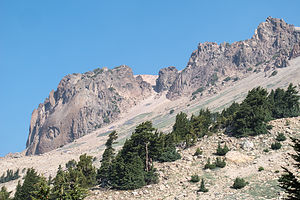 Vulcan Eye of Lassen PeakWhen we had visited Lassen in 2013, the trail to the top of Lassen Peak was closed, because of a multi-year trail restoration project, which was triggered by the tragic death of a 9-year-old boy in 2009 when a retaining wall supporting the trail gave way, hurtling him down the rocky mountainside.
The National Park Service closed the trail to the peak for 6 years while it reconstructed and stabilized the retaining walls and stone steps along the trail. The trail reopened in the summer of 2015.
Lassen Peak had always been on our list of classic hikes in the west, so when we heard the news about the trail reopening, we added Lassen to our trip itinerary. A phone call to the Manzanita Campground confirmed that we would have no trouble getting one of the first-come-first-served RV sites if we arrived on a weekday.
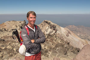 Herb at Lassen Peak OverlookWe left Camp Richardson bright and early on a Thursday morning and made the 5-hour scenic drive up 395 through Reno and west on 44 through Susanville and then down 89 into the Park.
It was too late to start any big hikes, so we stopped at the Visitor Center / Loomis Museum and watched the movie about the park. The National Park Visitor Centers does a very good job at orienting people to the parks, and I find that the movies are always extremely well done, informative, and a pleasure to watch.
Afterwards we selected one of the first-come-first-serve campsites in the nearby Manzanita Lake Campground, where there is a sandy beach, a place to launch kayaks, and a 1.5-mile trail encircling the lake. For this evening, we chose beach chairs and a bottle of wine on the beach.
Hiking to Lassen Peak
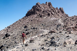 Lolo on Trail between Lassen SummitsThis was the big day – the hike to Lassen Peak and the reason we had returned here.
10,457-foot Lassen is quite a noteworthy geological attraction. Besides being the southernmost active volcano in the Pacific Ring of Fire, a string of 20 volcanoes which stretches 700 miles from southwestern British Columbia, it is the largest plug dome volcano in the world. This type of volcano is formed when the lava is too viscous to flow very far and instead piles up around the vent, creating a big dome
It is also the site of the second most recent eruption in the Cascade Range, which occurred in 1914 to 1917. The explosion spewed rock, gas, and volcanic ash as far away as 200 miles and triggered a mudflow, known as a lahar, which destroyed a 5 square kilometer area, now appropriately named the Devastated Area, which, on a clear day, can seen from the summit.
 Helen Lake View from Lassen Peak HikeOn a really clear day, you can even see Mt. Shasta, 100 miles north, from the summit. However, this was the summer of intense wildfires in Northern California, so we were just hoping that our views from the summit wouldn’t be completely obstructed by the smoke. At least it was a lot clearer than yesterday.
We parked in the huge parking lot at the base of the peak, which sits at an elevation of 8,500 feet – almost 2,000 feet below the summit. This is an extremely popular trail, so we were surprised at how empty the parking lot was. Perhaps it was because it was a weekday. Whatever reason, we were thrilled about having the trail pretty much to ourselves.
From the parking lot, we began the ascent up the south face of Lassen. There aren’t many trees along the way, so there is little shade, but great open expansive views. After about a half mile, the switchbacks started and didn’t let up until the top.
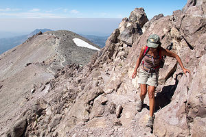 Final Scramble to Lassen PeakAfter about 2.4 miles, we came to what I initially thought was the top, but turned out to be a false summit. I hate when that happens. To reach the official summit, we had to hike down into the saddle between the two summits and then scramble up the talus on the rim of a crater. The correct path to the top was not very clear, so we just went where it felt right. It wasn’t that easy and probably explained why many people just satisfied themselves with the first summit.
The brass geological survey marker we found on top confirmed that we had indeed reached the official summit of Lassen Peak at 10,457 feet above sea level. Thankfully we had been acclimating to higher altitudes for the last couple of days or the scramble to the top would have been much harder. Unfortunately, the skies were still quite smoky from the fires, so we weren’t able to see Mt. Shasta, but the views were still quite incredible.
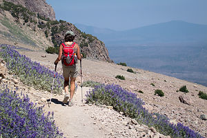 Lolo on Descent from Lassen PeakThe 2.6-mile hike down was much easier aerobically than the way up, but as usual, tougher on the knees. I think we were pretty quick though - an hour and 15 minutes up and 55 minutes down. Much less than the 3-5 hours suggested by the hiking guide books. Well, I guess maybe if you add the time spent on the summit admiring the view, 3 to 5 hours is a pretty good estimate.
On the drive back to the campground, we stopped at the Chaos Crags and Jumbles Scenic Pull-out for our daily cell coverage fix. It was the only place in the park where you could consistently get coverage. Everybody seemed to know about it, and there was always a car or two parked here with the driver yapping on the phone. Providing cell coverage is the one thing (and probably the only thing) that I would change in the national parks.
Chaos Crags was worth a stop even without the coverage. There are hundreds, if not thousands, of boulders strewn over a couple of square miles from an avalanche that occurred 350 years ago from the Chaos Crags lava domes.
Hiking to Mill Creek Falls and Kayaking around Manzanita Lake
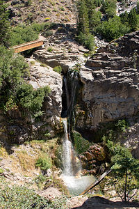 Mill Creek FallsI think the second most popular hike in Lassen Volcanic National Park is the hike to Bumpass Hell, Lassen’s largest hydrothermal area, complete with bubbling hot springs, boiling mud pots, and hissing fumaroles. However, we had done that on our last visit, so we looked at online hiking trail sites for something new.
The 4-mile out and back hike to Mill Creek Falls, the highest waterfall in Lassen Park, was just what we were looking for. Not only would this be a new hike for us, but just getting to the trailhead would have us drive along a section of the scenic, windy park road that we had not been on as of yet. The trailhead is located right behind the amphitheater on the east side of the Kohm Yah-mah-nee Visitor Center parking lot, near the southwest entrance to the park.
We set off on the trail, which led through the Southwest Campground, set in a lovely red fir forest. After about 0.2 miles, we crossed West Sulphur Creek and began climbing a steep sunny hill totally covered with clumps of huge brown leaves shaped like mule ears. We are not botanists by any means, so at the time all we knew was that they were dead and very interesting to photograph. We later learned that they are woolly mules ear wildflowers that blossom with lovely yellow flowers in July. We had just missed them by a month.
From there the trail continued along East Sulphur Creek, constantly going up and down a series of gullies. At about a mile and a half the trail descended steeply and we got our first glimpse of Mill Creek Falls, with a drop of 75 feet.
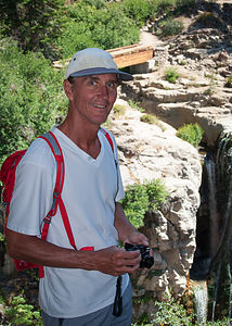 Herb at Mill Creek FallsAlthough the official trail description ends at this point, we continued on and crossed a footbridge directly over the falls and gazed below at the water cascading down a narrow canyon. A second footbridge led over a second creek that fed the falls.
The trail continued on to Conard Meadows and Crumbaugh Lake, but this was our turning around point. Herb took off ahead of me to go back to the viewpoint above to photograph the falls. I thought he wanted me as a subject on the footbridge, so I spent about 10 minutes in various poses before joining him up at the viewpoint, only to learn that he didn’t even know I was on the footbridge. Too bad – it would have been a great photo.
The trail was an out and back, so we returned from whence we came, once again up and down the gullies. Although the waterfall was at about the same elevation as the trailhead, our GPS confirmed what I felt – our elevation gain was close to 1,000 feet.
I used to think that elevation gain was the difference between the elevation at the start and the elevation at the highest point of the hike, but it’s not. Elevation gain is the sum of every gain in elevation you make throughout a hike, and elevation losses don’t count.
It was really surprising to me that the elevation gain on the hike up to the top of Lassen Peak yesterday was 2,082 feet, and our Mill Creek Falls hike today was 949 – almost half. That seemed so crazy.
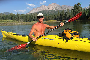 Herb Kayaking Manzanita LakeAfter our hike, there was still plenty of time for another activity, so we launched our kayaks in Manzanita Lake. I was so glad that Herb decided to keep the kayaks on the roof of the Subaru rather than going through the contortions required to put them back on top of the motorhome after each usage. This way it wasn’t a big deal to get them down, and we used them so much more. Already in the past week we had kayaked around Tenaya Lake in Yosemite, Mono Lake, Falling Leaf Lake in South Lake Tahoe, and now Manzanita Lake – more times in one trip than we had used them in the entire two years they had lived in California.
It was only a mile and a half paddle around the lake, but a very rewarding one. While there are no expansive views from the launch area, once we got to the far side of the lake, Lassen Peak and Chaos Crags revealed themselves in all their splendor. It was nice to just lie back, float, and take in the surroundings. I think I was really perfecting this technique of kayaking.
For those without kayaks, there’s a trail around the lake that provides the same spectacular views.
Description
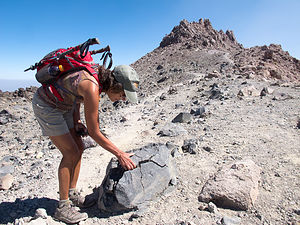 Lolo with Rock on Lassen False SummitLassen Volcanic National Park in northern California contains Lassen Peak, the southernmost volcano in the Cascade Volcanic Arch, which extends for over 700 miles from British Columbia through Washington and Oregon to northern California. The Cascade Volcanoes are part of the Pacific Ring of Fire, the ring of volcanoes and associated mountains around the Pacific Ocean.
10,457 foot Lassen Peak is the largest plug dome volcano in the world. These types of plug or lava domes are formed when the ejected lava is too viscous to flow very far, and instead piles over and around its vent, creating a big dome over the volcano.
Although dormant now, Lassen Peak was the site of the most recent volcanic eruption in northern California. It began in 1914, spewing rock, gas, and hot ash billowing into the atmosphere. In 1915 it blew a cloud of ash almost 6 miles high and triggered a mudflow, known as a lahar, which wiped out a 5 square kilometer area now called the Devastated Area, which can still be seen today. It erupted for seven years before finally settling down in 1921.
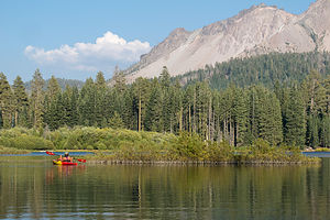 Manzanita Lake with LoloThe park is the only place in the world where all four types of volcano can be found: plug dome, shield, composite, and cinder cone. In addition, in Bumpass Hell in the southern part of the park there are bubbling hot springs, boiling mud pots, and fumaroles in six geothermal fields. It is quite a geologically active place.
If you only have a day to visit the park, the best way to see it is to drive the 30-mile Lassen Volcanic National Park Highway, stopping at various highlights along the way. Starting from the northwest entrance, the following are some very worthwhile stops along the way:
- Manzanita Lake – the iconic photo of the park is Lassen Peak reflected in this beautiful lake. It is also a good place to kayak, fish, or hike around its shores.
- Loomis Museum where one can view artifacts and photographs from the park’s 1914-1915 eruption
- Chaos Crags and Jumbles Scenic Pull-out – the site of an avalanche 350 years ago from the Chaos Crags lava domes, which scattered hundreds of thousands of large rocks over a couple of square miles
- Devastated Area – a ½-mile interpretative trail looks through the devastation caused by Lassen’s 1914 eruption
- Summit Lake – the midpoint between the northern and southern entrances, this is a great place to take a dip in Summit Lake or to stroll around it on the loop trail.
- Kings Creek picnic area – lovely spot to stop for lunch where the Kings Creeks flows through a meadow at the foot of Lassen Peak
- Lassen Peak Parking Area and Viewpoint – this is the highest point on the park road at 8,512 feet. From here you can just enjoy the view or, for the more adventurous, hike the strenuous 2 ½ mile to the summit, where you can look into the rim or out over the entire park. (This trail is currently closed for trail maintenance beyond the halfway point)
- Bumpass Hell – a 3 mile roundtrip hike brings you up close to bubbling hot springs, boiling mud pots, hissing steam vents (fumaroles)
- Sulphur Works Thermal Area – located near the southern entrance to the park, this is the most easily accessible hydrothermal area, where paved walks lead past boiling springs, burbling mudpots, and sulphur-emitting steam vents.
There are three campgrounds along the Lassen Volcanic National Park Highway that accommodate RVs:
- Manzanita Lake Campground – located near the northwest entrance to the park and adjacent to Manzanita Lake. The campground offers swimming, fishing, kayaking, and hiking. It is the largest of the Lassen campgrounds with 179 sites, some of which can be reserved. It is open from the end of May until it snows.
- Crags Campground – located five miles south of Manzanita Lake on the main park road. The campground offers easy access to the Lost Creek and Devastated Areas, in addition to Crags and Manzanita Lake. There are 45 RV sites, and operates on a first-come-first-served basis. It is open from mid-June to mid-September.
- Summit Lake Campgrounds - located 12 miles south of Manzanita Lake. The campground is comprised of a North and South section, each with access to the lake. There are 94 sites, some of which can be reserved. Summit Lake North is open from late June through mid-September and Summit Lake South is open from late June through late October.
South Lake Tahoe area
Monday, August 17, 2015 - 1:45pm by Lolo120 miles and 3 hours from our last stop - 3 night stay
Travelogue
 Secret CoveOur drive from Lee Vining to South Lake Tahoe took us north along one of our favorite roads - US 395, also known as the Eastern Sierra Scenic Byway. However, Google Maps suggests that you turnoff 395 onto 89 in the town of Topaz and go through Monitor Pass to get over the Sierras. We had done this on a previous trip, and swore to never to do it again.
In fact, we now know to avoid any road that starts off with the warning “Kingpins not advised.” Since that time, we purchased a book on Amazon called “Mountain Directory West for Truckers, RV, and Motorhome Drivers.” It’s pretty expensive – I think Herb paid about $30 for it used, but when you consider the dangers it helps you avoid, it is money well spent. The guide tells you where the steep grades are, how long they are, how steep (%) they are, etc. For example, it describes Monitor Pass as having a 7–10% grade for 7 ½ miles. We really don’t like grades steeper than 6%.
So now, we stay on 395 and go into Nevada to the town of Minden and then take 88 back down to 89 after the Pass. It adds a few miles, but saves us from getting a few more gray hairs.
Our destination in South Lake Tahoe was Camp Richardson, a lakeside resort with RV camping, lodging, a full-service marina, and restaurant on the water. It was quite nice and really in the heart of things.
 Lake Tahoe WatersAfter driving the motorhome, Herb usually likes to just sit and relax for awhile, while I, on the other hand, am a bit hyperactive and can’t wait to get out and explore. He suggested I go out for a run, knowing that that was his only chance of getting any peace and quiet. Ok, I can take a hint, so I put on my sneakers and set out across the road towards the lake.
I ran along the beach a bit before finding a paved trail that took me into the Tallac Historic Site where I found myself weaving amongst the buildings of what were obviously parts of an old estate. It was really cool and I was anxious to go back and tell Herb all about it. I’m not sure if he was as anxious for my return, however.
After telling him that we definitely had to go back there so he could see it, I looked up Tallac Historic Site on the internet and learned that what I had seen were three private estates from the early 1900s – the Baldwin Estate, the Pope Estate, and Valhalla. Back then, Lake Tahoe was a summer retreat for socially prominent families from the San Francisco Bay area -- sort of a Newport of the West Coast. Today thanks to the Tahoe Heritage Foundation and the U.S. Forest Service, visitors can step back in time and visit these estates, each designed in the “Old Tahoe” style.
For now, however, cocktail hour was approaching, so we threw our beach chairs and a bottle of wine in the car and drove the short distance down to the Camp Richardson beach and marina to watch the sun set over the mountains by Emerald Bay. Very nice. I also took note of the people happily dining al fresco at the beachside Beacon Bar and Grill and added that to my list of things to do while in South Lake Tahoe.
Secret Cove
 Herb at Secret CoveIt was a beautiful warm sunny day, so we drove up to Secret Cove, one of a series of secluded, pristine beaches along Highway 28 on the remote Nevada eastern shore of the lake. We had discovered it on our last visit to Tahoe, and it remains one of Herb’s favorite beaches – and that is saying a lot, as he is quite the beach aficionado.
Along this section of the lake, the highway is way above the lake, so we had to hike down a fairly long, steep path to the beach, lugging our beach chairs and cooler. At least this time, we didn’t have our tubes along, so it was a bit more manageable.
This beach really is stunning – sandy, but scattered with boulders, which you can tuck behind to get a bit of privacy, even when it’s crowded. Did I mention this is a clothing optional beach?
The water is so clear and incredibly deep Tahoe blue—a bit chilly as well, but there are plenty of rocks and boulders in the cove to climb up on to dry.
We met a nice couple, just around the next boulder, who we struck up a conversation with. They were from Southern California and loved camping in their little teardrop trailer, especially in remote, secluded places. They had even equipped their teardrop trail with heavy duty tires. Herb’s ears perked up as he likes the idea of being somewhere miles from the next human being, except me, of course.
 Lolo at Secret CoveThey told us how they camped at Racetrack Playa in Death Valley National Park – the place where rocks mysteriously move on their own. To get to it you have to drive 25 miles on a dirt, washboard road - high clearance vehicles with heavy duty tires required. No one has actually ever seen the rocks move. The only evidence that they do move is the tracks they leave behind on the mud surface of the playa.
Herb was getting pretty excited about this – I not so much. The thought of driving on a bouncy road for hours to watch rocks not move when I was looking just wasn’t doing it for me – just kidding (kind of). I think it would be cool to do for one night or two the max, but not a whole week like they did.
When we got back at Camp Richardson that evening, we went back down to the beach to watch the sunset. I also asked someone at the marina about kayaking and whether a paddle to Emerald Bay the next day would be feasible. He told us that although not impossible, it was about an 8 or 9 mile round trip where we would most likely encounter strong winds in the afternoon. He recommended that we try nearby 3-mile-long Fallen Leaf Lake instead. I liked the idea. Tahoe seemed so large and intimidating, but this sounded much more intimate.
Kayaking Fallen Leaf Lake, Dining at Beacon Bar and Grill, and Strolling through the Tallac Historic Site
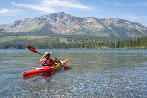 Lolo Kayaking Fallen Leaf LakeThe Camp Richardson marina guy was right. Fallen Leaf Lake was exactly what we were looking for in a kayaking destination. It was only about a mile south of Camp Richardson, there is a great boat launch at the southern end of the lake, it’s beautiful, and its size is just right for a leisurely paddle – 3 miles long by 1 mile wide.
While the Lake Tahoe Basin was formed by the rise and fall of the landscape due to faulting, Fallen Leaf Lake was formed by glaciers. Fortunately, the glacier ran out of steam and stopped just short of what is now Lake Tahoe; otherwise it would have been just another bay in a very large lake.
The land surrounding the lake is privately owned, leased from the U.S. Forest Service, and part of the Lake Tahoe Basin Management Unit. Except for a marina and store at the southern end of the lake, there is very little commercial development. As a result, the water quality is extremely good.
 Herb at Fallen Leaf LakeThey take their water quality seriously. Before launching the boat, a person from the marina came over and hosed off the bottom of our kayaks to ensure that we weren’t bringing and zebra mussels along for the ride. These invasive mollusks can wreak havoc on the natural food chain in a lake, so it is a precaution that is well worth taking to preserve the pristine waters of this lake.
We circled the lake in a counter-clockwise direction, paddling close to the eastern shore so that we could peek at the beautiful lake homes. The shore was quite heavily forested, and therefore shaded, so several people were sitting out on the very ends of their docks with their morning coffee, catching those first rays of sun. At this elevation, the temperature varies a great deal between sun and shade.
Towards the northern end of the eastern shore, there were no longer any houses, but just forest. At the very northern end of the lake, we pulled our kayaks up on a beach that was accessible either from the water, as we had come, or along a trail from the Fallen Leaf Campground, about 1/3 of a mile away.
After a chilly swim, we continue paddling along the western shore, which was much less developed except for a few smaller homes near the southern end.
As so often happens in the afternoon, the winds picked up, making it difficult to paddle. I hung close to the shore so that I would know that I was at least making some progress. A kayak with a sail on it passed us right by – what a good idea when the wind picks up!
 Lolo Kayaking Fallen Leaf Lake ShorelineWe made it back to the launch with no incident, threw the kayaks back up on top of the Subaru, and drove back to Camp Richardson.
There was still plenty of time left in the day, so we switch to sneakers and headed out for a run, this time sticking to the beach rather than turning off into the Tallac Historic Site. We made it as far as Baldwin Beach. Besides it being a beautiful beach, it was the closest place to launch a kayak to get around the promontory into Emerald Bay. Despite all the people I had asked about kayaking to Emerald Bay, nobody had told me about using this as a starting point. This was definitely something to consider for future visits here.
That evening, rather than cook in the motorhome, we went out for dinner at the Beacon Bar and Grill on the beach by Camp Richardson. We sat at a table on the outside patio, where we could watch the paddleboarders meandering around the bay. The food and service were good as well.
After dinner, we strolled through the Tallac Historic Site, listening to the sounds of a classical concert emanating from the Boathouse and sitting on the porches of the historic estates. I can’t believe they let you do this. There was no one else there. It felt like we owned the place. For a brief moment in time, I was a socialite in the early 1900s spending a lovely summer evening on the veranda with my wealthy husband. Then we went back to the RV.
Description
 Sandals in Fallen Leaf LakeI am not even going to attempt to give a full description of what Lake Tahoe has to offer, as we only spent a short time on its southern shore.
However, briefly, Lake Tahoe is one of the highest elevation lakes (6,255 feet high) in the U.S., as well as the second deepest (1,645 feet deep) – Crater Lake is the deepest. It is located along the border between California and Nevada. The four shores of the lake are each quite different. The north is quiet and upscale, the west and east are more rugged and less developed, and the south shore is busy and tacky with neon-lit hotels and casinos. The 72-mile drive around the lake is very scenic.
Lake Tahoe is known for its clear blue and green waters and the panorama of mountains that surround it on all sides. It is a year-round destination with swimming, boating, kayaking, and various other kinds of water sports during the summer; hiking, backpacking, and camping all year round; and tremendous skiing and snowboarding in the winter.
Two interesting nearby sites we did enjoy, include:
Tallac Historic Site
The Tallac Historic Site is comprised of three private estates dating back to the early 1900s, which served as summer retreats for three very socially prominent families from the San Francisco Bay area. In an effort to preserve “Old Tahoe,” the U.S. Forest Service acquired 74 acres, which included the three estates and a quarter mile of lakefront between Emerald Bay and Camp Richardson.
Today the remains of the restored estates attract thousands of visitors interested in recapturing this bygone and significant era in Tahoe’s history. Although the architecture of each is unique from its neighbors, each captures some aspect of the “Old Tahoe” style.
A list of activities and tours is available at the Visitor Center and the Baldwin museum.
Fallen Leaf Lake
 Fallen Leaf Lake SkyIf the thought of kayaking in a lake as large as Tahoe is a bit intimidating, as it was for me, there is a wonderful alternative just a mile south of Camp Richardson. Fallen Leaf Lake, which was created by glaciers, is approximately 3 miles long and 1 mile wide. If the glacier had continued, Fallen Leaf Lake would have been just another bay in Lake Tahoe.
The land surrounding the lake is privately owned, leased from the U.S. Forest Service, and part of the Lake Tahoe Basin Management Unit. Except for a marina and store at the southern end of the lake, there is very little commercial development. As a result, the water quality is extremely good.
Tuolumne Meadows / Mono Lake
Wednesday, August 12, 2015 - 11:00am by Lolo305 miles and 6.5 hours from our last stop - 5 night stay
Travelogue
 Yosemite Fire Glow from Mono Vista RV ParkAs anyone who has attempted to camp in Yosemite knows, it is extremely difficult to reserve one of its highly-coveted campsites. It requires knowing the exact date and time that the reservation window opens for the dates you are interested in and being poised by a computer when the floodgates open. Usually within 5 minutes of the start time all campsites are gone.
Being veterans of the process, Andrew and Celeste were shrewd enough to nab campsites in Tuolumne Meadow and Crane Flat for the four weekends in August. This particular weekend that we were joining them, they had a tent site in Tuolumne, too small to accommodate our motorhome. At first we considered trying to get one of the first-come-first-served sites, but the entire week before, I kept calling the available campsite hotline just to see whether Tuolumne Meadows sites were obtainable. They all seemed to be taken by 8:00 am.
Herb and I decided to play it safe and reserve space at the Mono Vista RV Resort, a commercial campground just outside the eastern entrance of the park that had views of Mono Lake. We still would have preferred being in Yosemite, but at least there were some redeeming features, like electricity, WiFi, cell coverage, and showers. Plus, it was only a half hour drive into the Park to get to Tuolumne Meadows.
The campground was actually in a very nice setting, set against a mountain backdrop looking out over the lake. Our fellow campers were also quite friendly. There was a very cute elderly couple in the site next to ours. When we got to talking to them, Herb shared the fact that he and I met in 3rd grade and knew each other for over 50 years. Well, that didn’t overly impress them as they had just returned from their 60th high school reunion and had known each other for 70 years. Show offs.
They were an inspirational couple – so active and full of life. Not only were they a pleasure to talk to, but they also gave us a great idea as to what to do tomorrow – hike in the 20 Lakes Basin area, one of the few Yosemite area hikes we had not yet done.
Hiking the 20 Lakes Basin Trail
 Lolo and Herb at 1 of 20 LakesThe beauty of Yosemite does not stop at its boundaries, as we learned when hiking in the spectacular 20 Lakes Basin area, just outside the eastern boundary of the park in the Hoover Wilderness Area. A very popular route through this region is an 8.4-mile loop hike starting at the south end of 10,087-foot-high Saddlebag Lake.
It was actually quite easy to get to the trailhead from our campground in Lee Vining. We just took 120 West as if we were going into the park, but after passing Ellery Lake at 10 miles we took a right onto a dirt road signed for Saddlebag Lake and continued for 2.7 miles to a designated parking area near the Resort.
The term resort might be a bit of an exaggeration, but there is a very nice Café and General Store with a cozy fireplace, and a place to rent fishing and pontoon boats. There is also a water taxi which goes between the Resort and the far north end of the lake, saving hikers about a mile and a half. The cost of the ferry is $8 one-way or $13 round-trip.
Since we were there to hike, we skipped the water taxi and headed off along the suggested eastern shore of the lake, which although slightly longer than the trail along the western shore, offers more scenic views.
 Lakes 1, 2 and 3 of 20 Lakes Basin Trail?Once we reached the ferry dock at the northern end of the lake (at about 2.2 miles) where the lazier hikers were being dropped off, we took a brief side trail to a very photogenic view of blue-green Greenstone Lake with North Peak in the background. Of course we had to stop and ask another couple to take our picture in front of that lovely backdrop.
From there, we chose to do the loop in a clockwise direction, although now I read that most hikers recommend going counterclockwise. The trail gradually began to ascend as we approached tiny Wasco Lake at 10,325 feet.
All in all, this trail did not have the grueling elevation gains we had become so familiar with on our Yosemite hikes. The trail continued on relatively flat terrain to the larger Steelhead Lake with breathtaking views of North Peak and the granite summit of Shepherd Crest.
After passing a small, unnamed lake (I was still counting it though), we continued through a pretty meadow along a talus slope to Shamrock Lake whose shores were ringed by rocky meadows and stunted white-bark pines growing amidst its granite ledges. North Peak and Mount Conness loomed towards the southwest.
 Lolo Hiking 20 Lakes Basin Trail - #1At 4.5 miles, we were slightly past our halfway mark and we had already passed 6 lakes. At this point, the trail got a bit sketchy as we descended the headwall to the basin that cradles Shamrock and Steelhead Lakes towards Helen Lake, which would be the northernmost point of our hike before heading back towards Saddlebag Lake. The trail required a bit of rock scrambling on scree-covered slopes and the crossing of a creek to get around the northern end of Helen Lake. We were back at 10,107 feet, about the elevation we had started at.
At the northeast end of Helen Lake, we came to a trail junction. To the left, was the trail towards Lundy Canyon and to the right the continuation of our loop hike back to Saddlebag Lake. Earlier this summer, we had hiked the Lundy Canyon trail from the trailhead on Lundy Canyon Road to the usual turnaround point at the scree-covered canyon walls. We realized now that this was where we would be in a very short distance if we turned left. Perhaps someday I would have the courage to connect the two hikes, but that was for another day.
From the trail junction, we turned right and proceeded up a steep rocky gorge towards Odell Lake, another pretty alpine lake tucked in a rocky bowl and surrounded by steep multi-hued cliffs.
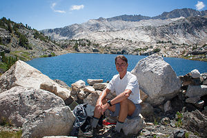 Herb resting on 20 Lakes Basin TrailThen it was on and up through Lundy Pass at 10,345 feet before descending once more to pretty little Hummingbird Lake nestled in a shallow bowl beneath Tioga Crest.
We continued descending to a trail junction near the northern end of Saddlebag Lake. Although we were quite tired, we didn’t even consider taking the ferry back as we wanted to complete the loop as a hike.
The trail along the western shore was nothing like the smooth dirt road we had started out on along the eastern side of the lake. It was very rocky and not exactly what I was looking for at this late point in the hike.
However, we soon were back at the Saddlebag Resort, pleasantly exhausted after what was a really spectacular hike – 8.8 miles, 928 feet of elevation gain, 9 beautiful alpine lakes, and breathtaking views all along the way.
All in all, a very good day.
Kayaking around Tenaya Lake and Rock Climbing at Murphy’s Creek
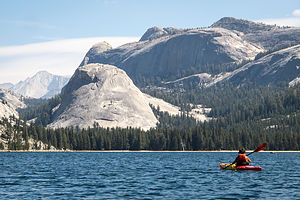 Tenaya Lake Domes with Lolo KayakingThe kids were arriving today. Andrew and Celeste were taking the day off from work and would be arriving early afternoon, but Tommy, who had just started a new job this week, didn’t want to ask for a day off so early in his employment, so he would not be arriving until late tonight. Cell coverage in the Park is very spotty, so we made a plan ahead of time to meet by Tenaya Lake where Herb and I would spend the day kayaking until their arrival.
Kayaking in this lake was something we had wanted to do on our visit here last August, but a cold front had moved in making it unwise without wetsuits or waterproof clothing. The lake is at 8,150 feet, so even summer days can be quite cold. However, today was a perfectly warm, sunny day.
Tenaya Lake is very pretty, surrounded by classic Yosemite granite peaks and domes. The only downside is its closeness to the road. At least, Andrew would have no trouble finding us in our bright yellow and red kayaks.
We launched from the picnic area and beach on the western end of the lake and paddled counter-clockwise around its shores. The entire trip around was only 2.8 miles, but we spent a good deal of time just floating and photographing the beautiful domes looming over the east end of the lake.
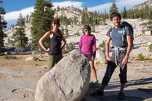 Celeste, Lolo, and Andrew on hike out of Murphy's CreekStill no sign of Andrew and Celeste, so when we got back to the beach, we put the kayaks away and switched to beach chair mode. We knew that relaxing was not going to be part of the itinerary when they arrived, so we took advantage of the last few peaceful moments we had.
It wasn’t long before they arrived, smiling and excited for a great weekend ahead. We sat on the beach for about 15 more minutes, before Andrew suggested we go climbing at a nearby crag called Murphy’s Creek. We didn’t even have to move the car, as the trailhead to get there was right across the road from the parking lot.
We hiked for about a mile and a half through woods before coming to a granite slab, which I assumed correctly was our destination. Although I do climb on occasion, this crag was not for me. Yosemite climbing usually involves crack climbing, where you have to jam your hands and feet into a vertical crack to work your way up the rock, much different from the type of climbing Herb and I are used to.
Andrew and Celeste worked on a 5.10d off-width, which involved them cramming and ooching their entire bodies into a wide crack and sort of shimmying their way up the rock. It looked extremely unpleasant. Herb must have agreed, because he decided to sit this one out.
After that, the three of them worked on a very difficult 5.11b crack, which looked even more horrible.
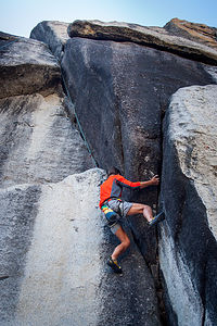 Herb climbing cracks at Murphy's CreekFinally, everyone decided they had tortured themselves enough, we hiked back out with the intention of having celebratory beers in Tuolumne Meadows. A refreshing beer after climbing has become a recent tradition of ours – gives us something to look forward to after hanging from a cliff.
That’s when I broke it to Andrew that I had forgotten to pack beers in the cooler, which was very unlike me. Oops! Fortunately, there is a small grocery store near the Tuolumne Meadows campground where we were able to rectify my oversight.
Refreshments in hand, we found a spot along the path through the meadow to sit and enjoy the unique beauty of this sub-alpine meadow. At an altitude of 8,600 feet, it is quite a bit cooler than the Valley, and also much less crowded. Even the rock formations are different. Rather than 3,000-foot massive granite monoliths, Tuolumne is studded with dozens of more manageably-sized domes, formed by the exfoliation of porphyritic granite.
Andrew and Celeste had come to love this part of Yosemite during their previous weekends here. That’s why I felt very honored that they were willing to give up their highly-coveted and difficult to obtain campsite in the park to come down to Mono Lake to stay in the campground where we were. They said that being together was more important. I thought that was pretty sweet.
Back at the Mono Vista RV Resort, we had a pretty long wait before Tommy’s arrival. In fact, so long that I was the only one that stayed up to greet him. He was coming from San Francisco on his motorcycle after work, so as a Mom I worried about him coming through those steep, windy roads through the park in the dark. No matter how old he gets or how competent he is, I am still his mother. Finally, around 11:30, I heard a motorcycle pull into the campground. To my ears, there could not have been a nicer sound.
Hiking to Lower Cathedral Lake and Rock Climbing by Olmsted Canyon
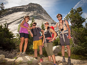 Happy Hikers on Route to Lower Cathedral LakeMost of our Yosemite trips have been to the Valley, so the Tuolumne Meadows area still has so many new places for us to explore and so many trails we haven’t been on.
We decided to start the day off with a hike to Lower Cathedral Lake and then climb in the afternoon. The trailhead for the hike was located right along the Tioga Pass Road about a half mile west of the visitor center. Parking is allowed along the shoulder of the road, so we found a spot just a quarter mile or so beyond the trailhead.
This hike is part of the iconic John Muir Trail, which extends for over 200 miles from Yosemite Valley to Mount Whitney. We, however, would be only be doing about 4 miles (each way) of it today. Wow! That sounds so wimpy.
This hike is also very popular with backpackers. Wilderness permits are required for overnight backcountry camping in the park, but this was the first time I saw it so strictly monitored. There was a ranger along a trail asking people with large packs that obviously had overnight gear to see their permits.
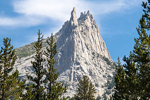 The Elusive Cathedral PeakIn addition to cameras and lunch, Andrew, Tommy, and Celeste had loaded their packs with climbing gear, just in case they decided to climb Cathedral Peak. Fully loaded, we crossed the road, found the trailhead, and began what was pretty much a continuous ascent through a lovely lodgepole pine forest. Good thing Herb and I had already been here a few days to acclimate to the higher elevation, as the trail started at 8,500 feet and only went up from there. We hoped that between the heavier loads they were carrying and their lack of acclimation to the altitude, they would be handicapped enough for us to keep up with them.
Eventually we left the forest behind and were treated to our first view of 10,911-foot high Cathedral Peak, one of Yosemite’s iconic granite pinnacles, and the rock formation that Andrew, Tommy, and Celeste were thinking of climbing. It seemed so very far away.
We decided we would hike to Lower Cathedral Lake first and then discuss options for climbing afterwards. So we continued on the John Muir trail until we came to the spur trail for the lake. We were now at the 3.2 mile point of our hike and had made about a 1,000 foot elevation gain. We took a right and walked about another half mile along a stream through a beautiful meadow to the granite shores of pristine Lower Cathedral Lake, set like a jewel in a glacial cirque.
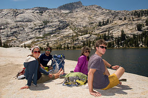 Hikers at Lower Cathedral LakeWell this seemed as good a place as any for lunch and a break from a fairly strenuous hike. The views were breathtaking – nearby Polly Dome and Tenaya Peak providing a picturesque backdrop to the lake, and Cathedral Peak looming over our shoulders from whence we came.
Tommy suggested a refreshing swim, but we ignored him. So he went it alone. Let’s just say it was very brief and literally breathtaking.
After lunch and much photographing of this beautiful spot, we retraced our steps through the meadow back to the junction with the John Muir Trail. This is when much deliberation began as to whether or not to try to climb Cathedral Peak. I knew my vote. I was already tired and the thought of what was required just to get to the base of this formation was not very appealing. The approach alone would take over an hour. If we did this, we would be hiking out in the dark. However, I hate to be a pooper, so I kept my mouth shut.
They know me too well, however, and sensed my apprehension. I think they too had some doubts as to whether we had enough time to do this. Finally, we agreed to put this climb off for another day when we got an earlier start and went directly there. Nobody was disappointed though, because the hike alone had been well worth it.
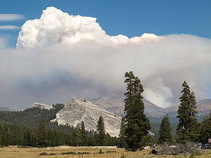 Yosemite Fire Clouds from Tuolomne MeadowsWe hiked the 3.2 miles back down to the trailhead. Back at the car, the boys consulted the climbing guide to select another area to climb where the approach wouldn’t be too long, as it was already mid-afternoon. They settled on Olmsted Canyon, so we headed west on Tioga Pass Road towards Olmsted Point.
For anyone driving the Tioga Pass Road, stopping at Olmsted Point is a must. The views of Tenaya Canyon and the northern side of Half Dome will take your breath away. However, we didn’t have much climbing time left in the day and we had been to this viewpoint several times in the past, so we continued on a short distance to the dirt turnout near the mouth of the canyon, which would give us access to the Olmsted Canyon climbing area.
The boys selected a 5.10d climb called Lord Caffeine, which was another one of Yosemite’s classic -- and according to Herb horrible-- crack climbs. Rather than leading what looked like a very difficult climb, the boys took the safer route and hiked around to set up a top rope. After spending a few hours on this climb, I think they came to agree with Herb’s assessment. Celeste managed to get about a third of the way up, Andrew got a little further, but said he wanted to vomit, and Tommy actually got it. Herb didn’t want anything to do with it. Funny how despite all the grunts and groans during the climb, each of them said afterwards, “That was fun!”
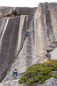 Boys and Celeste on "Lord Caffeine"We had definitely earned our post-hike/climbing celebratory beers, so we headed back to beautiful Tenaya Lake to enjoy the sunset. This time I had not forgotten to pack beers in the cooler. The views were lovely, the company was the best, and the cold beers were very refreshing.
That evening when we drove out of the park, the ranger at the gate told us that once we left we wouldn’t be able to come back. Since we were camping by Mono Lake, we didn’t ask why, but when we saw the flames off to our right, we figured it out. Fires throughout northern California had been an issue all summer, but this one was a little too close for comfort.
When we got back to the motorhome, we saw that our counters were coated with soot from the fire, which had gotten through our open vents. It smelled so strongly, that the kids decided to abandon their tents and spend the night inside the motorhome where we all felt more protected. Thankfully, they had decided to camp with us rather than stay in Tuolumne Meadows, or we would have been totally cut off from each other.
We inquired and found out that the fires were about 5 miles away at Walker Lake, and as of yet, there was no plan to evacuate the Lee Vining area. This was getting a bit scary though.
Saying Goodbye to Kids and Kayaking Mono Lake
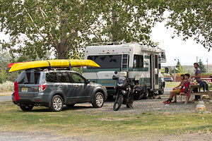 Camping at Mono Vista RV ParkThe next morning we were at a loss as to what to do. The skies were still very smoky and Tioga Pass Road was closed, meaning that not only could we not go into the park to recreate, but the kids had to find another, much longer, route back to San Francisco. Spirits were pretty low.
We put the decision off for now and went to have breakfast at Whoa Nellie Deli, the only fine restaurant I have ever been to that is in a Mobil gas station. Don’t let the façade fool you. This place is really great, with an interesting menu and excellent food. The experience helped raise spirits quite a bit.
We discussed the possibility of climbing somewhere outside the park, like Mammoth Lakes, but that would mean they would get back to San Francisco very late. Andrew and Celeste decided to start heading back via either Route 50 near South Lake Tahoe or Sonora Pass. Either way would add a good 2 hours from what their drive would have been if they could have driven through the Park.
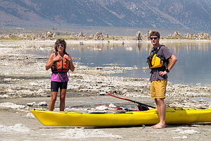 Lolo and Tom Kayaking Mono LakeTommy was in no particular hurry to get back to the city, so he decided to come with us to launch our kayaks in the lake. It really was very hot out, so we hoped that getting out on the water would cool us off.
Mono Lake is definitely not your typical lake. Besides being over a million years old, and probably the oldest continuously existing lake in North America, it is 2 ½ times saltier than the ocean and 80 times more alkaline. The other unique feature of this lake are its mystical “tufa castles” formed when carbonates in the water combined with calcium from freshwater springs feeding into the lake. As lake levels dropped, these extraordinary-looking knobs, spires, and minarets became exposed. Most of the towers visible in the lake are from 200 to 900 years old and rise as high as 30 feet above the water. Our goal was to paddle amongst the tufas.
The largest concentration of them can be found along the southern shore of the lake at the South Tufa State Reserve, but you can’t launch a kayak from there. The best place to launch is from Navy Beach, which is just ½ mile east of the South Tufa area by water, but a fairly longer drive along a bumpy dirt road to the launch parking lot. From there, we carried our kayaks and gear about 30 yards down to the water.
We only had two kayaks, so Herb suggested that Tommy and I go out, while he took a ride on Tommy’s Kawasaki KLR650 dual sport bike. He had been dying to get his hands on that all weekend. While he rode off into the distance down 120 East, Tommy and I launched the kayaks and paddled amongst the tufas. Although the tufa towers are very visible and close to the shoreline, it was much more fun weaving our way amongst them.
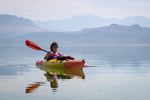 Lolo Kayaking Mono LakeAfter much photogging, we paddled back to Navy Beach where a happy Herb was waiting for us. He had really enjoyed riding Tommy’s bike, hopefully not enough to want him to add one to our already robust arsenal of toys.
Tommy had a long ride ahead of him, especially with the detour around Yosemite, so he said his goodbyes and headed north on 395 with the intention of taking the windy road through Sonora Pass.
We had the rest of the day to ourselves, so we took the kayaks back out and paddled towards the Paoha Island in the center of the lake. Funny how distances are so deceptive on the water. The island was just a little over 3 miles from Navy Beach, but I could swear that it kept moving further and further away the more I paddled. At least the lake was calm, at least for now. We would have to keep an eye out for changing conditions because the winds usually pick up in the afternoon making kayaking extremely difficult.
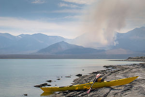 Yosemite Fires Smoke view from Paoha IslandHerb’s kayak is much longer than mine, and therefore much faster – or at least that’s the excuse I use – so before long, he was just a tiny yellow dot in the distance. Rather than get annoyed at being left behind, I decided to enjoy the solitude and sniff the roses. Sometimes I just stopped paddling, leaned back, and gazed at the clouds and mountains in the distance. Hopefully, the massive billows of smoke in the mountains didn’t mean that the fires were getting closer. I started worrying about Lee Vining being evacuated and not being able to get back to our motorhome. Herb says I worry too much, but he wasn’t here right now so I could worry all I wanted.
Eventually, I paddled up onto the beach where Herb had landed about a half hour ago. We had been to this island on our visit earlier this summer, so I wasn’t as surprised this time when I stepped onto the shore and my feet broke through its crunchy, white moon-like surface, which, like the tufas, was primarily composed of calcium carbonate.
This island is very young in geological years, formed just 350 years ago when a volcanic eruption pushed sediments from the lake bottom and volcanic material 290 feet above the lake surface.
It was really hot and there was absolutely no shade to be found on the island. Herb, who I think is part lizard, loved it. After about an hour of sweating and swatting brine flies, I found myself getting cranky and anxious to get back out on the water where it was significantly cooler. Plus, those fires in the not so far distance were making me nervous.
 Mono Lake Sky with Tiny Lolo KayakingI think Herb was disappointed that I wanted to leave so soon, but I just couldn’t take the heat. Since he is a faster kayaker than me, I suggested he stay longer and just catch up to me when he was ready to leave.
He gave me the GPS so that I could more easily track a straight line to Navy Beach, rather than zigzagging my way across the lake, turning a 3 mile paddle into a 5 mile one. Plus, it told me my progress in tenths of a mile, which I found very rewarding.
I resumed my routine – paddle for awhile, rest and gaze at clouds and mountains, worry about fires, paddle again, gaze and worry again, and so on. Thanks to my trusty GPS, I arrived back at Navy Beach just about the same time Herb did.
We loaded the kayaks on the car and headed back to Mono Vista RV Park. The smoke was still pretty bad, and Tioga Pass Road was still closed, but 395 and the campground were still open. I’m not sure what we would have done if they weren’t.
Description
Yosemite – Tuolumne Meadows
 Pond on Hike Out from Olmsted CanyonIn my past Yosemite trip stop descriptions, I have focused on Yosemite Valley. However, this time our foray into Yosemite was limited to beautiful Tuolumne Meadows along the Tioga Pass Road in the northern part of the park.
Tuolumne Meadows is very different from Yosemite Valley. At an altitude of 8,600 feet, it is high country and therefore, quite a bit cooler and wetter. As its name implies, Tuolumne is a beautiful sub-alpine meadow along the Tuolumne River, surrounded by rugged snow-covered mountain peaks and glacially-carved granite domes. The rock is porphyritic granite, which has a tendency for exfoliation, resulting in the distinctive dome shapes found here.
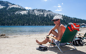 Herb beaching on Tenaya LakeHiking and rock climbing are extremely popular in this section of the park and tend to be much less crowded than the Valley. In contrast to the big walls in the Valley, the rock climbing routes on the major domes in the Meadow are shorter.
There are very few services in Tuolumne and the Tioga Pass Road is usually only open from Memorial Day through late October / early November, depending on the snowfall. During the summer (mid-June to mid-September), camping is available at Tuolumne Meadows Campground. It is extremely popular, so reservations are strongly recommended. However, there are also many sites saved as first-come-first-served. There is also a small grocery store, grill, post office, and gas station.
Mono Lake
Mono Lake is located just off Highway 395 near the town of Lee Vining, California, 13 miles east of Yosemite National Park. Mono Lake is extremely unique. First of all, at over 1 million years of age, it is one of the oldest continuously existing lakes in the continent. Secondly, it is about 2 ½ times as salty as the sea and about 80 times as alkaline. This is because Sierra streams flow into Mono Lake bringing trace amounts of salts and minerals, but the lake has no outlet other than evaporation. As a result, the concentration levels of salts and minerals keeps growing each year. Thirdly, and the main reason Mono Lake is so popular, are the hundreds of spectacular “tufa towers” that rise from the lake. These intriguing calcium-carbonate sculptures were formed beneath the water when carbonates in the water combined with calcium from freshwater springs feeding into the lake. As lake levels dropped, these extraordinary-looking knobs, spires, and minarets became exposed. Most of the towers visible in the lake are from 200 to 900 years old and rise as high as 30 feet above the water.
A good place to start your visit is at the Mono Basin Scenic Area Visitor Center, located just off Highway 395, north of Lee Vining, where you will find exhibits about both the natural and human history of the Mono Basin.
One of the best places to view the tufas is at the Mono Lake Tufa State Reserve along the southern shoreline of the lake. The trailhead for the south tufa castles and Navy Beach is at the edge of the parking lot. During the summer, rangers lead walking tours 3 times a day (10am, 1pm, and 6pm), but if your not lucky enough to catch one of these, there are plenty of informative signboards along the trail. A short walk along the mile-long trail brings you to the strange and fanciful tufa castles at Navy Beach. A swim in the buoyant waters of Mono Lake is a memorable experience, as long as you are willing to step through the millions of harmless alkali flies that line the water’s edge. It’s fun to watch what at first looks like black sand part before you.
Surrounded by volcanic hills, Mono Lake is also a geologist's paradise. The two major islands in the lake are actually volcanic domes. The large black island, which the Kuzedika Indians named Negit, meaning “blue-winged goose,” erupted about 1700 years ago. The white island, which the Native Americans named Paoha, meaning “spirits of the mist,” erupted 250 years ago.
Bird watching and photography are other popular activities at Mono Lake.

