Sebastopol and Side Trips through Sonoma and Marin County, CA
Today was pretty much a driving day. The GPS predicted about 5 ½ hours to get to Celeste’s house in Sebastopol, but since it was the Friday of Memorial Day weekend, we wanted to make sure we were nowhere near the city during rush hour. So, we took our time with the goal of waiting until after dinner to get through the congestion around San Francisco.
Our first stop after leaving Kings Canyon was at (according to the boys) a classic California fast food establishment – In-N-Out Burgers, known for their delicious and very high quality burgers. It lived up to its reputation, and we had some laughs comparing these burgers to the ones we had been begrudgingly served at the Kings Canyon Lodge just two days ago. Wow! Could it only have been two days. It felt like a week ago. Time certainly takes on a different dimension when it is filled with so many different experiences and activities.
The next form of family entertainment was trying to find the cheapest gas by using the Gas Buddy app on Herb’s phone. We successfully navigated ourselves off the highway to a station with prices that would have shocked us in New Jersey, but were inexpensive by California standards. However, I then forgot to reset the destination on the GPS to Sebastopol, so every time Herb got near the highway, it kept telling us to make a U- turn. By the third time we passed our gas station, with Herb getting more and more frustrated (to put it mildly), and the boys getting more and more amused, I finally realized my mistake. GPS’s are only as good as what you tell them—garbage in, garbage out—so I quickly reset our destination to Sebastopol, and it let us get on the highway without further squawking.
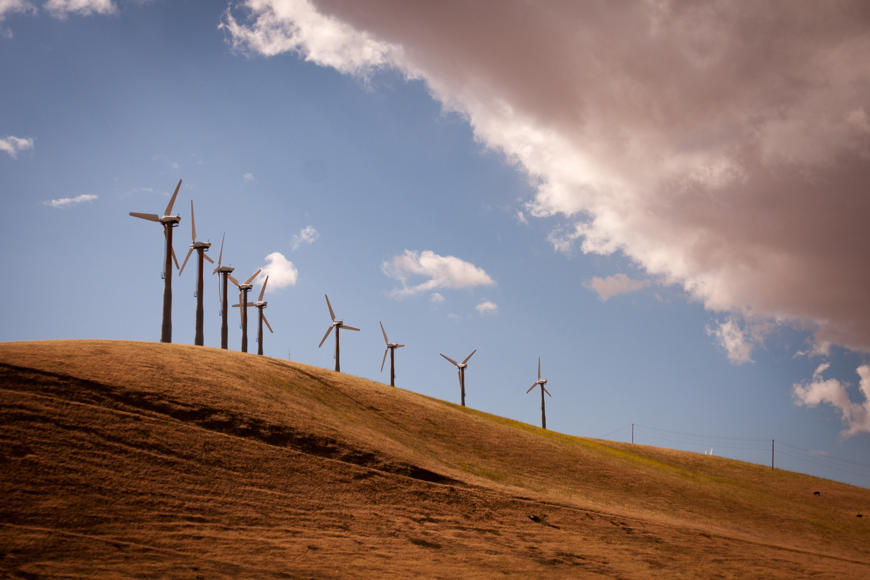
Out route along I-580 took us past a scene I always love on our trips to California – the seemingly endless landscape of windmills perched atop the rolling hills of Altamont Pass. I remember being impressed with this sight over 25 years ago when Herb and I made our first trip to Yosemite. With no place to pull over, Andrew, who had the best positioning in the car, was given the task of getting some highway speed photos. He did not disappoint.
As we approached Oakland, we decided to stop at a Trader Joe’s along route to find some goodies for a picnic as well as not to arrive at Celeste’s house empty handed. Hesitant to select wines for a family of wine connoisseurs living in Sonoma Valley, we shrewdly chose some interesting beers instead.
Just past the San Francisco Oakland Bay Bridge, we found a little park overlooking the Bay, called Point Emery--nothing much to it—just a piece of land jutting out into the Bay. Despite the chilly temperatures, we perched ourselves on a log on the small beach, enjoying our salads and sandwiches, and the great views of the Oakland Bay Bridge. Herb and I even managed to find a hidden geocache in the park.
Having successfully waited out the Memorial Day rush hour, we arrived in Sebastopol without any traffic hassles. The next five days were to give us a taste of what life is like Northern California. Let me give you a little preview: pretty darn good.
Day 1 – Annadel State Park and Willow Creek
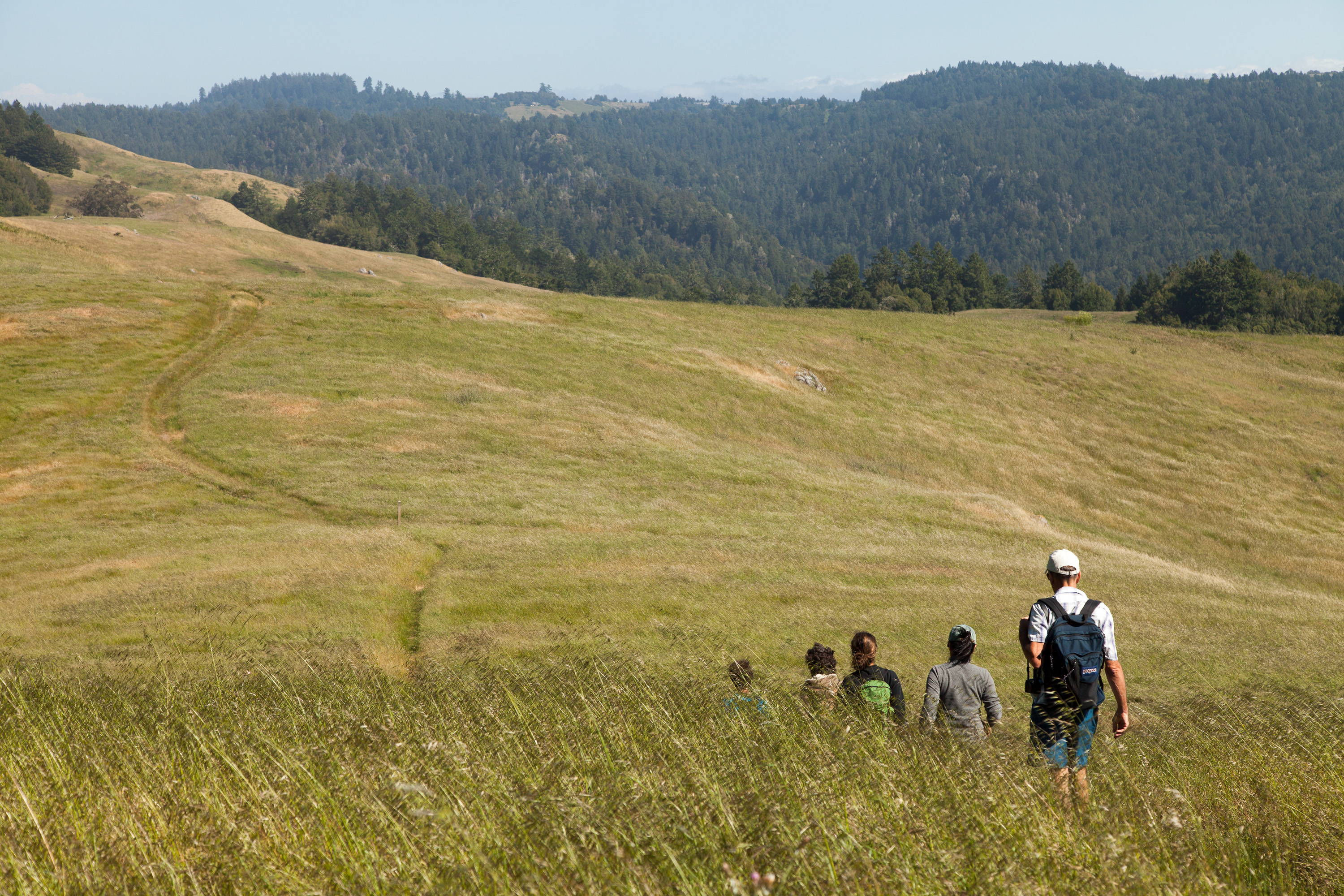
We tend to think of our family as pretty active, but we definitely met our match with Celeste’s folks. Our first day together began with an early morning trip to nearby Annadel State Park, on the eastern edge of Santa Rosa, where there are miles of trails for hiking, mountain biking, horseback riding, and trail running. Andrew, Tommy, Celeste, and Paul set off for a run, while Herb, Hilda, and I hiked and enjoyed the lovely scenery.
To reward ourselves for our efforts, we stopped in town at Screaming Mimi’s, Sebastopol’s finest ice cream, and the place where Celeste had worked for several summers. Like everything in Sonoma Country, this place took its ice cream making seriously and we were treated to a decadent post-exercise treat. Food was definitely going to be an important part of this trip. Thankfully, we never sat still long enough for the calories to find a permanent home.
After lunch and a brief rest back at the house, we set off for our second hike of the day at Willows Creek, a spectacular 3,373-acre “community-powered” park near Duncans Mill. What “community-powered” means is that stewardship and maintenance of the park is done by community volunteers, in conjunction with a non-profit organization called LandPaths. Without their efforts, this land would be neglected because of the State Parks budget crunch. In return, the land is accessible by permit only to those that work as stewards. Fortunately for us, Celeste’s dad was one of those stewards, which meant that we would get a chance to have this beautiful park practically to ourselves.
We left the house armed with wine and cheese – after all, this is California -- and made a stop to pick up what had to be the best bread I have ever had at Wild Flour Breads in the town of Freestone. All their breads are made in a wood-fired brick oven, which gives great flavoring and especially hard crusts. My palate was definitely being spoiled on this trip and would most likely mutiny when we returned home to my cooking.
The staff in Wild Flour had to be the happiest workers I have ever seen -- they danced, they smiled, they chatted with customers. They genuinely looked like they loved their jobs. There was such a variety of breads and scones that it was difficult making a choice. We deferred to Paul and Hilda, who selected a wonderful sampling. It was hard keeping the kids’ hands out of the bag—after all, this bread was meant to go with our wine and cheese picnic later.
Armed with wine, cheese, and now bread, we arrived at Willow Creek and set off on our hike up a fairly steep hill to a beautiful hilltop overlooking the sea. The wind was so strong that we tried to find a sheltered place to enjoy our feast. Since we basically had the whole place to ourselves, we finally decided to just set our picnic blanket down on the narrow path in a slightly protected section. Eventually some fellow hikers came our way and being quite amused by our selection of a picnic site, volunteered to take our picture. We remained until there was not a crumb or a sip left, and then headed back down the hill to return to Sebastopol.
It was a very full and rewarding day, culminating in the culinary magic that comes out of Celeste’s kitchen each night, followed by some very competitive Trivial Pursuits.
Day 2 – Sebastopol Farmers Market, Junk-Art Sculptures, and Run at Ragle Ranch Regional Park
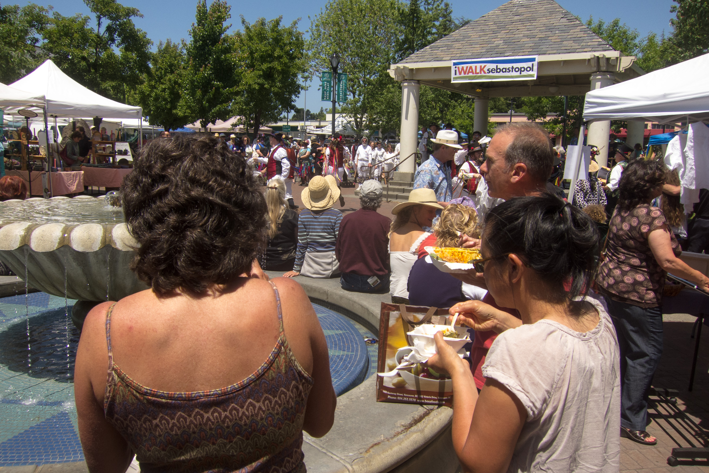
The next morning we arose to another beautiful sunny day, something that is apparently a given during the summer time in Sebastopol. I would have been content to just lie in the sun on their lovely backyard patio, but alas, that was not to be. This was Sunday, and Sunday in Sebastopol means the Farmers Market in the Plaza, where the whole town congregates to enjoy delicious fresh regional food, live music, and dancing.
After lunch, Celeste took us for a walk to nearby Florence Street for a real treat. Practically every other house on the street had a whimsical, cartoon-like junk-art sculpture on their front lawn. They were hysterical. For example, there was a baseball player made from an aircraft fuel tank, air compressor, and painted scrap metal and a mermaid with applesauce can lids for scales.

I later read the story behind these sculptures. They were all done by Patrick Amiot, who moved to Sebastopol about a decade ago. One of his first acts was to place a 14-foot-tall fisherman made of recycled metal on his front lawn. In case it wasn’t obvious enough, it was painted in vivid bright colors by his wife, Brigitte Laurent. Rather than the outraged complaints he expected from his neighbors, he received nothing but compliments and requests for his artwork. Today there are over 200 of his wacky, found-object works scattered throughout Sebastopol.
My only regret was that Herb missed out on the Farmers Market and the sculptures, but when we returned, it certainly didn’t seem like he had suffered very much.
We all went for a calorie-burning run at nearby Ragle Ranch Regional Park to make room for another delicious dinner that night.
Day 3 – Mill Valley, Stinson Beach, and Point Reyes Elk Refuge
This morning’s activity was a drive to the beautiful Marin County town of Mill Valley to run and/or hike a portion of the famous Dipsea Trail -- the site of the oldest trail race in America, having first been run in 1905. As is probably obvious, running is a very important part of our day—coming in second only to fine dining. It’s a great counterbalance of activities—input calories, output calories, input calories, output calories, etc., etc.
The reason we chose this particular run for the day was that in just two weeks Paul (Celeste’s dad) would be running the famous Dipsea Race, a significant honor that must be earned through past performances, and he wanted to get some practice on the course. Celeste and the boys wanted to run a portion of this classic trail as well. The race course begins in Mill Valley and immediately climbs up a steep set of steps (676 in all) and trails over Mt. Tamalpais before eventually making the long descent to Stinson Beach, 7.4 miles away. It is one of the most grueling and treacherous races in the country, but also one of the most beautiful.
Herb, Hilda, and I chose to hike instead. We too asscended the steep stairs, admiring the redwood trees and elegant homes perched like treehouses on the southern slope of Mt. Tamalpais. What a beautiful place to live. I am sure the prices must be reasonable. Having time to kill before the rest came back from their run, we went back to the center of town, watched a bit of the Memorial Day parade, and bought some very tasty sandwiches for a picnic later. Then we waited near the bottom of the trail for the runners’ return.
When they returned, they informed us of a slight mishap. The trail is a bit confusing, so at one point when they didn’t realize that Celeste was a bit behind, they turned one way and she turned the other, continuing along her merry way thinking they were just ahead. When they realized she was missing, Andrew went into a panic and frantically ran back to find her, which he did before she even realized she was lost. Happily reunited, they all returned together down the stepped trail. I must say they were very happy to learn that we had taken the initiative to buy lunch, which we planned to eat soon at Stinson Beach.
After Mill Valley, we drove the very winding, but highly scenic, Panoramic Highway through Mt. Tamalpais State Park and down to Stinson Beach. While the Dipsea Trail between Mill Valley and Stinson Beach is 7.4 miles, the drive was closer to 11.
By now the day had gotten quite overcast and cool, but regardless, the parking lot at Stinson Beach was still packed. Now I like the beach as much, if not more, than the next person, but these people romping around on the beach seemed to have no clue to the fact that it was really chilly and there was no sun! And, I know how California water temperatures compare to the Jersey shore too, and it’s not good. Not wanting to be weenies in a crowd of fun-loving, beach goers, we bundled up and squeezed next to each other (for body heat) on a log to have our picnic lunch.
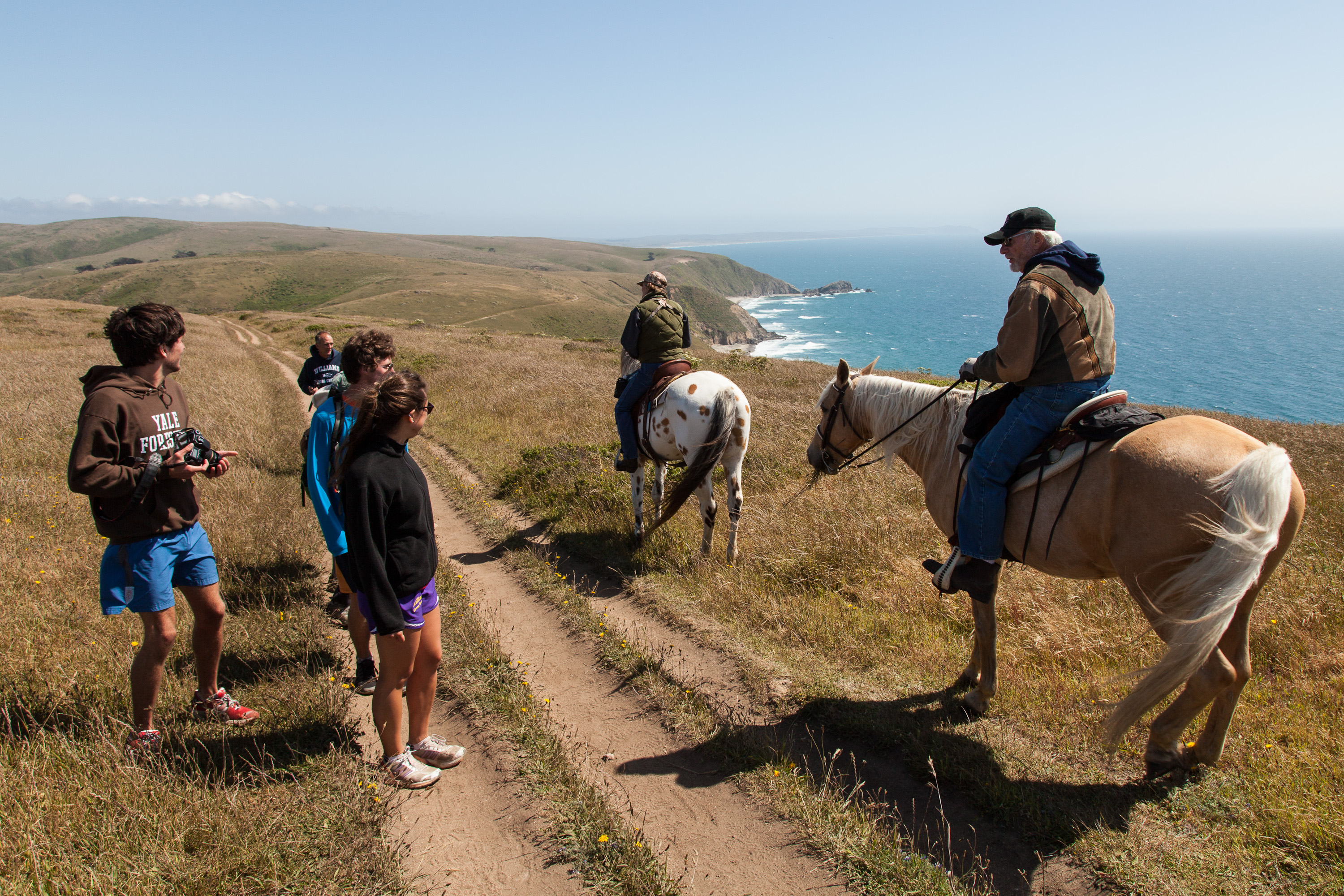
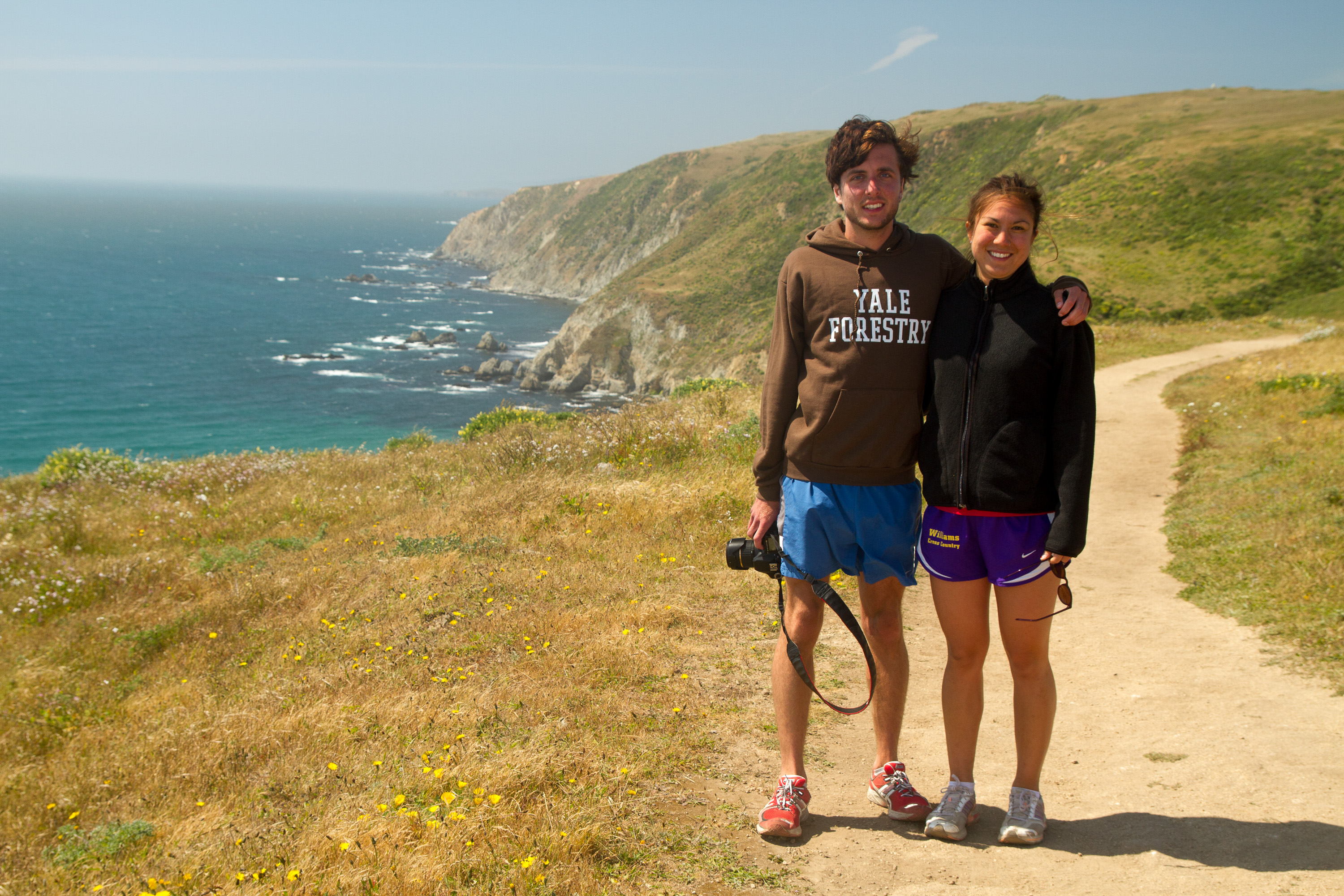
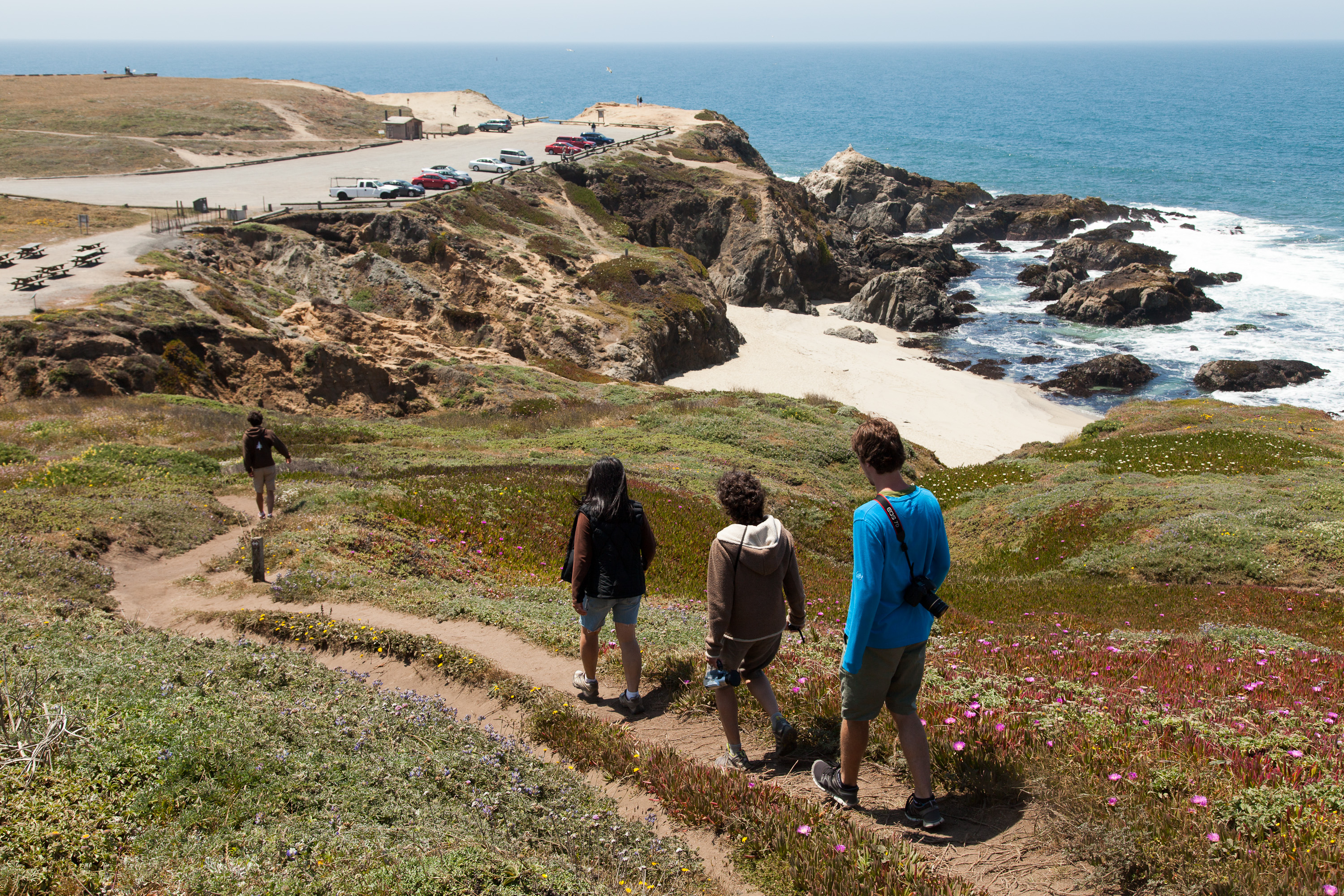
By now, we had already had what normal people would view as a full day, but ours was just getting warmed up. Our next stop was the breathtaking Point Reyes National Seashore, a bit further up the coast along Route 1. Our destination within the park was the Tomales Point Trail through the Tule Elk Reserve at the northern end of the park.
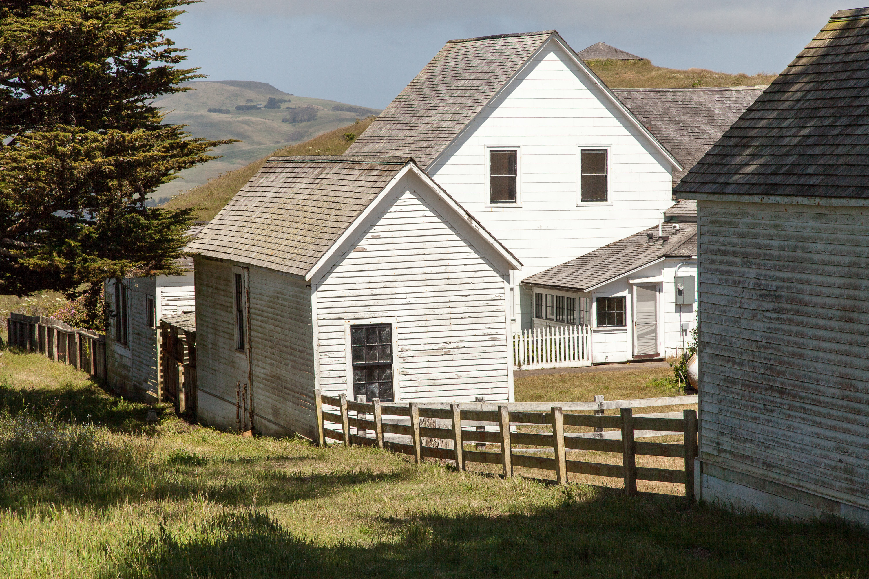
The trail begins at the western edge of the parking lot near a grouping of historic ranch buildings and then quickly veers north through a grove of cypress trees before giving way to a sparse mix of grass, coyote brush, and yellow bush lupine. From this point on, the trail is very open with expansive views in all directions. After about a mile of fairly level hiking, we began the descent to Windy Gap where the elk herds like to graze at a nearby a spring. Sure enough, they were there waiting for us. Fortunately, or unfortunately, depending on what you are looking for, this was not rutting season, so the elk appeared quite placid.
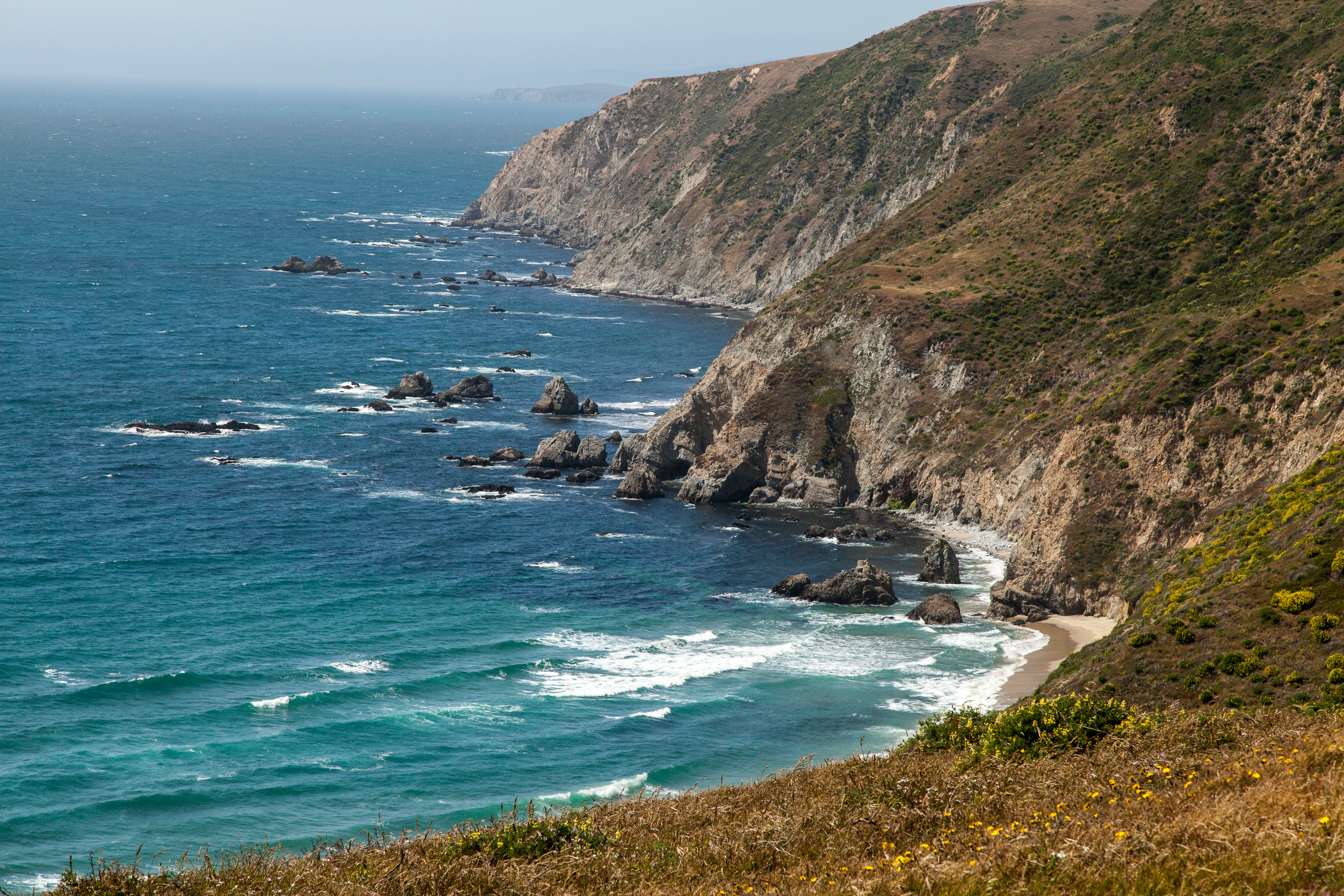
From here, the trail begins a moderate ascent to the wind-swept ridgeline overlooking Tomales Bay to the east, Bodega Bay to the north, and the Pacific Ocean to the west. The total distance to Tomales Point is 4.7 miles, but since it was already after 5:00, and we hadn’t even showered since our run on the Dipsea Trail that morning, which seemed like days rather than hours ago, we unanimously chose to turnaround at a rocky outcrop just ahead and retrace our steps back to the trailhead.
What a great day and an exhausting one. Dinner and a fine Sonoma Valley wine back at the house sounded like a really, really good idea.
Day 4 – Bodega Bay, Wineries, and Healdsburg
Before we left for this trip, I purchased a Lonely Planet Guide to Northern California and made a list of places I would most like to see, not thinking that we would be able to cover them all in such a short timeframe. Well, thanks to Celeste’s parents, we were checking off the stops on my list as well as adding plenty more that we would never have known about without local knowledge.
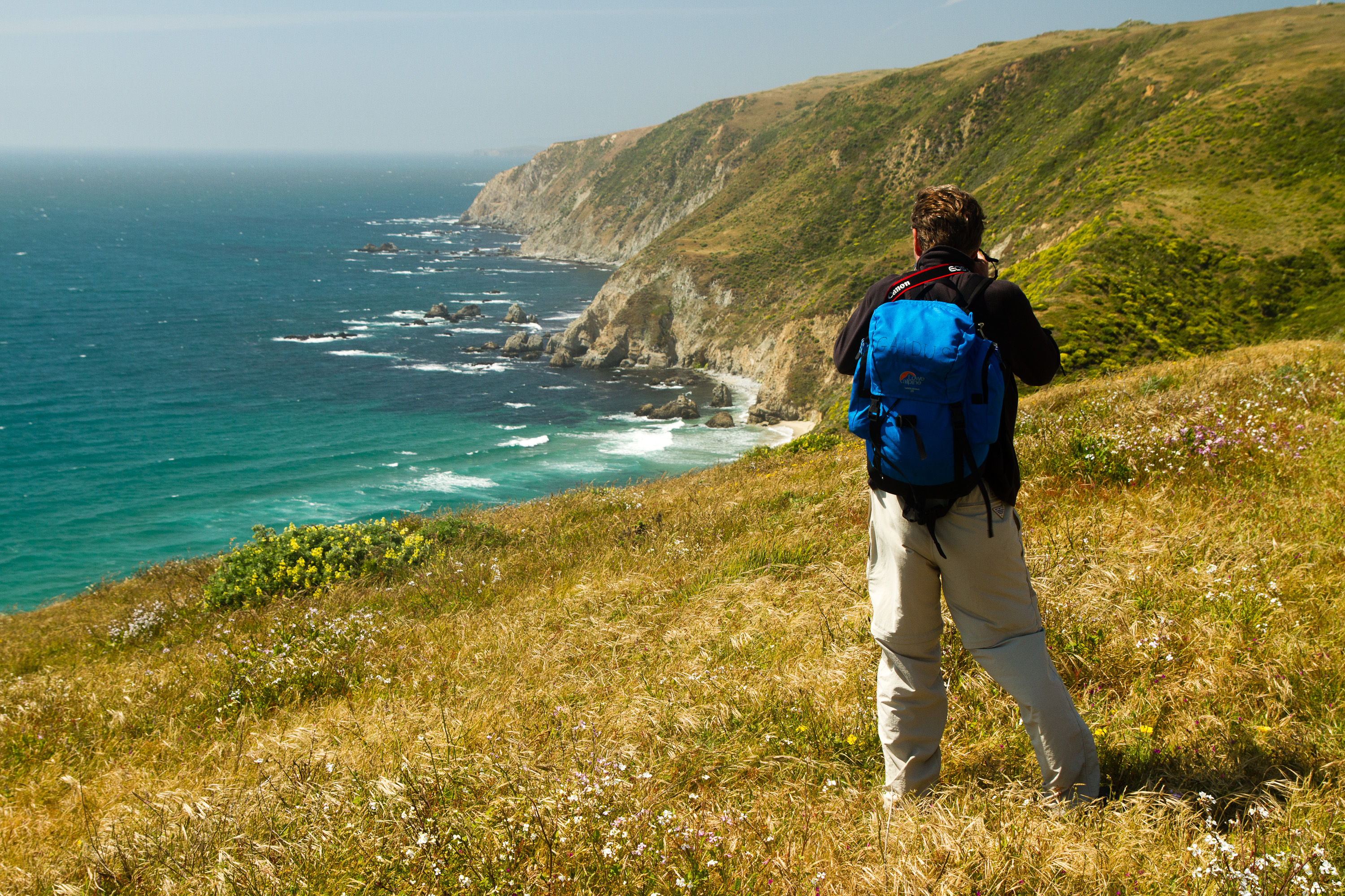
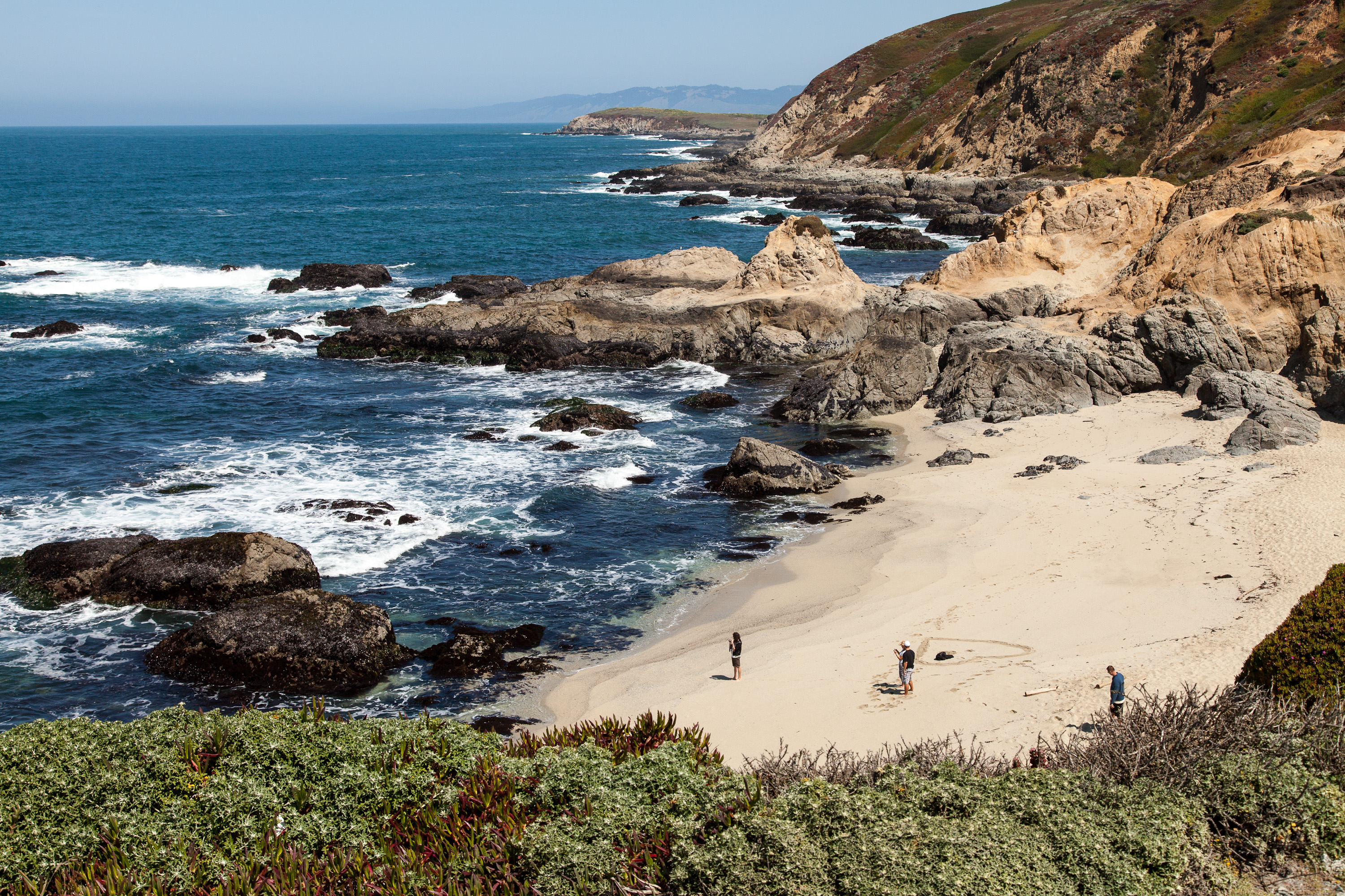
This morning’s agenda included a drive to Bodega Bay and a hike along the headlands of Bodega Head. This is just one of a series of beaches that are part of the Sonoma Coast State Beach system, which stretches for 17 miles north along the coast. Most of the beaches are tucked away in rocky sandy coves separated by rocky headlands, but are connected by coastal hiking trails that wind along the top of the bluffs.
I must say, that California beaches are very different from those we are used to in New Jersey and New England. The east coast beaches are beautiful, but with their warm temperatures, the main attraction is playing in them. Not being warm enough to flop around in the surf, the northern California beaches have to rely on their good looks, and I have to say, they are absolutely stunning.
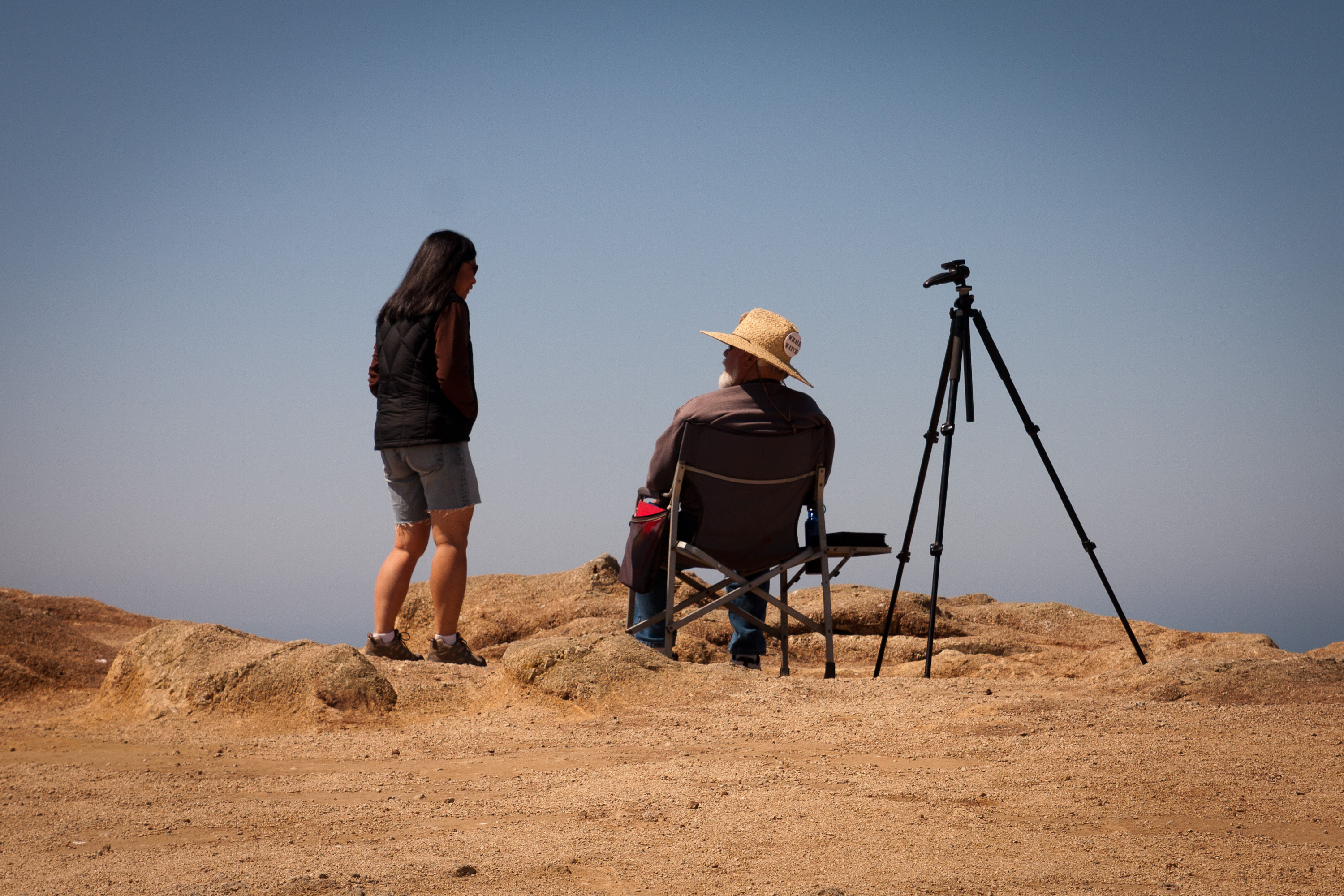
Our hike, which began at the Salmon Creek Beach parking lot, was a 2 to 3 mile loop atop a bluff. The terrain was mostly wind-swept grassland with sea fig, and purple and yellow bush lupine. The colors and textures of the vegetation were a perfect foreground for the dramatic pounding of the surf against the rocky shoreline below. It had to be one of the most beautiful places I have ever seen. We also saw lots of seals basking in the sun on a rock about a ½ mile off the coast.
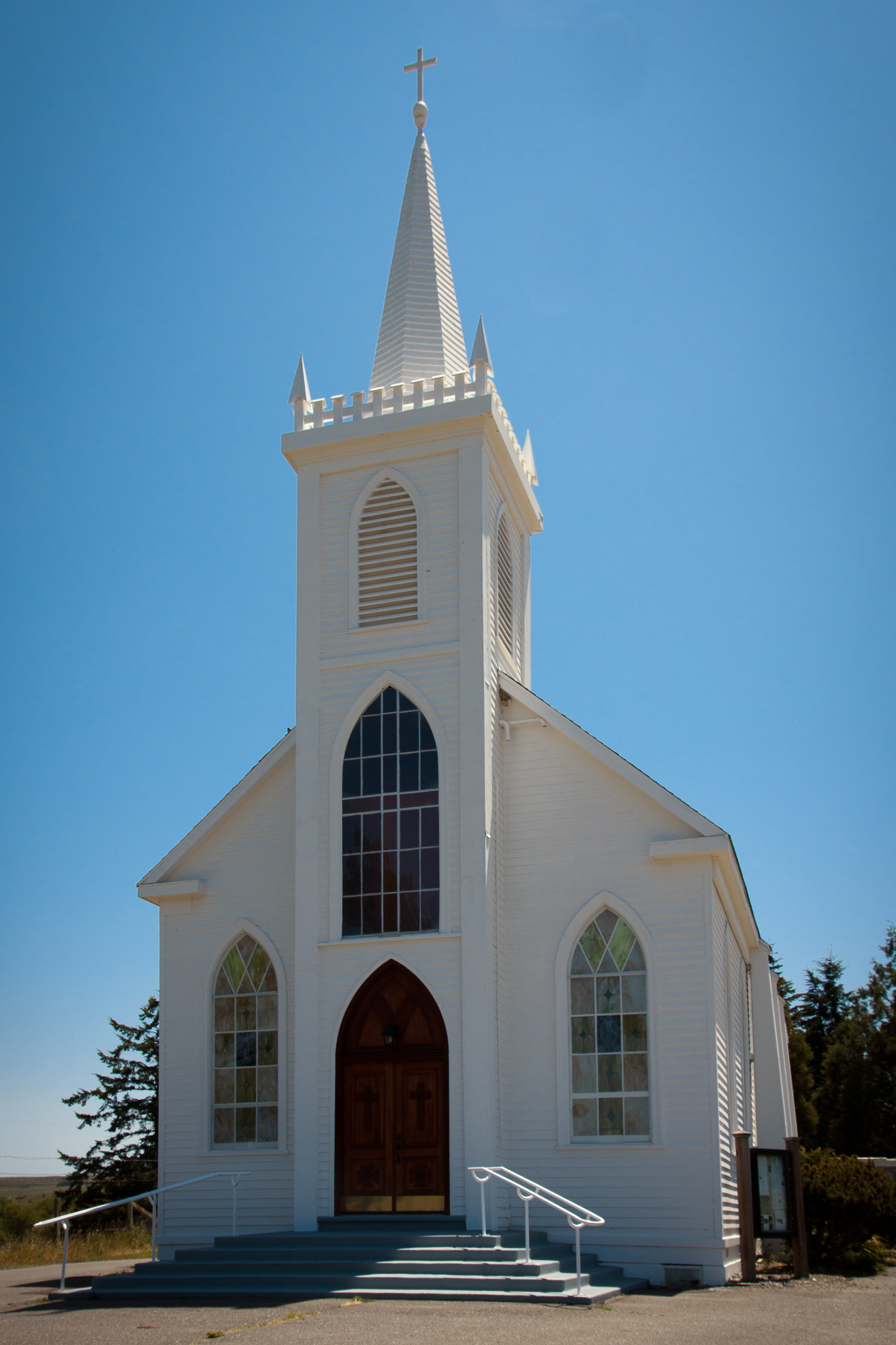
Besides its stunning beauty, Bodega Bay has another claim to fame as being the location for the filming of Alfred Hitchcock’s 1963 thriller “The Birds.” As we drove through the village, we noticed a life-size statue of the man himself outside a store, and made sure to stop at the Bodega Bay Church, which is quite recognizable for anyone that has seen the move as the place where the school children sought refuge from the attacking birds.
Later that day we set off for the quintessential Sonoma Valley experience – wine tasting at one (or as it turned out, two) of its many wineries. Celeste’s parents had asked us if we would prefer to go to Napa Valley, but since they lived in Sonoma and the wineries there were more casual and less touristy, we chose to stay in Sonoma Valley.
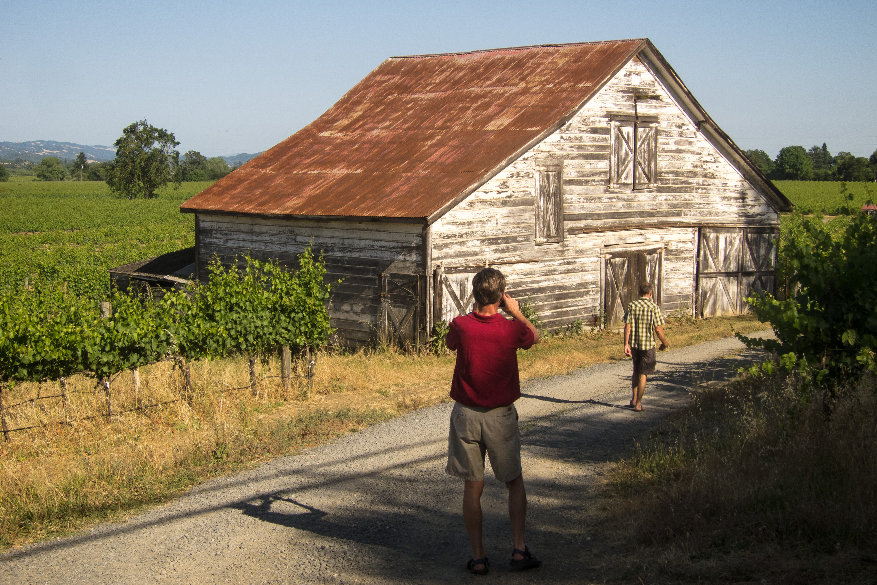
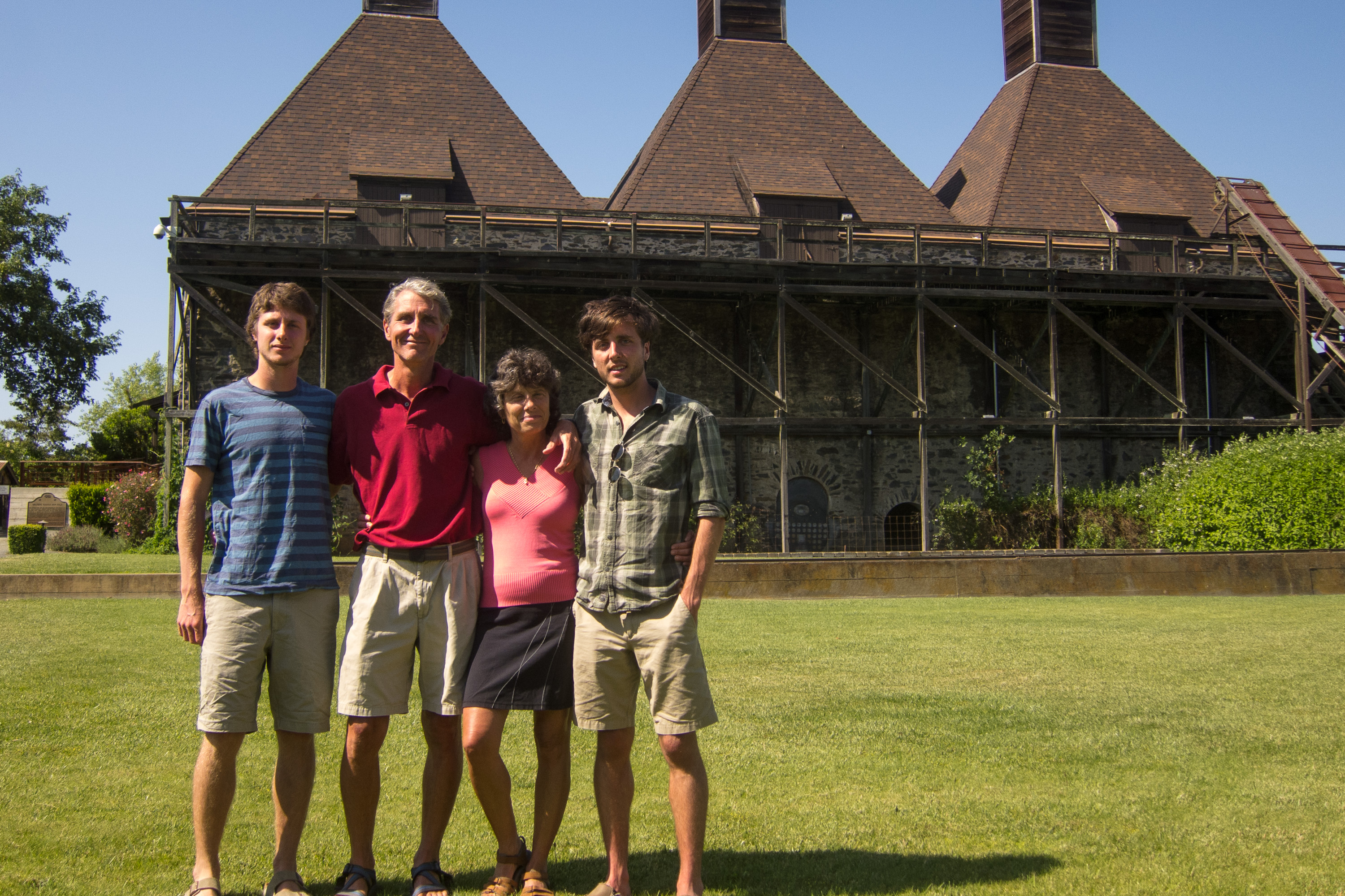
The first winery we visited was Hop Kiln, located on Westside Road in Healdsburg. While I found the wines average, the grounds were beautiful and the historical old brewery served as a great background for family photos.
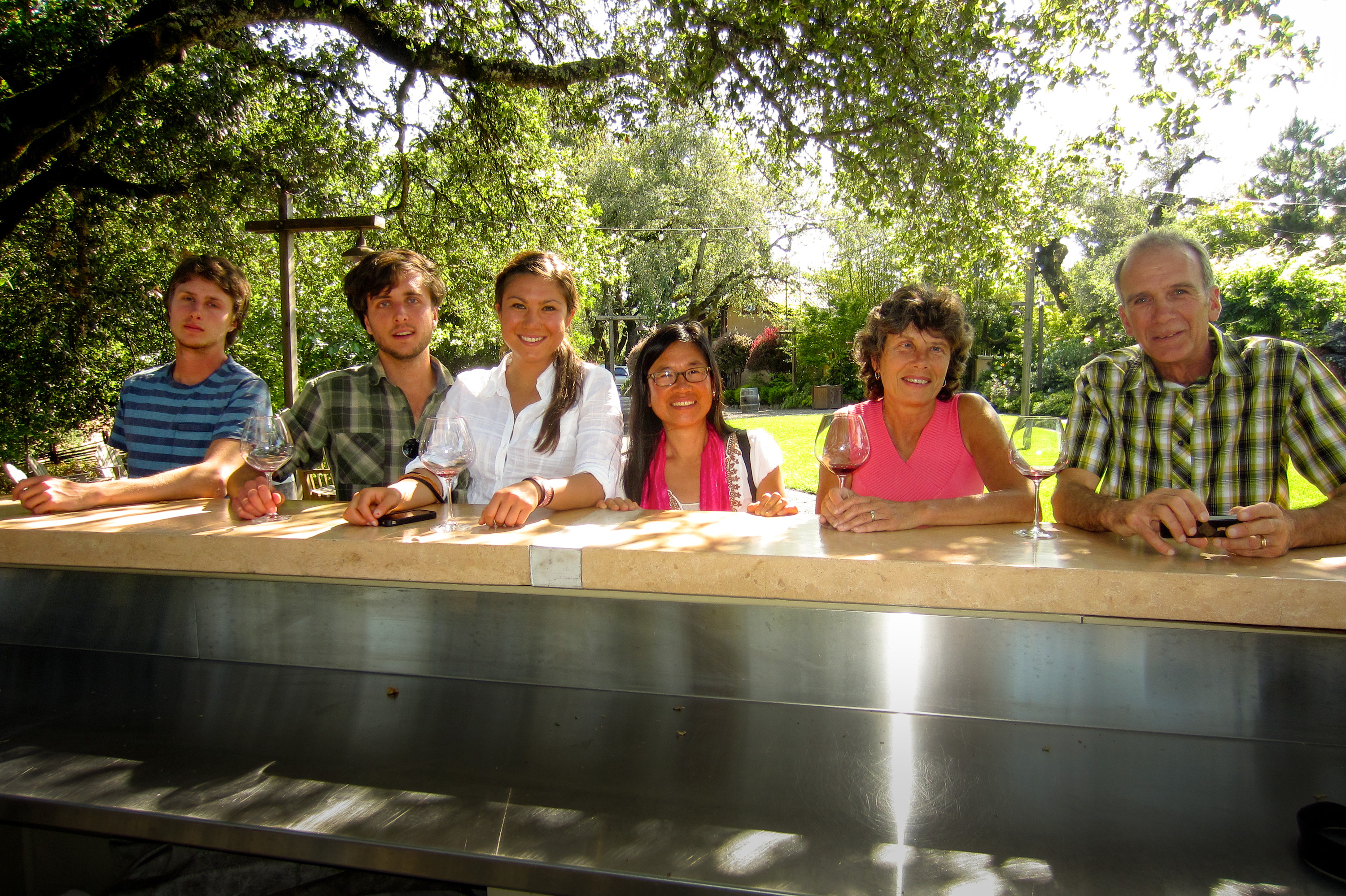
Our next stop was Arista Winery, also on Westside Road in Healdsburg, which we found much better both in terms of quality of wine and the grounds. They allowed us to leave the tasting room with our final wine selection to stroll through their lovely Japanese Garden. It was a beautiful afternoon, and what I thought were tiny amounts of wine in very big wine glasses were beginning to take effect. I am embarrassed to say that one of the memorable highlights from this winery was their bathroom. The tiling and original artwork rivaled that of a country chateau.
I was feeling a little bad for Tommy at this point. It must have been quite boring for a 20-year-old (and hence the designated driver) watch his parents and older brother pretend they knew what they were doing at a wine tasting. However, as always, he was a very good sport.
The day just kept getting better and better. After the wineries, we stopped in the charming town of Healdsburg where we happened upon their Tuesday Concerts in the Plaza. It was quite the scene—lively music, people dancing in the plaza—very layback, very California. The west coast was definitely starting to grow on me.
We completed an absolutely wonderful day at Diavola Pizzeria and Salumeria in Geyserville where there was an amazing selection of wood-fired pizzas. We didn’t know where to start, but once we got going, we sure knew how to finish. We ordered a delicious selection of four different pizzas and appetizers, and it was so good that we could barely speak between bites.
We returned home fully stuffed and fully satisfied from another wonderful day with our wonderful hosts!
Day 5 – San Francisco
Celeste and her parents had some family obligations to take care of today, so left to our own devices, we decided to head into San Francisco to get a flavor for the city.
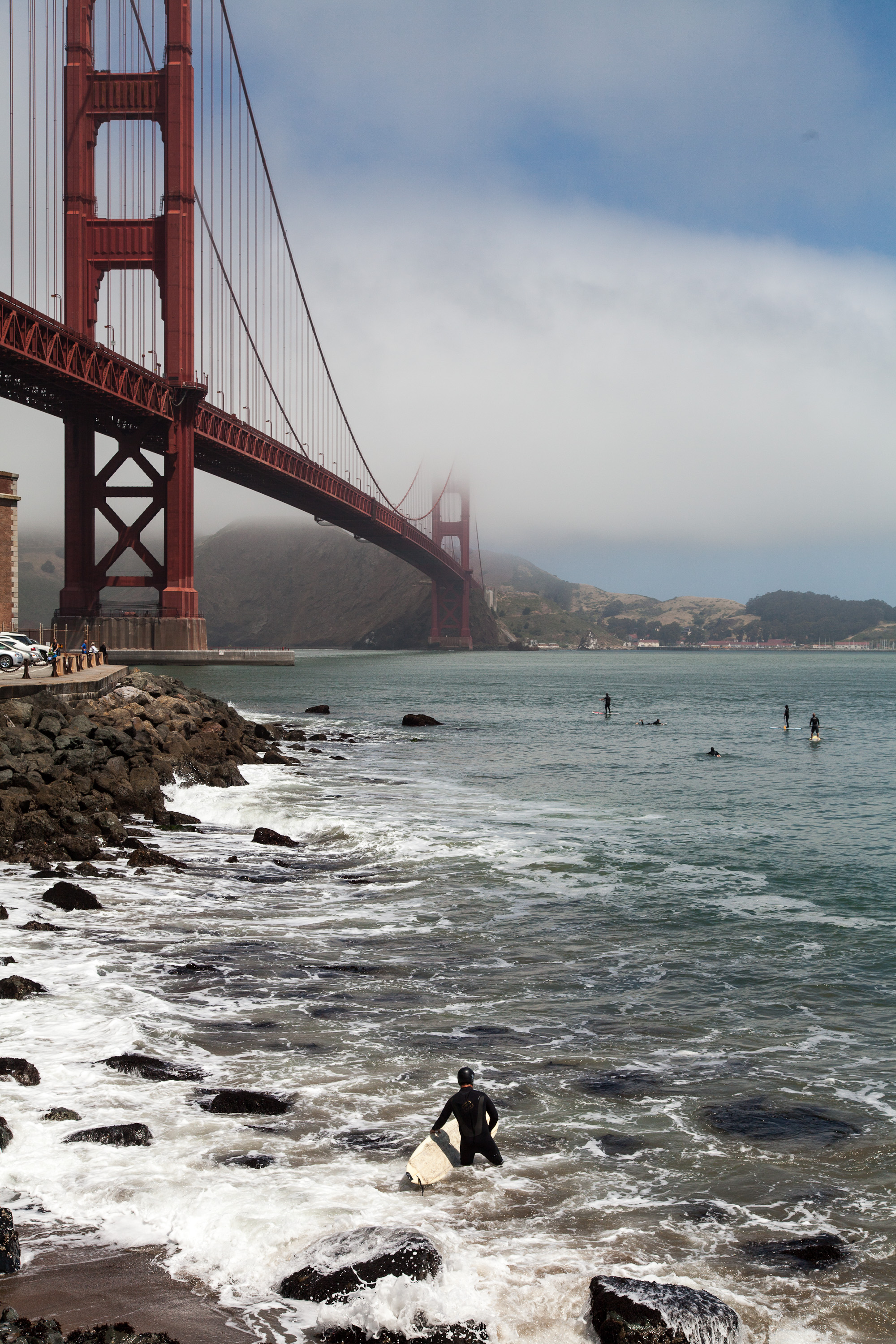
As if to confirm our preconceived image of San Francisco, our first viewing of the Golden Gate Bridge was cloaked in fog. I probably would have been disappointed if it wasn’t. We took note of a good viewpoint on the other side of the highway that we would try to hit on our way back out of the city—hopefully, after the fog had time to disperse.
Immediately after crossing the bridge, we exited 101 and looped back to Fort Point Historic Park, located right under the bridge. From here, Herb and the boys took photos of the bridge from every possible vantage point. Actually, the coolest sight was of five wetsuit-clad surfers on paddle boards rowing out to the beginning of the waves and riding them in dangerously close to the rocky shoreline.
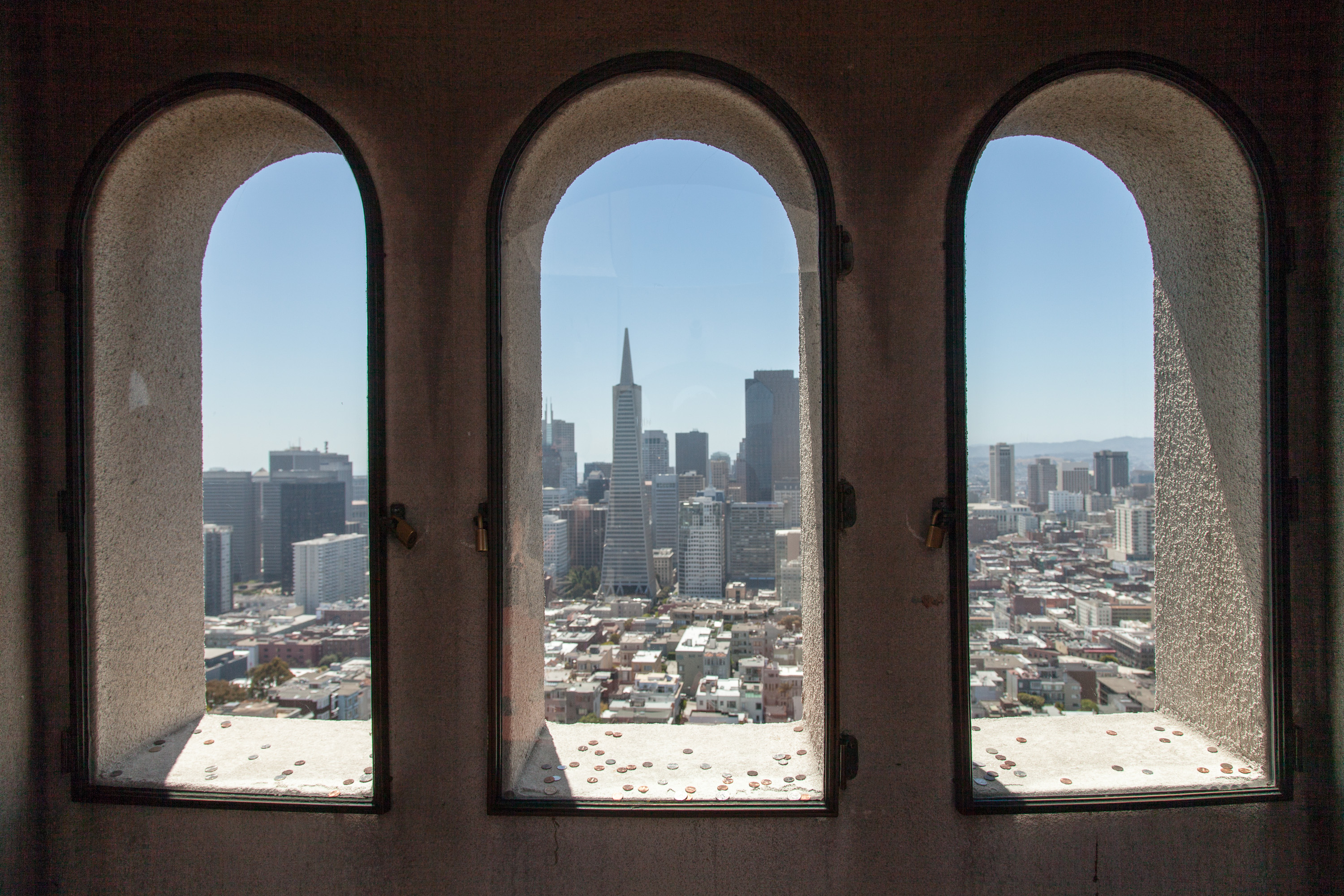
Having captured the bridge from every photographic angle, we drove across town to Coit Tower atop Telegraph Hill, an iconic emblem of San Francisco’s skyline—and a bit of a tourist trap. $28 dollars later, we were on the elevator to the top up the 210-foot, slender, white concrete tower for an incredible 360 degree view of the city and bay, Alcatraz, and both the Golden Gate and Bay bridges from its observation deck.
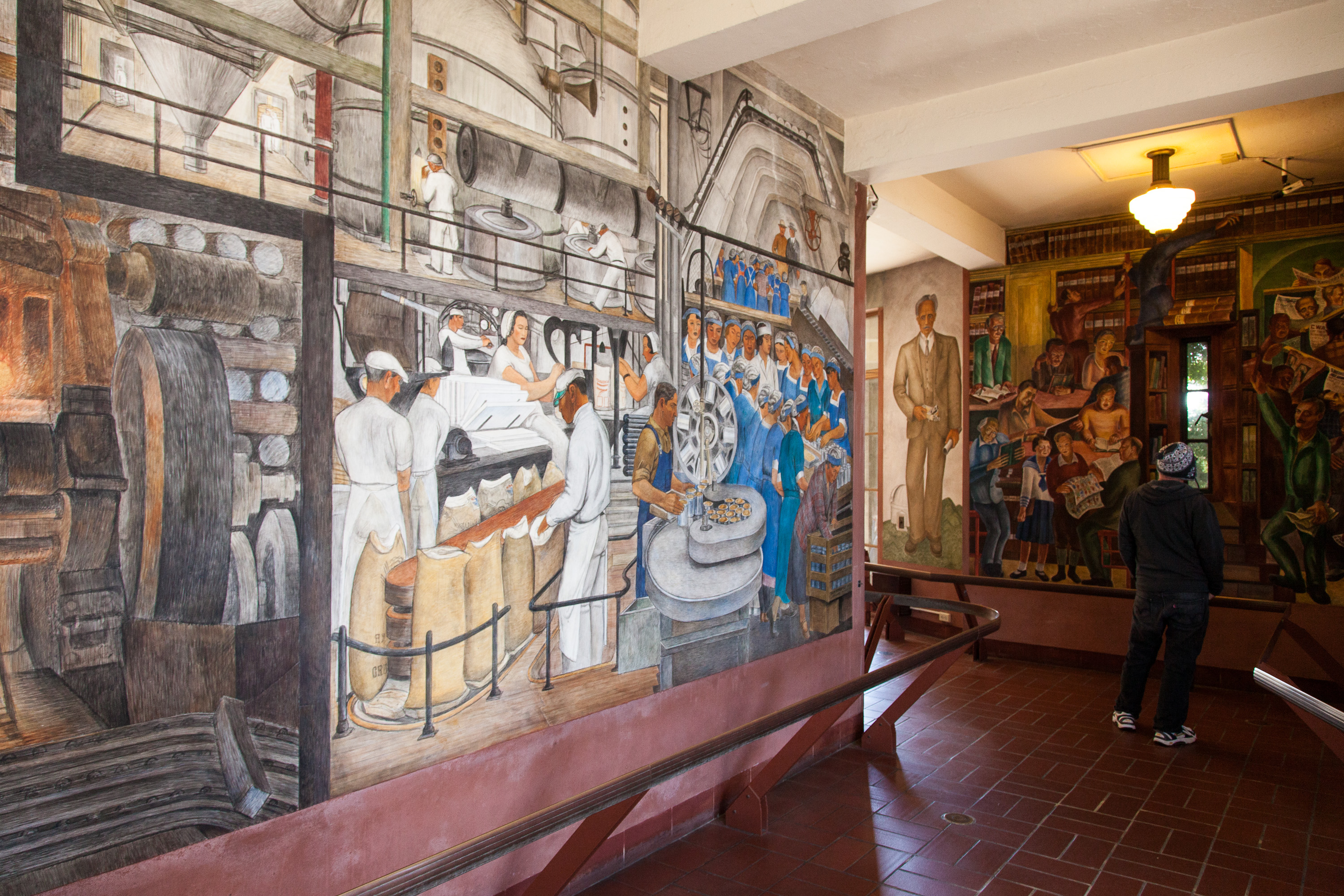
After navigating our way back through the gift shop, we spent some time enjoying the murals decorating the inner walls of the tower’s base. These murals, which depict life in California and the struggles of the working class during the Depression, were painted in 1934 by artists employed by the Public Works of Art Project. They have undergone quite a bit of controversy over the years due to what was considered radical Communist content. Today they are protected as historical treasures, and can be viewed for free on the first floor of the Coit Tower. The murals alone are well worth the visit to the Tower.
The original plan was to have lunch in Chinatown, but so did half of San Francisco. After circling through the neighborhood three times without finding parking, we switched gears and decided to have a picnic in Golden Gate Park.
Oh, but first – being the tourists we are – we, of course, had to drive down Lombard Street. It definitely was steep, so steep that it was designed with eight switchbacks, because without them, it would have been a 27% grade, way too steep for most cars to deal with. In fact, we had been on an 18% grade road on the way to the Isle-aux-Coudres in Quebec and we thought that was ridiculous. Since we were in a rental car this time, rather than the RV, it was fun. I don’t know how the people that live on this street can stand all the tourists driving down all day long snapping pictures.
Having safely made it to the bottom, and taking our own photos along the way, we headed over to Golden Gate Park. But first, there was the matter of obtaining lunch for our picnic. Tommy—always the techy of the group—quickly used the Yelp App (see Tips) on his smartphone, and found reviews and price ranges for restaurants and delis in our geographic proximity. After finding a deli that looked good, his phone was even nice enough to navigate us to it. I love technology.
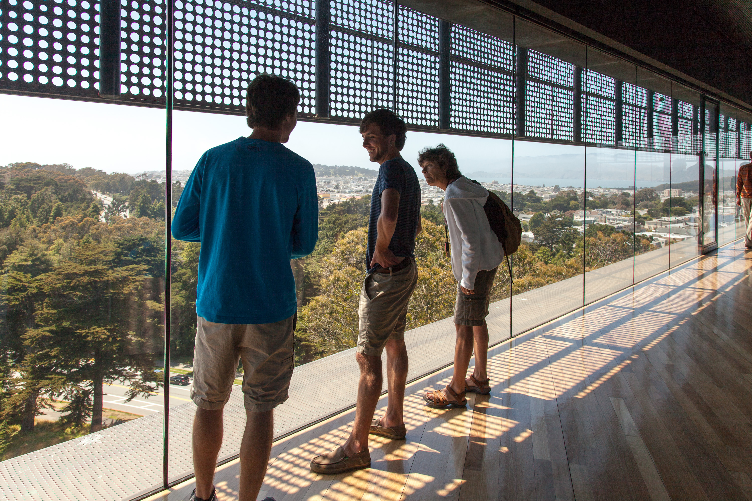
The park was lovely, and actually did remind me quite a bit of Central Park. A surprising fact is that it is even larger than Central Park. We really didn’t have enough time to do the park justice, but we did have a lovely picnic and then went to the top of the Hamon Observation Tower in the de Young Museum. Like the Coit Tower (except this one was free), there were fabulous panoramic views of San Francisco and the park, the Pacific Ocean, and the Marin headlands in the distance. The floor to ceiling glass walls of the tower made for a particularly impressive view and experience. There is so much to see and do in the park that we could easily have spent a day or two and not seen it all.
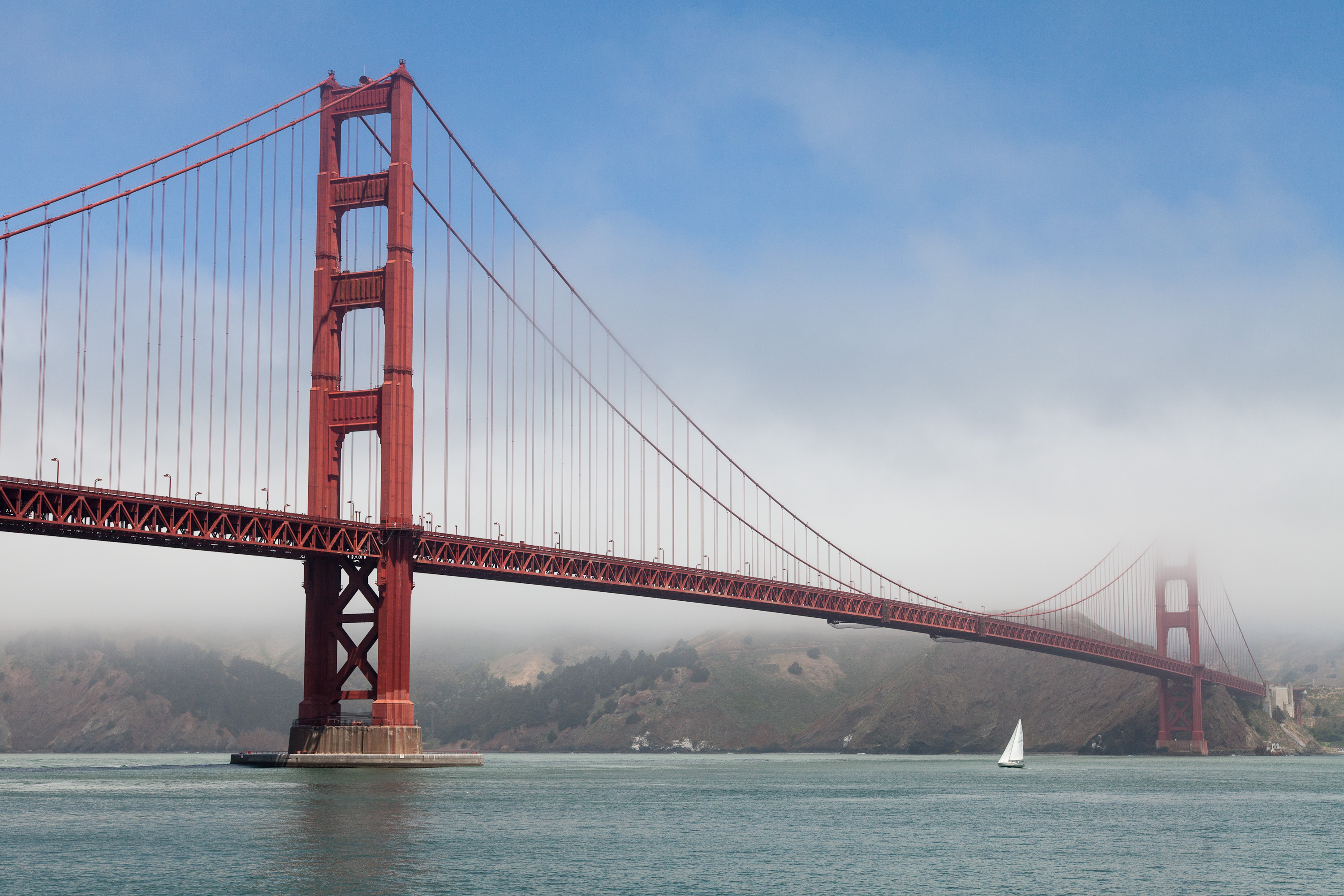
As planned, on our way back across the Golden Gate Bridge, we pulled into the scenic viewpoint parking lot right across the bridge and this time were able to capture images of the bridge sans fog.
Back at Celeste’s house, we had a lovely last evening together, but Herb and I still had to figure out what we were going to do with our 5 remaining days. Our first choice was Lassen Volcanic National Park, which we had never seen; but winters end late there, and a quick search on the internet confirmed our fear that the roads through the park were still closed. The next obvious choice would have been to continue up Route 1 all the way to Oregon, exploring Redwoods National and State Parks, but we had already kind of done the “tree” thing in Sequoia and Kings Canyon, and as much as we like trees, we wanted something to do something a little more exciting.
That’s went it hit us. We couldn’t possibly come this close to Yosemite and pass up the opportunity to stop by. I quickly got onto the internet to see if any accommodations were available over the next few days. Not much—just two nights in the Housekeeping Cottages for the following Saturday and Sunday night. That would give us two nights to do something new, and two more to visit an old friend. We grabbed it.
We had had such a wonderful time together in Sebastopol that I don’t think any of us were ready to see it end. But end it must. Tomorrow, bright and early, the kids would catch a flight back to New York. From there, Andrew and Celeste would head to Cambridge, Massachusetts to start their summer internships, and poor Tommy would hop in his car to travel back 2/3 of the way across the country to Boulder, Colorado to start his. Boy, I missed them already.
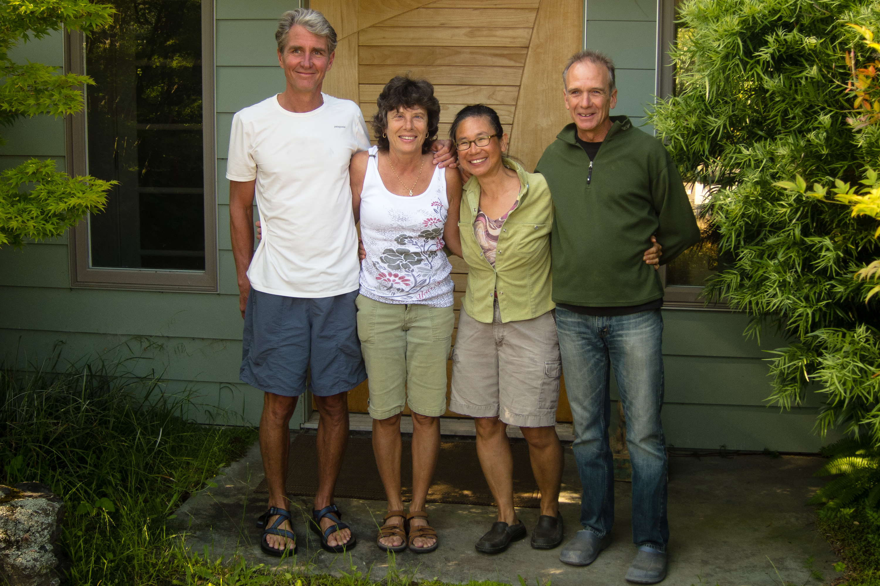
A giant thanks goes to Celeste’s parents who had been the most incredible hosts and tour guides that anyone could have hoped for.
Day 6 – Armstrong Redwoods
Now, that the kids were on their flights back home, Herb and I had to switch gears to a more romantic mode of travel—just the two of us, armed with maps and dreams, and 5 days to do whatever we wanted in northern California.
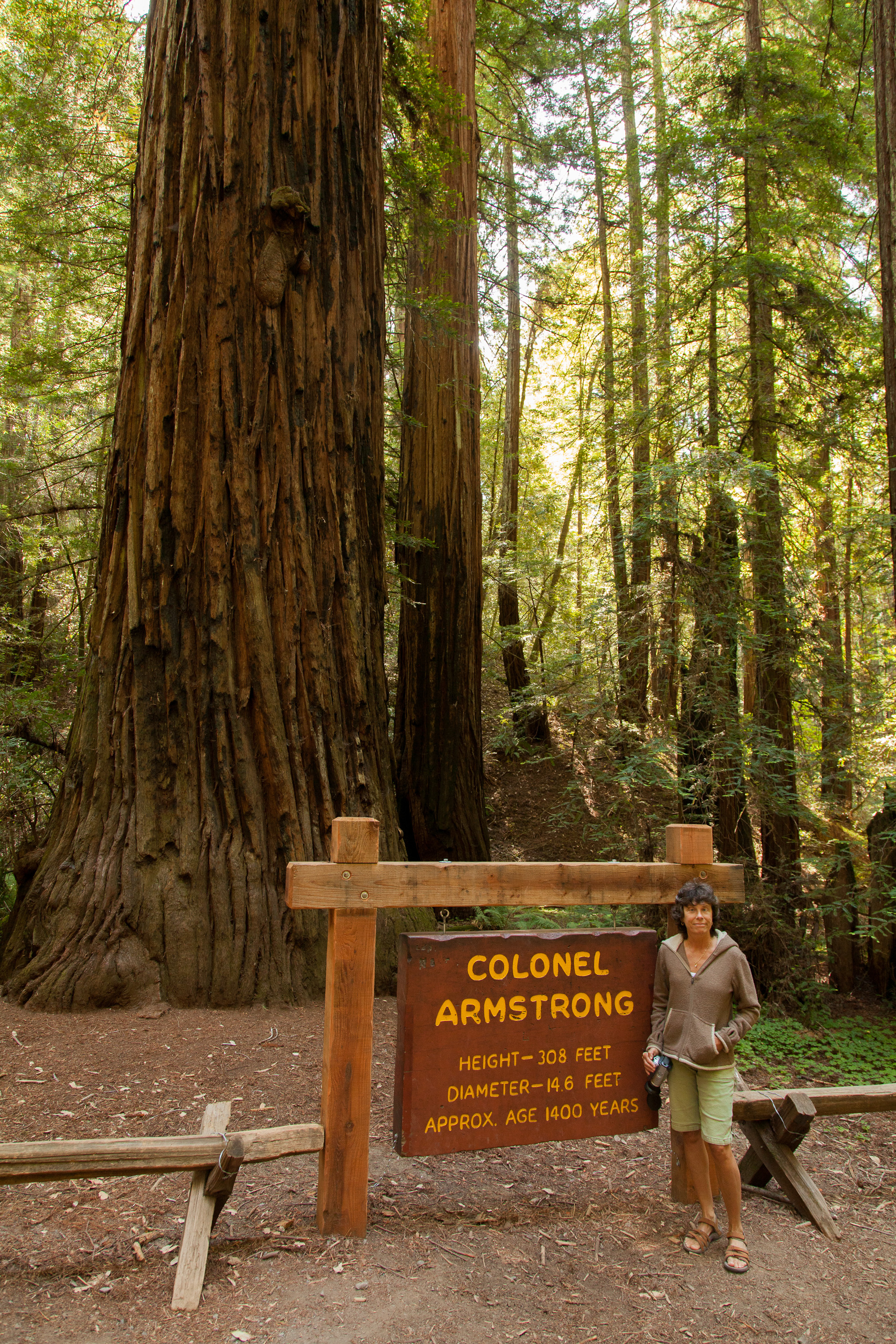
We began our adventure by heading back towards the coast, with a quick side trip to Armstrong Redwoods State Natural Reserve to pay our last tribute to these remarkable trees that are so much a part of the northern California landscape. Although you can drive through the park, we chose to park at the entrance and walk the 1.5 mile Pioneer Nature Trail to get a more up-close and personal experience with these giants. It was quiet, peaceful, and serene---or at least until we ran into a class trip of preschoolers.
The trees in the Armstrong preserve are coast redwoods—their fancier Latin name is Sequoia sempavirens. Rising 200 to 250 feet above the forest floor, they are the tallest living things on Earth. Typically they live 500 to 1,000 years, with some trees surviving over 2,000 years and growing as high as 350 feet. With 55 inches of rain per year, the Armstrong preserve provides the wet and mild climate needed for these coast redwoods to thrive.
Ironically, this beautiful 750-acre virgin redwood forest was set aside in the 1870s by James Armstrong, a timber tycoon who made his living by harvesting these very same types of trees. Before the massive logging operations of the 19th century, redwood forests, such as this, covered much of this area. Today, this serene, majestic grove is a small but magnificent reminder of that primeval redwood forest. Fortunately, Armstrong admired these incredible trees enough to give him the foresight and good sense to preserve (at least some of) them for future generations to enjoy..
Sebastopol is a charming town in Sonoma County, 52 miles north of San Francisco and about a 20-minute drive to the coast. Sebastopol is known for its apples and hosts an annual Apple Blossom Festival in April and the Gravenstein Apple Fair in August. Today, however, the apple orchards are becoming vineyards as wine-making moves more and more into the region.
Every Sunday, from April to mid-December, there is a Farmers market in the downtown plaza,
where people congregate to enjoy delicious fresh regional food, live music, and dancing.
Sebastopol is home to the artist, Patrick Amiot, known for his whimsical, cartoon-like, junk-art sculptures. There are over 200 of his wacky, found-object works scattered throughout Sebastopol, especially on Florence Street.
Side Trips from Sebastopol
Mill Valley and the Dipsea Trail
Mill Valley is a picturesque town, nestled amongst redwoods on the southern slope of Mt. Tamalpais. It is located in Marin County, about 14 miles north of San Francisco. Mill Valley began as a logging town in the 1830s, but has since become a very upscale community, with exclusive boutiques and expensive homes.Mill Valley is also the location for the start of the Dipsea Trail, the site of the oldest trail race in America, having first been run in 1905. The race course begins in Mill Valley and immediately climbs a steep set of steps (676 in all) and trails over Mt. Tamalpais before eventually making the long descent to Stinson Beach, 7.4 miles away. It is one of the most grueling and treacherous races in the country, but also one of the most beautiful.
For those not wanting to run the 7.4 miles over the mountain to Stinson Beach, the beautiful Panoramic Highway climbs from Mill Valley through Mt. Tamalpais State Park, before descending to Stinson Beach 11 miles later.
Stinson Beach
Stinson Beach is a 3-mile sandy beach located along Highway 1 about 20 miles northwest of San Francisco. Besides the beach, generally packed with surfers and swimmers on the weekends, there is a 51-acre park with more than 100 picnic tables. When not blanketed in fog, as it often is, there are tremendous views of San Francisco to the south and Point Reyes to the north. The town of Stinson Beach has plenty of restaurants, shops, and galleries to entertain on those foggy days.Point Reyes National Seashore – Tule Elk Reserve
The Point Reyes National Seashore is a 71,000-acre park preserve located on the Point Reyes Peninsula, about 40 miles north of San Francisco. It has 110 square miles of sandy beaches and over 150 miles of hiking trails.The Tule Elk Reserve is at the northern end of the peninsula at Tomales Point. Tule elk were nearly eliminated in the mid-1800s, due to hunting and displacement by cattle. In the 1970s, tule elk were reintroduced to the grasslands of Tomales Point. While population growth was slow at first, the introduced herd eventually began to show an exponential increase in population and is now at a sustainable level of 450 individuals. The Point Reyes National Seashore is the only National Park where tule elk can be found.
The Tomales Point Trail through the Reserve begins at the end of Pierce Point Road near the historic Pierce Point Ranch. The hike to Windy Gap, where the elk can be seen grazing, is about 2 miles. The open trail offers breathtaking views of Bodega Bay to the north, the Pacific Ocean to the west, and Tomales Bay to the east. Hikers can continue another 3.7 miles to the north tip of Tomales Point.
Bodega Bay
Bodega Bay is the first of a string of fishing hamlets that line the coast of Northern California. Its main claim to fame is that in was the setting for Alfred Hitchcock’s 1963 thriller, The Birds.The Bay itself lies at the northern tip of the Point Reyes peninsula and is approximately 5 miles across. It is protected in the north by Bodega Head, which rises 265 feet above sea level. There are numerous hikes along the stunning headlands of Bodega Head. From the Salmon Creek Beach parking lot there is a 2 to 3 mile loop atop a bluff overlooking the dramatic pounding of the surf against the rocky shoreline below.
Sonoma Wineries
While Sonoma Valley is only a few miles apart from its more famous neighbor, Napa Valley, it is quite different – more casual, less pricey, and much less crowded. Sonoma takes great pride in not being Napa.
When people talk about Sonoma, they mean the whole country, whose 1,500 acres make it much larger than Napa. Sonoma County extends all the way from the coast on the west, up the Russian River Valley, into Sonoma Valley in the east, and San Pablo bay in the south to Healdsburg in the north. It is so large, that it is broken down into districts:
- Russian River Valley - west of Highway 101
- Sonoma Valley – stretches north-south along Highway 12
- Alexander Valley - east of Healdsburg
- Dry Creek Valley - north of Healdsburg
- Carneros – straddles the Sonoma-Napa border
The weather varies significantly between these districts and determines what types of grapes do best. The Russian River Valley and Carneros are nearer the coast and therefore cooler and foggier. Burgundy-style wines, such as chardonnay and pinot noir do best in this type of climate. Sonoma, Alexander, and Dry Creek Valley are further inland where Bordeaux-style wines, such as sauvignon blanc, merlot, and cabernet sauvignon do better in the warmer and less foggy climate. There are approximately 200 wineries in Sonoma County.
San Francisco – Fort Point, Coit Tower, and Golden Gate Park
Our stop in San Francisco was brief, so this in no way is an attempt to give a thorough description of what to see in San Francisco. However, the following three sites are what we chose to do during our all too short one day visit.Fort Point is located below the southern end of the Golden Gate Bridge at the entrance to the Bay. It was this location that made it a perfect place for a fort to protect San Francisco Harbor from Confederates during the Civil War and foreign attack in later years. Its arched casements are considered an excellent example of brick masonry from the Civil War period. The fort is now a National Historic Site and is part of the Golden Gate National Recreation Area.
Its vantage point will be familiar to Alfred Hitchcock fans, for it was from here that he filmed the bridge in Vertigo. Surfers also flock to this spot to ride the waves in towards the rocky shoreline.
The 210-foot Coit Tower stands atop Telegraph Hill, between the Financial District and Fisherman’s Wharf. It was built in 1934 as a monument to San Francisco firefighters, financed by Lillie Hitchcock Coit. Lillie was quite a fan of the fire department and rarely missed a fire or a fireman’s funeral. She even had her bedsheets embroidered with the firehouse emblem. When she died, she left one third of her fortune for the building of this memorial. This art deco tower, built of unpainted concrete, was designed by Arthur Brown, Jr. and Henry Howard.
The interior walls of the tower are embellished with Diego Rivera-style fresco murals, most of them depicting life in California during the Great Depression. 25 artists worked on these murals as part of the WPA program of the New Deal. At the time the murals were quite controversial and denounced as Communist. Fortunately, they are now protected as national historic landmarks.
Visitors can pay $7 to ride the rickety elevator to the top of the tower for fantastic 360 views of the city, including the Golden Gate and Bay Bridges, Alcatraz, Lombard Street, Nob Hill, and more.
Golden Gate Park is to San Franciscans what Central Park is to New Yorkers. Its 1,017 acres make it 20% larger than Central Park. It is over three miles long (from east to west) and half a mile wide (north to south). The park design was the result of an 1870 competition, won by 24-year-old William Hammond Hall
Park highlights include:
- 7.5 miles of bike trails and 12 miles of equestrian trails
- Baseball fields, soccer fields, and tennis courts
- An archery range
- Fly-casting pools
- The De Young Museum
- The Academy of Sciences
- A Japanese Tea Garden
- The San Francisco Botanical Garden
- Kazar Stadium
- Golden Gate Park Stadium
- The Conservatory of Flowers
- The Aids Memorial Grove
- Stow Lake
- Spreckels Lake
- A bison paddock
Armstrong Redwoods State Natural Reserve
Armstrong Redwoods State Natural Reserve, located in Sonoma County just north of Guerneville, has preserved 805 acres of Coast redwood trees. Rising 200 to 250 feet above the forest floor, they are the tallest living things on Earth. Typically they live 500 to 1,000 years, with some trees surviving over 2,000 years and growing as high as 350 feet. With 55 inches of rain per year, the Armstrong preserve provides the wet and mild climate needed for these coast redwoods to thrive.Although you can drive through the park, the 1.5 mile Pioneer Nature Trail provides a more up-close and personal experience with these giants..