- Home
- About
- Map
- Trips
- Bringing Boat West
- Migration West
- Solo Motorcycle Ride
- Final Family XC Trip
- Colorado Rockies
- Graduates' XC Trip
- Yosemite & Nevada
- Colorado & Utah
- Best of Utah
- Southern Loop
- Pacific Northwest
- Northern Loop
- Los Angeles to NYC
- East Coast Trips
- Martha's Vineyard
- 1 Week in Quebec
- Southeast Coast
- NH Backpacking
- Martha's Vineyard
- Canadian Maritimes
- Ocracoke Island
- Edisto Island
- First Landing '02
- Hunting Island '02
- Stowe in Winter
- Hunting Island '01
- Lake Placid
- Chesapeake
- Provincetown
- Hunting Island '00
- Acadia in Winter
- Boston Suburbs
- Niagara Falls
- First Landing '99
- Cape Hatteras
- West Coast Trips
- Burning Man
- Utah Off-Roading
- Maui
- Mojave 4WD Course
- Colorado River Rafting
- Bishop & Death Valley
- Kauai
- Yosemite Fall
- Utah Off-Road
- Lost Coast
- Yosemite Valley
- Arizona and New Mexico
- Pescadero & Capitola
- Bishop & Death Valley
- San Diego, Anza Borrego, Joshua Tree
- Carmel
- Death Valley in Fall
- Yosemite in the Fall
- Pacific Northwest
- Utah Off-Roading
- Southern CA Deserts
- Yosemite & Covid
- Lake Powell Covid
- Eastern Sierra & Covid
- Bishop & Death Valley
- Central & SE Oregon
- Mojave Road
- Eastern Sierra
- Trinity Alps
- Tuolumne Meadows
- Lake Powell Boating
- Eastern Sierra
- Yosemite Winter
- Hawaii
- 4WD Eastern Sierra
- 4WD Death Valley +
- Southern CA Deserts
- Christmas in Tahoe
- Yosemite & Pinnacles
- Totality
- Yosemite & Sierra
- Yosemite Christmas
- Yosemite, San Diego
- Yosemite & North CA
- Seattle to Sierra
- Southwest Deserts
- Yosemite & Sierra
- Pacific Northwest
- Yosemite & South CA
- Pacific Northwest
- Northern California
- Southern Alaska
- Vancouver Island
- International Trips
- Index
- Tips
- Books
- Photos/Videos
- Search
- Contact
Red Rock State Park, NM
Saturday, August 10, 2002 - 11:30am by Lolo
80 miles and 1.5 hours from our last stop - 1 night stay
Travelogue
It was late afternoon when we pulled into Red Rock State Park, a few miles off I40 near the town of Gallup, New Mexico. We had already had a very full day--over 6 hours of driving with stops at Walnut Canyon and Petrified Forest. Herb was fried and ready to just settle down to a cold beer, some good music, and a view. Well, that's exactly what he got. From the back windows of our RV, there was an incredible view of a natural amphitheater, surrounded on three sides by red sandstone cliffs and buttes, with an interesting rock formation called Church Rock perched on the top of the cliff. Perfect!
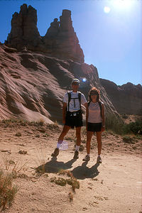
 Old Farts at Red RockBeing the hyperactive tourist I am, I just couldn't relax until I had explored a little and seen what this place had to offer. Besides, I had noticed an awful lot of activity in the parking lot in the day use area when we pulled in, so the kids and I just had to check it out, leaving Herb behind to unwind.
We were amazed with what we found! Set into the beautiful red sandstone cliffs of the Park was an 8,000-seat arena, and that night it was playing host to an Intertribal Indian Ceremonial Dance of some sort. I called Herb on the walkie-talkies to tell him of our find, but he wasn't budging. He reminded me that it was getting late and we hadn't even had dinner yet. Unable to overcome our curiosity, the kids and I went to the entrance of the arena to take a peek. A brief peek was all we got before we were asked to present our tickets. Since all I had in my pocket was $5 and we were starving, we said, "No Thank You," and headed back to the RV.
 Red RockLater, when I found out what a big deal this event was, I really regretted having missed it. It's one of the oldest and largest gatherings of Indian tribes in the nation, and it's been an annual event since 1922. Each year more than 14 tribes, each wearing its own distinctive dress, gather in Red Rock State Park to dance and, sell arts and crafts--and we didn't even know all this was going on just 100 yards from our campsite. I guess one of the disadvantages to winging an itinerary is not knowing enough about the places you decide to stop at.
The next morning we rose early to the sight of a colorful hot hair balloon floating through the amphitheater near Church Rock. Not a bad way to start your day.
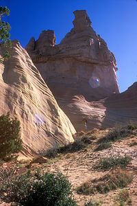
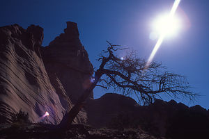
Before leaving Red Rock and continuing our drive east, we decided to take a quick hike up to Church Rock, about 2 miles away. There was no real marked trail leading up to it, but it wasn't as if we could miss it--it was pretty prominent. So, we just walked along the canyon floor and then scrambled up some slick rock to its base.
Then came our mistake--walking around the base of it without taking note of where we started. When it was time to descend, we each had a different idea of what direction we should take. It was like picking which spoke of a wheel to follow, and it all looked the same. My idea was to replay the video footage we had taken when we climbed up to try to recognize how the rock formation looked, but I guess Herb felt that this was the male equivalent of asking for directions and said it wasn't necessary. Knowing that he, by far, had the best sense of direction in the family, we followed his lead and tried to look for familiar stuff along the way. I was pretty worried because I knew that even a slightly wrong angle could lead us pretty far off course over the 2 miles we had to cover. Things got pretty tense on the way down as the kids and I started to panic that we actually were lost. Luckily, Herb kept his cool, but I think even he was starting to get a bit concerned.
Finally, we saw a road in the distance. This was both a good thing and a bad thing--bad because there had not been a road on our way up to Chimney Rock meaning we were lost, but good because at least we had found civilization. Getting to the road was a little rough going, but Tommy found a way for us to bushwhack down. As we stepped onto the deserted road and practically kissed the macadam in gratitude, the kids asked, "Which way?" "That way," said Herb and I, each pointing in different directions like characters in a Bugs Bunny cartoon. Bowing to Herb's better sense of direction, we headed towards the right. Herb ran ahead to make sure that we didn't go too far in the wrong direction. I had a different approach--I flagged down the first car I saw and asked for directions. Herb's instinct was right, and I just pretended I never had any doubts.
Description
Red Rock State Park is located just a few miles off I40 near the town of Gallup, New Mexico. The park has an 8,000-seat arena which is home to the Annual Lions Club Rodeo (considered one of the best in the state) as well as the Annual Intertribal Indian Ceremonial held each year in August. This event includes colorful Indian dances from various tribes and booths selling Indian foods, jewelry, and crafts.
 Red RocksNear the arena is a large, well-equipped campground set in a natural amphitheater, surrounded on three sides by red sandstone cliffs and buttes.
From the campground, trails lead into the amphitheater to Native American petroglyphs and to the most prominent rock formation in the park, Church Rock.
Videos
-
Church Rock Hike in Red Rock State Park
- ‹ previous
- 26 of 36
- next ›
Red Rock State Park location map in "high definition"
Javascript is required to view this map.
