Arthur's Pass and Castle Hill, NZ
We were nearing the end of our journey - just one more night in the campervan before we needed to return it to Wilderness Motorhome Rentals in Christchurch.
Back in Queenstown, we had made the decision to turn our 14-day adventure into a loop up the West Coast and back to Christchurch, rather than an out-and-back.
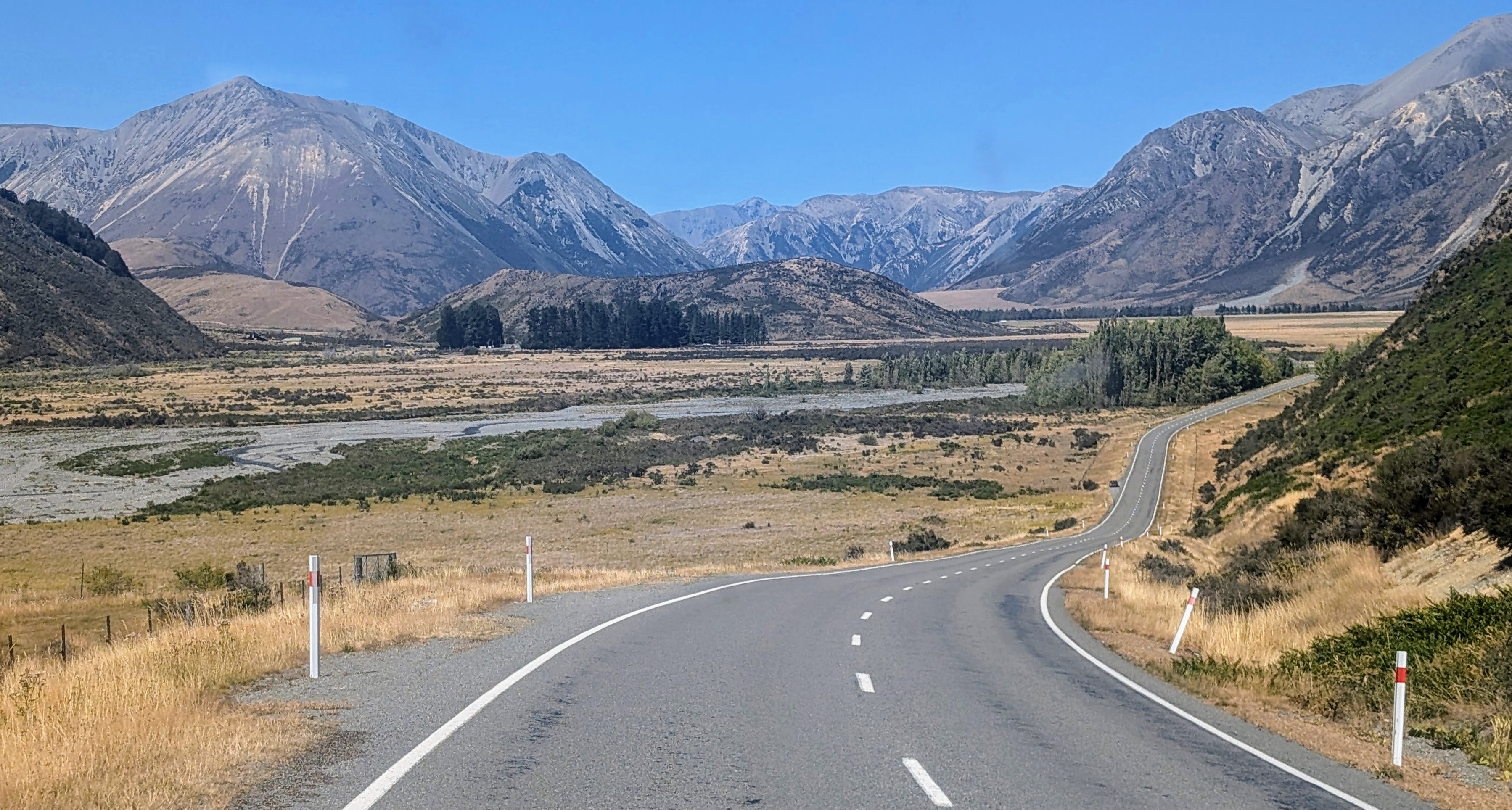
So, this would require us driving over the Southern Alps for a second time, the first being the drive from Wanaka to the West Coast (Tasman Sea) over Haast Pass, and now back across the Southern Alps from the West Coast to Christchurch along the Great Alpine Highway (also known as HIghway 73), one of the South Island’s most iconic roads - 150 miles of mountains, stunning rivers, weird rock formations, and quirky towns.
Originally, we thought we would spend our last night in the campervan somewhere along the Great Alpine Highway, but then we got it in our heads that it would be really cool to do a coast to coast drive from Pancake Rocks on the Tasman Sea all the way across to the town of Akaroa on the South Pacific Ocean.
But first we had to get up and over Arthur’s Pass.
Now that we had decided to go all the way to Akaroa today we limited our stops along the Great Alpine Highway to just the one that most intrigued us - the Castle Hill rock formations.
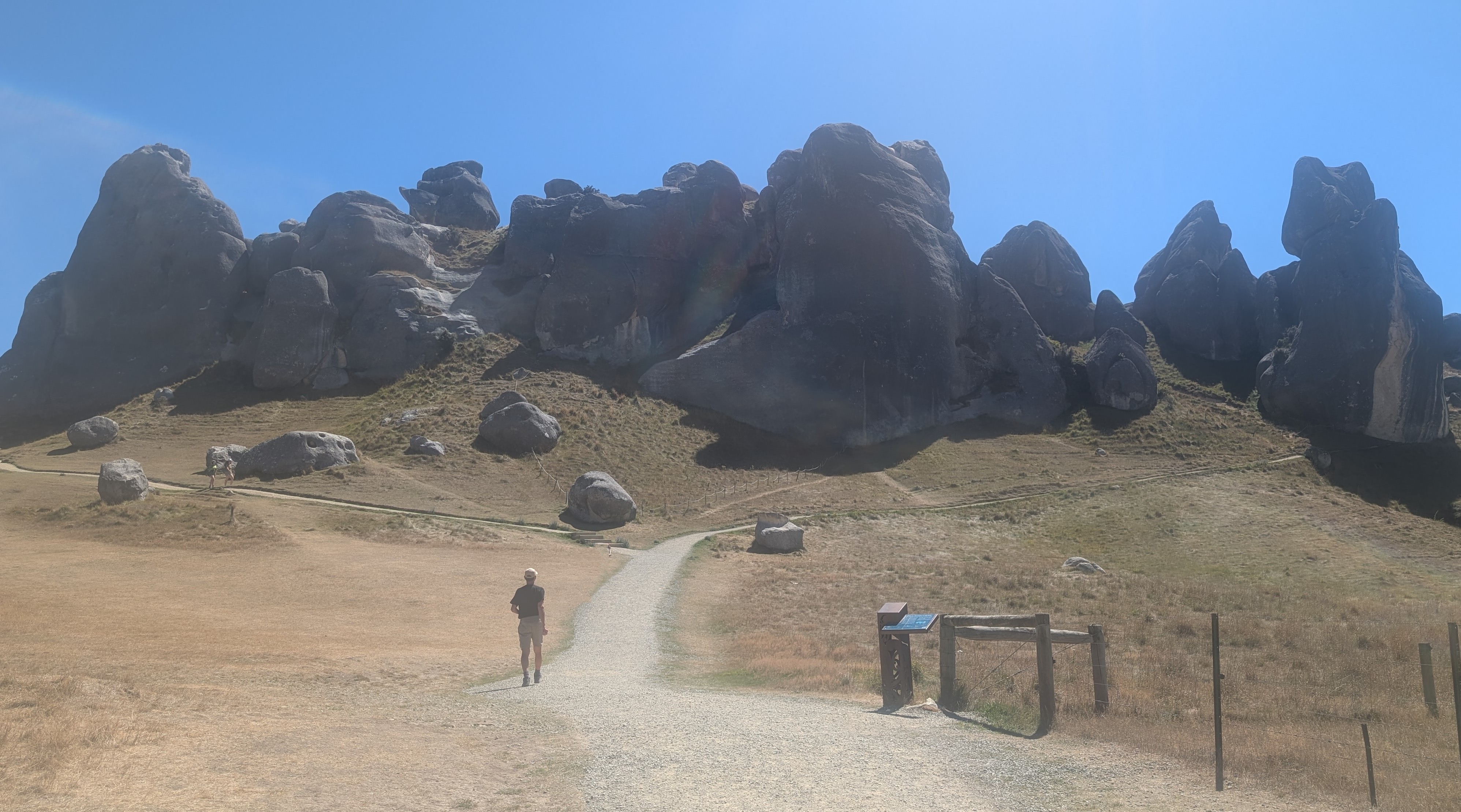
We got a little confused finding the trailhead and pulled into the Village of Castle Hill by mistake before checking All Trails and finding that the hike actually begins at the Kura-Tawhiti Access Track just a few miles past the village.
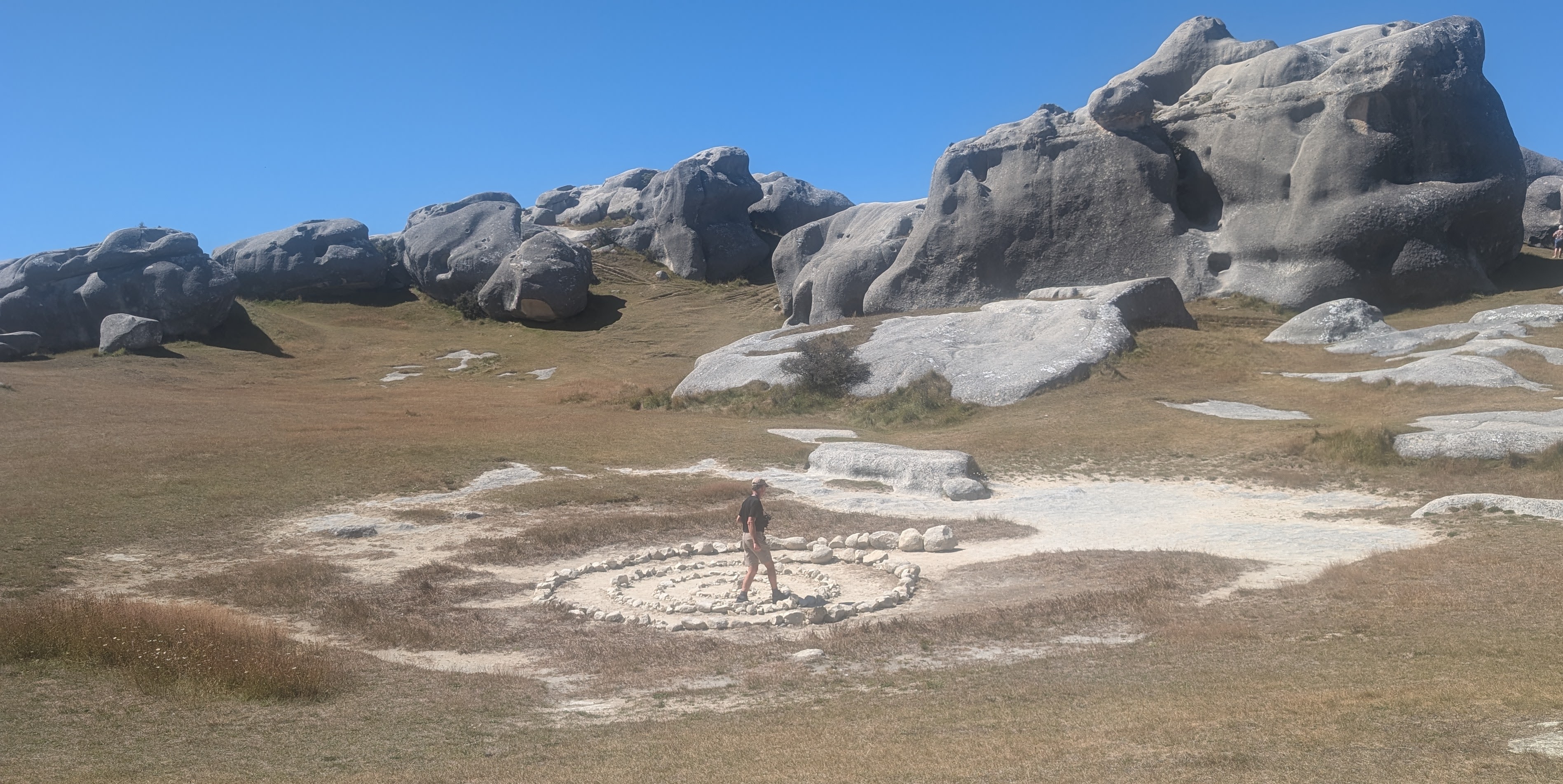
From the parking area, we walked along a dirt road toward a cluster of weird rock formations, rising from the landscape like ancient, weathered sculptures, or perhaps an old ruined castle. We really could go wild with our imagination here.

I could see why it was used as a filming location for the magical land of Narnia in "The Chronicles of Narnia: The Lion, the Witch and the Wardrobe."
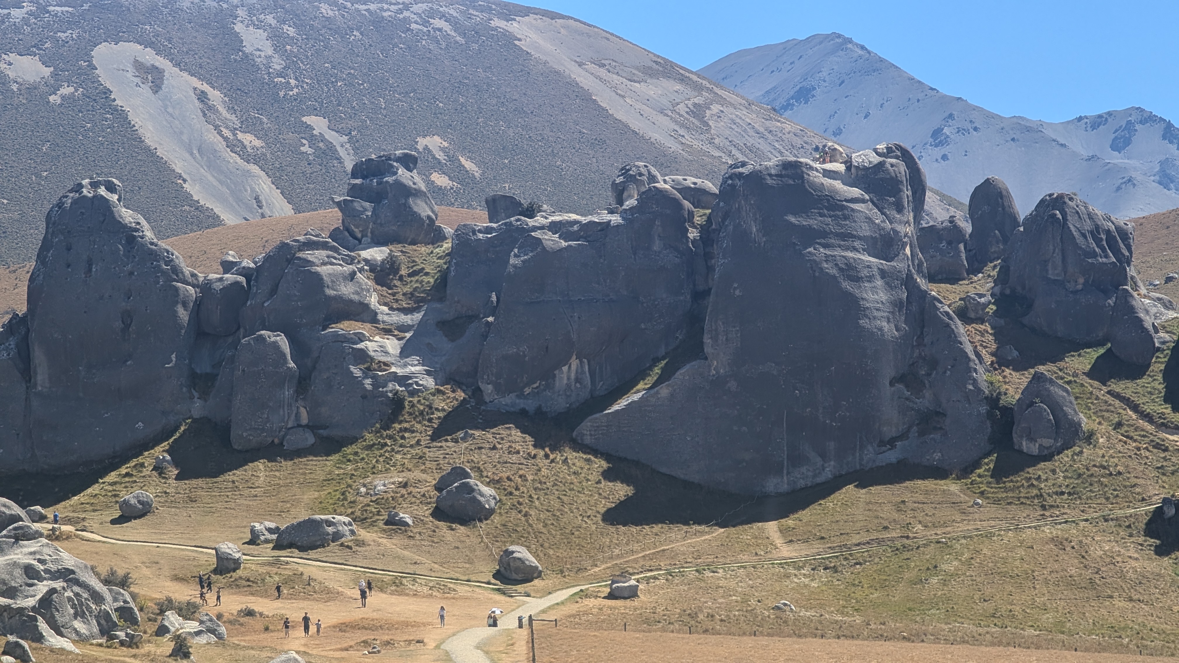
Upon reaching the boulders, we followed the track around them and sometimes wandered in and amongst them along a natural maze with a confusing network of passages, hidden corners and dead ends.
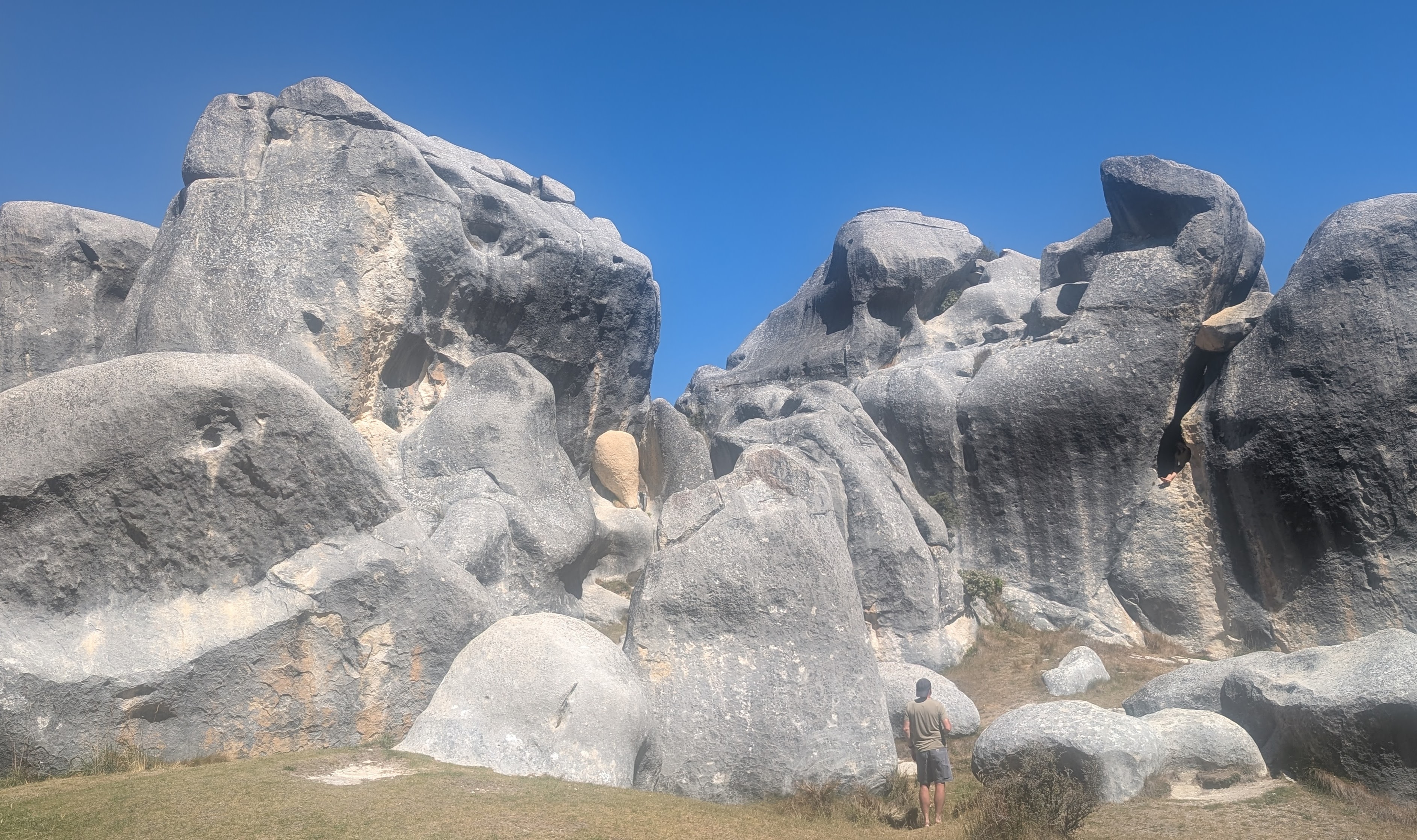
We found ourselves surrounded by these massive limestone boulders, each with its own shape and character. It was like finding animals and other shapes in the clouds. I was convinced that one of them looked just like a hamster, or maybe it was a rabbit. We were in New Zealand, so perhaps it was a Wallaby.
How did these unique limestone formations come to be? Well, pretty much the same way that the Pancake Rocks did:
30 million years ago this area was covered by an ancient inland sea, where over time marine organisms on the seabed were compressed into limestone
The inland ocean receded and the collision of tectonic plates lifted up the limestone and surrounding land
Forces of erosion (wind and water) went to work, sculpting the rock into the distinctive shapes we were enjoying today.
I was really getting to appreciate the beauty that limestone + erosion can create. Nature is a wonderful artist.
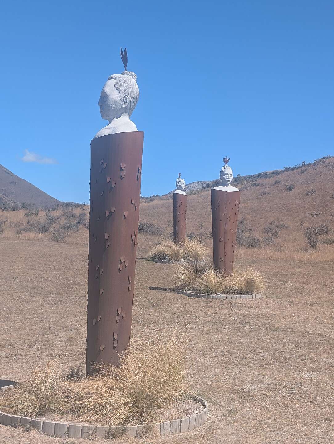
On the way back to the parking lot, we noticed three large carved wooden posts with the bust (from shoulder up) of a Maori man with a feather on his head. They represent three ancestors of the Ngāi Tahu tribe, which is the principal Maroi tribe on the South Island.
These posts (or "pou whenua" in Maori) serve as markers of territorial boundaries and their cultural connection to Kura Tawhit (the land we were currently on). Perhaps that is why they are looking in three different directions.
My one regret this trip is not learning more about the Maori people, who were New Zealand’s first inhabitants, having arrived from Eastern Polynesia in canoes around 1250 CE. Like the Native Americans in the U.S., they had a rich and complex society before the arrival of European settlers in 1840.
In recent decades, there has been a resurgence of Māori culture and language, and a growing recognition of Māori rights and interests. Today they make up about 20% of the population of New Zealand..