- Home
- About
- Map
- Trips
- Bringing Boat West
- Migration West
- Solo Motorcycle Ride
- Final Family XC Trip
- Colorado Rockies
- Graduates' XC Trip
- Yosemite & Nevada
- Colorado & Utah
- Best of Utah
- Southern Loop
- Pacific Northwest
- Northern Loop
- Los Angeles to NYC
- East Coast Trips
- Martha's Vineyard
- 1 Week in Quebec
- Southeast Coast
- NH Backpacking
- Martha's Vineyard
- Canadian Maritimes
- Ocracoke Island
- Edisto Island
- First Landing '02
- Hunting Island '02
- Stowe in Winter
- Hunting Island '01
- Lake Placid
- Chesapeake
- Provincetown
- Hunting Island '00
- Acadia in Winter
- Boston Suburbs
- Niagara Falls
- First Landing '99
- Cape Hatteras
- West Coast Trips
- Burning Man
- Utah Off-Roading
- Maui
- Mojave 4WD Course
- Colorado River Rafting
- Bishop & Death Valley
- Kauai
- Yosemite Fall
- Utah Off-Road
- Lost Coast
- Yosemite Valley
- Arizona and New Mexico
- Pescadero & Capitola
- Bishop & Death Valley
- San Diego, Anza Borrego, Joshua Tree
- Carmel
- Death Valley in Fall
- Yosemite in the Fall
- Pacific Northwest
- Utah Off-Roading
- Southern CA Deserts
- Yosemite & Covid
- Lake Powell Covid
- Eastern Sierra & Covid
- Bishop & Death Valley
- Central & SE Oregon
- Mojave Road
- Eastern Sierra
- Trinity Alps
- Tuolumne Meadows
- Lake Powell Boating
- Eastern Sierra
- Yosemite Winter
- Hawaii
- 4WD Eastern Sierra
- 4WD Death Valley +
- Southern CA Deserts
- Christmas in Tahoe
- Yosemite & Pinnacles
- Totality
- Yosemite & Sierra
- Yosemite Christmas
- Yosemite, San Diego
- Yosemite & North CA
- Seattle to Sierra
- Southwest Deserts
- Yosemite & Sierra
- Pacific Northwest
- Yosemite & South CA
- Pacific Northwest
- Northern California
- Southern Alaska
- Vancouver Island
- International Trips
- Index
- Tips
- Books
- Photos/Videos
- Search
- Contact
Brother's house in Columbus
Saturday, August 4, 2007 - 3:00pm by Lolo291 miles and 5 hours from our last stop - 2 night stay
Travelogue
 Gang playing croquet in the backyardWe made it back to my brother’s on the planned day and found a happy and well-cared for “Aggy” (my mother). In fact, I would go so far as to say that they spoiled her. My sister-in-law, who is probably one of the kindest and most patient people I know, took her shopping almost every day. This was bad news as I was not about to do this upon our return home. My brother, who is a lot less patient than his wife, also tried to entertain Aggy by taking her shopping. However, after spending two hours in a CVS as my mom wandered and browsed in every aisle, he almost lost his mind. Welcome to my world!
Seriously though, it was great being all together again, and we spent the next two days just visiting and enjoying each others company.
Description
My brother's home in a suburb of Columbus, Ohio
Vedauwoo Glens
Wednesday, August 1, 2007 - 9:00am by Lolo387 miles and 6.5 hours from our last stop - 1 night stay
Travelogue
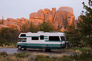 Lazy Daze in Vedauwoo Glens CampgroundThis was it. We had officially left our last planned fun stop and were now in pure driving mode. Anything good from this point on would just be gravy on top of a truly wonderful trip.
As we plugged along Route 80, I turned to my trusty to try to find someplace interesting to stay for the night. I came across a description for Vedauwoo Glen in Wyoming that seemed to fit what we were looking for: “a wonderland of huge chucks of pink granite” and only 1 mile off Route 80.
The campground was really quite lovely, set against the pink granite rock formations that the guide book had foretold. Unfortunately, as we pulled in, the clouds were building and the wind was picking up big time. A storm was definitely brewing. Also, we were at an atltitude of 8,000 feet so it was quite cool.
When I look back at this stop, I realize how well we had gotten into the groove of traveling together and how well we had achieved family harmony. Rather than mind the bad weather, I think we all found it rather cozy, and each of us settled in to do our own thing. Herb and the boys were busy loading photographs from their digital cameras onto their laptops and editing them and I was nestled with a good book.
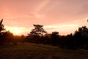 Vedauwoo Glens sunsetAfter an hour or two, the rain slowed down a bit so Andrew decided to go out for a run. Every once in awhile we would look out the window and see him run by off in the distance. At one point the rain stopped completely, so Tommy and I went out and clambered around on the rock formations just behind our site.
As evening approached I realized that Andrew had been gone for quite awhile and that the rain had started again. I kept looking out the window to see if I could see him, but all I saw was a white pickup truck going back and forth off in the distance where I normally would catch a glimpse of Andrew. Now I’m not usually a paranoid person, but I started worrying that someone—perhaps that white pickup truck—had taken Andrew. Herb and Tommy thought I was being ridiculous.
Obviously, they were going to be of no help, so I put on my jacket and started walking out towards the road in search of Andrew. I came across two women and asked them if they had seen a boy running in the rain. Not wanting to seem like a paranoid lunatic, I told them that I was looking for him to come home for dinner. They told me that they had seen him run by just recently.
Much relieved, I returned to the RV and informed Herb and Tom that Andrew was okay. They barely looked up from their laptops. Apparently, they don’t understand a mother’s hormonal need to protect her young.
A few minutes later, a very wet Andrew returned and said that some ladies told him that his dinner was ready. A bit embarrassingly, I told him how they might possibly know that. To make it worse, I also had to tell him that, in fact, his dinner actually wasn’t ready. I had just made that up. I think he appreciated how much I care about him, even if I did act a little crazy..
Description
Vedauwoo Glen is a popular rock climbing and camping area in the Medicine Bow National Forest of southwestern Wyoming, located just north of I80, about 17 miles east of Laramie and 30 miles west of Cheyenne. It is a secluded oasis of pink granite rock formations with dense pine forests and aspen groves surrounded by miles and miles of treeless plains. At an altitude of 8,000 feet, this is “high country” and very windy. Things to do include rock climbing, bouldering, trail running, and biking. There is a small campground with 50 semi-primitive sites just a stone’s throw away from I80.
Friends' home in Park City
Monday, July 30, 2007 - 11:00am by Lolo238 miles and 5 hours from our last stop - 2 night stay
Travelogue
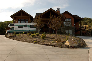 Nice Park City CampgroundOver the years, so many of our close friends have moved away to various parts of the country, so when our travels bring us near one of their neighborhoods, we love to take the opportunity to visit, especially when that neighborhood is Park City.
I think we took the Levines by surprise when we called and told them that we were in Nevada and would be passing through Utah via Route 80 the next day, but they didn’t hesitate for a minute to invite us to make their driveway our home for however long we wanted.
We all were quite excited about seeing each other again. Evan had been Tommy’s best friend since 3rd grade and over the years our families had grown quite close. We were kindred spirits in our love of the outdoors and a taste for adventure. While we expressed that love by criss-crossing the country each year in our RV, they expressed theirs by packing up and moving to Park City, a mecca for outdoor enthusiasts. Now our worlds were colliding once more.
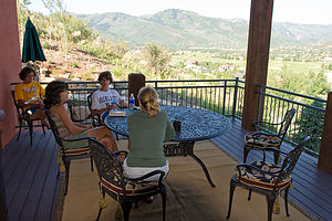 Lolo enjoying the view from the deckWhen we got to their house, Herb was more than a little concerned with how we were going to get the motorhome up their steep and curvy driveway. The back of the Lazy Daze sticks out about 8 feet beyond the rear wheels, so his fear was that we were going to bottom out. After some convincing, he began inching the motorhome up the driveway while I practically crawled alongside it watching for any scraping. It came really close at times, but we eventually made it to a nice flat area on top. We weren’t sure if we were ever going to get down again, but we were going to forget about that for now and just have a good time.
We had conveniently arrived around dinner time, but being the wonderful hosts they were, they wined and dined us in style. The views of the mountains from their deck were breathtaking.
The next morning the boys went over to the Deer Valley Resort to mountain bike down the ski slopes. Our boys had had some experience mountain biking down ski trails before in both Whistler and Vail, so we felt pretty comfortable with them doing it. We were a little worried though about their equipment. Riders that do this a lot have specialized bikes and wear full-body armor to protect them when they fall. Our guys, however, had regular mountain bikes and t-shirts. They promised to stick to the more reasonable trails. A short while after they left, we sat on the deck and watched a huge thundercloud build over the mountains where they were riding. Sure enough, the phone rang. It was the boys calling to tell us that the lifts had closed because of lightning.
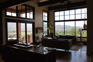 View from insideWe drove over to Deer Valley to pick them up. Although the storm looked like it was moving away, the resort did not reopen the lifts. Since the boys had only gotten one run in, the management was nice enough to refund their money. Undaunted, we decided to do what was Dennis’s original suggestion, a single-track trail known as the Lost Prospector Loop.
Rather than all drive to the trailhead, we took our bikes off the car and rode from Deer Valley down some really steep and winding roads through Park City. It was so much fun. I’m sure that, for me anyway, this type of ride was much more enjoyable than being bounced and beat up down a ski slope.
The Lost Prospector Loop was a really fun singletrack ride on the side of a mountain on Park City’s east side. It might be rated easy-intermediate, but it was plenty enough excitement for me. There was some elevation gain in the beginning, but nothing too horrible, and the switchbacks through the forests of quaking aspen and maples were really fun. There were also some great views of Park City and the surrounding mountains. I think even the boys would agree that this ride was more fun than riding down the ski trails of Deer Valley.
When we got back to the Levine’s house later that day, we tested our acrobatic skills on their new trampoline. I thought I was pretty good, but the videos told another story.
Later that evening we drove into historic downtown Park City to walk around and have dinner. There are still plenty of old Victorian buildings that give you a glimpse into Park City’s past as an old mining town, but now there are plenty of upscale shops, restaurants, and art galleries to satisfy the hordes of tourists that come here to enjoy Park City’s other natural resources. We spent some time wondering through the art galleries, especially those that emphasized photography.
When we got back to the house, we just sat out on the deck enjoying the tremendous view and each other’s company for one last night. We were going to head back home tomorrow morning.
The next morning we said our good-byes and had to repeat the tense “RV-down-the-steep-winding-driveway” process, in which I was in charge of checking for scraping. Fortunately, the only scraping that occurred was to my knees as I once again crawled on all fours beside the rig.
Then it was onward and eastward for many more miles on Route 80. Hopefully, we would find some more fun stuff to do along the way, because I wasn’t done yet.
Description
Park City is one of Utah’s two outdoor recreational meccas (the other one being Moab), famous for its world-class skiing and mountain biking. It lies in a spectacular setting, nestled in a valley at 7,000 feet on the eastern side of the Wasatch Mountain Range. The city is located near Interstate 80 approximately 32 miles east of Salt Lake City.
Park City is one of Utah’s two outdoor recreational meccas (the other one being Moab), famous for its world-class skiing and mountain biking. It lies in a spectacular setting, nestled in a valley at 7,000 feet on the eastern side of the Wasatch Mountain Range. The city is located near Interstate 80 approximately 32 miles east of Salt Lake City.
Park City began as a mining town back in 1870 when silver and a bit of gold and lead were discovered by some off-duty soldiers. Hordes of prospectors flooded the area turning the peaceful valley into a boisterous mining town. By 1880, Park City had grown into a substantial town with a population of 10,000. It was one of the few Utah towns that was not founded by Mormons, as its 27 saloons would attest to. A large fire in 1898 destroyed much of the town, but citizens quickly rebuilt. Most of the buildings you see in town today were built right after that fire. During the Great Depression, the drop in metal prices, labor problems, and some bad flooding in the mines pretty much brought Park City’s mining industry to an end. By 1950, the city had nearly become a ghost town.
Then in the 1950s, skiing came to town, but its mining past was still quite evident. In 1963 when Treasure Mountain opened to the public, a mine train was used to bring skiers three miles into the mountains where they were then lifted to the slopes by a mine hoist elevater. The chairlifts were old aerial trams that had been used for hauling oar. Even today, there are over a thousand miles of mining tunnels beneath the ski slopes. Tourism really grew in the 1980s, and today Park City is one of the most affluent resort towns in the United States.
The city has three major ski resorts: the Park City Mountain Resort, Deer Valley, and the Canyons. In addition, the Utah Olympic Park is located near the city. This was the site of the bobsled, luge, and ski jumping competitions in the 2002 Winter Olympics. Visitors looking for an adrenaline rush can take an 80 mph bobsled ride down the entire length of the Olympic bobsled track, ride the world’s steepest zipline, or just sit back and watch a freestyle aerial and ski jumping show.
Park City is also a popular summer destination. The three ski areas keep a lift open in the summer to bring hikers and mountain bikers up the mountain. Deer Park has 55 miles of single and double track trails and the Park City Mountain Resort has anothr 35. The Utah Olympic park has summertime bobsled rides and an alpine slide.
Even if you’re not a skier, biker or hiker, there’s still a lot to do in Park City. The historic downtown area has 64 turn-of-the-century Victorian buildings that are listed on the National Register of Historic Places, and the Main Street is lined with fine restaurants, art galleries, and upscale shops. There are music concerts, theater performances, rodeos, the Artstravaganza music and arts festival in August, and the renowned Sundance Film Festival in the second half of January.
It would be tough for anyone to not find something fun to do in Park City.
Great Basin National Park
Sunday, July 29, 2007 - 11:00am by Lolo10 miles and 0.25 hours from our last stop - 1 night stay
Travelogue
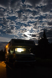 Lazy Daze in Great Basin campground One of the reasons we chose to drive the Loneliest Road across Nevada—besides the fantastic scenery—was to visit Great Basin National Park, right near the Nevada-Utah border. We’re always looking to add another National Park to our ever-growing collection, and since the chances of passing through this way again any time soon were pretty slim, it was now or never. The Park’s location, over a hundred miles from the nearest Interstate, makes it one of the least visited parks in the National Park System, which for us is a definite plus.
Great Basin’s major attraction is 13,063-foot high Wheeler Peak, the second highest mountain in Nevada. Unfortunately for us, the only way to explore the mountain is via the very steep and winding 12-mile Scenic Drive, which did not allow RVs and trailers. It’s too bad because I really would have loved to have seen the bristle-cone pine forest up near the treeline. They are the oldest living creatures on Earth—some of them more than 4,000 years old. I found it pretty ironic that in 1964, one of these bristle-cone pines, now nicknamed Prometheus, was cut down by a graduate student and a U.S. Forest Service employee for research purposes. The result of their research: they had just cut down the oldest living organism on Earth. What were they thinking?
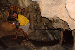 Dad on Lehman Cave tour - AJGSince we couldn’t drive up to Wheeler Peak, we had to satisfy ourselves with driving a short portion of the drive to the Lower Lehman Campground, elevation 7,500 feet. There were only 11 campsites at this lovely little campground along a stream, and when we got there 10 of them were already occupied. I hadn’t even thought about the possibility of a full campground in this very remote Park, so I guess we were pretty lucky that there was one left for us. Although it wasn’t the most level of sites, it did have a great view so we were happy. As we sat out on our picnic table eating our dinner later that evening, we were treated to the sight of a full moon rising out over the Great Basin.
Early the next morning before leaving Great Basin, we decided to explore Great Basin’s other major attraction: the Lehman Cave system. Well, actually I really decided to. The boys were tired and quite honestly a little done with cave tours. Through the years they have been so many—Luray Caverns, Wind Cave National Park, Mammoth Caves, Carlsbad Caverns, etc.—that they were pretty much caved-out. However, we managed to extract them from the RV with the promise of no more cave tours after this one. As far as cave tours go, this was a good one, and since there was only one other gentleman on the tour, we got a lot of personal attention from the ranger and learned some things we hadn’t on our previous tours.
Description
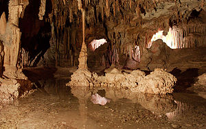 Lehman Cave - AJGGreat Basin is Nevada’s only national park. It was created to preserve and showcase a prime example of the vast Great Basin ecosystem, which occupies nearly 20% of the land area in the continental U.S. It received its name because the rainwater that falls here has no outlet to the sea.
With only 77,000 acres, it is one of the smallest parks in the national park system, and its remote location near the Nevada-Utah border also makes it one of the least visited. Yet despite its small size, it boasts a treasure trove of riches, including:
- the only glacier in Nevada
- 13,063-foot Wheeler Peak, the second highest mountain in the state
- a large forest of 3,000- to 4,000-year-old bristle-cone pines, the oldest living creatures on the planet
- groves of white-barked aspen
- the extensive and fascinating Lehman Caves.
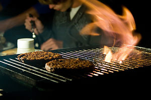 Burgers on Weber with Tom - AJGA visit to the park usually begins with a stop at the Visitor Center where there are exhibits on the flora, fauna, geology, and history of the park. It is also where you purchase your tickets for the 90-minute ranger-led tour of Lehman Caves. A short paved trail from the Visitor Center takes you down into the caverns where the temperature averages 50°F, and the walls are intricately decorated with stalactites, stalagmites, draperies, and shields that have been formed over millions of years by the oozing and dripping of water.
Another major highlight of the park is the 12-mile Wheeler Peak Scenic Drive, which climbs 3,400 feet from the Visitor Center to the Wheeler Peak Campground (elevation 9.950 feet) at the base of Wheeler Peak, Although the road is paved, it is so steep (8% grade) and winding that it is not recommended for RVs and trailers. Along the drive there are several pullouts where you can stop for views of the Great Basin and Wheeler Peak. At the end of the road is the trailhead for the 8.6-mile (RT) Wheeler Peak Summit Trail, a strenuous but spectacular climb to the treeless summit. An easier, yet still interesting hike, from the Wheeler Peak Parking Lot is the 4.6-mile (RT) Bristlecone Pine Forest Trail that takes you through a grove of ancient trees to a view of an ice field.
There are four developed campgrounds in the park with a total of just over 100 sites (only a few of which can accommodate rigs over 25 feet. None of them have hookups, dump stations, or showers. The four developed campgrounds are:
- Lower Lehman Creek Campground (elevation 7,500) - 11 sites
- Upper Lehman Creek Campground (elevation 7,800) - 24 sites
- Baker Creek Campground (elevation 8,000 feet) - 32 sites
- Wheeler Peak Campground (elevation 9,950) - 37 sites.
The Loneliest Road in America
Sunday, July 29, 2007 - 6:00am by Lolo376 miles and 7.75 hours from our last stop
Travelogue
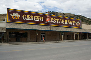 Main Street Eureka - AJGFrom Reno it was time to start heading East back towards home. We had a decision to make: hightail it on the Interstate or take the more layback and scenic Route 50, also known as the “Loneliest Road in America.” Feeling that we needed some natural beauty to wash the thought of Reno away, we chose US-50. This route also would lead us to a new National Park that we hadn’t been to before—Great Basin.
They weren’t kidding about the road being lonely. For close to 400 miles, we wound across the entire width of Nevada, passing through an occasional small town (some of which looked like they were left over from the gold rush), but otherwise just miles and miles of mountains, desert, and sagebrush.
I had expected the road to be straight and flat, which it was in some parts, but a good portion of it entailed climbing up and down some pretty steep mountains.
During the whole 400 mile stretch, we only passed through 4 towns. It was a good thing that we started this journey with a full tank of gas. Besides Fallon, which is the first town we passed through and fairly modern with its shopping malls and fast-food chains, the rest were quaint remnants of Nevada’s mining days.
110 miles after Fallon, we climbed the steep Toiyabe Mountains and came to the tiny town of Austin (population 300), another one of Nevada’s silver mining boom towns gone bust. We didn’t stop, but just slowly drove along the steep Main Street through town.
From there we climbed even further up to the Austin Summit before descending to what was the longest and flattest stretch of the drive.
About 25 miles east of Austin is the Hickison Petroglyph Recreation Area, but we decided to continue on another 45 miles to Eureka (population 650), which we had read was one of the best-preserved mining towns in Nevada. This time rather than just drive through town, we decided to park and explore. I felt like I was walking through a movie set rather than an actual town. Along its Main Street, there was an old 1879 County Courthouse, an old newspaper office, which is now a museum, and even an 1880s Opera House—but the weird thing was, there were no people. Besides us, there was not another living soul in sight. It was Sunday, but still, you’d think someone would be out and about. Tommy and I went into Raines Market to see if we could find hat pins that said “Eureka” or “Loneliest Road” to add to their collection. Although there were no hat pins, we felt bad about not buying anything, so Tommy selected a toy gun that shot suction-cup rubber darts. It cost only $1. It even had a target. When we got back to RV and showed Herb our purchase, his response was, “No possible good can come of this.” Andrew’s response was, “Can I have one too?” So, I went back to Raines and purchased another $1 toy gun. They spent the rest of the drive delightfully shooting, sometimes at the target, but mostly at each other, in the back of the RV.
Then it was back on the road, past more mountain peaks and sage-covered valleys before arriving at the relative metropolis of Ely (population 4,750), home to the only supermarket in 250 miles. We took advantage of the fact that there was more than one gas station in town (a little competition) to fill up before continuing on too Great Basin.
After leaving Ely, the road is pretty flat and straight for about 25 miles before it starts the climb up 7,722-foot Connor Pass. From the summit, there is a great view of 13,061-foot Wheeler Peak, which is in Great Basin National Park. We were deceptively close to our destination. However, there was still another 20 miles to go before we reached the town of Baker and the turnoff for Great Basin.
Description
The 400 miles of US-50 that cross Nevada have been dubbed “The Loneliest Road in America.” For miles and miles of what used to be a Pony Express route, there is nothing but mountains and sagebrush dotted with the occasional small town.
Once entering Nevada from the west, US-50 winds north along the eastern shore of Lake Tahoe before turning east again towards Carson City , the state’s capital. When gold and silver were discovered in nearby Virginia City in 1859, prospectors flocked to the area and Carson City sprung up overnight. Today a few of the impressive mansions of the luckier miners remain. One of the earliest, the Bowers Estate, still stands about 10 miles north of town. Besides the casinos, the one place to stop is the Nevada State Museum across from the capitol, where there are displays on mining as well as the natural history of Nevada.
US-50 then heads northeast across a sagebrush plateau to the tiny town of Dayton, which was the site of Nevada’s first gold strike in 1849. Today, the historic mining town is little more than the two blocks that run along Main Street. However, this small town did once have its share of celebrity visitors. John Huston, Arthur Miller, and Marilyn Monroe stayed here in 1960 while filming the movie The Misfits.
50 miles further northeast lies the relatively large (for Nevada) town of Fallon, with 7,000 residents and plenty of shopping malls and fast-food chains. The most surprising thing about Fallon is that it is green, with fields of alfalfa as far as the eye can see. While other towns sprung up from gold and silver, this town had an even more valuable resource: water. In 1915, the just completed Lahontan Dam began bringing irrigated water from the Carson River, allowing for the growth of agriculture in the area. Fallon is also home to a U.S. Navy air base and target range that serves as a training center for fighter jets and bombers. Just northeast of Fallon is the Stillwater Wildlife Management Area and Refuge, with more than 200,000 acres of sanctuary for birds such as cinnamon teal, redheads, and whistling swans.
Between Fallon and the Austin, the next town 110 miles to the east, there are a few sights to see other than the endless landscape of desert and sagebrush. About 10 miles east of Fallon is the Grimes Point Archaeological Area, where a self-guided trail leads through several hundred boulders carved with 8,000-year-old petroglyphs.
Continuing east, in another 15 miles, the two-mile long Sand Mountain rises 600 feet from the flatlands. An interesting feature of this dune is that when the sand crystals oscillate at the proper frequency (between 50 and 100 hertz), it makes a deep booming sound. It takes about a half hour to trudge to the top of this giant sword-edged dune. At one end of the dune lies the dilapidated remains of an old Pony Express station. The Pony Express, though a legend, only lasted 18 months before it was replaced by the much faster and efficient transcontinental telegraph.
The road continues through sagebrush desert and begins to climb to 6,000 feet as it approaches the tiny town of Austin (population 300), on the northern slope of the Toiyabe Mountains. A 2-minute drive along its steep Main Street takes you past all there is to see. Historic Austin was another one of Nevada’s silver mining boomtowns. After a Pony Express rider accidentally discovered silver here in 1862, Austin quickly became one of Nevada’s most populated areas. Unlike many mining towns that went bust before they could complete constructing buildings, Austin has a number of surviving pioneer churches (one Catholic, one Methodist, and one Baptist). On the western end of town, looming over an old cemetery, you can catch a glimpse of Stoke’s Castle, a huge stone fortress built in 1897 by a mining baron. The house was lived in for only a month. Since that time, Austin has experienced a steady decline. However, recent efforts to mine the abundant turquoise and barium have met with some success.
Leaving Austin, the road climbs steeply to Austin Summit (elevation 7,484) before descending to the longest and flattest stretch of the drive through miles and miles of Great Basin nothingness. 25 miles east of Austin, on the eastern side of 6.564 Hickison Summit is the BLM-operated Hickison Petroglyph Recreation Area. A half-mile trail from the parking area loops through dozens of rocks covered with petroglyphs dating back as far as 10,000 B.C.
Another 45 miles brings you to the Eureka, one of the best-preserved mining towns in Nevada. In fact, Eureka County is still mining gold and has one of the largest and productive mines in the country. Along its 4 blocks of franchise-free Main Street are some interesting historic buildings, including the 1879 Eureka County Courthouse (still in use), and old newspaper office (now a museum), and an 1880s opera house.
The drive to Ely (population 4,750), 77 miles to the east, takes you through grazing grounds, more mountain peaks, and sage-covered valleys. Ely is the site of Nevada’s largest and longest-lived mining ventures, but they mined for copper, not silver or gold. At its peak during the 1950s, Ely produced over a billion dollars worth of copper ore and employed over 10,000 people. After the mines closed down in 1982, the railroad depot was turned into the Nevada Northern Railway Museum. On weekends, one can take a 90-minute, 14-mile ride aboard an historic coal-driven Ghost Train. The town also contains some needed travel services, such as gas stations and the only supermarket for 250 miles, as well as the landmark Hotel Nevada, with its giant cowboy and neon-lit slot machines.
East of Ely, US-50 continues another 25 miles before ascending 7,722-foot Connors Pass. From the summit, 13,061-foot Wheeler Peak comes into view. In another 20 miles is the town of Baker and the turnoff for Great Basin National Park (see next stop).
Reno / Grand Sierra Resort Casino & RV Park
Saturday, July 28, 2007 - 12:00pm by Lolo142 miles and 3 hours from our last stop - 1 night stay
Travelogue
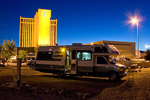 Lazy Daze at Grand Sierra Resort - AJGIt was a tough transition. Last night we had camped under the swaying lodgepole pines at Yosemite, and now here we were in the parking lot of the Grand Sierra Resort in Reno—perhaps we should have eased our way back into civilization more gradually. However, after 14 days out on the road, I desperately needed to do laundry, and on paper, the Grand Sierra Resort RV Park seemed like the perfect place to stop for the night—laundry facilities, heated pool, and easy access to the Truckee River Trail, which sounded like a great place for the boys to run.
Well, we’ve come to learn that things don’t always work out as planned. When we checked in around 7:30 that evening, we were informed that the laundry facilities were closing in 15 minutes and that the pool area turned into a nightclub after 8:00 with no one under 21 admitted. Oh great. Well, at least we had the running trail.
We pulled into our campsite, which consisted on a very dilapidated, crooked picnic table, and a rickety old fence separating us from the Truckee River Trail. Well, at least we were close to the trail.
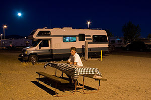 Dad with picnic table - AJGThe boys donned their running clothes and headed off for what they said would be a pretty long run. They were back in 10 minutes. Apparently the Truckee River Trail was home to many of Reno’s “homeless,” and Tommy felt very uncomfortable about weaving his way amongst them. Andrew, however, thought Tommy was just overreacting. I was having a déjà vu experience. This was the same argument we had had in Alaska last year, except that time it was over the prudence of running near grizzly bears and not homeless people.
I believe this was strike three for the Grand Sierra Resort.
Later that evening, we did try to make the best of our visit, and strolled over to a nearby Action Park where the boys did had some fun racing go-karts on a drift track. We also took a walk through the Grand Sierra Resort, but it was a quick one since the boys weren’t allowed in the casino areas.
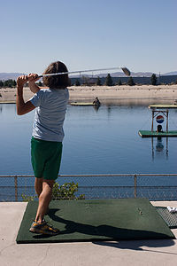 Andrew driving golf ballsAs we stepped out of the Resort to go back to our campsite, we were greeted by the pounding beat of “Rock the Casbah,” eminating from the pool area. Over the boys’ objections, I went in to have a peek. Let’s just say that this was not your typical KOA pool situation.
On the walk back to the campsite, we noticed a big, beautiful full moon rising over Reno. We would have sat out and enjoyed it, but our crappy picnic table had disappeared from our site while we were gone. Can you have a strike four?
I arose early the next morning to have first dibs on the washing machines. I had 6 loads, which had to be an all-time on-the-road record for us.
While the loads were going, we walked over to the Hilton Bay driving range right near the campground. This was actually quite fun. We each got a chance to drive some golf balls out over a man-made lake while attempting to get holes-in-ones on tiny islands in the lake. If you got one you won a prize. I wasn’t sure I wanted a prize. I was afraid it might be a few more nights in Reno. Anyway it wasn’t an issue. Although the boys came close at times, I barely made it out of the box withoug hitting the side walls.
Well, I think we were all pretty ready to leave Reno behind, but what was sad was that now, for the first time in 14 days, we were heading east, which meant only one thing—we were officially on our way home.
Description
I'm not even going to attempt to describe Reno--there are plenty of guidebooks that can do a better job. However, I will take a go at the small piece of it that we did see, the campground at the Grand Sierra Resort.
As you approach Reno from the south along US 395, the first thing you see is the humongous Grand Sierra Resort (formerly the Reno Hilton), Reno’s largest casino-hotel complex. This 2.5-million-square-foot hotel has 2,003 rooms and a 100,000-square-foot casino and takes up a over a square mile of real-estate.
Behind the hotel is an RV park (formerly a KOA) with 178 full hook-up sites. A fence separates the northern end of the RV park from the Truckee River, but there is access to the river trail through a gate in the fence. Caution: there are quite a few homeless people that have made this area their home.
Guests of the RV Park have access to the hotel facilities, including the pool (adults only after 8:00 pm), numerous restaurants, a 20-shop arcade, Nevada’s largest casino floor, a 50-lane bowling center, the Fun Quest arcade for kids, and a lake top golf driving range. If that’s not enough entertainment, a nearby Action Park has go-karts and bungee jumping.
Mono Lake South Tufa State Reserve
Saturday, July 28, 2007 - 6:00am by Lolo76 miles and 2 hours from our last stop
Travelogue
 Lolo exploring Tufas of Mono LakeAnyone coming from or going to Yosemite via the Tioga Pass entrance should definitely make the short side trip to the “tufa castles” of Mono Lake.
Mono Lake is not your typical lake. Besides being over a million years old, and probably the oldest continuously existing lake in North America, it is 2 ½ times saltier than the ocean and 80 times more alkaline. This is because the water that flows in from the Sierra streams, carrying trace amounts of salts and minerals with it, has no way to leave the lake other than evaporation. So, the concentration levels of these salts and minerals keeps building up year after year. I think it’s the same reason that the Great Salt Lake in Utah is so salty. However, although the Great Salt Lake might be more famous for its saltiness, Mono Lake does have one it doesn’t—“tufa castles.” Tufa, not to be mistaken with “tofu,” are calcium-carbonate deposits that form in lakes with high calcium contents. Normally they would just be hidden beneath the water, but as lake levels dropped, they became exposed, some of them rising as high as 30 feet above the surface—and they do look like castles.
 Lolo exploring brine flies of Mono LakeOne of the best places to see the tufas is at the Mono Lake Tufa State Reserve along the southern shoreline of the lake. You can get there by going south on 395 from the town of Lee Vining and then taking the turnoff for the State Reserve. From the parking lot, there is a mile-long loop trail that leads to a large concentration of tufa castles at Navy Beach. Although a ranger-led walk was forming when we got there, we decided to avoid the group-thing and enjoy the walk on our own. The “tufa castles” really were quite beautiful.
I was the only one of us that felt the need to swim amongst the tufas. The brine flies along the shoreline and the thought of the salt drying on our skin afterwards was not particularly appealing. The Gaidus men wisely chose to hang on the shore and photograph. With a wave of my arms, I parted the black mass of brine flies and entered the water. I expected to have to swim out to the castles, but the water never got any deeper than my knees. Well, it did make for a better photograph having one of us posing in front of the tufa castles.
Description
 Lolo of the TufasMono Lake is located just off Highway 395 near the town of Lee Vining, California, 13 miles east of Yosemite National Park. Mono Lake is extremely unique. First of all, at over 1 million years of age, it is one of the oldest continuously existing lakes in the continent. Secondly, it is about 2 ½ times as salty as the sea and about 80 times as alkaline. This is because Sierra streams flow into Mono Lake bringing trace amounts of salts and minerals, but the lake has no outlet other than evaporation. As a result, the concentration levels of salts and minerals keeps growing each year. Thirdly, and the main reason Mono Lake is so popular, are the hundreds of spectacular “tufa towers” that rise from the lake. These intriguing calcium-carbonate sculptures were formed beneath the water when carbonates in the water combined with calcium from freshwater springs feeding into the lake. As lake levels dropped, these extraordinary-looking knobs, spires, and minarets became exposed. Most of the towers visible in the lake are from 200 to 900 years old and rise as high as 30 feet above the water.
A good place to start your visit is at the Mono Basin Scenic Area Visitor Center, located just off Highway 395, north of Lee Vining, where you will find exhibits about both the natural and human history of the Mono Basin.
One of the best places to view the tufas is at the Mono Lake Tufa State Reserve along the southern shoreline of the lake. The trailhead for the south tufa castles and Navy Beach is at the edge of the parking lot. During the summer, rangers lead walking tours 3 times a day (10am, 1pm, and 6pm), but if your not lucky enough to catch one of these, there are plenty of informative signboards along the trail. A short walk along the mile-long trail brings you to the strange and fanciful tufa castles at Navy Beach. A swim in the buoyant waters of Mono Lake is a memorable experience, as long as you are willing to step through the millions of harmless alkali flies that line the water’s edge. It’s fun to watch what at first looks like black sand part before you.
Surrounded by volcanic hills, Mono Lake is also a geologist's paradise. The two major islands in the lake are actually volcanic domes. The large black island, which the Kuzedika Indians named Negit, meaning “blue-winged goose,” erupted about 1700 years ago. The white island, which the Native Americans named Paoha, meaning “spirits of the mist,” erupted 250 years ago.
Bird watching and photography are other popular activities at Mono Lake.
Yosemite Valley
Saturday, July 21, 2007 - 3:00pm by Lolo200 miles and 4.5 hours from our last stop - 7 night stay
Travelogue
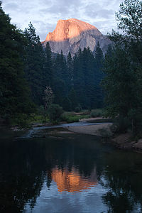 Half Dome alpenglow reflectionYosemite Valley has unanimously bumped Lake Powell from its prominent position as our all-time favorite spot on Earth. Then why, I wondered, did so many people tell me of their negative experiences at Yosemite? When I dug a little deeper, I found that the common thread to their stories was their approach, which was to stay somewhere outside the Park and then drive in and try to “do the Valley” in a day. All they remembered were traffic jams and hordes of tourists on the trails.
However, there is an art to doing Yosemite right. First of all, you really have to stay in the Valley itself and allow yourself at least 3 days to do it justice. This does require planning your trip months in advance, because everyone wants to stay in the Valley. Secondly, you have find ways to get away from the crowds, which really isn’t that difficult once you know your way around. There are plenty of pullouts along the drives from which you can find a totally private spot on the river to float around and gaze up at the cliffs, and at night, the various meadows are a great place to get away by yourselves to watch the sunset or the stars. Also, if you are willing to hike more than a mile, you can leave most of the crowd behind you on the trails.
With that being said, the following is a description of how we spent a very wonderful and relatively crowd-free week in Yosemite Valley.
Day 0: Late Night Arrival
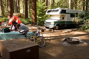 North Pine campsite with Lazy DazeThe family mood soared as we entered the Park through the Tioga Pass. I really didn’t think we were going to make it here today (see brakeline fiasco in Lone Pine). I couldn’t believe the change in the our enthusiasm level. We had definitely begun to drag from too many 100 degree plus days in the desert. Now it was evening, the air was crisp and fresh, the mountain lakes were sparkling, and there were big, beautiful pine trees as far as the eye could see—this was going to be so great!
By the time we finally arrived at the North Pines Campground in the Valley it was well after 10 o’clock. As we pulled into our campsite, we quickly turned off our headlights to avoid blinding the family gathered around a fire literally ten feet away from our front bumper. They certainly do pack you in tight here, much tighter than most National Parks, but it’s kind of a necessary evil. There are only about 400 campsites in the entire Yosemite Valley to accommodate the thousands and thousands of people who, like us, dream of camping in such an incredible place. Since we were one of the fortunate few to be able to reserve a site, I wasn’t about to complain about the tight accommodations.
Although we were exhausted, we were far too excited about being in Yosemite to just go to bed, so we went for a little stroll around the campground. The air was so fresh and the sky was so full of stars—the kind of sky you only see miles and miles away from the cities. Best of all, it was cool and green. I do love the desert, but it certainly does makes you appreciate trees.
Day 1: Valley Exploration by Bike
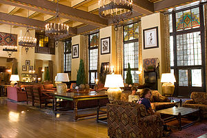 Boys in Ahwahnee Hotel "Great Lounge"The next morning, we decided to explore the Valley by bike. Yosemite Valley is a wonderful place to bike because it is flat and there are 8 miles of paved bike trails that cover the entire eastern section of the Valley, where most of the action is. Besides, the traffic can be pretty congested in the Valley, so we figured it would be better to just leave the RV parked at the campsite.
With backpacks loaded with cameras and spirits running high, we set off on our bikes to conquer the Valley. We crossed the bridge over the Merced River and got onto the bike path near Curry Village. At the intersection of the Northside and Southside Drives, we headed north towards Yosemite Village with the intention of doing the loop counter-clockwise.
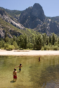 Lolo and boys wading the MercedHowever, before going to Yosemite Village, we made a side trip to the historic Ahwahnee Hotel, which I think is one of the most beautiful in the National Park System. We had actually stayed here once when the kids were 7 and 5 years old, and it was an unforgettable experience. I remember that Herb had asked for a Half Dome view. When we checked into our room and opened the curtains, Herb almost fainted when Half Dome opened up before him. It was hard to get him away from that window. Well now we were campers, but that didn’t mean that we couldn’t enjoy the facilities. I planned to make the Ahwahnee lobby my extended living room and to talk Herb into a few meals here. Speaking of which, it was Tom’s 16th birthday the following day, so we made reservations for lunch in the elegant Ahwahnee dining room. Tom has had some pretty fantastic settings to celebrate his on-the-road birthdays, and I was sure this one would live up to what he had come to expect.
Back on our bikes, we headed over to Yosemite Village, which is the main center for visitor services in the park. As a result, it is pretty crowded throughout the day. However, if you need something during your stay in Yosemite, you’re bound to find it here. There are restaurants, lodging, a grocery store, post office, and even a medical clinic. Our goal in the Village was the Ansel Adams Gallery, which is run by his son Michael Adams. Over the years of travel, photography has become more of a passion than a mere hobby in our household, so the same way that kids have basketball or baseball players as their heroes, our boys pretty much have Ansel Adams. After viewing some of the wonderful prints on exhibit, both by Adams as well as several contemporary photographers, we signed up for a ranger-led Photography Walk later that week.
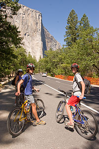 Lolo and boys on bikes approaching El CapitanFrom Yosemite Village, we continued on the bike path west towards El Capitan. We cruised right on by the Yosemite Falls Vista, since the roaring falls in mid-summer is reduced to a mere trickle.
However, there was plenty of water in the Merced River to have some fun, so we locked our bikes to a tree and spent a good part of the afternoon sunbathing on a sandy beach and swimming in the river. This was the life. The water was refreshing and the views were incredible. I only wished we had our tubes along, but they were back at the RV.
Once we were ready to move on, we followed the bike path south across Swinging Bridge and back alongside the Southside Drive towards the campground. Along the way we stopped at the tiny and often photographed Yosemite Chapel, hands down the cutest church I have ever seen. A bit further along, we came to Sentinel Bridge which we found was the place where Ansel Adams took some of his classic Half Dome shots. We would definitely have to come back here in the evenings when the sun was getting low.
Continuing on past the hustle and bustle of Curry Village, the other major center for visitor services in the park, we crossed back over the river and into the North Pines Campground, our home for the week.
We had seven nights reserved in North Pines. Originally, I thought we might choose to stay only five nights and then move on to something new, but after our first day in the Valley, we unanimously decided to spend every day we could in this Paradise.
Day 2: Tommy’s Birthday Lunch at the Ahwahnee and Hike to Glacier Point
 Ahwahnee Hotel dining roomWhen we were planning our stay in Yosemite, the one hike that we all agreed just had to be done was the one up the cable route on the back of Half Dome. Herb and I had done this hike 20 years ago (in our previous lives) and remembered it as the most challenging and rewarding hike that we had ever done.
The hike, however, is a serious one—16 miles out and back with an elevation gain of 4800 feet. Although we all are in pretty good shape, especially the boys, we thought it would be a good idea to do a warm-up hike first to make sure everything was working properly, like hiking boots, 50-year-old legs, etc.
As our warm-up, we chose to do the hike up to Glacier Point from the Valley via the 4-Mile Trail as it would give us some good elevation gain (3200 feet) and distance (9.2 miles round-trip) as well as some great views along the way.
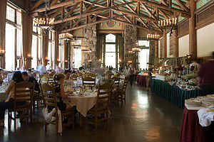
 Mom and Dad on Four Mile trail to Glacier Point - TJGHowever, before setting out on our hike, we had Tommy’s birthday lunch at the Ahwahnee to enjoy. This would work out great, because we would be so nice and full from lunch that we wouldn’t have to worry about packing food for the hike. When we got to the Ahwahnee, we requested the Queen’s Table, which is where Queen Elizabeth ate during one of her visits here. However, since it was already occupied, we were seated at the table next to it in a lovely little alcove at the back of the dining room. Quite honestly, I don’t remember what we ate that day, probably because the views from the floor-to-ceiling windows are so spectacular that I was too overwhelmed to even notice or care what I was eating. However, based on the list of dignitaries and celebrities that have dined here, I’m sure the food was wonderful.
After lunch, we changed into our hiking clothes and rode our bikes over to the trailhead for the Four Mile Trail to Glacier Point, located along the Southside Drive. There were no bike racks, so we walked out bikes off the trail and locked them up to a tree behind a large boulder. Hopefully, we would remember where they were when we returned later that evening.
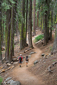
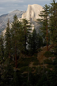 Half Dome and pine trees from Four Mile TrailThe hike was fairly strenuous with dozens of switchbacks to conquer, but the views of the Valley from some of the more exposed areas were well worth the effort. While we saw no other hikers along the entire four miles up, Glacier Point itself was full of tourists drinking lattes and eating ice cream, as most people arrive at Glacier Point by tour bus. Some of the hardier ones do choose to do the hike one-way back down to the Valley, but I think to really earn it you should climb it as well. Once on top, we fought our way through the throngs to a rock ledge with the best view of Half Dome and the Valley floor, set up a tripod, and took a potential Gaidus Family Christmas picture. Then we too had some ice cream before heading back down the trail to the Valley.
Although the way down was much less strenuous, it was also a lot harder on the knees, so we took lots of photo breaks along the way. Also, I had only packed my trail running shoes and they didn’t have nearly as good traction as my hiking boots, so I kept slipping and sliding on the loose gravel. Andrew and Tommy were kind enough to hold my hand on the steep parts, so that I wouldn’t fall. This slowed us down a bit. By the time we got back down, it had gotten pretty dark, and we were all a little spooked about running into a bear in the woods while trying to find our bikes, so we clapped our hands and made some noise to scare any lurking bears away. We found our bikes without incident and wearily rode them back to the campground to make dinner.
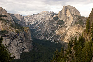 Half Dome and Royal Arches from Four Mile TrailThat night I was awoken from my peaceful slumber by what sounded like a mule screaming in pain. Since we were camping right next to the Yosemite Stables, this was not as implausible as it sounds. In my half-awakened state, I envisioned bears running amuck through the stables terrorizing the horses and mules. When I looked out the back window, I saw utter mayhem. People were running around like crazy, shining flashlights up trees, while a ranger’s truck kept circling the campground. I couldn’t believe that Herb and the boys were sleeping through this. They probably wouldn’t believe me in the morning and think that I had dreamt it all. Most of the people were now congregated around a tall pine tree in the campsite across the way, shining their flashlights up into the branches. I figured it must be an animal of some sort, most likely a bear. Gradually the group disbanded and I fell back asleep.
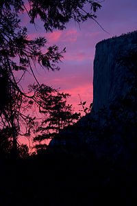 El Capitan Alpenglow - TJGThe next morning I was determined to find out what all the commotion had been about. When I told Herb and the boys about the mule noise, Andrew’s sleepy response was, “How does Mom know what a mule in pain sounds like?” That was not exactly the question I had expected. When I noticed that the guy in the campsite where the action had occurred was packing up his tent, I quickly ran out to conduct what Herb refers to as a “Lolo Extreme interview.” I call it being nosy.
Our neighbor told me that the previous evening while lying in his tent, he had watched the silhouette of two bear cubs pass by his tent. As if that wasn’t disconcerting enough, it was soon followed by the silhouette of the mama. I guess other campers saw the bears and that’s when the commotion began. The two little cubs ran up the pine tree on his campsite, which I guess got the mother bear pretty upset. I’m not sure who was more scared of who, the bears or the campers. Eventually, the cubs came down and ran off with their mama. I still have no idea what the source of the screaming mule sound was.
Apparently, these bear episodes are not uncommon in the campgrounds, so every night rangers ride through the campgrounds persuading them to leave. I spent the rest of my nights in Yosemite gazing out my back window waiting for some more bear excitement, but it never reoccurred while we were there.
Day 3: Floating on the Merced and Photographing Half Dome from Sentinel Bridge
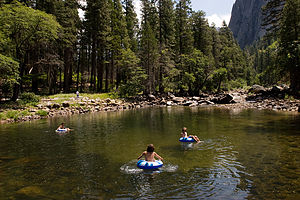 Lolo and boys tubing the MercedDay 3 was to be our rest day between the Glacier Point hike and the trek up the back of Half Dome, so we decided to spend it floating around the Merced River. Now that we knew our way around the Valley a lot better, we realized that we could pretty easily take the RV and find a pullout along either the Northside or Southside Drives from which we could access the river. This way we would have all the conveniences of home along with us, including our tubes, and could use that spot as a base camp for the day. We could run or bike from there, make lunch, shower, etc. It turned out to be a great idea, and one that we would repeat several times that week.
Fortunately, there were enough choices of pullouts to allow us to be quite fussy in our selection. We chose one along the Northside Drive where there wasn’t much room for other cars, so that as Herb put it “we could have a little piece of paradise to ourselves.” 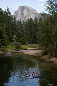 Half Dome from Sentinel Bridge with Andrew tubingUnlike the sandy beach we had been at the other day, this section had a rocky shoreline, but our Crazy Creek chairs worked just fine on the rocks. Also, the river was narrower and rockier here, so the current was much faster and more fun for tubing. The boys found a section a little bit downstream that was pretty fast and required some maneuvering between rocks. They suckered me into being part of a human chain, placing me on the tube in the middle so that I couldn’t escape. Not noticing that the nozzle of my tube was open, I bounced my butt along the rocks on uninflated vinyl. The boys were quite amused when I picked up my flaccid tube at the end of our ride. Herb tried it next, but he did it the wimpy way—on an inflated tube.
Later that afternoon we moved the RV to a parking area near Sentinel Bridge where we intended to photograph Half Dome when the lighting got low. We were definitely not the only ones with this idea. The bridge was already full of photographers with some very impressive tripods and camera gear, but we managed to stake out some territory of our own. The reason this spot is so popular with photographers is the way the light hits Half Dome at this time of day and the way the Merced River, which flows through the foreground of the picture, creates a second image of Half Dome in its reflection. 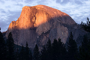 Half Dome alpenglowWe wanted to personalize our photos, so we sent Andrew out as our stunt tuber to float down the river. After a few passes under the bridge, he decided he had had enough and came up to take some pictures of his own. Meanwhile I went back to the RV and cooked up a chicken marsala dinner.
After dinner, we walked out on the bridge once more to take one last look at Half Dome before calling it a night. To our surprise, it was no longer completely in shadow, but lit by a beautiful reddish glow. We later learned that this phenomenon, known as alpenglow, occurs as the scattered light from the setting sun hits the mountains. Whatever it was called, it was stunning. We ran back to the RV for our cameras, and just got in a few shots before the lights went out on Half Dome for good that night.
Day 4: Half Dome Hike
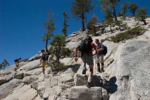 Lolo and boys hiking up Half Dome's shoulderThe next day (Day 4) was the one we had all been anxiously anticipating – the 16-mile round-trip hike from the Valley up the steep back of Half Dome via a precarious cable route, with a total elevation gain of 4800 feet. We awoke at 5:30, very early for us, to get an early start on what was estimated to be a 10-12 hour hike.
After packing our backpacks full of camera gear, snacks, and plenty of water, we rode our bikes over to the Happy Isles Nature Center to start our trek up to Half Dome. From Happy Isles we followed the Mist Trail through a lovely forest of ponderosa pines and black oaks. The trail was rough asphalt and pretty flat at first, but it soon steepened and became much rockier. At .8 miles we came to Vernal Bridge and a great view of Vernal Falls rushing towards us. Vernal Falls is one of the few falls in Yosemite that don’t dry up in the summer, so the hike to it is very popular this time of year. There are flush toilets and drinking fountains near Vernal Bridge. In fact, this is the only place to get water along the entire hike, unless you choose to treat water from the Merced.
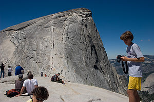 Half Dome cable view from top of shoulderA little bit past the bridge we came to a junction with the John Muir Trail, but continued upriver on the Mist Trail, which was not really a trail anymore but rather a steep granite stairway of seemingly endless rocky steps. With each step we became more and more aware of the approaching falls as it got louder and louder and began to spray us with a fine mist. Finally we reached the brink of the falls and gazed down its thundering cascade from behind the safety of a guard rail.
Herb looked at his altimeter watch and informed us that we had climbed 1,000 feet so far. I felt like choking him. That meant we had 3,800 more feet to go. This was going to be a very long day.
Just beyond the top of the falls, the trail led past the Emerald Pool, full of happy swimmers ignoring the Danger No Swimming signs. I must admit that the thought of hanging here in the sun for the day was tempting—which was what most of these people were doing—but onward to Half Dome we must go. Then, I suggested a quick swim to cool off, but the more practical part of the family didn’t want to hike all wet. So, we decided to swim on the way back down. It would give me something to look forward to.
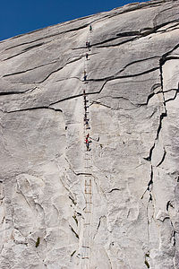 Half Dome cables with climbing touristsOn a more practical note, there are outhouses near Emerald Pool. The next bathroom stop wouldn’t be until Little Yosemite Valley.
Right past the Emerald Pool, we crossed a bridge back over the Merced and began the steep climb up a series of endless switchbacks with Liberty Cap to our left and Nevada Falls slipping in and out of view ahead. At mile 2.8 the Mist Trail came to an end and joined up with the John Muir trail. You can take the John Muir trail a short distance to the right to a bridge over the Nevada Falls, but we took a left and kept plodding onward following the signs towards Half Dome. I checked Herb’s altimeter watch. We had gained 2,000 feet in elevation, less than half of what we had to do that day. This was going to be a humbling experience.
We continued on through Little Yosemite Valley, where Herb and I had backpacked 20 years ago. There was a very nice restroom to stop at there—the last one we would encounter on our way up. Unfortunately, there was no water and we were going through ours pretty quickly. We were going to have to start rationing.
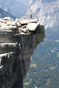 Dad on Half Dome ledge - TJGEventually we came to a trail junction signed for Half Dome, 2.5 miles away. Another check of the altimeter watch showed that we were at 7,000 feet, just 1,800 more to go. We continued our ascent through a lovely forest of Jeffrey Pines and red firs. The boys were now in the lead and I was dragging a bit behind. About this time, a black bear ran full speed across the trail, just a few yards in front of the boys. I, however, must have been staring down at my weary feet and missed it. After that, the boys stuck a lot closer to Herb and me.
Finally, after what seemed like a week, the back of Half Dome came into view. The trail continued up the shoulder of Half Dome in a series of very steep and rocky switchbacks. I wasn’t looking forward to coming back down these in my poorly tractioned trail running shoes, but I wouldn’t worry about that ‘til later. I had plenty enough to worry about for now. This part of Half Dome was hairy enough, and we hadn’t even gotten to the cables yet. For some reason I don’t remember this being so bad when we did it 20 years ago. They must have made it steeper. There were lots of signs warning hikers to turn back if a storm was approaching, but we had no excuse—the sky was perfectly clear.
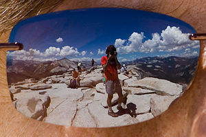 Half Dome summit view in sunglasses - AJGWe made it to the big rock slab at the base of the cables, where we found dozens of other hikers just sitting there, staring in awe at the cables and contemplating their next move. We joined them and started staring as well. It really was very intimidating. The route was about 400 feet up the back side of the dome, and so steep that hikers need to hold onto cables to make the ascent. The steel cables are about 3 feet apart and are suspended at arm’s height from pipes set in the rock. About every 10 feet or so there are wooden boards attached to the rock to serve as a place to place your feet and rest.
Fortunately, we didn’t know at the time that a hiker had fallen to his death from these cables a month ago, or we probably would have talked ourselves out of it. Rationally, I knew if I just held on tight to the cables, I would be fine. The trouble was that the cables were really crowded with people going both up and down, so that as you passed each other, you had to let go with one hand and hold onto the cable on one side with both your hands as the people went by. That was going to be the tough part. When Herb and I did this 20 years ago, I don’t remember there being anybody else but us on the cables, but today there must have been at least 50 people at a time on the route
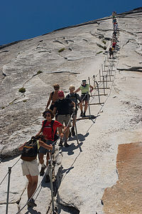 Lolo cautiously descending Half Dome cablesIt was interesting to watch and listen to the other hikers’ discussions about whether or not to go up. You couldn’t predict their decision by looking at them. There were two couples near us that came up with a split decision. The girls decided to go up while the guys remained behind. Fear of heights was not a matter of machismo.
I knew there was no way we weren’t all going to do it, but Andrew and I were definitely more apprehensive about it than Herb and Tommy. In a crevasse of a rock at the base of the cables we found a bunch of rubber gloves which people had left behind for other hikers to use while gripping the cables. I selected a hot pink pair.
At this point I just wanted to get it over with, so we started our ascent. Tommy was worried that I would be the weak link, so he very kindly went behind me, I guess with the intention of catching me if I slipped. With sweaty palms inside my hot pink gloves, I gripped those cables, pulling myself further and further up the Dome. My arms actually hurt later from the pulling, but Herb told me that if I had used my legs more, I wouldn’t have had to pull so hard. The entire 15 minutes or so it took to get to the top, I never took my eyes away from the granite face in front of me, knowing full well I was missing out on an awesome view of Clouds Rest behind me. That view could wait until I got to the top. The final part of the ascent gets a lot less steep and before I knew it I was standing on the large flat summit of Half Dome (elevation 8,842 feet). All of Yosemite Valley and Tenaya Canyon spread out before us. It was absolutely breathtaking!
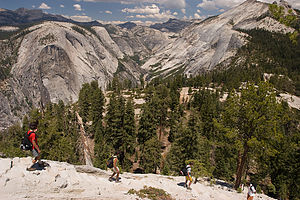 Lolo and boys descending Half Dome shoulderNear the dome’s highest point, there is a slab of rock that protrudes out beyond the cliff face, kind of like a diving board. I remember looking up at Half Dome from the Valley Floor and thinking that it looked like Half Dome’s eyebrow. Some of the braver hikers on top walked out onto this slab to get their pictures taken. Some even sat on its edge with their legs dangling over. It made my palm sweats just watching them. 20 years ago, when Half Dome was less high, Herb had walked out on this slab so I could take his picture. I too had followed, sort of. Herb has a very embarrassing picture of me crawling like a worm out onto the ledge.
Herb, who was an avid rock climber for over 10 years before the kids were born, felt the need to walk out on the overhang once again. However, he did admit to feeling a bit of vertigo that he hadn’t experienced the last time. Tommy walked out next and had no problem, except for the embarrassment of his mother yelling for him to get back from the edge. Andrew and I decided to just enjoy the view from the safety of a broader and flatter surface.
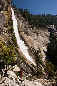 Andrew and Nevada FallsI could never completely relax on top because I knew that I had to get down the cables again, and I had a feeling that going down was going to be a lot worse than going up. There are two different approaches to going down. One is walking forward while looking out at the expansive view before you, and the other is going backwards while pretending you’re really interested in the geological make-up of the granite you have your face pressed against. While Herb and the boys were okay with either, I chose the latter method, which is a bit slower. I think I caused a little gridlock at one point, but frankly I didn’t care. What was everybody’s rush?
I think that probably the worst part of the entire hike for me was climbing down the steep rocky switchbacks on Half Dome’s shoulder below the cable route. The gravel was so loose that I kept slipping and sliding the whole way. Fortunately, my butt only made contact with the ground once.
It was a long way back and we were almost out of water. I really thought we had packed more than enough, but it was so hot and the hike was so strenuous that I guess we drank a lot more than we anticipated. We should have brought along a water filter or iodine tablets so that we could have drank the water from the Merced River. It looked so tempting, but we knew how sick we could get if we drank it unpurified.
Near Nevada Falls, there is a choice of ways down to the Valley. The John Muir Trail is slightly longer and less steep. Many people use this trail to make the hike to Vernal and Nevada Falls a loop with the Mist Trail. We, however, chose to retrace our steps on the Mist Trail because we wanted to swim in the Emerald Pool.
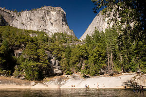 Lolo and Andrew at the Emerald PoolHowever, when we finally got back to the Emerald Pool, we were so thirsty that we didn’t know whether we should stop to swim or just continue on for water. We knew that there were water fountains about 1 ½ miles ahead at the Vernal Falls Footbridge, but I really wanted to swim. Luckily, Andrew found an unopened bottle of Gatorade in the bottom of his backpack, and solved the problem.
The Pool was still quite full of people ignoring the Danger No Swimming signs. I think the real danger is in the springtime when the water flows so swiftly that there is a real chance of being swept downstream over the falls, but in mid-summer the current just isn’t strong enough. The water was very refreshing and it certainly felt good to wash away the layers of dirt that had accumulated from 10 hours on the trail.
Feeling reinvigorated, we continued down the steep rocky steps past Vernal Falls and back to our bikes at Happy Isles. It had been a very challenging but extremely rewarding day. I think we should do this hike every 20 years.
Day 5: Ranger-led Photography Walk, Sentinel Beach, and Ahwahnee Meadow
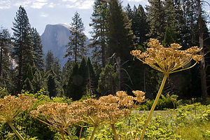 Half Dome with flowersThe next morning we rode our bikes to Yosemite Village for our scheduled Photography Walk with a park ranger. When I saw that the group gathered in front of the Ansel Adams Gallery included several young children, I was concerned that the talk would be too basic and that Herb and the boys would be bored, but I worried for naught, because our ranger was amazing. She was able to connect with group members of all abilities, from kids with point-and-shoot cameras to the most sophisticated of photographers. I think that every one of us learned something new that day.
For the next hour or so, she took us on a stroll through a meadow we hadn’t been to before and taught us to focus on some of the more intimate details of nature that one rarely takes notice of in a place surrounded by such overwhelming icons as Half Dome and El Capitan.
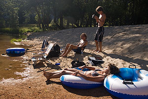 Lolo and boys relaxing at Sentinel BeachWe were all pretty sore from our Half Dome hike the day before, so the most activity we wanted for the rest of the day was relaxing and floating on the river. We rode our bikes back to the RV and went on a quest to find the perfect river spot. After missing a few opportunities to pull over, we decided to pull into the Sentinel Beach Picnic Area along the Southside Drive. Since this was a parking area, we didn’t have it all to ourselves like our spot along the Northside Drive the other day, but by wading across the river to the beach on the other side, we pretty much did. Also, from this side of the river, we could just sit back and gaze at Sentinel Rock. The river was a bit wider and slower here than our spot the other day, so the tubing was more leisurely than exciting. The boys took the tubes up the river to Swinging Bridge a few times where the water was a bit faster and then drifted back down to us.
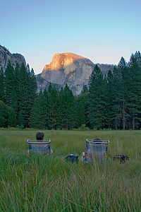 Mom and Dad at Ahwahnee Meadow - AJGIn the evenings, we usually tried to find a scenic spot to park the RV where we could have dinner and take some photographs. On this particular evening, we parked on the road south of the Ahwahnee and set up our beach chairs in the Ahwahnee Meadow facing Half Dome. The amazing thing was that despite the thousands of visitors who were running around the Valley, we were the only living souls that had come to spend an evening in this beautiful meadow. The boys went for a run while Herb and I sat in our chairs sipping wine, and as Herb said, “wait for the Big Fella to turn colors.” We got a bit nostalgic—perhaps it was the wine—as we reminisced about sitting in this same meadow as newlyweds over 20 years ago. Things had changed a bit since then. We were a bit more seasoned now, and rather than just being by ourselves, we had two wonderful happy and healthy boys running laps around this very meadow, waving to us on each pass. Oh, and one other thing had changed—Half Dome had gotten bigger and the cables steeper since I last climbed it.
When the boys got back, we set up the tripods in the meadow and just hung out there while Half Dome did its “alpenglow” thing. It was so peaceful and serene that none of us wanted to leave, so we just stayed on and waited for the stars to come out. As it got darker and darker, I got to thinking more and more about bears and whether they liked meadows as much as they did campgrounds. While Herb and the boys took time-lapsed exposures of the surrounding cliffs and stars, I protected the family by keeping watch for any suspicious movements in the field. I’m not sure what I would have done if there was, but thankfully I didn’t have to find out.
It was well after 10 o’clock before we left the meadow that night. I think we were all becoming aware of how little time we had left in Yosemite and didn’t want to waste one precious moment of it.
Day 6: El Capitan Vista, More Floating on the Merced, and the Ahwahnee
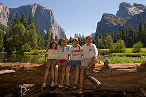 Gaidus family on log with El CapitanWell, it had finally arrived—our last full day in Yosemite. I think for all of us the significance of this was bigger than just Yosemite. It symbolized the end of an era and probably the happiest week we had ever spent together as a family—and believe me we’ve had many. Soon after our return home Andrew would be heading off to college, and life as we knew it would be forever changed. Or maybe it was just me thinking these mushy thoughts while the Gaidus men were just worrying about where to float on the river that day.
For our farewell tour of the Valley, we decided to take the RV out for the day and drive the 12 or so miles of the Valley Loop once again, stopping wherever and whenever we felt like it. Also, we thought it was time we paid a little more attention to Yosemite’s other famous landmark in the western end of the Valley—El Capitan.
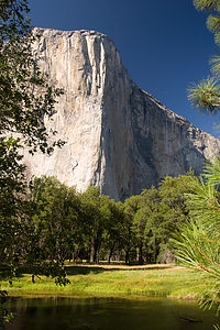 El Capitan "Nose"We drove along the Northside Drive and pulled into a parking area with a great view of El Cap. It really is an impressive sight—3,000 feet of the largest piece of exposed granite in the world. Since there was no one else there, we thought it would be a good place to compose another family Christmas picture. There was even a conveniently placed log with El Capitan looming behind it that we could all squeeze onto. With the aid of tripod and self-timer, we managed to get off a few good shots just before a tour bus pulled into the parking area. Soon there were dozens of people scurrying around trying to get their own perfect shot of El Cap. We decided to hide in the RV until the crowd left.
It actually was pretty entertaining. After they were done photographing El Cap, many of the people became interested in peeking into the RV, not realizing that we were in there and that although they couldn’t see in through the tinted windows in the back, we could see them perfectly. I felt like I was in an aquarium.
We continued on, making the turn near the exit onto the Southside Drive to head back towards the eastern end of the Valley. It was another hot day in the upper 90s, so we began our search for a pullout with river access. This time we stopped at one that required a little further walk through the forest to get down to the river, but that was okay. I think it was called El Capitan Vista, but if it wasn’t, it should have been.
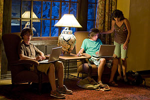 Boy's getting "wi-fi" at the AhwahneeFor pure swimming and beaching, this wasn’t as good a spot as some of our other stops this week, but it was by far the best in terms of views and solitude—two very important Gaidus criteria. We were directly across the river from El Capitan and could even see little tiny climbers on its face. In fact, except for those climbers, there was no one else in sight. After spending the rest of the afternoon floating and gazing at El Capitan, we unanimously dubbed this our favorite river spot.
Later that afternoon, we moved the RV to our spot near the Ahwahnee Meadow and walked across the meadow to the Ahwahnee to have dinner on the outdoor patio. The boys had another motive for wanting to go to the Ahwahnee—WIFI. It had been 8 days since they last had Internet access and they were beginning to show signs of withdrawal. So they brought their laptops along and made themselves quite at home in one of the lovely sitting rooms of the hotel; and just like at home, they wouldn’t come to dinner when I called them. So Herb and I enjoyed a glass of wine alone, which was quite nice, before they finally decided to join us. Dinner was great—much more casual and affordable than the elegant dining room inside. However, I still think everyone should experience eating in the Ahwahnee dining room at least once during a visit to the Valley.
After dinner it was back to the sitting room for more laptopping before finally returning home across the meadow.
Day 7: Departure
All good things must come to an end, so we said farewell to the Valley and drove back out along Tioga Road and through the East Entrance. Yosemite had been a real vacation for me. Now I had to get back to work, plotting interesting and exciting stops for our journey home. Yosemite would be a hard act to follow.
Description
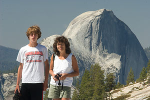 Tom, Lolo, and Half Dome from Olmsted PointYosemite National Park lies near the eastern border of California in the heart of the Sierra Nevada Mountains. Its spectacular waterfalls, soaring granite cliffs, and lush meadows are just a few of the reasons it is considered by many to be nature’s ultimate masterpiece. In the words of John Muir, “it is surely the brightest and the best of all the Lord has built.”
This description will focus on Yosemite Valley, which is the section of the park we visited. Although the Yosemite Valley is just a small portion of Yosemite’s 761,268 acres, it is part receives 95% of its visitors. In fact, an estimated 4.1 million people visit the Valley each year, making it extremely crowded.
Two one-way roads traverse Yosemite Valley: the east-bound Southside Drive and the west-bound Northside Drive, which wind through woodlands and meadows along the base of the 3,000-foot-high granite cliffs. As of today, cars are still allowed to enter and drive through the valley, but visitors are highly encouraged to park their vehicles and use the park’s free shuttle bus, which stops at the major attractions in the valley.
Virtual Tour of Yosemite Valley Highlights
- As you enter the valley, the first sight you’ll see is the 620-foot Bridalveil Falls flowing down from a hanging valley to the valley floor. From the parking area, a short paved path leads to the base of the falls. This is one of the few falls in Yosemite that does not completely dry up in the summer.
- Just past the Bridalveil Fall parking area, the Southside Drive begins to trace the Merced River. Soon El Capitan comes fully into view. This 3,000 foot high granite cliff is the largest single piece of exposed granite in the world and one of the most famous landmarks in Yosemite. If you look closely, you might see small dots that are actually rock climbers along its face.
- Continuing east on the Southside Drive are two riverside picnic areas and beaches: Cathedral Beach and Sentinel Beach.
- Right after the Sentinel Beach parking area is the trailhead for the 4-Mile trail, which ascends more than 3,200 feet from the valley floor to Glacier Point and one of the most spectacular views of the valley.
- A short distance further is Swinging Bridge, another picnic and swimming area. This area is also the westernmost point of the 8-mile bicycle loop that goes through the eastern part of the valley. From this point on, the bike path parallels the road.
- Next stop is the picturesque tiny Yosemite Chapel where many outdoor enthusiasts choose to exchange wedding vows.
- Now you enter the congested and developed portion of the valley.
- Right past the chapel, you can either take a left onto Sentinel Bridge towards Yosemite Village and the park exit, or you can continue straight towards Curry Village, the campgrounds, and Happy Isles Nature Center. For now, let’s stop at Sentinel Bridge for what is probably the most spectacular Half Dome viewpoint in the park. It’s a great spot for a photograph of Half Dome with the Merced River in the foreground.
- Continuing east on the Southside Drive, you pass Housekeeping Camp and Curry Village. Curry Village has lodging, restaurants, bicycle and raft rentals, a grocery store, and other shops. Curry Village is also one of the main parking areas in the valley.
- From Curry Village you can either take Northside Drive across the Ahwahnee Bridge back to Yosemite Village and the park exit, or continue east to the campgrounds. The Happy Isles Nature Center is also this way, but only shuttle buses are allowed on the road to it.
- The Happy Isles Nature Center features exhibits on the natural history of the park. It also serves as the trailhead for some of the best hikes in Yosemite. 1.5 mile trail leads to the top of Vernal Falls and then continues another 1.5 miles to the top of Nevada Falls (two waterfalls that flow even in the summer time). From there you can continue even further into the backcountry of Yosemite, including the cable route up the back of Half Dome.
- From Curry Village, the Northside Drive crosses the Ahwahnee Meadow, a wonderful spot to gaze at Half Dome during sunset, and enters Yosemite Village, the main center of visitor services in the park. Here you’ll find the park’s main Visitor Center, restaurants, lodging, shops, a grocery store, a post office, a medical clinic, the Ansel Adams Gallery, an Indian Cultural Exhibit and more. It’s also a good place to park your car and jump on the shuttle.
- A short dead end road from Yosemite Village leads to the majestic old Ahwahnee Hotel, which has played host to Queen Elizabeth, President John F. Kennedy, and Clint Eastwood, to name a few. This beautiful six-story rock structure offers tremendous views from every room. Within the hotel is the elegant and quite expensive Ahwahnee Dining Room (jackets required for dinner).
- Back on the Northside Drive heading west from Yosemite Village, the next stop is the Yosemite Falls parking area. At 2,425 feet, Yosemite Falls is the highest waterfall in North America. It is actually three waterfalls in one, with an upper, middle and lower section. A short walk from the parking lot along a paved walk leads to the base of Lower Yosemite Falls. This is the most visited landmark in the valley. Except in summer when the fall temporarily dries up, you’ll be sure to be covered in spray.
- A little further west on the Northside Drive is Yosemite Lodge, which marks the end of the developed area of the park going west.
- Right after Yosemite Lodge is Sunnyside Campground/Camp 4, a place where most rock climbers choose to congregate. From this campground begins the popular and strenuous Yosemite Falls hike, which ascends 2,600 feet from the valley floor to the top of the Upper Falls. The views from the top are incredible.
- Continuing west, there is nothing but woods and meadows from which to enjoy the views. Along the road there are several pullouts where you can stop and walk down to the Merced River for a swim. Just after the El Capitan Bridge, you’ll come to the El Capitan Meadow where you’re sure to find people looking through binoculars at the miniscule rock climbers clinging to the granite face.
- Just to the west of El Capitan, Ribbon Falls plunges over 1,600 feet down to the valley floor. It is the seventh highest waterfall in the world. However, it too dries up in the summer time.
- Finally the road nears the end of the Northside Drive at Valley View where El Capitan, on the left, and Cathedral Rocks, on the right, frame a magnificent valley view.
Several guided bus tours are also available. The 2-hour Valley Floor Tour is a great way to get acclimated. Visitors ride through the valley in an open tram while a guide leads a informative discussion of Yosemite’s history and geology. There are many photo stops along the way. In addition, there are bus tours out of the valley to Glacier Point, the Mariposa Grove of sequoia trees, and Tuolumne Meadows.
Although much of Yosemite can be enjoyed from the comforts of your car or a shuttle, the best way to truly experience Yosemite is do get out and experience it more directly.
Things to do in Yosemite
- Hike one of the many trails around the valley, ranging from an easy walk to the base of Lower Yosemite Falls to the strenuous 16-mile round trip hike up the back of Half Dome via cables
- Take an overnight backpacking trip
- Bike along the 12 miles of bicycle paths that loop through the Valley. Rentals are available at Curry Village and Yosemite Lodge.
- Rock climb in one of the premier climbing places in the world
- Raft down the calm waters of the Merced River through the valley. Rentals are available at Curry Village.
- Swim or tube in the Merced River. Besides the designated beaches, there are many pullouts along the road from which you can walk down to the river.
- Join one of the many ranger walks, which are offered daily
- Take a free art class at the Yosemite Art and Education Center
- Photograph the amazing scenery of the valley and surrounding granite cliffs
- Browse the Ansel Adams Gallery and see some of the photographs that first made Yosemite famous
- Relax in the meadow while gazing up at Half Dome or El Capitan
- Dine at the 5-star Ahwahnee Hotel, where presidents and royalty have stayed
Although many try to see Yosemite in a day, it is best to devote several days to seeing all the park has to offer. Besides the numerous hotels, lodges, and cabins in the Valley, there are three RV campgrounds: Upper Pines (238 sites), Lower Pines (60 sites), and North Pines (81 sites). That’s less than 400 campsites to accommodate all the people that want to camp here.
Since these campgrounds usually fill-up within the first hour they become available, it is essential to make your reservations as soon as possible. Campground reservations are available in blocks of one month at a time, up to five months in advance, on the 15th of each month at 7 am Pacific time. For example, if your arrival date is July 15 through August 14, the first day you can make reservations is March 15. The National Park Reservation System can be found at www.recreation.gov. Good luck!
Lone Pine
Saturday, July 21, 2007 - 7:15am by Lolo80 miles and 1.5 hours from our last stop
Travelogue
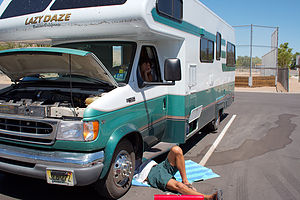 Dad fixing brakes - TJGThe western route out of Death Valley was much steeper and twisting than we had anticipated, but quite beautiful as the Death Valley ranger had said. After a particularly intense series of twists and turns, we pulled over to enjoy the view and to let our brakes take a well-need rest. That’s when Herb discovered that he could press the brake pedal all the way down to the floor with little or no resistance. We waited a bit to see if letting them cool off would help, but to no avail.
We weren’t sure what to do. The options weren’t that great. Having the RV towed out of Death Valley to some semblance of civilization would probably cost more than our entire vacation. Driving it as is wasn’t particular appealing either.
We turned on the laptop and looked at our map program to see how far away we were from the next town. The news wasn’t good. The nearest town was Lone Pine, and it was about 25 or 30 miles away. However, there was some good news as well. The road from here to Lone Pine was straight as an arrow, meaning that the mountains and twisting turns were behind us and we were into the flatlands.
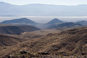 Road out of Death ValleyWe decided to go for it—driving slowly and downshifting to slow us down. Fortunately, the road was perfect for this—straight, flat, and totally devoid of other vehicles. I don’t think we passed another car the whole 25 miles. Still, it was quite tense.
At one point I glanced back at the boys in the rear of the RV and saw them contentedly watching a Seinfeld episode on TV. They were oblivious to the situation. We decided not to ruin it for them.
Eventually, we saw the intersection for US 395 (which is also the Main Street of Lone Pine) up ahead and slowly coasted and downshifted to a stop at the light. We noticed a Visitor Center on our left, so we pulled in to inquire about where we could get some mechanical assistance for our problem.
Mind you, it was already lunch time on Saturday, and since nothing was going to be open on Sunday, time was of the essence. Also, the family had gotten quite cranky about the blistering heat of the past few days and was very much looking forward to our stay in Yosemite Valley, which was supposed to begin that evening.
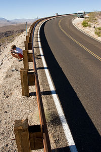 Lazy Daze without brake fluid at turnoutAt the Visitor Center, we found that our choices were the lone mechanic in town (I’m sure his prices would be cheap) or a NAPA auto parts store. As I expected, Herb who is definitely a do it yourself kind of guy, decided to go the NAPA route. We slowly inched our way through town and pulled into a parking lot right across the street from the NAPA.
Herb took out some old towels and crawled under the RV to assess the situation, while we all anxiously gathered round to hear the verdict. The sounds we heard from beneath the RV were definitely not good. It was probably about as bad as it could get—the right rear brake line had rusted and split opening, explaining why we had lost all our brake fluid. I think this was a bigger job than even Herb anticipated, but we were all so used to him being able to fix everything that we just assumed everything would be okay and that we would be on our way in a few hours.
The boys went off on a run, while Herb and I went over to the NAPA to see what could be done. As we expected, they didn’t have a direct replacement for the brake line, but they did have the parts to kludge one. While they began working on that, Herb went back across the street to crawl under the RV and remove the old brake line. Poor Herb. It was about 105 degrees out and the brake line was not coming out easily because of a lot of rusting. However, Herb finally did manage to get it out, as I knew he would, and brought it across the street to the NAPA. Meanwhile, the clock was ticking away. It was already 3:00 and the NAPA store was closing at 5:00. The guys in the store were great, but I’m sure they didn’t plan on wasting their Saturday night on our brake line. The kludging of the new brake line got pretty tense at one point, when the only steel tube they had in stock had to be bent into position. If it broke, we would be spending a good deal more of our vacation in Lone Pine than we wanted to.
Not that Lone Pine isn’t nice. It really is. There is a great view of Mt. Whitney from the corner by the NAPA store. In fact, Ansel Adams took one of his famous shots of Mt. Whitney from this very town. However, we still really wanted to be in Yosemite by bedtime.
Thankfully, the construction of our new brakeline went off without a hitch. The NAPA men had done their part and now it was up to poor Herb to install it. He’s definitely my hero. He worked the rest of the afternoon in the blistering heat and got us to Yosemite Valley before midnight.
What a day, but it could have been a lot worse. Herb had nightmares that night of losing the brakes while going down the steep descents out of Death Valley. He was going to really need this week in Yosemite to recover.
Description
The town of Lone Pine (population 1,655), located on California Highway 395, is a popular tourist destination because of its proximity to so many major attractions, such as Mount Whitney, Death Valley, Kings Canyon National Park, Sequoia National Park, and Yosemite. There are views of 14,496 foot high Mount Whitney, the highest mountain in the continental United States, right from town. In fact, one of Ansel Adams’ most famous prints is a photograph of the mountain taken from the town.
Although its Wild West days are long gone, Lone Pine’s unspoiled scenery has lived on in more than 250 Hollywood film and TV shows, such as the Lone Ranger and Roy Rogers. At the Alabama Hills Recreation Area, just west of town on the Whitney Portal Road, you might recognize the strange rock formation that rise from the valley floor from one of the many Westerns that were filmed here. Today the towns movie roots continue at the Lone Pine Film Festival held here each October.
Just north of Lone Pine on 395 is the Manzanar National Historic Site, a Japanese American internment camp during the Second World War. During the war, more than 100,000 Japanese Americans were rounded up and forcefully departed to various internment camps throughout the West. This monument serves as a reminder of that very shameful chapter of our nation’s history.
Death Valley National Park
Friday, July 20, 2007 - 10:00am by Lolo272 miles and 6 hours from our last stop - 1 night stay
Travelogue
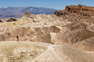 Lolo at Zabriski Point OverlookI don’t think we were all approaching Death Valley with the proper level of enthusiasm that it deserved. Lake Mead’s oppressive heat had drained us, and as far as the boys were concerned, Death Valley was going to be a Lake Mead, minus the lake—not a very appealing thought at that moment.
We entered Death Valley from the east on Route 190 and made our first stop at Zabriskie Point, which according to the guide book was one of the most spectacular overlooks in the park. I had a hard time convincing the men to get out of the air-conditioned RV to climb up the steep hill to the viewpoint, but I knew they wouldn't stay behind for too long. They just wanted to make sure I knew how miserable they were. The thermometer on the dashboard read 120°F. Even though they wouldn’t admit it, I think we all felt that the view of the colorful badlands of Golden Canyon was definitely well worth it. I walked out on the actual point so Herb could take my picture. The boys were too cranky to follow.
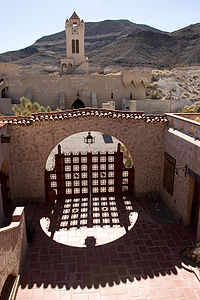 Scotty's Castle courtyardWe continued on to the Furnace Creek area where we were surprised to see some greenery and tall palm tress—very different from the rest of Death Valley. There is a beautiful, and quite pricey, resort here complete with an 18-hole golf course, tennis courts, and spring-fed swimming pools.
After a brief stop at the Furnace Creek Visitor Center, we headed onto the North Highway for the 50-mile drive to Scotty’s Castle, one of the most popular attractions in Death Valley. The drive north took us through some very desolate but beautiful scenery, with desert stretching to the west and mountains rising to the east. Along the way we saw some of Death Valley’s renowned alluvial fans, which are these beautiful and colorful fan-like piles of debris that funnel out of the mountains and spill out across the valley.
About 40 miles into the drive, we noticed that we were being followed. A small coyote, with panting tongue, was running alongside our RV. Whenever we slowed down it did, and whenever we sped up, it followed suit. We couldn’t understand how he could keep up that pace in the heat. Later when we told a ranger about the coyote, she explained that he was looking for a handout and that they were often quite clever at achieving this. I felt kind of badly that we didn’t give him anything for his efforts, but then again, we know that feeding wildlife in the parks is not a very wise thing to do.
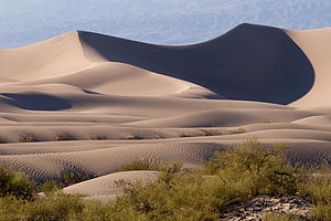 Death Valley sand duneScotty’s Castle was definitely very cool and worth the extra drive. It’s also located at a higher elevation than the rest of the Valley, so the heat was a little less oppressive. I must say that on the approach it was pretty odd to see a Moorish Castle rise out of an otherwise empty and unhospitable landscape.
The tours themselves are given by park rangers dressed in 1930s clothing who greet you at the door as if you are one of Scotty’s guests. I won’t give it away, but the tales of how this unlikely castle came to be were definitely very entertaining and intriguing. In fact, Scotty never really owned the castle at all. The one-hour tour is a definite must for anyone visiting Death Valley.
Since it was getting late and the men were still a bit cranky from the heat, we decided not to make the side trip to the Ubehebe Crater, but to head straight back down the North Highway to Stovepipe Wells where we planned to camp for the night.
 Stovepipe Wells gas pumps - AJGBack in March when I was planning this trip I had called the Stovepipe Wells campground to make sure that they were open in July (as it is the off season) and to ask whether reservations were necessary. I didn’t realize at the time why the gentleman on the phone sounded so amused by my questions, but when we pulled into the village of Stovepipe Wells on this July afternoon, I realized how foolish my second question was. The campground, which was quite large—I think over 200 sites—was totally empty. The only other inhabitant was a bedraggled-looking raven with its mouth open, gasping for air in an attempt to regulate its body temperature. I think he was the campground host.
Check-in was at the small motel across the road, and the nice woman behind the counter gave us the premier site #6 (one of the 15 with electric) and told us that we were welcome to use the motel pool. I knew where I would be spending the evening.
There wasn’t that much to the village, but it actually was quite nice and compact. Besides the campground and the motel, there was a general store, a saloon, and a restaurant—pretty much all a tired tourist needed after a long hot day out on the desert..
 Stovepipe Wells General Store - AJGThe pool was just what we needed. We did notice that everyone else hanging out at the pool was European, which is something we often find when visiting the National Parks in the West. We had heard that Americans usually only come to Death Valley in the winter—I now know why—but Europeans come here in summer to experience the essence of Death Valley, which is its extreme heat. The hotter the better. Well, they must have been very happy.
If we had more time to spend in Death Valley, there definitely would have been a lot of other stops I would have liked to make, like Badwater (just to say I had been at the lowest and hottest place in the U.S.), the Ubehebe Crater, and the infamous Racetrack, where rocks mysteriously move on their own. Maybe next time, but certainly not in July again.
The next morning, we took a ranger’s advice and headed towards Yosemite via the west entrance of the park, where the drive was said to be spectacular—and it was. Little did we know at the time that we would be making an unscheduled stop in the town of Lone Pine where we would become far too familiar with the NAPA Auto Parts staff. I’ll explain in the next stop.
Description
 Scotty's CastleIn 1994, the Desert Protection Act added an additional 1.2 million acres to Death Valley National Monument and upgraded its status to National Park, making it the largest national park outside of Alaska. The park is located on the eastern border of a remote section of California with some small portions extending into Nevada. Despite its remoteness, it is one of the most highly visited parks in the national park systems. Many of these visitors come all the way from Europe and Japan to experience the extremes of this stunningly beautiful desert.
Death Valley received its name from the unfortunate forty-niners who were forced to cross the burning sands here in order to avoid the severe snowstorns in the nearby Sierra Nevada on their way to the California Gold Rush. Many perished along the way, and those that survived remembered it as a place of suffering and death. The current names of many of the places in Death Valley reflect its harshness: Dead Man Pass, Funeral Mountains, Furnace Creek, Hell’s Gate, Devil’s Golf Course, Starvation Canyon, etc.
 Lazy Daze at Stovepipe Wells Campground - AJGThe valley itself is over 130 miles long, but only about 12 miles wide, flanked on both sides by unvegetated reddish mountains. From an elevation of about 3,300 feet in the north, the land slopes steadily downward to an elevation of 279 feet below sea level at Badwater, the lowest point in the western hemisphere. In fact, 70 miles of the desert floor is below sea level, accounting for its extremely high termperatures, which can exceed 130°F in summer.
In many ways, not much about the valley has changed since the pioneers first crossed here. Its intense heat, frigid cold, and the driest air imaginable still make it one of the most inhospitable locations on earth. However, today’s visitors can enjoy Death Valley and see most of its highlights from the comfort of their air conditioned cars and stay in comfortable, and even luxurious, hotel rooms at night.
The park is criss-crossed by a network of roads, ranging form washboard dirt ones to paved, well-maintained highways, making the most popular destinations quite accessible. The Furnace Creek Visitor Center, near the center of the park, is a great place to get oriented and to begin an exploration of Death Valley. This greenness of this area is a surprise to most visitors who come to the park expecting to see nothing but miles and miles of sand. Fed by warm springs, this area is a verdant oasis with palm trees as tall as 50 feet. There are also two world-class resorts here: the elegant Furnace Creek Inn and the more down-to-earth Furnace Creek Ranch.
Highlights traveling south from Furnace Creek on Route 190
- About 5 miles south of the Furnace Creek Visitor Center is Zabriskie Point, one of the most spectacular overlooks in the park. A short walk uphill from the parking lot brings you to a panoramic view of Golden Canyon and the surrounding vibrantly colored badlands. The views are particularly stunning in the lowlight of early morning or late afternoon.
- Another 1.5 miles down the highway s the turnout for Twenty-Mule Team Canyon road, a one-way dirt road that rejoins the highway in 2.7 miles. The road winds through Twenty-Mule Team Canyon with close-up views of the same colorful badlands seen from Zabriskie Point. RVs and trailers are not allowed on this road.
- 4.5 miles further south on 190 is a turnoff for Dante’s View (restricted to vehicles less than 25 feet). The road to Dante’s View climbs steeply to an overlook 5,000 feet above the valley floor, where the temperatures average 20° F cooler than in the valley. From this viewpoint, which most consider the most breathtaking in the park, one can see the lowest point (Badwater) and the highest point (Telescope Peak) in the park.
Highlights traveling south from Furnace Creek on Badwater Road
- About 1.8 miles south of the Visitor Center is the turnoff for Badwater Road. 1.5 miles further south on Badwater Road is the parking lot for the popular hike into Golden Canyon. A well-marked nature trail (2 miles RT) leads into the narrow canyon, wedged in by eroded cliffs and the slopes of golden badlands.
- Back on Badwater Road, continue south past Artist Drive (get that on the way back as it is a one-way road going north). Around 9 miles south of Golden Canyon is the turnoff for the unpaved spur road to Devil’s Golf Course. The road leads to an odd and forbidding landscape created by salt and erosion on a lake bed that dried up 2,000 years ago. The result is a jagged terrain of salty white miniature mountains and spires, less than 2 feet high. The name comes from the feeling that “only the devil could play golf on such rough links.”
- About 8 miles south is the Badwater Basin, the hottest and lowest point in Death Valley accessible by car. Surprisingly, its permanent spring-fed pools also make it one of the wettest. Legend says that it got its name from a surveyor whose mule refused to drink it. Although not poisonous, it is similar in composition and taste to Epsom salts. Despite its apparent inhospitableness, it is home to water beetles, insect larvae, and a soft-shelled saltwater snail that slowly adapted to these conditions.
- Turning back north on Badwater Road towards Furnace Creek, in 8 miles you come to the turnout for the one-way, 9-mile paved Artist Drive, which winds through a colorful display of sedimentary and volcanic rock hidden from the main road. It received its name from the rainbow of colors—red, pink, yellow, orange, and brown—that paint these rocky hills. About half-way through the loop is the parking lot for Artists Palette, one of the most colorful areas along the loop. Artist Drive is restricted to vehicles less than 25 feet.
Highlights traveling north from Furnace Creek on Route 190
- About 1.7 miles north of the Furnace Creek Visitor Center are the remains of what was once the Harmony Borax Works. Borax, which the prospectors called “white gold,” was once a big business in Death Valley. In the 1880s, Chinese laborers were hired to rake borax “cottonballs” from the valley floor and bring them to the Harmony Borax works to be purified. From there the refined borax was loaded onto the famous twenty-mule team wagons and transported 165 miles across the desert to the train station in Mojave. From there it was shipped to processing plants where it was used to make soaps, disinfectants, and food preservatives. Between 1883 and 1927, more than $30 million worth of borax was produced in Death Valley. A short trail leads past the ruins of the old borax refinery and some outlying buildings. More information on the mining of borax in Death Valley is available in the Borax Museum at the Furnace Creek Ranch.
- 12 miles further north on 190 is the turnoff for the 1.2 mile gravel road to Salt Creek, home to the famous Death Valley pupfish. When the lake that once covered Death Valley dried up thousands of years ago, the desert pupfish was the only fish that managed to adapt to the harsh conditions here. Isolated from each other in scattered salty pools, springs, and creeks, nine types of pupfish have evolved. A tenth has already become extinct. They are found no place else on earth. The pupfish can often be seen from the short wooden boardwalk nature trail that crisscrosses the stream and marshes.
- About 21 miles north of the Visitor Center, Highway 190 turns west towards Stovepipe Wells and the west entrance to the park. At this point, you can either continue on 190 or head north on the North Highway another 32 miles to Scotty’s Castle, the major man-made attraction in Death Valley.
Highlights along the North Highway (traveling north)
- The drive to Scotty’s Castle on the North Highway is a very scenic one with desert stretching out on the west and mountains rising to the east. About 10 miles north on the North Highway is a pullout with great views of Death Valley’s renowned alluvial fans. These fans are something like an hourglass with debris from the mountains funneling through a narrow opening and spilling out in a wedge shape into the valley. They come in many shapes and sizes. The ones near this viewpoint are smaller and steeper.
- 25 miles further north in the remote Grapevine Canyon looms the unlikely sight of a Moorish Castle. Construction of what was more officially called Death Valley Ranch was begun in 1922 by Chicago millionaire Albert Johnson, whose doctors had advised him to spend more time in a warm, dry climate. However, the mansion is known as Scotty’s Castle, named after Johnson’s unlikely friend, Walter Scott. Walter Scott was a cowboy that had traveled with Buffalo Bill’s Wild West Show in the 1880s before taking up prospecting. Albert Johnson was one of Scotty’s gullible investors in his “secret gold mine” in Death Valley. After several trips west to see the mine, Johnson realized that he was being duped by Scotty. Despite that, Johnson truly enjoyed his new friend and the tall tales he told. Scotty helped Johnson conceive the idea of this vacation villa in Death Valley and lived in it after Johnson’s death.
- In 1970, Scotty’s Castle was purchased by the National Park Service from the foundation to whom Johnson had willed it. Today the colorful history of the castle is brought to life by rangers dressed in 1930s clothing that welcome you as if you were Scotty’s guests. The one-hour guided tour is excellent, both for its inside look at this unusual mansion as well as for the stories about the eccentricities of the two men that built it. Tours depart every 20 minutes from 9 am to 5 pm. Plan to arrive early because they fill up quickly.
- About 1.5 miles down Grapevine Canyon heading back south on the North Highway is the turnoff for the 8 mile road to Ubehebe Crater. This half-mile wide, 600-foot deep crater was formed by volcanic explosions several thousand years ago. Dark cinders and volcanic fragments cover the surrounding countryside. From the parking area there is a steep trail up to the crater’s rim. Be prepared to battle some very gusty winds.
- Because of its remote location, few visitors get to see the famous Death Valley Racetrack, where rocks mysteriously move across the dry lakebed on their own accord. Although no one has actually seen the rocks move, they are known to move because of the trails they leave behind them. After studying the phenomenon for decades, scientists now believe they have solved the mystery. The surface of the lakebed is a fine clay that becomes very slippery when wet. After a rain, heavy winds as high as 70 mph blow the rocks across the slick surface. A 4-wheel drive vehicle is needed to reach the Racetrack, which is 27 miles past Ubehebe Crater on a rough dirt road.
Highlights traveling west along Route 190 from the junction with the North Highway
- Just west of the junction is the parking area for the surrealistic Devil’s Cornfield. On both sides of the road are odd-looking clumps of brush four to ten feet tall that resemble corn stalks. They are actually arrowweed bushes, whose stems were used by Native Americans to make arrow shafts.
- A few miles further west on 190, pull over on the shoulder by a roadside display where the Sand Dunes come close to the highway. These are the highest of a 14-square-mile field of dunes. Although there are no trails to follow, hikers are free to roam the dunes on their own. The best time of day to visit the dunes is in the morning or late afternoon when the temperatures are cooler and the lighting is more dramatic.
- Two miles further west is the village of Stovepipe Wells, Death Valley’s first tourist resort. The village actually got its name from an historic site about 5 miles north where an old stovepipe was sunk into the sand to form the shaft of a well. For years this well was used by travelers as a source for water. Around 1926 a developer planned to build a small resort near the well. However, his lumber trucks got stuck in the sand before he could reach it. Rather than unload and reload his trucks, he decided to try and dig a well where they were. They struck water and stayed. That spot is the current location for Stovepipe Wells. Today the village has a motel, general store, saloon, restaurant, and campground.
Campgrounds that will accomodate RVs in Death Valley
- Furnace Creek Campground (136 sites, no hookups) – located just north of the Visitor Center. Open year round. This is the only park campground that takes reservations.
- Mesquite Spring Campground (30 sites, no hookups) – located 5 miles south of Scotty’s Castle. Open year round.
- Panamint Springs Resort (40 sites, 12 hookups) – located 30 miles west of Stovepipe Wells on Route 190. Open year round. This campground is privately operated and takes reservations.
- Stovepipe Wells Campground (200 sites, 15 hookups) – located in the village of Stovepipe Wells. Open year round.
- Sunset Campground (1000 sites, no hookups) – located .25 miles east of the Furnace Creek Ranch. Open October through April.
- Texas Spring Campground (92 sites, no hookups) – located near Sunset Campground. Open October through April.
- Wildrose Campground (30 sites, no hookups) – located 30 miles south of Stovepipe Wells off the Trona-Wildrose Road. Open year round.
In addition to the park campgrounds, there are two privately-owned campgrounds in the park:
- Furnace Creek Ranch Campground (26 sites, all full hookups) - located at The Ranch just south of the Visitor Center. Open year round. Guests can enjoy the Ranch’s natural spring-fed swimming pool, shower facility, coin operated laundry, tennis courts, shuffleboard, volleyball, Bocci Ball and basketball court.
- Panamint Springs Campground (37 sites, 12 full hookups) - located at the western end of Death Valley National Park on Highway 190 in the town of Panamint Springs
