- Home
- About
- Map
- Trips
- Bringing Boat West
- Migration West
- Solo Motorcycle Ride
- Final Family XC Trip
- Colorado Rockies
- Graduates' XC Trip
- Yosemite & Nevada
- Colorado & Utah
- Best of Utah
- Southern Loop
- Pacific Northwest
- Northern Loop
- Los Angeles to NYC
- East Coast Trips
- Martha's Vineyard
- 1 Week in Quebec
- Southeast Coast
- NH Backpacking
- Martha's Vineyard
- Canadian Maritimes
- Ocracoke Island
- Edisto Island
- First Landing '02
- Hunting Island '02
- Stowe in Winter
- Hunting Island '01
- Lake Placid
- Chesapeake
- Provincetown
- Hunting Island '00
- Acadia in Winter
- Boston Suburbs
- Niagara Falls
- First Landing '99
- Cape Hatteras
- West Coast Trips
- Burning Man
- Utah Off-Roading
- Maui
- Mojave 4WD Course
- Colorado River Rafting
- Bishop & Death Valley
- Kauai
- Yosemite Fall
- Utah Off-Road
- Lost Coast
- Yosemite Valley
- Arizona and New Mexico
- Pescadero & Capitola
- Bishop & Death Valley
- San Diego, Anza Borrego, Joshua Tree
- Carmel
- Death Valley in Fall
- Yosemite in the Fall
- Pacific Northwest
- Utah Off-Roading
- Southern CA Deserts
- Yosemite & Covid
- Lake Powell Covid
- Eastern Sierra & Covid
- Bishop & Death Valley
- Central & SE Oregon
- Mojave Road
- Eastern Sierra
- Trinity Alps
- Tuolumne Meadows
- Lake Powell Boating
- Eastern Sierra
- Yosemite Winter
- Hawaii
- 4WD Eastern Sierra
- 4WD Death Valley +
- Southern CA Deserts
- Christmas in Tahoe
- Yosemite & Pinnacles
- Totality
- Yosemite & Sierra
- Yosemite Christmas
- Yosemite, San Diego
- Yosemite & North CA
- Seattle to Sierra
- Southwest Deserts
- Yosemite & Sierra
- Pacific Northwest
- Yosemite & South CA
- Pacific Northwest
- Northern California
- Southern Alaska
- Vancouver Island
- International Trips
- Index
- Tips
- Books
- Photos/Videos
- Search
- Contact
Pinnacles National Park, CA
Tuesday, November 1, 2016 - 10:15am by Lolo
190 miles and 4.5 hours from our last stop - 4 night stay
Travelogue
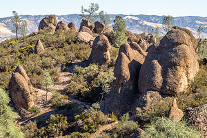 High Peaks RegionIt has been far too long since we’ve been to a new national park, so we were quite excited to be heading to Pinnacles. It was new, not only to us, but it was new to the National Park list – promoted in 2013 from a National Monument.
The park is divided into an eastern and a western section, without any roads connecting them. Since the campground and most of the action is located in the eastern part, that is where we headed.
I had made camping reservations a few days ago, so we were set. In my haste to make a reservation on Recreation.gov, I did not notice that there were electric sites, so I booked a non-electric one. Although we can dry camp just fine in our Lazy Daze, we certainly do appreciate the amenities electricity can provide – our little heater for the cold nights, the ability to keep lights on without draining the battery, microwave, hair dryer, etc. It would have especially been nice since the days were so short and it was dark by 5:30.
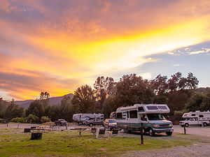 Pinnacles CampgroundHowever, the Pinnacles Campground actually does have electric sites, which we discovered on a late afternoon stroll through the campground on the 3rd of our 4 nights there. Herb gave me a bit of a dirty look, as I am supposed to be in charge of such things and apparently had failed miserably. Oops. Unfortunately, the office was already closed, but we were back there first thing in the morning to switch our site.
Pinnacles is quite small by national park standards – just 26,000 acres, but I took that as a personal challenge to conquer all its nooks and crannies in our three days here.
Day 1 – Condor Gulch, High Peaks, and Rim Trail Hike
If you only have one day to spend in the Park, I think the High Peaks Trail is far and away the best thing to do. It’s fairly strenuous – 7.5 miles with a 2,236-foot elevation gain, but there is much reward along the way.
We started off by driving to the Bear Gulch Day Area where the Condor Gulch Trail begins. From there, we hiked up a smooth, winding trail, constantly keeping our eyes out for California Condors, which according to neighbors of ours that had visited the park in late May, were quite abundant and not very shy of people – quite disconcerting considering they do have a 9-foot wingspan.
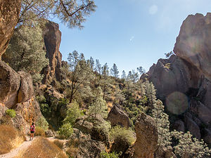 High Peaks RegionAfter about a mile, we came to an overlook and gazed out over the canyon we had just climbed, but try as we might, there were no condors to be seen. Shortly after the overlook, we met a fellow hiker coming down from the High Peaks who told us that he hikes this trail all the time, and this was one of the few times that he had not seen one.
We continued up the Condor Gulch trail for about another ¾ of a mile before turning left (west) onto the High Peaks Trail. The scenery had already been quite impressive, but now things got really good as we wound our way through the pinnacle formations that give the park its name. At about mile 2.3, we came to a junction with the Tunnel Trail, where hikers have the choice of continuing on the “Steep and Narrow” High Peaks Trail, or taking the milder, but slightly longer Tunnel Trail. Both converge again at the Juniper Canyon trailhead in about 0.7 miles.
We chose to take the more exciting High Peaks Trail, which led us through narrow passageways, and up and over steep rock formations, with near-vertical drop-offs off to side. Fortunately, in the more precarious sections there were steps cut into the rock to form staircases and handrails to grip onto. As long as I can hold onto something, I am usually okay with heights, so I found this section of the trail really fun.
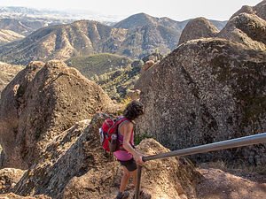 Precarious section of High Peaks TrailWhen we converged once more with the Juniper Canyon Trail near Scout Peak, we scrambled up the rocks alongside the trail to get a better view while eating lunch. To pass the time searching for non-existent condors, I used my Iphone to read Herb fun facts about condors from Wikipedia. For example, we learned that California condors do not have a sense of smell and have to rely on other scavengers, like vultures, to find dead carcasses to eat. Then they just swoop down, scare the smaller birds away, and feast. No wonder they almost went extinct. They also defecate on their legs to reduce their body temperature. Not exactly great lunchtime conversation.
At about 5 miles into our hike, we came to the junction with the Rim Trail and decided to take it rather than go directly back to the car. One of the assignments the boys had given us on our visit to Pinnacles was to research the rock climbing possibilities, and the specific climbs they wanted us to look at were along the Rim Rock/Moses Spring loop.
The Rim Trail actually goes along the top of climbing routes, rather than along their base. We took a path labeled Discovery Wall, which was one of our homework assignments, and spoke to a few volunteer climbers that were working on replacing bolts on the wall. The type of rock in Pinnacles is volcanic breccias, which is much more delicate and likely to break off than walls of granite or basalt. That’s why, despite its rather close proximity to San Francisco, the boys had avoided climbing here as of yet. The thought of a hold coming off in your hand is a bit disconcerting.
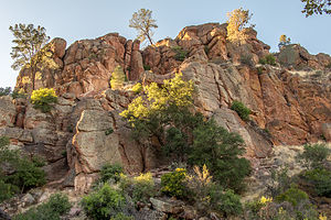 Along the Rim TrailHowever, these guys certainly seemed to love climbing here and had done so dozens of times. They also told us about a wall a short distance away called Top Rope Rock, where Herb would not have to lead a climb, but could just set up a top rope on for us to use -- good idea, as I am not 100% confident in my ability to belay him on lead. Perhaps tomorrow.
We continued our hike along the Rim Trail to the Reservoir. From there, we could have gone through Bear Gulch Cave, but it was getting late, we were tired, and really had no desire to crawl around in a cave. Instead we walked upright like Cro Magnons on the Moses Spring Trail. Along the way, we passed The Monolith, the second rock wall we were asked to research.
It had been a great day – 7.5 miles of great scenery and a good workout.
We got back to the campground just in time to bring out our beach chairs and sit in the sun a half hour before it dipped behind the mountains and things cooled down real fast. I hate these short days, especially without electricity in the motorhome.
Day 2 – Rock Climbing on Top Rope Wall
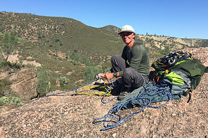 Herb setting up on Top Rope WallUntil I get my lead belay certification, Herb and I are somewhat limited in what we can climb when it is just the two of us. That is something I really need to work on. However, fortunately, Pinnacles had a Top Rope Wall, also called Teaching Rock, which was perfect for us.
It was right near the Discovery Wall where we had talked to the climbers yesterday. We parked at the Moses Springs parking lot, hiked 0.1 miles along the Moses Spring trail, hung a right onto the High Peaks trail for another 0.3 miles, then turned left on the Rim Trail for another 0.2. From there a side trail off to the left brought us to the top of the camel hump, aka Teaching Rock, aka Top Rope Wall, aka Lolo Rock.
Anchors were already set up on top of the rock, so all Herb had to do was setup a top rope, throw both ends of the rope down to the base of the rock, and come down to the base himself via the walk-off path around the side. This allowed us to safely belay each other and climb.
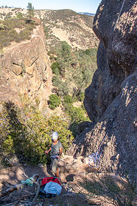 Climbing at Top Rope WallThe routes to the top varied in difficulty from 5.6 to 5.9. We weren’t exactly sure which route was which, but I certainly hope that the first one we tried was the 5.9, because I got stuck below the bulge and couldn’t get much further. Herb, of course, did it just fine and then suggested that I try going slightly to the right around the bulge rather than straight up over it. Although still challenging for me, I was able to get the complete climb. We did another one to the left of the first climb as well.
It was very interesting rock – very different from anything we have climbed on before. There were all these angular pieces of rock that looked like they were cemented to the rest of the rock. Some of them were good to grab onto – others, not so much. Still it was lots of fun and satisfying. Plus, now I could say I climbed at Pinnacles before the boys did.
It was a beautiful day and our campsite was actually quite nice, so we went back around 3:00, so we could spend an hour or two just relaxing and reading in the beach chairs.
Day 3 – Hike to West side of Park
As I mentioned earlier, Pinnacles is a small national park, so given a few days, one can pretty much walk all its trails. So, that was pretty much our goal for the day – to hike the Old Pinnacles and Balconies Trail over to the west side of the park and then come back via the High Peaks Trail. Also, we hoped that going through the High Peaks section of the park again would give us another shot at seeing California Condors.
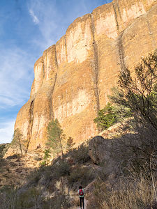 Old Pinnacles TrailThere aren’t a whole lot of roads in the park, so getting to trailheads is quite simple. This time, instead of veering left at the fork for the Bear Gulch Day Area, we hung a right on Old Pinnacles Road to the trailhead parking at the end.
From the parking lot, we walked about 0.2 miles to the junction of the Old Pinnacles and Bench Trails. Although most of the hiking guides suggested taking a left onto the Bench Trail and doing the loop clockwise, we chose to stay right on the Old Pinnacles Trail, because we wanted to do the High Peaks Trail section in the opposite direction from what we had done two days ago – that way the views would be different and it wouldn’t feel like a repeat.
The first 2 miles or so of the Old Pinnacles Trail were along a wide sandy trail through a dry canyon populated with pine trees and brush. No big views or big climbs, but a very pleasant stroll. At about 2.1 miles we arrived at Balconies Cave. I think most people hike this trail because of the cave, but we’ve done so many caves and scrambling over rocks in our day, that we decided to literally take the high road – the Balconies Cliff Trail which went above it.
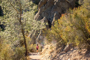 Juniper Canyon TrailAt about 4 miles, we came to the Chaparral Ranger Station and Parking Area, which is the western access to Pinnacles National Park. From there we hung a left onto the Juniper Canyon Trail where the scenery and the topography began to change. For the next 2 miles, we climbed over 1,000 feet through a series of switchbacks with views of pinnacles and interesting rock formations across the canyon.
At the trail junction for the Tunnel Trail, we turned left (northeast) onto it and continued climbing until the junction with the High Peaks Trail at about mile 6. This was the junction we came to from the other direction two days ago, where we chose to go south through the "Steep and Narrow" section with handrails to keep from falling off the steep drop-offs.
However, today we were headed east on the High Peaks Trail back towards the Old Pinnacles trailhead. All that climbing we had done up to now finally paid off, because it was pretty much all downhill from here.
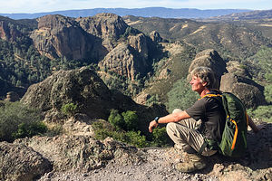 High Peaks HerbThe next mile was the only repeat from our previous hike, the section between the Tunnel Trail and Condor Gulch junctions – but a section well worth repeating, as it is probably the most scenic part of the park, with amazing views of the rock spires rising out of the pine and chaparral-covered ridges towards Bear Gulch in the south and the bulging canyon walls of the Balconies to the north.
As we continued along the 2-mile section of the High Peaks Trail between Condor Gulch and the Bench Trail, the views of rock spires and monoliths gave way to views of ridges and canyons – less dramatic, but still quite lovely.
When we reached the Bench Trail, we turned left (north) and hiked about another mile back to our car. All in all, we had hiked 9.8 miles with a 1,885-foot elevation gain through some very awesome scenery.
It was time for a cold beer back at the campsite where we now had electricity – Woo Hoo!
I forgot to mention that once again, despite our best efforts, we had not seen a California Condor, even though we hiked for a second time through the High Peaks region, which is where they are most commonly seen.
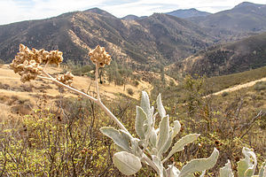 Descending the High Peaks TrailHowever, later that afternoon while relaxing in our beach chairs, sipping our well-deserved beers, gazing at the sky above the campground, we spotted some very large birds riding the thermals along the ridge.
We couldn’t make out the distinctive white markings under their wings from this distance, so I went over to the campground viewing area and looked through one of the telescopes. I was joined by a gentleman quite knowledgeable about birds that confirmed for me that they were indeed condors and that immature ones do not yet have the white markings.
If I had only known that condors are more easily spotted from a beach chair with beer in hand, I wouldn’t have had to do all that vigorous hiking.
After 10 nights out on the road dry camping, we spent our first evening in a water/electric site enjoying the wonders of electricity, as if for the first time – microwaving, blow drying my hair, turning lights on, running the heat, watching movies – even if we didn’t need to.
Pinnacles is truly a wonderful park, and one to which I am sure we will return to again and again – or at least until I have fed a condor out of my hand.
Description
Pinnacles National Park
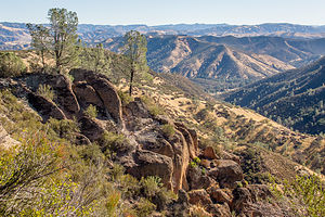 View from Condor Gulch TrailIn 2013, 26,000-acre Pinnacles National Monument graduated to the status of National Park. The park is located a little over two hours south of San Francisco, east of the Salinas Valley. The park is named for the towering rock spires that rise abruptly out of the chaparral-covered Gabilan Mountains.
These rock formations are the remnants of an extinct volcano that erupted 23 million years ago. As the Pacific plate crept northward along the San Andreas Fault, it split a big chunk off from the main body of this volcano and dragged it 200 miles northwest to where Pinnacles is today. Millions of years of weathering and erosion have resulted in the formations you see today.
The rock in Pinnacles is quite unique. It is breccias, a type of sedimentary rock composed of broken angular fragments of minerals or rock cemented together by a fine-grained matrix of smaller particles.
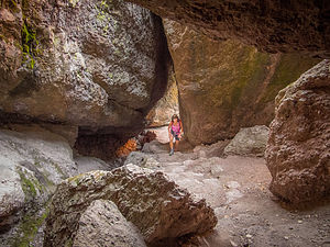 Bear Gulch CaveEarthquake and volcanic activity were also responsible for the Pinnacles’ Balconies and Bear Gulch talus caves, formed when boulders fell into deep, narrow gorges and lodged between the rock walls, forming a roof over the canyon. Today, these caves are home to several species of bats.
The Park is divided by the rock formations into an eastern and a western section with no road connecting the two. The Visitor Center and Campground are located on the east side of the park.
Activities in the park include:
- Hiking the 30 miles of trails
- Rock climbing – however, the volcanic breccias and tuff is weak compared to the granite and basalt rock of other climbing areas
- Exploring the Bear Gulch and Balconies talus caves
- Watching California Condors soar on the thermal drafts over the high peaks section of the park
- ‹ previous
- 2 of 3
- next ›
Pinnacles National Park location map in "high definition"
Javascript is required to view this map.
