Cathedral Valley, UT
The Cathedral Valley is a separate district of Capitol Reef National Park, located just north of Highway 24 between Torrey and Hanksville. It is a scarcely visited, remote, rugged region of eroded colorful buttes and pinnacles that rise high above a flat desert plain. It’s a geologist’s playground with so many stories told by the fascinating and unique rock formations.
The only way to explore the Cathedral Valley is to drive the 58-mile loop dirt road past breathtaking scenery and solitude all the way.
The Cathedral Valley Loop requires a 4WD high clearance vehicle, and it is recommended to drive the loop clockwise, so that you get the Fremont River crossing over with first to make sure it is feasible.
The turnoff for the river crossing is located at Mile Post 91 on Utah 24. Fortunately the river was pretty shallow, so we had no problem making the crossing.
.jpg)
Once across the river, we continued on Hartnet Road as it climbed past the colorful hills of the Waterpocket Fold. 200 million years ago, this area consisted of flat layers of sediment formed at near sea level. Then about 50 to 70 million years ago, tectonic forces uplifted them, forming a 90-mile massive wrinkle in the Earth’s crust, now known as the Waterpocket Fold, North America’s largest.
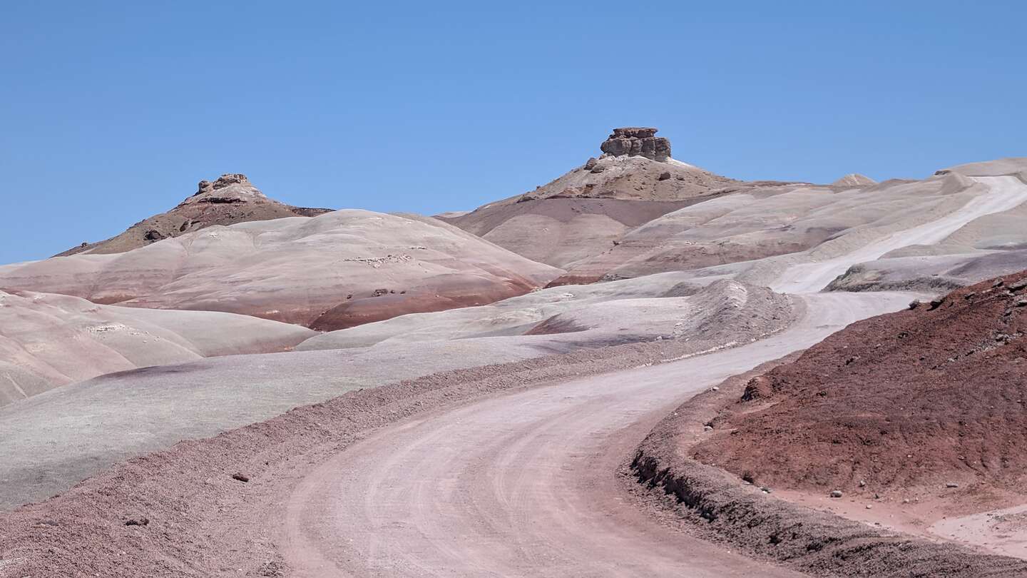
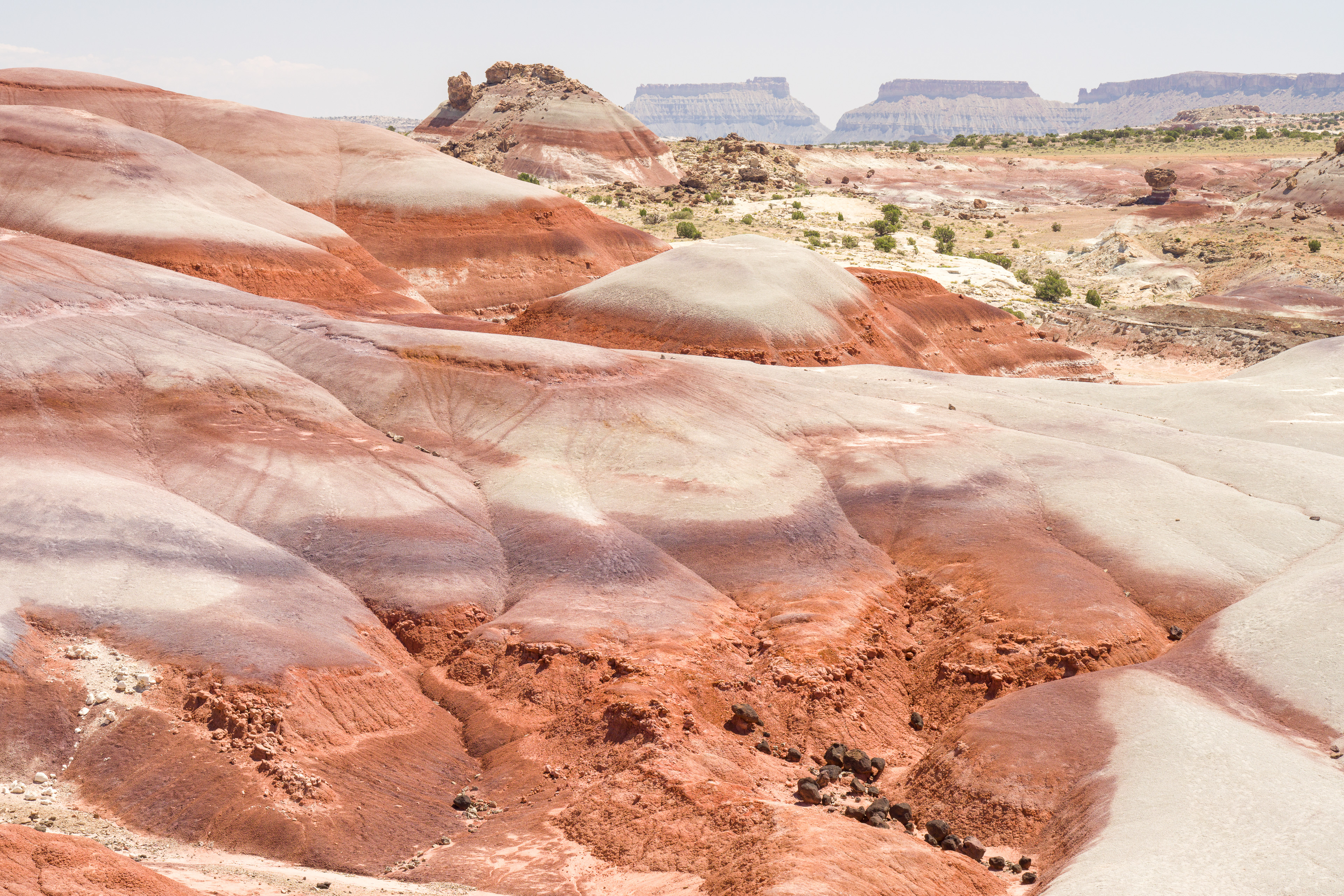
At about 9 miles from the river ford, we entered the beautiful, multi-colored Bentonite Hills, a series of rounded mounds with bands of brown, red, purple, gray, and green.

Fortunately, today was a beautiful sunny day, because when it rains, the Bentonite clay absorbs the water and becomes very slick, making it very difficult to drive on.
The Bentonite Hills get their colorful appearance from the minerals within the bentonite clay. This clay was formed during the Jurassic period from altered volcanic ash, sand, silt, and mud deposited in swamps and lakes. As the clay absorbed water, it developed a distinctive texture and the characteristic reddish-brown color. During different times of the day and lighting, the hills often take on a blue and purplish hue.
.jpg)
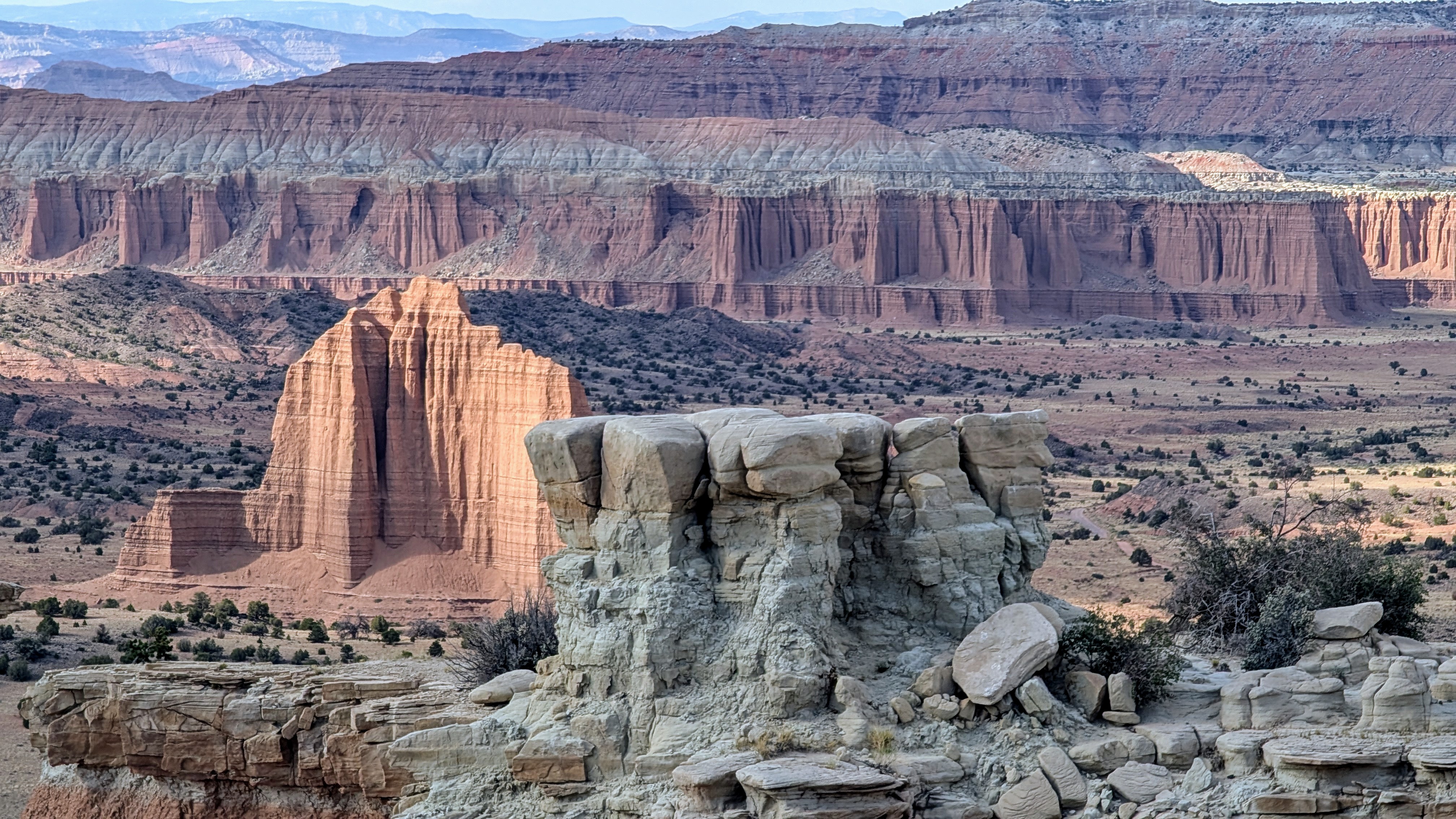
10 miles further on, we stopped at a pull-out and took a short hike up a steep hill that overlooked the monoliths of Lower Cathedral Valley.
Most of the fluted cliffs in Cathedral Valley are composed of soft, red Entrada sandstone, originally deposited as sandy mud on what was once a tidal flat. Some of them are capped by a thin, hard greenish-gray marine sandstone.
It was hard to believe that pioneers used to graze their cattle in this Valley in the 1800s.
Open-range grazing practices were common during this period, and the extensive use of these lands by cattle and sheep sometimes led to overgrazing and de-vegetation of portions of the area.
In an arid, desert environment like this, the cattle had to graze on whatever native vegetation was available, especially native grasses that were adapted to the dry conditions here.
.jpg)
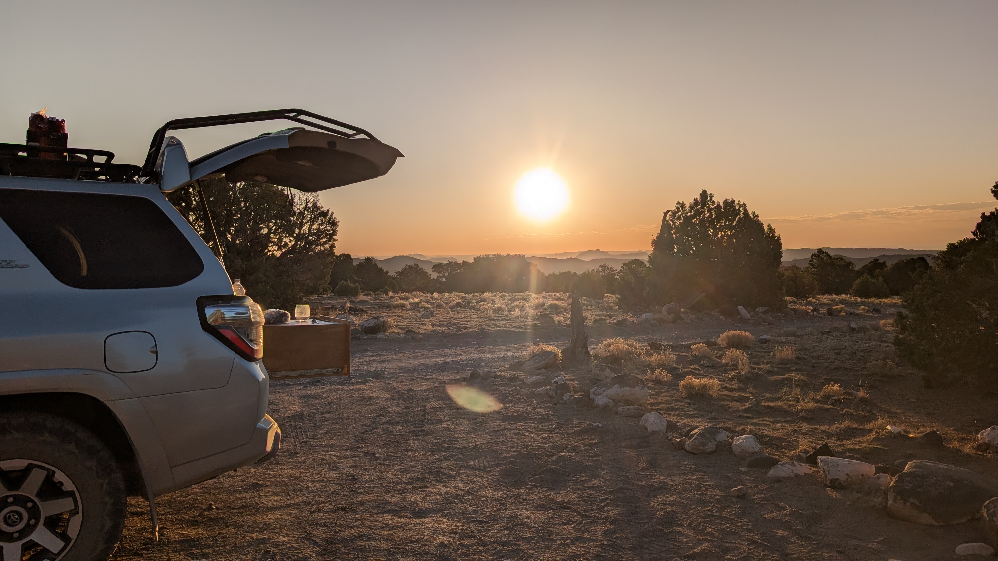
After hiking back down to the car, we continued on. About halfway around the Cathedral Valley loop, there is a small first-come-first-serve campground with 6 sites. We were lucky and got the last one.
This would allow us to spend the sunset at the nearby Upper Cathedral Valley Overlook, known for its "cathedrals" – towering sandstone monoliths that resemble Gothic architecture.

These colossal, spire-like formations are composed primarily of buff-pink Entrada Sandstone, with a hard cap rock of grayish-green Curtis Sandstone, protecting them from erosion and contributing to their unique shapes.
It is considered one of the most beautiful views, not just in this park, but in all of Utah, and that’s saying a lot.

Unfortunately, when we first got there, the sun was hidden by clouds, so the monoliths were dark, but then for a brief moment the sun peaked out, lighting up one of the “cathedrals,” as if there was a spotlight on it. It was absolutely stunning.
For another vantage point, we walked out onto an outcrop overlooking the entire Upper Cathedral Valley.
We spent the next hour, just watching the light change in the Valley, eventually lighting all of them up at once.
When the show was over, we returned to our nearby campground for another Mountain House camping dinner and a glass of wine.
The next morning, we continued along the Cathedral Valley Loop towards the Temples of the Sun and Moon.
.jpg)
Before arriving there, we took a short spur road to see a different kind of geological feature - a large Gypsum Sinkhole, which was over 50 feet across and 200 feet deep.
These sinkholes are formed when groundwater dissolves a buried gypsum plug. The cavity left behind collapsed under the weight of the overlying rock layers.
Herb and I decided to take photos of our shadows on the wall on the other side of the sinkhole. Herb is imitating a petroglyph we once saw of an angry warrior, with arms raised and legs spread. I must be the innocent maiden he is protecting.
.jpg)
We continued on to our second favorite stop along the Cathedral Valley loop (the Upper Cathedral Valley Overlook being the first) - the Temple of the Sun and the Temple of the Moon, rising respectively 422 feet and 265 feet from the valley floor.
Unlike the monoliths we saw in the Upper Cathedral Valley, these have lost their protective gray caps of Curtis Formation sandstone. This means that they are eroding pretty rapidly, in geological terms anyway.
.jpg)
Up close, the face of them looks a bit like flowing mud. That’s because in some way, it actually is. When there is a heavy enough rainstorm, the surface actually turns into mud and oozes down, hardening again when things dry.
We continued on to the turnout for Glass Mountain, from which we could photograph all three mountains (this and the Temple of the Sun and Moon) in a diagonal line.
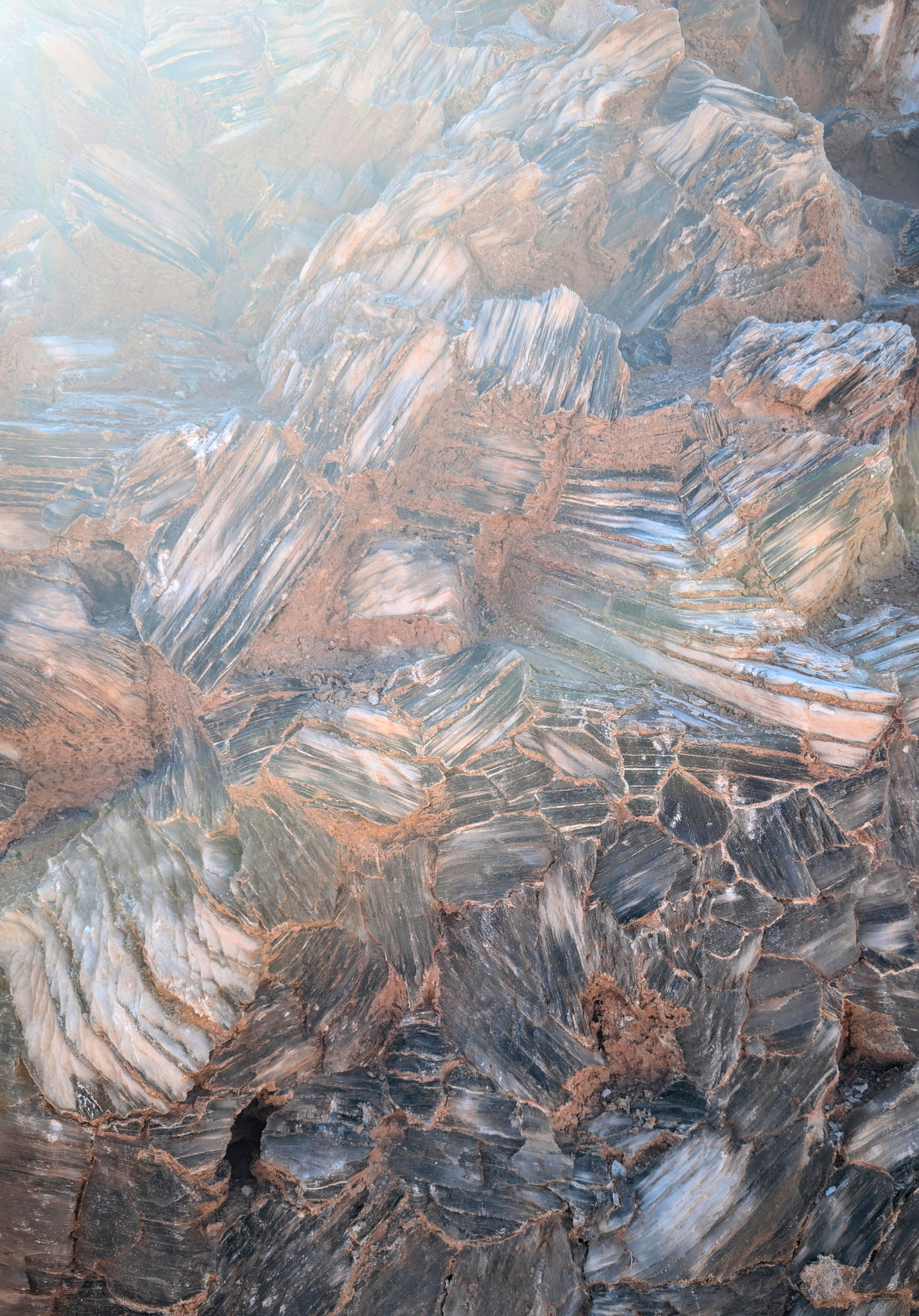
The Glass Mountain is a bit of a geological curiosity. It is composed of large selenite (gypsum) crystals forming a mound, or plug, about 15 feet high. That is only the tip of the iceberg, so to speak, as it goes deep underground for about 60 meters.
Since selenite (gypsum) is a slightly soluble mineral, precipitation will eventually (over a very long time) dissolve Glass Mountain and create a sinkhole, like the one we saw on our last stop.
Before leaving, we, of course, had to climb to the top of it. It was actually quite easy because the selenite crystals are easy to grab onto.
We still had a lot to see today, so we continued on the loop road, past more beautiful multi-colored mounds, to Utah 24 in the town of Caineville, where we turned left towards the town of Hanksville, for a hearty lunch at Duke’s Slickrock Grill, a place we had been to several times before when visiting this area. It’s named after John Wayne, and the place is full of memorabilia about the Duke. The restaurant is really good and serves very large portions.
But the day wasn’t over yet. This afternoon, we would go off-road again to explore the Mars Desert Research Station, Factory Butte, and Moonscape Overlook..