- Home
- About
- Map
- Trips
- Bringing Boat West
- Migration West
- Solo Motorcycle Ride
- Final Family XC Trip
- Colorado Rockies
- Graduates' XC Trip
- Yosemite & Nevada
- Colorado & Utah
- Best of Utah
- Southern Loop
- Pacific Northwest
- Northern Loop
- Los Angeles to NYC
- East Coast Trips
- Martha's Vineyard
- 1 Week in Quebec
- Southeast Coast
- NH Backpacking
- Martha's Vineyard
- Canadian Maritimes
- Ocracoke Island
- Edisto Island
- First Landing '02
- Hunting Island '02
- Stowe in Winter
- Hunting Island '01
- Lake Placid
- Chesapeake
- Provincetown
- Hunting Island '00
- Acadia in Winter
- Boston Suburbs
- Niagara Falls
- First Landing '99
- Cape Hatteras
- West Coast Trips
- Burning Man
- Utah Off-Roading
- Maui
- Mojave 4WD Course
- Colorado River Rafting
- Bishop & Death Valley
- Kauai
- Yosemite Fall
- Utah Off-Road
- Lost Coast
- Yosemite Valley
- Arizona and New Mexico
- Pescadero & Capitola
- Bishop & Death Valley
- San Diego, Anza Borrego, Joshua Tree
- Carmel
- Death Valley in Fall
- Yosemite in the Fall
- Pacific Northwest
- Utah Off-Roading
- Southern CA Deserts
- Yosemite & Covid
- Lake Powell Covid
- Eastern Sierra & Covid
- Bishop & Death Valley
- Central & SE Oregon
- Mojave Road
- Eastern Sierra
- Trinity Alps
- Tuolumne Meadows
- Lake Powell Boating
- Eastern Sierra
- Yosemite Winter
- Hawaii
- 4WD Eastern Sierra
- 4WD Death Valley +
- Southern CA Deserts
- Christmas in Tahoe
- Yosemite & Pinnacles
- Totality
- Yosemite & Sierra
- Yosemite Christmas
- Yosemite, San Diego
- Yosemite & North CA
- Seattle to Sierra
- Southwest Deserts
- Yosemite & Sierra
- Pacific Northwest
- Yosemite & South CA
- Pacific Northwest
- Northern California
- Southern Alaska
- Vancouver Island
- International Trips
- Index
- Tips
- Books
- Photos/Videos
- Search
- Contact
Bangkok
Thursday, March 15, 2018 - 8:00am by Lolo0 miles and 0 hours from our last stop - 3 night stay
Travelogue
Day 1 (or possibly Day 3, depending on how you think about it)
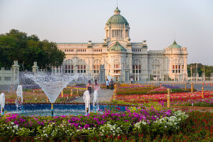 Dusit PalaceWe left our house for the airport on a Tuesday night and arrived in Bangkok on Thursday morning. Where did Wednesday go? Perhaps we would find it on the way back home.
Thankfully, a smiling Gate1-arranged driver was there to greet us at the airport and deliver us to the Century Park Hotel where we would be spending the first 3 nights of our trip. Once deposited inside the lobby, we were relieved of our luggage, handed a refreshing drink, and approached by another smiling man, which turned out to be Mr. Udom, our Gate1 tour guide for the next 12 days.
What we were quickly learning about the culture of Thailand is that everyone smiles, and it is truly genuine. They have to be one of the friendliest and most hospitable people in the world.
The hotel was lovely and far more luxurious than what I am used to - after all, our primary means of travel is a motorhome. I could definitely get used to this.
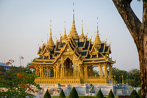 Temple on the Dusit Palace groundsThe actual guided part of our tour didn’t start until the next morning, so we had the rest of the day to ourselves. After a quick nap, we decided to set out on foot to do a bit of an exploratory. With the humidity and action-packed days on the tour ahead of us, we knew our only form of exercise would be walking, so we planned to do as much of it as possible.
The second thing we learned about Thailand is that it is not particularly pedestrian-friendly and that you take your life in your hands every time you step off a curb. Speeding, aggressive lane changing, crazy tuk tuk drivers, motorbikes with entire helmet-less families on them is the norm. Also, they drive on the other side of the street, so we found ourselves looking the wrong direction for oncoming vehicles. The incredible thing is that there is no horn honking. I’m not sure if it’s because nothing could possibly surprise anyone in this chaos or that the Thai people are too polite to honk.
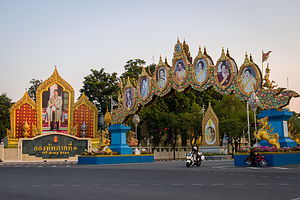 Portraits of the royal familyNot exactly knowing what we were doing, we looked on the map for an interesting destination within walking distance from our hotel and came up with the Dusit Royal District, a park-like setting with royal palaces, temples, and administrative buildings, about 3 ½ miles away.
The Dusit district is Bangkok's "new" royal city. It was established by King Rama V in the early 20th century upon his return from a European tour, where he was exposed to the great capitals of the west. Inspired by what he saw and wanting to appear modern, Rama V established a new palace compound which he named Dusit, which means "Heavenly Garden."
Unfortunately for us, the grounds were closed by the time we arrived, so we had to peer through the iron fences to take photos, always under the watchful eyes of the palace guards, standing at attention at each entrance to the grounds. I got the feeling they were not going to make an exception and let us take a closer peek.
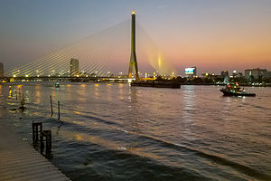 View of Chao Phraya River from In Love outdoor patioWithin the fenced and highly guarded compound was a huge ornate Italianate building called the Ananta Samakorn Throne Hall. Closed to the public, except for one day a year, this building housed the Thai parliament before the 1932 coup which ended the absolute monarchy. The history of Thailand’s kings and government gets pretty confusing, so I am not going to even attempt to get into it in any depth, except to give places we visited some context. Today, this beautiful building is used for state occasions.
The plaza in front of the throne hall, which we could walk through, had a beautiful garden and fountain and a large equestrian statue of King Rama V. Surrounding the plaza are large, ornately framed portraits of the royal family. That’s another thing we would quickly learn about Thailand - the importance of the royal family to them. There are photos of the king (present one and the one that recently passed away) everywhere in Thailand. King Rama IX, who passed away in 2016 after ruling the Thai people for 70 years, is particularly beloved and looked upon as a father to the people. I think they are still feeling out the new king, Rama X. He has some pretty big shoes to fill.
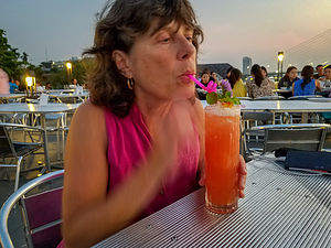 Lolo enjoying her first Mai Tai in ThailandFrom the royal district, we walked another mile to a restaurant called In Love, overlooking the Chao Phraya River, with great views of the Rama VIII Bridge. We sat out on the patio, which I have to say was pretty magical, made even more so by a refreshing Mai Tai.
I did panic a bit half way through the drink when I remembered that we were warned not to drink tap water or ice cubes made from tap water. This was a pretty upscale restaurant frequented by tourists unarmed with bad-water fighting bacteria, so I tried to reassure myself that the ice cube that I was swirling around in my mouth was just fine. I forged on.
Dinner was delightful. The food was fine, but the view was what really made it. What a nice way to end our first day in Bangkok.
Actually, it wasn’t quite over yet. We had walked five miles from our hotel to get here, and we had no intention of walking back. There weren’t a whole lot of cabs near the restaurant, so we continued walking another mile and a half to Khao San Road, where there is a lot of night action and hopefully a means of transport home.
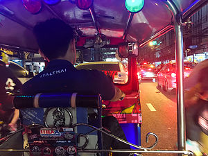 View out of our tuk tukOnce a major rice market, today Khao San Road has become a world-famous “backpacker ghetto”, with cheap accommodations, internet cafes, massage parlors, tattoo shops, and countless bars and restaurants. It was quite the happening scene, with loud music emanating from bars and tons of food stalls hawking such delicacies as barbecued insects and other exotic snacks.
As suspected there were plenty of cabs and tuk tuks. While Herb was haggling with a cab driver, I pointed to a tuk tuk and asked how much. “Same price as taxi,” he said. For those that don’t know what a tuk tuk is - which was me about a week ago - it’s a three-wheeled motor vehicle driven by a crazy person (just kidding).
There was still one more adventure before calling it a day - a wild, extremely exhilarating tuk tuk ride back to our hotel. Our neighbor, who has traveled the world and been to Thailand on numerous occasions, told us that we just had to experience a tuk tuk ride, even if just once. Well, she was right. It was probably the wildest and most exhilarating experience I have had in a long time. We made it back to our hotel in record time, but I do think “just once” is sound advice.
Day 2 - The Official Tour Begins: Wat Pho and the famous Reclining Buddha
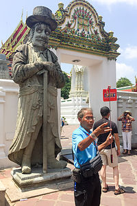 Udom leading the wayThis was the first day of our guided tour. For the next 10 days, we would entrust ourselves to Mr. Udom to learn about and absorb the fascinating culture of Thailand, and hopefully experience some great Thai food along the way.
The bright red Gate1 tour bus (easy to find) was quite impressive - clean, comfortable reclining seats, and surprisingly only half full, as our fellow travelers only numbered 23, while the bus could easily hold twice that number. We didn’t know anybody yet, so it felt a little like the first day of school, where we nervously looked around hoping to make new friends.
Everyone seemed nice and friendly, and there was a wider range in ages than I expected - most in their late 40s to early 60s, but also 3 in their 20s and one very robust octogenarian.
 Spirit HouseMr. Udom (who we later just called Udom) had a microphone and he knew how to use it - in a really good way. For the entire 10 day tour, he never just sat back and enjoyed the ride, but continually, and quite enthusiastically, shared his vast knowledge about the country he obviously loved so dearly.
As we drove through the streets of Bangkok towards Chinatown and the Indian Market, Udom gave us some basic information about the culture - the Buddhist religion (to which he very devoutly belonged), the political structure and the Thai people’s relationship to their king, the progress Thailand was making to become a modern day country, etc.
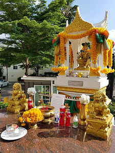
Before we knew it, we were getting off the bus at a market along the river, following Udom and his Gate1 flag. Rather than a totally structured tour and spiel, Udom would just stop and talk about interesting things we passed along the way. He stopped at a food vendor to buy us fresh mangos and then again in front of a beautiful dollhouse-sized home atop a pedestal - which I had been curious about because they seemed to be all over - even in front of our high-rise hotel.
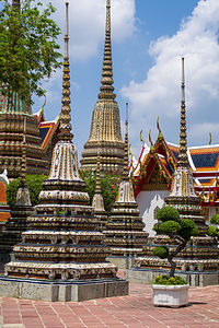 Wat Pho chedis (or stupas) used to house the remains of Buddhist monks or nunsAs Udom explained, these were “spirit houses” often placed in the corner of a property to provide shelter for spirits that might otherwise cause trouble - usually those that once owned and lived on this property. Offerings, such as votive candles, flowers, and fruit are often left at the house to propitiate the spirits. Although 95% of the Thai population is Buddhist, spirit house rituals are based on ancient animistic practices inherited from their ancestors thousands of years ago.
Next, Udom let us loose in a huge warehouse building which held the Pak Klong Talad Flower Market, the largest flower market in Bangkok, with instructions to meet him at the other end in 20 minutes. I have never seen so many flowers for sale in one place. The varieties sold ranged from local species (jasmine, chrysanthemum, orchids, lilies, roses, etc.) to imported species such as tulips, snapdragons, iris, delphinium, and more - and very inexpensive.
I think I mentioned in yesterday’s write-up that the streets of Bangkok are not particularly pedestrian friendly, but we were still taken aback when we had to move out of the way of motorcycles riding up the aisles of the flower market. We were going to have to keep our wits about us.
Then it was back on the bus and on to our major attraction for the day - Wat Pho, the largest of Bangkok’s Buddhist temples and home to the famous 150-foot Reclining Buddha. Although many use the word temple and wat interchangeably, Udom explained to us that a temple is not officially a wat unless it has an ordination hall.
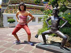 Lolo doing some bad yogaUpon entering the courtyard, we were greeted by a group of beautiful Chinese conical structures, decorated in ceramic pottery flowers and colorful tiles. They are called chedis (or stupas), and they house relics, generally the remains of Buddhist monks or nuns.
Behind the chedis are a series of multi-peaked, steeply roofed buildings - also glittery with lots of shimmering gold plate. Each of the roof peaks was adorned with a blade-like projection, called a chofah, that resembled a tall thin bird, and is believed to represent Garuda, a legendary bird in Buddhist and Hindu mythology.
Please forgive my rather awkward attempt at describing Thailand architecture and refer to our photos instead to truly appreciate the beauty of this place.
Continuing on to the main temple, we passed through a lovely garden populated by whimsical bronze statues (with elf-like ears) in various yoga poses. Needless to say, we couldn’t resist imitating them for a photo or two.
Our next stop, and the Wat Pho’s main attraction was the temple of the Reclining Buddha. As with any Buddhist temple, we had to leave our shoes outside and make sure that our clothing covered our shoulders and knees. We entered at the temple at the head of the Buddha and strolled along its 150 foot gold-plated body to its giant 16-foot feet. The bottom of the toes are decorated in mother-of-pearl swirling spires - 3 on each toe. This particular Buddha sculpture is not detailed in its rendering of the human body, but it more than makes up for it in its enormity.
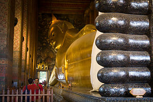 Reclining Buddha's tootsiesAfter rounding the Buddha’s feet, we strolled back along the other side of his body. The wall on this side contained a long table with 108 bronze bowls, used to collect donations to help preserve Wat Pho. 108 is a sacred number in Buddhism. It refers to the 108 positive actions and symbols that helped lead Buddha to perfection, and it is also the number of beads on a Buddhist prayer bead. Conveniently located at the start of the table was a woman selling a handful of coins (108 of them in fact). Striving for perfection and not looking like cheap tourists, we purchased our coins and dropped them one by one in the series of bowls. It actually was quite a mindful exercise, as we tried to focus on the dropping of each coin into the bowl. Actually Herb did. I was too busy trying to pass the slower people in front of me.
Out final stop in Wat Pho was the ordination hall, which if you recall, made this complex of temples and chedis an official “Wat.” An ordination hall is used for performance of the ordination of Buddhist monks and other ritual ceremonies.
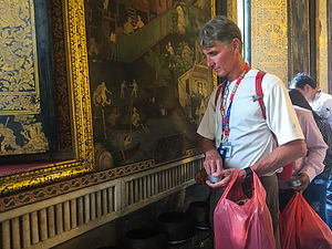 Herb giving alms at Wat PhoThe hallway we first entered contained a series of about a dozen gold-plated buddhas sitting in the lotus position. From there we entered the ubosot where the actual ordinations of new monks take place. Inside the ubosot there was a magnificent alter with a large Buddha, finished in gold and crystal with a large gold cone hanging above its head. Visitors are welcome to respectfully kneel in devotion or prayer before the altar. You don’t have to be a Buddhist to benefit from a moment of contemplation in this serene and spiritual setting.
It seemed like we had seen far too much of Bangkok already for it to only be 1:30 in the afternoon, but that is what it was when the Gate1 bus brought us back to the Century Park Hotel. We were on our own for lunch, so we consulted our Gate1 packet for recommendations on restaurants near the hotel. We selected Baan Ajarn, a cozy restaurant and pub, just a short walk from our hotel. Herb is allergic to shellfish so he was warned to be very careful ordering as even curries sometimes have oyster sauce. We decided to play it safe and order the chicken with cashews. It was delicious, and as we would continue to find out, very reasonable.
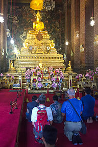 Herb in Wat Pho templeThe only other thing on the agenda for the day was a Gate1 welcome reception, hosted by Mr. Udom, in the hotel bar at 6:00 (one free drink included). Plenty of time for a quick nap before. Although we were ready in plenty of time, Herb suggested we arrive about 10 minutes fashionably late. I argued that since we did not know the custom in Thailand regarding punctuality, we should be there by 6:00. I really tried hard not to say “I told you so,” when Mr. Udom called our room phone at 6:03 asking us if we were coming down.
So, we apologetically slinked into the bar where everyone was seated on couches and chairs waiting for us. I don’t think we made a particularly good first impression.
We spent a pleasant hour introducing ourselves to each other and listening Udom explain what we could expect over the next 10 days. Herb and I were the only Group Tour virgins in the room. Literally everyone else had been on at least a few Gate1 tours before. Everyone seemed really friendly and interesting, and raved about their previous Gate1 experiences. Okay, maybe this group thing wasn’t going to be too bad.
From the bar, we transitioned to the hotel dining room, where there was a buffet with enough food to feed an army. This was the first of many hotel buffets we would dine at this trip, and it was wonderful. Not being a connoisseur of Thai cuisine, it gave me a wonderful opportunity to sample a wide variety of Thai food options.
Satiated, Happy, and Exhausted, we headed up to our room with instructions to meet in the lobby 8:30 the next morning.
Day 3 - Grand Palace / Wat Phra Kaew (Temple of the Emerald Buddha) and Siam Niramit Show & Dinner
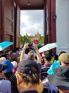 Swimming upstream into the Grand PalaceWe started our day with a wonderfully delicious and copious breakfast at the hotel buffet. If this kept up, we would be returning home with about 10 extra pounds.
Then it was onto Bangkok’s most visited attraction - the Grand Palace, which served as the official residence of the Kings of Siam (and later Thailand), as well as the administrative and religious center of the kingdom from 1782, when King Rama I moved the capital city from Thonburi to Bangkok, until the abolition of absolute monarchy in 1932. Today, besides being a major tourist attraction, the Grand Palace still remains a working palace, with several royal offices still situated inside.
Upon disembarking from the bus, Udom herded us like cattle through the gates of the Grand Palace, while we desperately tried to keep our eye on the Gate1 flag faithfully waving above the endless sea of humanity. Fortunately, we all were wearing earphones through which we could hear Udom speaking into a microphone. To this day, I can still here, “Gate1, Gate1, this way Gate1.”
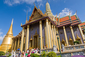 Wat Phra KaewRather than being a single structure, the Grand Palace is made up of numerous buildings, halls, temples, and gardens. There is not one unified architectural style in the complex, because each successive king made additions based on their preference. For example, in the 1860s when Anna Leonowens worked as governess during the reign of Rama IV (made famous in the movie the King of Siam), a bit of western influence begins to be seen.
We began our tour of the palace complex in the temple compound generally referred to as Wat Phra Kaew. A covered walkway surrounded the area, the inner walls of which were covered with murals (178 panels in all), depicting the Hindu epic, the Ramayana, which describes Rama’s struggles to retrieve his kidnapped wife.
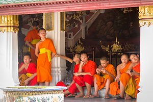 Young Buddhist monks playing with their material possessionsOn the steps of the courtyard were about half a dozen teen-age monks (or monks in training) clad in traditional orange robes totally absorbed, not with contemplating their path to Nirvana, but rather with their cell phones. We found this an interesting juxtaposition to the ancient mythological portrayals behind them and asked Udom how cell phones fit in with the disposal of all earthly possessions.
In their defense, he explained that it is all about the motive for owning a possession and how it is used rather than the object itself. If used as a way of connecting with loved ones, then it is a good thing; playing video games, not so much so. He further explained that these boys were most likely short-term monks (novices) rather than those that dedicate their entire life to celibacy and a monastic life. In Thailand, most young men will enter the monkhood before marriage for about a three month period, generally from July to October - kind of like summer camp. Udom didn’t say that. That was my own interpretation.
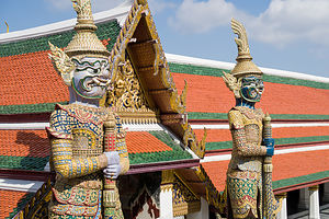 Yakshas guarding the temple gates at Wat Phra KaewFrom the courtyard, we passed through a gateway, guarded by some scary creatures called Yaksha, into the inner compound where the famous Temple of the Emerald Buddha resides. Unfortunately, you are not allowed to take photos of the Emerald Buddha, which is really a shame, because at our age if we don’t have a photo, it never happened.
The most surprising thing to us was how small he is - just 26 inches tall. Despite his diminutive size, however, this Buddha is considered to be the most important icon for the Thai people, who feel that the safety of the nation is dependent upon it. Despite being referred to as the “Emerald” Buddha, it is not made from emerald, but rather jade.
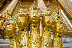 5-headed nagas of Wat Phra KaewRaised high on a series of ornately, jeweled platforms, no one but the king is allowed near the Buddha. The Buddha wears a golden seasonal cloak, changed three times a year to correspond to the summer, winter, and rainy season. A very important ritual called the changing of the robes is performed by the King to bring good fortune to the country during each season, typically in March, August, and November. On March 2nd of this year, the new Thai king, Rama X, changed the Emerald Buddha’s seasonal attire from winter to summer.
I’d like to digress a minute to talk a little more about the fascinating mythical creatures scattered throughout the complex, because they are what I will remember most from the Grand Palace, and even if I do forget, unlike the Emerald Buddha, I will have photos of them to jog my memory.
First, there are the yakshas, which we first encountered standing guard at the Temple of the Emerald Buddha. Yakshas are spiritual beings from Hindu literature that live in the subterranean earth and are the protectors of treasures. In Thailand, they have evolved to be guardians of gates, temples, and royal possessions. Their fierce, demon-likecreaturekii appearance certainly qualifies them for the task. These highly ornate, porcelain statues typically have bulging eyes, fangs, and multi-colored, monkey-liked faces and stand at attention, clutching a sword.
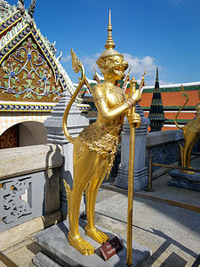 Kinaree at Wat Phra KaewThen there are the five-headed golden serpents called nagas. Their primary role is to protect the Buddha, so they are often positioned on stairs leading into a temple.
There are also several mixed creature statues, such as the golden statue with the legs and tail of a lion, the upper body of a woman, and the face of a monkey that is having a bad day. Very often these “kinaree” (mixed creature) statues have the upper body of a woman and the lower body of a bird. Their role is to watch over the well-being of humans in times of trouble or danger. I’m not so sure that the monkey-faced one had my best interests at heart.
My personal favorites, however, were the monkey statues (monkey faces with human bodies) that supported the Golden Chedi, in a traditional yoga pose. Their faces are similar to that of the yaksha and I suppose their appearance is ferocious enough to also make them effective guards, or perhaps fierce yoga instructors. Of course, we had to do the tourist thing and imitate them for a photo - silly, but necessary.
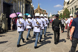 Changing of the Royal Guard at the Grand PalaceOne other note, mostly just to show off my new-found knowledge of Thai architecture, is the difference between the chedi here and at Wat Pho, which we visited yesterday. As you may or may not recall, chedi are structures used to hold relics, such as the remains of Buddhist monks or nuns. While Wat Pho’s chedis were conical and pointy and covered in colorful ceramic flowers and tiles, the chedis in the Grand Palace were golden and bell-shaped.
Like most royal complexes, the religious part (Wat Phra Kaew) is separated from the administrative offices and royal residences. Although most of the buildings in the Grand Palace section are not open to the public, we were still able to enjoy a brief tour of the exterior or the buildings, many of which were an interesting mix of Thai and western architectural styles.
Having completed our Grand Palace tour, our bus took us back to the hotel where we had a few hours of free time before the next event - the Siam Niramit Show & Dinner, which was an one of the optional activities that we added to our tour.
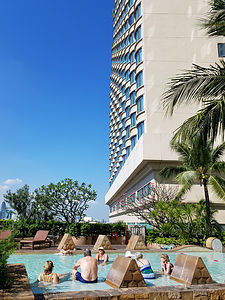 Century Park Hotel poolWe spent our precious free time in the Century Hotel Pool, where we ran into several of our fellow Gate1 travelers. The pool had a shallow section, obviously designed to provide a safe place to stay cool while sipping on one of the fancy drinks served a poolside waiter. I had my second Mai Tai of the trip (feeling confident that this hotel had good ice cubes), but Herb stuck with his go to while we were in Thailand, Chang Beer.
Refreshed, we were ready for the Siam Niramit Show. Our evening started with a buffet dinner, followed by a performance in the courtyard of dancers in traditional Thai clothing. There was also an elephant to ride, as well as two lovely, costumed Thai young ladies who you could pose with for 2 bhat. I encouraged a reluctant Herb to do it, because I thought the grin on his face, which I fully expected, would be worth it. I was right.
Just before 8:00, we were summoned to assume our seats in the theater, which were phenomenal. I’ve come to expect nothing less from Gate1. The stage is huge; in fact, according to the Guinness Book of World Records, it is the largest stage in the world. It was built to accommodate the show’s monumental set pieces, a legion of performers, including real elephants, and amazing special effects, including boats floating along a realistic river.
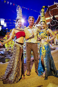 Peek inside Herb's fantasy worldThe show had the rather ambitious goal of portraying 700 years of Siam’s (now Thailand’s) history. The show is structured into three acts.
Act 1 portrays the cultural history and traditions of the Lanna Kingdom in the north, the role sea trade played in the south, as well as the formation of the Ayutthaya Kingdom in the 14th century.
Act 2 provides an understanding of the Law of Karma, in which Earthly deeds dictate what happens in our next lives. Remember, ninety percent of the population of Thailand are Theravada Buddhists and almost all of them believe in reincarnation, so this was not just fantasy for much of the audience, but rather a warning - kind of like the Last Judgment sculptural depictions over the portals of most Medieval cathedrals. The act begins with a Fiery Hell, where sinners are punished with tortures appropriate to their sins (a lot like Dante’s Inferno), followed by the Mystical Himmapan, a mystical forest which serves as the gateway between heaven and earth, and concluded with Blissful Heaven where angels dart across the stage casting pieces of twinkling tinsel. Happy Ending!
The final act portrays the joy and peace that Buddhism brings to its people as the stage explodes in a colorful celebration.
Wow! It was quite a show. Although it would have been a lot easier to follow along if we knew more about Thailand’s history, even without that the beautiful stage setting and costumes and the creative special effects kept us riveted every moment.
Maui
Wednesday, January 17, 2018 - 2:30pm by Lolo0 miles and 0 hours from our last stop - 5 night stay
Travelogue
Day 1 - Arrival on Maui, Stocking Up at Safeway, and checking into our Maui Banyan Condo in Kihei
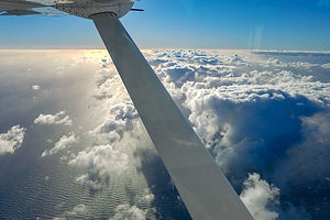 Flight to MauiI’m not a particularly big fan of flying in small planes, so I have to admit to being somewhat terrified on our Mokulele flight between the Big Island and Maui. The winds were gusty at 35 mph, the plane was a small 9-passenger Cessna, and our pilot was wearing skinny jeans and looked about 17.
We had already cheated death once this vacation during the incoming ballistic missile alert, so I was none too thrilled to be thinking about my mortality once again. Herb, of course, thought I was being ridiculous. I guess he was right, because I obviously have lived to talk and write about this.
Although quite bumpy, the pilot did a great job and we landed safely in Kahului on beautiful Maui island.
This time we stocked up at a Safeway rather than a Costco, because we had to throw out so much food on the Big Island because we just couldn’t get through the Costco-sized groceries, especially with Herb’s stomach virus.
 Maui sunsetAs we drove toward Kihei where we would be staying the next 5 days, we immediately noticed how different Maui was from the big island. Rather than endless fields of dark lava, Maui was mountainous and green, reflecting its older age. It was absolutely stunning. Also, everything seemed much more manicured and swanky. You could definitely drop a few bucks here.
After a few wrong turns, we finally found our condo in a large condo complex called Maui Banyan. The location was great - right across the street from a beach and in walking distance to lots of restaurants. I was a bit disappointed in our condo, however. When I think condo, I think kitchen, but all this one had was a tiny microwave and frig. Also, all the available closets were locked and used by the owner. I guess we were spoiled by our accommodations on the Big Island.
Day 2 - Makena Beach and strolling around Kihei
 Makena BeachHerb and I were playing a bit of virus tag team. Just as he was starting to recover from his stomach virus, I came down with a god-awful sore throat and hacking cough. However, we were determined that the show must go on.
Our absolute #1 thing to do on Maui was the hike down into Haleakala Crater, but we decided to put that rather strenuous activity off for a day, in the hope of feeling better tomorrow, and just relax on the beach for the day.
How to choose. So many beautiful beaches, so little time. Fortunately we had our Maui Revealed guidebook to give us some options, complete with rating really spectacular beaches as “Real Gems.” Just to give you an idea as to how stunningly beautiful the beaches on Maui are, there are 9 Real Gems in South Maui alone.
We chose Makena Beach, considered by many to be “the” beach on Maui. With its beautiful crescent of golden sand almost ⅔ of a mile long, it is the type of beach most people think of when they think Hawaii.
There are actually two beaches at Makena - Big Beach and Little Beach. Big Beach is the one closest to the parking lot, and Little Beach is reached by climbing over a rocky promontory at the northern side of Big Beach.
We spent a lovely afternoon reading, relaxing, swimming, and coughing (in my case) on Little Beach.
That evening we strolled across the street from our condo to Kamaole Beach Park, where we sipped a glass of wine and watched the sunset over the Pacific. Afterwards had wonderful Ahi Ahi fish tacos at the nearby Coconut’s Fish cafe. It was so fresh and delicious - and surprisingly inexpensive. I thought dining in Maui was going to be much more expensive.
Day 3 - Haleakala National Park
 Lolo descending into Haleakala CraterI had gotten very little sleep last night, having spent most of it coughing and sipping tea to ease my burning throat, so I wasn’t exactly feeling my usual energetic self. Still we were determined to go to Haleakala with the intention of hiking the Sliding Sands Trail to the crater floor.
The drive up to the summit of Haleakala summit was an endless series of steep, nausea- inducing switchbacks. If you’ve ever seen Hawaii travel footage of cyclists careening down a steep, windy road requiring no pedaling for miles, this is the place. However, it's not like the old days where cyclists started their descent from the 10,000-foot Haleakala summit. The Park banned commercial cycling back in 2007, so now biking tour companies have to drop bikers off at 6,500 feet, outside the boundaries of the National Park.
As we drove the windy road towards the summit, we became enveloped in clouds. No worries we thought. The guide book warned us that we would hit clouds on the way up, but would rise above them at the summit where the skies would be clear.
 Clouds in Haleakala CraterWhen we stopped at the first Visitor Center at 7,000 feet, it had already begun to rain. When I asked the ranger about weather conditions at the summit, she told me that it was cloudy and rainy there too, and would probably be that way for the whole day. Oh no! We were so looking forward to our hike.
Not knowing what else to do, we continued on to the upper Visitor Center at the 10,000-foot summit, where it was, as predicted, rainy and windy. We were so disappointed.
After killing some time in the Visitor Center, we decided to just walk over to the Sliding Sands Trailhead to get a feel for what it was like. As we stood at the top of the trail, the rain slowed down to a drizzle, and a tiny bit of sun peeked out between the clouds, dramatically lighting up a portion of the colorful hills of the crater. When a rainbow appeared, we took it as a sign.
 Awesome colors of HaleakalaWe ran back to the car for our lunch and backpacks and began our descent, hoping the weather kept moving in the right direction, so we could make it the 4 miles to the crater floor, 2,400 feet below.
The colors inside the crater are amazing - cinder cones tinted by red, orange, yellow, green, and blue volcanic ash and rock and shimmering silverswords dotting the landscape like blotches of paint.
The weather just kept getting better and better. We had started out with 4 layers of clothing - including a down jacket covered by a rain jacket, and were down to short sleeves by the time we reached the crater floor. So glad we didn’t listen to the forecast.
While having lunch at the bottom, I started getting a headache. Herb suggested that I might have a bit of altitude sickness. After all, we had driven up from sea level to 10,000 feet in about an hour and a half, giving ourselves absolutely no time to acclimate. I took an Ibuprofen and tried to drink lots of water. I don’t think it particular helped that I was already pretty sick, and later found out that I had a low-grade fever.
 Haleakala SilverswordThe climb back out of the crater, which would normally just have been a hearty hike for me, became quite an ordeal as my headache worsened to the point where it felt like there was an ice pick sticking in my brain. Herb knew I was hurting when I suggested that we stop every few minutes to rest. After what felt like forever, we made it to the top and I immediately got in the car and assumed the fetal position. The long twisty ride down from the summit didn’t exactly help, and I was quite car sick by the bottom.
The hike was, as my adventurous sons would describe many of their weekends, Type II fun - miserable while happening, but fun in retrospect. I would definitely do it again.
Day 4 - Makena Beach and strolling along the Wailea Coastal Path
 HiloI definitely needed a recovery day after yesterday’s battle with altitude and my worsening cold. Fortunately, if you have to be sick on vacation, Hawaii is probably the best place to do it. Lying on a gorgeous beach with a good book can hardly be considered a hardship.
So, we spent the day at Makena Beach, the gorgeous beach we had discovered the other day. This time Herb got a chance to snorkel, but I just wasn’t up for it.I’m glad he did, because on the Big Island it had been the reverse - I snorkeled while he was sick. Not exactly how we envisioned our vacation, but still, we were trying to make the best of a challenging situation.
After leaving the beach, we went for a stroll on the Wailea Coastal Walk, a lovely paved path with some of the most exclusive Maui hotels on one side and sandy beaches on the other. During our 3 ½ mile walk, we saw everything from luaus to breaching humpback whales.
That evening had dinner at Fred’s Mexican Cafe, another dining establishment near our condo. At first I hesitated going to a Mexican restaurant on Maui, but where better to have tacos - and of course since we were on Maui, fish tacos. It was quite good, and like Coconut Fish Cafe (where we also had fish tacos), very reasonable.
Despite the way I was feeling, it really was a lovely day. It’s hard not to be happy on Maui.
Day 5 - Lahaina and the Nakalele Blowhole
 Front Street in LehainaToday we would explore West Maui, the bulge extending into the Pacific on Maui’s northwest side - specifically the lovely town of Lahaina, which is pretty much the only town on Maui that has an actual downtown to stroll around.
During the 19th century, Lahaina was the capital of the Hawaiian Kingdom, as well as a bustling seaport and whaling village. Even Herman Melville spent time in Lahaina during a whaling voyage.
Although today Lehaina is a bustling Maui hotspot with dozens of restaurants, art galleries, and unique shops, we still got a feel for its past while strolling along the waterfront on Front Street.
 Banyan Tree ParkWhat first attracted me to Lahaina was a picture of its famous banyan tree, one of the largest in the United States. Imported from India in 1873, this sprawling tree now stands over 60 feet high and sprawls outward the length of an entire city block. Although this seems like a clump of trees, it is actually only one tree, which spreads by producing aerial roots that hang down and take root wherever they touch the ground. It was probably one of the most beautiful trees I have ever seen.
We concluded our stop in Lehaina with lunch at the Paia Fish Market, where for a change from fish tacos, we had fish and chips, or in my case, shrimp and chips. It was delicious.
After lunch, we continued north along coastal highway 30, which after Kapalua became extremely twisty. The topography of this island definitely must boost Dramamine sales.
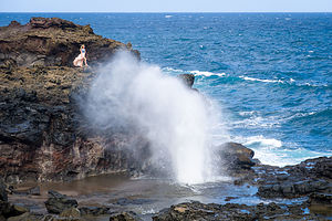 Nakalele BlowholeAt mile marker 38.5, we pulled into a small parking lot to hike the Acid War Zone Trail down to the Nakalele Blowhole. The trail is named for the erosion in this area caused by salt spray and wind. There’s really no marked path down from the parking lot, so we kind of just weaved our way down over the rocky terrain. There is another parking lot at mile marker 38 with an easier route down to the blowhole.
The blowhole was pretty impressive, with jets of water shooting as high as 50 feet in the air. It reminded me a bit of Old Faithful. This phenomenon is caused by the ocean undercutting the shore and forcing seawater up through a large lava shelf. It is especially exciting during high tide and surf.
It was challenging to time the perfect photo, as the blasts were rather unpredictable and short-lived. So, we took a lot, hoping to capture one at its height. One embarrassing aside. On our flight home, while reviewing photos on my phone, I asked Herb a bit too loudly if I could see his blowhole pictures. I probably could have phrased that a bit better.
Day 6 - Time to go home
Despite some challenges, we had covered a lot of ground, seen some amazingly beautiful places, hiked some awesome trails, eaten our share of fish tacos, and not been wiped out by a ballistic missile All in all, I would have to call it a success.
Aloha.
Description
 Haleakala CraterI am not even going to begin to attempt a description of the island of Maui, as there are people that have already done that much better. Instead, I highly recommend purchasing the book "Maui Revealed" before planning your trip. It has an incredibly detailed wealth of information about everything you need to know.
Hilo (Big Island)
Sunday, January 14, 2018 - 4:30pm by Lolo0 miles and 0 hours from our last stop - 3 night stay
Travelogue
Day 1 - Mauna Kea, Hawaii Tropical Botanical Garden, Akaka Falls, and arrival at the Grand Naniloa Hotel in Hilo
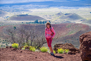 Lolo atop Sunset Hill on Mauna KeaThere are many ways to get to Hilo from Kailua-Kona - the northern route, the southern route, or directly across the middle on Saddle Road. We chose the middle route, as it was the fastest and would take us past two of the island’s largest volcanoes, Mauna Loa and Mauna Kea. The area the road passes through is called The Saddle, because that is the shape of the valley between the two volcanoes.
Although we couldn’t make the entire 14.7-mile drive to the summit of Mauna Kea in our 2WD rental car, we decided to go at least as far as the Visitor Center, 6 miles up the access road. Beyond that, the road gets too rough for anything but 4WD vehicles.
There wasn’t a whole lot to do at the Visitor Center, which wasn’t even open yet, so we took a short hike up to the top of Sunset Hill for a nice vantage point of the area.
 Waterfall in Hawaii Tropical Botanical GardenFrom there, we continued along the Saddle Road to Hilo. Since it was too early to check into our hotel, we decided to pass right through Hilo for now, and visit the highly-acclaimed Hawaii Tropical Botanical Garden, located about 8 miles north of Hilo along the Hamakua Coast’s 4-Mile Scenic Drive.
We paid our $20 admission (per person) - a bit pricey, but well worth it -- and set off across the street to begin our self-guided tour of the gardens, which are set in a lovely, lush 40-acre valley above Onomea Bay.
After crossing under the entrance gate, we followed a 500-foot elevated boardwalk down a steep ravine into a lush tropical rainforest, where we meandered along a series of nature trails, with over 2,500 species of exotic plants, a lovely waterfall, and vistas of Onomea Bay.
What a contrast this lush landscape was from the Kona side of the island, most of which were stark fields of dark lava.
As we learned in the Visitor Center, these beautifully manicured trails and gardens were not the way the valley always was, but rather the untiring efforts of one man from San Francisco, Dan Lutkenhouse, who discovered Onomea Valley in 1977 while on vacation with this wife. Falling in love with the seclusion and beauty of the valley, he purchased a 17-acre parcel without really being able to see it, as the vegetation was so overgrown and impenetrable.
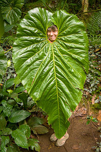 Lolo's creative anti-ballistic missile shieldHe sold his trucking business in San Francisco, moved to the island, and spent the next few decades clearing the jungle and transforming it into a tropical paradise. It truly was a labor of love. Mr. Lutkenhouse, himself, chose the location of every plant and tree introduced to the Garden. Today, the entire valley is treated as a nature preserve.
Some of my favorites included the orchids, birds of paradise, and heliconia. Oh, and there was this one giant leave as tall as me, with an opening on top exactly at my face level - as if it had been made just for me to peek through, like one of those silly plywood figures with cut-out faces at a carnival. Herb and I joked that it was a ballistic missile shield, which would have come in handy during the alert a few days back.
After what had turned out to be a lovely garden tour, we decided to make one more stop before returning to Hilo to check into our hotel. As we often do when we are in a new area, we consulted the Trip Advisor app on our phones to look at the top Things to Do near Hilo, and found Akaka Falls State Park, about 20 minutes further north.
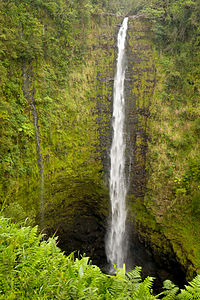 Akaka FallsI hate to appear jaded, but being frequent visitors to Yosemite, where we get close enough to its spectacular waterfalls to actually feel their spray, we are a bit hard to impress.
But this is where we were now, so we paid our $1 and joined the crowd on the 0.5-mile paved path to the viewpoint, where we peeked between the overgrown vegetation at the falls, which were quite far away. I’m sure the 420-foot waterfall would have been much more impressive if we had been able to get a bit closer.
It was after 3:00, so we headed back to Hilo to check into our room at Grand Naniloa Hotel Hilo, where we were pleasantly surprised to find that our 5th-floor room had a balcony with a wonderful view of Hilo Bay and the beautiful outdoor swimming pool. Although there was no full kitchen like we had in Kailua Kona, there was a refrigerator, microwave, and coffee maker.
That evening we took a stroll from the hotel along Banyan Drive to nearby Lili’uokalani Gardens, a 24-acre Japanese garden with banyan trees, fish ponds, bridges, pagodas, statues, and a teahouse. It was absolutely lovely.
From the gardens, we walked over a footbridge to Coconut Island, or Moku ola (“island of life”), once the site of an ancient temple dedicated to healing - something Herb and his stomach virus could use about now. We climbed up a small stone tower on the east side of the island where we had great views of Hilo Bay and our hotel.
Hilo had such a different feel to it than Kailua-Kona, much more tranquil and slow-paced. I kind of liked it.
Day 2 - Hawaii Volcanoes National Park
 Sulphur Banks in Hawaii Volcano National ParkMoku ola certainly hadn’t done its job of healing. Herb was still feeling quite drained from his stomach virus, and now I had a really bad sore throat. However, although somewhat wounded, we decided to proceed with our plan for the day of visiting Volcanoes National Park.
Visiting Volcanoes was the main reason we chose to come to the Big Island in the first place. Who wouldn’t want to see red molten lava plunge into the sea and watch new land form before your eyes? Unfortunately, as luck would have it (especially our luck this trip), the lava was not flowing. Still there was plenty to see and do in the Park.
We started our trip at the Visitor Center where we watched a very informative 25-minute film called “Born of Fire, Born of the Sea.”
The Park encompasses two active volcanoes: Kīlauea, one of the world's most active volcanoes, and Mauna Loa, the world's most massive shield volcano. Most of the area we would be exploring today would be in and around the Kilauea Caldera.
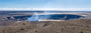 Steam rising from Halema’uma’u CraterFrom the Visitor Center we took a stroll on the Sulphur Banks trail, where we were greeted by the smell of rotten eggs as volcanic gases (hydrogen sulphide, sulfur dioxide, and carbon dioxide) seeped out of the ground along with groundwater steam. Besides being stinky, the area is also quite colorful, because the hydrogen sulphide and steam form deposits of sulphur, gypsum, and hematite on the ground.
From there we passed by the Steam Vents, where puffs of steam rose from the ground as the groundwater seeped down to the hot volcanic rocks below and returned to the surface as steam.
A little bit further on we came to Steaming Bluff, at the edge of the massive Kilauea Caldera, where we got our first view of the steam emanating from the Halema’uma’u Crater. From there, we returned to the Volcano House, across from the Visitor Center, via the Ilahi Trail.
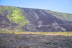 Chain of Craters RoadI love National Park Inns, so I took a quick look inside the Volcano House. When I saw the dining room, with its huge windows looking out over Halema’uma’u Crater, I knew I had to eat there. Herb was still not feeling well enough to enjoy fine dining, so I made a reservation for the following night in the hope that he would rally.
For now, we would continue our tour of the park from the comfort of our car. The main way to see the Park is to drive along the Crater Rim Trail, stopping at various sites along the way. However, in March of 2008, the section of the trail between the Jaggar Museum and the Chain of Craters Road junction was closed indefinitely due to the current eruption in Halema’uma’u Crater, a crater located inside the much larger Kilauea Caldera.
From the Visitor Center, we headed counter-clockwise on Crater Rim Trail to the Jaggar Museum and the Hawaiian Volcano Observatory. Besides the interesting exhibits regarding volcanic activity in the park, this is the best place to see the Halema’uma’u Crater.
 Herb playing with the lava at the end of Chain of Craters RoadThe crater is still active and contains a molten lava lake. During the day, you can see large plumes of steam rising from its vent. However, the real show happens at night, when it gives off an eerie orange glow.
Herb was not feeling great, so we decided to put off the hike down into the Kilauea Iki Crater until tomorrow. Instead we drove the steep, twisty Chain of Craters Road 19 miles down to the sea where it ends abruptly where the current lava flow cut it off. From here there was nothing but miles and miles of desolate, barren, black lava rock as far as the eye can see.
This is near the area where the lava usually flows when heading to the ocean.
We headed back to Hilo, with the plan of returning to the Park the next day to do the Kilauea Iki Crater hike and dinner at the Volcano House
Day 3 - More Hawaii Volcanoes National Park
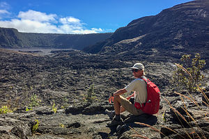 Herb getting ready to descend into Kilauea Iki CraterWe had some unfinished business to do, so back to the Park we went to do the Kilauea Iki Crater hike, highly acclaimed by our “Hawaii Revealed” book as the “if you only have time to do one hike on the Big Island, this is the one.”
The hike started at the Kilauea Iki Overlook and led down through a fern forest to the crater floor, 400 feet below, with several viewpoints into the crater along the way. The descent into the crater is somewhat steep, but there are steps carved into the trail in spots and a few railings to hold onto to ease the way.
When we got to the bottom, we were amazed at the transformation from lush, cool forest to barren lava - so much variety in such a short distance. The crater floor is sort of an open field to wander across, but there were cairns to mark a suggested path.
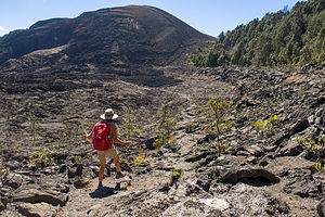 Lolo of Kilauea Iki CraterAbout a third of the way across the crater floor, we stopped for lunch by a large pile of lava rock with steam emanating from the top. Against my wishes, Herb climbed to the top of the pile to check out the steam vent, while I wandered around the rocks on the crater floor trying to make sure he didn’t fall in. He thinks I worry too much. He didn’t and he made me climb up and over the pile as well.
We came out of the crater near the Thurston lava tube where we managed to sneak in between tour buses - it’s a very popular spot. Before entering, we read the board describing how it was formed. From what I recall, it goes something like this: Several hundred years ago during an eruption, low-viscosity lava flowed through this area. The upper layer of the flow cooled first, forming a hard crust, while the molten lava beneath continued to flow in tubular conduits beneath the surface. Because of the insulation of the upper crust, the liquid magma stayed heated enough to travel quite a distance before solidifying as well. Or, something like that.
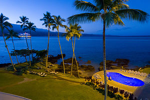 View from our hotel balconyThe section we were able to walk through was about 600 feet long and very well lit. It was definitely pretty cool. One woman was so enthusiastic that after exiting, she went around to the entrance for another turn.
It was only 2:00 and we pretty much had seen what we had wanted to see - plus Herb was dragging a bit - so we canceled our 6:30 dinner reservation at the Volcano House and drove back to Hilo.
We don’t often stay in fancy resorts, as we are usually in our Lazy Daze, so we decided to spend the evening enjoying the beautiful grounds - sipping wine, listening to live music, etc. A lovely way to spend our final evening in Hilo.
Description
 Lili’uokalani GardensUnlike the sunny west side of the island, Hilo, on the eastern side of the island, is the wettest city in the U.S. receiving around 140 inches a year. Whereas the west side is dominated by lava, Hilo is home to numerous waterfalls and lush plant life.
Beyond that, I am not even going to begin to attempt a description of the eastern coast of the Big Island, as there are people that have already done that much better. Instead, I highly recommend purchasing the book "Hawaii The Big Island Revealed" before planning your trip. It has an incredibly detailed wealth of information about everything you need to know.
Kailua-Kona (Big Island)
Wednesday, January 10, 2018 - 5:30pm by Lolo0 miles and 0 hours from our last stop - 4 night stay
Travelogue
Day 1 - Arrival on the Big Island, stocking up at Costco, and checking into Castle Kona Bali Kai in Kailua-Kona
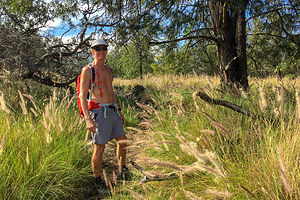 The Pu’u Wa’awa’a cinder cone hike beginsA trip to Hawaii definitely made more sense now that we had moved to the West Coast. The flight from San Francisco is under 6 hours and you even gain 3 along the way. There was still plenty of day left upon our arrival.
After picking up our rental car, we stopped at a Costco on our way to our condo in Kailua-Kona to stock up for our week on the Big Island. Theoretically, our accommodations in Kailua had a kitchenette. I certainly hoped so, because if not, we were going to have a lot of food to figure out what to do with.
We continued on Castle Kona Bali Kai, where we had booked a condo for the next four days. When we arrived, the office was already closed, but we followed the instructions for late check-ins and eventually found our condo.
Although a bit tired looking, the condo was well furnished and equipped with a full kitchen, complete with refrigerator, oven and stove, microwave, and coffee machine. The best part was the location. We were right on Alii Drive, the main drag through Kailua, and we had a view of the ocean and sunset from our deck.
Exhausted from our travels, we ate a quick dinner and hit the sack.
Day 2 - Hike to the top of Pu’u Wa’awa’a cinder cone and Kapuna Beach
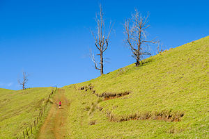 Trail to the top of the Pu’u Wa’awa’a cinder coneAlthough Herb and I love relaxing on a beautiful beach as much as the next guy, we think of that more as a reward after a day of physical activity. Fortunately, the “Hawaii The Big Island Revealed” book gave us plenty of suggestions on good hikes.
So, we would start our Hawaii vacation with a vigorous 7 ½ mile hike to the top of a cinder cone in Pu’u Wa’awa’a Cinder Cone State Park, about 20 miles north of Kailua on the inland Highway 190, between mile markers 21 and 22.
I don’t think I will every be able to remember the name of this cinder cone - it’s amazing what can be done with just the letters a, p, u, and w. Anyway, Pu’u Wa’awa’a literally means “many-furrowed hill,” because of the many apparent wrinkles running down its side. In actuality it looks more like an upside-down jello mold. I wonder how that would be translated in Hawaiian?
This particular cinder cone was created about 100,000 years ago when the nearby Hualalai Volcano (one of the Big Island’s five volcanoes) erupted, spewing blobs (“cinders”) of lava high in the air, which then fell around the opening to the volcano, forming a circular, or oval, “cinder” cone. It’s easy to recognize a cinder cone, because they are always symmetrical (before erosion anyway), with slopes between 30–40°.
 Interesting tree on Pu’u Wa’awa’a summitWe have hiked many cinder cones in our day, mostly in the Pacific Northwest and down into northern California, the other area you can find volcanoes in the U.S.
The hike was great, about 7.5 miles out and back with an 1,800 foot elevation gain. It took us through a forest, along hillsides with grazing sheep, goats, and cattles, and eventually up to the soft grassy summit of the cinder cone, where there are breathtaking views of Mauna Loa, Mauna Kea, and Kohala.
After the hike we continued north on Highway 190 and then took the Waikoloa Road West to the Kohala coast, in search of a beach to spend the rest of the afternoon. The Big Island of Hawaii has so much lava on it, that sandy beaches are fairly hard to come by; and when there is one, a giant resort has usually claimed it. However, they are required to provide public access. Unfortunately, that access is somewhat limited by the number of parking spaces provided.
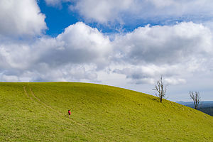 Hike up Pu’u Wa’awa’a cinder coneWe first tried to go to Mauna Kea Beach, which came highly recommended as a classically perfect beach in our “Hawaii Revealed” book, but were unable to obtain one of its highly coveted 40 parking spaces.
Thwarted, we headed back out to the Queen Ka’ahumanu Highway, which runs along the coast, and drove south a few miles before turning into Hapuna Beach, another “perfect” beach according to “Hawaii Revealed”. Since this is a State Recreation Area, rather than a resort, there was ample parking ($5), restrooms, showers, and a picnic area.
Hapuna Beach is lovely, with a half mile of golden sand and great waves for boogie boarding. I can see how people visiting the Hawaiian islands are tempted to do nothing but relax on its incredible beaches. We were going to have to try hard to resist their lure.
Day 3 - Aborted hike to the Golden Pools of Ke-awa-iki and Anaeho’omalu Beach
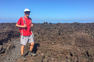 Lava Trail to Keawaiki BeachAs I mentioned in the Trip Overview, there were several calamities and mishaps that challenged the fun and relaxation we had hoped to achieve on this trip. Let’s just say that we wouldn’t have been surprised if we were attacked by locusts at some point.
The first of our challenges started on Day 3 - actually technically in the wee hours of the morning between Day 2 and 3. It seemed that Herb had picked up some sort of stomach virus - probably on the plane - and had spent the entire night in the bathroom experiencing, as he described it, the equivalent of a colonoscopy prep. He looked and felt terrible.
I suggested we just hang around the condo for the day, but Herb insisted that we forge on with our original plans for the day. That plan, unfortunately, included a hike, not a long one, but still Herb looked barely capable of getting to the car.
Undaunted, we drove north along the Kohala coast to the trailhead for the hike to the Golden Pools of Ke-awa-iki, just north of mile marker 79 on the Queen Ka’ahumanu Highway highway (Hwy 19). The hike, which, if completed, would have been 4 miles round-trip, began along an a’a lava trail, which led to the ocean. From there one can choose from a white sand beach on one end or a black sand beach on the other, as well as explore some tide pools.
This was far too ambitious a plan for someone as sick as Herb, so we turned around once we go to the end of the lava trail at Keawaiki beach. We would have to adjust to the situation at hand - perhaps, lying still on a beach (near a restroom) would be a more appropriate activity for the day.
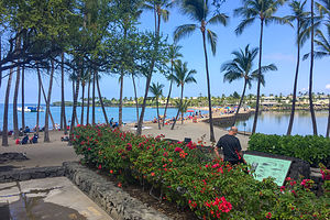 Anaeho’omalu BeachWe drove a little further up the Queen Ka’ahumanu Highway and turned right on Waikoloa Beach Road to get to Anaeho’omalu Beach, which according the “Hawaii Revealed,” is another picture-perfect beach - of course it is. This is Hawaii after all, and every beach is picture perfect.
As expected, the beach was beautiful. I only regret that Herb didn’t get to enjoy it, as he spent most of the time curled up in a fetal position on his beach towel. I tried not to have too good a time frolicking by myself in its warm, tranquil waters. Unlike Hapuna Beach where we were yesterday, this beach has no big surf, because it is protected by an offshore reef.
Right behind us, there were two large fishponds surrounded by palm trees, once used by ancient Hawaiian royalty for raising mullet. To maximize the yield, the opening to the pond was covered with a grate that would allow small fry to enter from the ocean, but not allow these same small fry that fattened up on algae and shrimp in the pond to get out again. Not exactly sporting, but effective.
Herb really didn’t look good, so I drove back to the condo while he slept. Once he was comfortably tucked in bed, I went out for a 6 ½ mile exploratory run along Alii Drive.
Hopefully, tomorrow would be a better day.
Day 4 - Incoming Ballistic Missile Alert, Hikiau Heiau, Pu'uhonua O Honaunau National Historical Park, and snorkeling in Honaunau Bay
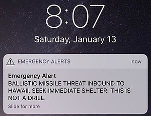 Bad way to start a morningThen again, maybe not. Herb was still sick as a dog, and just as I was getting ready to go out for a run, sirens when off, and I received the following text message:
Emergency Alert:
BALLISTIC MISSILE THREAT INBOUND TO HAWAII. SEEK IMMEDIATE SHELTER. THIS IS NOT A DRILL.
Seriously?
We didn’t know what to think or do. In retrospect, I’m surprised we weren’t panicking more. I think we really didn’t believe it was real, despite the “THIS IS NOT A DRILL” portion of the alert. For all we knew, every time North Korea tested a missile, this is what happened. Besides, if it was true, there was nothing we could do about it anyway.
However, in these traumatic situations, you have to feel like you are doing something. So, we closed the drapes and went into the bedroom. That should do it.
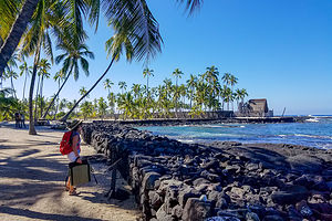 Pu'uhonua O Honaunau National Historical ParkFor the next 38 minutes we waited for I’m not sure what. I can’t believe it took them that long to correct the mistake! Fortunately, by searching the internet, we knew in about 20 minutes that the alert was false. Still, much too long to ponder the thought of our imminent deaths. This was taking my announcement to friends before leaving on this trip that “Hawaii will be my last state” a little too literally.
Well, it did put Herb’s stomach virus back in perspective. He was up and ready to seize the day, because we almost didn’t have one.
We decided to spend the day exploring Kailua-Kona -- perhaps visiting a few human sacrifice temples to cheer us up. Somehow, we missed the turnoff for the Captain Cook Monument on Kealakekua Bay, but did manage to find the Hikiau Heiau at Napo’opo’o Beach, an ancient temple used for human sacrifice and the site where Captain Cook first landed in 1778.
When Captain Cook arrived, the natives thought he was the returning of Lono, their god of agriculture, and honored him with a feast. Unfortunately, afterwards things made a serious turn for the worse. After Cook left, a mast broke on his ship and he was forced to return to have it repaired. A dispute over one of his rowboats being stolen by a native got a bit tense, and Cook was stabbed to death in the conflict.
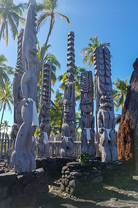 Modest godsToday all that remains of Hikiau Heiau is a raised platform of stacked lava rock, as dark as its history. A smaller stone platform is built on top of the main platform and is believed to have been the location of the lele (altar).
After that cheery stop, we continued on to Pu'uhonua O Honaunau National Historical Park, also called Place of Refuge to learn more about the history and culture of the Hawaiian people. What was nice about this place is that instead of being a place of human sacrifice, it was a place for human forgiveness.
To understand why there was a need for a Place of Refuge, one needs to know a little bit about the kapu, the set of rules and prohibitions in Hawaiian traditional culture and religion. Some examples of kapu were men and women could not eat together, citizens were not allowed to have their shadows fall across a chief, and even commoners were not allowed to surf in the chief’s surfing spot.
The punishment for an offense that was kapu was immediate death - either by club, strangulation, fire, or spear. The reason justice was applied so quickly was that native Hawaiians believed that the gods retaliated against kapu breakers with such fun things as volcanic eruptions, tidal waves, droughts, etc. Therefore, they tried to eliminate the problem before the gods had a chance to act.
However, there was one Get-out-of-jail-free card. If someone that violated kapu could get to a pu’uhonua (place of refuge) before getting captured, they were offered asylum. All they had to do was perform certain rituals to be forgiven.
Pu'uhonua O Honaunau was one of these sanctuaries for violators of kapu. It was made into a national park in 1961. The Park includes a remarkable stone wall, called the Great Wall built in 1500. It is 1,000 feet long, 10 feet high, and 17 feet thick. Also, on the grounds are reconstructed Hawaiian houses and temples, as well as wood carvings of gods. It’s a lovely place to take stroll, especially near sunset.
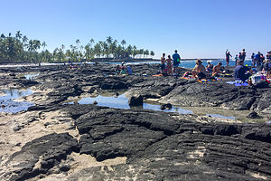 Snorkeling beach near Pu'uhonua O Honaunau National Historical ParkAdjacent to the National Park, but not part of it, is a lava beach on Honaunau Bay, known for its good snorkeling. Before leaving on this trip, I had insisted that we pack our snorkeling gear, so we wouldn’t have to run around trying to rent gear when we needed it. This pushed us over into checked bag territory, which Herb wanted to avoid, so I figured I better get out there and snorkel to justify the extra luggage. Herb was still too under the weather.
I’m a big chicken in the water, so it was a big deal for me to go it alone -- well, not exactly alone as there were dozens of other people doing it, but I didn’t have my own personal snorkel buddy. I tried first around the boat launch where there were a bunch of little kids snorkeling. I did okay and actually saw some brightly colored fish, so I was ready to up my game and join the adults who were entering and exiting the water from the lava rocks. Getting in wasn’t too bad, and I did see some cool fish, but I was not particularly graceful climbing back up the sharp rocks, against which I was being smashed by waves. However, mission accomplished. Hopefully, Herb would start feeling better soon and we could snorkel together.
Description
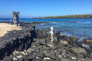 Vigilant gods gazing out to seaThe Kona side of the Big Island has the sunshine, and is pretty much always warm and beautiful. It is also where the best beaches and most activities are.
Beyond that, I am not even going to begin to attempt a description of the western coast of the Big Island, as there are people that have already done that much better. Instead, I highly recommend purchasing the book "Hawaii The Big Island Revealed" before planning your trip. It has an incredibly detailed wealth of information about everything you need to know.
Home
Thursday, September 21, 2017 - 12:00pm by Lolo375 miles and 7.5 hours from our last stop - 1 night stay
Travelogue
With the exception of a bit of snowfall in South Lake Tahoe, it was an uneventful drive home
Description
Our home in Sonoma Valley
Big Pine
Wednesday, September 20, 2017 - 11:45am by Lolo57 miles and 2.5 hours from our last stop - 1 night stay
Travelogue
Our trip was pretty much wrapping up. We had accomplished our goal of testing out the viability of the 4Runner as a camping option. I obviously love the comforts of our Lazy Daze much better, but the truck did allow us to do things we can't in that - like driving on remote 4WD roads.
We settled in for our fourth night of sleeping in the truck at the Glacier View Campground, at the junction of 168 and 395.
The trip had been lots of fun, but I was about ready for my real bed back home. Still, I would definitely do it again.
Description
Bridgeport is a town located along the scenic Eastern Sierra Byway, about 15 miles south of Bishop. It lies in the lovely Owens Valley between the Sierra Nevada and the White Mountains. It is notable for proximity to the Ancient Bristlecone Pine Forest and its access to the western border of Death Valley.
Death Valley - Saline Valley Warm Springs
Tuesday, September 19, 2017 - 9:15am by Lolo70 miles and 4.5 hours from our last stop - 1 night stay
Travelogue
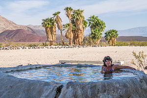 Palm Oasis shady poolEver since we visited the Saline Valley Warm Springs a few months back, Herb had wanted to get back to it, as he loves nothing better than a natural hot spring surrounded by incredible scenery. I do too, but last time we were here, I found the community that has set up a semi-permanent camp here, a little too weird and cultish for my taste. Also, it was the worse night of camping we had ever experienced. Fierce winds that sounded like an approaching jet practically blew our tent away, and Herb spent the entire night battling the wild burros that kept rummaging through our stuff. Now that we had a hard, burro-proof shell around us, we were willing to give it another try.
There were two options for getting to the springs from the Racetrack. The most direct route was Lippincott Road, but both the Ranger and the guide books definitely warned against it, as it is the most extreme road in the Park.
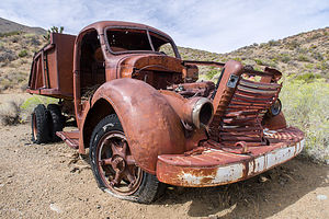 Abandoned vehicle at Goldbelt mine camp along Hidden Valley RoadInstead of a 10-mile, death defying drive, we headed back to Teakettle Junction to take the Hidden Valley Road up over Hunter Mountain to Saline Valley Road and then up to the warm springs.
About a mile past Teakettle Junction, we entered Lost Burro Gap, a narrow canyon connecting Racetrack Valley with Hidden Valley. At the Lost Burro junction we continued on Hunter Mountain Road for about 11 miles until we came to a sign for the Goldbelt Spur Road to an old abandoned mining camp less than a mile away.
We decided to take the detour to check it out. As with many mining towns, this one had a few lives before finally dying out for good in the 1960s. All that remains are a few collapsed cabins, miscellaneous junk, and an old truck.
Although we knew we were only about a mile from Hunter Mountain Road, we had a tough time finding it again as our GPS kept directing us to roads that no longer existed. Finally, we found our way back to the road and continued up and over the east face of Hunter Mountain eventually reaching the junction with the Saline Valley Road.
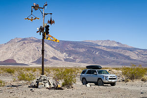 I think we're in the right placeFrom there we traveled north for about 20 miles to the turnoff for Lower Warm Spring Road. To be exact, it was 19.4 miles, and I carefully tracked that because the turnoff is not obvious at all. From there, it’s about 6 miles to the first oasis.
Anyone unsure if they are on the right road to the springs will have no doubt when at about the 4 mile point they come across a tall post with metal bats hanging from it. As we learned last time, bats are a commonly-used motif in the Saline Valley community.
At about 6.5 miles, we arrived at the first oasis, where we had camped on our previous visit. Surprisingly, it was so quiet compared to last time. I think things don’t really get going in this place until October, because September is still considered too hot.
Having bad recollections from last time, we decided to continue on for another mile to the second oasis, which had two beautiful pools - one out in the open, hot desert sun, and the other tucked under the shade of a palm tree. There was absolutely no one there, so we decided to stay for the night.
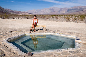 Palm Oasis sunny poolDespite the absence of people, the camp was still amazingly well maintained and stocked with supplies. The outdoor shower had soap and shampoo, and the bathroom was stocked with Costco size toilet paper packages, cleaning products, air fresheners, etc.
We spent the rest of the day enjoying Paradise where the only stress is deciding whether to soak in the sunny or the shady pool. We did both.
Herb would have gladly stayed a week, but I get antsy after 24 hours of total non-activity in hot desert sun. So much to his chagrin, the next morning we packed up and headed out.
Rumor had it that the Death Valley / Big Pine Road west of Saline Valley Road was open again, so rather than take the long route south and out through Panamint Springs, we drove north for 40 miles on Saline Valley Road back up to asphalt and civilization of Big Pine.
Description
The Saline Valley road is a very rough dirt road that runs for 95 miles from SR 168 in the north to SR 190 in the south, ranging in elevation from 1,094 to 7,593 feet. High ground clearance 4WD vehicles and full-sized spare times are strongly recommended.
Coming from the north the drive to the warms springs is a rough 40 miles. The turnoff from the Saline Valley road onto the Warm Springs Road, which can be difficult to find, is at the 32.7 mile point. Here, the road gets even rougher. At about 4 miles there is a tall post with metal bats hanging from it. Once you see that, you are almost there.
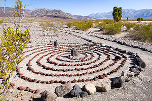 Outdoor art at the springsA few miles further is a serious of gorgeous warm springs, each with multiple soaking pools. Although these springs weren’t unheard of during the mining heydays, it wasn’t until the 1960s that they became popular among hippies who developed a semi-permanent camp here. The residents soon set to work making home improvements – taming the wild springs into several concrete, rock, and tile soaking pools, building showers, dishwashing facilities, and latrines, building creative fences out of branches, and planting shady grassy areas.
In 1994 the Saline Valley became part of Death Valley National Park and put under the watchful eye of the NPS. The camp was dispersed and visitation was limited to 30 days. One man named Wizard remained and eventually became the caretaker for the site. When he passed away, Lee “Lizard” Greenwell took his place and is still there today.
Today the springs are not found on any NPS maps and rangers are hesitant to tell visitors how to find them. Meanwhile, Lizard and his sycophants live on happily enjoying their bit of paradise.
Death Valley - The Racetrack
Monday, September 18, 2017 - 5:30pm by Lolo250 miles and 5.5 hours from our last stop - 1 night stay
Travelogue
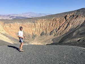
Normally, we would have entered Death Valley from Big Pine and driven the Death Valley / Big Pine Road to the start of Racetrack Road near the Ubehebe Crater, but unfortunately storms had taken out many of the backroads in Death Valley, including the one in from Big Pine.
Instead, we had to come in via the Panamint Springs entrance much further to the south. However, this would allow us to stop at the Furnace Creek Visitor Center to get information on 4WD road conditions in the park to make sure we were not embarking on something foolish.
Now, which son to give the responsibility of calling a Death Valley ranger to search for his missing parents if they didn’t call in 2 days? I chose Tommy for two reasons. First, he is not nearly the worrywart that Andrew is, and secondly, he is always doing things to worry me, like climbing El Cap or skiing down Mt. Rainier, so I figured I would give him a chance to be on the other side of the worry equation.
With the ranger’s blessings as to our intentions, we headed north on Scotty Castle Road to the Ubehebe Crater, where Racetrack Road begins. Ubehebe Crater, which is a half-mile wide and 750 feet deep, is too spectacular to just pass by. We have hiked to the bottom of it on a previous trip, but this time we were just stopping at the rim for a quick photo. The wind was so strong it almost blew our door off.
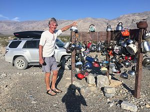
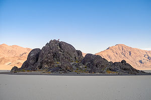 Lolo atop the GrandstandConditions were great on Racetrack road, so we were able to move along at a good 20 mph pace. After our drive to Coyote Flat yesterday, this truly felt like a racetrack. After 19 miles of incredible natural desert scenery, we came upon a bit of a man-made attraction at Teakettle Junction, where the sign marking the junction of Racetrack and Hunter Mountain is strung with dozens of old teakettles.
No one quite knows how this tradition began, but rumor has it that kettles were hung to show early settlers that there was water nearby. Another theory is that it was considered good luck to leave a kettle with a message on or in it for fellow travelers to read. When the number of teakettles get to be too much, Rangers remove them, and the process begins all over again.
For this afternoon, we continued straight for another 6 miles to the Racetrack and the primitive campground just beyond. Tomorrow we would return to this junction and take Hidden Valley Road over Hunter Mountain.
Before long, we arrived at the Grandstand Parking Area at the northern end of the Racetrack Playa (dry lakebed), which at 3 miles long and 2 miles wide, was much larger than I had envisioned. Rising from the playa is a large, dark outcrop of quartz monzonite, which is actually the tip of a mountain buried long ago by material eroded from the surrounding mountains. It looked like an island in a sea of clay. We just had to walk out to it. In fact, Herb even made me climb to the top of it, so he could get a photo of me silhouetted against the evening sky.
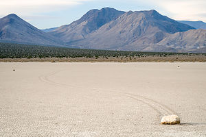 Moving rock and its trailAfterwards, we continued driving another two miles to another parking area nearer to the “moving” rocks, which the Racetrack is famous for and walked out onto the playa to visit some of them. We could easily find the culprits by the tracks they left behind in the clay. It was incredible.
Scientists have been studying this strange rock behavior for decades and think they have finally solved the mystery. The theory is that after a rain, the surface of the playa, which is clay, becomes quite slippery. Accompanying that loss of friction with the strong winds that blow out of the Saline Valley, sometimes as high as 70 mph, and you get a sufficient force to actually move a rock across the slick surface, some of which are as large as 1,000 pounds. Some of them have moved as much as several hundred feet, leaving long tracks behind them showing the direction of their journey.
Using GPS measurements, scientists have mapped, measured, and even named 162 rocks. Kitty weighs in at 1,275 pounds and is 22 inches tall, while Hannah is a measly 1 pound. Apparently, rocks are female.
 Lolo Racing the RockNo camping is allowed in the parking areas alongside the playa, so we continued on to the primitive campground, just two miles beyond, where there are a half a dozen or so places to camp, only one of which was occupied.
The theory of the strong winds moving the rocks after a rain was confirmed in our minds by the fact that even the outhouse was chained down to prevent it from moving. I would love to put a GPS on that untethered and see how far it moves.
The next morning we drove back out from whence we came and stopped once more to walk out on the playa. I tend to get a little antsy without a lot of physical activity, so Herb suggested I relieve some of my pent up energy by running around the “racetrack.” Doing the whole perimeter would have been 10 miles, requiring more energy than I had pent up, so I satisfied myself by running a 3-mile loop around the Grandstand.
We said goodbye to Kitty and Hannah and continued on back to Teakettle Junction, this time taking the road towards Hunter Mountain, with the intention of getting to Saline Valley Warm Springs to camp that night.
Description
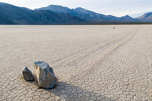 Pretty big rock to moveBecause of its remote location, few visitors get to see the famous Death Valley Racetrack, where rocks mysteriously move across the dry lakebed on their own accord. Although no one has actually seen the rocks move, they are known to move because of the trails they leave behind them. After studying the phenomenon for decades, scientists now believe they have solved the mystery. The surface of the lakebed is a fine clay that becomes very slippery when wet. After a rain, heavy winds as high as 70 mph blow the rocks across the slick surface. A 4-wheel drive vehicle is needed to reach the Racetrack, which is 27 miles past Ubehebe Crater on a rough dirt road.
Bishop - Coyote Flat
Sunday, September 17, 2017 - 3:45pm by Lolo85 miles and 4.5 hours from our last stop - 1 night stay
Travelogue
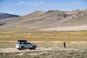 Coyote FlatAfter seeing how well the 4Runner handled the backroads to and from Bodie, Herb was antsy to try a little more challenging drive. We had two great offroading books with detailed descriptions of routes of various difficulty levels: “Sierra Nevada Byways” and “Guide to California Backroads & 4-Wheel-Drive Trails”.
Since we love the Bishop area, we chose an Intermediate trail called Coyote Flat, the start of which was just a few miles outside of town. In addition to the drive sounding extremely scenic, there was what looked to be a great hike to Baker Lake from atop the Flat, as well as a primitive campground there.
Right from the start, the trail began a steep climb out of the Owens Valley, at about 4,400 feet, and led us through a series of switchbacks that just didn’t seem to quit. In contrast to our drive to Bodie, where we were cruising along at around 20 mph, this one was much steeper and rockier keeping us at a pace closer to 5 mph. We were going to have to adjust our expectations for the day.

Since it was too late to fit in a long hike, and the temperature atop the Flat was quite chilly, we decided to skip the camping and head back to Bishop. We didn’t linger long because we wanted to make sure we got back before sunset, as we certainly didn’t want to be driving this road in the dark.
Herb handled the drive just fine and we made it back to Bishop with daylight to spare. Herb (and me too) was really pleased with the 4Runner’s capabilities and quite excited about how this opened up so many new opportunities to explore beautiful, remote areas.
Rather than find camping, we decided to stay in the Bishop Village Motel that night, as after this we would be primitive camping for a few nights in Death Valley.
Description
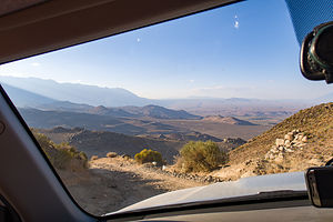 Passenger's eye viewBishop is my favorite town in the Eastern Sierra. It is located along US 395 between the towns of Mammoth Lakes and Big Pine. It lies at the northern end of the Owens Valley with the Sierra Nevada mountains to the east and the White Mountains to the west.
One of the town’s claims to fame is that it is the "Mule Capital of the World," holding a week-long festival each May called Bishop Mule Days. Part mule show, part test of skills, and part Wild West Show, this annual event has been attracting crowds for over its 47 year history, growing from a crowd of 200 in its early days to becoming an international world class event with more than 30,000 fans. Over the course of a week, more than 700 mules compete in 181 events including calf roping, steer roping, barrel racing, flat racing, carriage driving, team chariot racing, and even dressage.
The reason we go to Bishop is for the excellent rock climbing. The three major climbing areas in Bishop include:
The Owens River Gorge is a steep 10 mile long canyon just north of Bishop that is a very popular destination for rock climbing. With 416 sport-climbing and 52 trad routes it is California’s most concentrated sport climbing area. The climbing is on volcanic tuff and features edges, pockets and cracks. Although there is a full range of difficulty level, the best climbs are in the 5.10 to 5.11 range. The most popular walls are located in the Central Gorge – Warm Up Wall, the Pub, the Social Platform, and the Great Wall of China, which feature tons of 5.8 to 5.11 sport routes. Summers get a bit too hot to climb in the gorge.
Buttermilk Country, one of California’s premier bouldering destinations, is located southwest of Bishop along the western edge of the Owens Valley. These massive glacial erratic boulders sit in the foothills of the Sierra Nevada under an impressive backdrop of high peaks just a mere four miles to the west. There are 243 bouldering routes, many of which top out at over 20 feet.
The Volcanic Tablelands, another popular bouldering destination, lie just north of Bishop in an area where the floor of the Owens Valley rises abruptly, forming a 300 foot-high volcanic plateau. Along the southern tip of the plateau there are numerous canyons and washes containing thousands of boulders. The Happy Boulder area with 418 routes and the Sad Boulder area with 187 routes are the most popular. Because of its 4,500 foot elevation, the Volcanic Tablelands are climbable year round.
Long Valley Primitive Hot Springs
Saturday, September 16, 2017 - 3:30pm by Lolo65 miles and 2 hours from our last stop - 1 night stay
Travelogue
 Lovely Long ValleyWe were having so much fun driving the less-traveled dirt roads that rather than take 270 back to 395 from Bodie, we continued on Cottonwood Canyon Road, which brought us to the northern shore of Mono Lake, which lovely views of our approach along the way. From there, we got back on 395 and headed south to the Long Valley Primitive Hot Springs area, just south of Mammoth Lakes - another favorite we had discovered a few months back.
Most of the land in the Long Valley is owned by the Los Angeles Department of Water and Power (LADWP) and the BLM. As a result, it has fortunately not been commercially developed, as so many other hot springs in California. While the LADWP allows day use, the BLM land has no restrictions on overnight camping.
So we turned left (east) onto Benton Crossing Road in search of the perfect place to camp. Once again, we had our Falcon Guide, “Touring Hot Springs California and Nevada,” which gives a very detailed description of the location of about a dozen hot springs in the area.
 Boardwalk to Wild Willy's PoolWe headed first to the “Crab Cooker,” our favorite from a previous trip. It’s a bit tougher to reach in that the roads to it are unpaved and rougher, but that made it all the more likely to be unpopulated. However, when we got there, there were already some people near it - not in, just near. Not sure if they were arriving or departing, we walked down the hill to it to have a look. We soon discovered that the reason no one was in it was that it was cool. After poking around, we discovered that there was debris in the pipe connecting the pool with its hot water source, making it a rather ineffective “cooker.” That’s the challenge with natural hot springs - their status is always changing.
It didn’t make sense to camp near a cool pool, so we headed back to the Crowley Hot Spring area (also known as Wild Willy’s), where we knew there were hot pools and places to camp nearby. Just before the parking lot for Wild Willy’s, we took a right turn on a dirt road along which camping was allowed. We selected an empty pull-out with a path leading back towards the pools. Perfect.

So, some new toys came out. First he set up a pop-up shower tent, which doubled as a privacy booth to get dressed and take care of nature’s needs. It looked a bit like a phone booth. Herb also had bought a nemo helio, which is a shower device powered by a foot pump. He looked quite satisfied, having provided me with all the comforts of home.
Domestic chores complete, we donned our bathing suits and followed the path to the pools. There are actually two pools in this area to choose from. One is built of concrete and has a wooden deck, about 9 by 12 feet and 3 feet deep, surrounding it. The other is a smaller and more primitive one with a mud bottom. As expected, they were both already occupied.
The primitive one was a bit warmer, so we joined a group of people, all of whom were about one third our age, in that one. I felt a bit old, but since Herb and I are still quite physically active, we were able to share some of our own tales of adventure in the Sierra.
 Our campsite in Long ValleyIt was a bit chilly getting out of the pool, as the air temperature was now in the 40s. We scurried back to our campsite, where I proceeded to use my privacy phone booth to put on most of the clothing that I had packed. Once warm and cozy again, we sat in our beach chairs sipping wine and gazing out at what was a truly dramatic setting. Herb was feeling pretty smug right now about the experience he was providing me.
The next morning before departing we took another quick soak in the pool before continuing on our journey, which would take us next to Bishop, with the eventual goal of Death Valley..
Description
 All the comforts of homeThe Long Valley Primitive Hot Springs area, just east of Highway 395 a few miles south of Mammoth Lakes, contains one of the best collections of primitive, unspoiled hot springs in California.
Most of the land in the valley is owned by the Los Angeles Department of Water and Power (LADWP) and the BLM. While the LADWP allows daytime use, the BLM areas also allow camping. LADWP land is marked with large white signs.
The valley is a hotbed of constant seismic and volcanic activity, created by an eruption about 760,000 years ago, in which the volcano collapsed, forming a massive caldera, which is now the valley. The area is still volcanically active, and recent renewed earthquake activity has caused concern that another eruption is in the making.
Benton Crossing Road, which is paved, is the main access road to the springs. From this road, dirt roads of varying quality (some graded and some quite rough) lead to the springs. Some of the more popular springs include:
- Crowley Hot Spring (Wild Willy’s)
- Hilltop Hot Spring (Pulky’s Pool)
- Alkali Lake Hot Spring
- The Crab Cooker
- Shepherd Hot Spring
