- Home
- About
- Map
- Trips
- Bringing Boat West
- Migration West
- Solo Motorcycle Ride
- Final Family XC Trip
- Colorado Rockies
- Graduates' XC Trip
- Yosemite & Nevada
- Colorado & Utah
- Best of Utah
- Southern Loop
- Pacific Northwest
- Northern Loop
- Los Angeles to NYC
- East Coast Trips
- Martha's Vineyard
- 1 Week in Quebec
- Southeast Coast
- NH Backpacking
- Martha's Vineyard
- Canadian Maritimes
- Ocracoke Island
- Edisto Island
- First Landing '02
- Hunting Island '02
- Stowe in Winter
- Hunting Island '01
- Lake Placid
- Chesapeake
- Provincetown
- Hunting Island '00
- Acadia in Winter
- Boston Suburbs
- Niagara Falls
- First Landing '99
- Cape Hatteras
- West Coast Trips
- Burning Man
- Utah Off-Roading
- Maui
- Mojave 4WD Course
- Colorado River Rafting
- Bishop & Death Valley
- Kauai
- Yosemite Fall
- Utah Off-Road
- Lost Coast
- Yosemite Valley
- Arizona and New Mexico
- Pescadero & Capitola
- Bishop & Death Valley
- San Diego, Anza Borrego, Joshua Tree
- Carmel
- Death Valley in Fall
- Yosemite in the Fall
- Pacific Northwest
- Utah Off-Roading
- Southern CA Deserts
- Yosemite & Covid
- Lake Powell Covid
- Eastern Sierra & Covid
- Bishop & Death Valley
- Central & SE Oregon
- Mojave Road
- Eastern Sierra
- Trinity Alps
- Tuolumne Meadows
- Lake Powell Boating
- Eastern Sierra
- Yosemite Winter
- Hawaii
- 4WD Eastern Sierra
- 4WD Death Valley +
- Southern CA Deserts
- Christmas in Tahoe
- Yosemite & Pinnacles
- Totality
- Yosemite & Sierra
- Yosemite Christmas
- Yosemite, San Diego
- Yosemite & North CA
- Seattle to Sierra
- Southwest Deserts
- Yosemite & Sierra
- Pacific Northwest
- Yosemite & South CA
- Pacific Northwest
- Northern California
- Southern Alaska
- Vancouver Island
- International Trips
- Index
- Tips
- Books
- Photos/Videos
- Search
- Contact
Salzburg
Sunday, May 28, 2017 - 10:15am by Lolo34 miles and 0.75 hours from our last stop - 1 night stay
Travelogue
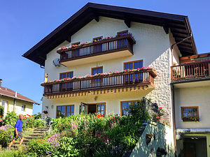 Camping Nord-SumSalzburg, the city of Mozart and the Sound of Music, came highly recommended by Rick Steves and practically every other European travel guide I picked up during my planning. Plus, its proximity to Chiemsee (only 45 minutes) and Berchtesgaden (less than 45 minutes) - two planned stops on our itinerary - confirmed our decision to visit this lovely old city.
However, before entering Austria we had to stop at a gas station before crossing the border to buy a vignette to display on our windshield to allow us to travel on the Austrian highways without receiving a large fine. While the German highways are free, most of the other countries in the European Union have some sort of toll system. A 10-day vignette cost us 8.90 euros.
As we had hoped, there was a choice of two campgrounds less than 4 bike path miles from the Altstadt (Old City) that rented bicycles. Somewhat randomly, we chose Camping Nord-Sum, a small, family run campground with grassy sites separated by trees and shrubs, and a heated swimming pool. The office was located in a beautiful Bavarian-style home, complete with flower boxes on the wood balconies and a nice dining area in front that could be used by campers.
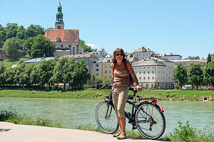 Biking to SalzburgAfter getting the camper van situated, we rented a pair of bikes and headed out on the bike path that led to the Aldstadt. In about a mile and a half, the path made a left and we rode for the rest of the way along the Salzach River, where we had wonderful views of the Aldstadt.
Salzburg’s Altstadt, which is a Unesco World Heritage Site, is a charmingly preserved old town with splendid gardens, Baroque churches, cobblestone streets, and Europe’s largest intact Medieval fortress. Coming from a land where history goes back only 300 years or so, it was still a novelty for us to wander through so many more centuries of history.
We crossed the Salzach River on the Makartsteg Bridge, Salzburg’s newest pedestrian bridge, where there was a sea of “Lover’s Locks” covering almost every inch of the fence just below the railing. I have seen these in several locations in the U.S., but never this dense. They looked like colorful jewels glinting in the sunlight.
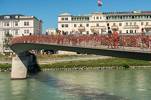 Lover's Locks on Makartsteg BridgeIt added a bit of romance to what was already a romantic city. There are many stories as to how this tradition started, but most people credit this phenomenon to a 2006 novel by Federico Moccia called “I Want You,” in which two lovers fix a lock to the Ponte Milvio bridge in Rome to express their unbreakable love for each other. Typically, the lovers’ names or initials are inscribed on the lock, and the key is thrown away - hence, the unbreakable part of the symbolism. From there, the tradition has spread around the world to mixed reviews. Some cities treat the locks as vandalism and remove them, while others embrace them as art and a way to attract tourists. Salzburg was definitely the latter and I think it really added charm to the city.
Having only rental bike locks at our disposal, we sadly had to miss declaring our eternal love for each other in Salzburg. Instead, we rather pragmatically used our locks to secure our bikes to a rack at the other end of the bridge, so that we could continue on foot.
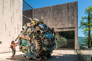 Museum der Moderne SalzburgWherever you are in Salzburg, it’s hard not to feel the presence of the Monchsberg, a cliff face that rises 400 feet above the city. There is a funicular connecting the Aldstadt to the Hohensalburg Castle atop the cliff, but we decided that we would walk to the Museum of Modern Art on top instead.
It was a lovely walk mostly through a forest, until we arrived at the restaurant terrace of the museum, which had a wonderful view of the Salzach River winding its way through the old town.
We probably should have stuck with gazing at the view, because I would have to say that the museum itself was pretty disappointing. Now, we are not art connoisseurs, so maybe we just weren’t getting it. However, we felt somewhat vindicated in our feelings after reading the reviews on Trip Advisor. Still, it did bring us to a great spot atop the Monchsberg.
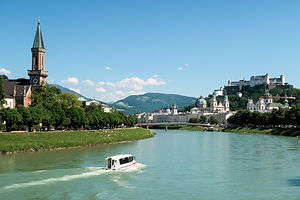 Salzach River flowing through the AldstadtRather than hike back down to street level, we followed the path along the top of the cliff for about a mile and descended behind the legendary Augustiner Braustubel, Austria’s largest beer inn and garden. It was founded by Augustinian monks in 1605.
The beer garden didn’t open until 2:30 on Sundays, but a line was already forming on its steps when we arrived at 2:00. We didn’t have to worry about getting a seat though, as the beer garden alone sits 1,400 people. There are also several indoor dining halls as well.
As with the other beer gardens we had been to so far, the tables were set in the shade of old chestnut trees. Herb was convinced that the purpose of the lids on German beer steins is to prevent the droppings from these trees getting in one’s beer. Perhaps he was right, because we noticed that many people were placing their coasters on top of the mugs between sips.
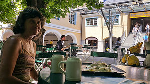 Lolo enjoying the Augustiner BraustublBeer gardens are self serve, so Herb went off to forage for beer, which was a multi-step process. First he first went to a cashier and purchased two tokens. He then used these tokens to select two stone-made “Maß” (one-liter) mugs off a shelf. These mugs were then filled with beer from a wooden barrel.
Next it was my turn to find lunch. I ascended a series of steps leading into into an arcade lined with small shops and market stalls, called the “Schmankerlgang”. There were so many choices. Everything looked so good, that I couldn’t go wrong. I finally selected a stall near a statue of St. Augustine, the namesake of our beer, and purchased two orders of bratwurst, sauerkraut, and potatoes.
The lunch and the meal were wonderful, but what I really like about beer gardens is the atmosphere of conviviality - families and friends gathered together on a Sunday afternoon to enjoy each other’s company, enhanced by some great food and beer.
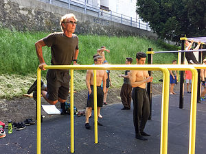 Herb showing the younguns how it's doneWe couldn’t leave Salzburg without visiting Mozart, so we strolled along the Salzach River back towards the Aldstadt. Along the way we passed a park with exercise stations, where shirtless, jacked twenty-somethings were working out. Despite being at least twice their age, Herb jumped in and did as many dips as they were doing. The old man’s still got it - even after some wurst and a Maß beer.
Continuing along, we got off the main drag and wandered through the narrow pedestrian alleys that we have come to love in Europe. In the Mozartplatz we stopped to admire the Mozart statue and the beautiful old pink Church of St. Michael, built in the 800s.
Looming 400 feet above the square atop a rock called Festungsberg is the imposing Hohensalzburg Fortress, built in the 11th century as a show of the Catholic Church’s power.
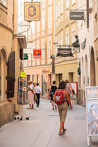 Strolling through the AldstadtIf we had the time and energy, we would have climbed back up the cliff to take a tour, but instead we continued through the Aldstadt to Mozart’s Geburtshaus (birthplace) and the place where he composed most of his works as a young protege. It is the most visited sight in the city.
On our bike ride back to the campground, we stopped at a climbing gym right alongside the bike path to take a peek. It was a really nice gym, but surprisingly empty. When we asked why, the girl at the counter said that on nice days, everyone climbs outdoors. This would be something fun to do tomorrow we decided. As we were hopping back on our bikes, the girl ran out with one of those large Bavarian pretzels. “Hungry?” she asked. “I have lots of these left over because no one came today.” I rode the rest of the way back, with a pretzel strapped to my backpack.
That evening we swam in the campground pool and lounged around, discussing plans for the next day. Our original intention was to spend another day in Salzburg, but a quick check on the weather showed that rain would be moving into the Alps in a few days. We really had our hearts set on hiking in Berchtesgaden National Park, so we decided to cut our visit to Salzburg short and get there before the weather changed.
Description
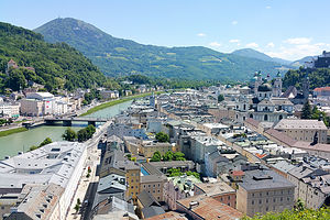 View from the Museum der Moderne SalzburgSalzburg has a charmingly preserved old town with splendid gardens, Baroque churches, cobblestone streets, Europe’s largest intact Medieval fortress. It is famous for being the birthplace of Mozart and the location for the Sound of Music, around which many guided tours are centered.
Saltzburg’s Aldstadt (Old Town) is a Unesco World Heritage Site
- connected to the top of the Monchsberg mountain (great views) via funicular and elevator
- Funicular brings you to imposing Hohensalzburg Castle
- Elevator brings you to cafes, the Museum of Modern Art, wooded paths, and great views
- You can also walk up to the top from several points in town – behind the cathedral, Toscaninihof, and the Augustiner Braustubl beer garden
Walking tours of Salzburg
- One-hour guided walk without a reservation – just meet at the TI on Mozartplatz
- Or do on our own with Rick’s Steve audio tour (which can be downloaded for free)
- Mozartplatz
- Residenzplatz
- New Residenz and Glockenspiel
- Mozart’s birthplace
- Old Residenz
- Salzburg Cathedral
- Kapitelplatz
- St. Peter’s Cemetery
- St. Peter’s Church
- Toscaninihof
- Universitatsplatz
- Monchsberg Cliff Face
- Getreidegasse
- Alter Market
Salzburg Card (26 euro for one day)
- Entrance to all the major sights and attractions
- Free river cruise
- Unlimited use of public transport (including cable cars)
Chiemsee
Friday, May 26, 2017 - 3:30pm by Lolo87 miles and 1.5 hours from our last stop - 2 night stay
Travelogue
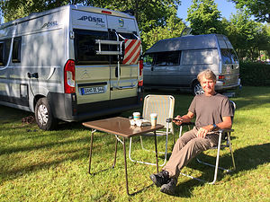 Herb enjoying his first day in the camperHow exciting! Our first of 27 days touring Europe in our little camper van. We are very accustomed to motorhome life and have criss crossed the U.S. over a dozen times in our 27-foot Lazy Daze, but we knew we would be faced with unfamiliar challenges, such as road signs we could not understand and roads that were much narrower than we are used to.
In my planning for this tip, I had used a rather old (2004) European Camping Guide to find campgrounds near places on our itinerary. Europeans seem to be much more camping-friendly than Americans. Everywhere we wanted to visit - whether it be city or village - was accessible, either on foot or by public transportation, from a campground. And the campgrounds themselves far exceeded our expectations - clean, great facilities, and most of them even had a restaurant or beer garden on site.
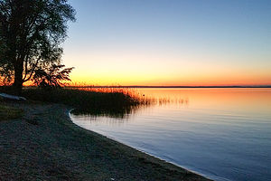 Chiemsee sunsetFor Lake Chiemsee, I had found two campgrounds on different sections of the lake, each within walking distance to a boat ferry to the islands we wanted to visit. The woman who gave us the instructional on the camper told us that at this time of year (late May - early June), we should have no problem getting a campsite anywhere. So we headed to the first one (Panorama Camping Harras, on a peninsula jutting into the lake), without a care in the world, only to find that it was totally booked. The owner, who fortunately spoke English very well, told us that many people were making a long weekend out of the Thursday Father’s Day holiday. He told us we could probably park behind the hotel down the road and come back in the morning to see if anyone checked out. This was not exactly how we wanted to spend our first night in the camper.
We made a quick call to the second campground I had on my itinerary, Chiemsee-Camping Rödlgries, which was also on the lake about 10 miles east. They said they had room for us, so we set off immediately to ensure that we had a place to land for the night.
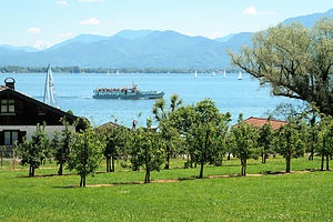 Chiemsee Schifffahrt (boat ferry) from FraueninselIt was a lovely campground with shady, grassy sites, a beer garden, and very clean and ample bathroom / shower facilities. Plus, the walk to a boat ferry that would take us to the islands was only 1 km rather than the 2.5 km walk that we would have had to make from the previous campground. We both were quite glad that the last campground didn’t work out, because this one seemed much nicer and more convenient.
It was already quite late in the day by the time we settled in, so we relaxed and got to know the camper better and then took a sunset walk along the campground beach. Tomorrow we would take the ferry to visit the islands of Herreninsel and Fraueninsel. Kind of an interesting concept - Man Island and Woman Island.
Early the next morning, we walked to the boat dock for the Chiemsee Schifffahrt (boat ferry), where we were the first on line for the first ferry of the day from Ubersee. The tickets for a trip to both islands were 9.70 euro each.
The ferry stopped first at Fraueninsel, but we stayed on the boat because we were more interested in seeing Schloss Herrenchiemsee, King Ludwig II’s castle on Herreninsel. Hopefully, by being early we would beat most of the crowds. We could stop at Fraueninsel on the way back.
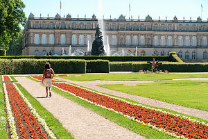 Gardens at Schloss HerrenchiemseeUpon disembarking on Herreninsel, we purchased our tickets to tour the castle for 8 euros each and walked about a half mile to get to the palace. We were assigned a specific tour time, so we didn’t have much time to wander about and photograph the beautiful gardens - we would do that afterwards. As luck would have it, we were part of an English-speaking tour.
Unfortunately, no photographs were allowed inside the castle, so it’s difficult for me to portray what an amazing place this is. Let’s just say that you have to see it to believe it.
Herrenchiemsee is the least famous of Ludwig II’s three castles. He is most well known for Neuschwanstein, his fairy tale castle immortalized by Walt Disney’s Sleeping Beauty, and Linderhof, his jewel-box palace. However, Schloss Herrenchiemsee cost more than the other two combined and pretty much depleted nine centuries of Wittelsbach wealth.
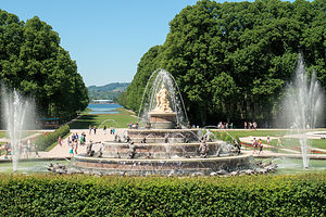 Gardens at Schloss HerrenchiemseeThe castle was never intended to be inhabited. In fact, Ludwig only spent 10 days in the palace. Rather, it is a replica of the Palace of Versaille, meant to be a sort of museum where he could transport himself in his imagination back to the court of Louis XIV of France, whom he seemed to have a man crush on. There is even a Hall of Mirrors modeled on the one in Versailles, but even larger. As a result, the replica ceiling paintings had to be resized to fit the bigger room.
Only 20 of the planned 70 rooms were finished before Ludwig’s mysterious death in 1886 and construction was stopped. Each of those 20 rooms is more magnificent and opulent than the next.
After the palace tour, we took our time wandering through the formal gardens, also modeled on Versailles; however, now we were allowed to take photos. The gardens are filled with fountains and statues both in the classical style of Versaille and the fantastic romanticism that Ludwig loved.
There is also a baroque Augustinian monastery on the island built in the 1600s. Between the monks and Ludwig wandering around alone in his castle, there wasn't much of a female presence on the island - hence the name Herreninsel.
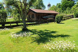 Idyllic FraueninselThe next stop on our boat tour was Fraueninsel, which had a much different feel to it than Herreninsel - much more idyllic and peaceful. Most of the island's inhabitants are either fishermen or artists. There has been an artists' colony on the island since the late 19th century.
The island’s best-known attraction is Frauenworth, an 8th century Benedictine convent with a beautiful campanile that can be seen from far away across the lake. Although the nunnery is closed to the public, the Klosterkirche, nunnery's church, which dates back to the 11th century, is not. It is well worth a visit. While we were there, a wedding was just about to get under way. What a wondeful place for a wedding.
We wandered around the island for a bit before taking the ferry back to Ubersee. From there it was just a short stroll back to our campground.
Description
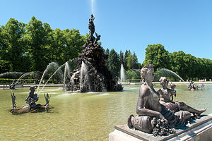 Fountains at Schloss HerrenchiemseeChiemsee, which is only an hour and a half from Munich, is the largest lake in Bavaria. It has three islands, which can be reached by ferry:
- Herreninsel - major attraction is Schloss Herrenchiemsee, a neo-Baroque royal palace built in 1878 by “Mad” King Ludwig II. It was meant to be a replica of the Palace of Versailles in honor of the Sun King Louis XIV of France, whom Ludwig admired almost obsessively. There is even a great Hall of Mirrors modeled on the one in Versailles, but even larger. Ludwig died in 1886 before the building could be completed. Tours of the palace and its gardens are conducted throughout the summer.
- Fraueninsel - fishing village and site of an 8th century Benedictine convent
- Krautinsel - uninhabited
Trips to the islands, which cost less than 10 euro per person, run from several docks around the lake and are operated by the Chiemsee Schifffahrt:
http://www.chiemsee-schifffahrt.de/en/preise/preise-bis-31122015/
McRent RV Rental
Friday, May 26, 2017 - 8:00am by Lolo0 miles and 0 hours from our last stop
Travelogue
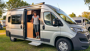 Our sweet little PosslThis was it. The big day where we'd pick up our camper van and begin our European road trip. Herb had spent a good portion of last Fall researching motorhome rental places and vehicles and come to the conclusion that McRent was the best place (largest motorhome rental company in Europe) and that the smaller the vehicle the better to manage the narrow roads in Europe. Herb originally thought that I would prefer a larger one, because I was spoiled by our 27-foot Lazy Daze, but I too wanted as little stress as possible navigating our way around.
We decided on a Compact Standard Van with a bath and shower that would sleep 2 - more specifically, a Possl 2Win. It was pretty perfect for our needs:
https://translate.google.com/translate?hl=en&sl=de&u=https://www.poessl-...
The Munich McRent is not actually located in Munich, but rather in the town of Sulzemoos about 20 miles northwest of Munich. There really were no good public transportation options to get there from our hotel, so we paid $65 for an Uber.
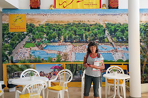 The Campground of Herb's dreamsOne more trip-changing discovery we made while wandering the showroom was a huge advertisement in their lounge for Camping Marina di Venezia. The photo showed a huge campground on the Adriatic Sea with half a dozen gorgeous pools. "Is this the campground you have on our itinerary for our time in Venice?" Herb asked. Oops. We took a picture of the ad for future reference. Spoiler alert - it was the best campground we ever stayed in.
At 2:00, we returned to the rental office and began the very thorough pickup process. A woman spent about 45 minutes with us going over every detail of the vehicle. Fortunately, Herb is an engineer and also the owner of a much larger motorhome, so understanding how to work this one was not a big deal for him. I can, however, imagine how it would be a bit overwhelming for people driving a motorhome for the first time.
Excited, we set out in our new home for the next four weeks towards the first destination on our itinerary - Lake Chiemsee, about an hour and a half to the east.
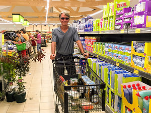 Aldi Sud - Our favorite German supermarketHowever, our first order of business upon hitting the road was stocking up the motorhome, so we stopped at Aldi Sud, a German discount supermarket recommended to us by McRent. Although we had difficulty finding what we wanted, we made due with the choices they had. Breakfast and lunch items were fairly easy, but we still hadn’t figured out what and how we would be cooking dinner in the camper. There was only a 2-burner stove - no microwave or oven like I was used to in our Lazy Daze, so we would have to figure out what worked best. We found some tortellini packages that we thought would get us started, but I was kind of freaked out by the fact that they weren’t refrigerated, as I was accustomed to. However, the prices were unbelievably low - a 6-pack of German beer for 3 euros and wine for only a little more. However, I reminded Herb that we could not live on beer alone.
Description
A motorhome rental service operating throughout Europe that offers all kinds of motorhomes. In fact, it is Europe's largest motorhome rental company.
Here is a link to their fleet, which ranges from small camper vans to larger Class C and Class A RVs:
https://www.mcrent.eu/motorhome-rv/
You can currently find McRent motorhome rental in Germany, the Netherlands, Spain, France, Portugal, Italy, Switzerland, Norway, Sweden, Finland, Great Britain, Ireland, Estonia, Poland and Iceland.
In Germany, where we rented, they have locations in Aalen, Berlin, Berlin-Ost, Bremen, Dettingen, Dortmund, Düsseldorf/Mülheim, Frankfurt/Main, Hamburg, Hamburg-Süd, Hannover, Isny, Karlsruhe, Konstanz, Köln/Bonn, Leipzig, Limburg, Mannheim, München, Nuremberg, Potsdam, Regensburg, Rheine, Rheinfelden, Stuttgart and Warendorf.
The contact information for the Munchen location where we rented ours is:
Ohmstraße 16
85254 Sulzemoos
Phone: +49 8135 6234020
Fax: +49 8135 6234021
info@wohnmobil-muenchen.de
Munich
Tuesday, May 23, 2017 - 10:45am by Lolo0 miles and 0 hours from our last stop - 3 night stay
Travelogue
Day 1 - Viktualienmarkt, Marienplatz, churches and more churches, English Gardens, Chinesischer Turm, Isartor Gate, and Hofbrau Haus
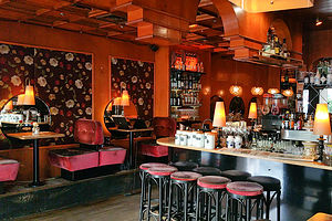 Hotel Lux BarGetting to Munich from our hotel involved a shuttle back to the airport and then a train, which dropped us off smack under the Marienplatz. Since our luggage was not exactly conducive to sight-seeing, after a quick glance around this beautiful square, we headed directly to our hotel, which fortunately was right near by. In fact, its proximity to the Marienplatz, which is the heart of Munich's Altstadt, is why we chose the Hotel Lux for our 3-day sojourn in the city.
From the moment I stepped into the quaint old Hotel Bar, which also serves as the Reception area, I knew I would love this place. The hotel clerk was extremely friendly and helpful and spoke perfect English - in fact, he was actually from Portugal. It was much too early to check in, so he took our bags and suggested we wander over to the Viktualienmark to get a bite to eat. He would have our room ready for us by 2:00 pm.
We took his advice and walked the short distance to what was familiar to us as a farmers’ market in the states, but much larger and more permanent (open every day but Sunday). We didn’t know where to start - there were well over a hundred stalls and shops selling flowers, poultry, fish, exotic fruits, fresh produce, cheese, bread, wine, and all sorts of Bavarian specialties. There were wursts as far as the eye could see.
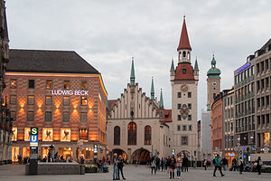 MarienplatzIn the center of the Viktualienmarkt is a beer garden, which sits over 600 people, shaded by hundred-year old chestnut trees. Every six weeks or so they offer a different beer from one of the legendary breweries - Augustiner, Paulaner, Spaten, Hofbrau, Lowenbrau, etc. We weren’t quite ready for the beer portion of the day yet (still a bit jetlagged), so we just got panini sandwiches at one of the stalls and ate them on a bench, while watching the activity around us. The sandwiches were reasonably priced and delicious.
Check-in time at our hotel was still awhile away, so we decided to do some sightseeing, beginning at the nearby Marienplatz, Munich’s vibrant city square since 1158. After only traveling in the U.S. up until now, and thinking that Independence Hall was old, it was mindblowing to contemplate just how much history there is here.
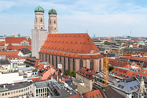 Frauenkirche from atop the Neues RathausThe Marienplatz is dominated by the Neues Rathaus (New Town Hall), which was built in the late 1800s. However, its neo-Gothic style makes it look much older than the Altes Rathaus on the other end of the square, which was built in the 1300s.
The most striking feature of the building is its 85-meter (255 foot) tower, which is home to the famous Glockenspiel. For 2 Euros, we took the lift to the top of the tower for a wonderful view of the city.
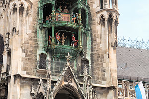 Glockenspiel in the MarienplatzAfterwards we made sure we were well positioned in the Marienplatz for the 11:00 am Glockenspiel show (there are only three shows a day in summer: 11:00 am, noon, and 5:00 pm). As the hour approached, we and about a hundred other tourists gazed anxiously upwards towards the balcony in the tower where the 32 figurines stood poised for action. Pretty close to the hour, the 43 bells started ringing and the upper balcony began spinning - sort of like a lazy Susan - while the figures also spun, acting out a 1568 knight’s tournament. When they were done, the lower balcony began to spin while barrel makers took their turn, performing a ritual dance to celebrate the end of the plague around 1500. I was glad that our timing worked out so that we could see it. After all, you can’t come to Munich and not experience the Glockenspiel.
Munich is a very Catholic city and it served as the center of the German counter reformation. As a result, there are numerous cathedrals, each vying for the faithful’s attention with their spirituality and ornateness.
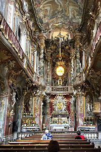 AsamkircheWe visited four that day, and I hate to admit it, but with the exception of one, they kind of blend together in my memory. I am going to start with the one that I didn’t forget, because it was the most amazing church I have ever seen.
It’s called the Asamkirche and it is on Sendlinger Strasse about 600 meters southwest of the Marienplatz. We almost missed it, because from the outside it doesn’t even look like a church - but once we stepped inside, Wow! It was a baroque extravaganza, with every inch of its walls and ceilings covered with gold, Putti, frescoes, and stucco flourishes. It is the epitome of religious opulence and ostentatiousness. The church is tiny - only 30 feet wide and can fit only one pew across its nave.
It was built by two brothers in 1740 and meant to be their personal place of worship and eventually their burial place. However, higher-ups in the church hierarchy demanded that it be opened to the public, which thankfully for us, it still is today. Be sure to say hello to the gilded grim reaper on your left when leaving.
The other three cathedrals we visited that day were much more typical of what we expected, and each of them was beautiful and impressive in its own right. I will try to do them justice.
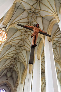 Frauenkirche - Van Dyck’s “Christ on the Cross”The Frauenkirche (Church of Our Lady), with its 99m high onion-domed towers, is the spiritual heart and symbol of Munich. This lovely Gothic church built in the 1400s is located just a few hundred yards northwest of the Marienplatz - in fact, we looked down on it from atop the observation deck of the Neues Rathaus. For a few Euros we could have ridden a lift to the top of the south tower and looked back at the Neues Rathaus, but we figured one aerial view of the city was sufficient.
This church is huge and can seat 4,000 people - such a different feel than tiny little Asamkirche. However, like the Asamkirche, much of its interior was remodeled in the baroque style - but in a much more subtle manner. Van Dyck’s “Christ on the Cross” hangs impressively from the vaulted ceiling near the end of the nave.
One of the more interesting legends surrounding this church is that of the Devil Footprint. According to one version (and there are many), the Devil made a deal to finance the construction of the church if it was built without windows so that he could wander around in it as he pleased. However, the builders tricked the Devil with an architectural illusion by building windows that couldn’t be seen from the foyer. When the Devil realized he was duped, he stomped his foot, leaving a black mark on the floor that still remains today. I wish I had done my research before rather than after visiting this church, because I missed it. Hopefully, now my readers won’t.
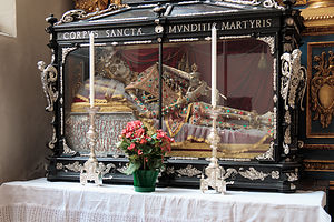 St. Peterskirche - Jeweled skeleton of a female martyrJust south of the Marienplatz is another one of Munich’s spiritual landmarks, St. Peterskirche, the oldest parish church in the city, known affectionately by locals as Alter Peter (“Old Peter”). Its interior is a virtual textbook of art through the centuries with an eclectic mix of Gothic, Baroque, and Rococo features. I thought the baroque ceiling fresco by Johann Baptist Zimmerman was absolutely stunning. However, I would have to say that my personal favorite was a jeweled skeleton of a female martyr in a glass coffin, located in a chapel on the left side of the church. It felt a bit like something you would find in a Ripley’s Believe It or Not. Kept hidden away in a wooden box since her beheading in 310 AD, Saint Munditia, the patron saint of spinsters, was put back on display in 1883. She was a beaut.
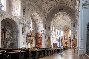 MichaelskircheAfter so many beautiful churches, it was hard to keep up the same level of awe. It was exhausting. Our last church of the day was Michaelskirche, just west of the Frauenkirche. At the time of its completion in 1597, it was the largest Renaissance church north of the Alps. With so many huge churches in such close proximity, I wonder just how full the pews could be on a Sunday morning - except in tiny Asamkirche. What stands out most for me in this church was its impressive unsupported barrel-vaulted ceiling. Also, it is the final resting place of “Mad” King Ludwig II, prolific builder of castles. For 2 Euro one can visit his humble tomb in the crypt - assuredly the only humble dwelling he ever spent time in.
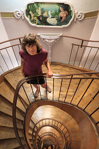 Hotel Lux - 4th FloorIt was nearing check-in time, so we walked backed to the Hotel Lux, and as promised, our room was ready and our bags had been brought upstairs. Thank God, because our room was on the fourth floor, which in Germany is really the fifth floor, because they call the street level one the ground floor and the second floor the first. Fortunately, we are still fit, but I can see how this could be a real problem for those that are less so. The wooden spiral staircase was beautiful though with artwork on the walls along the way to distract you. Our floor had a painting of a young bare-breasted mythological nymph at the top of the landing that over the next few days would inspire Herb to keep on climbing. We took a picture down from our floor to the bottom -- it looked like a wooden snail.
The room was small, but very neat and comfy. Like the Arcadia Hotel, the bed had two down duvets rather than a single comforter - to prevent “tucking and rolling” your partner’s blanket away. It really was a smart concept. We were pretty exhausted from our morning sightseeing and a bit of remaining jetlag, so we took a nap before heading out again.
We set off on foot to the English Gardens, Munich’s version of Central Park, about a mile and a half from our hotel. It was absolutely lovely, with miles and miles of paths winding along a lovely stream which flows the length of the park.
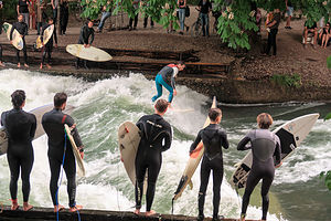 English Gardens SurfersShortly after entering the park, next to the Haus der Kunst, we came upon a crowd gathered on a bridge watching a group of surfers below -- that’s right, surfers in the middle of Munich. We had heard about this, but weren’t exactly sure where it was done, so I’m glad we stumbled upon it. The source of the wave was the Eisbach, an artificial stream that runs through the park. With a little help from some planks of wood hanging from the bridge arches, surfers have shaped and stabilized the flowing water in such a way as to create a continuous wave, about 1 meter high and 12 meters wide, flowing about about 5 meters per second. The better surfers were able to ride the wave back and forth across the stream for several minutes. It was really quite amazing to watch.
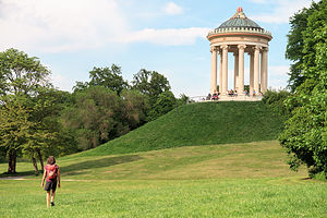 English Gardens MonopterosA little ways further in the park, we came upon an Ancient Greek style temple called the Monopteros. set atop a man-made hill. Monopteros is a Greek architectural term for a structure with a circular colonnade supporting a roof, but without any walls. It was quite lovely, and that hill just needed to be climbed. Apparently, the youth of Munich thought so too, as many of them were hanging out on its steps, socializing and having a few beers. From atop the hill, there were wonderful views of the city.
From there, we continued through the park to the Chinesischer Turm (Chinese Tower) where there is a huge beer garden with room to seat 7,000 people. We got in line and bought two one-liter mugs of beer, leaving a euro deposit for each of the mugs. When we first got there, it was relatively empty and we were able to easily find a seat at one of its green picnic tables. However, after about 5:30 or so (I assume the end of the German workday), people started arriving in droves on their bicycles, still dressed in the their work cloths, meeting up with friends and family. This was definitely not a tourist trap, but the real deal. What a wonderful custom to see families and friends talking and laughing together over a beer and a pretzel or some bratwurst.
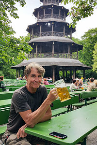 Herb enjoying the Chinesischer Turm beer gardenAfter finishing our beers - Herb had some of mine -- we walked the 2 ½ miles back to our hotel stopping along the way at the Isartor Gate, one of the four main gates of the old Medieval city wall (only three still remain). Completed in 1337, the gate has a 40-meter tower and was the main gate of Munich’s Salt Road. Murals of the Wittelsbachs’ past military victories adorn the walls over the arches. It is one of the most photographed landmarks in Munich.
I’m not sure why, but we felt like we just had to have dinner at the Hofbrauhaus, the famous three-floor beer hall dating back to the 16th century located right near our hotel. It is a bit of a tourist trap - you won’t find many locals here - but still a lot of fun. However, it wasn’t long before we we were clapping along with the oom pah band, raising our mugs, and yelling “Zicke zacke, zicke zacke, hoi hoi hoi!”
It was hard to believe that we had only arrived in Munich that morning, as we had already covered so much ground and seen so much of the city. We were going to have to slow down the pace a bit if we were going to survive four weeks of this.
Day 2 - Munich's Art Museums (Alte Pinakothek, Neue Pinakothek, and Pinakothek der Moderne)
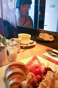 Hotel Lux breakfastOur stay at the Hotel Lux included a wonderful hot buffet breakfast with eggs, bacon, various other meats, fruit, fresh bread, etc. We helped ourselves to a heaping plate and sat in one of the booths in the very cozy bar. It was a great way to start our day.
Munich has a wonderful art district called the Kunstereal, just west of the southern end of the English Gardens, and a little over a mile walk from our hotel. Since we couldn’t decide whether we were in the mood for Old Masters, baroque, impressionism, or modern, we figured we would try to do it all -- so much for slowing down the pace.
My sense of order required that we move sequentially from old to new, so we started our day at the Alte Pinakothek, which holds one of the most famous collections of Old Master paintings from the 14th through the 18th century. Since we planned to visit several museums that day, we purchased a combo ticket for 12 euros each.
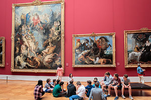 Alte Pinakothek - The Great Last Judgment by RubensThe Alte Pinakothek, which has a neo-classical exterior, was ordered to be built by King Ludwig I of Bavaria in 1826 to hold the Wittelsbach collection. At the time of its completion in 1836, it was the largest museum in the world and well ahead of its time in terms of skylights and room layout for displaying art. Up until then, art had pretty much been displayed on the interior walls of castles. The building became the model for new galleries throughout Europe. As with many old buildings, this one was in the midst of some construction work so parts of the museum were closed.
The list of artists whose works are on display is a veritable “Who’s Who of Renaissance, Baroque, and Rococo Art”: Albert Durer, Rogier van der Weyden, Hieronymus Bosch, Rembrandt, Frans Hal, Rubens, van Dyck, Pieter Bruegel the Elder (my personal favorite), Leonardo da Vinci, Giotto, Botticelli, Raphael, Titian, Tintoretto, El Greco, Velaquez, and on and on. No wonder this museum is featured in “1,000 Places to See Before you Die.”
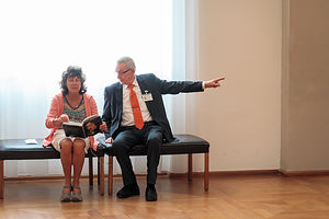 Lolo's new friend breaking it to her that there is no TitianWhile wandering through the gallery rooms, I don’t know what possessed me to ask a museum security guard where the Titian’s were. He did not speak a word of English, and no matter how many times I slowly said “Titian” in a German accent, he had no clue what I was looking for. He was so sweet though. He directed me to sit on a bench and quickly returned with a catalog of the museum’s collection. Herb looked a little confused when he found me and the elderly guard, sitting like old friends on a park bench, flipping through the pages of a catalog together. I never did find out if there were any Titians on display, but I did make a friend.
Moving along our timeline of art history, we continued on to the nearby Neue Pinakothek, which has an impressive collection of 19th and 20th century paintings and sculpture: Realism, Romanticism, Impressionism, Post-Impressionism, and Art Noveau. It too has an all-star lineup: Delacroix, Courbet, Millet, Manet, Monet, Renoir, Pisarro, Cezanne, Degas, Van Gogh, Munch, Klimt, Turner, and more.
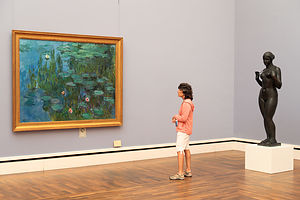 Lolo enjoying MonetImpressionism and Post Impressionism are my favorite types of art, so I felt quite at home wandering through the rooms, recognizing most of the artists before reading the plaques besides the paintings. It was like visiting old friends and family, and identifying distant cousins from their similar characteristics.
Although our combo pass was good for five museums, we concluded our museum tour with the Pinakothek der Moderne, one of the world’s largest museums for modern and contemporary art. It too was just a short walk away. The Museum is divided into four major collections.
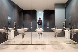 Pinakothek der Moderne - Mens RoomThe State Gallery of Modern Art contains works from artists such as Picasso, Braque, Matisse, Magritte, Klee, Dali, Kandinsky, Andy Warhol, and more. This is pretty much the collection we focused on. There is also the New Collection, which focuses on applied design, with such pieces as VW Beetles, Eames chairs, early Apple macs, etc. This was pretty interesting as well. We were pretty worn out by now and starting to glaze over, so we really did not give much attention to the Architectural collection, which focuses on the history of baroque and Bauhaus architecture, and the State Graphics Collection, which has drawings, prints, and engravings, from artists such as da Vinci, and Cezanne.
We really enjoyed the paintings, especially those by Magritte and Dali, but I am embarrassed to say that our favorite pieces of art (and ones that I only saw second hand) were the shiny silver sinks and creatively shaped urinals in the men’s room. Herb was kind enough to photograph them for my enjoyment.
Day 3 - Boulderwelt Climbing Gym, Orleansplatz Beer Garden, and English Gardens again
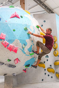 Herb at BoulderweltToday was an official public holiday in Germany. In fact, it was two - Ascension Day to mark Jesus’s ascension to heaven and Father’s Day, or Mannertag. I’m not sure how Ascension Day is celebrated but we certainly got a look at how Father’s Day is.
The first thing that surprised me is that in Bavaria men really do wear Lederhosen and those cute little hats with feathers in them, especially when out hiking or drinking beer, which is basically what Father’s Day is all about. Unlike in the States where fathers spend this day with their children, it is customary in Germany for groups of men, both young and old - excluding pre-teenage boys, I guess because of the beer drinking - to go on a hike together. In the old days, they used to pull a Bollerwagen behind them, full of wine, beer, and food. I’m not sure if this is still done today.
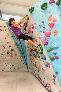 Lolo at BoulderweltI do know, however, that they do seem to pre-load for their hike, because by 10:00 am in the morning, the beer gardens were full of Lederhosen-clad men raising their mugs in celebration of their “fatherness.”
Poor Herb didn’t have his sons along to drink beer and hike with, so he was stuck with me, but I was after all the one that helped make him a father. I spent most of the rest of that day trying to convince him that he would look cute in Lederhosen, but he wasn’t buying it.
Since we had spent the last two days sightseeing, we decided to spend the day doing things that we would normally do at home, like going to a rock climbing gym. A quick internet search revealed that there was a bouldering gym about a mile and a half away on the eastern side of the Isar River. We have found on our travels, that visiting local climbing gyms is a great way to get some exercise, while spending time with locals rather than fellow tourists.
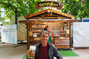 Herb enjoying German Father's Day in the OrleansplatzSo we headed off on foot to Boulderwelt, which turned out to be a very impressive bouldering gym. Normally, Herb and I like to top-rope, where you are tied in while climbing and your partner belays you to stop your falls. Bouldering is a little different in that there are no ropes involved. Rather, the climbs are short enough that falling onto the padded floors is not a problem. I still don’t particularly like falling through free space, even if it is only for a few feet. That tends to keep us on climbs graded easy enough where we feel pretty confident that we won’t fall. The younger people in the gym (which basically means all of them) had no problem dropping 6 to 10 feet onto the mats.
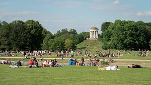 Father's Day in the English GardensOn the walk back to the hotel, quite by accident, we stumbled upon a crowded beer garden in the Orleansplatz, complete with oom-pah band, food stalls, and of course, very large mugs of beer. It looked so festive that we just had to stop. We spent a very pleasant hour drinking beer, eating some kind of fried fish on a stick, and watching people, quite uninhibitedly, dancing in the square. It was so unexpected and so much fun. These people really knew how to celebrate Father’s Day.
Later that afternoon, we took another walk to the English Gardens, just to sit by the river and share in the festive mood of the people of Munich. It seemed like the whole city was out recreating. We really felt an affinity for the people of this wonderful city.
Description
While I will not attempt to do an in-depth description of all Munich has to offer -- there are numerous guidebooks to do just that -- the following is a list of interesting sites that we enjoyed:
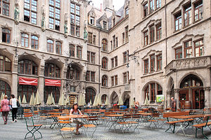 MarienplatzMarienplatz- city’s main square since 1158
- Anchored by Mary’s Column built in 1838 to celebrate victory over Swedish forces during the Thirty Years’ War - topped by golden statue of the Virgin Mary balancing on a crescent moon
- Neues Rathaus - square is dominated by this neo-Gothic New Town Hall
- Take the lift up the 85m-tower for views of Munich ($1)
- Glockenspiel - 43 bells and 32 figures perform two actual historic events
- Top - story of a knight’s tournament in 1568
- Bottom - portrays the Schafflertanz - ritual dance by barrel makers to celebrate the end of the plague around 1500
- Altes Rathaus (eastern side of Marienplatz)
- Where Joseph Goebbels gave a hate-filled speech that launched Kristallnacht pogroms - today a toy museum
Viktualienmarkt (just south of St. Peterskirche)
- Munich’s famous farmers’ market (open every day but Sunday) with over a hundred stalls and shops selling flowers, poultry, fish, exotic fruits, fresh produce, cheese, bread, wine, and all sorts of Bavarian specialties.
- Blue and white striped Maypole
- Centerpiece – beer garden with picnic tables in shade of chestnut trees
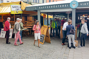 Vicktualienmarkt
Frauenkirche (Church of Our Lady) - Frauenplatz 1 (just a few hundred yards NW of Marienplatz)
- Gothic style – build in 1400s
- Spiritual heart of Munich
- 99m high with onion-domed twin towers – symbol of the city
- Panoramic views from south tower (2 euro)
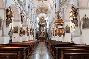 St. PeterskircheSt. Peterskirche (Church of St. Peter)- Rindemarkt 1 (just south of Marienplatz)
- Munich’s oldest church (1136)
- 92-meter tower (300 steps) with best view of central Munich
- Virtual textbook of art through the centuries
- 2nd chapel on left – skeleton of female martyr in a box
- Nave lined with bronze statues of apostles
- Gothic St-Martin altar
- Johann Baptist Zimmermann’s baroque ceiling
- Ignaz Gunther’s rococo sculptures
Michaelskirche (Church of St. Michael) - Kaufingerstrasse 52 (just a little west of Frauenkirche)
- Completed in 1597 - then largest Renaissance church north of Alps
- Ornate baroque interior
- Impressive unsupported barrel-vaulted ceiling
- Most famous as final resting place of King Ludwig II - humble tomb in crypt (2 euro)
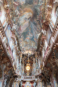 Asamkirche
Asamkirche – 62 Sendlinger Strasse (just 600 yards SW of Marienplatz)
- Built in 1740 Pocket-sized (just 30 feet wide) late baroque created by two brothers
- Every inch of wall space covered with paintings, Putti, gold leaf, and stucco flourishes
- Dome – actually painting on a flat ceiling
- Marble columns – actually made of wood
- Gilded grim reaper – on left side as you are leaving
English Gardens (starts about 1 mile NE of Marienplatz)
- Bigger than Central Park
- Chinesischer Turm (Chinese Tower) - at the heart of Munich’s oldest beer garden
- Monopteros - small Greek temple with view of Munich skyline
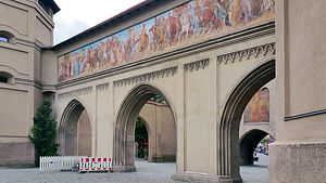 Isartor GateIsartor (Isar Gate) - about ¼ mile SE of Marienplatz
- One of the most photographed Munich landmarks,
- Only tower left from the wall that once encircled Munich
Hofbrauhaus - Am Platzl 9 (½ mile east of Marienplatz
- world’s most celebrated beer hall – 5000 seat
- very touristy but lots of fun
Marienhof (behind new Town Hall)
- Dallmayr Delicatessan – most aristocratic deli in all of Germany
Kunstereal (Art District)
- Alte Pinakothek - Barer Strasse 27 - (just 1 mile north of Marienplatz) - $7
- featured in 1,000 Places to See Before you Die
- Old World Masters between 14th and 18th centuries - Cranach the Elder, Durer, Rubens, Botticelli, Raphael, Titian, El Greco, Velazquez
- Neue Pinakothek - Barer Strasse 29 (near Alte Pinakothek) - $7
- 19th and 20th century paintings and sculpture from rococo to art nouveau - Monet, Cezanne, Degas, and Van Gogh
- Pinakothek der Moderne - Barer Strasse 40 (near Neue Pinakothek - $10
- Spectacular four-storey interior centered on an eye-like dome which spreads soft natural light throughout white galleries
- Four collections:
- State Gallery of Modern Art - Picasso, Klee, Dali, Kandinsky, Andy Warhol
- New Collection - focuses on applied design - VW Beetles, Eames chairs, early Apple macs
- State Graphics Collection - drawings, prints, engravings - da Vinci, Cezanne
- Architecture Museum - baroque architect and Bauhaus
Arcadia Hotel München Airport
Monday, May 22, 2017 - 10:30am by Lolo0 miles and 0 hours from our last stop - 1 night stay
Travelogue
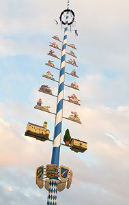 MaypoleKnowing we would be exhausted, confused, and jetlagged upon our arrival, we had reserved a room ahead of time at a hotel that had a shuttle from the airport. Despite some bad reviews about their unreliable shuttle, there it was as soon as we exited the Baggage Claim area.
The hotel was fine, clean and comfortable and in walking distance to a good Italian restaurant - that’s right, it was my first night in Germany and I was going to have a pizza.
The room looked like a typical American hotel room with the exception of the bed. Rather than a single comforter on the double bed, there were two twin-sized duvets folded in half, laid side-by-side on the bed. Herb loved the concept as he often accused me of “tucking and rolling,” leaving him uncovered on many a cold night. Also, there was no flat sheet between the fitted sheet and the duvet. We would find this same setup in our Munich hotel as well.
After a quick nap, we took a walk around the small, but quaint town of Oberding, my very first German village. I just couldn’t resist posing beside the maypole. I wonder if the villagers could tell I was a tourist.
There weren’t very many restaurants in town, but fortunately there was Il Casale, a reasonably priced and highly rated Italian restaurant with a lovely outdoor dining area. I had fully expected to have bratwurst and beer on my first night in Germany, but instead we had a very tasty artisan pizza and a beer. There would be plenty of time for bratwurst later.
The next morning we took the hotel shuttle back to the airport, so we could catch a train into Munich where we would be staying for the next three nights.
Description
The Arcadia is a 3-star hotel located in Oberding, Germany close to the Munich Airport, which offers a shuttle (charge) to and from the airport.
Home
Saturday, April 29, 2017 - 2:45pm by Lolo187 miles and 4 hours from our last stop - 1 night stay
South Lake Tahoe
Friday, April 28, 2017 - 2:45pm by Lolo150 miles and 3.5 hours from our last stop - 1 night stay
Travelogue
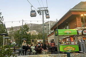 Heavenly Village GondolaIt was already pretty late in the afternoon by the time we finished exploring the Long Valley hot springs area, so rather than drive all the way home, we decided to stop in South Lake Tahoe, a place we have enjoyed numerous times before, both in summer and in winter.
As with Lee Vining and Bishop, wish we also love, this time we were just passing through, so this trip stop write-up does not do justice to all the wonderful things there are to see and do in this area. For that, I refer you to our visit in 2015:
http://www.cross-country-trips.com/south-lake-tahoe-area
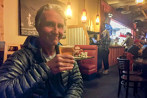 Toast to a successful tripWe got a room at the comfy and reasonably priced Big Pines Mountain House, just a short distance from the Heavenly Ski Area. As we often do, we used our Yelp app to find a place to eat and chose the highly reviewed Base Camp Pizza, located right near the Heavenly Gondola. Apparently, we weren’t the only ones that knew about this place, because it was packed, and we had to wait almost an hour before being seated. The area around the gondola was a nice place to wait. We even played a game of Corn Hole right outside the restaurant’s bar. The restaurant did not disappoint – the pizza was good, the service was fast, and the beer recommendation was right on.
Over dinner, we reflected on the trip, which was very different both in terms of length and form of travel. Although there were times I very much missed the motorhome – particularly the night where we battled wild burros outside our tent – the change had been fun. It’s good to mix things up once in awhile.
Description
Lake Tahoe is one of the highest elevation lakes (6,255 feet high) in the U.S., as well as the second deepest (1,645 feet deep) – Crater Lake is the deepest. It is located along the border between California and Nevada. The four shores of the lake are each quite different. The north is quiet and upscale, the west and east are more rugged and less developed, and the south shore is busy and tacky with neon-lit hotels and casinos. The 72-mile drive around the lake is very scenic.
Lake Tahoe is known for its clear blue and green waters and the panorama of mountains that surround it on all sides. It is a year-round destination with swimming, boating, kayaking, and various other kinds of water sports during the summer; hiking, backpacking, and camping all year round; and tremendous skiing and snowboarding in the winter.
Two interesting nearby sites we did enjoy, include:
Long Valley Primitive Hot Springs
Friday, April 28, 2017 - 1:15pm by Lolo57 miles and 3 hours from our last stop
Travelogue
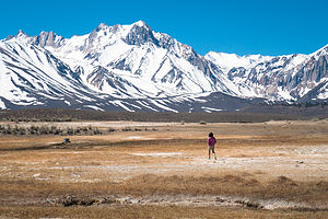 Long Valley Primitive Hot SpringsToday our plan was to find, and hopefully soak in, a few of the many unspoiled, primitive hot springs in the Long Valley area, just south of Mammoth Lakes. We had been on this stretch of road so many times without realizing that the opportunity for a scenic hot soak was just a short dirt-road drive away.
Most of the land in the Long Valley is owned by the Los Angeles Department of Water and Power (LADWP) and the BLM. As a result, it has fortunately not been commercially developed, as so many other hot springs in California. While the LADWP allows day use, the BLM land has no restrictions on overnight camping.
To guide us on our quest, we had the Falcon book entitled “Touring Hot Springs California and Nevada,” which gave a very detailed description of half a dozen of these hidden gems and how to find them.
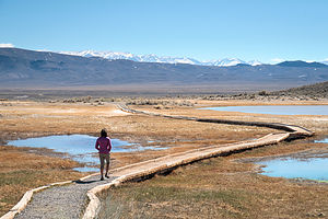 Approach to Crowley's Hot SpringWe began our adventure by turning right (east) off of 395 onto the paved Benton Crossing Road by the big green church. From there, we drove 3.1 miles, crossing two cattle guards, before turning right onto a small dirt road, which we followed for another 1.2 miles before coming to a parking area just past a large rock outcrop for Crowley Hot Spring, also known as Wild Willy’s. Although there is no camping allowed in the parking lot, there are several areas to camp nearby.
After parking the car, we strolled along a wooden boardwalk, built by the BLM to protect the vegetation, to the springs and the pools. There were two of them – one built of concrete with a wooden deck, about 9 by 12 feet and 3 feet deep, and the smaller, more primitive one with a mud bottom. As expected, they were both already occupied. It was really quite cold out (about 45 degrees), so I am sure the 95 degree water was quite inviting. However, rather than get wet so early in our exploration, we decided to continue on, hoping to find a pool that we could have to ourselves.
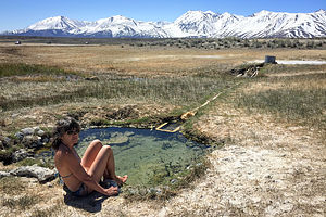 Testing the Waters in Alkali Lake Hot SpringWe drove back out to Benton Crossing Road where we turned right to continue another 0.3 miles to the turnoff for the Hilltop Hot Spring, also known as Pulky’s Pool. From there, it was only a quarter mile drive along a decent dirt road to the parking lot where a few other cars were parked - looked like this one wouldn’t be empty either. We walked a short distance to the top of a hill to find a lovely concrete tub (for about 4 people) with fantastic views of the snow-covered Sierra Mountains. Although empty at the time, it did not remain so for long, so we continued on to the next one – the Alkali Lake Hot Spring.
Although we carefully kept track of the mileage to the turnoff (0.8 past Hilltop Hot Spring; 4.2 from start of Benton Crossing Road), we passed the turnoff, because we saw a gate and thought it was private. However, after finding no other option, we made a u-turn and returned to the place with the gate. This was it. We parked the car, opened the gate and walked across a marshy area to the spring, which was a small concrete-lined tub fed through a PVC pipe by a hot spring source a few yards away. There was no one in it – I had no more excuses to avoid getting down to bathing suit in this cold weather. Herb, with his body fat content of 11% said he would take pictures. I quickly undressed and put my foot in the pool, only to find that it was way too hot. I started to feel like one of the three bears – “this one is too crowded,” “this one is too hot.”
 Herb in the Crab CookerWe forged on in search of the “Crab Cooker” – not sure how something called a crab cooker was going to be any cooler than the Alkali Lake Hot Spring. Also, our Falcon Guide said that the tub had been dry in recent years, so our chances for soaking in it were slim. We decided to do an exploratory anyway, and I am certainly glad we did.
Our Falcon Guide had a fairly detailed map, so we improvised and took a turnoff from the Benton Crossing Road rather than go back to the Whitmore Tubs Road junction, from which the directions in the book were given. This road was much rougher and definitely not doable by 2WD. Eventually we bounced our way to a parking lot, which had one other car in it. From the parking lot, we could see a lovely little pool built out of rocks and cement that very definitely was not dry – probably the result of the near record breaking rains this winter. It had one inhabitant in it, but he was just getting out and drying himself off. The views of the snowy Sierras beyond it were incredible.
This one looked “just right.” Even Herb agreed and we quickly rushed down to it before anyone else arrived. We spent a wonderful half hour soaking in its perfectly temperatured water while gazing at the mountains. To get this experience in a commercial hot spring would have cost hundreds of dollars, and it still would be well worth it. However, it was much more satisfying getting it for free.
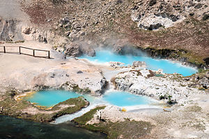 Hot Creek Geothermal AreaAfterwards, we discovered that the road to the Crab Cooker did not go on to the Shepherd Hot Spring as the map in the guide book indicated, but dead ended. However, you could walk to it from the Crab Cooker parking lot, which we did just to see it. It was another nice pool, with two inhabitants in it.
We drove back over the rough road, but made a turnoff to the Whitmore Tubs Road rather than go all the way back to Benton Crossing Road because we wanted to stop at the Hot Creek Geothermal Area, which is now closed to bathing because of scalding temperatures, but still interesting and pretty to visit. From a fenced walkway, we looked down upon two beautiful aquamarine hot springs feeding into a winding cold-water creek. This must have been a fabulous place to soak before conditions changed making it dangerously hot. Hopefully, this will not happen to the other pools in Long Valley.
What a great discovery Long Valley had been. I am very definitely sure that we will be back!
Description
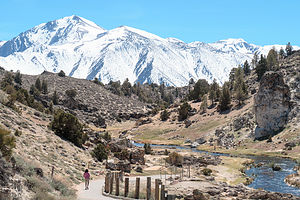 Hot Creek Geothermal AreaThe Long Valley Primitive Hot Springs area, just east of Highway 395 a few miles south of Mammoth Lakes, contains one of the best collections of primitive, unspoiled hot springs in California.
Most of the land in the valley is owned by the Los Angeles Department of Water and Power (LADWP) and the BLM. While the LADWP allows daytime use, the BLM areas also allow camping. LADWP land is marked with large white signs.
The valley is a hotbed of constant seismic and volcanic activity, created by an eruption about 760,000 years ago, in which the volcano collapsed, forming a massive caldera, which is now the valley. The area is still volcanically active, and recent renewed earthquake activity has caused concern that another eruption is in the making.
Benton Crossing Road, which is paved, is the main access road to the springs. From this road, dirt roads of varying quality (some graded and some quite rough) lead to the springs. Some of the more popular springs include:
- Crowley Hot Spring (Wild Willy’s)
- Hilltop Hot Spring (Pulky’s Pool)
- Alkali Lake Hot Spring
- The Crab Cooker
- Shepherd Hot Spring
Bishop
Thursday, April 27, 2017 - 10:15am by Lolo85 miles and 3.5 hours from our last stop - 1 night stay
Travelogue
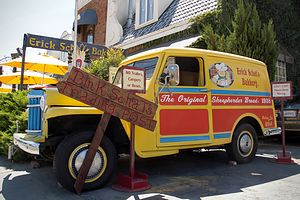 Erick Schat's Bakery MobileWe have been to Bishop several times before. In fact, the stretch of 395 from Lone Pine to Lee Vining is one of our favorite roads in the west.
Since we were just passing through this time, this trip stop write-up does not do justice to all the things there are to see and in this incredible area. For that, I refer you to our visit in 2015:
http://www.cross-country-trips.com/eastern-sierras-south-mammoth-lakes-b...
After our sleepness night battling the wind and wild burros of Saline Valley, we decided to spend the night in a motel. There are so many of them in Bishop that you can get a pretty good deal with all the competition. I think we paid something like $65 for a nice room right off the main drag.
We really were beat from our sleepness night, so we grabbed a cup of coffee at one of our favorite Bishop establishment, the Erick Schat's Bakery, known for its delicious pastries and other baked goods.
Somewhat rejuvenated, we drove back down 395 a few miles to the primitive, natural pools just below the Keough Hot Springs resort to take a soak. We had enjoyed these pools numerous times on our previous journeys up and down beautiful 395. Unfortunately, however, the flooding from the record breaking winter rain and snow had changed the flow from the resort to the “Ditch” as it is called. Rather than a series of distinct pools, it was now more like a continuous river. I stuck my hand in and the water felt a bit cooler than I remembered as well. Oh well. We definitely prefer natural pools to the concrete, cement variety, but with that comes the risk of changing conditions.
It was pretty late in the afternoon and we were still pretty beat from lack of sleep, so we just walked around town for a bit before settling in for the night.
Description
Great western town located along the Owens River on the Eastern Sierra Scenic Byway (Highway 395) between the towns of Big Pine and Mammoth Lakes. The town lies between mountain ranges - the Sierra Nevada to the west and the White Mountains to the east.
Known as the "Mule Capital of the World," the town holds a week-long festival called "Mule Days" every Memorial Day weekend since 1969. It is also an extremely well-known and popular rock climbing area.
Death Valley - Saline Valley Warm Springs
Wednesday, April 26, 2017 - 9:00am by Lolo106 miles and 4 hours from our last stop - 1 night stay
Travelogue
 It only gets stranger from hereAfter our hike, we said goodbye to David, and headed back out from whence we came along the South Eureka Road. However, this time when we reached the Death Valley / Big Pine Road, we headed west towards Big Pine and the road to Saline Valley. When we got to the turnout for the Saline Valley road, we pulled over and had a discussion as to whether or not we had enough gas to make the 40 mile drive to the warm springs and back. This involved many calculations with guestimates as to gallons remaining and mpg to expect off-roading. After determining that we did, but not by much, we decided to drive out to Big Pine anyway, just to be safe. It was about a 30-mile diversion, but one we felt would give us peace of mind.
The road to the Saline Valley Warms Springs from Big Pine Road was 40 miles, just as our drive to Eureka Dunes was yesterday; however, it was far rougher and more desolate. During our entire drive, we did not encounter another vehicle. I was so glad we had filled up our gas tank. Fortunately, everything went smoothly (well maybe smoothly is a bad word to describe the bumpy journey) and it only took us 2 ½ hours.
 ParadiseThe most interesting site along the way was the rusty old remains of an old mining operation, where we stopped to take a break and some photos.
The turnoff for the Warm Springs can be easy to miss, so we carefully watched our odometer to hit the magic 32.7.
The Warm Springs road was significantly rougher and definitely achieved the goal of keeping the timid of heart and non high-clearance vehicles out. About 4 miles into our bumpy drive to the Palm Spring Oasis, we came to a tall post with metal bats hanging from it. I guess we were getting close.
Soon the oasis came into view, like a mirage rising from a dry stark landscape. It was surreal.
We expected to find the Palm Oasis campground empty – after all, we had not encountered another soul on our way in, but to our surprise it was a thriving community whose inhabitants were definitely there for a longer duration than we had planned. I felt a little bit like a tourist in a foreign country – easily standing out, not understanding the culture and rules, etc.
 The Pools at the OasisThe place was amazing – prettier and better maintained than most commercial hot springs. There were several soaking pools made of concrete, rock, and tile as well as showers (with soap and shampoo supplied (to use before entering the pool. In addition, there was a fully stocked bathroom, with Costco size toilet paper packages, cleaning products, air fresheners, etc. The grounds were beautiful, with planted shaded grass areas and creative fencing made from branches. If I ever had an image of Paradise, this was pretty darn close to it.
As we were setting up our tent in the area above the pools, a pair of wild burros wandered by and began rummaging through the contents of our absent neighbor’s camping boxes and even his truck, which was foolishly left with the hatch in the back open. Despite Herb’s lack of experience in burro management, he bravely began waving his arms and yelling at them. They dispersed for approximately 2 minutes before resuming their mischievous behavior. Herb repeated this exercise several times before giving up and asking me to walk through the camp and find the owner of the vehicle, which I attempted with no success.
 Sunset in Saline ValleyFinally, we gave up, took our beach chairs and a bottle of wine, and went to sit in the grassy area that looked out over the Saline Valley. It wasn’t long before a gentleman came over and asked us if this was our first time here – I guess we weren’t blending in as well as I thought. Maybe it was the beach chairs and the wine glasses.
I think his main purpose for talking to us was to make sure that we understood the campground etiquette regarding the campground’s caretaker, “Lizard” Lee. He explained that after the main pool was done being cleaned, Lizard liked to soak for a bit by himself – in other words, “stay out of the pool then.” We assured him that we would behave.
This place certainly didn’t feel like part of a National Park – I guess no ranger talk tonight. In fact, it seems like the National Park Service kind of just ignores this place and lets Lizard and his sycophants do what they want. They certainly do keep it nice though.
After a soak in one of the “Lizard free” pools, we went back to our campsite to make dinner.
 Good Riddance!!That night was probably the worst night I ever spent tent camping. The winds were so strong that it sounded like a jet was coming through the tent. At some point, the jet began to hee-haw – the damn burros were back and they were now going through our camping boxes, which we foolishly left outside. Herb, the newly minted “burro whisperer,” flew out of the tent, yelling and waving his arms. It was about as effective as his last attempts. The next morning we found burro teeth marks in our Rubbermaid storage boxes.
We had originally planned to spend another night at the oasis, but we had had enough. Exhausted, we packed up the next morning and started out to retrace our long 40-mile bumpy drive back to the paved Big Pine Road. Oh, but before were even a mile on our journey, a group of burros approached our car to say goodbye. One actually pressed his nose against our windshield. I think we had made the right decision to leave early.
Once again, we did not pass a single vehicle along the way. They were all still back there with Lizard and those damn burros.
Description
 Lizard's PoolThe Saline Valley is a large, deep, and arid valley that runs along the western edge of Death Valley National Park. It is known for its salt, borax, abandoned mines, and controversial, clothing-optional hot springs located in a series of palm oases.
The Saline Valley road is a very rough dirt road that runs for 95 miles from SR 168 in the north to SR 190 in the south, ranging in elevation from 1,094 to 7,593 feet. High ground clearance 4WD vehicles and full-sized spare times are strongly recommended.
Coming from the north the drive to the warms springs is a rough 40 miles. The turnoff from the Saline Valley road onto the Warm Springs Road, which can be difficult to find, is at the 32.7 mile point. Here, the road gets even rougher. At about 4 miles there is a tall post with metal bats hanging from it. Once you see that, you are almost there.
 More sunset in Saline ValleyA few miles further is a serious of gorgeous warm springs, each with multiple soaking pools. Although these springs weren’t unheard of during the mining heydays, it wasn’t until the 1960s that they became popular among hippies who developed a semi-permanent camp here. The residents soon set to work making home improvements – taming the wild springs into several concrete, rock, and tile soaking pools, building showers, dishwashing facilities, and latrines, building creative fences out of branches, and planting shady grassy areas.
In 1994 the Saline Valley became part of Death Valley National Park and put under the watchful eye of the NPS. The camp was dispersed and visitation was limited to 30 days. One man named Wizard remained and eventually became the caretaker for the site. When he passed away, Lee “Lizard” Greenwell took his place and is still there today.
Today the springs are not found on any NPS maps and rangers are hesitant to tell visitors how to find them. Meanwhile, Lizard and his sycophants live on happily enjoying their bit of paradise.
