- Home
- About
- Map
- Trips
- Bringing Boat West
- Migration West
- Solo Motorcycle Ride
- Final Family XC Trip
- Colorado Rockies
- Graduates' XC Trip
- Yosemite & Nevada
- Colorado & Utah
- Best of Utah
- Southern Loop
- Pacific Northwest
- Northern Loop
- Los Angeles to NYC
- East Coast Trips
- 1 Week in Quebec
- Southeast Coast
- NH Backpacking
- Martha's Vineyard
- Canadian Maritimes
- Ocracoke Island
- Edisto Island
- First Landing '02
- Hunting Island '02
- Stowe in Winter
- Hunting Island '01
- Lake Placid
- Chesapeake
- Provincetown
- Hunting Island '00
- Acadia in Winter
- Boston Suburbs
- Niagara Falls
- First Landing '99
- Cape Hatteras
- West Coast Trips
- Colorado River Rafting
- Bishop & Death Valley
- Kauai
- Yosemite Fall
- Utah Off-Road
- Lost Coast
- Yosemite Valley
- Arizona and New Mexico
- Pescadero & Capitola
- Bishop & Death Valley
- San Diego, Anza Borrego, Joshua Tree
- Carmel
- Death Valley in Fall
- Yosemite in the Fall
- Pacific Northwest
- Utah Off-Roading
- Southern CA Deserts
- Yosemite & Covid
- Lake Powell Covid
- Eastern Sierra & Covid
- Bishop & Death Valley
- Central & SE Oregon
- Mojave Road
- Eastern Sierra
- Trinity Alps
- Tuolumne Meadows
- Lake Powell Boating
- Eastern Sierra
- Yosemite Winter
- Hawaii
- 4WD Eastern Sierra
- 4WD Death Valley +
- Southern CA Deserts
- Christmas in Tahoe
- Yosemite & Pinnacles
- Totality
- Yosemite & Sierra
- Yosemite Christmas
- Yosemite, San Diego
- Yosemite & North CA
- Seattle to Sierra
- Southwest Deserts
- Yosemite & Sierra
- Pacific Northwest
- Yosemite & South CA
- Pacific Northwest
- Northern California
- Southern Alaska
- Vancouver Island
- International Trips
- Index
- Tips
- Books
- Photos/Videos
- Search
- Contact
San Francisco North / Petaluma KOA
Tuesday, August 12, 2014 - 5:30am by Lolo51 miles and 1.25 hours from our last stop - 2 night stay
Travelogue
 El CapitanThe first few days of our arrivals on the West Coast are always a bit tedious – taking the motorhome out of storage, unpacking, food shopping etc. However, this one was a bit rougher than most.
As a result of a Michelin tire recall, we had arranged to drop the motorhome off at a local truck repair shop to have all our tires replaced. We thought this was just great – all new tires (worth about $1,700) for free.
However, when changing the tires, the mechanic noticed that our front left rotor was cracked. Herb also found that the front ball joints were worn. After much deliberation, we decided to let them go ahead and redo our brake system and ball joints, and guess what…the bill was $1,700, the same as our free tires. We urged them to complete the job as soon as they could, because we were heading down to San Francisco that evening to see Andrew and Celeste’s new apartment and then leaving for Yosemite early the next morning.
This was a big step for Herb, because when the motorhome was stored in our backyard, he did all the work on it himself, and has always been hesitant to trust anyone else. I helped persuade him that he shouldn't have to do all these repairs himself, and that we should spend our time on the West Coast having fun, not rolling around in the dirt under an RV.
As promised, the motorhome was ready at 5:00. We tucked it back into our campsite and drove down to San Francisco for the evening. Andrew and Celeste’s new apartment was adorable – so cozy and neat. They were absolutely loving it. They cooked us a wonderful dinner and then afterwards we walked around their neighborhood, stopping at their favorite ice cream shop. San Francisco is a really great place to be young and in love – and I think Andrew and Celeste were enjoying it too.
 Lazy Daze with Half DomeThe next morning we set off for Yosemite, hoping to get there by mid-afternoon – enough time to maybe get in a run or bike ride around the Valley. However, that was not to be. It wasn’t too long into our drive that Herb realized that the motorhome was pulling really hard to the left, so bad that we started googling alignment places. We were lucky enough to find Hewitt Alinement Service in Stockton, that was able to take us immediately. After two hours, we were back on the road again and hoping to still make it before sunset. Herb said the motorhome was tracking better than it had in years.
Less than an hour later, as we approached the town of Oakdale, Herb thought he felt the motorhome pulling to the right a bit. “Do you smell anything?” he asked. I rolled down the window and was greeted with the dreaded smell of burning breaks. We quickly pulled over and Herb used his temperature sensor to confirm that indeed our front right brakes were off the charts hot.
After an angry phone call to the place that redid our brake system, and the offer of using a tow service to bring our vehicle somewhere, Herb decided to just do it himself. He jacked up the motorhome, took off the tire, and saw, as he expected, that the calipers were stuck, causing the brakes to overheat. The calipers were the only part that wasn’t replaced in our brake system repair job.
We continued on to Yosemite, hoping that the calipers would cooperate, and we could safely navigate the steep roads down into the Valley. What should have been a pleasant and scenic four and a half to five hour drive had turned into a 10 hour odyssey. We limped into the Valley near 10:00 pm, exhausted and stressed. The worst part was, we didn’t know what to do next to ensure that the motorhome would be safe for us to travel through mountain passes.
Since we had 10 days where we didn’t have to move the motorhome, we decided to put it out of our minds for now and just have a good time with the boys, who would be arriving tomorrow night.
If I remember correctly, Herb had a gin and tonic after we pulled into our campsite. Actually, I think he might have had two.
Description
The Petaluma KOA is an award winning camping resort located within an hour’s drive of San Francisco, Napa and Sonoma Valley Wineries, giant redwoods, and Sonoma County and California Coastal Beaches. It is considered to be the RV resort in the San Francisco Bay area.
On its 70 acres, there are 312 spacious RV sites, 32 camping cabins, and 10 Wine Country lodges.
Other amenities include:
• Guided tours of San Francisco (from May through October)
• Huge heated pool and spa
• Inflatable waterslide
• Rock climbing wall
• Huge playground
• Petting zoo
• Karaoke
• Hayrides and live weekend entertainment
The campground is open all year.
Flight Home
Friday, June 20, 2014 - 1:00pm by Lolo55 miles and 1.5 hours from our last stop - 1 night stay
Travelogue
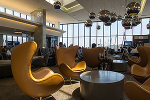 United Terminal at SFOAt the airport, I spoke again to Hospice to get an update on my Mom’s condition, and became more and more convinced that my Mom had decided that it was not yet her time. We have thought she was at death’s door at least a dozen times in the past two years she has been on Hospice – yes, that’s right, two years on Hospice – and each time, she bounces back. Originally when I got the call from Hospice a few days ago, I thought that this would be just another one of those times. In fact, when I called Andrew to tell him what was going on, he told me, “You know she’s going to rally. She always does.” However, Hospice and my sister-in-law who is a nursing home nurse assured me that this time was different and that there would be no rally.
Needless to say, when I arrived at the nursing home first thing the next morning, my mom was up in her wheelchair in the dining room being fed an entire bowl of oatmeal. She actually greeted me with, “Oh hi. What are you doing here? Did you come to see me?” I didn’t know whether to laugh or cry. I think the little drama queen just missed me.
San Francisco North / Petaluma KOA
Tuesday, June 3, 2014 - 10:15am by Lolo439 miles and 8 hours from our last stop - 2 night stay
Travelogue
By the time we reached Petaluma, reports from Hospice about my Mom’s condition were beginning to change in tone. “You know your Mom. She is going to do things in her own way and time.” Yep, she was rallying once again. That old Mark Twain quote came to mind: “Reports of my death have been greatly exaggerated.”
We briefly considered changing back to our original plan of celebrating my birthday in San Francisco this weekend with the boys -- Tommy was even going to fly down from Seattle – but too many things were already in motion, so we went forward on our plan to come home early. We spent the day prepping the RV for storage and packing up to go home.
That evening, Andrew drove up from the city for a visit and to say goodbye. We went out for dinner at Cucina Paradiso, a lovely Italian restaurant along Petaluma’s riverfront. Before finding this place, I didn’t even know that Petaluma had a riverfront. It was quite nice, with several restaurants and bars with outside dining along the river – definitely a place to explore more on future visits.
Description
The Petaluma KOA is an award winning camping resort located within an hour’s drive of San Francisco, Napa and Sonoma Valley Wineries, giant redwoods, and Sonoma County and California Coastal Beaches. It is considered to be the RV resort in the San Francisco Bay area.
On its 70 acres, there are 312 spacious RV sites, 32 camping cabins, and 10 Wine Country lodges.
Other amenities include:
• Guided tours of San Francisco (from May through October)
• Huge heated pool and spa
• Inflatable waterslide
• Rock climbing wall
• Huge playground
• Petting zoo
• Karaoke
• Hayrides and live weekend entertainment
The campground is open all year.
Stanton Park
Monday, June 2, 2014 - 8:45am by Lolo437 miles and 8 hours from our last stop - 1 night stay
Travelogue
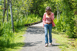 Lolo Talking with Hospice NurseTommy wasn’t gone 10 minutes before we got a call from the Hospice Nurse at my mom’s nursing home facility. At first I wasn’t too alarmed, because we do keep in close contact when I am away. However, I am the one that usually does the calling, so this time seemed different. She informed me that my mom had taken a serious turn for the worse. She was in a semi-comatose state, no longer eating or drinking, and had been put on oxygen. They didn’t think she would last through the weekend.
I didn’t know what to do. Our return flight was over a week away. The only reason I hesitated at all, was that my Mom has more lives than a cat, and we have gathered around her theoretical death bed many times, only to have her rally and come back to life. How was I to know whether this time was really different?
I called my sister-in-law, who is an ex-nursing home nurse and asked her if she could stop in to see my mome and assess the situation. She did and confirmed Hospice’s prognosis that she was truly near the end.
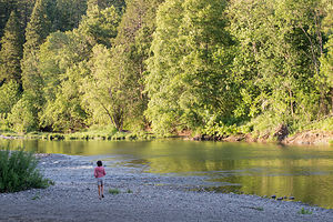 Lolo on South Umpqua River in Stanton ParkOkay, this was it -- time to start figuring out how to get home. First step, we called United Airlines to see what we could do about switching flights, especially in light of the fact that we didn’t have trip insurance. They were so incredibly nice, and allowed us to move up our flights to 3 days from now, without any charge.
Step two – start driving down I5 to get back to Petaluma to store the motorhome and fly back home.
We made a quick side trip to the Mount St. Helens Visitor Center near Silver Lake, just 5 miles off I5 on the Spirit Lake Highway, to get information for a possible future visit. Unlike other National Park System Visitor Centers, this one is run by the Washington State Park System and charges $5 to see the movie and the exhibits. I must admit I was a bit too distracted to really enjoy it much though and spent most of the time, hiding behind exhibits, talking on my phone to my sister-in-law and brothers about my mom.
Before leaving, we took a quick stroll along the Silver Lake Trail behind the Visitor Center, a lovely trail that includes boardwalks over marshlands. I pretty much missed that too, spending most of that walk on the phone with the Hospice nurse.
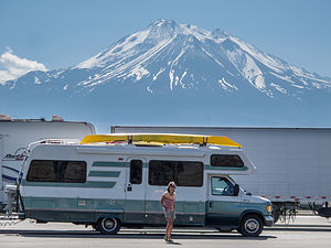 Lolo and Lazy Daze with Mount Shasta at I-5 Rest StopWe really did not give this place justice at all. I want to come back someday under better circumstances and take the ride out to the Johnston Ridge Observatory, about 50 miles further on, to actually see the 1980 blast zone. The visitor center here is the closest you can get to the mountain by car when driving in from the west. Also, when we come back I would like to stay at the Eco Park Resort, which I believe is the closest you can stay to the mountain. It’s located about halfway between I5 and the Johnston Observatory and has cabins, yurts, and camping.
Vowing to come back on a future trip, we continued our drive down I5 through Oregon. We had never been this way before, and I was quite surprised how scenic it was. Herb was also surprised how hilly it was, and was not really enjoying its many steep ups and downs.
After about another 5 hours of driving, we stopped for the night at Stanton Park, a 40-site campground on the South Umpqua River, just a short distance off I5 in the town of Canyonville, Oregon. It was actually quite nice. After dinner Herb and I took a short stroll down to a rocky beach on the river – very pretty.
Description
 Mount St. Helens Visitor Center Silver Lake TrailStanton Park is part of the Douglas County Park System. The 40-site campground is located on the South Umpqua River at Canyonville off I-5 Exit 99. The park has a picnic area, large pavilion, accessible restrooms with showers, fishing, and playground. Individual sites are available on a first come-first served basis.
Seattle
Thursday, May 29, 2014 - 6:15am by Lolo228 miles and 4.5 hours from our last stop - 4 night stay
Travelogue
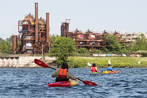 Approaching Gas Works Park via KayakVisiting a city with a motorhome is always a challenge, so finding the proper campground to use as a base camp for Seattle has been a work in progress for us. On our first visit, we stayed at Saltwater State Park, a lovely campground with a beach right on Puget Sound, about 23 miles south of the University District where Tommy lives. However, I5 can be a nightmare in terms of traffic, with a morning rush hour that lasts practically overlaps the afternoon one.
On our next visit we stayed at the Seattle Tacoma KOA, about 4 miles closer to Seattle. Although the setting is not as nice as Saltwater State Park, it does have the amenities that Saltwater does not, such as hookups, a pool, and laundry.
This year, thanks to the Moon West Coast RV Camping book that I have come to depend on, we found a new option: the Vasa Park Resort, right on lovely Lake Sammamish in Bellevue, Washington, just 7 miles from Tommy’s office in Redmond. It pretty much had it all – convenient location, beautiful setting, hookups, and a laundry. It’s really small though and fills up on weekends. There are 16 campsites, 6 full hookups and 10 partial. Fortunately, I had made a reservation in advance for one of the partial sites.
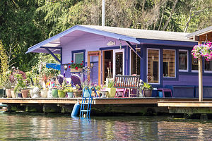 Lake Union HouseboatThat night we just hung out at the campsite and barbecued salmon. It was really pleasant, with great views of the lake, which was only about a 100 yards from our campsite. It was hard to believe that this place was so close to the city. Tommy was considering moving here and living in a tent, so he wouldn’t have to contend with rush hour traffic from Seattle to Redmond every morning.
For the next day’s activities, I had really pushed for (and won) a kayak trip. Herb and my kayaks were spending far too much time just riding up and down the West Coast on the roof of the motorhome, so getting them out on the water was far overdue. Also, Seattle has so much beautiful water surrounding it that it would be the perfect place to exercise them.
Although Puget Sound would have been our first choice, the forecast was for strong winds, making the more protected Lake Union a better option.
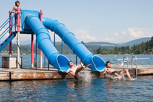 Andrew and Tommy in Synchronized Water Tube SlidesWe got a very good deal on kayak rentals for the boys at Moss Bay on Lake Union’s southeastern shore. On weekdays, if you rent for two hours, you get the next two hours free. The hourly rate was only $14, so each kayak was only $28 for 4 hours – not bad at all.
Lake Union is part of the Lake Washington Ship Canal System, so you can go west out through the locks to Puget Sound or east through Portage Bay and Union Bay into Lake Washington. However, those are really long trips, meant more for a powerboat or a multi-day kayak trip. We would content ourselves with exploring Lake Union.
We started off along the eastern shore of the lake, past the houseboats popularized in the movie Sleepless in Seattle. One of my favorite activities is peeking in windows of cozy homes, so this was a great opportunity for me, especially since most of these homes were mostly windows to take advantage of the great views of the city.
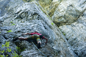 Tommy Leading on World War I Wall at Exit 32After admiring the floating homes, we paddled over to Gas Works Park, the site of an old Seattle Gas Light Company gasification plant that has been transformed into a public park. Much of the old plant’s rusty towers, tanks, and pipes remain and make for a very interesting landmark on the lake – a sort of industrial still life. We had hoped to beach our kayaks and have lunch, but there were numerous signs forbidding it due to sediment toxicity surrounding the plant.
Undaunted, we continued on through Portage Bay and into the narrow Montlake Cut, which is the University of Washington’s crew team’s home course. The walls alongside the cut were covered with inspirational graffiti, extolling the superiority of the Huskies, and urging rowers to push harder to the finish line. It even got me to paddle a little faster.
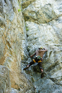 Andrew Leading on World War I Wall at Exit 32Our turnaround point and lunch spot was at the entrance to Union Bay at the Washington Park Arboretum, a 230-acre botanical garden that is managed jointly by the University of Washington and the City of Seattle. It would have been nice if we could have left the kayaks and explored the park a bit, but Tommy suggested that we come back by car on another day. Instead, we sat on a picnic table at the water’s edge and ate our lunch. It was a lovely spot.
The way back was a bit tougher – the winds were picking up as forecasted and the water was getting a bit choppy. As we got back into Lake Union, we were treated to wonderful views of the city and the Space Needle, which had been behind us on our way out.
I was falling a bit behind as we were finishing our paddle, so I missed most of the rescue operation that Herb and Andrew got themselves involved in. Tommy had stayed behind with me to make sure that I was okay and wouldn’t require my own personal rescue.
As Herb describes it, as they were approaching Moss Bay, they saw a kayaker struggling to get back into his capsized kayak. Often people like to get out of their own messes, especially if they are experienced, so they were unsure at first whether he wanted their help. As they approached him, they saw his hand rise above the kayak and the word “Help” coming from his direction. I guess that was about as clear as it gets.
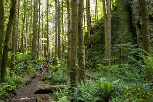 Hiking the Little Si TrailHerb came up alongside him and tried to hold his kayak in place while he climbed back in. After several failed attempts, they reverted to plan B. The capsized kayaker climbed onto the dock with his river bag, while Herb towed his kayak back to the rental dock, which was only about 100 yards away. That’s right, he had only gotten 100 yards before capsizing. Perhaps it was a good thing he did, because if he had gotten out onto the open water, he might have gotten in a lot more trouble. The poor guy. Andrew saw him empty his river bag on the dock, and water, along with his smartphone and wallet, poured out. Apparently, this was also his first time securely closing a river bag as well.
Our total trip, according to Strava, was about 7 miles, just about right on a day with conditions like this.
Back at the campsite that evening, we decided to try the water tube slides at the campground beach. The boys love nothing more than getting me to do stupid things. At first I questioned whether the slides were only meant for small children, but after a rather large father came shooting out of one of them, that excuse was gone.
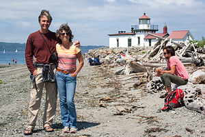 Lolo, Herb, and Andrew at West Point LighthouseThe boys went first, trying to synchronize their exit so that Herb could photo them shooting out at the same time – not a trivial matter, considering one tube was straight and the other J-shaped. Starting at the same time wouldn’t cut it. It took them only three attempts before they got a perfectly timed exit. Herb then photographed my less than graceful, sideways exit, while clutching my nose. It wasn’t pretty but it certainly was fun.
Saturday was rock climbing day. Tommy took us to one of his favorite weekend climbing spots at Exit 32 (on I90) in the town of North Bend. This is the town where the old TV series Twin Peaks was shot. We even saw the famous “Double R Diner” (now Twede’s Café), where you could get a great piece of cherry pie and a “damn fine cup of coffee.
The climbing area is actually halfway up the extremely popular hike to the summit of Little Si, so the parking lot fills up very quickly on weekends. Fortunately, we were early enough to nab the last parking spot. The climbing area is actually rather unoriginally named Exit 32 and there even is a guide book of its routes. There is also a climbing area called Exit 38 – also not very original, but it certainly does make driving directions easier.
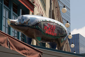 Pike Place Market Pig SculptureThe climbing here was very different from Smith Rock, both in terms of scenery and the type of rock. Rather than desert, this was a lush Pacific Northwest forest, beautiful in a different way. We set up on a wall, creatively called World Wall I, and Herb and the boys did about four climbs. There was nothing on this wall easy enough for me to do, so I was quite happy just being a spectator for the day .
After we finished climbing, we hiked the rest of the way to the summit of Little Si, along with about a hundred other people. The total hike is about 5 miles round trip, and very much worth it, as the views from its 1,576-foot summit of the Snoqualmie Valley are stunning.
Since we normally, don’t hike with a cooler – but had it along to hold our lunch while we were climbing – Herb can be forgiven for leaving it at the summit. We only discovered it was missing when we got back to the car. We even have a nice photo of Herb and I posing with it on the summit. I wonder if it is still up there.
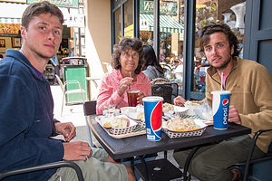 Lunch at Pike Place ChowderThat evening we just relaxed at the campground, taking turns with the kayaks out on Lake Sammamish. Andrew and I had a race between two buoys. He had me beat until he flipped his, and I cruised by for the victory.
Later, after much pestering, Tommy took Andrew out in his car to teach him how to drive stick shift. Andrew hates being the only one in the family that can’t. Tommy reported that some progress was made, and that hopefully his transmission was not any worse for wear.
Sunday was our last day together. Andrew had a flight back to San Francisco at 6:00 pm, giving us quite a bit of time to explore the city.
Our first stop, and one which had thwarted us on our visit here last year, was Discovery Park, Seattle’s largest park with 543 acres of tidal beaches, sand dunes, dramatic sea cliffs, meadows, and forests. We parked in the North Lot and set off to find the trail down to the beach and out to the lighthouse.
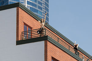 Pike Place Market Mannequins with GuitarSince Tommy was our local expert and had run the trails here on several occasions, we let him lead the way. After walking to the Native American Tribal Center and enjoying the views of Puget Sound from the newly built viewing platform, he took us on a “shortcut” through a dense maple forest down along an overgrown, infrequently used trail. Despite our skepticism, we soon joined the main trail, which led us out onto a lovely beach on Puget Sound with wonderful views of the Olympic Mountains. I could have easily spent the entire day here. We strolled along the beach to the West Point Lighthouse, located on a piece of land that jutted out into the Sound. From there it was uphill on a real trail back to the car.
Our next stop was the famous Pike Place Market, and what better place to be at lunchtime? No one should come to Seattle without stopping at this iconic Seattle landmark.
I think Tommy and I were rather unoriginal in our selection of Pike Place Chowder, the same place we had eaten last year, but the chowder was just so darn good. Herb and Andrew were not as excited about our selection, because they both are allergic to shellfish and couldn’t partake in most of the menu selections.
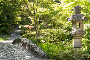 Seattle Japanese GardenAs always, there was a line out the door, but it moved pretty quickly, and Herb was able to secure us a table on the outside patio before we got our food.
Tommy and I very much enjoyed our Seafood Bisque and Dungeness Crab Roll sandwich Combo, while Herb grumbled a bit about his Alder Smoked Salmon sandwich having more bread than salmon. Andrew seemed pretty happy though with the Salmon Sandwich and a Southwest Chicken and Corn Chowder.
After lunch we strolled through the market and actually did see fish vendors tossing a salmon back and forth, as seen on TV. Then we went back through the infamous Post Alley to see the Gum Wall, where previously chewed gum of all shapes and colors covers the entire length of an alley, from street level to 6 feet above. There really is a fine line between litter and art, but I would have to go with art for this one, because it really is quite beautiful in its own way.
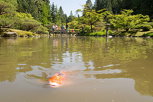 Seattle Japanese Garden KoiWe had time for one more stop before dropping Andrew off at the airport, so we drove over to the Seattle Japanese Garden, which is part of the larger Washington State Arboretum, where we briefly beached our kayaks two days back. We didn’t have much time before having to leave for the airport, so we hesitated for a moment at paying the $24 (for the four of us) admission fee for such a short visit. Feeling somewhat responsible as our tour guide, Tommy generously whipped out his credit card and paid for our entry. “I just don’t want to hear you guys grumbling,” was his official motivation. Whatever, works was fine with us.
The Garden was fairly small, just 3 ½ acres, but very, very lovely. I find Japanese gardens so peaceful and restful, which was probably what we all needed about now. The garden had a cherry orchard, babbling brooks, a teahouse, and my favorite – a beautiful pond filled with flowering lily pads and colorful koi. We noticed that the koi were coming to the surface with their mouths wide open. Herb said that this was a sign that there is not enough oxygen in the water, and they are doing that to get more air. I found it hard to believe that the koi weren’t properly managed in such a beautifully maintained park as this. I think they were just trained to look for handouts from people on the bridge over the pond.
I am so glad we stopped here. If this garden is representative of the rest of the Washington Park Arboretum, we definitely have to spend more time here on our next visit to Seattle.
Our time was up, so we drove down I5 and dropped Andrew off at the Seattle Tacoma Airport. Afterwards Tommy dropped us off at the campground and went back to his apartment to do laundry and get ready for the work week ahead. He came back though. Realizing that his commute to Microsoft was better from Vasa Park than his home, and knowing that Mom and Dad are always good for a free dinner, he returned to spend the night with us. I was happy, because I will take any time I can to spend with him.
The next morning, we said our goodbyes and he headed off to work. Now, once again after an active week with the boys, we were on our own slower paced schedule – or so we thought.
Description
Seattle
The following is in no way an attempt to give a thorough description of what to see and do in and around the city. However, the following sites are what we chose to do during our all too short visit.
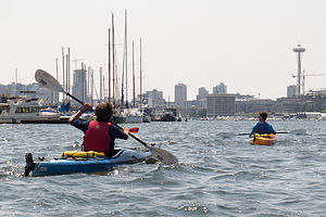 Boys Kayaking in Lake Union with Space NeedleKayaking Lake Union Lake Union is part of the Lake Washington Ship Canal System, which connects Lake Washington with Puget Sound. As far back as 1854, Thomas Mercer predicted that someday canals would join these two bodies of water in a “union of waters” -- hence the name Lake Union. Lake Union’s proximity to scenic views of Seattle makes it a popular recreational spot for power boaters, kayakers, and paddle boarders. Also of interest are the floating homes that line its shores, popularized by the movie Sleepless in Seattle. There are several parks on the shores of the lake, with Gas Works Park being the largest and most popular. There are several kayak rental shops on its shores, including Moss Bay and the NorthWest Outdoor Center.
Little Si is a very popular hiking and rock climbing destination for Seattleites. It is located about a ½ hour east of Seattle, just off Exit 32 of I90 in the town of North Bend. At 1,576 feet, it is smaller than its taller neighbor, 4167-foot Mount Si. Those planning to hike Little Si, especially on the weekends, should arrive early at the trailhead, as the parking lot often fills up early. The 5-mile hike to the summit and back leads through a lovely forest before scrambling over rocks near the top. The views of the Snoqualmie Valley from the summit are phenomenal. Little Si is also well known for its rock climbing and bouldering. The rock climbing area is located about halfway up the hike.
Discovery Park’s 534 acres makes it Seattle’s largest park. It is located in the Magnolia/Queen Anne district of Seattle. The park has a wide variety of terrain, including two miles of protected tidal beaches, active sand dunes, dramatic sea cliffs, meadows and forests, and a lighthouse. The more than 11 miles of trails includes routes along the beach and up and along the bluffs. From atop Magnolia Bluff, the views of Puget Sound and the surrounding Olympic and Cascade mountain ranges are spectacular. Maps and suggested walking/hiking routes are available at the Discovery Park Visitor Center.
Pike Place Market is one of the nation’s largest and oldest public markets. Founded in 1907, it has now become one of Seattle’s most famous and popular attractions, hosting over 10 million visitors each year. Perched atop Pike Hill overlooking Elliot Bay, the nine-acre market district consists of several levels, offering fresh produce, unique foods, handmade arts and crafts, restaurants, the first Starbucks, numerous talented street performers, and even one of the oldest head shops in the country. However, the most popular section is the upper level, pedestrian-friendly covered arcade, with its iconic huge red neon sign and fishmongers tossing salmon to the cheers of the expectant crowd.
The Seattle Japanese Garden is a 3 1/2 acre formal garden, located within the Washington Park Arboretum. It was designed and constructed under the supervision of world-renowned Japanese garden designer Juki Iida in 1960. The garden includes a cherry orchard, babbling brooks, a lake rimmed with Japanese irises and filled with flowering lily pads and colorful koi, and a teahouse. Admission is $6 for adults; $4 for ages 6-18, 65-plus, college students with ID and the disabled.
Columbia River Gorge National Scenic Area
Wednesday, May 28, 2014 - 1:15pm by Lolo166 miles and 3.5 hours from our last stop - 1 night stay
Travelogue
 Multnomah Falls with Benson BridgeAs we drove north on Highway 97 towards Hood River, we encountered our first rain of the trip, hopefully not a sign of what was to come as we crossed over to the wetter, western side of the Cascades.
Our plan was to drive along the Oregon side of the Columbia River Gorge National Scenic Area, stopping along the way to camp and hike. Herb and I had done this drive last year, but it had rained pretty hard for most of it, so we were hoping to get better conditions this year. Also, the boys had never been through the Gorge, and it is pretty unique, both climatically and geologically.
Both sides of the river, which serves as the border between Washington and Oregon, have been designated as the Columbia River Gorge National Scenic Area. Highways on both sides trace the river with many scenic stops along the way. Last year we started near Portland and drove east, driving along the Oregon side for the first half and the Washington half the second. This year we were pretty much going to stick to the Oregon side the whole way, with one little crossover back and forth to Beacon Rock.
The Gorge itself is only about 80 miles long, but during those 80 miles it transitions from a temperate rainforest in the west, with an average of 100 inches of precipitation per year, to dry grasslands, where the annual precipitation is less than 15 inches. This drastic change in climate is caused by the Cascade Mountains, which the Gorge passes through. Clouds drop their moisture on the western side of the range, leaving the eastern slopes drier and sunnier.
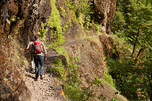 Hiking the Eagle Creek Trail carved into the CliffThe dramatic beauty of its colorful basalt cliffs, cascading waterfalls, and snow-covered volcanic peaks makes for a very scenic drive.
Our first stop was the town of Hood River, famous for its very intense winds. The Cascade Mountains have extreme pressure differentials on either side, which creates a wind tunnel effect and steady winds of over 35 mph. The consistency and strength of these winds makes it an extremely popular destination for kiteboarders and windsurfers.
We got a taste of these strong winds first hand when I opened the RV door in the Hood River Visitor Center parking lot and it flew right out of my hand smashing the little plastic latch that normally locks it in place when it is open. Fortunately, Tommy’s car was parked just far enough away from the motorhome to not smash it when his door flew out of his hands as well. They weren’t kidding about this place being windy.
We thought for sure we would see dozens of kiteboarders out on the river taking advantage of this wind, but so far there were none. The girl in the Visitor Center said they were probably waiting for the winds to build up later in the day – wow! they were already pretty scary.
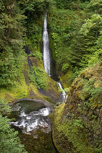 Loowit FallsWe asked for a recommendation for lunch and were directed to the Solstice Wood Fire Café, just across the street from the Hood River,where we had some delicious artisan pizzas.
Still no kiteboarders, so we continued on along I84 West, which traces the river, towards the Cascade Locks Marine Park, where we planned to camp for the night. I chose this campground because it was very close to the Eagle Creek Trailhead, the most popular hike in the Gorge, which we planned to do later that day. Although my calls to the campground went unanswered, I was hoping that they would have a spot for us. I didn’t think it would be too much of a problem as it was mid-week after a very busy holiday weekend.
When we arrived, the Campground Host was not home, so we pulled into the campground and selected a site with a view of the river. We were immediately greeted by Logan, a blond-haired, blue-eyed camper with a colorful shawl draped around his neck. He was extremely friendly, and told us that the hosts were shopping in town and would be back later. He even offered to let us park our extra car in his site, as he didn’t have one. Logan was a very new age, spiritual kind of guy who seemed very high on life, and other things as well. He told us that this was his lucky day, because he had left his iPad charging in the bathroom and it was stolen. I think we were looking fairly perplexed as to how this theft of an iPad could result in a lucky day, when he cheerfully added that it had been returned to him after he had spent time meditating in his tent and communing with his Native American ancestors. I was about to comment that I had never seen a blond haired, blue eyed Native American, when I thought better of it, and we excused ourselves to go on a hike. I think, if given the chance, he would have talked to us all day.
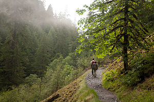 Hiking Eagle Creek TrailAfter depositing our campground fee in the self-registration box, we left Logan and headed to the Eagle Creek Trailhead, a short distance away.
The full Eagle Creek hike is a 12-mile out and back to Tunnel Falls. However, since it was already late afternoon, we made it a goal to get as far as High Bridge, making it a 6.4 mile hike. Besides, the description of the entire hike said that we would pass dozens of waterfalls, bubbling streams, and tall basalt cliffs all in the first two miles.
Although we cut the entire hike a little short, we definitely did get a flavor for the beauty of the lush temperate forests and spectacular waterfalls that characterize the Pacific Northwest.
For the first mile or so, the trail took us high above the creek before bringing us deep into a lush old-growth forest. In about a mile and a half, we took a short spur trail for a view of 100-foot Metlako Falls, the tallest along Eagle Creek. Back on the main trail, we walked about another half mile before coming to another spur trail, which led us to Punchbowl Falls, appropriately named for the punchbowl-shaped pool that it cascades into.
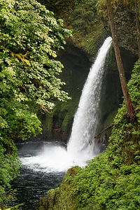 Metlako FallsWe continued on crossing several side creeks, some by hopping on rocks and other by footbridge, before eventually arriving at another impressive waterfall, Loowit Falls, on the opposite side of the creek.
Although most of the hike is relatively flat, with only a 480 feet elevation gain, there are some narrow sections where there are steep drop-offs, especially the approach to High Bridge, where the path is carved into a steep cliffside. Also, the trail is rocky and can be quite slippery when it is wet, which is not uncommon considering this is the Pacific Northwest. However, I didn’t find the trail intimidating at all, and I am not exactly a hero when it comes to heights. Also, in the more precarious sections, you can hold onto cable lines that have been built into the walls.
Then there it was, our goal, the aptly named High Bridge, which dramatically spans a very narrow channel 120 feet high above the creek. We each took our obligatory walk across the bridge, before returning from whence we came. It was a very worthwhile hike indeed.
True to my tendency to, as Herb says, try to stuff 10 pounds into a 5 pound bag, I originally had a second shorter hike planned for the day, but even I recognized how ridiculous that would be, so we returned to the campsite to relax for the remainder of the evening.
The next morning we hopped in Tommy’s car and drove across the Bridge of the Gods to the Washington side of the Gorge and over to the Beacon Rock Trailhead – just 8 miles from our campsite.
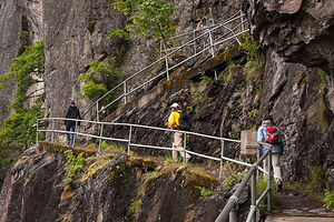 Beacon Rock Hike SwitchbacksI had been intrigued by Beacon Rock when researching things to do on this trip. Besides having what looked like a really cool hike to the top, it had a very interesting history as well, both geologically and culturally.
Geologically, Beacon Rock is an 848-foot high basalt monolith that was once the core of an ancient volcano about 60,000 years ago.
The Native American called it “Che-Che-op-tin,” which means “navel of the world” – pretty astute considering it was once the belly of a volcano. Lewis and Clark saw it on their journey west and named it Beaten Rock before later changing it to its current name of Beacon Rock.
When the white man came along, they figured they had to own it. It was first purchased by a pioneer in 1850 and it exchanged hands several times before Henry Biddle, editor of the Lewis and Clark Journals, bought it for $1 in 1915 for the purpose of preserving it and building a trail to its summit. Just in time too, because the U.S. Army Corps of Engineers were already removing parts of this rock to use as material to build a jetty at the mouth of the Columbia River. In fact, they had already dug three caves on its south side.
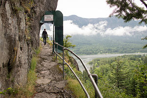 Beacon Rock HikeBiddle was intrigued by the idea of building a trail to the summit in what he thought was “perhaps the most difficult location in which a trail had ever been built.” The trail took three years to build.
I must say, he did a great job and it was a lot of fun. The trail is a little less than a mile long, yet it has 51 switchbacks that zizzag to the top. It’s very well-constructed, with boardwalk bridges and plenty of handrails to hold onto. From the top, we enjoyed expansive views of the gorge and its cliffs, as well as Mt. Hood and Mt. Adams.
One last interesting historical fact. When Biddle tried to gift the rock to the state of Washington to make it into a state park, they refused it and only accepted it when Oregon offered to take it. So, today it is part of the Washington State Park system.
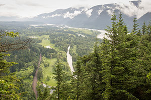 View from Beacon RockAfter the hike, we returned to the campground to pick up the RV and continue west along I84 to our next stop—Multnomah Falls, the tallest falls and most visited attraction in Oregon. There is a large parking lot just off I84 at Exit 31 that can accommodate RVs. We were a little disconcerted by all the signage warning of frequent thefts and the need to not leave valuables in your vehicle. There was even a warning sign next to the Visitor Center that was literally chained down, as if crime was so bad that even the sign would be stolen if not chained down. I don’t understand how or why theft is such a problem here.
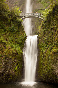
All this talk of theft made us kind of want to cut our visit short, so instead of taking the short paved footpath up to the Benson Bridge as I would normally have liked to do, we just walked to the lower falls viewpoint and took photos of the bridge with the falls in the background.
I must say though that the lovely, two-tiered falls are very impressive and well worth the stop.
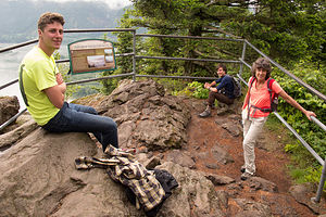 Lolo and Boys at Beacon Rock SummitI did take time to read a plaque which told of an interesting incident which occurred on the Bridge in the 1990s. As a wedding party was posing for photos, a 400-ton boulder broke off the face of the waterfall and fell 225 feet into the upper cascade pool causing a 70 foot wave of water to wash over the bridge. Fortunately, no one was severely hurt. I hope the photographer got a picture of that scene, but if not, I am sure they will never forget it.
We briefly stopped in the historic Multnomah Falls Lodge, long enough for me to see that there was a very warm and cozy dining room that would be a nice place to have lunch or dinner on a future visit.
Originally, I wanted to make one more stop at the historic Vista House, but since it is located on the non-RV friendly, twisty Historic Columbia River Highway, it would have required us to take a car and leave the RV behind in the parking lot with all the theft warnings. Neither Herb nor I were comfortable with that, so we decided to forge on to Seattle.
Description
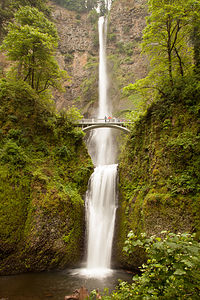 Multnomah FallsThe Columbia River Gorge National Scenic Area encompasses 292,500 acres, running from the mouth of the Deschutes River (east of The Dalles) to the mouth of the Sandy River (near Troutdale, Oregon), spanning southern Washington and northern Oregon.
In those 80 miles, the Gorge transitions from a temperate rainforest in the west, with an average of 100 inches of precipitation per year, to dry grasslands, where the annual precipitation is less than 15 inches. This drastic change in climate is caused by the Cascade Mountains, which the Gorge passes through. Clouds drop their moisture on the western side of the range, leaving the eastern slopes drier and sunnier.
The Cascade Mountains are also responsible for the extreme atmospheric pressure differentials on either side, which create a wind tunnel effect in the gorge, resulting in winds in excess of 35 mph. This makes the Gorge an extremely popular destination for kiteboarders and windsurfers, especially in the Hood River area.
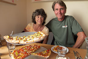 Herb and Lolo at Solstice Wood Fire CaféGeologically, the Columbia River is older than the dramatic gorge which rises above it. Towards the end of the last Ice Age, about 12,000 years ago, huge glacial ice dams, in what is now Montana, burst and sent floodwaters, as high as 1,200 feet, rushing down the Columbia River. Rock and ice carried by the rushing waters carved out the sides of the once gently sloping valley, leaving behind the steep-walled, mile-wide gorge we see today.
The dramatic beauty of its colorful basalt cliffs, diaphanous waterfalls, and the snow-covered volcanic peaks of Mt. Hood and Mt. Adams flanking its shores makes the Columbia River Gorge a popular year-round destination for outdoor enthusiasts who come to hike, mountain bike, rock climb, and windsurf in this truly unique area.
Today, the Columbia River serves as the border between Washington and Oregon. Highways in both states trace the river, with many scenic stops along the way. The following is a brief list of highlights along the way (from west to east):
Washington side (Highway 14):
- Cape Horn Viewpoint – panorama of the Gorge from atop the basalt cliffs rising hundreds of feet above the river
- Beacon Rock – 848-foot high basalt monolith, which is the core of an ancient volcano. There is a steep, zigzagging 1-mile trail to the summit (with handrails) with expansive views of the gorge and its cliffs, as well as Mt. Hood and Mt. Adams.
- Bonneville Hot Springs Resort
- Stevenson – old lumbering town that now has a two-hour cruise on a 600-foot stern-wheeler.
- Home Valley Park – great spot for fishermen, windsurfers, and picnickers. From here there is a great view of the Guardians of the Gorge, Wind Mountain in Washington and Shellrock Mountain in Oregon.
- Roadside Park – you have now left the lush, forested section of the gorge and entered the dry grasslands of the eastern side of the Cascades. There are excellent views of the gorge from this park.
- The Dalles Lock and Dam – another hydroelectric plant along the gorge. Visitors can take a shuttle to the powerhouse, fish ladders, and petroglyphs that were moved here for display. Scanning the sky for bald eagles is also popular along the shoreline of Lake Celilo, a 24-mile reservoir formed by the dam.
- Maryhill Museum of Art - small, very eclectic art museum situated atop a remote bluff overlooking the Columbia River Gorge in the town of Maryhill, Washington
- Maryhill Stonehenge - full-size replica of Stonehenge in England, built in 1918 as a memorial to the soldiers of Klickitat County, Washington, who had died in World War I.
Oregon side (I84 and Historic Columbia River Highway):
Both I84 and the Historic Columbia River Highway trace the Oregon side of the river. Although I84 is the fastest road, the Historic Highway is much more scenic. However, it is not recommended for RVs or trailers.
The first three stops can only be reached via the Historic Highway.
- Portland Women’s Forum State Scenic Viewpoint
- Vista House – stands 733 feet above the river on Crown Point, the Vista House is one of the most photographed spots in the Gorge. The views of the Gorge and the Cascade Mountains are phenomenal.
- From Crown Point, the historic highway drops back down into the Gorge past several picturesque and easily accessible waterfalls: Latourell Falls, Shepherd’s Dell Falls, Bridal Veil Falls, Mist Falls, and Wahkeena Falls
- Multnomah Falls – 621-foot high Multnomah Falls is the tallest falls in Oregon and the most visited natural attraction in the state. The ribbon-like upper falls drops 542 feet into a deep pool before flowing another 69-feet in its lower tier. A short, paved footpath leads up to Benson Bridge, which spans 25 feet above the lower tier.
- Bonneville Lock and Dam - nation’s largest hydroelectric plant, where there was a visitor center with exhibits on the history of the dam. Fish ladders and an underwater fish viewing window allows visitors close-up glimpses of migrating salmon swimming upriver to spawn.
- Bonneville Fish Hatchery - The hatchery raises 8 million Fall Chinook, 1.2 million Coho, 200 thousand Summer Steelhead, and 60 thousand Winter Steelhead. However, it's most famous resident is Herman, the 70-year-old, 10-foot long, 450 pound sturgeon.
- Eagle Creek Trail – this relatively flat hike, which leads through a lush rain forest, past dozens of spectacular waterfalls and basalt cliffs, is one of the most popular in the Columbia River Gorge
- Bridge of the Gods – connects Washington and Oregon
- Cascade Locks – this stop is a bit of a misnomer today. This section of the river was once a raging torrent that required boaters to portage around. In 1896, the Cascade Locks were built to allow steamships to pass safely. With the construction of the Bonneville Lock and Dam, the cascades were flooded and the locks became superfluous.
- Rooster Rock State Park – the most prominent feature of the park is a basalt column that forms a natural obelisk. Lewis and Clark camped near this rock in 1805, and named it “Cock Rock” because of its phallic shape. The name was later changed to the more politically correct “Rooster Rock.” The park also has long sandy beach for swimming.
- Hood River – once a lumber town, Hood River is now known for its fruit orchards and as a mecca for windsurfers and kiteboarders, who come to take advantage of this natural wind tunnel
- Columbia Gorge Discovery Center in The Dalles – serves as the eastern gateway to the Columbia Gorge. The museum as exhibits on the geology and history of the Gorge.
Bend
Friday, May 23, 2014 - 11:00am by Lolo220 miles and 5 hours from our last stop - 5 night stay
Travelogue
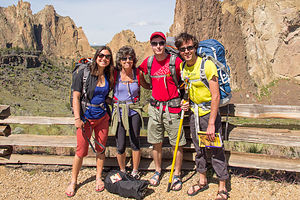 Happy Smith Rock ClimbersEvery once in a while you find a place that you know you’ll be coming back to time and time again. Bend, Oregon is one of them. In fact, it is the type of place I could very much picture living in. It’s pretty much got it all – great climate, awesome scenery, world class hiking, biking, fishing, skiing, and rock climbing, and the ever-popular Deschutes Brewery. What more could one ask for?
Also, it was a good meet-up spot for our visits to the boys, as it was kind of half-way between San Francisco and Seattle – about an 8 hour drive from SF and 6 from Seattle. Last year when we moved the boys out West, Herb and I spent a really fun weekend here with Tommy and vowed to come back again and hopefully get a chance to have Andrew join us. I knew he too would absolutely love this place.
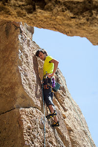 Andrew on LeadAs has become the norm now that we are scattered around the country, logistics of getting together are always a bit of a challenge, but I think we had a decent plan. Herb and I, of course, would drive the motorhome to the Crown Villa RV Resort in Bend on Friday, where the boys and Celeste would arrive later that night. Andrew and Celeste would fly from San Francisco to Portland (which was actually quite a bit north of Bend), and Tommy would drive down from Seattle after work, scoop them up at the airport, and continue on to Bend where they would arrive around 2:00 in the morning. That kind of plan works well only when you are in your 20s.
Before their arrival, Herb and I spent the day relaxing at campground, resting up for what we knew would be a very physically active weekend.
It’s hard to use the word “campground” when describing this place, as it really is more of a “resort,” a kind of RV land for the rich and famous, with million dollar RVs parked on pads constructed of decorative, paver bricks, professionally landscaped patios, a guest lounge, a spa and fitness center, a tennis court, and more.
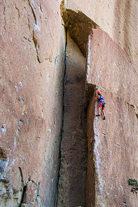 Celeste approaching Crossover to the AreteWhile most campgrounds categorize their sites in terms of full, partial, or no hookup, here you are assigned to either a Platinum, Gold, or Silver section. Last year we had stayed in Platinum, where a newspaper was delivered to our campsite each morning. However, this year we had worked our way down to Gold, where we had to suffer the indignity of getting our own newspaper from the office each morning. Perhaps this was the result of us during our previous stay being the only ones with rock climbing gear spread out on the fancy pavers. Our goal, this year would be to hold onto our Gold status and not find ourselves in Silver next year.
I was very excited about the boys’ arrival. We had seen Andrew briefly in San Francisco when we arrived on the West Coast, but we hadn't seen Tommy since New Years. This get together was very long overdue, so there was no way I was going to go to sleep before their arrival.
Fortunately, we had something to entertain us and keep us up. This evening was the Camelopardalids meteor shower, where the Earth would pass through a cloud of dust left behind in the 1800s by a comet named 209P/LINEAR. As many as 200 meteors per hour were predicted.
Herb and I got out the beach chairs, poured a glass of wine, and craned our necks up to the sky to view the show. I even called the boys to keep an eye out for shooting stars on their drive from Portland to Bend. Needless to say, the meteor show was a bit of a dud, and we saw absolutely nothing. It wasn't just us though. News reports the next day said that in actuality there were only about 10 an hour. I would have been happy with just one. It did keep us occupied though and before we knew it, the kids were here. We were so very, very happy to see them.
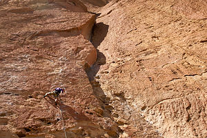 Tommy on LeadWith their late arrival, I figured we would be sleeping in the next morning, but I guess when you have only a limited amount of vacation time, you want to make the most of every minute of it. They were up by 8:00, sandwiches were efficiently manufactured for the day, and we were off to a day of rock climbing at Smith Rock State Park, about 29 miles north of Bend.
More and more, our family vacations are becoming oriented around rock climbing. Herb had started rock climbing at “The Gunks” in New Paltz, New York over 30 years ago, and now the boys, and Celeste, had caught the bug as well. It really can become quite addictive.
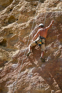 “Old Man Herb” still climbing at 58I think I was the only non-addict. Although I had climbed a bit in my day, it was never something that I had become totally comfortable with, nor very good at. However, if I didn't want to be relegated to a mere spectator on family vacations, I was going to have to get with the program. Plus, the boys had given me a climbing helmet for Mother’s Day and Herb had given me a cute, purple chalk bag for Valentine’s Day—it’s not easy being the only woman in the family. I think they were less than subtly hinting that I step up my game. So, for the past year or so, I had started going to an indoor climbing gym with Herb and was really starting to enjoy it and make some progress.
Despite my gains, I was nowhere close to ever being able to climb anything the rest of them could. Every climb has a difficulty rating, from 5.4 (being the easiest) all the way up to 5.14 (which looks absolutely impossible to get up). They were more in the 5.10 to 5.11 range, while I would be lucky if I could do a 5.7. Fortunately, Smith Rock had a bit of everything, often right next to each other.
Smith Rock is a very unique place. The rock formations in the park are spectacular – multi-colored, jagged ridges of basalt, formed from volcanic activity millions of years ago, when lava flows entered this canyon and cooled. Winding between these basalt peaks is the lovely Crooked River, which twists and turns its way for miles through the park. It’s not just a great place to rock climb, but also a great place to hike or run.
Since it was Memorial Day weekend, the park was extremely crowded. However, since most people were parking along the road approaching the park because it was free, we were easily able to find parking in the lot past the $5 fee station.
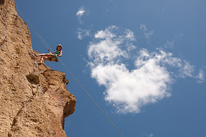 Lolo on Descent in the CloudsAfter parking the car, we took the trail down to the river, crossed a bridge, and then followed the River Trail along the banks of the Crooked River. It was breathtakingly beautiful that it was hard not to stop every few minutes to take pictures. We knew right away that this would be the site of our 2014 Family Christmas photo, but we had plenty of days to work on that. Right now, we were all anxious to find a climb that was not already taken.
One thing to understand about rock climbing is that there are two basic types: “traditional” and “sport.” For years at “The Gunks, Herb had done traditional (or “trad”) climbing. What Tommy and Andrew prefer to do is “sport” climbing. What that means is that rather than the traditional way of putting protection pieces in the rock as you climb to prevent you from falling, the bolts and protection are already permanently fixed to the rock. It’s a bit safer and quicker to set up a climb, which is a very good thing as far as I am concerned. Smith Rock is known around the world as a sport climber’s mecca, with over 1,000 bolted climbing routes.
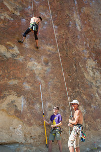 Tommy pinching Andrew's butt with "Hot Dog"Plus, to make things even safer, this year we had “Hot Dog,” which, for some unknown reason, was the name of Andrew’s clip stick. For those that don’t know (and I was in that category a mere month ago), a clip stick is a pole with a clamp on the end that allows you to clip the climbing rope into the first bolt on the route. This is pretty important for safety, as until that first bolt is clipped into, the climber could hit the ground if he falls. You can buy a clip stick in a climbing store – or even on Amazon – but they are pretty easy to make yourself, and that way you can personalize them with stupid names, such as “Hot Dog.” Needless to say, “Hot Dog” was multifunctional and often used to pinch an unsuspecting butt, particularly that of one’s brother.
While I won’t go into a detailed description of each climb that was done that day – that has been anal-retentively documented in an Excel spreadsheet by Andrew – I will give a brief overview of the day’s events. However, to do so, I admit that I am peeking at the spreadsheet that I just made fun of.
They (and by they, I mean everybody but me) did several 5.10 climbs (one 5.10a, two 5.10b, and one 5.10c), each of them taking a turn leading. Herb cruised through his first “lead” in 20 years on a 5.10c climb called, “No Golf Shoes.” I tried a 5.9, rather unsuccessfully, and was informed by Tommy that I should try harder next time. Just to show him, I successfully completed my first outdoor climb in many, many years. It was a 5.7 called “Dancer,” probably because of the graceful, dance-like moves that most climbers display on this climb. I, however, did not display anything resembling grace on my ascent. Despite that, I was quite proud of myself, and I think the rest of them were as well.
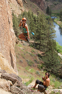 Celeste with a Stylish DescentTowards the end of the day, it was very hot, and we began overhearing other climbers discussing what we all were thinking about – a cold refreshing beer at one of Bend’s 19 craft breweries. If you like craft beers, Bend is the place to be. It even has an Ale Trail featuring 14 breweries along the way. If you get your Bend Ale Trail passport stamped at 10 of them, you get a prize – a silicon drinking glass called a silipint. If you visit all 14, you get a Bend Ale Trail bottle opener as well. I love the advice (probably suggested by an attorney) they give on their website: “It's probably not wise to attempt the entire Bend Ale Trail in one day.”
I kind of thought it would be a neat thing to do, since we had 4 days here and 5 people to drink the requisite beers, but we never did get around to doing it. Perhaps next time, because I looked on the Internet and those silipints are really cool.
That evening we went to the Deschutes Brewery Pub, where we had a very good dinner and some very tasty beers. Last year when we were here, Tommy, who also functions as my personal beer consultant, introduced me to the Deschutes Freshly Squeezed IPA, and it was love at first taste. It is still my favorite beer of all time. Apparently, it is a lot of people’s favorite, because when I ordered it, I was informed that they were all out. Instead, I did as the others did and ordered a sampler of 6 individually selected beers, which wasn't such a bad consolation.
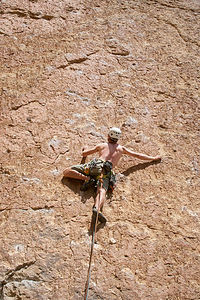 Tommy on a Crimpy LeadThe next morning, we chose to go on a hike rather than climb, because it is difficult to climb consecutive days without a rest in between. I had bought a book of 100 hikes in the Central Cascades, but unfortunately most of the really spectacular ones are inaccessible until July because of lingering snow cover. Instead, we chose another Central Oregon classic, a 5.4-mile hike along the Metolius River from the West Metolius River Trailhead, about 9 miles northwest of the town of Sisters, to the Wizard Fish Hatchery and back. It was a lovely, easy hike, perfect for a rest day from climbing. It traced the shores of the Metolius River past gushing springs and wildflowers.
The Fish Hatchery was pretty cool with several pools holding various age Atlantic salmon, brook trout, cutthroat trout, kokanee, and rainbow trout. For 25 cents, we bought a handful of fish food. At first we threw in one pellet at a time, but soon found that it was much more fun to see the chaos caused by a whole handful at one time.
When driving back to Bend, we stopped for a picnic lunch at the Three Sisters viewpoint where there is a wonderful view of the Cascade Peaks, including Mt. Bachelor, the Three Sisters, Broken Top, and Mt. Jefferson.
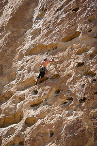 Andrew Leading “Five Gallon Buckets”Afterwards, we drove to the summit of Pilot Butte, a volcanic cinder cone located right in the city of Bend. I think it is one of only four places in the U.S. where you can find a cinder cone located within the boundaries of a city. The scenery from atop the 500-foot summit was spectacular with views of Bend, the Cascades, Newberry Crater and many snow-capped volcanoes. You can also hike or run up to the top, which is what we probably should have done, but we had other things on our agenda, one of which was to walk around the Old Mill District of Bend.
Instead of lumber mills, which once were a major part of the town’s economy, this area along the Deschutes River is now full of up-scale shops, galleries, and restaurants. Its history as a lumber town is still visible, primarily in the three large smokestacks that rise above what is now an REI store. In fact, we could see these smokestacks from the top of Pilot Butte. REI was having a big Memorial Day sale, so we spent some time and money shopping in what is one of my favorite stores.
Afterwards, we stopped for ice coffees, and then strolled along the riverfront and across the bridge to McKay Park, where there is a grassy swimming beach. It was still pretty early in the season, and the water was a bit too cold to entice us. There were, however, several paddle boarders and kayakers out on the river. One of these days, I want to experience the Deschutes River the way it is supposed to be experienced – floating in a tube, kayak or raft, with a cooler of cold beers.
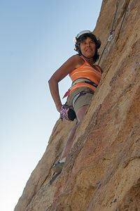 Lolo demonstrating correct use of the Chalk BagWe still had one more event planned for the day. I had gotten this really good book about Bend, called Bend, Overall, and discovered that there was an indoor hot soaking pool right in the Old St. Francis School in town. The pictures in the book intrigued me – it looked like an ancient Roman bath. So, after a delicious Penne Vodka dinner in the motorhome, by chef Andrew, I convinced the family that we should really try this place out. They became more motivated when I told them that you could purchase drinks in plastic cups from one of the three bars in the establishment and sip them while soaking in the pool.
It’s truly a unique place – an old Catholic school converted into a commercial establishment with a hotel, several bars, a brewery, a movie theater, and a hot soaking pool.
We got there as early as we could, because there is a limit to how many they will allow in the pool at any one time. At only $5 per person, I was thinking that this could be a very popular place. Fortunately, there was room for the five of us. We were given towels and a locker key, and had to leave our driver’s licenses at the desk. Also, during the evenings you have to be at least 21 years of age, so the IDs also served as proof for the kids.
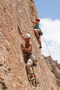 Herb and Celeste ClimbingThe pool had plenty of people in it, but was not overly crowded, and the water was hot, but not so hot as to be uncomfortable. The artwork was interesting. Turquoise tilework covered the walls with subdued light streaming in through the luminous stained glass windows. There was a large mural depicting St. Francis and others harvesting grapes.
Several people in the pool were sipping from plastic cups, so we sent the boys on a mission to purchase beers. They wrapped towels around their waists and headed out. After more than a half hour had passed and they still hadn’t returned, we started to wonder what had become of them. Finally, they returned, beers in hand, quite amused by the process they had to go through. Since they were relatively young looking, the bar wouldn’t serve them without an ID. Since their IDs were being held by the front desk, they had to go there and retrieve them before returning to the bar. When they were waiting for their drinks at the bar, they began to notice that people were staring at them – perhaps it was because they were bare-chested with nothing but a towel wrapped around their waist. Finally, five beers in hand, they had to make their way back to the front desk to once again leave their IDs, and then wind their way back through the hallways to the pool. It seemed like a pretty inefficient system to me. They probably could have made a lot of money providing pool-side service.
The next day was another Smith Rock climbing day. Herb is usually the first to awake, but this time he said that when he peeked out the window to check the weather, there was Celeste on the table outside already diligently making the sandwiches for the day. She is such a delight to have along, and not just because of her wonderful sandwich making.
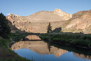 Crooked RiverThis time we started our climbing on the Rope de Dope Block, a 40-foot high solitary rock across the river from the main climbing area. It had a nice variety of climbs, ranging from 5.5 to 5.10c – a little something for everyone, even me. It kind of felt a little bit like a climbing gym wall.
The four of them got to do a few really nice 5.10a and 5.10b climbs, once again taking turns leading. They really are getting good at this.
Not wanting to leave me out, Andrew and Tommy went up the backside of the block and set up a top rope for me on a 5.7 climb called “How Low Can You Go” – not exactly the most flattering of names. I had been watching several people, who were a lot better climbers than me, have some trouble with the beginning part of the climb, so. I didn’t have much hope for success. I asked the boys if I could start on the easier climb to the left, which I think was rated 5.5, but they weren’t pleased with my defeatist attitude and told me to at least give the 5.7 a try. It was very slabby with only these tiny little protrusions to grab onto, but amazingly I got through it. I was so, so glad that they pushed me into trying. There is definitely some serious role reversal going on in this family.
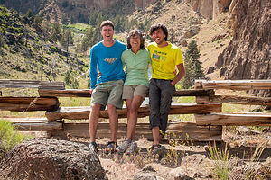 Lolo with Boys post Climbing at Smith RocksAfterwards, we moved back across the river to the main climbing area to a wall called the Zebra Area. The rock along this wall was really bizarre looking, with huge pockmarks, known as huecos – some of them big enough to almost crawl into. I am not sure, but I think they were caused by volcanic bubbles. One particular 5.8 climb here called “Five Gallon Buckets” is by far the most popular climb in the park. As is almost always the case, someone was already on it, and more people were waiting in line to go next.
Herb, Tommy, Andrew, and Celeste each did a 5.10c, and then started playing around on a 5.9 next to “Five Gallon Buckets,” which had the same type of huecos. I tried it too, and it was really fun until I ran out of buckets and it started to get crimpy. We really wanted to try “Five Gallon Buckets,” since it is such a Smith Rock classic, but there was still a lineup of people at its base. We figured we would try to hit it first thing tomorrow morning. Also, since it would be the Tuesday after Memorial Day, hopefully the Park would be much less crowded.
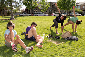 McKay Park Riverfront YogaSatisfied with another great day of climbing, we headed back up the steep hill to the parking lot. It’s hard to keep moving here, not just because of the steepness of the trail, but because of the temptation to stop every few minutes to take pictures of the incredible scenery.
After a little hot tubbing at the campground, we headed into town and rather unoriginally went back to the Deschutes Brewery for dinner and samplers. Hey, when you find a good thing, why change it.
The next day, Tuesday, was our last day in Bend. Celeste had to fly back to San Francisco on Wednesday to go to work, while the boys, who had taken the entire week off, would be traveling with us up to Seattle. Although we normally alternate climbing and rest days, we decided to make an exception this time, because it was our last chance at Smith Rock.
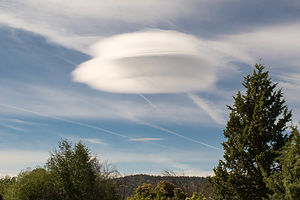 Lenticular Cloud over BendAs planned, we went directly to the Zebra Area and were the first ones to get on “Five Gallon Buckets.” It was really, really fun, but actually a bit harder than I thought. Just because the buckets were big didn’t necessarily mean that they had good holds where I wanted them. Herb climbed on the route next to me wearing a Go Pro on his helmet to film me climbing this classic. I just watched it again last night, and it is a pretty entertaining video.
They all did a few more 5.9s and 5.10s, and I struggled through another 5.7, before we had to leave to drop Celeste at the Bend Redmond airport. We were all very sorry to see her go. She had really done some amazing climbing, including some very challenging leads. She also makes really delicious sandwiches.
That night we just had Mac and Cheese and hot dogs back at the campground and did tons of laundry. I was so impressed with the Crown Villa laundry room. They had a computerized system where you used a credit card to select washers and dryers. No more having to carry around those cumbersome rolls of quarters -- just another great amenity at this very lovely and well-run campground.
Description
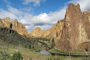 Smith Rock Park Morning LightBend is the largest city in Oregon east of the Cascades. It is located in the high desert, along the banks of the Deschutes River on the eastern edge of the Cascade Range. A major reason for Bend’s popularity, both as a place to live and as a tourist destination, is its sunny skies. With an annual average of 158 clear days, 105 mostly sunny, and the remaining still with some sunshine, it is the sunniest city in the state.
Bend is also an outdoor enthusiast’s mecca and there is so much to do in all four seasons: skiing the powdered slopes of Mt. Bachelor, kayaking or rafting the mighty Deschutes River, hiking the Three Sisters, golfing at one of its many fine courses, fly fishing the lakes and streams, mountain biking the miles of backcountry trails, and on and on.
For the less active, or for those after an exhausting day of outdoor activity, there is the lively downtown area with its many fine restaurants and shops.
About 25 miles north of Bend is Smith Rock State Park, whose jagged peaks of basalt attract rock climbers from around the world. Considered to be the birthplace of American sport climbing, it has over 1,000 bolted climbing routes. Its stunning location in the Crooked River Gorge also makes it an ideal place for hiking or mountain biking along its many miles of trails
Lake Siskiyou Camp Resort
Wednesday, May 21, 2014 - 11:00am by Lolo25 miles and 0.5 hours from our last stop - 2 night stay
Travelogue
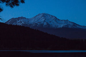 Starlight over Mount ShastaWe didn’t make much progress driving north this day, intentionally going just a mere 25 miles north of Castle Crags to the Lake Siskiyou Camping Resort, another find from our Moon West Coast RV Camping book. It took us a lot longer than it should have, as there was an accident on I5, which kept traffic stopped for over an hour.
When we saw how pretty the lake was, we decided to stay 2 nights, so that we would have a full day tomorrow to just relax before meeting up with the boys for a very physically active weekend in Bend. Also, Herb was anxious to find a place to try out our old Avon inflatable raft and Johnson motor, which hadn’t seen action in – we couldn’t believe it when we figured it out – 9 years. The last time we could remember using it was in Lake Powell in 2005.
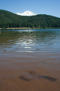 Hatchery Trout with Mount ShastaOur uses of the raft have always been trip highlights, so we never wanted to leave it behind. The raft is stored in a bag at the end of the bed on top of the cab, and the motor is attached to the ladder on the back of the motorhome, often eliciting inane questions, such as, “Can your motorhome go in water too?” as if it were some kind of magic school bus.
Herb gave the motor starting a less than 50% chance, even though he had put gas stabilizer in it. He’s always a bit of a pessimist though. After all, he didn’t think the motorhome would start up either after 5 months of non-use, but it started up like a charm. My bet was on the Johnson. Also, the motor was mine. Before we married, Herb had bought the raft and I bought the motor. For a while that was the closest I could get to a commitment from him. It made it much harder for him to break up with me.
Now where was I? Oh yes, Lake Siskiyou.
The campground was quite nice – good-sized sites set in a lovely shaded forest. While not actually on the lake, it was just a short drive (or bike ride) to either the boat launch or the swimming beach.
Rather than wait for the morning, we got the raft out of its bag and inflated it to make sure that it didn’t have any leaks. So far, so good. However, the real test would come tomorrow when we mounted our little Johnson 6 h.p. motor on the back and tried to start it after 9 years of neglect.
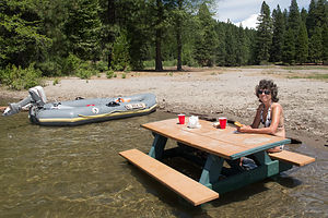 Lolo lunching on submerged Picnic TableLater that evening, when the sun began to set – our favorite time for photographing – we headed down to the campground beach to take photos of Mount Shasta reflected in the lake. There’s certainly nothing like the sight of a massive, volcanic mountain looming over you to make you feel insignificant, which is probably a good thing once in a while.
The next morning we arose to another beautiful day, which we have come to expect this time of year in Northern California. We loaded the raft on to top of the Subaru and drove down to the boat launch. It was a very serious boat ramp, meant for boats a lot more substantial than ours. There already were plenty of boats out on the lake, but since there is a 10 mph speed limit, it was mostly fisherman either anchored or trolling for trout and small mouth bass.
We unloaded the boat, mounted the motor, attached the gas tank, gave it a few good pumps, and pulled. It started right up, just like the 200 year old Volkswagen in the Woody Allen movie Sleeper. I’m never going to listen to Herb’s lack of faith in our toys again.
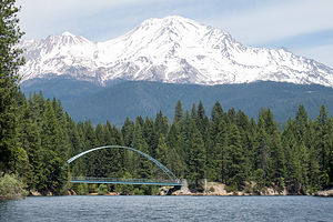 Wagon Creek Bridge with Mount ShastaNow that we had a motorized boat, Herb had to run up to the marina and tackle shop to buy a boat permit. Based on all the fisherman out on the lake, I suggested he pick up a fishing license and bait as well.
While Herb was gone, I waited with the boat down by the lake and watched a Crystal Lake Fish Hatchery truck back down the ramp and proceed to shoot trout out of two pipes on the back of the truck. I asked the fish hatchery guy how many trout he was putting in the lake, and he estimated that there was 2,000 pounds of fish at about 3 or 4 fish to the pound. That was a lot of trout. Herb would have absolutely no excuse for not catching dinner today.
Fortunately, I got my camera out in time to photograph the scene. Some of the trout flopped onto the boat ramp. I wanted to help them find their way to the water, but the fish hatchery guy told me not to worry – they would figure it out. I guess he had seen this before. My favorite photo was of a trout just barely in the water, with the ubiquitous Mount Shasta in the background.
Herb had seen what was going on and knew that the pressure was on. He mumbled some pre-game excuses about newly introduced baby trout having to get acclimated before being interested in eating. We just needed one or two quick learners.
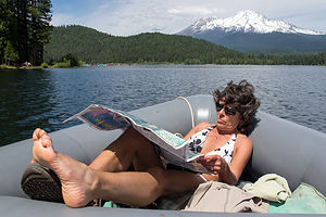 Lolo Navigating the Perimeter of the LakeThe motor worked like a charm and we cruised around the entire perimeter of the lake. We stopped for lunch at a picnic table that was about 10 feet from shore – that’s 10 feet in the lake, not on the beach. I’m not sure how it got there or why, but it was a hot day, so eating lunch at a partially submerged table was just fine with us, and rather unique.
While there were so many picturesque spots on the lake, my favorite was cruising under the pretty Wagon Creek pedestrian bridge with Mount Shasta looming in the background. The bridge had an arch that framed the mountain very nicely. It was quite new – completed in 2010 as part of the Lake Siskiyou Trail, which encircles the lake.
I am sorry to report that despite the tonnage of trout dumped into the lake that morning, my husband came up empty-handed. In all fairness, the surroundings were so beautiful that he was more interested in using his camera than his fishing rod. After all, photos are forever, while fish only last a day.
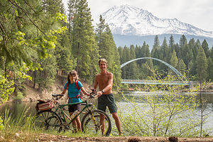 Biking the Lake Siskiyou TrailThat evening we returned to the swimming beach when the light got low to have a glass of wine and take some more pictures. Being so far away from any city, the number of stars you could see was incredible.
The next morning before leaving, we decided to bike the 7-mile Lake Siskiyou Trail, which goes around the entire lake. Normally, I would have run it, but my blisters from the Castle Crags hike were still making it a bit difficult to even walk.Biking was really fun though. It was a nice, dirt-packed trail with great views of the lake and the mountain much of the way. As with our previous day boat trip, the best part was the Wagon Creek Bridge, which this time we got to ride over rather than under. I would have to say though that the picture taking was better from the boat. From what I have heard, although it is illegal, people like jumping off this bridge 25 feet down to the water below. There is a movement to try to legalize it. There is no way I would jump from it myself, but it would be fun to watch and photograph.
Satisfied that we had experienced Lake Siskiyou fully by both land and sea, we packed up and headed towards Bend to meet up with the boys.
Lake Siskiyou is definitely a repeat destination, one that I am sure we will visit again on our treks between San Francisco and Seattle.
Description
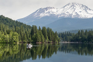 Lake Siskiyou Boat with Mount ShastaThe Lake Siskiyou Camp Resort is located just 3 miles west of Mount Shasta City, on the lovely shores of glacier-fed, 435-acre Lake Siskiyou. With fantastic views of snow-covered Mount Shasta from its shores, it is one of the prettiest reservoirs in Northern California.
Recreational opportunities on the lake include:
• swimming
• trout and smallmouth bass fishing
• low-speed boating (boat ramp and boat rentals available)
• hiking the Lake Siskiyou Trail
The 7-mile dirt Lake Siskiyou Trail, which encircles the lake, is popular with walkers, joggers, and mountain bikers. The views of Mount Shasta along the way are awesome.
There is a large 150-site, very popular campground for RVs of any length, with full and partial hookups. There are 225 additional sites for tents. There is also a marina, boat rentals (canoes, kayaks, pedal boats, motorized boats), free boat launching, a fishing dock and fish-cleaning station, boat slips, and a swimming beach.
Castle Crags State Park
Tuesday, May 20, 2014 - 7:15am by Lolo310 miles and 6 hours from our last stop - 1 night stay
Travelogue
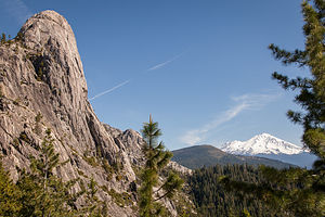 Castle Dome and Mount ShastaWe left the Petaluma KOA Tuesday morning and started driving north towards Bend, where we would meet up with the boys and Celeste on Friday night. That gave us 4 days in between to explore whatever I5 and its surrounds had to offer. Some ideas I had were the Mount Shasta area and Grants Pass, where we could raft the Rogue River.
As we were driving up I5, I started reading out loud the section of the guide book on the Mount Shasta area to see what we might want to do. As I read these words, “Castle Crags State Park is named for the awesome granite spires that tower 6,000 feet above the park. Beyond to the north is giant Mount Shasta (14,179 feet), making for a spectacular natural setting,” we knew exactly where we wanted to go. Fortunately, it was mid-week, because the park only has three RV camping sites. A quick call confirmed that we would have no problem getting one for the night.
The State Park is really close to I5. In fact, the spires are quite visible from the highway. I think Herb would have been quite upset with me if we first learned about them when speeding by them.
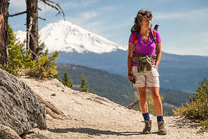 Lolo on Crags Trail and Mount ShastaAfter settling into our pull-thru site, we detached the Subaru and drove up the steep, windy road at the end of the campground to Vista Point. From the parking lot at the top of the road, we walked the ¼-mile trail to the viewpoint, where we looked out over the picturesque spires of Castle Crags and snow-covered Mount Shasta. As spectacular as the view was, we knew it would only improve with the low light of sunset, so we decided to come back later with a bottle of wine, cheese and crackers, and tripod and camera.
Since we had a few hours to kill, I went for a run on the River Trail which runs alongside the Upper Sacramento River. It was a very cool run, first passing under I5, then through a tunnel under the railroad tracks (as a very noisy train was passing by overhead), and then across the river on a pedestrian suspension bridge. From there, I ran along a dirt trail that traced the river for about 1.5 miles, before turning around and retracing my steps. It was a very peaceful and satisfying run, especially after a day of sitting in the motorhome.
After a shower and a quick dinner, Herb and I drove back up to Vista Point with cooler and camera gear, where we had a very lovely evening sipping wine and gazing out at the truly incredible scenery.
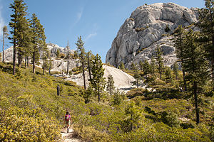 Lolo Approaching the Base of Castle DomeThe guidebooks had warned that this park can be quite noisy due to its proximity to I5 and the railroad tracks, but it didn’t bother us at all. Perhaps it would have been more of an issue if we were camping in a tent rather than a motorhome. I did hear an occasional train pass by, but for some reason I always find that peaceful and romantic, so it didn’t bother me in the least.
The next morning we set out to do the classic hike in the park, the 5.7-mile (RT) hike to the base of Castle Dome. Castle Dome is quite distinguishable in that it is much more rounded and less “craggy” than the other spires, and it looks a bit like a smaller version of Half Dome in Yosemite.
The hike was quite steep and it wasn’t long before I felt a slight burning sensation on the back of my right heel. Herb has always warned me to stop immediately when something like this occurs to avoid getting a bad blister, so we stopped and applied some moleskin.
I can understand why this hike is a classic. For the first mile and a half or so, the trail passes through a lovely forest before emerging into the open for some incredible views of the ubiquitous Mount Shasta and the Crags. From here on, the hike got a bit more strenuous as we eventually ascended up to and through the pinnacles themselves.
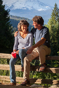 Herb & Lolo at Vista Point ViewpointFor the last 1/2-mile or so, I had begun to feel my left heel and my (I am embarrassed to say) left bunion burning. Stupidly, I ignored the Herb rule of immediately stopping and figured I would just deal with it at the top. Big mistake!
For the last mile of the trip the views just kept getting better and better, and we stopped often to take photos. Mountain ranges, such as the Rockies are truly spectacular, but nothing can compare to the awe-inspiring sight of a singular, massive volcanic mountain dominating the landscape.
When we stopped at the base of Castle Dome to have lunch, I took off my hiking boots for a peek. Oops – too late. I already had some serious looking blisters starting. We applied moleskin, but I am afraid the cow was already out of the barn.
If my foot wasn’t so bad, I would have loved to hike a bit more amongst the pinnacles, but I figured we already had far enough to go just to get down to the car—and as most hikers know, downhill is in many ways just as hard, or even more so, than uphill. By the time I got back to the car, I knew I wouldn’t be doing much hiking for the next few days. I just wanted it to get better by the time we met the boys on Friday, so that I wouldn’t have to stay behind while they all did fun stuff.
We had worked it out with the park ranger that we could have a late checkout, so rather than stay another night, we headed out mid-afternoon to drive just 25 miles further north to the Lake Siskiyou Camp Resort, where we would have more terrific views of Mount Shasta, this time from the shores of a lake.
Description
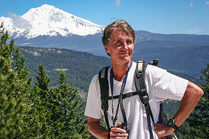 Herb with Mount ShastaCastle Crags State Park is located in the town of Castella, just off I5, about 45 miles north of Redding, California. The park is named for its soaring granite spires that tower 6,000 feet above the park. Like nearby Mt. Shasta, these spires were formed by volcanic activity more than 200 million years ago. During the past million years or so, the eroding forces of wind, rain, and ice have shaped the granite into its current distinctive shapes. Standing out amongst the spiky peaks, is one rounded one, known as Castle Dome – often compared to Yosemite’s Half Dome.
Recreational opportunities within its 4,350 acres include:
• 28 miles of hiking trails
• Fishing and swimming in the Sacramento River
• Rock climbing the crags
• Gazing at Mt. Shasta from Vista Point
Most visitors to the park make the short, twisty drive to Vista Point (no RVs or trailers allowed), and walk the ¼-mile trail to a spectacular view of three distinct volcanic features: Castle Crags, Mount Shasta and Grey Rocks.
The most popular hike in the park is the 5.7 mile (RT) steep hike to the base of Castle Dome. The first 2/3 of the hike leads through thick forest before emerging and winding through the lower crags. The final third of this strenuous hike ascends through granite pinnacles with incredible views of Mount Shasta, Grey Rocks, and Castle Dome.
There is a 76-site, mostly tent-only campground, with 3 sites for RVs up to 27 feet (no hook-ups).
San Francisco North / Petaluma KOA
Friday, May 16, 2014 - 3:30pm by uberHerb55 miles and 1.5 hours from our last stop - 4 night stay
Travelogue
 Tiburon Bikers before final climb to finishWell, we were finally back, after a much longer absence than we had intended. Winter in New Jersey had been particularly miserable this year, but we hung around because my 93-year-old Mom with Alzheimer’s was, in Hospice’s words, “nearing the end.” In fact, I was pretty much informed that March would be “her month.” However, true to form, my mom had her own plan, and no one was going to tell her when her time was up. So, after watching her stabilize in March and April, and becoming quite convinced that she would live to 100, we finally made plans to head back to the West Coast to visit the boys. We hadn’t seen them since Christmas, and 5 months was a bit too long for my taste.
Also, leaving the motorhome and Subaru sitting in storage for 5 months probably wasn’t a good thing. Herb was pretty convinced that there was absolutely no way either vehicle would start when we got there—even though we had detached the battery cables—so I was bracing myself for the possibility of having to sleep in the motorhome in the storage area until we could buy a new battery the next day. I should know by now that Herb can be a bit of a pessimist. Both vehicles started up on the first try.
Although we had a lot of maintenance planned for the weekend, I was really anxious to get down to San Francisco to see Andrew and Celeste. They were just so tantalizingly close. So, the next morning I managed to convince Herb to put off maintenance for another day so that we could meet up with them for a bike ride in Marin.
 Golden Gate Bridge before Climb out on BikesHowever, since we weren’t meeting them until the afternoon, we decided to go for our 5-mile Petaluma run in the morning, as we had been so sedentary the day before on the plane and shuttles to and from the airport. In retrospect, this run was a big mistake, as we had a very physically active day ahead of us. Being with Andrew and Celeste is a little bit like going to boot camp.
After lunch, we loaded the bikes on the back of the Subaru and headed down US 101 to the southbound Vista Point parking lot, just north of the Golden Gate Bridge to meet up with Andrew and Celeste. To get to the major Vista Point parking lot on the northbound side we would have had to go across the bridge and back. The southbound parking lot wasn’t that big, and since this was a weekend, we had to wait a bit for a parking space, but it didn’t take too long. Andrew and Celeste didn’t need to find parking because they were riding their bikes over the Bridge to meet us. I was so excited when they approached, that I hugged them for what must have been 10 minutes. They looked great and very, very happy.
The plan was to do the 25-mile ride that they often do through Sausalito and out to the Tiburon Peninsula and back. They often add on another 25 miles and go all the way up to Fairfax, but we told them that a 25-mile ride would be just fine for today, especially considering we were on mountain bikes while they were on their spiffy new road bikes.
 Andrew's 25th Birthday CelebrationSince the parking lot was at bridge level, we had to go down some pretty serious hills to get to the waterfront in Sausalito. These downhill sections where you effortlessly fly through space are always exhilarating and fun – yet I can never quite totally enjoy them, because always lurking in the back of my mind is the realization that I will be facing them in the opposite direction on the way back.
Once we got down to the town of Sausalito and onto the Mill Valley / Sausalito bike path, the ride got flat and very scenic. Sausalito is really a lovely town. We pretty much followed the path along the water, which eventually wound its way around the bay and down onto the equally lovely Tiburon Peninsula on the Tiburon Path. Since this was a weekend, there was much activity in Tiburon – I think it was some sort of Wine Festival. We bought some coffee and snacks and sat in the grass near the ferry to San Francisco, just watching the activity.
The way back was pretty much a repeat of the way there, with the exception of a turn which brought us under the eastern side of the Golden Gate Bridge, for a really great perspective. The return to the parking lot up on the hill was a bit tough for me and I fell quite a bit behind. However, I eventually made it and met up with the others in the parking lot.
As I mentioned, Andrew and Celeste are an extremely active couple, so our day was not over yet. The plan all along had been to bike ride and then go into San Francisco to their rock climbing gym – just in case we didn’t get enough of a workout on the bikes. The problem was that it was already 6:30, and we found that the gym closed at 8:00, rather than 10:00 as we thought.
Herb and I began to question the wisdom of racing over to San Francisco to get to the gym with only about a half hour left to climb before closing, but we could see the disappointment in their faces. They really love bringing us to their climbing gym, and genuinely like to encourage me in my efforts to become a rock climber like everyone else in the family.
Andrew and Celeste had no desire to ride their bikes back across the bridge at this point, and it would just have taken them too long, so we took the back wheels off their bikes and stuffed them into the trunk of the Subaru. We got to the gym by 7:15, where the very persuasive and determined Celeste talked the guy at the desk into letting me and Herb climb for free, as there was only a short time left.
It was great. I thought I would be too tired, but climbing required an entirely different set of muscles than biking. By 8:00, I think that every muscle in my body had probably been worked to exhaustion. It was a nice exhaustion though.
Some Thai food at King of Thai Noodle near their apartment in the Inner Richmond hit the spot. By the time Herb and I got back to the campground, we were full, content, exhausted, and aching in that nice way you feel after a very satisfying, active day. Needless to say, we slept very well that night.
The next two days were pretty much spent as if we were home back in New Jersey – food shopping, taking the car to the car wash, waxing the motorhome, doing some well needed repairs and improvements on the rig, etc.
However, we did manage to squeeze in one more bit of fun. On our last night before heading north to Bend, we drove down to San Francisco with Hilda (Celeste’s mom) to celebrate Andrew’s 25th birthday. We joined him and some friends at a classic San Francisco pizza place called Georgio’s on Clement Street – another great dining spot in walking distance to their apartment. The pizzas were terrific and the company was fun. I can’t believe I have a 25 year old son.
Description
The Petaluma KOA is an award winning camping resort located within an hour’s drive of San Francisco, Napa and Sonoma Valley Wineries, giant redwoods, and Sonoma County and California Coastal Beaches. It is considered to be the RV resort in the San Francisco Bay area.
On its 70 acres, there are 312 spacious RV sites, 32 camping cabins, and 10 Wine Country lodges.
Other amenities include:
• Guided tours of San Francisco (from May through October)
• Huge heated pool and spa
• Inflatable waterslide
• Rock climbing wall
• Huge playground
• Petting zoo
• Karaoke
• Hayrides and live weekend entertainment
The campground is open all year.

