- Home
- About
- Map
- Trips
- Bringing Boat West
- Migration West
- Solo Motorcycle Ride
- Final Family XC Trip
- Colorado Rockies
- Graduates' XC Trip
- Yosemite & Nevada
- Colorado & Utah
- Best of Utah
- Southern Loop
- Pacific Northwest
- Northern Loop
- Los Angeles to NYC
- East Coast Trips
- 1 Week in Quebec
- Southeast Coast
- NH Backpacking
- Martha's Vineyard
- Canadian Maritimes
- Ocracoke Island
- Edisto Island
- First Landing '02
- Hunting Island '02
- Stowe in Winter
- Hunting Island '01
- Lake Placid
- Chesapeake
- Provincetown
- Hunting Island '00
- Acadia in Winter
- Boston Suburbs
- Niagara Falls
- First Landing '99
- Cape Hatteras
- West Coast Trips
- Maui
- Mojave 4WD Course
- Colorado River Rafting
- Bishop & Death Valley
- Kauai
- Yosemite Fall
- Utah Off-Road
- Lost Coast
- Yosemite Valley
- Arizona and New Mexico
- Pescadero & Capitola
- Bishop & Death Valley
- San Diego, Anza Borrego, Joshua Tree
- Carmel
- Death Valley in Fall
- Yosemite in the Fall
- Pacific Northwest
- Utah Off-Roading
- Southern CA Deserts
- Yosemite & Covid
- Lake Powell Covid
- Eastern Sierra & Covid
- Bishop & Death Valley
- Central & SE Oregon
- Mojave Road
- Eastern Sierra
- Trinity Alps
- Tuolumne Meadows
- Lake Powell Boating
- Eastern Sierra
- Yosemite Winter
- Hawaii
- 4WD Eastern Sierra
- 4WD Death Valley +
- Southern CA Deserts
- Christmas in Tahoe
- Yosemite & Pinnacles
- Totality
- Yosemite & Sierra
- Yosemite Christmas
- Yosemite, San Diego
- Yosemite & North CA
- Seattle to Sierra
- Southwest Deserts
- Yosemite & Sierra
- Pacific Northwest
- Yosemite & South CA
- Pacific Northwest
- Northern California
- Southern Alaska
- Vancouver Island
- International Trips
- Index
- Tips
- Books
- Photos/Videos
- Search
- Contact
Walmart Supercenter in Chino, California
Monday, November 30, 2015 - 2:15pm by Lolo344 miles and 7 hours from our last stop - 1 night stay
Travelogue
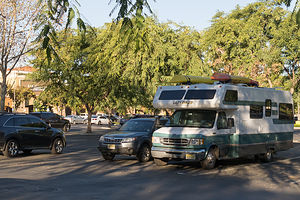 Walmart in ChinoOn long driving days, I hate having to pay for a campsite just to sleep, and since Walmart Supercenters and Flying J Truck Stops allow RVs to park overnight, they are a good choice to just bed down for the night.
Herb wanted to stop at the Lazy Daze factory in Montclair on the way down to San Diego to pick up a new vent cover to stop a leak, so we wanted to position ourselves somewhere near, so we could stop there first thing in the morning.
The Walmart Supercenter in Chino was perfect - 10 minutes from Lazy Daze and in a very nice, safe neighborhood.
Description
Many Walmart Supercenters allow RVs to park in their parking lots over night since they are open 24 hours. It is a good idea, however, to call ahead and speak to a manager to confirm.
Yosemite National Park
Tuesday, November 24, 2015 - 2:00pm by Lolo245 miles and 5 hours from our last stop - 6 night stay
Travelogue
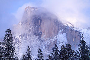 Veiled Half DomeThanksgiving in Yosemite was definitely becoming somewhat of a family tradition. It began in 2013 when the boys moved West, and we wanted to save them the trouble and expense of flying home for Thanksgiving.
We had had so much fun in 2013 that that we returned in 2014, upping our game to Thanksgiving dinner in the elegant and quite-expensive Ahwahnee Dining Room.
Now that Herb and I were living on the West Coast, we decided to drive our home on wheels back to Yosemite for our third annual Gaidus Thanksgiving. You can never have too much Yosemite, so the boys were more than happy with the plan.
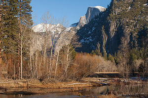 Last Day in YosemiteBeing a veteran of the stress of reserving a Yosemite campsite, I made sure I nabbed an Upper Pines site as soon as the November booking window became available. Upper Pines is the only campground open all year round, so although there are less people visiting the park in November, there are also less campsites. I booked it for the Tuesday before Thanksgiving through Sunday night, which would give me and Herb a little extra time on either end of the boys stay with us.
I also made Thanksgiving dinner reservations well in advance. We decided to return to the Yosemite Lodge Mountain Room, where we had eaten in 2013. The Ahwahnee was so awesome, but quite extravagant, so we decided that we would alternate years between the two venues.
Herb and I drove out on Tuesday and tucked ourselves into our campsite just in time before the snow began to fall. Hopefully, it would stop before the boys joined us tomorrow evening.
Valley Loop Photography, Boys Arrival, and Ice Skating
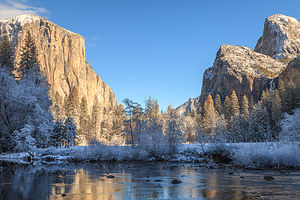 El Cap in ProfileThe next morning we looked out the window and saw that about 3 inches of snow had fallen. Already there were kids – some still in their pajamas – running around the campground, throwing snowballs, building snowman, and just plain old having fun. It was a winter wonderland – our first time seeing Yosemite under a blanket of snow!!
We decided to spend the day driving the Valley Loop, stopping to take photos along the way. Fortunately, we had an all-wheel drive Subaru Forester, because the roads were snow-covered and quite slippery. Although we have driven around this valley dozens of times, with the snow, it was like seeing it for the very first time.
Our first stop was the beautiful Ahwahnee Hotel, which never ceases to awe me. We walked through the lobby and out the back door into the yard where there were dozens of boisterous families, dressed in colorful hats and scarves, making snow angels and building snowmen. It was like we had stumbled into a Currier and Ives Christmas card. Usually I take my time easing into the holiday spirit, but this festive scene thrust me there in one fell swoop.
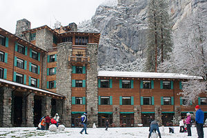 Ahwahnee Fun in the SnowHerb had to drag me away to continue our tour. Since the roads around the Valley are one way, we started off along Northside Drive, stopping first to walk to and photograph Lower Yosemite Falls. This walk is always crowded, in that it requires very little effort for an awesome view from the base of the 2,425-feet Yosemite Falls, the highest waterfall in North America. It is actually three waterfalls in one, with an upper, middle and lower section.
Continuing west, we passed Yosemite Lodge where we would be having Thanksgiving dinner tomorrow and then Camp 4, which the most renowned climbers in the world have used as their base camp for the last 50 years. Not many were camping there now, probably because of the snow.
By El Capitan Bridge, you can either turn left, to circle back east through the Valley, or continue on out towards the Park Exit. We continued on, stopping first at El Capitan Meadow, where there is a terrific view of this amazing 3,000-foot high granite monolith, the largest single piece of exposed granite in the world. . During certain times of the year you can see tiny little climbers clinging to its granite face – however, none today, as far as we could see.
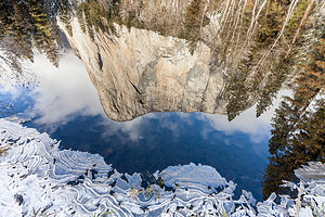 Rock and IceWe continued on to one of our favorite viewpoints at Valley View, where El Capitan, on the left, and Cathedral Rocks, on the right, frame a magnificent valley view.
From there, rather than exiting the park, we turned left, parked in the Bridalveil Falls parking lot, and took the short hike up to see the 620-foot falls, which flows down from a hanging valley. It was still snowing, and the trail was very slippery, so we pretty much had the trail to ourselves, which was quite nice.
Continuing east on the Southside Drive, we stopped at Sentinel Beach for Herb to take his classic shot of El Capitan reflected in the river – except this time with a snow-covered foreground.
Our last stop before heading back to await the boys’ arrival was Swinging Bridge, another picnic area and beach. As we walked across the bridge into a lovely meadow, I looked down instead of up for a change and noticed a lone snowman in the meadow, his only companion being a small gray fox stalking its prey in the snow. There is beauty to be found at every scale in this incredible Valley.
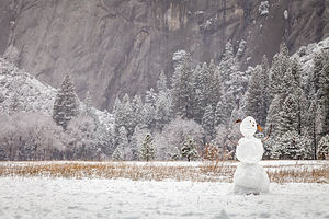 Lonely Snowman in the MeadowCompleting our loop, we returned to the motorhome and began preparing dinner so that it would be ready when the boys arrived. That way we could get to Curry Village in time to ice skate that evening.
I love the fact that these Yosemite Thanksgivings have brought ice skating back into my life after a 10 year hiatus. Plus, I admit that I love surprising the boys with some level of physical competency. I was actually pretty good in my day, and can still skate backwards while doing crossovers and even spin around a little. They were shocked the first time they saw me do this.
So, now it has become expected that I will be the crazy lady spinning around out in the middle of the ice. We weren’t there 10 minutes before I went into one of my spins, which Andrew said was quite impressive, or at least, that is, until I flew on my back and hit my head on the ice. Fortunately, I didn’t hit it too hard, but hard enough to make me think twice about doing that again.
Why the heck don’t people wear helmets while ice skating? It’s a really hard surface to hit. Or maybe the more relevant question is why do ladies pushing 60, who think they are Peggy Fleming, not wear helmets while skating?
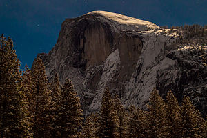 Moonlit Half DomeNot quite ready to get back on the horse again so soon, I contented myself with gliding counterclockwise around the rink with everyone else, making sure I kept both skates firmly on the ground.
I give Herb credit for being a good sport about the skating, as he definitely wanted to be photographing the full moon rising over Half Dome instead. He did leave the session a little earlier than the rest of us to set up his tripod in the parking lot, but the moon had already risen too high in the sky to capture it in the same frame as Half Dome. Still, the moon's indirect presence was very much felt.
When we finished skating, Herb volunteered to drive us back to the motorhome and then come back out by himself to photograph, but we told him that “we were in this together” -- our family mantra for good times and bad.
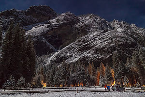 Curry Village by Moon LightWe moved our operation out to the road, and set up the two tripods we had. It was truly magical. The moon and the stars were illuminating the Valley, and it was so eerily quiet and still, in the way that only happens after a snowfall.
The boys, who were taking turns with one of the tripods, noticed that Herb was aiming his camera not at Half Dome, but back towards the lights of Curry Village. When we got back to the motorhome and looked at the photos we had taken, we saw that they each had taken the identical awesome photo of Glacier Point Apron with the lights of the Curry Village skating rink in the foreground. What a coincidence! Herb cried “copyright infringement” when Andrew posted his version on Facebook first, almost immediately getting 100 Likes for his incredible photo. In the world of Social Media, he who posts first wins.
What a great first day in the Valley it had been, and to think we had four more!
Valley Loop Photo Tour again, Cross Country Skiing in El Cap Meadow, Thanksgiving Dinner in Mountain Room, and the Ahwahnee Great Lounge
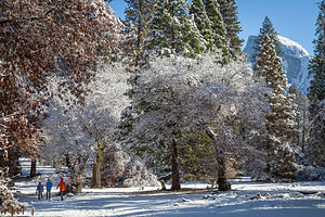 Over the River and thru the Woods...Thanksgiving dinner wasn’t until 4:00, so we had plenty of time to explore before then. This was the first time the boys had seen the Valley covered in snow as well, so we pretty much did a repeat of yesterday’s photo tour, adding a few extras in as well.
Our hope was to find a place to cross country ski along the way, so we had to take two cars to fit the four of us plus all the ski equipment.
We parked at Yosemite Lodge, and walked to the Swan Slab climbing wall, where we had climbed so many times before and probably would again later this weekend. From there, we took the slippery, snow-covered trail to Lower Yosemite Falls and got our first and only family shot of the trip.
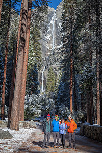 Family with Yosemite FallsBack in the car, we continued west along Northside Drive, stopping next at El Cap Meadow where there were a few snow-covered walking trails crisscrossing the meadow. Looked like as good a place as any to try out our XC skis – at least the boys and I thought so. Herb was a bit more skeptical. Besides he was like a kid in a candy shop with all the photo opportunities of a snow-covered Valley to tempt him. That’s when we decided to split up for now and meet up further along the Valley Loop.
The conditions were not ideal, and we did have to scramble over the occasional log or two, but the views of El Cap were awesome and playing with the boys in the snow is always a blast. After about 2 miles of looping around the meadow, we packed the skis back in the car and headed off in search of Herb.
He mentioned wanting to go to the Wawona Tunnel Viewpoint, where there is an incredible view of El Capitan, Half Dome, and Yosemite Valley in between, so we went there, but no Herb. There was, however, the usual bus tour crowd of about 100 people jockeying for position to take a selfie with this iconic backdrop.
We continued back into the Valley along the Southside Drive where we eventually caught up with Herb at Sentinel Beach, once again taking his favorite reflection shot of El Cap in the Merced River.
It had been a pretty full day already, and we hadn’t even gotten to the main event – Thanksgiving Dinner in the Mountain Room at Yosemite Lodge. Although not as elegant as the Ahwahnee, the dining room is very cozy and warm and has wonderful views out its floor-to-ceiling windows.
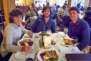 Thanksgiving DinnerThey seated us at our table at 4:00 on the dot, and within 5 minutes there was bread and water on the table and the waiter took our order. Before another 5 minutes passed, our soup and salad had arrived. Now, normally I like quick service, but this was Thanksgiving and I was beginning to feel like I was on an assembly line with courses passing in front of me before I could finish the last. It wasn’t like this when we dined here two Thanksgivings ago. They must be trying to make the seatings shorter so they could push more people through.
What a difference from the calm elegance of the Ahwahnee dining experience. We would seriously have to consider switching back next year. It was definitely worth the extra dollars to be able to linger over what is supposed to be the most celebrated meal of the year. By 4:45 we were out of there and the next group was being seated.
To regain our serenity, after dinner we went for a walk by the Ahwahnee Meadow and then settled into the Ahwahnee Great Lounge with our kindles and a deck of cards. Although the Great Lounge is huge, there are so many nooks and crannies and side rooms that we were able to find our own private cozy spot on the second floor looking down over the lounge. What could be better than sharing this magical place with the people I love most? Then Tommy pulled out a small Bluetooth speaker from his backpack and began softly playing Christmas music while we played hearts. I was so content I never wanted this moment to end.
On the drive back to the campground, Tommy cranked up the volume and we sang Christmas carols the whole way.
Yosemite Falls Hike and Ahwahnee Great Lounge
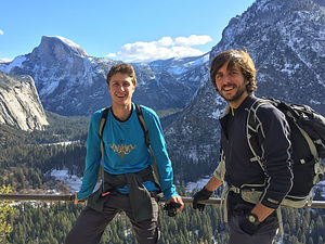 Yosemite Falls TrailUsually during the Thanksgiving holiday weekend we rock climb, but this time it was much colder and the rock was still wet from the snow storm. Hopefully, it would dry out enough for tomorrow.
The snow was already beginning to melt in the Valley, drying out the trails, so we decided that a robust hike to the top of Yosemite Falls would be a great way to spend the day. Herb and I had already done this hike twice – once when we were about 29 years old and then again in 2012. I remember it being one of the most exhausting hikes I have ever done, but also one of the most rewarding.
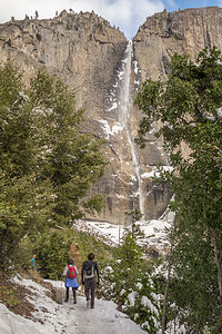 Approaching the FallsJust looking up at the top of the falls, and thinking about getting there on foot from the Valley Floor, is pretty daunting. It’s 3.6 miles each way, and over that distance it climbs over 2,700 feet – that’s over a half a mile of vertical gain.
But, the boys had never done this hike, so I was not about to be the pooper holding us all back. So, I put on a cheery face and a skip in my step, and we set off on the trail, which begins next to Sunnyside Campground (Camp 4), the rock climbers’ campground behind Yosemite Lodge.
This hike doesn’t fool around. In the first half mile, it climbs steeply along a series of over three dozen switchbacks. At least the snow had melted, so the trail wasn’t slippery. By the time we reached one mile, we had already gained 1,000 feet in elevation.
A thousand or two feet really makes a difference in temperature. Soon we were hiking across a few patches of snow and had to stop to put our jackets and gloves on. At about the halfway point, the trail became almost completely covered with snow and a lot slipperier. We stopped to have lunch and to discuss whether we should turn back or press on. I knew the boys really wanted to get to the top, but they were worried about me falling. I suggested that I could turn back while they went on, but they repeated our family vacation refrain, used in both good times and bad, “Oh no, we’re in this together.”
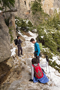 The Trail Gets SlipperyThat’s when Tommy realized he had a pair of Yaktrax in his backpack that would probably fit over my hiking shoes. The little cleats on the bottom keep you from slipping and sliding on the snow and ice. Soon, to the annoyance of the rest of them, I was practically dancing up the trail. These things were great!
The last quarter mile before reaching the top is a series of torturous, seemingly endless switchbacks, even under the best of conditions. Without the Yaktrax I would be lying face down in the snow by now.
Finally, we reached the top, but it wasn’t time to celebrate yet. The Overlook was actually below us, down a short, but intimidating, series of steps cut into the rockface. Thankfully, there was a guard rail to hang onto for dear life. I tried not to look out over the steep drop below. From the overlook we looked down from above at the falls cascading over the edge.
By the time we got back up the steep, slippery steps, it was snowing very hard. It was a winter wonderland. For a brief moment, I was so lost in the sublimity of the scene that I forgot to worry about how I was going to make it back down to the Valley.
I guess it was just going to have to be one slippery step at a time. At least I had the Yaktrax to give me some traction. I don’t know how they did it without them. I made a mental note to get Yaktrax for the entire family for Christmas.
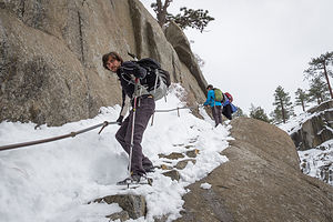 Precarious Descent to the OverlookI was so grateful when we reached dry trail again, and even more so when we got back to Camp 4. For some reason that I will never understand, I was less exhausted this time than when I did this hike in better conditions when I was three years younger. I think the boys’ confidence that I can do challenging things, and the distraction from all the laughter when we are together, make life in general a little easier, and a whole lot more fun.
I did have enough sense, however, to reject their suggestion of ice skating at Curry Village that evening, and persuaded them instead to return to the warmth of the Ahwahnee Great Lounge for more reading and cards, and, of course, the caroling on the way home. I have never been in such high Christmas spirits this early in the season. I hoped I wasn’t going to peak too soon.
Rock Climbing at Swan Slab and Sunnyside Bench and the Ahwahnee Great Lounge
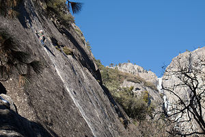 Tommy on Swan SlabToday was Saturday, our last full day together, and the snow had melted enough to make climbing somewhat viable, if not exactly ideal.
Over the last few years, we had gotten much more familiar with climbing areas in the Valley. One of our favorites is Swan Slab, a very popular climbing area on the north (sunny) side of the Valley, between Camp 4 and Yosemite Falls. I personally like it, mainly because it has some climbs at an easy enough grade for me to try, but also because it is a great spectating spot – the approach is short, the base is sunny, and there is even a bench to sit on.
They selected a 5.11b “aid” climb, appropriately named Aid Route, which eventually led to a nice 5.8 crack. An aid climb kind of looks like cheating, but it’s not. Rather, it’s a method of getting past the “unclimbable” (at least for most climbers) parts of a route. It was the method used for the first ascents of El Cap, and is still used in ascending many “big wall” routes today.
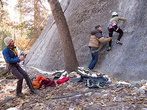 Lolo getting a Little BoostTommy volunteered to lead it. Unlike the elegant moves I usually see him do, this wasn’t pretty. It involved him placing a piece of gear as high as he could, clipping a quickdraw to it, and then hauling himself up on the draw to reach better holds. When that didn’t work, he clipped a full-length sling to the piece, put his foot in the loop of the sling, and then stood up on it. This act was repeated over and over until he reached the point where he could “free” climb. At the top, he set up a top rope, so that Andrew and Herb could climb it without having to place protective gear.
“Okay, you’re up next Mom,” he said after being lowered back down. At first I thought he was kidding, but then I realized that he was dead serious. I didn’t know whether to make a run for it, or be proud that he actually through I could make some upward progress on this wall. I went with pride and began putting on my harness, helmet, and shoes.
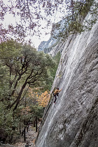 Andrew on Sunnyside Bench WallIt was ridiculous and so tiring. To even get started, Tommy had to make a cup with his hands for me to step up into and reach the first supposed hold. From there, I did a combination of hauling myself up on the rope, whimpering, pulling on quickdraws, begging for mercy to be let down, stepping into slings that tried to swing away from me, sobbing, etc., until I finally reached the 5.8 crack.
By this time, my heart was pounding so hard and my arms were so pumped that I didn’t know how I could go on. Then I looked down at their smiling, proud faces and the small crowd of people that had gathered to watch this spectacle, and decided that I had no choice but to surge on. Working on pure adrenaline, to my utter amazement, I actually completed the rest of the climb.
Herb and Andrew took turns on it as well, and agreed that it was probably my biggest outdoor climbing accomplishment to date. I was ready to retire on the top of my game..
I thought we were done climbing for the day, but I was wrong. We moved our operation to another climbing area called Sunnyside Bench, just a little ways to the right of Lower Yosemite Falls. Our “solo” climbing friend Charlie, who we met last Thanksgiving by Swan Slab, had shown us this area, and in particular, a classic 5.9 climb called Jamcrack.
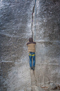 Tommy's First Crack Climb Wearing MittensUnlike Charlie, Andrew used ropes and led the first pitch of the climb, a noteworthy event in that it was his first lead in Yosemite Valley. He set up a top rope so that Herb and Tommy could do this climb, as well as Lazy Bum, the 5.10d next to it.
There was one other first I would like to mention regarding Andrew’s climb. We believe it was the first ascent of Jamcrack accompanied by “Der Bingle” singing Christmas carols. That’s right. Tommy had brought along his Blue Tooth speaker for this very reason. Need I say that Christmas spirits were incredibly high.
Actually, I think there might have been another first. It was getting so cold that Tommy didn’t bother to take off his puffy down parka and mittens to climb. I don’t think anyone has ever documented completing a crack climb while wearing mittens. He looked more like an astronaut about to walk on the moon, than a climber about to ascend a crack.
It was dark by the time we finished and hiked back to the car in the Yosemite Lodge parking lot.
Ahwahnee Brunch and more Valley Photography
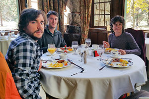 Ahwahnee BrunchIt has become something of a Gaidus Family tradition to wrap up every visit to the Valley with Sunday Brunch in the Ahwahnee Dining Room.
As usual, we requested the “Queen’s Table” in the alcove at the back of the dining room, where Queen Elizabeth sat during one of her visits here. We have made this request probably a half a dozen times over the years, but someone has always beaten us to it. Well, this year we finally nabbed it. Although the Gaidus men always treat me like a queen, this was really special.
The Ahwahnee Dining Room, with its 34-foot-high beamed ceilings, granite pillars, chandeliers, and floor-to-ceiling windows, is the perfect venue for a memorable dining experience and the perfect way to end a wonderful holiday weekend.
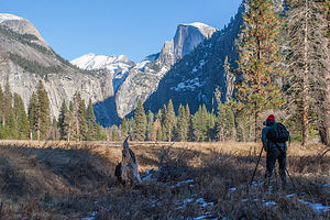 The Young AnselIt was time for the boys to head back to real life in San Francisco. After they left, Herb and I spent the day wandering around the valley, taking more photos, and discussing where to go next.
After years of winter backpacking and ice climbing, somehow Herb has developed a distaste for the cold. So, after his supposed “suffering” in beautiful, snow-covered Yosemite for the past few days, he decided that he should reward himself with a trip down to sunny San Diego.
Sounded good to me!
Description
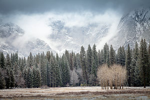 Snowy MeadowYosemite National Park lies near the eastern border of California in the heart of the Sierra Nevada Mountains. Its spectacular waterfalls, soaring granite cliffs, and lush meadows are just a few of the reasons it is considered by many to be nature’s ultimate masterpiece. In the words of John Muir, “it is surely the brightest and the best of all the Lord has built.”
This description will focus on Yosemite Valley, which is the section of the park we visited. Although the Yosemite Valley is just a small portion of Yosemite’s 761,268 acres, it is part receives 95% of its visitors. In fact, an estimated 4.1 million people visit the Valley each year, making it extremely crowded.
Two one-way roads traverse Yosemite Valley: the east-bound Southside Drive and the west-bound Northside Drive, which wind through woodlands and meadows along the base of the 3,000-foot-high granite cliffs. As of today, cars are still allowed to enter and drive through the valley, but visitors are highly encouraged to park their vehicles and use the park’s free shuttle bus, which stops at the major attractions in the valley.
Virtual Tour of Yosemite Valley Highlights
- As you enter the valley, the first sight you’ll see is the 620-foot Bridalveil Falls flowing down from a hanging valley to the valley floor. From the parking area, a short paved path leads to the base of the falls. This is one of the few falls in Yosemite that does not completely dry up in the summer.
- Just past the Bridalveil Fall parking area, the Southside Drive begins to trace the Merced River. Soon El Capitan comes fully into view. This 3,000 foot high granite cliff is the largest single piece of exposed granite in the world and one of the most famous landmarks in Yosemite. If you look closely, you might see small dots that are actually rock climbers along its face.
- Continuing east on the Southside Drive are two riverside picnic areas and beaches: Cathedral Beach and Sentinel Beach.
- Right after the Sentinel Beach parking area is the trailhead for the 4-Mile trail, which ascends more than 3,200 feet from the valley floor to Glacier Point and one of the most spectacular views of the valley.
- A short distance further is Swinging Bridge, another picnic and swimming area. This area is also the westernmost point of the 8-mile bicycle loop that goes through the eastern part of the valley. From this point on, the bike path parallels the road.
- Next stop is the picturesque tiny Yosemite Chapel where many outdoor enthusiasts choose to exchange wedding vows.
- Now you enter the congested and developed portion of the valley.
- Right past the chapel, you can either take a left onto Sentinel Bridge towards Yosemite Village and the park exit, or you can continue straight towards Curry Village, the campgrounds, and Happy Isles Nature Center. For now, let’s stop at Sentinel Bridge for what is probably the most spectacular Half Dome viewpoint in the park. It’s a great spot for a photograph of Half Dome with the Merced River in the foreground.
- Continuing east on the Southside Drive, you pass Housekeeping Camp and Curry Village. Curry Village has lodging, restaurants, bicycle and raft rentals, a grocery store, and other shops. Curry Village is also one of the main parking areas in the valley.
- From Curry Village you can either take Northside Drive across the Ahwahnee Bridge back to Yosemite Village and the park exit, or continue east to the campgrounds. The Happy Isles Nature Center is also this way, but only shuttle buses are allowed on the road to it.
- The Happy Isles Nature Center features exhibits on the natural history of the park. It also serves as the trailhead for some of the best hikes in Yosemite. 1.5 mile trail leads to the top of Vernal Falls and then continues another 1.5 miles to the top of Nevada Falls (two waterfalls that flow even in the summer time). From there you can continue even further into the backcountry of Yosemite, including the cable route up the back of Half Dome.
- From Curry Village, the Northside Drive crosses the Ahwahnee Meadow, a wonderful spot to gaze at Half Dome during sunset, and enters Yosemite Village, the main center of visitor services in the park. Here you’ll find the park’s main Visitor Center, restaurants, lodging, shops, a grocery store, a post office, a medical clinic, the Ansel Adams Gallery, an Indian Cultural Exhibit and more. It’s also a good place to park your car and jump on the shuttle.
- A short dead end road from Yosemite Village leads to the majestic old Ahwahnee Hotel, which has played host to Queen Elizabeth, President John F. Kennedy, and Clint Eastwood, to name a few. This beautiful six-story rock structure offers tremendous views from every room. Within the hotel is the elegant and quite expensive Ahwahnee Dining Room (jackets required for dinner).
- Back on the Northside Drive heading west from Yosemite Village, the next stop is the Yosemite Falls parking area. At 2,425 feet, Yosemite Falls is the highest waterfall in North America. It is actually three waterfalls in one, with an upper, middle and lower section. A short walk from the parking lot along a paved walk leads to the base of Lower Yosemite Falls. This is the most visited landmark in the valley. Except in summer when the fall temporarily dries up, you’ll be sure to be covered in spray.
- A little further west on the Northside Drive is Yosemite Lodge, which marks the end of the developed area of the park going west.
- Right after Yosemite Lodge is Sunnyside Campground/Camp 4, a place where most rock climbers choose to congregate. From this campground begins the popular and strenuous Yosemite Falls hike, which ascends 2,600 feet from the valley floor to the top of the Upper Falls. The views from the top are incredible.
- Continuing west, there is nothing but woods and meadows from which to enjoy the views. Along the road there are several pullouts where you can stop and walk down to the Merced River for a swim. Just after the El Capitan Bridge, you’ll come to the El Capitan Meadow where you’re sure to find people looking through binoculars at the miniscule rock climbers clinging to the granite face.
- Just to the west of El Capitan, Ribbon Falls plunges over 1,600 feet down to the valley floor. It is the seventh highest waterfall in the world. However, it too dries up in the summer time.
- Finally the road nears the end of the Northside Drive at Valley View where El Capitan, on the left, and Cathedral Rocks, on the right, frame a magnificent valley view.
Several guided bus tours are also available. The 2-hour Valley Floor Tour is a great way to get acclimated. Visitors ride through the valley in an open tram while a guide leads a informative discussion of Yosemite’s history and geology. There are many photo stops along the way. In addition, there are bus tours out of the valley to Glacier Point, the Mariposa Grove of sequoia trees, and Tuolumne Meadows.
Although much of Yosemite can be enjoyed from the comforts of your car or a shuttle, the best way to truly experience Yosemite is do get out and experience it more directly..
Things to do in Yosemite
- Hike one of the many trails around the valley, ranging from an easy walk to the base of Lower Yosemite Falls to the strenuous 16-mile round trip hike up the back of Half Dome via cables
- Take an overnight backpacking trip
- Bike along the 12 miles of bicycle paths that loop through the Valley. Rentals are available at Curry Village and Yosemite Lodge.
- Rock climb in one of the premier climbing places in the world
- Raft down the calm waters of the Merced River through the valley. Rentals are available at Curry Village.
- Swim or tube in the Merced River. Besides the designated beaches, there are many pullouts along the road from which you can walk down to the river.
- Join one of the many ranger walks, which are offered daily
- Take a free art class at the Yosemite Art and Education Center
- Photograph the amazing scenery of the valley and surrounding granite cliffs
- Browse the Ansel Adams Gallery and see some of the photographs that first made Yosemite famous
- Relax in the meadow while gazing up at Half Dome or El Capitan
- Dine at the 5-star Ahwahnee Hotel, where presidents and royalty have stayed
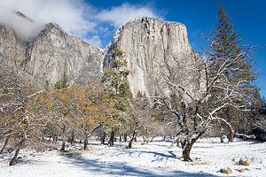 More El CapAlthough many try to see Yosemite in a day, it is best to devote several days to seeing all the park has to offer. Besides the numerous hotels, lodges, and cabins in the Valley, there are three RV campgrounds: Upper Pines (238 sites), Lower Pines (60 sites), and North Pines (81 sites). That’s less than 400 campsites to accommodate all the people that want to camp here.
Since these campgrounds usually fill-up within the first hour they become available, it is essential to make your reservations as soon as possible. Campground reservations are available in blocks of one month at a time, up to five months in advance, on the 15th of each month at 7 am Pacific time. For example, if your arrival date is July 15 through August 14, the first day you can make reservations is March 15. The National Park Reservation System can be found at www.recreation.gov. Good luck!
San Francisco North / Petaluma KOA
Friday, November 13, 2015 - 2:15pm by Lolo150 miles and 3.5 hours from our last stop - 1 night stay
Travelogue
The next morning we drove the remaining 150 miles to the Petaluma KOA, where we had our motorhome stored for the past 2 years. We took it out of storage and prepped it for being our new “home” until we found one that wasn’t on wheels.
Description
The Petaluma KOA is an award winning camping resort located within an hour’s drive of San Francisco, Napa and Sonoma Valley Wineries, giant redwoods, and Sonoma County and California Coastal Beaches. It is considered to be the RV resort in the San Francisco Bay area.
On its 70 acres, there are 312 spacious RV sites, 32 camping cabins, and 10 Wine Country lodges.
Other amenities include:
• Guided tours of San Francisco (from May through October)
• Huge heated pool and spa
• Inflatable waterslide
• Rock climbing wall
• Huge playground
• Petting zoo
• Karaoke
• Hayrides and live weekend entertainment
The campground is open all year.
Utah to California
Thursday, November 12, 2015 - 2:00pm by Lolo523 miles and 8 hours from our last stop - 1 night stay
Travelogue
Less than 700 miles to go – Woo Hoo! Reno was about 430 miles away, so stopping there for the night would put us in striking distance to make the final push the next day.
Also, there is an excellent art museum there that currently had a special exhibit called “Tahoe: A Visual History,” which surveyed historical art of Lake Tahoe and Donner Pass, two areas that we have grown to love in our recent travels.
The exhibit was arranged chronologically and covered over 200 years of the culture and history of the Lake Tahoe area – the Native Americans who first populated this region, the infamous and tragic story of the Donner Party, the laying of the Transcontinental Railroad by Chinese laborers, the logging and mining boom, the shift to tourism and the rise of resorts in the early 20th century, and the impact of climate change on the lake’s ecosystem.
I looked on Priceline for inexpensive hotels to stay in Reno. We stopped in one that advertised a $100 price, but had so many hidden service charges and fees that the total would have been more like $180. I only knew this before being suckered in, because there was a gentleman next to me at the hotel desk screaming about his final bill. We walked out and continued driving west.
After leaving Reno, we drove for another 100 miles before finding a place to stay in Auburn, California. We were almost home – or whatever home might mean these days.
We stayed at a Quality Inn, right next to a very highly rated restaurant called Joe Caribe Caribbean Bistro and Café. It was excellent – in fact, so much so that Herb wrote his first restaurant review on Trip Advisor, raving about their fish tacos. He gave it 5 stars.
Description
Drive from Wendover, Utah to Auburn, California
Wyoming to Utah
Wednesday, November 11, 2015 - 1:45pm by Lolo310 miles and 5 hours from our last stop - 1 night stay
Travelogue
 Momentum Rock Climbing GymYesterday was the long driving day, so that meant that today we could schedule in some fun. We picked out two very different types of activities in Salt Lake City: rock climbing at the indoor Momentum Gym and touring the Mormon Temple Square.
I have rarely made a climbing gym I didn’t like, and Momentum was no exception. The only down side to visiting new gyms is that you have to get belay tested in each one to make sure you know what you’re doing and won’t let your partner fall to the ground. I definitely agree that checking one’s competency is a necessity, but I wish there was some kind of nationally recognized belay certification so that you didn’t have to waste an hour every time you visit a new gym.
When I think of Salt Lake City, I think Mormons, so we couldn’t just pass through without visiting Temple Square.
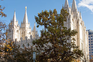 Salt Lake TempleWe started our visit at the South Visitor Center and asked if we could take a tour. They said we could and that it was free, and then had us wait for our tour guides in a sitting area with a video screen full of smiling, wholesome faces of various ethnicities upon which you could click to hear their story about how and why they became a Mormon. I think the goal of the “I’m a Mormon” program was to make people feel more comfortable that Mormons were normal people that lead normal lives, and therefore, you could and should become one too.
After getting through about three stories of Mormon conversions, our two tour guides arrived. They were young women – one from Paris and one from Italy – very courteous and very plainly dressed. They were also very, very passionate about the Church of Latter Day Saints.
They took us first to a model of the Temple in the Visitor Center, which was placed before a window opening out to the real thing. Since non-Mormons are not allowed to enter the Temple, this was about as close as we were going to get. I think the lack of access to the public adds to the belief that non-Mormons, such as us, have that secret cult-like stuff is going on in there. In any case, the architecture of the Temple is absolutely stunning.
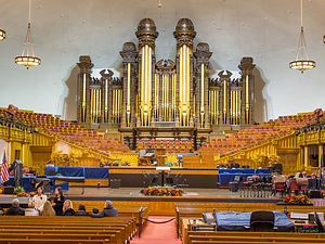 Large Mormon OrganOur guides were, however, able to take us into both the Tabernacle, home of the world-renowned Mormon Tabernacle Choir, and the Chapel, where weekly Sunday services take place.
Rather than stay overnight in Salt Lake City, we continued driving on I80 through Utah. As we did, I continued to play with the “Things to Do Nearby” function on the Trip Advisor app. Up came the “Tree of Utah,” an 87-foot high abstract sculpture of a tree on the edge of I80 on the barren Bonneville Salt Flats. Sounded pretty cool, but traffic was traveling at 70 mph, and there was no place to pullover. I rolled down the window and got my iPhone ready. I actually managed to capture it. It definitely did not look like a real tree, but more like 6 bowling balls protruding from a telephone pole. I have a problem with abstract art.
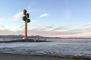 Karl Momen's "Metaphor: The Tree of Utah"To give it the respect it deserved, I googled it and found that the tree is supposed to be a metaphor, and it is also called the “Tree of Life.” It was created by the Swedish artist Karl Momen in 1982. The inscription on the trunk of the tree is Schiller's Ode to Joy, as sung in the choral climax of Beethoven's Ninth Symphony.
We continued on a few miles to the Best Western in the town of Wendover, the last town in Utah before the Nevada border. – in fact, we were so close to Nevada that we could see the lights of the casinos just 100 yards down the road from our motel.
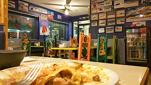 Pancho Special at the Salt Flats CafeWe checked on Trip Advisor for a place to eat (I was getting obsessed with this app), and selected the Salt Flats Café, a Mexican restaurant located in a Sinclair station truck stop back near the entrance to the Bonneville Salt Flats.
The ambience was just what we were looking for – rustic, casual, with photos of Salt Flats racers covering the walls. The colorful chairs with Mexican motifs were really cool as well. Everyone in the place knew each other, which is always a good sign. They only take cash, which was fine, because you didn’t need much of it. Herb and I both ordered the Pancho Special, which featured a chile verde burrito, steak tostada, steak enchilada, rice and beans – all for $6.95. One of them would have been enough for the both of us.
The next morning, before leaving Utah, we drove back out to the Bonneville Salt Flats to photograph this amazing place in the morning light. The salt flats are about 12 miles long and 5 miles wide and are comprised of approximately 90% common table salt. Near the center of the flats, the salt crust is almost 5 feet thick, but it tapers off to about 1 inch along the edges. .
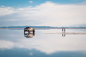 Truck on Bonneville Salt Flats with CoupleBonneville is on the National Register of Historic Landmarks because of its contribution to land speed racing, which has been going on since 1914. It was on the Bonneville Speedway that the 300, 400, 500, and 600 mile-per-hour land speed barriers were broken.
We were surprised to see that there was a shallow layer of water covering much of the flats, since we thought that the West was undergoing a severe drought. Maybe that was just California. In fact, the August racing events had been canceled for two years in a row because of heavy rains swamping the flats. I can imagine that wasn’t very good for the local economy.
Nebraska to Wyoming
Tuesday, November 10, 2015 - 1:45pm by Lolo660 miles and 10 hours from our last stop - 1 night stay
Travelogue
 Lolo with Abe Lincoln's Head on a PedestalWe figured that we had to get some physical activity at least every other day, so since we climbed at Climb Iowa yesterday, this would be our long driving day.
To pass the time, Herb suggested I play with the Trip Advisor app to look for Things to Do “Near Me Now,” which is actually very useful when crossing the country with no particular plan in mind.
That’s how I discovered Happy Jack Road (Wyoming Highway 210), a 40-mile scenic alternative to I80 that connects the towns of Cheyenne and Laramie, Wyoming. After 400 miles of driving, we were about ready for Happy Jack.
It was great. We went from the streaming traffic of 80 to feeling like we were out in the middle of nowhere – just prairie and ranches and rocky plateaus.
Just before we got back to I80, we stopped at a Visitor Center – mainly to find a restroom -- and were surprised to find a giant 13 ½ foot statue of Abraham Lincoln’s head atop a 30-foot granite pedestal, obviously made to be visible from Route 80. It was built to commemorate Lincoln’s 150th birthday.
Why a bust of Lincoln in Wyoming you might ask, as I did? Well, before there ever was an I80, connecting New York City with San Francisco, in the early 1900s the old Lincoln Highway did the job. The statue originally stood alongside the highest point of the old highway, at Sherman Point (8,878 feet above sea level), but was moved to this location in 1969 when I80 was completed.
 Lolo in Happy Jack Road Visitor CenterHappy Jack Road was a good diversion, and we were recharged to forge on. As we continued west through Wyoming, we began hearing forecasts for heavy snow in the higher elevations, which we had now officially entered.
Sure enough, shortly after dark it started to flurry. We needed to find a place to stay soon, but the next major town, Rock Springs, was about an hour away. I consulted the Trip Advisor app to find something highly rated (as we might be snowed in for a day), but reasonably priced. I found an extended stay hotel – hopefully our stay wouldn’t be that extended – called My Place. It even had a small kitchenette. We got there just in time before it started snowing more heavily.
We quickly went out to get takeout Chinese food at nearby Wonderful House, brought it back to eat in our room, and settled in for what we hoped would only be one night. It was kind of cozy. I was getting used to the life of a nomad.
The next morning we awoke to find that the forecasted snowstorm was thankfully a bomb. I reheated the leftover Chinese food for breakfast, and we surged on westward.
Iowa to Nebraska
Monday, November 9, 2015 - 1:30pm by Lolo393 miles and 6.5 hours from our last stop - 1 night stay
Travelogue
 Lolo enjoying Dinner at "The Kitchen"After being humbled by Kitty in the Climb Iowa gym, we continued driving on I80 West, eventually stopping for the night at the New Victorian Inn in York, Nebraska.
Despite the rather less than satisfactory experience with the last restaurant recommendation we received from a motel clerk in Iowa, we asked the girl behind the check-in desk for a good place to get a bite to eat. Without hesitation, she recommended The Kitchen, just a short walk up the road.
Our faith in local recommendations was restored. The Kitchen had a diner like setting, good service, an ample salad bar, and served breakfast all day. It was just what we were looking for.
Description
Drive from Davenport, Iowa to York, Nebraska
Ohio to Iowa
Sunday, November 8, 2015 - 12:45pm by Lolo515 miles and 8 hours from our last stop - 1 night stay
Travelogue
 Entrance to Iowa 80 Truck StopAfter leaving my brother Jim’s house in Ohio, we still had over 2,400 miles to go to reach our new temporary home, our RV, which was stored in Petaluma, California. We had somewhat of a time constraint as well, since we had to beat the moving truck with our entire life’s possessions to our reserved storage unit in Santa Rosa, CA.
However, we needed some way to break up the trip and get some physical exercise along the way. Then it hit me – a tour of rock climbing gyms across the country. I quickly googled Iowa rock climbing gyms and looked for matches not too far from I80. Bingo! – Climb Iowa in Grimes, the largest climbing gym in Iowa, and less than a mile off of 80.
It was too far to get to today (about 670 miles), so we stopped at a Days Inn in Walcott, Iowa, right near Iowa 80, the largest truck stop in America. We would save that treat for tomorrow morning. In the meantime, it was time to get some dinner, so after asking the hotel clerk for a recommendation, we headed over to Gramma’s Kitchen for some Iowa homestyle cooking.
 Herb belaying Kitty at Climb IowaWhat we learned at Gramma’s is that Iowans very much love their gravy, so much so that you can barely find your entrée beneath it. My turkey dinner was covered with a gelatinous brown blob, so salty that I could barely finish it. Meanwhile, at the table next to us, a man was asking for extra gravy for his steak. Our goal now was to get out of Iowa before our arteries clogged.
We couldn’t be so close to the largest truck stop in America and visit, so we stopped in for some Caribou coffee before continuing on 80 West. As one would expect at the largest truck stop, there was a Trucking Museum dedicated to the restoration and preservation of antique trucks and trucking artifacts. Maybe next time, but today I had climbing on my mind.
We arrived at Climb Iowa about 5 minutes before it opened. As we sat in the car, we noticed an elderly gray-haired woman, perhaps in her 70s, anxiously waiting by the door for it to open. Was she going to climb? I’m used to being the old lady in a climbing gym.
 Lolo and Kitty at Climb IowaLet’s just say that Kitty – that was her name; it was even embroidered on her harness – was the real deal. She was awesome, and so was the gym. I take back all my narrow-minded preconceptions that Iowa was such a flat state that it couldn’t possibly produce climbers.
Since that day, I have friended Kitty on Facebook and followed her achievements. She recently ice climbed a silo. That’s right. The people of Iowa have figured out a way to ice the sides of silos so that they can climb them, and Kitty was right there with her ice ax and crampons to show how it’s done. I hope that I will be like Kitty when I am 71. In fact, I wish I was like Kitty now.
New Jersey to Ohio
Friday, November 6, 2015 - 12:45pm by Lolo530 miles and 8 hours from our last stop - 2 night stay
Travelogue
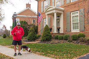 Jim and Charlie the BeaglePulling out of our driveway at the start of a cross country adventure has always filled me with anticipation and excitement about the adventures before us. This time, however, was a bit more emotional. We were leaving our home of 30 years for the final time and migrating West to start a new life. I couldn’t look back. From here on, it was forward – or else I would cry.
A visit with my brother Jim and his family is always a treat, so we made our first diversion off our planned I80 route to dip down to his home in New Albany, Ohio, voted, as he proudly states, the “Best Suburb in America” for two years in a row.
We were greeted enthusiastically by his very exuberant new Beagle pup, “Charlie,” who we had never met, but felt we knew from the dozens of posts my brother has made on Facebook of his new best friend. He was adorable, but not exactly the best watch dog, as he loves everyone he meets.
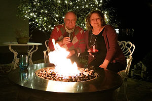 Jim and BevNew Albany is a very walkable community, so later that evening, instead of getting in our car to drive to dinner, we strolled to the center of town and had dinner at the Rusty Busket, a cozy tavern about a quarter mile from his house. What a nice change to be able to walk to restaurants.
After dinner, we spent the rest of the evening sipping wine around my brother’s firepit, catching up and laughing about old times.
The next morning we accompanied Jim on his morning constitutional with Charlie. Walking Charlie was quite a unique experience. He was so interested in sniffing everything along the way that he actually walked sideways, sort of like a crab, while my brother dragged him along. I had never seen anything like it. When we asked Jim if Charlie had been trained at all, he said “No, that would take away his personality.” Ok good. At least he hadn’t been ripped off by a dog trainer.
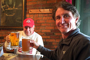 Jim and Herb with 32oz. BeersLater that day, we drove to the historic German Village in Columbus to have lunch at the famous Schmidt’s Sausage Haus. Herb is 100% German and loves a good “wurst,” so I think he was quite excited – or as excited as a German gets.
The place was mobbed, and we had to wait well over an hour to finally get a table. However, as promised by Jim, it was well worth the wait. Following Jim’s advice, Herb had a 32 oz. beer and the “Bahama Mama,” a huge platter of beef and port, hickory-smoked sausage. As if that was decadent enough, we had their famous Jumbo Cream Puffs for dessert. I was pretty sure we wouldn’t need to eat again until we got to the West Coast.
A stroll around the historic German Village helped get the digestion process started, but it had its work cut out for it.
The next morning it was time to say our goodbyes and hit the road – next stop Iowa.
San Francisco North / Petaluma KOA and Flight Home
Tuesday, September 8, 2015 - 11:00am by Lolo196 miles and 4 hours from our last stop - 2 night stay
Travelogue
Not much to report here -- just a full day of cleaning the RV and prepping it for storage once again.
We did manage to squeeze in an afternoon of climbing at Vertex, a gym in Santa Rosa. It is a much smaller gym than Planet Granite in San Francisco, and the climbs are graded much harder. I just had to adjust my mindset to the new gradings. Nothing was really that easy though, so we certainly got a good workout.
Time to go home. As we took the Sonoma County Airport Express to the airport, we wondered if this would be the last time we had to fly home to New Jersey. Hopefully, before we returned to California again, our house would be sold and we would be coming out west permanently.
I guess we will just have to wait and see.
Description
The Petaluma KOA is an award winning camping resort located within an hour’s drive of San Francisco, Napa and Sonoma Valley Wineries, giant redwoods, and Sonoma County and California Coastal Beaches. It is considered to be the RV resort in the San Francisco Bay area.
On its 70 acres, there are 312 spacious RV sites, 32 camping cabins, and 10 Wine Country lodges.
Other amenities include:
• Guided tours of San Francisco (from May through October)
• Huge heated pool and spa
• Inflatable waterslide
• Rock climbing wall
• Huge playground
• Petting zoo
• Karaoke
• Hayrides and live weekend entertainment
The campground is open all year.

