- Home
- About
- Map
- Trips
- Bringing Boat West
- Migration West
- Solo Motorcycle Ride
- Final Family XC Trip
- Colorado Rockies
- Graduates' XC Trip
- Yosemite & Nevada
- Colorado & Utah
- Best of Utah
- Southern Loop
- Pacific Northwest
- Northern Loop
- Los Angeles to NYC
- East Coast Trips
- 1 Week in Quebec
- Southeast Coast
- NH Backpacking
- Martha's Vineyard
- Canadian Maritimes
- Ocracoke Island
- Edisto Island
- First Landing '02
- Hunting Island '02
- Stowe in Winter
- Hunting Island '01
- Lake Placid
- Chesapeake
- Provincetown
- Hunting Island '00
- Acadia in Winter
- Boston Suburbs
- Niagara Falls
- First Landing '99
- Cape Hatteras
- West Coast Trips
- Colorado River Rafting
- Bishop & Death Valley
- Kauai
- Yosemite Fall
- Utah Off-Road
- Lost Coast
- Yosemite Valley
- Arizona and New Mexico
- Pescadero & Capitola
- Bishop & Death Valley
- San Diego, Anza Borrego, Joshua Tree
- Carmel
- Death Valley in Fall
- Yosemite in the Fall
- Pacific Northwest
- Utah Off-Roading
- Southern CA Deserts
- Yosemite & Covid
- Lake Powell Covid
- Eastern Sierra & Covid
- Bishop & Death Valley
- Central & SE Oregon
- Mojave Road
- Eastern Sierra
- Trinity Alps
- Tuolumne Meadows
- Lake Powell Boating
- Eastern Sierra
- Yosemite Winter
- Hawaii
- 4WD Eastern Sierra
- 4WD Death Valley +
- Southern CA Deserts
- Christmas in Tahoe
- Yosemite & Pinnacles
- Totality
- Yosemite & Sierra
- Yosemite Christmas
- Yosemite, San Diego
- Yosemite & North CA
- Seattle to Sierra
- Southwest Deserts
- Yosemite & Sierra
- Pacific Northwest
- Yosemite & South CA
- Pacific Northwest
- Northern California
- Southern Alaska
- Vancouver Island
- International Trips
- Index
- Tips
- Books
- Photos/Videos
- Search
- Contact
Klamath - Riverside RV Park
Monday, September 16, 2013 - 6:45pm by Lolo294 miles and 6 hours from our last stop - 1 night stay
Travelogue
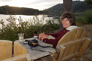 Lolo on Klamath RiverOur next campground reservation was for a two night stay in Sunset Bay State Park along the Oregon Coast, about 10 hours from Petaluma. I had planned it so that we had an extra night in between, so we wouldn’t have to drive the whole way in one day. We toyed with driving the coastal route along Route 1 from Petaluma, but decided instead to make some time on US 101 to Eureka. I felt a little guilty just driving through Redwood National and State Parks without stopping, but we had just been there two months ago on our previous trip out West, so I didn’t feel too bad. Besides, we had a lot of driving to do.
At first I thought Crescent City might be a good stopping point, but then Herb reminded me that the town and the campground we stayed in last year were a bit sketchy, so perhaps it would be a better idea to find someplace new.
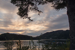 Klamath Riverside RV Park SunsetAs we drove along US 101 into the town of Klamath, about 20 miles south of Crescent City, we noticed several campgrounds right along the Klamath River that looked pretty nice. In fact, there were three right next to each other. We somewhat randomly chose Riverside RV Park, and selected a nice site along the river.
The owners of the campground told us that although the campground was quiet now, it had been hopping the week before during the steelhead salmon run up the river. That would have been exciting to see, but a bit of a Catch 22, because if they were running, we never would have been able to get a campsite . Now that we have a son living in the Pacific Northwest, we really have to learn more about where and when the salmon are running, because it really is a big deal out here.
We spent the remaining daylight enjoying a glass of wine and watching the sunset over the river.
Description
Lovely RV Park located near the mouth of the Klamath River on Highway 101 in Klamath, California.
San Francisco North / Petaluma KOA and Side Trips to San Francisco
Wednesday, September 11, 2013 - 4:00pm by Lolo55 miles and 1.5 hours from our last stop - 5 night stay
Travelogue
 Herb at Baker BeachThis flying stuff was great. After years of spending 5 grueling days crossing the country, it's still hard for us to get used to the novelty of waking up in New Jersey and going out to dinner in San Francisco that night.
Fortunately for us, Andrew was kind enough to take time off from work to pick us up from the airport, but the late afternoon traffic in the city was so bad that rather than go directly up to the Petaluma KOA to take the motorhome out of storage, we decided to go back to his apartment to visit while the traffic cleared. Also, he had plenty of chores for Herb to do, such as building an IKEA coffee table and TV stand. We (and by we, I mean Herb) were happy to do it. It was so fun seeing how nicely their apartment was coming along. Also, they live in a neighborhood with tons of really good and inexpensive Asian restaurants. They took us to one of their favorites.
Afterwards, Andrew drove us up to the Petaluma KOA to reunite with the motorhome and to move it out of storage and into a campsite. It felt good to be back.
Day 1 – Reorient and Errands
The next day was spent doing errands – food shopping, washing the car, etc. Petaluma was actually beginning to feel a little bit like home. The campground has a nice pool with lots of comfortable lounge chairs, so after getting resettled, we spent the greater part of the afternoon reading and swimming. Before dinner, however, we did go out on a run. Herb and I discovered a great 5-mile loop from the campground, along country roads through dairy farm country. Despite its proximity to US 101 and San Francisco (about 45 minutes), the Petaluma KOA is really quite rural. In fact, when the wind is right (or wrong, depending on your perspective), you can actually catch the occasional whiff of cattle from your campsite.
Day 2 – Coastal Trail, Planet Granite, and Toronados
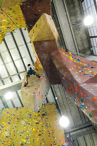 Herb at Planet GraniteOn Friday, we drove down to San Francisco in the afternoon. We were planning to meet Andrew and Celeste at Planet Granite, their climbing gym, after work. Herb has been an avid rock climber for literally decades, and it was very exciting for him to have his sons take up a love for the sport as well. Not only have Andrew and Tommy become very competent climbers, but Andrew’s girlfriend Celeste is on track to surpass them all.
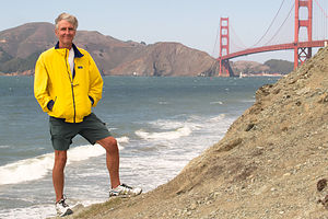
Since we were in the city a bit early, Herb and I took a walk along the Coastal Trail in the Presidio to Baker Beach. It was quite cold, and Herb did his fair share of complaining about freezing in California, but the views of the Golden Gate Bridge were stupendous.
Around 5:00 we headed over to Planet Granite to meet up with Andrew and Celeste. Before being allowed to climb in the gym, Herb and I had to pass a belay test to prove our competence – a good idea in view of the fact that when belaying someone you are really the only thing between them and the ground. Luckily, Herb had given me a brief refresher course before we entered, so I passed with flying colors.
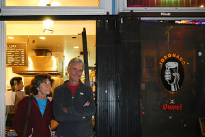 Lolo and Herb Dining at Toronado PubPlanet Granite is an incredible climbing gym. Even if I wasn’t climbing, I would love it for its views alone. Floor to ceiling windows look out onto the Golden Gate Bridge, Alcatraz, and the Mark di Suvero sculptures in Crissy Fields. It was hard to keep my eyes on the climbing wall.
I have spent time in our own climbing gym in New Jersey, but this gym has so many more climbs that I can do. It was the best climbing experience I had ever had. It was also fun to see how much Andrew and Celeste have improved.
After climbing, Andrew took us to Toronados, their favorite post-climbing sausage and beer place in the Haight section of San Francisco. The bar was really crowded and a bit noisy, but the sausages were delicious and the beer very refreshing after our climbing workout. Herb and I were stuffed, but Andrew and Celeste somehow still managed to fit in some ice cream at the Toy Boat Dessert Cafe, their favorite ice cream place. It’s great how they have really gotten to learn this city and have their favorite places for every type of food imaginable – eating is their second favorite sport after climbing.
Stuffed and content, Herb and I drove back up to Petaluma with the promise of returning early the next morning to explore the city with them by bike.
Day 3 – Bike Tour of San Francisco
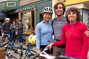 Andrew, Celeste and Lolo at Arizmendi BakerySan Francisco is truly a very bicycle-friendly city, especially if you know your way around. Fortunately, Celeste did, so it was nice to not have to constantly stop and pull out a map and to let someone else be the tour guide for a change.
The first stop on what was to be a 26-mile hilly bike ride – after all it is San Francisco – was Arizmendi Bakery, Andrew and Celeste’s favorite bakery. I must say, they do know their food, because everywhere they take us is unbelievable. After a very large pastry and a cup of coffee, we remounted our bikes and rode into Golden Gate Park to see the buffalo herd that lives there. You could very easily spend an entire day in this amazing park, which is actually bigger than NYC’s Central Park. However, we had lots to see that day, so we kept on moving.
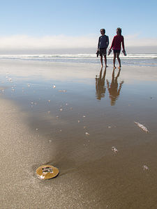
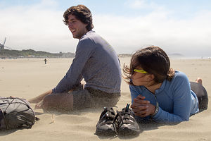 Andrew and Celeste in Pelting Sand at Ocean BeachOur next stop was Ocean Beach, where our walk was cut somewhat short by the sand pelting us in the face. It was a very windy day, which we really hadn’t noticed when we were inland in the park. This beach was definitely worth a revisit on a less windy day.
Continuing on, we began a very steep ascent up the Great Highway, past the Cliff House Restaurant and Sutro Baths. I think Andrew and Celeste were quite impressed that I made it all the way up without having to dismount and walk my bike. I wanted to die.
After a very brief rest, we continued up even more hills until we got to the California Palace of the Legion of Honor in Lincoln Park. This very impressive building is part of the San Francisco Museum of Fine Arts. It was to this very museum that Jimmy Stewart followed Kim Novak in Alfred Hitchcock’s Vertigo, where she was compulsively drawn each day to sit for hours staring at a painting of a woman named Carlotta. But I digress. Back on the bikes we go.
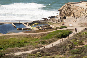 Sutro Baths OverlookFinally, our climbing was over and soon we were careening, probably much faster than I should have, down a steep hill to Crissy Field. I just love this part of San Francisco. The city of San Francisco is very progressive with their public space—a really good thing for residents, as there are so many beautiful places to enjoy on weekend day.
Crissy Field had undergone quite a transformation since the 1990s when it was taken over by the National Park Service. Prior to that, it had served as a U.S. Army airfield and was often used for the dumping of hazardous materials. In fact, when acquiring it, the NPS declared it to be, and I quote, “a derelict concrete wasteland.” Well, wasteland no more. As part of the Golden Gate National Recreation Area, it has been transformed into a very successful example of urban public space, with beaches, picnic areas, biking trails, historic buildings, and a restored tidal marsh. Today it is a premier recreation area for residents and visitors to San Francisco.
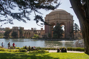 Biking to the Palace of Fine ArtsAlso, since May of this year, eight of Mark di Suvero’s giant modern art sculptures have been on display here. These were the sculptures that I had spent my time at the climbing gym gazing out at, with the Golden Gate Bridge, Marin Headlands, and Alcatraz as a backdrop. It seemed almost too perfect to be real.
Crissy Field is also very bicycle friendly and has a trail leading all the way through it from Fort Point to Marina Green. I was definitely enjoying the reprieve from the hills, as well as the incredible views.
About this time, I was developing a strong craving for an Iced Caffe Mocha, as I have found myself doing since the boys first introduced me to them, so we stopped at the Beach Hut Café to take a break. Afterwards, we walked over to the beach to watch the America’s Cup trials, but unfortunately the wind was so strong that all the races for the day were canceled. We pretended for awhile to enjoy having our faces pelted once more with sand before Herb suggested that we move on to someplace a bit more inland and away from the wind.
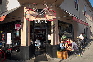 Beers at the Velo Rouge CafeWe found just what he was looking for a short distance away at the Palace of Fine Arts, probably one of the most beautiful settings in a very beautiful city. This Greek-style rotunda and colonnades with its surrounding lagoon were originally built for the 1915 Panama-Pacific Exposition. While most of the other buildings in the exposition were demolished when it ended, thanks to the efforts of William Randolph Hearst’s wife Phoebe, this iconic structure has been saved and lovingly restored. Its reflection in the lagoon is probably one of the most photographed spots in the city. We took our fair share of shots as well and enjoyed lying on the grass, not being covered with sand.
We ended our 26-mile bike tour of the city with another one of Andrew and Celeste’s “favorite” stops – beers at the Velo Rouge Café. I can’t describe how wonderful it was to just sit at an outdoor table, sipping a refreshing and well-earned beer.
It had been an extremely satisfying day in so many ways, and Herb and I really appreciated Andrew and Celeste’s very successful effort at showing us the city from a non-tourist point of view.
Day 4 – Hiking Marin Headlands
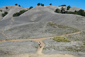 Herb on Matt Davis TrailThe next day, and our last before heading north up the coast to Seattle, was spent hiking in Marin, probably one of the most beautiful counties in the U.S. Celeste’s mom Hilda, met us at the campground and we drove down to Stinson Beach together where we met up with Andrew and Celeste. Knowing the area very well, Hilda took us the scenic route rather than along U.S. 101. I have to say that I was very glad that we were driving a car rather than the motorhome, because the roads were incredibly steep and winding.
Andrew had spent a lot of time researching hikes in the area, of which there are so many wonderful ones to choose from. His choice, and a very good one indeed, was to link the Dipsea, Steep Ravine, and Matt Davis trails together for a spectacular 7-mile loop past waterfalls, through a redwood canyon, and up to expansive views of the coast, before descending once again to Stinson Beach. The 1,600 foot elevation gain made for a challenging and extremely satisfying hike.
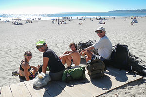 Coffee at Stinson BeachPost-hike, we bought coffee at a beach café and sat sunning ourselves on the beach, in the very same spot we had sat and froze last year. September is definitely the San Francisco Bay Area’s season – sunny skies and warm temps. May, June, and July are so much colder and foggier. We will have to time our visits to the boys accordingly because June and July are absolutely beautiful in Seattle.
That evening we met up with Celeste’s father in San Francisco, who had just finished a week-long, 500-mile Cycle Oregon event, and had dinner together at Troya Mediterranean Kitchen, a Turkish restaurant near Andrew and Celeste’s apartment. I had absolutely no idea what I was ordering, but whatever it was, it was delicious. They really are lucky to have such an ethnically-diverse selection of high-quality restaurants in walking distance from their home.
After dinner, it was goodbye for now, because tomorrow we would begin our drive north along the Northern California and Oregon coast to Seattle and our visit with Tommy.
Description
 Andrew and Lolo at Ocean BeachThe Petaluma KOA is an award winning camping resort located within an hour’s drive of San Francisco, Napa and Sonoma Valley Wineries, giant redwoods, and Sonoma County and California Coastal Beaches. It is considered to be the RV resort in the San Francisco Bay area.
On its 70 acres, there are 312 spacious RV sites, 32 camping cabins, and 10 Wine Country lodges.
Other amenities include:
• Guided tours of San Francisco (from May through October)
• Huge heated pool and spa
• Inflatable waterslide
• Rock climbing wall
• Huge playground
• Petting zoo
• Karaoke
• Hayrides and live weekend entertainment
The campground is open all year.
Flight Home
Saturday, July 20, 2013 - 4:15pm by Lolo55 miles and 1.5 hours from our last stop - 1 night stay
Travelogue
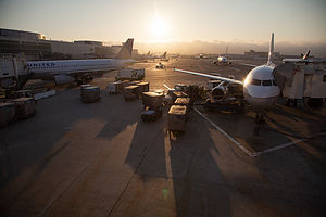 High-Speed Flying RVThe next morning we called Petaluma Taxi to take us to the Petaluma Fairgrounds where the Sonoma County Airport Express ran shuttles to the airport.
Haven driven back and forth across the country so many times, it was weird to think that we would be home sleeping in our very own beds that night -- no Nebraska, no Iowa, no Ohio, just 6 hours and we would be home. I think I am going to learn to love this flying thing.
Description
The Sonoma County Airport Express runs shuttles to the airport every hour from several locations: the Park and Ride in Santa Rosa, the Doubletree Hotel in Rohnert Park, and the Petaluma Fairgrounds. Fares are $34 each way.
San Francisco North / Petaluma KOA and Side Trips to San Francisco
Sunday, July 14, 2013 - 4:00pm by Lolo117 miles and 2.5 hours from our last stop - 6 night stay
Travelogue
 Bacon and ProsciuttoThe remainder of the trip was more of a settling of the RV into its new home, and Andrew into his. We were fortunate to discover the San Francisco North / Petaluma KOA to use as our base camp for the next 6 days. It is a really wonderful campground in so many ways.
It has a great location – 45 minutes to the Golden Gate Bridge, a half hour to Marin County, and about an hour to Napa Valley.
There is a huge, heated pool and hot tub with dozens of comfortable lounge chairs around it, and tons of activities for kids – although sadly we were long past that stage. They also run guided tours to San Francisco and the Wine Country.
Also, the campground was extremely well maintained and run, so much so that we decided to entrust our beloved motorhome to their care. For $75 a month, we could store the motorhome in their secured, fenced-in storage area, and our Subaru in the overflow field.
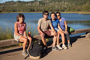 Hike at Annadel State ParkWe spent the next few days depressurizing from what had been a trip filled with so many emotions. Those lounge chairs at the pool certainly helped with the process.
Celeste’s (Andrew’s girlfriend) parents live about 20 minutes from Petaluma, so we had a chance to do a lot of fun, low-key activities with them and the kids. They are the most amazing hosts and chefs, so it was absolutely wonderful going over to their house for dinner a few times.
I spent one fun-filled day with Andrew at the California DMV, transferring the title for the Honda and getting a California driver’s license. We had no idea that California required a smog certification, so we lost time in the DMV line having to leave, get that done, and come back to wait on line again. It was quite a hoot.
Very appropriately after a day at the DMV, we met up with Celeste and her folks at the Lagunitas Brewery, right in Petaluma. The food choices were somewhat limited, but food is not the reason people come here. We sat at an outside table, ordered samplers of beer, and listened to live music. It was a very fun evening.
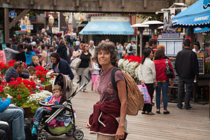 Lolo with Pier 39 TouristsHerb and I also took a few trips into San Francisco. The first time we drove down and parked near the waterfront and walked over to Fisherman’s Wharf. We knew it was touristy, but I had never seen it and I wanted to. It was a bit crowded, as we suspected, but fun nonetheless.
However, I did embarrassingly fall victim to the notorious “Bushman” of Fisherman’s Wharf, who for the last 30 years has been frightening unsuspecting tourists, such as myself. I think I was probably the only one in the crowd that didn’t know that the bush on the edge of the sidewalk was not in reality a bush, but rather a madman who has too much time on his hands. I almost had a heart attack when he jumped out at me.
After my heart stopped pounding, we continued our walk, keeping an eye out for incongruous objects. I would not be so easily fooled again.
I wanted to figure out some good biking San Francisco options for later in the week, so I stopped at various bike rental vendors along the way, pretended I was interested in renting a bike the next day, and asked them for suggestions as to where I should go. By the time I was done, I had pretty much settled on parking in Marin, biking across the Golden Gate Bridge, down to Fort Point, and over to Crissy Field.
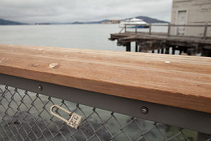 Fisherman's Wharf Love LockAfter our brief tour of San Francisco, we met up with Andrew and Celeste to see the apartment they had just signed a lease on. It was located on Clement Street in the Inner Richmond. The place was amazing – three bedrooms (they would be sharing with friends from college), beautiful hardwood floors, a huge kitchen, living room, and dining room, and two bathrooms. It was in a nice, safe, Asian neighborhood with plenty of good restaurants and small grocery shops to walk to. It was the kind of place I knew they would be happy in, so I felt a tremendous sense of relief. Hunting for an apartment in San Francisco is not for the faint of heart. There is so much competition that apartment hunters practically bribe the realtors to get first dibs. They were very, very lucky to get this place.
A few days later we did take that bike ride across the Golden Gate Bridge. The main Vista Point parking lot for people walking or biking across the bridge is at the northern end of the Golden Gate Bridge and can only be reached coming from the south. Since we didn’t want to drive across the bridge, pay the southbound toll, and then just turn around and drive across again, we parked in the lesser known lot on the southbound side of 101, just north of the bridge. From there, we walked our bikes down a set of stairs and under the bridge to get to the Vista Point parking lot on the northbound side.
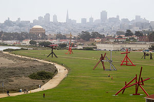 Crissy Field from Bike RideWe were definitely not the only ones with the idea of biking across the bridge. It was packed with cyclists, many of whom looked like they were riding a bike for the first time. You had to go pretty slow and be constantly on the defensive. Also, despite the fact that it was mid-July, it was frigid out. Now mind you, Herb hates the cold, and he couldn’t understand why he should be spending his summertime in California wearing a parka. He told me of a Mark Twain quote that I had never heard before: “The coldest winter I ever spent was summer in San Francisco.” I suggested that he think more positively. I mean really, just look at the view!
After maneuvering our way across the Golden Gate, we rode down to Fort Point Historic Park, located right underneath the bridge. From there, we rode along the waterfront, past the giant outdoor sculptures, by such artists as Mark di Suvero, to the sandy beach at Crissy Field where we watched the America’s Cup boats practicing out in the Bay—and all this with Alcatraz and Sausolito in the background. What an amazing place! I definitely knew that Andrew and Celeste would be happy living here. I already knew Celeste would. She was from this area. It was my East Coast boy I was a bit more worried about.
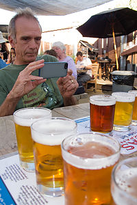 Paul Composing a Photo at Lagunitas BrewerySince we had plans for dinner in San Francisco that evening with Andrew and Celeste and her parents and their friends, we biked back across the Golden Gate to our car and then drove back into the city to their apartment.
Their neighborhood has so many restaurants in walking distance. We walked over to an Italian place called Mescolanza. The food was great and the company even better, so we had a really good time.
We spent the last day at the KOA prepping the motorhome for storage. It was going to be very weird flying home and leaving it behind.
Things were coming together though. Tommy was happily settled in Seattle, Andrew and Celeste had found a beautiful apartment in San Francisco, Andrew had nabbed a job in Mill Valley, which he would be starting the week after we left, and the RV had a nice, new home in Petaluma. We should be so lucky.
Description
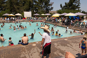 Petaluma KOA PoolThe Petaluma KOA is an award winning camping resort located within an hour’s drive of San Francisco, Napa and Sonoma Valley Wineries, giant redwoods, and Sonoma County and California Coastal Beaches. It is considered to be the RV resort in the San Francisco Bay area.
On its 70 acres, there are 312 spacious RV sites, 32 camping cabins, and 10 Wine Country lodges.
Other amenities include:
• Guided tours of San Francisco (from May through October)
• Huge heated pool and spa
• Inflatable waterslide
• Rock climbing wall
• Huge playground
• Petting zoo
• Karaoke
• Hayrides and live weekend entertainment
The campground is open all year.
Mendocino
Friday, July 12, 2013 - 3:30pm by Lolo221 miles and 6 hours from our last stop - 2 night stay
Travelogue
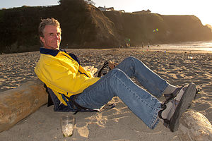 Herb at Caspar BeachOn our first trip to Northern California in 2012, we had visited and fallen in love with Mendocino. We just felt so at home there. Normally we spend two weeks every summer on the island of Martha’s Vineyard off the coast of Massachusetts, but because of the boys’ move west this summer, this would be the first time in 30 years that we wouldn’t be able to get there. Mendocino would have to give us our New England “fix,” with its saltbox houses, gingerbread mansions, white-picket fences, rose gardens, and water towers.
Although we had been to Mendocino before, this would be the first time with the motorhome, and after our harrowing drive down Route 1 from 101, I feared it might be our last. The steep switchbacks leading down to the coast were unbelievable, and there was no place to pull over. Herb could feel the brakes pressing a bit too far down to the floor, the same thing that had happened to us when our brakes failed coming out of Death Valley. Despite the lack of a spot to pullover, we just stopped as far right as we could on the road, took a deep breath, and waited for the brakes to cool off. We now knew that whenever there is a road sign warning “No King Pins,” we don’t want to be on that road. However, I don’t know if there is a better alternative. You have to get down to the coast somehow.
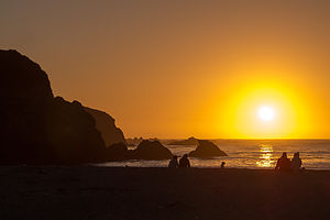 Caspar Beach SunsetHerb was toast by the time we reached Caspar Beach RV Park, where we would be spending the next two nights. Fortunately, I had made a reservation in advance, because it was the weekend, and the campground was absolutely packed. As far as RV parks go, this one was pretty bad. They packed you in so close to your neighbor that you could barely open the door. What it did have, however, is location location location. The campground is right across the street from beautiful Caspar Beach. For that, we were willing to put up with the close quarters. We could watch the sunset from the beach, and then just go inside and pull down the shades. And that is exactly what we did that first night.
The next morning we decided to get some exercise mountain biking the trail that runs along the Big River. The trail begins at the end of a dirt road just north of the Big River Bridge, and a short distance south of the village of Mendocino. Adjacent to the parking lot, there is a nice sandy beach that is a good place to swim or launch a kayak.
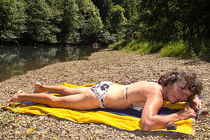 Lolo relaxing on the Big RiverA gate at the end of the parking lot marks the beginning of the Big River Trail, an old railroad right-of-way that now serves as a recreational trail for hikers, bikers, and joggers. Although the trail actually extends for over ten miles into the Mendocino Woodlands, most cyclists turn around at the fork at mile 6.5, making it a nice 13 mile ride.
The first 4 miles of so of the ride were quite level and scenic, with frequent views of the river. Since the river is tidal, this section is also great for kayaking, and if timed right, you can go up river on the rising tide and return on the ebb.
After about mile 4, the estuary ends at Dry Dock Gulch and the ride became a little hillier and the foliage along the river a bit thicker, obstructing the view of the river.
Around mile 5, we started looking for a way to get down to the river to have lunch and maybe even swim, hopefully on a sandy beach. It was a bit of a challenge, but we eventually found a nice spot to do just that, except the water was a bit too shallow at this point upstream to do much more than wet our ankles. Still, it was nice and peaceful.
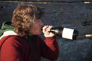 Lolo at the Headlands sans Red CupAfter our break, we continued riding another mile and a half or so before the trail came to a fork, and like most other riders, we turned around and headed back out to the mouth of the river.
While the river ride was nice, the real draw of Mendocino is its beautiful coastline, so once again, as in our last visit, we picked up a bottle of wine and some delicious sandwiches at the Mendocino Market Deli and headed out to our favorite bench on the Mendocino Headlands for a picnic. It’s nice to feel so familiar with a place that you actually have a favorite bench.
The evening was perfect, or at least it would have been if I had remembered to pack the red cups, and we didn’t have to swig surreptitiously out of our wine bottle. Hopefully, no one saw.
Actually there was one thing that Herb felt was a little less than perfect – the temperature. Last year, we were here in late May and it was warm. Tonight, however, it was quite chilly, and we had to be pretty well bundled up to stay warm.
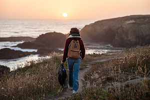 Hiking towards the Headlands SunsetWhile we sat on a bench enjoying the scenery, we noticed a young couple with a small child and a dog, romping playfully on the beach at the base of the bluff. It’s funny how two people (that have been married as long as Herb and I) can have such different perceptions of the same scene. While I thought the scene was idyllic – a happy, loving family enjoying each other’s company on a beautiful evening in a spectacular setting, Herb mumbled something about it being so sad. “What could you possibly mean?” I asked in surprise. My husband, who has learned to hate the cold and craves warmth and sunlight, responded, “That poor child is going to grow up thinking that it’s perfectly fine to be wearing a parka on the beach in mid-July.” I chose to ignore him and swig from my bottle of wine.
As if the scenery wasn’t beautiful enough, just after the sun set, we began to hear music off in the distance. This place was so magical. Last time we sat on this bench watching the sunset, we were serenaded by young woman who sat nearby playing a dulcimer. Now we were being treated to some lovely classical music.
Like moths drawn to a flame, we followed the sweet strains of Rachmaninoff’s Symphony #2 to its source: a large white tent a bit further in on the headlands. Unbeknownst us, we had fortuitously stumbled upon opening night of the annual Mendocino Classical Music Festival. Never ones to pass up a free entertainment opportunity, we set up our Crazy Creek chairs on the edge of the bluff, right behind the tent, and spent the next hour happily gazing out over the water and listening to the San Francisco Symphony Orchestra.
It just doesn’t get much better than this.
Description
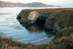 View from the Headlands BenchMendocino is a charming and picturesque hamlet of 1,100 residents along the Pacific Coast Highway (Route 1), about 170 miles north of San Francisco. Built by homesick New Englanders during the logging boom of the 1850s, the town resembles a New England village with Victorian gingerbread mansions, white picket fences, and rose gardens. The logging days are long gone, and today the town if full of upscale Bed and Breakfasts, shops, and restaurants.
The spectacular Mendocino Headlands State Park surrounds the village, with trails crisscrossing the bluffs and rocky coves.
Redwood National and State Parks
Thursday, July 11, 2013 - 1:30pm by Lolo173 miles and 3.5 hours from our last stop - 1 night stay
Travelogue
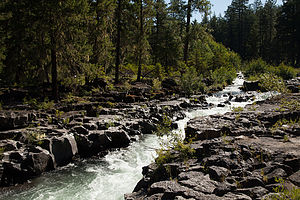 Rogue River Gorge ViewpointAfter leaving Crater Lake, we made a short stop at the Rogue River Gorge Viewpoint, near the town of Union Creek, about 30 miles southwest of the park. We walked the short 1/4-mile interpretative trail past spectacular views of the wild and churning river as it cascaded through a narrow basalt lava cut canyon.
From there we continued southwest on Route 62 and eventually onto Route 199 into California. From the Oregon border to Crescent City on the coast, Route 199 (also known as the Smith River National Scenic Byway) winds its way for 33 highly scenic miles through spectacular mountain scenery.
The road also passes through Jedediah Smith Redwoods State Park, which along with two other state parks and national park land, makes up Redwood National and State Parks system.
We decided to only go as far as Crescent City that day, so that we could spend the whole next day driving the Redwood Highway and exploring the National and State Parks. Also, we saw in the Woodall’s Guide that there were a few campgrounds located right on the beach, so even if it was too cold to swim, at least we could enjoy the view from the back of the RV. I called ahead and booked a site at Harbor RV Anchorage.
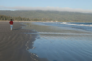 Lolo on Crescent BeachI must say that the campground and the surrounding area were much more rundown than I expected. Most of the occupants of the sites seemed to be permanent residents. When I told Andrew where we were, his girlfriend’s family, who are from California, said, “What the heck are you doing in Crescent City? That is where the Pelican Bay maximum security prison is.” Oops.
We did manage, however, to get a campsite along the outer perimeter with unobstructed views of the beach, and fortunately, no views of the rest of the campground. It was much too cold to sit out on the beach, so we took a brisk walk instead, and then spent the rest of the afternoon contentedly reading in the back of the motorhome.
The next morning, we headed south on US 101 (also known as the Redwood Highway) to see the giant California redwood trees. Technically, they are called Sequoia sempervirens, and they are the largest and tallest trees on earth, living thousands of years and growing as high as 379 feet tall.
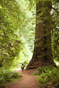 Hiking Big Tree Loop in Prairie Creek Redwoods State ParkThere was a time when these beautiful coast redwood forests were in jeopardy of being lost forever. After the gold rush, many miners that failed to strike it rich turned to harvesting these giant redwoods. By the early 1900s, these priceless forests were badly threatened by years of unrestricted clear cut logging.
However, today, thanks to the foresight and work of the state of California and the Save the Redwoods League, hundreds of groves have been acquired and protected for our enjoyment. In 1968, Redwood National Park was created for the purpose of cooperative forest management with three other state parks: Jedediah Smith, Del Norte, and Prairie Creek. Today Redwood National and State Parks encompasses 133,000 acres and protects 45% of all remaining coast redwood old-growth forests.
Today visitors to the park can enjoy these majestic groves along the scenic Redwood Highway without ever leaving the comfort of their car. However, to really experience the majesty of these giant trees, you really have to get out of the car and walk among them.
After scanning the hiking options in my new book, Best Short Hikes in Redwood National and State Parks, I chose the Cathedral Trees – Big Tree Loop in Prairie Creek Redwoods State Park because it had two interesting features: a very large (but unimaginatively named) tree and several cathedral tree groupings.
The hike begins at the eastern edge of the Elk Prairie Visitor Center and passes under the Newton B. Drury Scenic Highway through the culvert for Boyes Creek. In .2 miles, we took a right at the Foothill Trail junction and passed several large redwoods. At .4 miles we turned left onto the Cathedral Trees Trail and soon came upon a pair of cathedral tree groupings. I am not exactly sure why they are called “cathedrals.” They look more like a circle of huge brown columns, with each column being an individual redwood tree. The reason that they are so closely clumped together is that they all sprouted from the same ancestral stump.
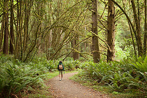 Hiking Big Tree Loop in Prairie Creek Redwoods State ParkAt about 1.1 miles, we cross Cal Barrel Road and continued for another ½ mile or so to the junction with the Circle Trail. A quick left brought us to the Big Fella, so big that he needed to be fenced in. It is really very difficult to photograph these trees as they just won’t easily fit in the frame, but Herb tried. We then continued on the trail which paralleled the Parkway, back to the Visitor Center. The hike, which was 2.6 miles in total, had provided us with a wonderful experience in an ancient California redwood forest.
There was so much more to see and do along the Redwood Highway, but once again we were running on a much too aggressive schedule and had to get to Mendocino that evening. Too bad, because there are lots of interesting stops between here and there. Just to name a few: Lady Bird Johnson Grove, Tall Trees Grove, Humboldt Lagoons State Park, Trinidad State Beach, Azalea State Reserve, Humboldt Redwoods State Park, the Avenue of the Giants, and Richardson Grove State Park.
Description
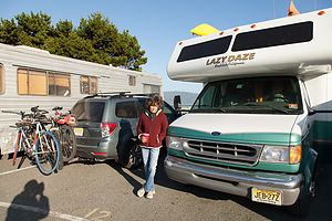 Lolo at Harbor RV AnchorageIn the 1850s, old growth coastal redwoods covered more than 2 million acres along the northern California coast. These California redwoods, technically called Sequoia sempervirens, are the largest and tallest trees on earth, living thousands of years and growing as high as 379 feet tall.
Unfortunately, following the gold rush, many miners that failed to strike it rich turned to another source of riches – harvesting the giant redwoods. By the early 1900s, these priceless forests were badly threatened by years of unrestricted clear cut logging.
However, thanks to the work of the state of California and the Save the Redwoods League, hundreds of groves have been acquired and protected. The result was the creation of three redwoods state parks: Prairie Creek (1923), Del Norte (1925), and Jedediah Smith (1929). In 1968 Redwood National Park was created for the purpose of cooperative forest management. Its boundary encircled the three state parks to better protect these ancient redwood forests. The combined parks contain 133,000 acres and protect 45% of all remaining coast redwood old-growth forests.
Today visitors can enjoy these majestic groves along the scenic Redwood Highway. The drive (from north to south) starts at the California/Oregon border on US 199 and travels for 33 winding and scenic miles through spectacular mountain scenery until it joins US 101 in Crescent City and continues for another 42 miles to the town or Orick.
Jedediah Smith State Park, along US 199, is the northernmost and least visited of the parks in the National and State Parks system. The redwood stands in the park are so dense that few trails penetrate the park. However, the 11-mile Howland Hill scenic drive provides access to many of the park’s stately groves. Mostly unpaved and often one lane, the road is not recommended for RVs.
10 miles further along US 199 is the town of Crescent City and the junction with US 101. Crescent City had a bit of a rough past, being devastated by two tsunamis – one in 1964 and then again in 2011 after the Japan earthquake. Today the economy depends on shrimp and crab fishing, tourism, and the Pelican Bay maximum security prison. While a good northern base for exploring Redwood National and State Parks, the weather is damp and foggy and the town is a bit lacking in charm. The Park Headquarters is located in Crescent City at 2nd and K Streets.
South of Crescent City on US 101 is Del Norte Coast Redwoods State Park, the second of the state parks in the system. The 6,400 acres of this park stretch all the way to the coast. There are 15 miles of hiking trails both along the foggy coastline and through dense virgin redwood forests.
Continuing south on 101, the parkway crosses the Klamath River, famous for its autumn migrations of Chinook salmon. A short detour off of 101 onto Requa Road leads to the Klamath River Overlook, situated on a bluff above a driftwood-strewn beach. This is one of the best whale watching spots in California as well as one of the most spectacular viewpoint on the North Coast.
South of Klamath is the largest of the state parks, Prairie Creek Redwoods State Park. This 14,000 acre park has over 70 miles of hiking trails and one of the most scenic drives in the park – the 8-mile Newton B. Drury Scenic Parkway, which runs parallel to 101, passing through pristine ancient redwood forests.
For the next 10 miles or so, US 101 passes through the National Park. Noteworthy stops in this section include the Lady Bird Johnson Grove, one of the park’s most spectacular, and the Tall Trees Grove, the location of several of the world’s tallest trees. A free permit is required to drive your car along the rough and unpaved 6 mile road to the Tall Trees Grove parking area. From there it is a 3.7 mile roundtrip hike down to the grove to see the Tall Tree, which stands over 362 feet tall. Permits can be obtained at the park visitor centers. There are only 50 issued per day, and they rarely run out.
The Kuchel Visitor Center is located in the small town of Orick, is located at the southern boundary of the park.
From this point south, you are no longer in Redwoods National & State Parks, but that does not make it any less beautiful. Other interesting places to visit along the Redwood Highway include: Humboldt Lagoons State Park, Trinidad State Beach, Azalea State Reserve, Humboldt Redwoods State Park, the Avenue of the Giants, and Richardson Grove State Park.
.
Crater Lake National Park
Tuesday, July 9, 2013 - 4:00pm by Lolo123 miles and 3 hours from our last stop - 2 night stay
Travelogue
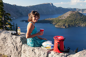 Sunset Wine and Cheese at Crater Lake OverlookCrater Lake has been on our radar for a long time. We’ve been to most of the national parks in the West, but this one has always evaded us, mostly because it was just too far to get to when traveling back and forth across the country from NJ in under 4 weeks. But now that we have a son living in Seattle, and an RV living in Northern California, the time had finally arrived to visit this spectacular park.
After saying goodbye (for now) to Tommy, we drove the 3 hours south to Crater Lake National Park, entered the park through the North Entrance, and drove along the scenic western portion of the Rim Drive.
Our first views of Crater Lake definitely did not disappoint. I have never seen a lake so deep blue. We tried not to get hyper about pulling into every viewpoint, because we knew that tomorrow we would drive the entire 33-mile Rim Drive around the lake. Going clockwise was the recommended direction anyway, as all the viewpoints are on the lake side of the road.
Our first stop was the Visitor Center in Rim Village, where we purchased tickets at the kiosk for a boat tour the following day. The current day tours were already sold out.
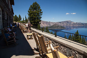 View from Crater Lake Inn PorchThere are two types of boat cruises offered, but the Wizard Island Tour was the one we wanted. Anyone that has been to or seen pictures of Crater Lake has seen this little island rising 755 feet above the lake. In fact, it would be hard to find a photo of Crater Lake without it.
To better appreciate Wizard Island, you first have to know a little bit about the geological history of Crater Lake. Herb and I have been watching TTC (The Teaching Company) videos of various college courses, including two on Geology. I wish we had watched these years ago, because it is so much more interesting to visit a place where you understand how it came to be.
The first thing to realize is that Crater Lake is a misnomer, as it more accurately should be called Caldera Lake. For millions of years, there was a huge mountain here called. Then, around 7,500 years ago, the mountain erupted, spewing out so much pumice and ash that the summit collapsed, creating a giant caldera, measuring 4,000 feet deep and 6 miles across. That giant caldera was eventually filled in with rainwater and snowmelt, creating the lake, which is somewhat incorrectly called Crater Lake.
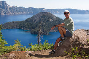 Herb at Crater Lake OverlookThe reason the lake is so clear and has such a deep blue hue is because of its depth and purity. It is the deepest lake in the U.S., measuring 1,943 feet at its deepest point. Because it is so deep, when sunlight hits the lake, the longer red waves are absorbed and the deeper violet and blue waves are reflected, causing its deep blue intensity.
Wizard Island is one of several cinder cones formed from a series of smaller eruptions that occurred after Mount Mazama blew. However, Wizard Island is the only one tall enough to be exposed. Today you can visit that island, or cinder cone, by boat and climb into the crater at the summit, which is 100 feet deep and 500 miles across.
But I digress. Wizard Island is tomorrow’s adventure.
We continued on to our reserved campsite in the Mazama Campground, located in Mazama Village, about 5 miles south of the lake. Even though we had a reservation, it wasn’t site specific, so we drove around the loops a bit and found a really nice one in the outermost loop with a great view out over Annie Creek Canyon—a perfect place to plant our beach chairs.
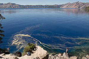 Cleetwood CoveIt was still relatively early in the day, so we detached the Subaru from the RV and drove back up to the lake to check out some of the viewpoints on the West Rim Drive. I must say, it was really nice having a tow vehicle for the first time. There is no way we would have come back up here again so quickly if we had to drive the motorhome. The only downside with not using the motorhome is that since you are not lugging your entire home along with you, you actually have to think about what you want to pack for on an outing. For now, this meant cheese and crackers and a bottle of wine.
At around mile 4 of the West Rim Drive, we parked in a pullout with an excellent view of Wizard Island. In fact, I think this is probably the place where the iconic photos of Crater Lake are taken, because Wizard Island stands out in such a way that you can see the lake all around it. From many of the other angles, the island blends into with the background, and you can’t really even tell that it is an island.
We planted ourselves on the stone wall at the edge of the parking lot and sipped a glass of wine while gazing out over the lake. It was really very beautiful.
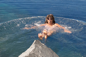 Lolo enjoying the frigid waters of Cleetwood CoveThe wine and scenery must have gotten to Herb, because he suggested going to dinner at the Crater Lake Lodge rather than cooking back at the RV. I was definitely into not cooking in the RV.
It was such a beautiful evening, that rather than eating inside in the dining room (which was very lovely), we chose to eat out on the lakeside porch. Although it was very nice, and the food was actually quite good, we did have a few problems with it. First, the rocking chair that I sat in was so broken that I almost flipped over backwards every time I leaned back. Fortunately, the couple next to us finished before us and offered me their less aggressive rocker. Secondly, the stone wall in front of us had a wrought iron railing on top of it, with no possible functional purpose except to block what would have been a spectacular view of the lake. You had to stand up to take a photo. It would have really been so nice to just be able to sit back and look out over the lake. Thirdly, just as dusk approached, the mosquitoes arrived in droves and made it practically impossible to remain outside. Still, all that being said, it was a very pleasant evening, and much, much better than cooking in the RV. Maybe we should have eaten inside in the dining room after all.
We arrived back at the Mazama Campground, just as the Ranger Talk in the amphitheater was concluding. Too bad, because these national park ranger talks are usually very good.
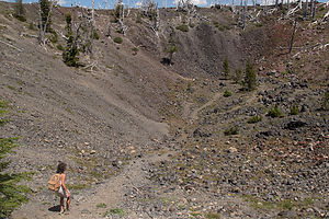 Lolo hiking down the Wizard Island Summit CraterThe next morning, we set out for our boat tour to Wizard Island. Since the lake is situated in a deep caldera, it is only accessible from one point -- the very steep Cleetwood Cove Trail on the north side of the lake. Those not in good shape should think carefully before hiking down this 1 mile trail, as the way back up is quite strenuous.
Although our boat tour wasn’t until 12:30, I wanted to get down to the lake early enough to swim and watch people jump off the rock into the lake. Friends of ours had visited Crater Lake the previous year and shown us pictures of people jumping off a high rock into the chilly, crystal clear waters of the lake. It looked very cool (in more ways than one).
In person, the rock looked a lot higher than it had in the pictures, so I chickened out of jumping off of it. Herb hates cold water, so he never had any intention of doing it in the first place. I still felt compelled to do something daring, so I climbed down the rocks to water level, slid in, screeched, swam for 2 minutes, and quickly climbed back out again. It certainly was very, very cold.
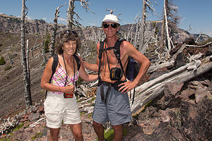 Lolo and Herb at Summit of Wizard IslandIt was fun to watch other people approach the edge of the high rock and decide whether or not to jump. One couple was particularly entertaining. The boyfriend jumped in first and then waited patiently in the water for his girlfriend to follow. She stood on top of that rock for about 10 minutes, taking a step forward to jump, then hesitating and stepping back, on and on again until her boyfriend was turning blue. She never did make the leap, but her boyfriend never got mad. Chivalry is not dead, although a little longer and it might have been hypothermic.
Right on time, we boarded the boat for Wizard Island, and spent the next 20 minutes or so cruising to the island while an interpretive ranger from the National Park Service explained the geological history of the lake.
When we were dropped off on the island, I was surprised to learn that no park ranger would be staying with us. We would be left to explore on our own. That is one thing I love about the National Park Service. Everyone always says that the national government has too much regulation, but not the park service. They let you stand at the edge of the rim of the Grand Canyon with no fences, climb El Capitan in Yosemite, swim in Crater Lake without a lifeguard, and on and on. It’s great!
The island is not that large, so there are really only two things to do: hike to the crater on the summit and hike to Fumarole Bay. Hopefully, if we were quick, we could do them both.
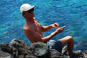 Herb catching a Trout at Fumarole BayThe summit was definitely what we thought would be the more interesting thing to do, so we headed up the 0.9 mile (each way) Summit Trail, enjoying the views of the lake along the way. Herb and I were the first to reach the top, and I was the first to run madly down into and across the crater, which was about 100 feet deep and 500 feet across. To think that I was standing where hot lava had once spewed out was pretty exciting. Now, it was pretty much just an ordinary looking bowl-shaped hole.
We got back to the dock with plenty of time left to explore Fumarole Bay. The 0.7-mile hike to Fumarole Bay, although not steep like the Summit Trail was actually more difficult in that much of it is over rough volcanic rock.
Herb had brought his fishing rod along, because he had been told by a ranger that the lake is filled with rainbow trout and kokanee salmon, just ready for the taking. These fish are not indigenous to the lake. In fact, since the lake has no streams flowing in or out of it, there were no fish at all until 1888, when it was first stocked with these two species of fish. This practice was stopped in 1941, and now the park service wants to rid the lake of these non-indigenous species. As a result, unlike most parks, no fishing license is required, and there is no limitation of size, species, or number that you can take. In fact, the park encourages visitors to remove as many fish as they can from the lake.
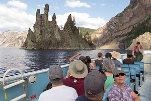 "Phantom Ship" view from Boat TourIt wasn’t long before Herb caught three of them. Although we were supposed to do our part and remove them from the lake, we really didn’t feel like carrying them around for the rest of the day, so we quietly gave them a reprieve and slipped them back into the lake.
The boat ride back to Cleetwood Cove continued our natural history tour along the eastern shore of the lake, past Phantom Ship, the other noteworthy feature, besides Wizard Island, on the surface of the lake. It’s named for the fact that it resembles a two-masted sailing ship, and tends to emerge and disappear from visibility depending on the weather and lighting conditions. Like everything else at Crater Lake, this rock formation is the result of volcanic eruptions.
Once back onshore, we hiked up the fairly strenuous Cleetwood Cove Trail to our car and then continued our drive around the eastern shore of the lake, stopping at various viewpoints along the way.
That evening, rather than drive back up to the lake from the campground, we sat in our beach chairs on our very own campsite looking out over Annie Creek Canyon, sipping a glass of wine. We even managed to catch the Ranger Talk that evening on the impact of climate change on Crater Lake.
One more phenomenal national park of the West completed. Now on to Redwood.
Description
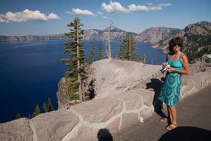 Lolo the VideographerCrater Lake is the only national park that is located within a dormant volcano. More than 7,500 years ago, Mount Mazama erupted, spewing out so much pumice and ash that the summit collapsed, creating a giant caldera, measuring 4,000 feet deep and 6 miles across. A series of smaller eruptions afterwards formed several cinder cones on the caldera floor, the largest of which is 2,700-foot high Wizard Island.
Over the next 700 years or so, rain and snowmelt filled the caldera creating what is now the deepest lake in the United States. It is 1,943 feet deep at its deepest point.
Wizard Island is the only cinder cone tall enough to be exposed, rising 755 feet above the current lake level. The top of the Wizard Island cone is capped by a crater about 100 feet deep and 500 feet wide. In fact, this is the only crater in Crater Lake National Park. The lake itself should more accurately be named Caldera Lake.
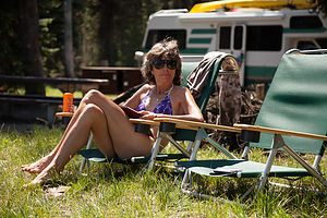 Lolo relaxing at Mazama CampgroundIt is Crater Lake’s extreme depth and purity that gives it its clarity and magnificent deep blue color. As sunlight penetrates the lake, the water molecules absorb the longer red waves in the spectrum and reflect the shorter violet and blue waves, giving its intense deep blue hue.
Crater Lake has no streams flowing into or out of it. It is refilled entirely from rain and snowmelt and is lost through evaporation and subsurface seepage. As a result, the lake had no fish in it until rainbow trout and kokanee salmon were introduced by humans from 1888 to 1941.
If you only have a day to visit the park, the best way to see it is to drive the 33-mile Rim Drive, which encircles the entire lake, stopping at its many overlooks. Because of heavy snowfalls, the Drive is generally open from July to October, and partially open in May, June, and November.
A good place to start the drive is at the Rim Village Visitor Center at the southern end of the lake, where you can stroll out to the Sinnott Memorial Overlook for a spectacular view of the lake and Wizard Island.
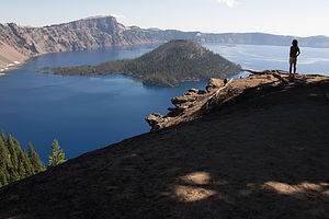 Wizard Island from Overlook in the MorningThe best way to do the Rim Drive is clockwise, so that you can most easily pull into the scenic viewpoints on the lake side of the road. There are 25 of them, so it is very easy to spend a half-day enjoying the drive. My favorites are the overlook at mile 4, which offers an excellent view of Wizard Island, rising 755 above the lake’s surface, and the Phantom Rock Overlook at mile 23.2.
If you have more time, a boat trip out on the lake is definitely worthwhile. Tours are offered from late July to mid-September and in 2013. There are two types of cruises offered. The Standard Tour leaves 6 times a day and costs $35 for an adult. It does not stop at Wizard Island. The Wizard Island Tour only leaves twice a day (9:30 and 12:30) and costs $45 for an adult. This tour drops people off and allows them to hike and explore the island for 3 hours before the boat returns to bring you back. Each tour has a park ranger aboard to discuss the geology and natural history of Crater Lake. Tickets sell out quickly, so be sure to buy them in advance at the kiosk in the Crater Lake Lodge. I definitely recommend the Wizard Lake Tour.
To get to the boat, park at the Cleetwood Cove Trailhead on the north side of the lake, and hike the steep 1 mile trail down to the lakeshore. This trail provides the only access to the lake. Before committing to the trek down, make sure you feel comfortable with the strenuous climb back up.
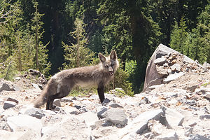 Grey FoxOnce you reach the lakeshore, you are sure to see dozens of people jumping from a high rock into the chilly waters of the lake.
Once on Wizard Island, there are two hiking options. The most popular is the relatively steep 0.9 mile trek (each way) up the steep Wizard Island Summit Trail. Besides the wonderful views of the lake along the way, once on top of the cinder cone, you can descend into 100-feet deep crater.
The other option is to hike along the rough volcanic rock along the shore to Fumarole Bay – about 0.7 miles each way. There is an excellent view from here of Watchman Peak, straight across the lake. The shallow, clear water in the bay is good for swimming (chilly) and fishing for rainbow trout and kokanee salmon. Unlicensed fishing is allowed in the park without any limitation of size, species, or number. In fact, the park encourages fishing to try to rid the lake of these non-indigenous fish.
In addition to the Cleetwood Cove and Wizard Island trails, there are several other hiking options in the park. These include:
- 3.5 mile (round trip) steep hike to Garfield Peak, with tremendous views after ½ mile of hiking. The trail starts from the parking lot of Crater Lake Lodge
- 1.7 mile (round trip) Annie Creek Canyon Trail, which begins behind the amphitheater at the Mazama Campground and loops down to the bottom of a deep, stream-cut canyon and back.
- 3.9 mile (round trip) hike to the summit of Mt. Scott, the highest point in the park, with panoramic views of the lake and Klamatch Basin.
- 0.7 mile (round trip) Pinnacles hike through dramatic tall pinnacles and spires. The trailhead is located on the Pinnacles Spur Road, 7 miles southeast of the Phantom Ship Overlook in the southeast corner of the park.
The park has two campgrounds:
- The Lost Creek campground is tent only and is open from mid-July to late September. This campground is located on the Pinnacles Spur Road in the southeast corner of the park.
- The Mazama Campground has 213 tent and RV sites (and some hookups) and is open from late June to mid October. This campground is located in Mazama Village, about 3 miles south of the Steel Visitor Center
Bend
Sunday, July 7, 2013 - 4:00pm by Lolo293 miles and 6 hours from our last stop - 2 night stay
Travelogue
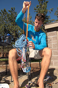 Tom organizing his climbing rack at the Crown Villa RV ResortBefore we left Tommy in Seattle a few days back, we made a plan to meet up again in Bend so he and Herb could go rock climbing at nearby Smith Rock State Park. Also, we very much wanted to see Bend. We had heard so many good things about it – great outdoor activities, terrific weather (over 260 sunny days, a year), and the Deschutes Brewery.
I really hadn’t looked at what our route would be, other than keying Bend in as our destination on the GPS, so we were delighted to find ourselves driving through the Mt. Hood National Forest with excellent views of the mountain.
While driving, I called ahead to reserve a campsite for two nights at the Crown Villa RV Resort in Bend, a very highly rated campground that advertises as being a place for the “discriminating RVer.” I have a feeling they are a bit discriminating as well as to who they allow in, because there was a brief moment when I feared they weren’t going to have a site for us when I told them that our motorhome was a 1999. I think they had this vision of Cousin Eddie from “Christmas Vacation” pulling in and sullying their fancy brick pavers. I very defensively explained that my husband is meticulous and that the motorhome looks like brand new. I even pulled the “Lolo Extreme” card and told them that they could look at pictures of it on our website.
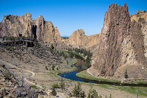 Viewpoint approaching Smith RockNot only did they give us a site, but they booked us one in the Platinum section of the resort—wow! a campground with social classes. When we checked in and were being told about the many fine amenities in the resort, the girl behind the desk explained that complementary coffee and newspapers were provided each morning in the guest lounge. However, when she realized that we were “Platinum” guests, she quickly corrected herself and informed us that our newspaper would be delivered right to our door. Now, that’s camping!
The Resort was one of the nicest kept campgrounds (excuse me, “resorts”) we have ever stayed in, rivaled only by Tiger Run in Breckenridge, Colorado. This was not your typical campground, but more of an RV land for the rich and famous, with million dollar RVs parked on pads constructed of decorative, paver bricks, professionally landscaped patios, a guest lounge, a spa and fitness center, a tennis court, and more. It was worth every penny of the $84 a night we had to pay.
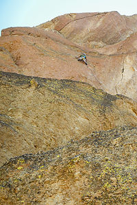 Tom leading up the five pitch "Wherever I May Roam"That evening we drove the Subaru into town and had dinner at the Deschutes Brewery Pub, described in the guide books as a brewery that had very good food. We were fortunate to get a table on their upstairs outdoor patio, looking out over the action on Bond Street. They were right. The food was great and the beers were terrific. As always I had Tommy, my personal beer consultant, make the selection for me. The Fresh Squeezed IPA he ordered for me was unbelievable, very hoppy with a nice citrus touch. I have come to be very discriminating in my beers as of late.
After dinner, we strolled around town for a bit through Drakes Park along the Deschutes riverfront. It is a very lovely town and I can understand why it is the fastest growing city in Oregon.
The next morning we arose early to get ready for our trip to Smith Rock State Park, a world class rock climbing destination, just about ½ hour north of Bend. Each of us was busily working away at our assigned tasks. Tommy was laying out his climbing gear on the fancy, brick pavers to make sure he had everything. I think I can safely say that we were the only ones in the resort doing this. I was making sandwiches and packing the cooler, and poor Herb was ferociously jabbing at a clogged toilet with a coat hanger. I can probably also safely say that he was the only one in this resort doing that as well. Even I was beginning to wonder if we really were “Platinum” material after all.
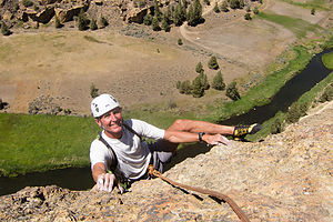 Gratuitous Heel Hook by HerbGear sorted, cooler packed, and toilet unclogged, we headed out in the Subaru to Smith Rock. Smith Rock was the reason that Tommy had driven all the way down from Seattle to meet up with us. Herb has been an avid rock climber since he was in his 20s, and in recent years the boys had developed a love, or more correctly obsession, for it as well. It’s nice when they get a chance to do some father-son bonding on the rock.
While Herb had always done traditional (or “trad”) climbing at the Gunks in NY State, Tommy prefers to do “sport” climbing. What that means is that rather than the traditional way of putting protection pieces in the rock as you climb to prevent you from falling, the bolts and protection are already permanently fixed to the rock. It’s a bit safer and quicker to set up a climb, which is a good thing as far as I am concerned. Tommy had known for awhile that Smith Rock, was a sport climber’s mecca, with over 1,000 bolted climbing routes.
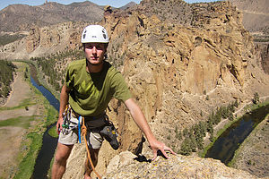 Tom at Summit of "Wherever I May Roam"Although I have done a bit of rock climbing in the past, I never really got that comfortable with the heights, so I usually choose to hike or run when Herb is climbing. Fortunately, this park had beautiful scenery and plenty of miles of trails to entertain me.
The rock formations in the park are spectacular – multi-colored, jagged ridges of basalt, formed from volcanic activity millions of years ago, when lava flows entered this canyon and cooled. Winding between these basalt peaks is the lovely Crooked River, which twists and turns its way for miles through the park.
After parking the car, we took the trail down to the river, crossed a bridge, and then followed the River Trail along the banks of the Crooked River. Rivers have a tendency to not take the quickest route from Point A to Point B, so Herb and Tommy abandoned me when we got to Asterisk Pass, a rather steep rock scramble over one of the ridges to get to their desired climb.
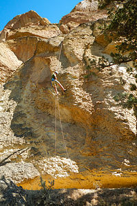 Tom "On Rappel"I actually started up Asterisk Pass with them, but turned back when I got scared. That was fine. I wanted to hike anyway. It was only about an extra mile and a half or so to follow the river around the ridges to the base of where they would be climbing. As I got closer to where I thought they would be, I kept calling out their names and scanning the rock cliffs to see if I could see them. Finally, they answered me, but I saw no good way to get up from the River Trail to the base of the cliffs. Not able to find a real trail up, I scrambled up the rocky slope, grabbing at vegetation to keep from sliding back down – probably not the recommended way up. I later learned that if I had only gone a little further, there was a better trail up to the base of the cliff.
The climb up “Wherever I May Roam” (the name of the climb) took a good part of the day, but I was perfectly content reading my book below and gazing out at the scenery. Herb and Tommy absolutely loved the climb and eventually rappelled back down, exhilarated and happy.
Before going back to the campground, we searched for a place in Bend to swim in the Deschutes River. It took us awhile, but we eventually found a small swimming beach in McKay Park, across the river from the Old Mill District, and a short distance downstream from a small waterfall on the river. Tommy and I went for a quick dip, which was fun, especially when we went out a short distance and floated downstream in the strong current from the nearby waterfall. However, the real way to experience the Deschutes through Bend is to float it in a tube, but since we didn’t have any, we had to watch in envy as people entered below the waterfall and happily floated by. Next time—and there definitely will be a next time in Bend--I will have tubes.
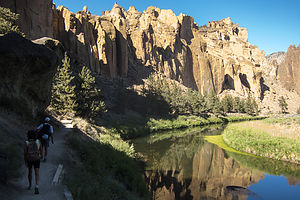 Herb and Lolo Hiking at Smith Rock - TJGAfter drying off, we cross the bridge over the waterfall and walked around the Old Mill District. This is a really nice part of Bend with lots of shops, galleries, and restaurants, but we were a bit too wet still from our river dip to take advantage of these. Instead we strolled along a lovely river walk and also spent some time admiring a very unique 18-hole, golf-style fly fishing course, where anglers can practice their casting skills.
It had been a really great day, but I was a bit sad because we would be parting ways with Tommy tomorrow morning, and I was unsure when we would see him again. However, his move to Seattle would provide us with lots of excuses to come back to enjoy the many wonderful places of the Pacific Northwest.
Description
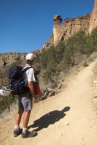 Herb viewing "Monkey Face"Bend is the largest city in Oregon east of the Cascades. It is located in the high desert, along the banks of the Deschutes River on the eastern edge of the Cascade Range. A major reason for Bend’s popularity, both as a place to live and as a tourist destination, is its sunny skies. With an annual average of 158 clear days, 105 mostly sunny, and the remaining still with some sunshine, it is the sunniest city in the state.
Bend is also an outdoor enthusiast’s mecca and there is so much to do in all four seasons: skiing the powdered slopes of Mt. Bachelor, kayaking or rafting the mighty Deschutes River, hiking the Three Sisters, golfing at one of its many fine courses, fly fishing the lakes and streams, mountain biking the miles of backcountry trails, and on and on.
For the less active, or for those after an exhausting day of outdoor activity, there is the lively downtown area with its many fine restaurants and shops.
About 25 miles north of Bend is Smith Rock State Park, whose jagged peaks of basalt attract rock climbers from around the world. Considered to be the birthplace of American sport climbing, it has over 1,000 bolted climbing routes. Its stunning location in the Crooked River Gorge also makes it an ideal place for hiking or mountain biking along its many miles of trails
Mount Rainier National Park
Friday, July 5, 2013 - 11:00am by Lolo100 miles and 2.5 hours from our last stop - 2 night stay
Travelogue
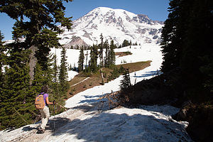 Lolo approaching the Skyline TrailMount Rainier had pretty much dominated the horizon during our entire tour of Seattle. Practically everywhere we went, there it was rising in all its majesty above the city. We were very fortunate, because more often than not, the mountain is hidden in the clouds, and you are not even aware that it is there.
Although we had been to Mt. Rainier in the past, it was definitely worth a revisit, especially since the skies had been so clear the last few days. I called and booked two nights at the Mounthaven RV Resort, located just ½ mile from the Nisqually entrance to the park.
We were very pleasantly surprised when we arrived at the campground. It was small – only 16 RV sites – and nestled in a grove of cedars. Plus it was a very convenient base from which to explore the park.
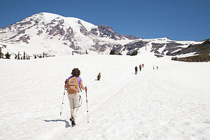 Lolo on Skyline TrailDespite the fact that our clear skies had given way to a thick cloud cover obscuring the mountain, we drove to the Longmire Museum and Ranger Station, about 6 ½ miles into the park, to get some hiking options for the next day. I already had the answer in mind, as I had read that if you only have time to do one hike in Mt. Rainier, it should be the Skyline Trail.
We spoke to some rangers at Longmire, who were very helpful, but couldn’t tell us with any surety what we wanted to hear – namely, that the mountain would be out in the clear tomorrow. I think that no one really knows what it is going to do at any particular point in time, and even if it does come into view, it can quickly disappear. Herb was not very pleased when she suggested some hikes with lovely views of wildflowers. Now, we like wildflowers as much as the next guy, but that was not what we came here for. We wanted to see and be out on the mountain.
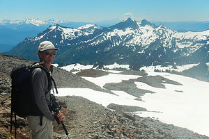 Herb Hikes tooWhen we expressed our strong preference for a mountain hike, she informed us that the hike we had picked out ourselves, the Skyline Trail from Paradise, had too much snow on it to complete the entire loop. Sensing our disappointment and determination, she suggested that perhaps we could hike the Skyline Trail to where the snow got too high, and then make it into a loop by taking the Golden Gate Trail down. This definitely appealed to us more than the wildflower meander. Now we just had to hope for clear skies.
On the way back, we stopped to take the short walk down to Narada Falls, but the day was too gray to really get any good photos.
The next morning we were absolutely thrilled to wake up to clear blue skies. Although our campsite was too nestled in the forest to have any views, I just knew that Mt. Rainier was out there strutting her stuff.
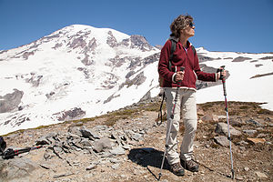 Lolo contemplating the dreaded Snow TraverseWe quickly got our gear together and drove to the Paradise Visitor Center to start our hike. Paradise is aptly named , because it is truly the most beautiful part of the park. This is where the historic, and very cozy, I might add, Paradise Inn is located and it is also the starting point for mountaineers climbing to the summit.
The trailhead for the Skyline Trail is located just to the left of the Ranger Station in the large parking lot at Paradise. While walking to the trailhead, I stopped a ranger in the parking lot and asked her if our plan to hike the Skyline Trail to the Golden Gate Trail was a good one. She confirmed that it was in fact an excellent choice and even complimented my Asolo hiking boots as being perfect for the conditions.
The trail started out on the stone steps behind the Henry M. Jackson Visitor Center and climbed briefly up to a series of trail junctions. There are a lot of trails starting from Paradise, but they are very well marked and heavily traveled. At the junction, we bore right, following the signs to Panorama Point on the Skyline Trail.
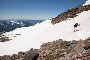 Lolo Conquering the Dreaded Snow TraverseWe were definitely not the only ones with this trail in mind. After all, it was a perfect day and the entire mountain was in view. In addition to being a day hiking trail, this trail was also the starting point for ascents to the summits, so there were dozens of climbers laden down with heavy packs and equipment making their way up to base camp before dark. From there, the next morning they would rise by 3:00 am to do the really tough part up to the top. While most of them looked very fit and prepared, I was a bit concerned about the potential success of a few of them.
One gentleman in particular was very slowly and deliberately walking, one foot forward, pause, then the other foot foward, pause -- kind of like you see on Mt. Everest ascent movies when climbers are nearing the top. The problem was that he was still within sight of the parking lot. His brand new gear – so new that I actually looked to see if the price tags were still on – was swaying from side to side as he labored up the mountain. Also, unlike other large parties of climbers accompanied by a guide, he was all alone. I certainly hoped he knew what he was doing.
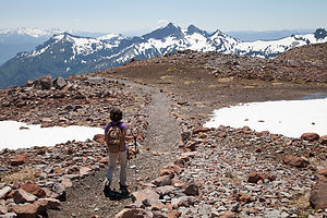 Lolo on the Golden Gate TrailA bit further on, we passed another situation in which a rather frustrated guide, whose job it obviously was to hang back with the slowest in the party, was expressing concern to one of the climbers in his group that if he was feeling that bad already, there was an awfully long way to go, and he should perhaps reconsider his continuing on.
This mountain was serious business, and I can imagine the guide’s dilemma of having to suggest to someone that probably had paid a lot of money and had done a lot of training to get to this point, that maybe they should turn back. Going on could not only jeopardize himself, but perhaps the safety of the entire group.
In the meantime, we were having the hike of our lives. The sky was so blue, and being so up close and personal with Mt. Rainier and the Nisqually Glacier was truly an awesome experience. As we got higher and higher up the trail, there was more and more snow on the side of the trail and less and less meadow. At approximately 2 miles we reached aptly named Panorama Point, and when we turned our backs on Mt. Rainer, we were treated to a spectacular view of Mt. Adams, Mt. Hood, and Mt. Saint Helens in the distance.
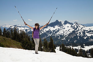 Triumphant Lolo "cheating death" againThe mountains of the Pacific Northwest are so different than those of the Rockies in that since they are volcanoes, they rise up as a single mountain rather than as part of a range. This makes them so much more dramatic, and I guess a little more frightening, if you think about why they are formed the way they are.
The Skyline Trail continued climbing for a bit above Panorama Point before dropping down to a field of snow covered rocks. At first I got a little nervous – I had had a bad experience with a snowy traverse in Rocky Mountain National Park the previous year. I suggested to Herb that maybe we should think about turning around and retracing our steps down the Skyline Trail, but he was having none of it, so we continued on. Crossing the snow really wasn’t that bad, especially with the help of trekking poles. After approximately another mile, we came to the junction for the Golden Gate Trail, which was the route the ranger suggested for the descent to Paradise.
The way down was equally, if not even more, spectacular than the way up, but quite different. Rather than Mt. Rainier dominating our view, we now were looking out over a vast expanse that extended all the way to Oregon.
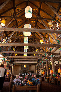 Paradise Inn Great HallAbout a third of the way down, we ran into a party of three young men on their way up the Golden Gate Trail, who warned us that they had just had to climb some very steep snowy areas. I didn’t particularly like hearing this, and once again questioned Herb as to whether we should turn back. At this point, turning back and retracing our steps would make for a very long hike. Herb calmed me down and convinced me to go on.
Once again, it really was not a big deal. I don’t mind going down steep snowy slopes when there is no dropoff or boulders to hit at the bottom. This was more like a very steep sleigh riding hill. I was so glad Herb talked me into continuing.
When we arrived back down in Paradise, we just had to go into the historic Paradise Inn. I absolutely love the warmth and coziness of National Park lodges, and this one was one of my favorites. We had been here several times in the past – our first was 23 years ago when we stayed at the Inn with Andrew when he was just one year old, and then again in 2001 when we came back with both Andrew and Tommy and had lunch in the beautiful dining room. This time all I was getting was coffee, but still it was great to just sit in front of one of the giant stone fireplaces in the great hall, contentedly sipping my mocha.
What a perfect day!
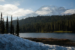 Mount Rainier from Wonderland Trail near Reflection LakesBut it wasn’t over yet. That evening, after dinner in the motorhome, we drove back into the park once again to photograph the mountain in the evening light. This time, we drove all the way past Paradise to Reflection Lakes, where if conditions are just right, you can see the mirror image of the mountain in the lake. This is the iconic shot of Mt. Rainier. Unfortunately, by the time we got there, the clouds had already moved in obstructing the mountain. Oh well. The mountain owed us nothing. We had gotten to play with it all day.
We took a brief stroll along the lakeshore on a portion of the Wonderland Trail, which encircles the entire mountain. This trail, on which we hiked about ¼ mile, is 93 miles long, and is supposed to be a spectacular 8-day backpacking trip.
I am sure that someday soon, especially since Tommy is now living only 2 hours away in Seattle, we will be back to Mt. Rainier. But next time I will be whining about more than a little snowfield to cross, because Herb has officially added backpacking the Wonderland Trail and climbing to the summit of Mt. Rainier to our bucket list. I am not sure if you are allowed to add things to a bucket list that you have already done in your life, but I don’t care. Staying at the Paradise Inn again is now officially on there as well.
Description
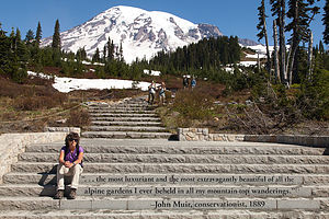 Lolo channeling John Muir for the hike up Mount RainierMount Rainier, the highest mountain in the Cascade Range, dominates the landscape of western Washington, often visible for more than 100 miles. Unfortunately, the mountain often hides in the clouds for days or even weeks at a time, making it big news in the Seattle-Tacoma area when it is "out."
Nisqually GlacierNisqually GlacierMount Rainier stands 14,411-feet above the surrounding lowlands and 1 ½ miles higher than the surrounding mountains. It is the world's most massive volcano, with its base covering an area of over 100 square miles. Although it has been dormant for more than 150 years, Rainier is still an active volcano with its next predicted big eruption to be in about 500 years.
Mt. Rainier is so high that it makes its own weather. The moist, east winds off the Pacific Ocean are trapped and forced upward by the mountain, resulting in heavy amounts of precipitation on the west side. At lower elevations, the precipitation is in the form of rain, creating the Carbon River Valley rain forest in the northwest corner of the park. At higher elevations, an average of over 50 feet of snow falls a year. As a result of these massive amounts of snow, there are more than 26 glaciers on Mt. Rainier, making it the most glaciated mountain in the lower 48 states.
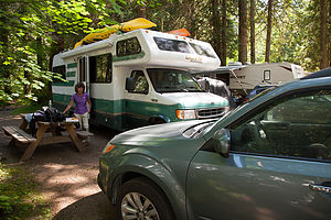 Camping at Mounthaven RV ResortEvery year more than 8,000 climbers attempt to reach its summit, with only about 4,500 reaching the top. Because of its difficulty, mountaineers from around the world use it as a training ground before attempting such peaks as Mt. Everest and K2. However, most of the 2 million annual visitors do not attempt to climb the mountain, but rather spend their time hiking in the beautiful alpine meadow, satisfying themselves with just viewing this incredible mountain.
Because of its close proximity to Seattle and Tacoma, Rainier is a very popular and therefore crowded park, especially during the short July to September summer season where there are often traffic jams and difficulty parking.
Mount Rainer disappearing in the cloudsMount Rainer disappearing in the cloudsMost visitors enter the park from the west at the Nisqually Entrance and stop at Longmire, where there is a museum, visitor center, lodge, campground, and general store. Longmire was the site of the historic 1899 Mineral Springs Resort, the first hotel in the park. The pioneer James Longmire discovered mineral springs here and brought tourists in with the promise of curing their ailments with water treatments. The .7 mile Trail of Shadows Nature trail goes through a wildflower-filled meadow and past what is now a cool mineral spring, the site of the former resort.
About 10 miles east of Longmire is Paradise, the most popular spot in the park, with its beautiful subalpine meadows and endless fields of wildflowers. There are several popular hikes that start from the visitor center here. One of the best is the Nisqually Vista Trail, an easy 1.2-mile hike through the meadow to the base of the Nisqually Glacier. Also at Paradise is the historic 1917 Paradise Inn, a beautiful rustic mountain lodge with spectacular views of the Nisqually Glacier and mountain.
Continuing east from Paradise is the Reflection Lakes, where on a clear, calm day you can see the mountain reflected in the waters. About 20 miles east of Paradise is Ohanepecosh and one of the most popular hikes in the park, the 1.5-mile Grove of Patriarchs Nature Trail. This hike goes through an old-growth forest and over a bridge to a small island in the Ohanepecosh River, dominated by huge ancient red cedar, Douglas-fir, and western hemlock trees.
About 17 miles north of the Grove of Patriarchs is the White River Entrance to the park. From there a 12-mile road winds through thick forests on its way to Sunrise, the highest point in the park accessible by car. From here there are breathtaking views of the meadows, mountains, and glaciers. The ½-mile Emmons Vista Trail goes to an excellent view of Emmons Glacier, Mt. Rainier's largest glacier.
For those that really want to experience hiking at Mount Rainier, there is the 93-mile Wonderland Trail, which completely circles the base of the mountain. Most people allow 2 weeks time to do the whole loop, but portions of it can be done as a day trip.
There are 5 RV campgrounds in the park
Seattle
Tuesday, July 2, 2013 - 7:30am by Lolo247 miles and 2.5 hours from our last stop - 3 night stay
Travelogue
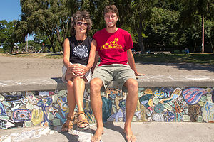 Lolo and Tom at Golden Gardens ParkLike most cities, Seattle does not have a campground within its boundaries, so before heading out on this trip, I searched for campgrounds within a 25 mile radius. We tend to prefer national and state parks to commercial campgrounds, so I was very pleased to discover Saltwater State Park, exactly 23.3 miles from the University District in Seattle, where Tommy was going to be living. Since our stay would overlap 4th of July, just to be safe, I made reservations for a 3-night stay.
When we arrived, I was extremely pleased with my selection, so much so, in fact, that I was practically gloating. The park had 1,445 feet of beachfront on the Puget Sound, including a sandy swimming beach, and tide pools that were exposed during low tide. The campground itself was nice as well, nestled in a forested ravine along a creek, and just a short walk from the beach.
Tommy drove down to join us after unloading some of his belongings, and we headed down to the beach with cameras, a cooler, and chairs to watch the sun set over Puget Sound and the Olympic Mountains. It really was quite lovely. I thought I had found the perfect base camp from which to explore Seattle.
 Tom Photographing Jumping Salmon Sign at Chittenden LocksI only later discovered a few issues that made it a bit less than perfect – still pretty darn good – but not perfect.
Firstly, I was unaware that the park was located along the flight path for jets approaching SeaTac Airport. At first, it was amusing and as each jet roared by overhead, I would point up and say, “Look a plane.” However, after realizing that there was only about a 15 minute interval between planes, this got old pretty quick.
Secondly, and this was my fault, I didn’t realize that our site did not have a water or electrical hookup, so we probably should have filled up with more water before arriving. That would explain why it was only $23 per night.
Thirdly, that 23.3 mile trip to Seattle was not quite as convenient as we thought. During certain times of the day, I5 approaching Seattle is more similar to a parking lot than a highway. We would definitely have to avoid a wide window around rush hour.
Day 1 – Seattle Tour
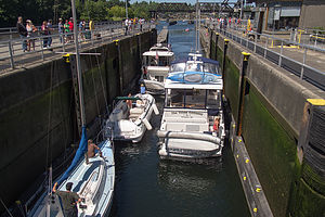 Boats in Chittenden LocksThe next morning, Herb and I set out fairly early to meet up with Tommy in Seattle to do a whirlwind tour of the city. There really are so many great places to see and things to do that we had to limit ourselves to just a few selections that would give us a flavor for what this great city has to offer.
We started off at Green Lake Park, not too far from where Tommy was now living. Rather than just stopping at tourist destinations, I wanted to get a feel for where the locals spend their time. After all, Tommy was now a local, even if for just one day. The park was lovely, and there was so much to do. It was a very bustling place, even on a Wednesday. There are two swimming beaches, one on each side of the lake, and a place to rent kayaks, canoes, and paddleboats. A 2.8 mile paved trail circles the lake and it was filled with joggers, rollerbladers, bicyclists, people walking their dogs, moms pushing strollers, you name it. In addition, there were dozens of people just relaxing in chairs or on blankets watching the action go by. I could definitely picture this as a place to just come and hang out at on a sunny day.
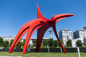 Calder's "Eagle" at the Olympic Sculpture ParkNow that we had experienced a Seattle urban park, we headed west to Golden Gardens Park on the Puget Sound. It was a nice day, and although there were quite a few people on the beach, no one was braving the chilly waters. That’s one thing that I have to say the East Coast has over the West – oceans with swimmable temperatures. However, the West Coast beaches do dominate when it comes to scenic views from your beach blanket; in this case, we the snow-capped Olympic Mountains rising beyond Puget Sound.
Chittenden Locks was a very fun stop. I am not sure which was more interesting – watching the boaters and lock-keepers scurrying to get boats securely tied before the locks were raised or lowered, or the salmon, looking equally frenzied as they scrambled to get up the next fish ladder. These locks provide the connection between the saltwater of Puget Sound and freshwater Lake Union and Lake Washington. It is a very busy place, as well as one of the most visited attractions in Seattle.
 Herb and Lolo on "The Western Oracle: We Will Tear the Roof Off the Mother"While the boats go both to and from the Sound, the salmon are only going one-way – upstream to spawn. After watching a few boats get through the locks, we went to the underwater fish-viewing window to watch the salmon and trout jump up the fish ladders. It is so amazing that they are so programmed to do this, and the ladders make it possible, despite the locks which have blocked their normal passage since 1917.
The way the ladders work is freshwater is forced to flow swiftly out the bottom of the fish ladder, simulating swimming upstream. When approaching the ladder, the fish smell the water and actually recognize the scent of Lake Washington – now that is pretty impressive. After entering the ladder, they have the choice of either jumping over each of the 21 weirs, or cheating a little and swimming through tunnel-like openings. When they exit, they are in freshwater and ready to continue along the waterway to the exact location where they were born. Then they perform their biological function: females lay eggs, males fertilize them, and then they die. Fortunately, their offspring live on to head out to sea before returning a few years later to repeat the whole process all over again.
 Typewriter Eraser, Scale XI hesitate to even include our attempt at visiting Discovery Park in the narrative, because we just couldn’t figure out where to go and what to do there. It is Seattle’s largest park and is, according to the guide books, a hiker’s paradise. What we should have done is find the Visitor Center to get some maps, but without the maps, we couldn’t even find that. However, based on my readings, if we had done it right, we would have hiked to an incredible view of Puget Sound and the surrounding Olympic and Cascade mountain ranges from the top of Magnolia Bluff. Oh well, maybe next time.
We had a lot more luck with our stop at the Olympic Sculpture Park, a lovely nine-acre outdoor museum overlooking Puget Sound, about a mile north of Pike Place Market. Some of the works were so very familiar, such as Alexander Calder’s iconic red steel sculptures – which we have also enjoyed on our visits to Storm King Art Center in New York State. But what really struck a familiar cord with us were Louise Bourgeois' Eye Benches. These large granite eyes with benches molded into the back of them were just like the ones outside the Williams College Museum of Art, where both boys went to college. In fact, they were by Bourgeois too. In addition to the coincidence with the Eye Benches, The University of Washington’s flags along the street near where Tommy lives have big purple W’s on them, once again, just like Williams College. Seattle was beginning to feel more like home for Tommy already.
 Lolo and Tom strolling Pike Place MarketThere were a lot of interesting sculptures to enjoy in the Park, but one of the most unusual ones for me was Heather Hart’s The Western Oracle: We Will Tear the Roof Off the Mother. This was not just a piece to look at, but one to interact with. From the upward side of the hill, it appeared as an independent rooftop without a house below. A roof alone is not too high, so I followed the tour guide’s encouragement to climb out on it. However, since the piece was built into the side of a hill, the view from the peak looking down and out over the Sound was a little bit more intimidating. Unfortunately, I had not read about this work before scampering about its roof, so I didn’t realize I could climb into the interior attic space. Reading about this piece now, I wish I did. The interior walls that hold the windows are made of Native elk drums, which are meant to beaten on, like a drum, to give them guidance and truth – hence the name The Western Oracle: We Will Tear the Roof Off the Mother.
There were plenty more works to enjoy in the garden as well, by artists such as Richard Serra and Mark di Suvero. The Park was definitely a very enjoyable and worthwhile stop.
 Lolo and Tom dining at Pike Place ChowderWe had accomplished so much already in our tour of Seattle, and we hadn’t even had lunch yet. That made our next stop absolutely perfect (and a bit overdue) -- Pike Place Market. I think that the image that comes to mind when people picture Seattle is probably the Space Needle, but not too far behind that is the huge, iconic red neon Public Market sign and the fishmongers throwing salmon. It was such a bustling place.
We started off walking through the upper level arcade, with its seemingly endless line of food and craft vendors. Hoping to see some fish tossing, we hung out for awhile near a fish vendor, but he must not have been in the mood. I would have to say that I never thought of watching people buy fish as a spectator sport before.
 Tom and Lolo at Gum AlleyWe were quite hungry, but there were so many places to choose from. As we often do, we used Yelp and found that Pike Place Chowder seemed to fit exactly what we were looking for. Despite the fact that it was mid-afternoon, and neither lunch nor dinner time, the line to order extended out onto the street. However, it moved quickly and it wasn’t long before we had our food and were seated at an outdoor table, where we could observe the action.
We all chose to order a combo, which included one of their delicious specialty chowders and a half sandwich. We unanimously went for the Smoked Salmon Chowder. Why get New England Clam Chowder when in the heart of salmon country. Tommy and I got their famous Dungeness Crab Roll, which was absolutely delicious, but poor Herb, who is allergic to shellfish, got the Alder Smoked Salmon sandwich. Hard to feel sorry for him, because that was delicious as well.
After lunch, we strolled around a bit more and came upon the infamous Gum Alley. At first I wasn’t sure whether to classify this as disgusting or beautiful, but I eventually settled on beautiful. There is a fine line between litter and art. The entire length of the alley, from street level to 6 feet above, was totally covered with bubble gum of every shape and color. It was amazing.
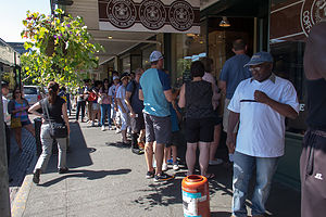 Line at the "Original" StarbucksBefore heading off for our next stop, we wanted to get a cup of coffee – and why not get one at the original Starbucks? I’ll tell you why not. Because the line extended halfway down the block, while a non-original Starbucks a short distance away had none.
Our next and final activity of the day was biking the paved trail along Alki Beach in West Seattle. We parked our car on Harbor Avenue near Salty’s Restaurant and took our bikes off the car. The trail runs for about 2 ½ miles along the Elliott Bay shoreline paralleling Alki Avenue the whole way. This was a very nice neighborhood, which colorfully painted houses across from the beach. If I was to live in Seattle, I think this would probably be my top choice. While there were plenty of people out and about on the beach, playing volleyball and such, no one was in the water. Those chilly water temperatures really do make for a different beach experience than back East.
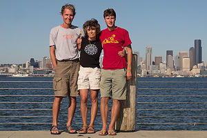 Herb, Lolo, and Tom on Alki Beach Bike PathWe found a Starbucks without a line wrapped around the block and very happily sat on a bench by the beach sipping our decadent ice mochas. Besides having the Puget Sound and the Olympic Mountains to look at, the Downtown Seattle skyline was right across the way.
We continued to where the path ended at Alki Point before turning around and retracing our way back to the car.
It had been a busy day, but a very fun and productive one as well. I feel that we had gotten a good feel for the variety of places and activities that Seattle has to offer, and I felt very comfortable that Tommy would be very happy here. Also, it would be a great place to visit.
Day 2 – Shopping and Fireworks
There was a lot of nesting that had to be done to get Tommy settled in his new apartment in Seattle, so he and I decided to spend the day shopping while Herb stayed back and the campground doing maintenance on the RV.
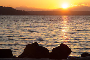 Saltwater State Park SunsetIt was 4th of July, but all the stores were open. First stop, Swedish meatballs and macaroni (at 10:00 am in the morning) at the Ikea Bistro. I had never had meatballs that early in the day, but they were pretty good, and the price was certainly right. Then we got down to business. By the end of the day, Tommy had bought a queen size bed and mattress, a dresser, an end table, and a desk. Rather than try to cram all this stuff into his car, we collectively decided it would be well worth the $60 to have it delivered.
Then it was on to Bed Bath and Beyond, where we managed to spend another $300 to fully stock his kitchen and bathroom.
It was a very, very productive day including some great mother son bonding. We treated ourselves to another decadent Ice Mocha with whip cream at a Starbucks drive-thru and headed back to the campground to meet up with Herb. I had ordered a venti (large) with the intention of sharing it with Herb when we got back, but somehow there was only about a ½ inch left when we arrived. Those things have an awful lot of calories.
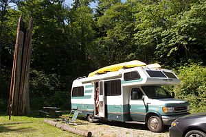 Camping at Saltwater State ParkWe had some time to kill before the fireworks that evening, so we went for a trail run within Saltwater State Park. The campground is located at the bottom of a ravine, so the trails were pretty steep and a little confusing to follow. Anyway, we did manage to get in some exercise and I was able to burn off probably about ¼ of the calories I consumed with that coffee.
After dinner, we took our beach chairs down to the campground beach to set up to watch the fireworks. The beach is part of the park’s day use area, so it was already getting quite crowded. Once the fireworks got started, we actually wound up sitting on the rocks along the beach for a better view. It was a different fireworks experience than I am used to. Rather than being close to one fireworks display, we literally watched over a dozen displays in communities up and down the coastline and across on Vashon Island. There were so many places to look at the same time. It was a really nice way to bring our visit to Seattle to a close.
We said goodbye to Tommy, who headed back up to Seattle to spend the next few days settling in. I wasn’t too sad though because this wasn’t the official goodbye yet. We were all planning to meet up again in Bend, Oregon in a few days.
Description
We chose Saltwater State Park as our base camp from which to explore Seattle.
Saltwater State Park
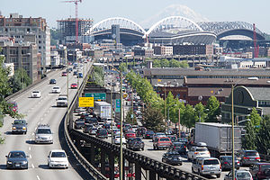 Mount Rainier view from Victor Steinbrueck ParkSaltwater State Park is an 88-acre marine camping park located about halfway between Seattle and Tacoma in the city of Des Moines, Washington. Its main attraction is its 1,445 feet of beachfront on the Puget Sound, including a sandy swimming beach, tide pools for exploring marine life, a submerged artificial reef popular with scuba divers, and salmon spawning in McSorley Creek. There is also a paved walking trail along the beach.
In addition to its waterfront section, the remainder of the park is nestled in a forested, steep ravine, with a network of hiking trails up to and along the surrounding ridges.
There is a 52-site, first-come first-served campground with no hookups. All sites are in McSorley Gulch along a road that parallels McSorley Creek.
The park is along the flight path for jets approaching SeaTac Airport, so it can get quite noisy at times. During certain hours, planes fly over the park every 15 minutes.
Seattle
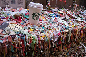 Gum AlleyOur stop in Seattle was brief, so this in no way is an attempt to give a thorough description of what to see in the city. However, the following sites are what we chose to do during our all too short one day visit.
Green Lake Park is a favorite amongst Seattleites who come here to enjoy its 342 acres of water and green space. Located in the center of a dense urban area, it draws thousands of people daily to swim, bike, jog, skate, stroll, boat, walk their dogs, or just sit on a blanket and people watch. There are two swimming beaches, one on the east side and one on the west, with lifeguards and swimming rafts. Green Lake Boat Rental, on the eastern side of the lake, rents paddleboats, kayaks, and canoes. A 2.8 mile paved trail circles the lake and is often crowded with strollers, bikes, bladders, and joggers. In addition, there are playgrounds, basketball and tennis courts, and athletic fields for baseball and soccer.
Golden Gardens Park, located in Ballard on Puget Sound, is a popular destination for Seattle beachgoers. While the waters are quite chilly for swimming, the extraordinary views of Puget Sound and the Olympic Mountains from its sandy beach make it a lovely spot to spend the day. The park also has two wetlands, a short loop trail, and a fishing pier. Watching the sunset over the sound gathered around a bonfire is another popular activity.
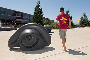 Tom with Louise Bourgeois' Eye BenchesDiscovery Park’s 534 acres makes it Seattle’s largest park. It is located in the Magnolia/Queen Anne district of Seattle. The park has a wide variety of terrain, including two miles of protected tidal beaches, active sand dunes, dramatic sea cliffs, meadows and forests, and a lighthouse. The more than 11 miles of trails includes routes along the beach and up and along the bluffs. From atop Magnolia Bluff, the views of Puget Sound and the surrounding Olympic and Cascade mountain ranges are spectacular. Maps and suggested walking/hiking routes are available at the Discovery Park Visitor Center.
Hiram M. Chittenden Locks is one of the most visited attractions in Seattle. The locks provide passage for boats along an 8-mile canal connecting Puget Sound with freshwater Lake Union and Lake Washington. Visitors can watch the parade of boats, tugs, and barges pass through the locks, as the water level is adjusted to allow them through. Another popular attraction is the fish ladder, built to allow salmon to migrate back to freshwater to spawn. An underwater fish-viewing window provides visitors with the opportunity to view several species of salmon and trout make their way back upstream. There is also a lovely botanical garden to stroll through.
The Olympic Sculpture Park is a nine-acre waterfront park that was transformed from an industrial site into an open space for art. The grounds, which are part of the Seattle Art Museum, are home for works by such artists as Alexander Calder, Richard Serra, and Mark di Suvero. On clear days there are stunning views of the Olympic Mountains and Puget Sound. Admission is free.
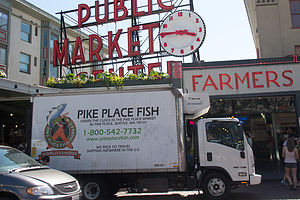 Pike Place Market SignPike Place Market is one of the nation’s largest and oldest public markets. Founded in 1907, it has now become one of Seattle’s most famous and popular attractions, hosting over 10 million visitors each year. Perched atop Pike Hill overlooking Elliot Bay, the nine-acre market district consists of several levels, offering fresh produce, unique foods, handmade arts and crafts, restaurants, the first Starbucks, numerous talented street performers, and even one of the oldest head shops in the country. However, the most popular section is the upper level, pedestrian-friendly covered arcade, with its iconic huge red neon sign and fishmongers tossing salmon to the cheers of the expectant crowd.
Alki Beach is a 2 ½ mile stretch of sand in West Seattle that runs from Alki Point to Duwamish Head on Elliott Bay. While few brave the chilly waters (temperature ranges from 46 to 56 degrees), the beach is popular for sunbathing and enjoying the spectacular views of Puget Sound, the Olympic Mountains, and the Downtown Seattle skyline. A paved bicycle path, which runs the whole length of the beach, is a hot spot for bicyclists, rollerbladers, joggers, and walkers.
