- Home
- About
- Map
- Trips
- Bringing Boat West
- Migration West
- Solo Motorcycle Ride
- Final Family XC Trip
- Colorado Rockies
- Graduates' XC Trip
- Yosemite & Nevada
- Colorado & Utah
- Best of Utah
- Southern Loop
- Pacific Northwest
- Northern Loop
- Los Angeles to NYC
- East Coast Trips
- Martha's Vineyard
- 1 Week in Quebec
- Southeast Coast
- NH Backpacking
- Martha's Vineyard
- Canadian Maritimes
- Ocracoke Island
- Edisto Island
- First Landing '02
- Hunting Island '02
- Stowe in Winter
- Hunting Island '01
- Lake Placid
- Chesapeake
- Provincetown
- Hunting Island '00
- Acadia in Winter
- Boston Suburbs
- Niagara Falls
- First Landing '99
- Cape Hatteras
- West Coast Trips
- Burning Man
- Utah Off-Roading
- Maui
- Mojave 4WD Course
- Colorado River Rafting
- Bishop & Death Valley
- Kauai
- Yosemite Fall
- Utah Off-Road
- Lost Coast
- Yosemite Valley
- Arizona and New Mexico
- Pescadero & Capitola
- Bishop & Death Valley
- San Diego, Anza Borrego, Joshua Tree
- Carmel
- Death Valley in Fall
- Yosemite in the Fall
- Pacific Northwest
- Utah Off-Roading
- Southern CA Deserts
- Yosemite & Covid
- Lake Powell Covid
- Eastern Sierra & Covid
- Bishop & Death Valley
- Central & SE Oregon
- Mojave Road
- Eastern Sierra
- Trinity Alps
- Tuolumne Meadows
- Lake Powell Boating
- Eastern Sierra
- Yosemite Winter
- Hawaii
- 4WD Eastern Sierra
- 4WD Death Valley +
- Southern CA Deserts
- Christmas in Tahoe
- Yosemite & Pinnacles
- Totality
- Yosemite & Sierra
- Yosemite Christmas
- Yosemite, San Diego
- Yosemite & North CA
- Seattle to Sierra
- Southwest Deserts
- Yosemite & Sierra
- Pacific Northwest
- Yosemite & South CA
- Pacific Northwest
- Northern California
- Southern Alaska
- Vancouver Island
- International Trips
- Index
- Tips
- Books
- Photos/Videos
- Search
- Contact
Rocky Mountain National Park, CO
Friday, June 28, 2013 - 10:45am by Lolo
252 miles and 5 hours from our last stop - 2 night stay
Travelogue
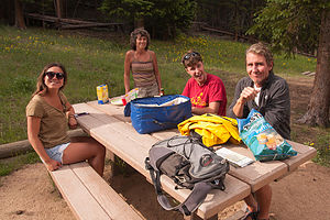 Picnicking at Hidden ValleyAndrew’s car still wasn’t working right, so we arranged to drop it off at a Midas shop in Fort Collins en route to Rocky Mountain National Park. We would have to be heading back out that way again anyway after our two-day stay at the park, so it really wasn’t too much out of our way to drop it off and forget about it for a few days. This was getting a bit ridiculous, but we figured as long as the car’s air conditioning was under warranty from the first repair in a Ohio Midas, we might as well keep trying to see if someone could fix it. We were becoming entirely too familiar with the Midas Regional Manager, who Herb called on a daily basis to vent about the crappy repair done in Ohio that, besides costing over $1,000, was now ruining our vacation.
The drive from Loveland west to Estes Park on Route 34 along the Big Thompson River was spectacular, tracing the twists and turns of the river. I was sad to read that the terrible floods in this area in September have caused much destruction, and this road is still closed as of this writing (November).
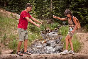 Tommy helping Lolo Cross the CreekOnce again, as in 2011, we decided to stay outside the park at the Mary’s Lake Campground in Estes Park. Actually the decision was made for us, as it was a weekend and all campgrounds inside the national park were full. The campground owner was kind enough to let us all squeeze on one site and park the extra cars near the office. The campgrounds proximity to the park entrance made it an ideal base camp for exploring the park.
Before setting out into the park, we decided to take a dip in the campground pool, but the presence of a rowdy scout troop made it far from relaxing. After having our cell phones and Kindles repeatedly soaked by the splashes of kids jumping in the “No Jumping Allowed” pool, we went back to our campsite and prepared to go for an exploratory ride into the park.
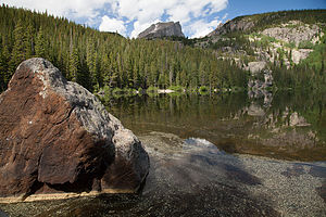 Bear Lake's Eastern ShoreWe loaded up camera gear and a cooler full of hors d'oeuvres (and a few libations) and drove through the east entrance of the park onto the very beautiful Trail Ridge Road. While this road winds and twists for 50 miles through the entire park past incredible vistas of snow-covered peaks, alpine meadows, and much wildlife, our goal for the late afternoon/evening was much less ambitious – perhaps about 15 miles in, stopping at various scenic viewpoints and then finding a nice place to picnic.
We drove as far as Many Parks Curve to take some photos, before turning around to hunt for a place to picnic. The national park map had a little picnic table icon at Hidden Valley, so we thought we would give it a try. It was lovely, with picnic tables spaced out along the rather steep slope. This was actually once a Ski Area and is still used in the winter for sledding and tubing.
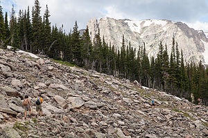 On Route to Lake HeleneWe marched up the hill with coolers filled with appetizers and a few beers and selected what we felt to be the best table. Always capable of having fun with the materials we had, the kids developed a game of Rocky Mountain National Park trivial pursuits, by which they used the National Park map to ask questions, such as “What year did it become a national park,” “How many named peaks does it have,” etc. Gradually the questions became more and more impossible, such as “When was the first major glacial episode.” It was around then that we quit and made a new game – sucker Andrew into bringing the coolers back to the car (so that we could hike) by making it a competitive event. We dared him that he couldn’t run down the steep hill to the car, put the coolers in the trunk, and get back to us in less than 3 minutes. He took the bait, and soon he was careening down the hill like a madman, tossing stuff in the trunk rather randomly, and then making the final climb back to us. He made it, but I think he didn’t account for the high altitude and definitely felt it was probably a stupid idea.
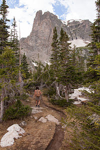 Lolo on Lake Helene HikeUnencumbered by coolers, we hiked up the hill. Part of the hike involved crossing a stream on rocks, which has never been my forte. Fortunately, Tommy who always keeps an eye out for me on these adventures, stepped in the water and helped me across. It was a lovely hike.
It was time to get back to the campground as we were expecting Tommy’s friend John, who would be joining us for the weekend. John is Tommy’s friend from high school who now lives in Colorado Springs. He always tries to meet up with us when we are passing through Colorado. Fortunately dinner was very easy that night. I had made a batch of Lasagna before we left on the trip, so all I had to do was hit that little Reheat button on the Microwave – my favorite type of cooking in the motorhome. That combined with one of Celeste’s salads made for a very nice dinner.
Just as we were finishing dinner, some pretty serious storm clouds moved in. I really love watching storms in the west. In New Jersey, if you see a storm, you are pretty much in it, but with the long vistas out west, you can be a casual observer of some pretty spectacular activity. Fortunately, the storm did not move our way, so we were able to watch the bursts of lightning, like we were sitting at a fireworks display.
The sleeping arrangements were a little different than our last time at this campground, when John had chosen to sleep on the roof of our motorhome, much to the amusement of our fellow campers. This time, John and Tommy slept in the back of John’s truck – a step up in accommodations for Tommy, who had been sleeping on the RV floor. Unfortunately, the next morning Tommy’s brand new thermorest pad was deflated. Apparently, there were some small pieces of broken glass in the back of the truck that he had placed his pad on.
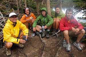 Lake Helene Hikers Lunching in RainThis was our one full day to enjoy the park, so we wanted to make the most of it. Tommy and John were more familiar with the park, having lived in Boulder for two summers, so we left it up to them to select a hike. They thought we might like the hike to Lake Helene from the Bear Lake Trailhead at the end of Bear Lake Road. I first made Tommy swear to me that he wasn’t going to make me traverse across a steep, narrow snow path like he did last year on our hike to Chasm Lake. I still have flashbacks. He assured me that I would be fine.
The problem with the Bear Lake area is that it is so popular that it is often difficult, if not impossible, to find parking. Because of that we decided to take the shuttle from the Visitor Center, and were even waiting at the shuttle stop when a park volunteer told us that if we left right away in our car, we should still be able to find parking at the trailhead. Foolishly, we listened.
We drove all the way to the end of Bear Lake Road, only to be turned back by a ranger informing us that the parking lot was full. Unsure what to do at first, we let Tommy and John convince us to get out and wait for them while they drove back to the closest shuttle stop, parked, and walked back to join us. It was really nice of them and it took a pretty long time. I got a little annoyed when I saw the park volunteer that told us we would find parking here get off the shuttle bus – a good half hour before Tommy and John eventually joined us.
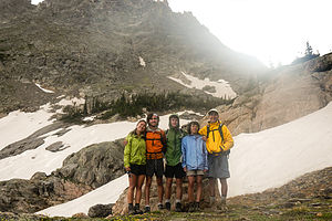 Lake Helene HikersThe hike to Lake Helene led us along the eastern shore of lovely Bear Lake before rising quickly through an aspen forest. In about a half mile, we came to a trail junction, and took the left towards Odessa Lake. Approximately another half mile further, we came to the Flattop Mountrail Trail split, and took a right towards Odessa Lake. About a mile further on, the forest opened and we crossed a short, but steep, scree field covered in snow. I gave Tommy a dirty look about this point, but it turned out to not be bad at all to cross. At roughly 3.2 miles we reached an unmarked side trail on the left that led to Lake Helene. It’s easy to miss. If the trail makes a sharp turn to the right and begins to descend, you have gone too far.
Meanwhile, storm clouds were moving in, and just as we reached the lake a gentle, but steady, rain began to fall. Weather changes so quickly in these mountains that you really have to be prepared. We had started out in shorts and t-shirts and were now in fleece and rain jackets, and still cold. Any thoughts of continuing on to Odessa Lake were extinguished. We huddled together, ate our peanut butter and jelly sandwiches, took some photos, and agreed to head down for fear that we would be caught in a thunder storming – not something you want to have happen here.
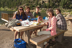 Picnicking at Lily LakeIt was quite beautiful though, and I wish we had caught it under better weather conditions. Along the north shores of this lovely alpine lake, rises aptly named high Notchtop Mountain.
I am always quite frightened of getting caught in a thunderstorm, which is a very likely possibility when hiking in the Rockies in the afternoon. However, fortunately, the skies cleared on our way down and we were already warm and dry by the time we got back to Bear Lake.
By the time we got back to the campground, weather had cleared up very nicely. We decided to pack up some appetizers and drive a short distance down Route 7 to a picnic area on Lily Lake, another lovely lake just inside the boundaries of the park. Although we were laughing and having a grand old time, I was beginning to feel a sense of sadness. This was the last night we would be together as a family for a long, long time. Tomorrow we would caravan together for awhile before splitting off – Tommy, Herb, and I to Seattle and Andrew and Celeste to San Francisco. I would miss John too, who would be heading back to Colorado Springs. Who knew when we would all be together like this again.
That night we went out to dinner at the Rock Inn Mountain Tavern. As I looked across the table at the boys, I tried to turn my feelings of loss of the past to the promise of the future. I already missed the little boys they had been – so much so that it physically hurt, but was so very proud of the wonderful young men they had become. It was the start of a brand new journey.
Description
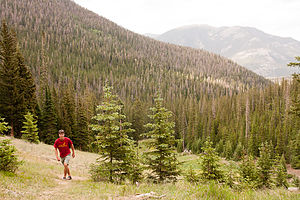 Hidden Valley HikeRocky Mountain National Park in north central Colorado encompasses 415 square miles of towering mountain peaks, alpine glaciers, dense forests, beautiful alpine meadows, and pristine lakes. Within the park there are more than 75 peaks above 12,000 feet, the highest of which is Longs Peak, at 14,255 feet. One-third of the park is above the treeline, where tundra predominates.
The major activities in the park include hiking and backpacking along the more than 355 miles of trails, mountain climbing the many peaks, and wildlife viewing (mountain goats, elk, deer, bear, and bighorn sheep, which have become the symbol of the park).
An excellent way to see many of the park's highlights is to drive the scenic 50-mile-long Trail Ridge Road, which rises to over 12,000 feet and crosses the Continental Divide. The road crosses the park from Estes Park in the east to Grand Lake in the southwestern corner of the park winds it way 12,183 feet above sea level into a world similar to the arctic regions of Alaska and Siberia. Along the way there are spectacular views of snow-covered peaks, alpine meadows full of wildflowers, deep forests, and much wildlife. Because of snow, the road usually does not open until Memorial Day and closes again in October.
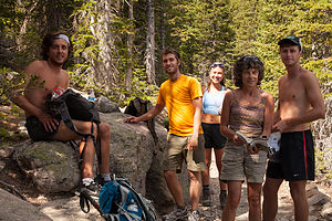 Rest Break on Hike to Lake HeleneAbout halfway along Trail Ridge Road, at a 12,110 elevation, is the Rock Cut parking area, which is the trailhead for the Tundra Nature Trail, an easy ½ mile hike that provides a close-up look at the hardy plants and animals that survive the harsh tundra environment at this elevation. A little further along the road is the Alpine Visitor Center. From here the short Alpine Ridge Trail climbs from the Visitor Center up a series of steps through the tundra to an excellent viewpoint.
There are many other excellent hiking opportunities in the park, including several along the Bear Lake Road. Most of these hikes offer tremendous views of mountain lakes and waterfalls. The 3.6 mile round trip Emerald Lake Hike starts at Bear Lake and goes past 2 more lakes before its final destination, Emerald Lake. The 1.2 mile round trip Alberta Falls Trail is an easy hike along a creek to the very pretty Alberta Falls.
There are 4 RV campgrounds in the park, only 2 of which take reservations. Campgrounds usually fill up by noon.
- ‹ previous
- 5 of 15
- next ›
Rocky Mountain National Park location map in "high definition"
Javascript is required to view this map.

Hi Lorry,
We were in Estes Park a couple of days after you were there. It would've been great seeing you after all these years.
By the way, this site is awesome.
Ken
Hi Ken,
With our mutual love of the national parks, we are bound to cross paths one of these days. Have fun in Yosemite this summer!!
Lorry
We are so looking forward to our trip to Yosemite. I love the picture of you guys sitting in the meadow drinking wine looking up at Half Dome. I can really see myself sitting there drinking a few beers. Can't wait to go out there. Take care.