Canyon de Chelly, AZ

After leaving Monument Valley we continued driving through the Navajo Nation to Canyon de Chelly. The Navajo Nation has its own government and laws separate from the United States. One of those laws, which I was just fine with, was strict enforcement of wearing masks both indoors and outdoors.
Canyon de Chelly National Monument is actually two canyons: Canyon de Chelly, which is the south fork, and Canyon del Muerto (“Canyon of the Dead”) the north fork.
Canyon de Chelly is one of the longest continuously inhabited places anywhere in North America, and archaeologists believe that human settlement in the canyon dates back about 5,000 years. These early prehistoric people used the canyon while hunting, but did not set up permanent homes. However, they did leave etchings on the canyon walls.
Around 200 BCE, semi-agricultural people, known as the “Basketmakers,” began to inhabit the canyon and grew corn, beans, squash, and other crops. They are considered to be the ancestors of the Ancestral Puebloan People.
Around 700 CE, the Ancestral Puebloan peoples (Anasazi) began to build larger settlements of cliff dwellings, multi-storied, apartment-like buildings made with adobe bricks, along the canyon walls. Wooden ladders were used to navigate the various stories and to enter the round kivas, ceremonial pits. These are the cliff dwelling ruins that we see on the canyon walls today.
In its heyday (1150 CE) Canyon de Chelly had about 800 inhabitants. Then, around 1300 CE the Ancestral Puebloan just abandoned the canyon, as the area entered a drought and they sought better farmlands. It is thought that they migrated south toward the more fertile Rio Grande Valley. Their descendants are the Pueblos of New Mexico, the Zuni, and the Hopi.
The Hopi continued to visit and partake in rituals in Canyon de Chelly from c. 1300-1700 CE, and they still revere the ruins today. The Navajo arrived in the region in the late 17th century CE, and they occupy the region today.
Canyon de Chelly National Monument was authorized in 1931 by President Herbert Hoover in order to preserve the important archeological resources that span more than 5,000 years of human occupation.
Today, although the monument is under National Park jurisdiction, about 40 Navajo families live down in the canyon from May to October growing corn, squash, beans, peaches and apples and grazing their sheep, cattle, and goats.
The Canyon had been closed for 477 days because of Covid, which hit the Navajo population quite hard, so they were very happy that it was reopening and they could move back down from their homes on the rim.
As with most sites within the Navajo Nation, most areas are off-limits unless you are accompanied by a Navajo guide. In the case of Canyon de Chelly, all you can really do on your own is drive along the North and South Rim drives, stopping at overlooks along the way.
You used to be allowed to hike down to the White House ruins in the canyon, but that is no longer allowed because sadly cars at the trailhead were being vandalized. The only way to go down into the canyon today is on a Navajo jeep tour.
So, it looked like we would be doing the Rim drives and the jeep tour.
There are two hotels in the town of Chinle, but we decided to stay at the Thunderbird Lodge, within the bounds of the Monument, because it seemed more authentic than staying at a Holiday Inn. Plus they offered Jeep tours right from the lodge.

Before leaving on our tour of the Rims, we reserved a Jeep tour for 9:00 the next morning, even though the forecast was for those dreaded desert winds.
We decided to drive along the North Rim first, which goes along Canyon del Muerto, because evening light is better along the South Rim. We were surprised to find that the drive was really a highway outside the park, with spur roads into the overlooks.
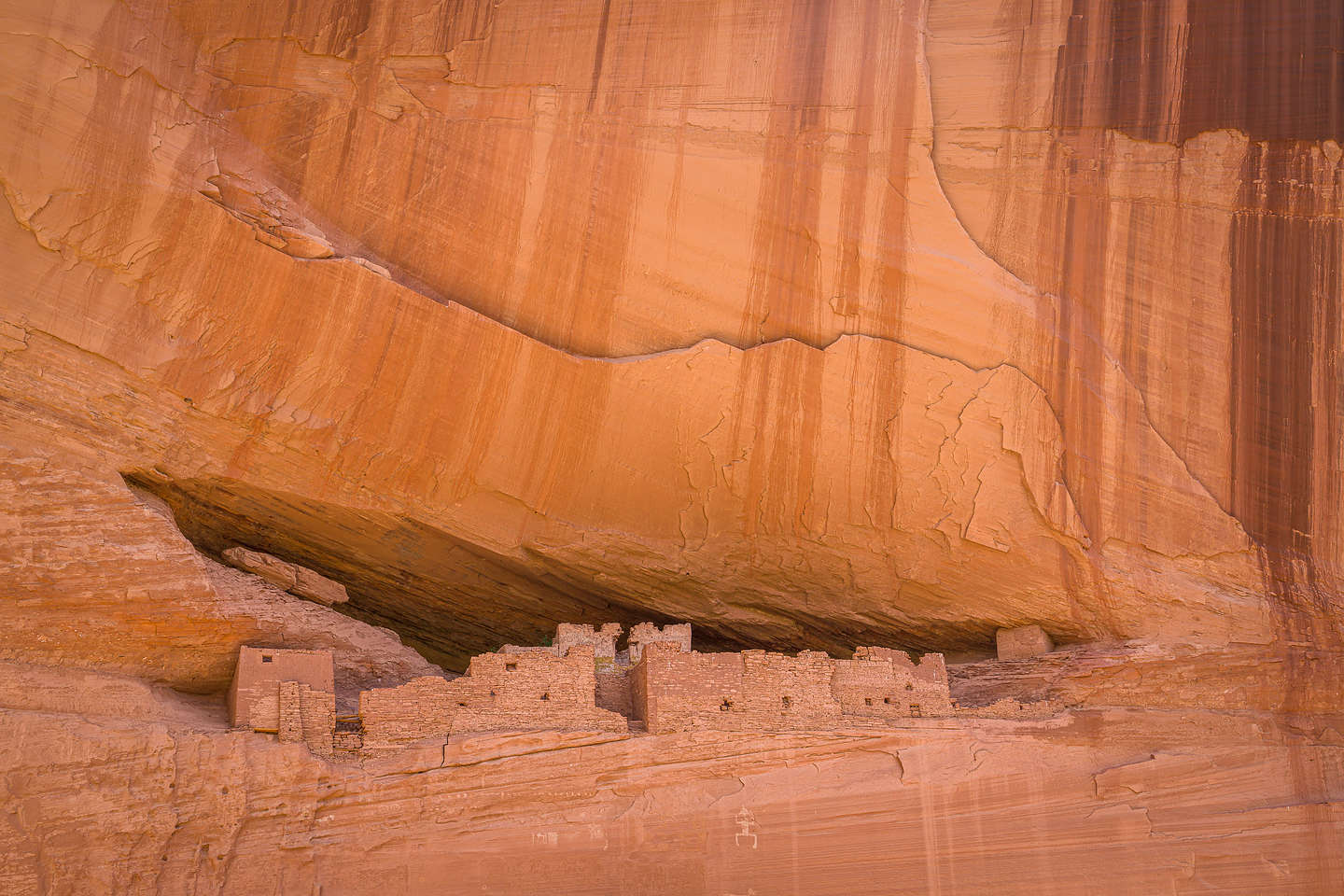
Our first stop along the North Rim was Antelope House Ruin overlook. I went ahead of Herb and scanned the cliff walls for the ruin, not expecting to see much because the guidebooks say that it is in shadow all day. I was so excited when I looked at the bottom of a 600 foot cliff and saw an extensive complex of towers, vertical walls, and kivas, and it was in the sun!
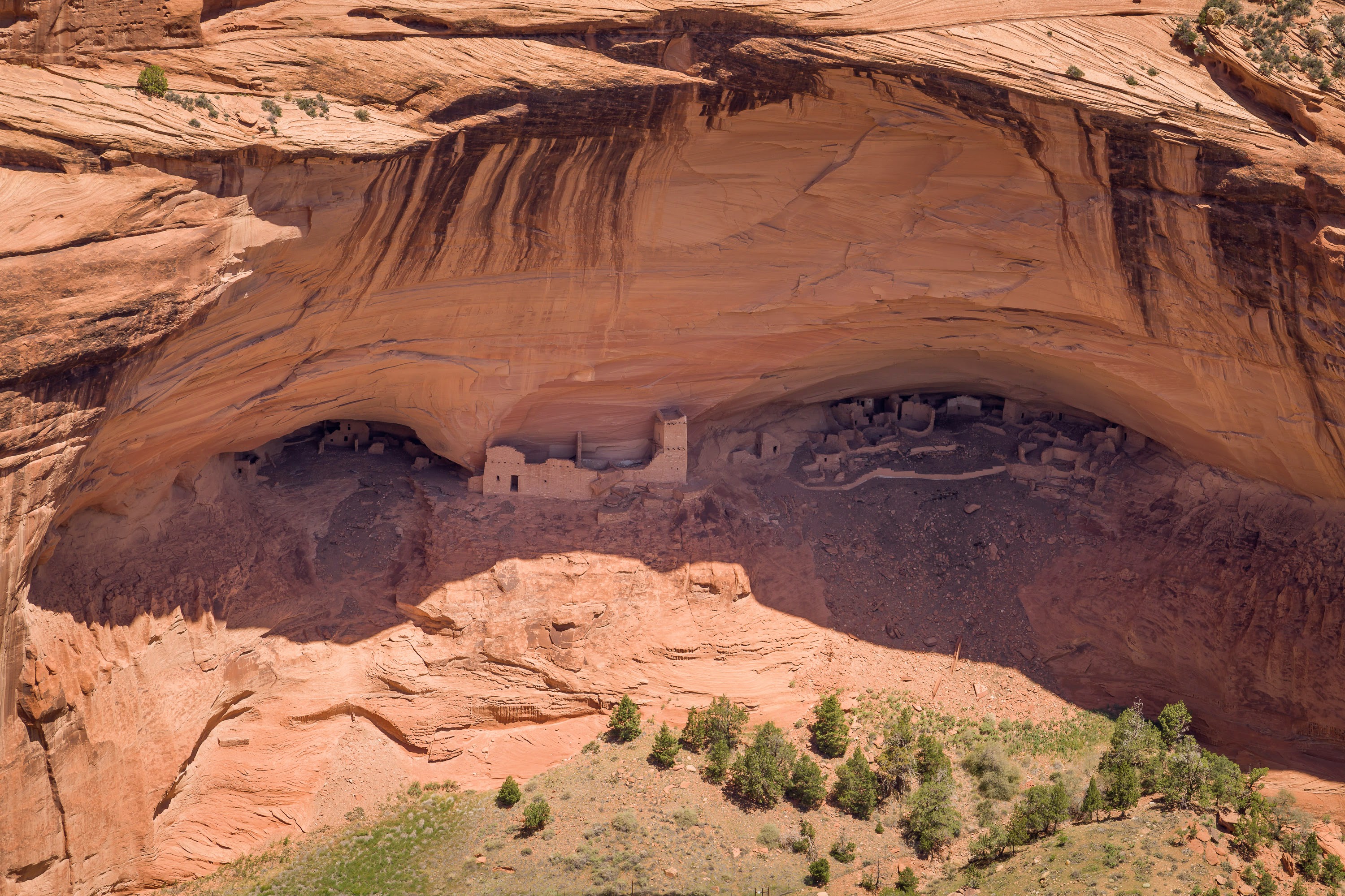
Continuing up the North Rim, we turned off a side road to Massacre Cave and the Mummy Cave Overlook.

We walked first to the right to visit the Mummy Cave Overlook. Although it wasn’t in the sun, which it was supposed to be, we could still see it quite clearly. This cave once provided shelter for about 60-75 people. Altogether some 70 rooms have been uncovered at Mummy Cave, and there are also at least three kivas. There is an impressive three-story tower near the eastern cave.
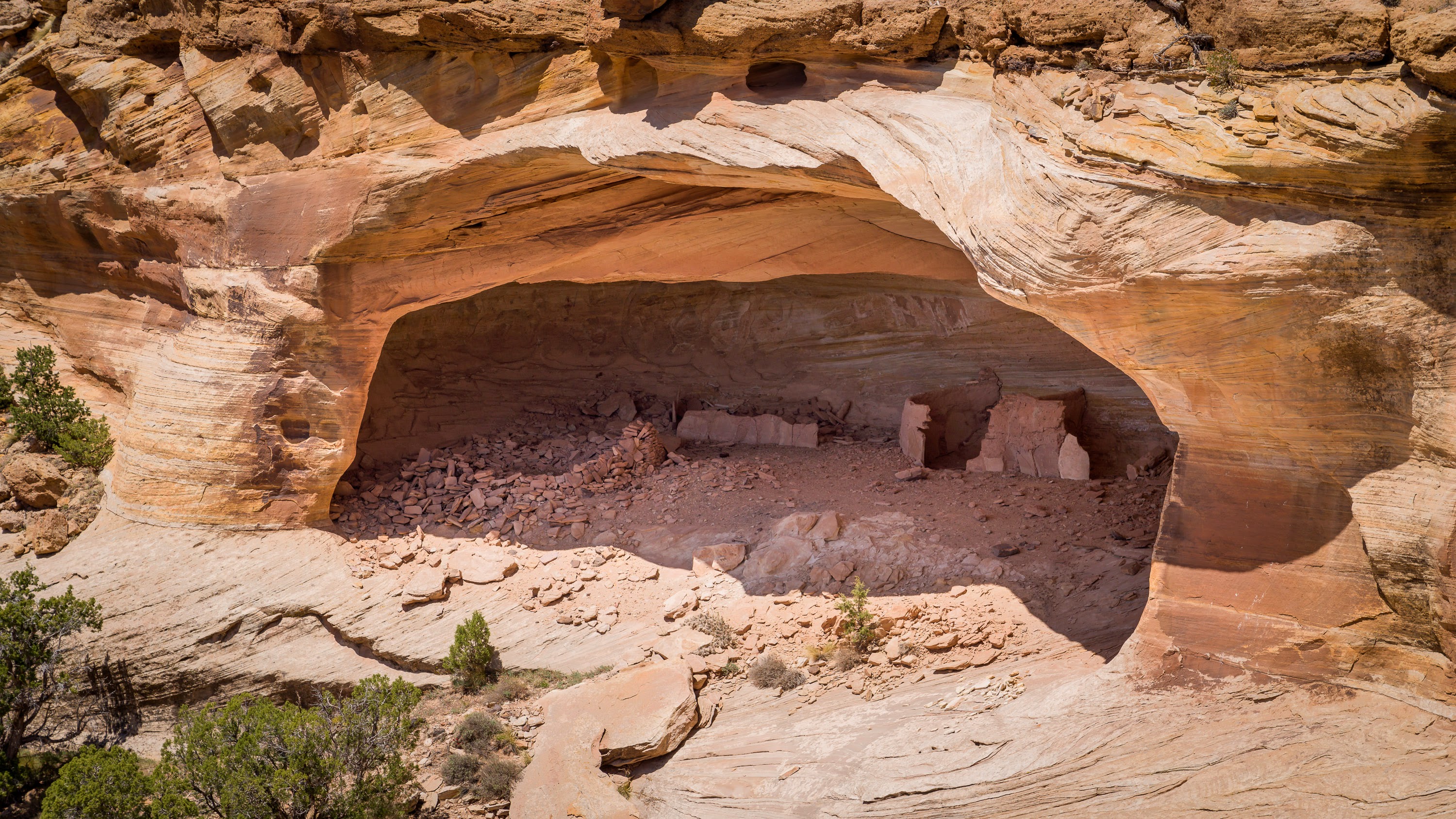
Back at the junction, we walked to Massacre Cave, which is the site of a horrible moment in history when in 1805, many Navajo tribes people, including women and children, took shelter in this cave while under attack from Spanish soldiers, killing all 100 people inside. I think it's the reason this canyon is named Canyon de Muerte.
That was it for the North Rim, so we returned to the Visitor Center and headed out along the South Rim.
The two highlights along the South Rim Drive are the White House Ruins Overlook and Spider Rocks Overlook.
We already knew that we could no longer hike down to the White House Ruins because of a problem with vandalism in the parking lot, but we were shocked to find that we couldn’t even drive to the overlook, as the road was blocked off. Needless to say, we were very disappointed.
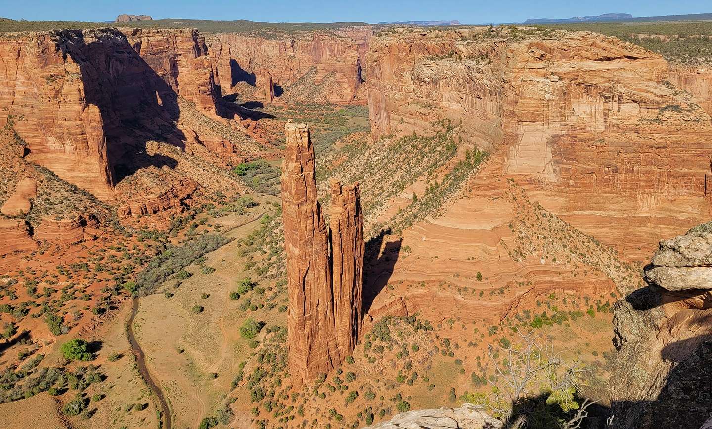
We briefly stopped at all the overlooks along the way, but spent most of our time at Spider Rocks, an 800-foot sandstone spire that rises from the canyon floor at the junction of Canyon de Chelly and Monument Canyon.
While we were there, a large tour bus pulled in and about 40 teenagers got out. So much for peace I thought. However, I later ate my words, when these 40 high school students, which happened to be Native Americans, and their teachers walked in total silence along the path to the rock and then listened to their teachers talk about both the geology that resulted in the creation of this incredible spire as well as the spirituality and significance of it. I found myself trying to eavesdrop on their conversation.
That was it for the places we could visit on our own, so we returned to the Thunderbird Lodge for the night.
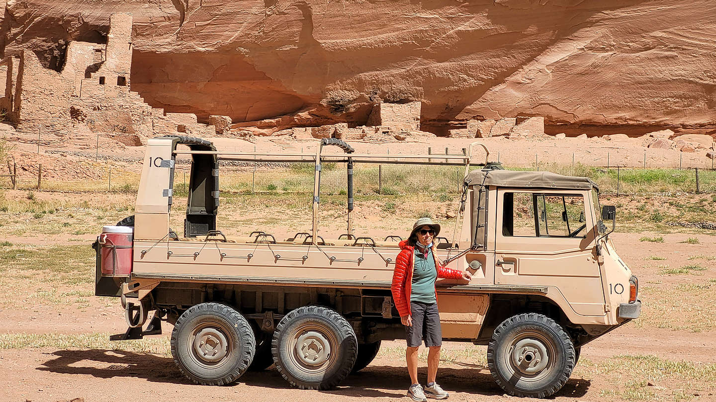
The next morning was our Jeep tour and it was already getting windy. We were pretty lucky in that the group of 19 was divided into 3 jeeps, and we wound up in one with only 5 people, making it easier to take photos along the way.
The jeep was more of a tank than a jeep. I looked it up and it actually was an Austrian 6WD Pinzgauer army troop carrier, maybe a bit of an overkill for where we would be going today.
Our Navajo guide’s name was Harold. I was hoping for something a bit more colorful, but Harold would have to do. He was great and taught us so much about the history of the canyons and the Ancestral Pueblo (Anasazi), Hopi, and Navajo people that called it home throughout the last millennia.
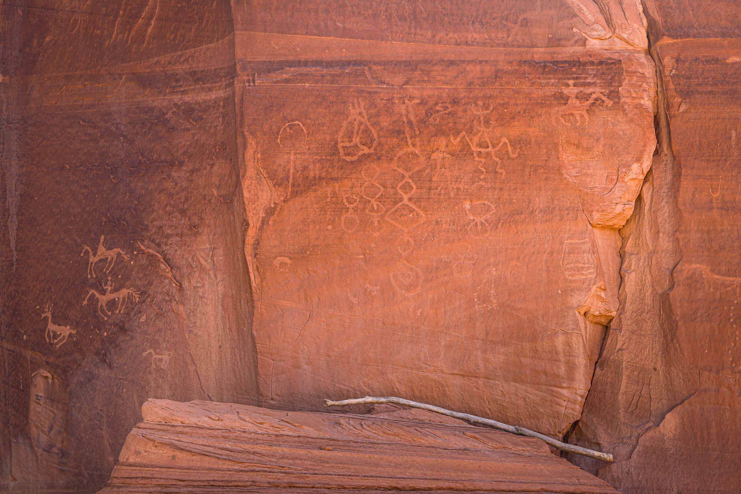
One of the first stops we made was to a wall of petroglyphs. Inhabitants of this canyon have been painting on the canyon walls for over a thousand years. Harold tried to explain how you can tell whether the artwork is Anasazi, Hopi, or Navajo by its content.
This particular wall had my favorite subject - Kokopelli, the hunchbacked flute player, which you can see lying on his back next to another almost frog-like human figure. Kokopelli is a kachina, or spirit, found in the mythology of the Hopi and other Pueblo Indians of the American Southwest. He’s a bit of a character, playing various roles,, including those of fertility spirit, trickster, and hunter.
Another nearby wall had pictures of horses on it. Native Americans didn’t have horses until the Spanish brought them to North America in the 1500s, so this pictograph must have been made by either the Hopi or Navajo, who inhabited the canyon after the Ancestral Puebloan abandoned it.
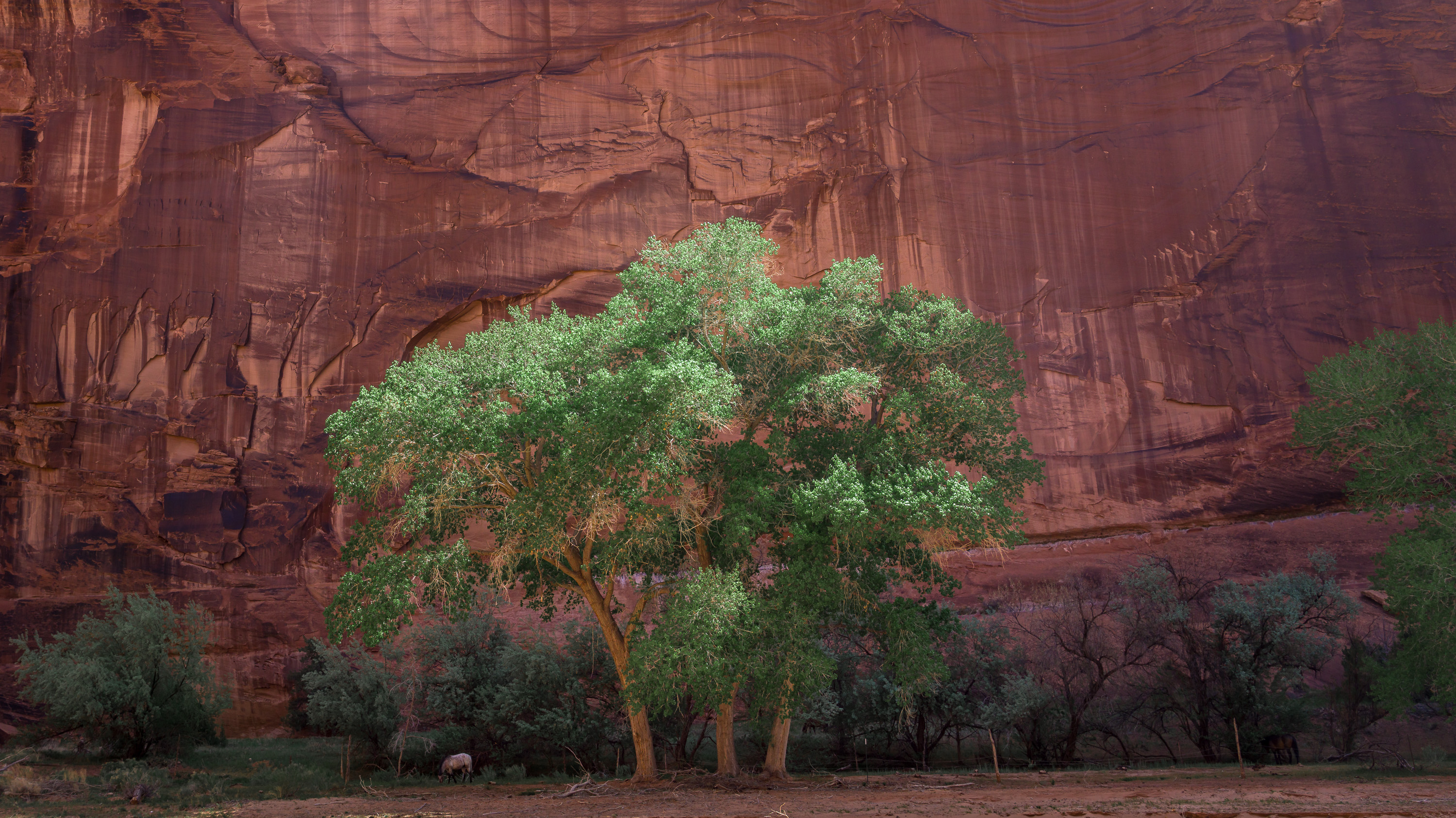
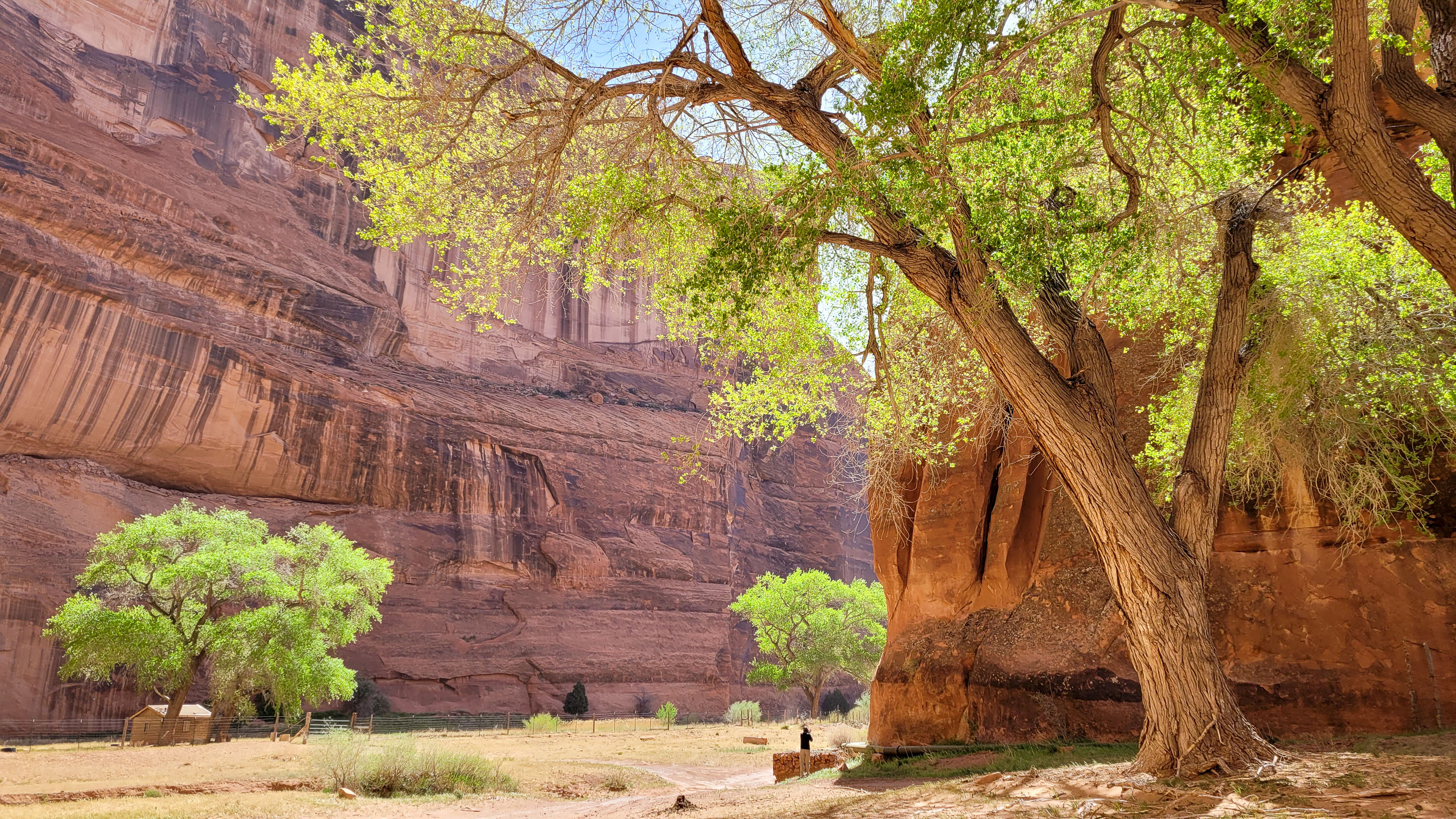
The thing that surprised me the most was how lush the valley was. The bright green cottonwoods against the red rock background was stunning. It’s amazing what even a little water can do.
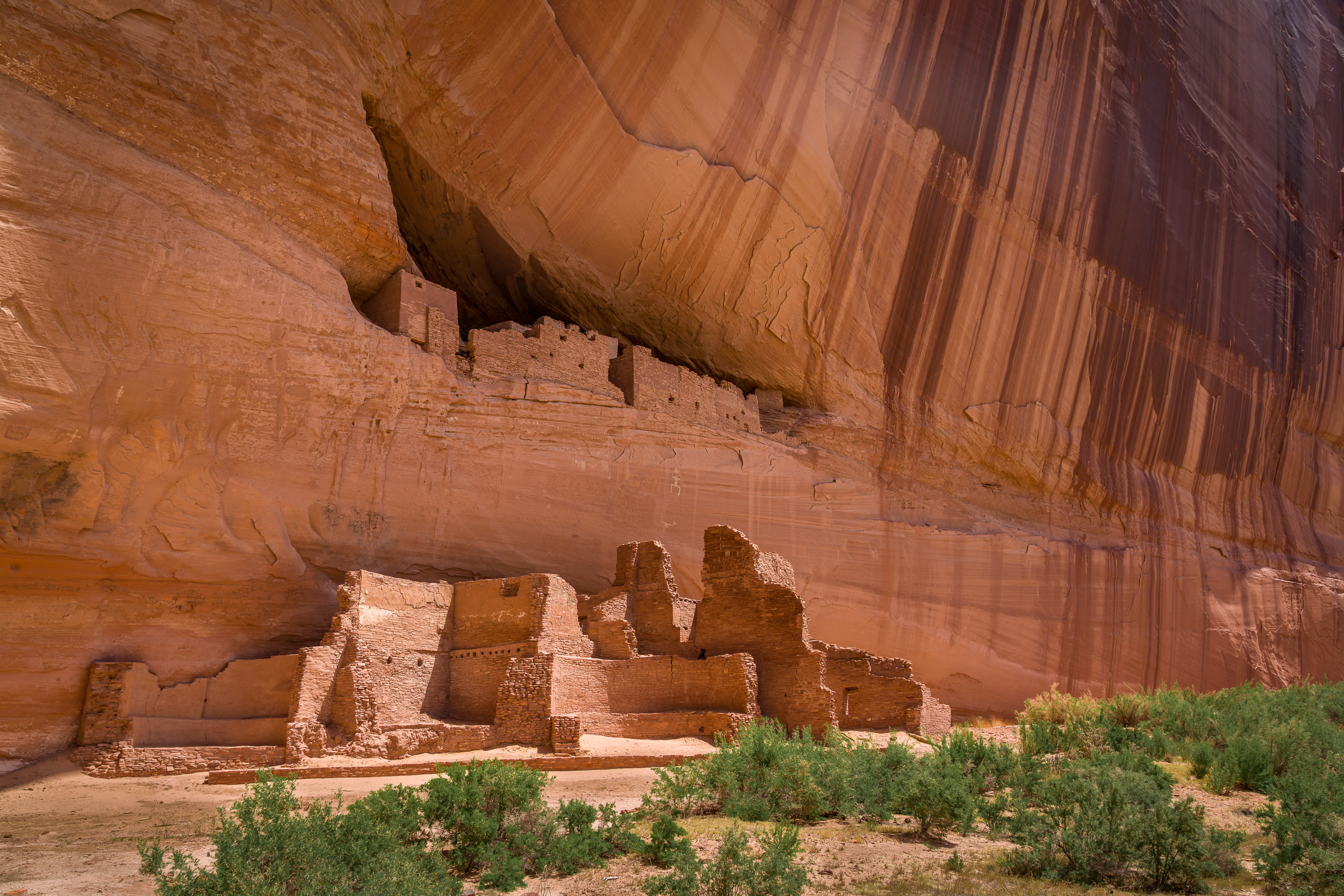
We passed several ruins including the Antelope House Ruins which we had seen from the North Rim yesterday. I recognized its kivas and three-storey tower.
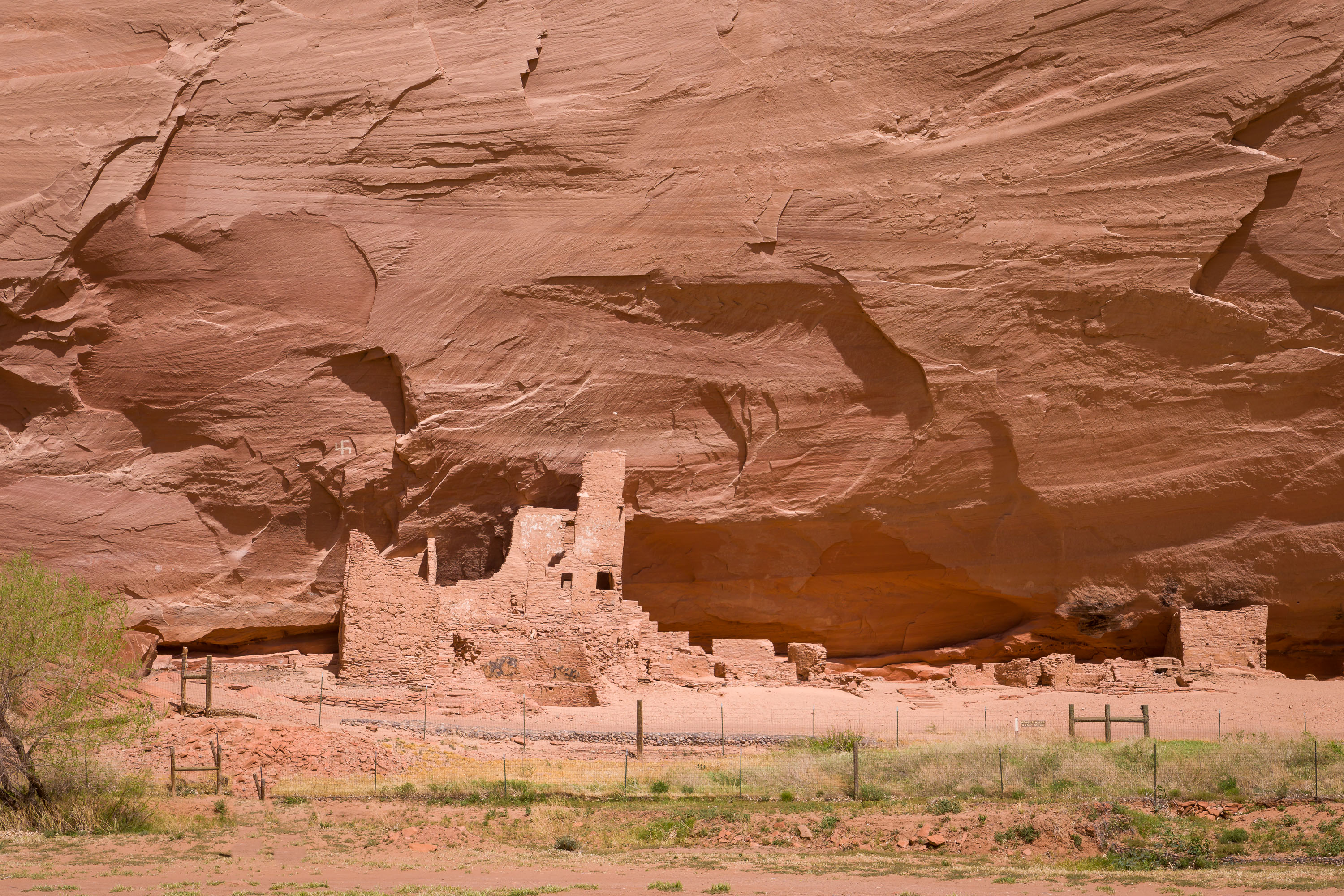
One thing we hadn’t seen from above though was the pictograph of a swastika located just above the end of the wall on the left. What we learned was that Native Americans used this symbol long before the Nazis co-opted it. For the Native American, this symbol represented the four directions. It was also referred to as “whirling logs.” Because of its association with Nazis, in 1934 native craftspeople stopped using it as a design element on their pottery, rugs, etc.
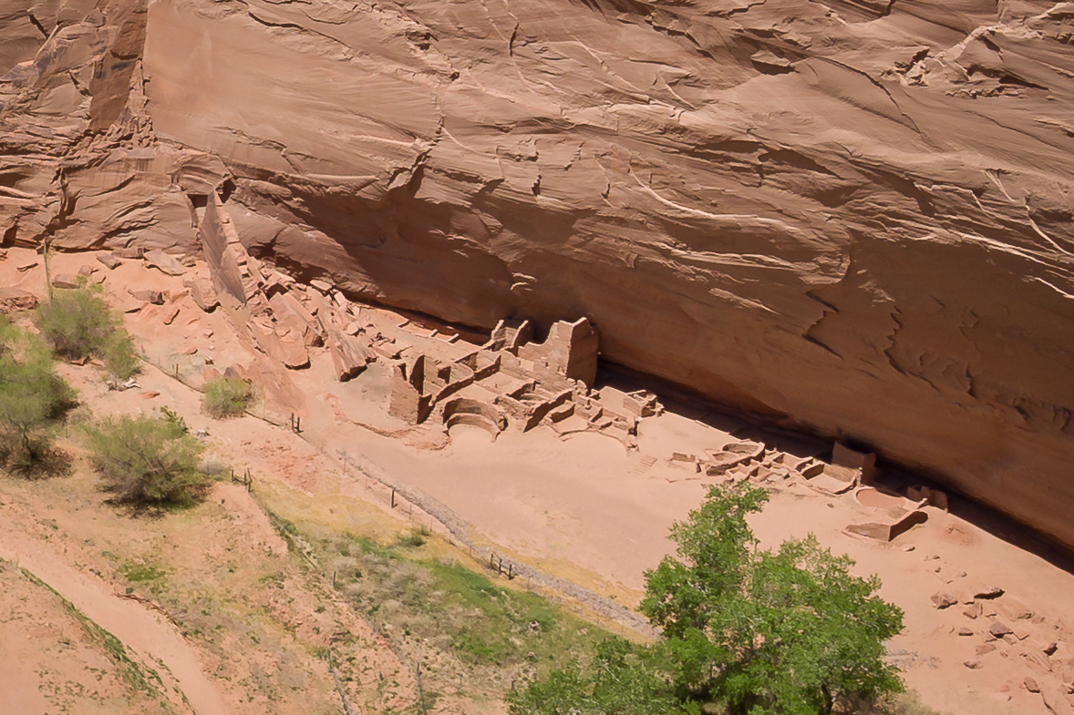
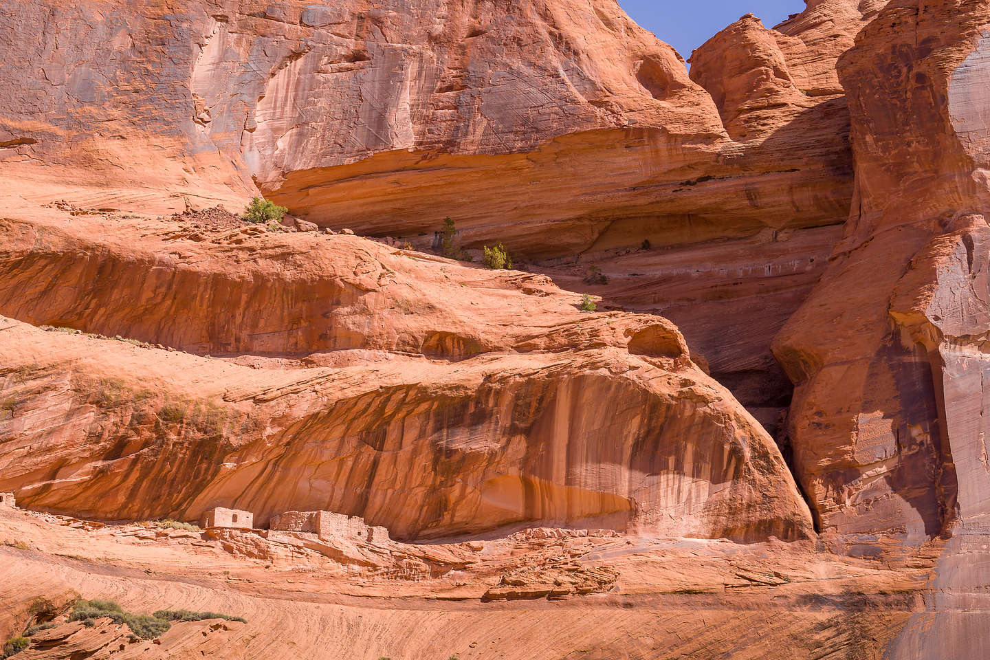
However, the highlight of our trip down into the Canyon was seeing the White House Ruins, one of the most interesting and recognizable Ancestral Puebloan ruins in the entire Southwest. This 80-room complex was built by the Ancestral Puebloans about 1,000 years ago and is named for the long, white plaster wall in the upper dwelling.
The lower block of buildings at the base of the cliff provided easy access to arable lands on the canyon floor, while the upper multi-storied buildings, set in the alcove in the cliff, provided sanctuary during enemy incursions. At one time they were connected, probably by ladders. During its heyday, the entire complex had about 80 rooms and housed as many as 100 people.
My next favorite stop was Harold’s ancestral home, where he showed us the hogan where his grandmother taught him to speak Navajo.
I forgot to mention that the wind was gusting so hard that we were pelted with sand the whole second half of the trip. However, we still loved it and found it very informative and worthwhile.
Next stop - Shiprock, also in the Navajo Nation.