Mono Lake, CA
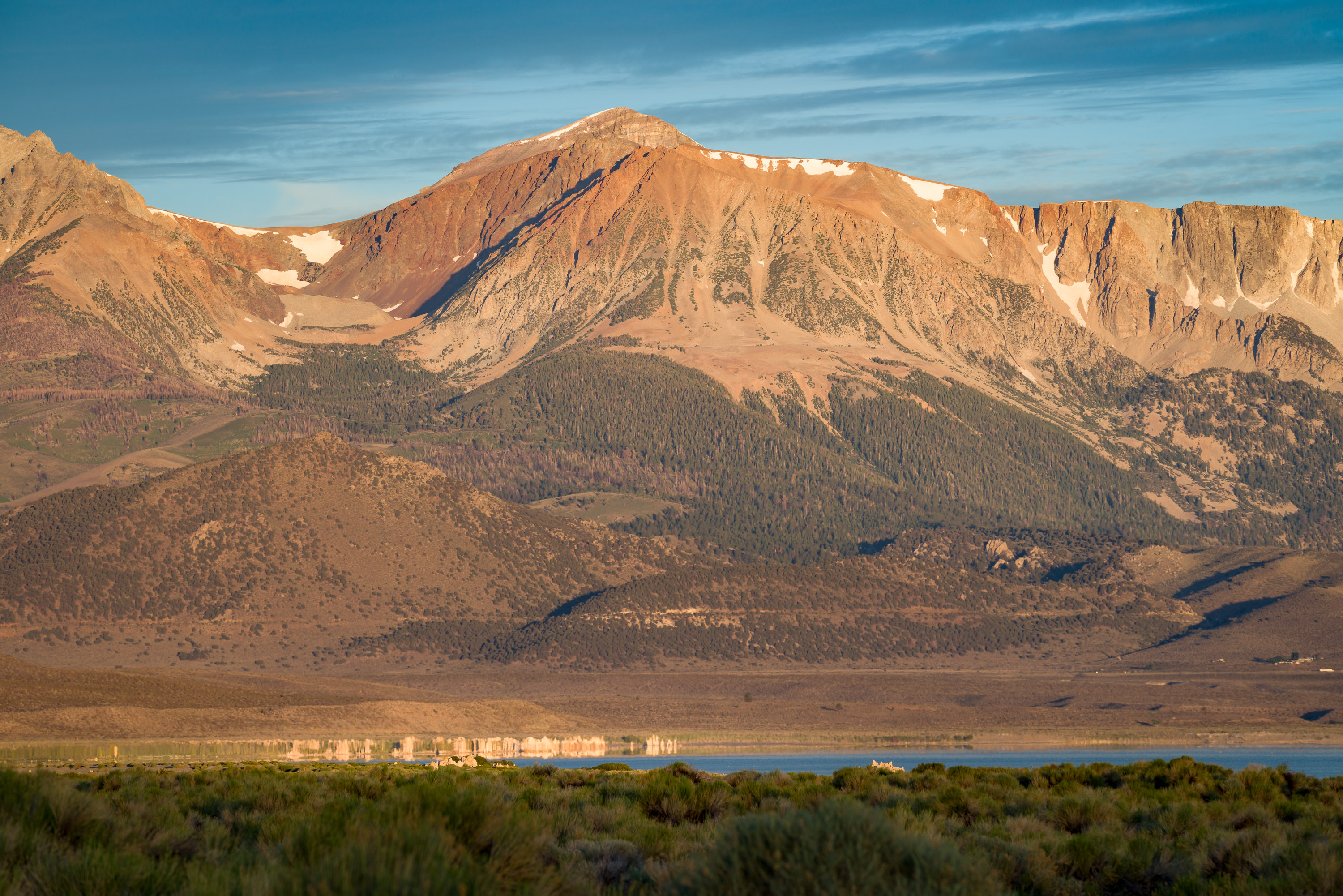
The drive along the Tioga Road east to Mono Lake is dramatically beautiful, with views of Mount Dana and Mount Gibbs, Ellery and Tioga Lakes, and the Lee Vining Canyon along the way. I feel bad that Herb, as the one driving the motorhome down this precariously steep and twisty road, doesn’t get to appreciate the scenery. We always breathe a sigh of relief when we Mono Lake comes into view and we know we have reached flatter ground.
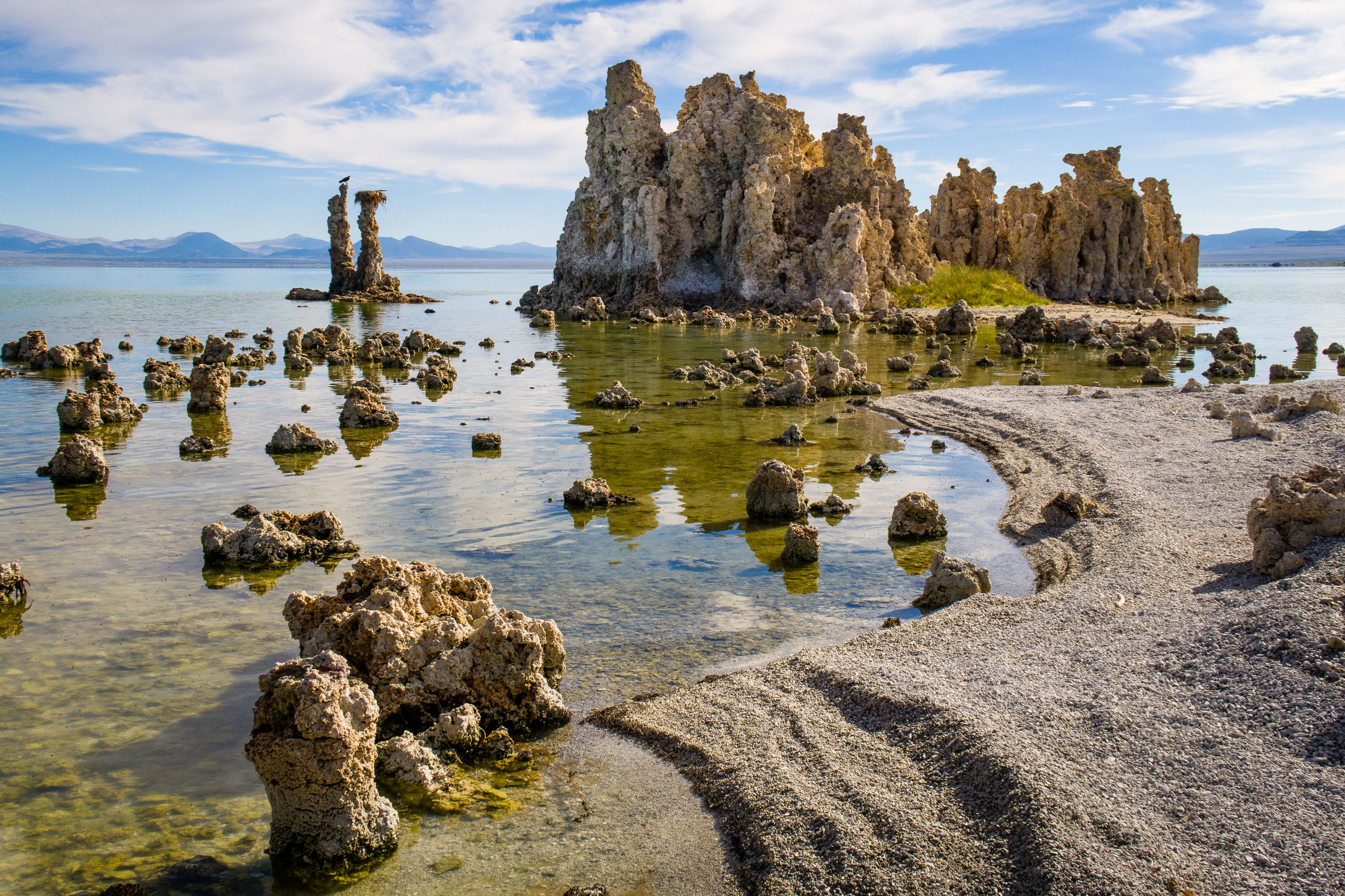
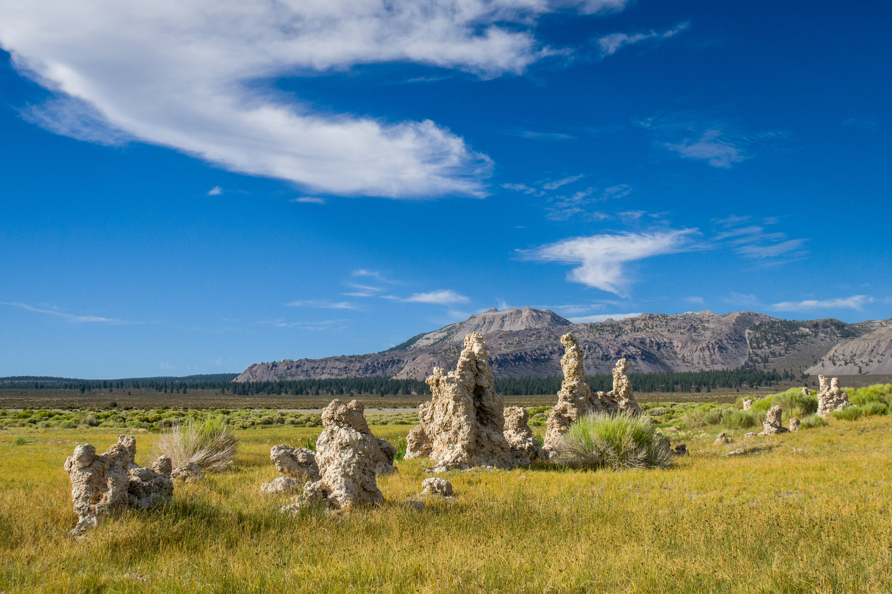
For anyone traveling through the Eastern Sierras, a stop at the Mono Lake to see the “tufa castles” is a must. It’s a place like no other.
We absolutely love Mono Lake. It is such a unique and otherworldly place. Besides being over a million years old, and probably the oldest continuously existing lake in North America, it is 2 ½ times saltier than the ocean and 80 times more alkaline.

The other unique feature of this lake is its mystical “tufa castles” formed when carbonates in the water combined with calcium from freshwater springs feeding into the lake. As the lake levels dropped over the years, these extraordinary-looking knobs, spires, and minarets became exposed. Most of the towers visible in the lake are from 200 to 900 years old and rise as high as 30 feet above the water. The largest concentration of them can be found along the southern shore of the lake at the South Tufa State Reserve, just ½ mile west of Navy Beach.
Our kayaks weren’t along this time, so rather than paddling out to Paoha Island like we usually do, we drove our 4WD 4Runner along the sandy southern shore to find a place to camp. We were hoping to get to the remote tufa area that we had kayaked to in 2016, where there is a spring and interesting shaped tufas. There’s even one that looked like a giraffe.
We knew it was about 6 miles beyond Navy Beach, because that is how far we had to kayak to get to it, but we hit deep, soft sand well shy of that, so we had to turn around and look for another place to camp. The road doesn’t go too close to the lake, so we wanted to find something where we could at least walk down to it fairly easily.
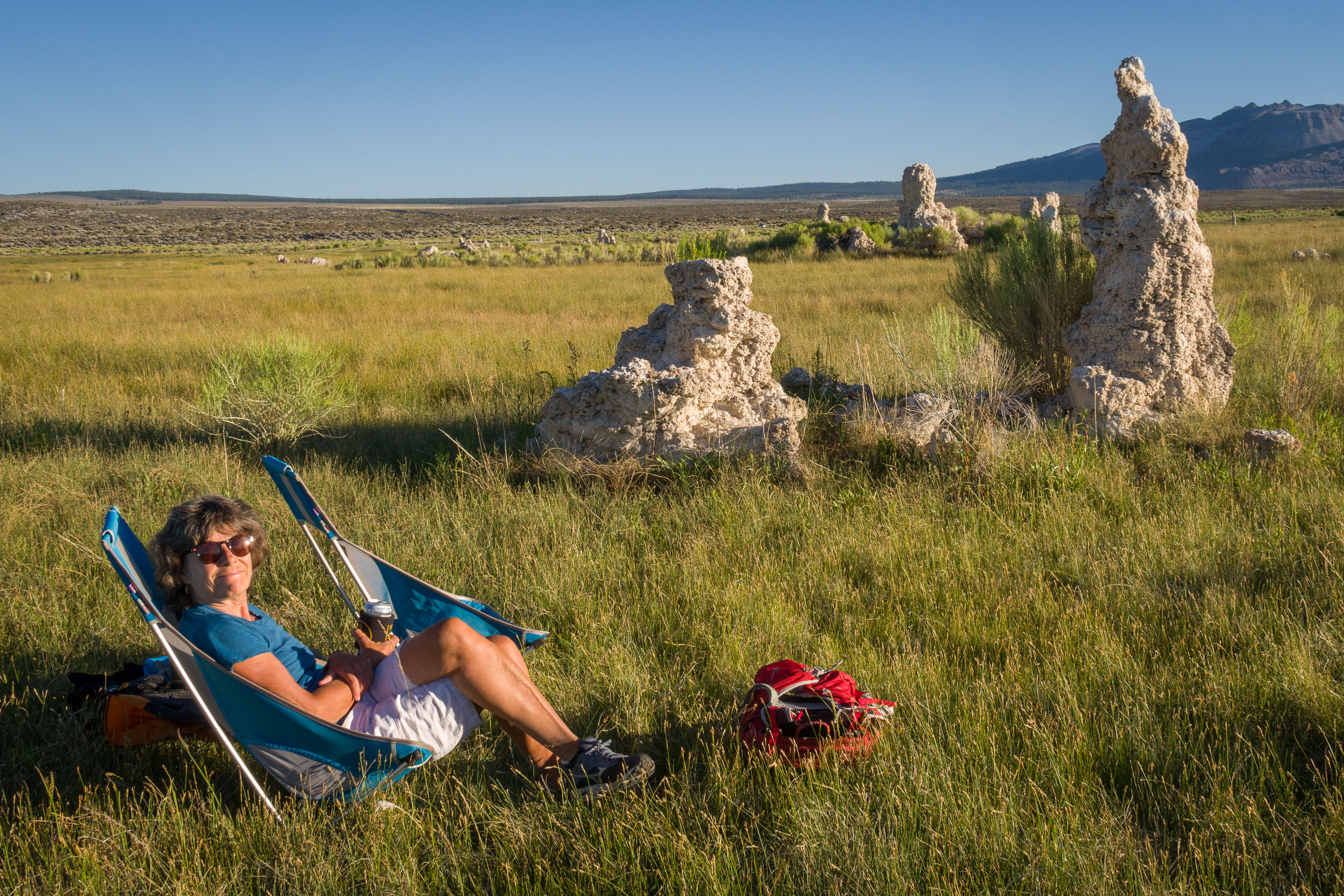
After settling into a spot with a decent pullout off the main sandy road, we headed off through much sand and sage grass towards the water’s edge where we saw some tufas.
It wasn’t long before we discovered that the sage grass was not always on as firm ground as we expected, and we found ourselves frequently sinking down into knee-deep muck. I have had this experience at Mono Lake in the past, one time sinking thigh-high deep in the sand bringing by iPhone, which was clutched in my hand, down with me. The water table is a pretty high here.
After about ¾ of a mile, we got to the tufas, and were able to wander around on the beach without sinking.
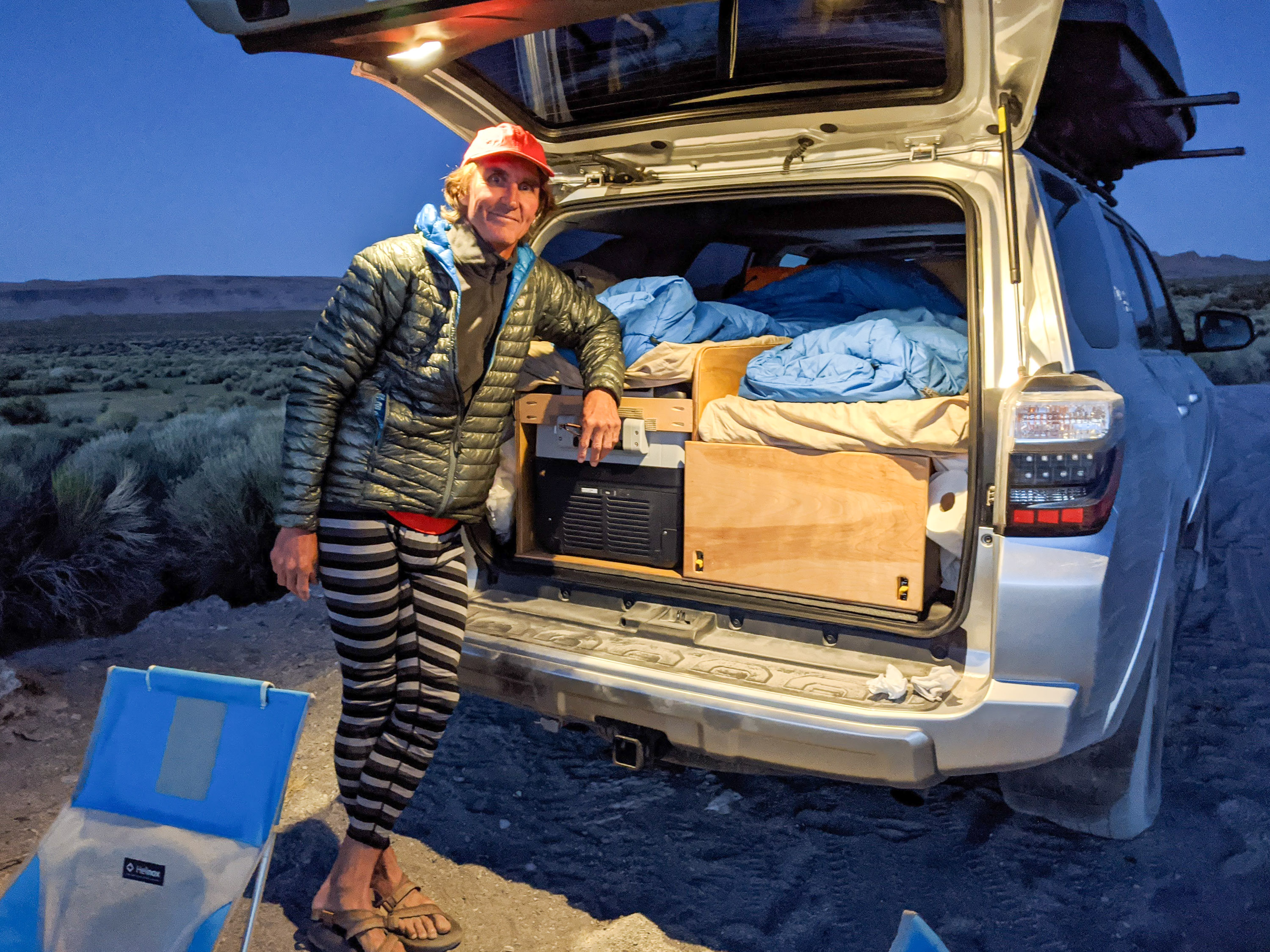
I am used to always suffering from the heat at Mono Lake, so I was a bit surprised how cold it got that night, forcing us to don our long johns and winter jackets. It was plenty warm though sleeping in the truck that night.
The next morning, now that we knew a bit better how to navigate around the minefield of muck, we strolled back down to the water to photograph the tufas in morning light.
Our next stop was Bishop, where our son and daughter-in-law lived, and our other son and fiancee were visiting - in other words, Mommy heaven.
Rather than take the usual route down 395, we decided to try something different - east on Highway 120 to Benton Springs and then south on 6 into Bishop. It was a very nice road, and it is always fun to see something different.
Not too far on 120 we stopped at Crater Mountain, part of a chain of craters, domes, and lava flows that stretches 25 miles from the northwest shore of Mono Lake to the south of Mammoth Mountain. This is, or at least was, a very active geothermal area.
We continued on 120 but rather than go all the way to Benton Springs and down 6, we decided to take the Bentron Crossing Road, an inviting-looking dirt road off to the right, that would bring us past Crawley Lake and the Long Valley Hot Springs, before delivering us back to 395 and down to Bishop.
I was so excited to see the boys (and girls)!