- Home
- About
- Map
- Trips
- Bringing Boat West
- Migration West
- Solo Motorcycle Ride
- Final Family XC Trip
- Colorado Rockies
- Graduates' XC Trip
- Yosemite & Nevada
- Colorado & Utah
- Best of Utah
- Southern Loop
- Pacific Northwest
- Northern Loop
- Los Angeles to NYC
- East Coast Trips
- Martha's Vineyard
- 1 Week in Quebec
- Southeast Coast
- NH Backpacking
- Martha's Vineyard
- Canadian Maritimes
- Ocracoke Island
- Edisto Island
- First Landing '02
- Hunting Island '02
- Stowe in Winter
- Hunting Island '01
- Lake Placid
- Chesapeake
- Provincetown
- Hunting Island '00
- Acadia in Winter
- Boston Suburbs
- Niagara Falls
- First Landing '99
- Cape Hatteras
- West Coast Trips
- Burning Man
- Utah Off-Roading
- Maui
- Mojave 4WD Course
- Colorado River Rafting
- Bishop & Death Valley
- Kauai
- Yosemite Fall
- Utah Off-Road
- Lost Coast
- Yosemite Valley
- Arizona and New Mexico
- Pescadero & Capitola
- Bishop & Death Valley
- San Diego, Anza Borrego, Joshua Tree
- Carmel
- Death Valley in Fall
- Yosemite in the Fall
- Pacific Northwest
- Utah Off-Roading
- Southern CA Deserts
- Yosemite & Covid
- Lake Powell Covid
- Eastern Sierra & Covid
- Bishop & Death Valley
- Central & SE Oregon
- Mojave Road
- Eastern Sierra
- Trinity Alps
- Tuolumne Meadows
- Lake Powell Boating
- Eastern Sierra
- Yosemite Winter
- Hawaii
- 4WD Eastern Sierra
- 4WD Death Valley +
- Southern CA Deserts
- Christmas in Tahoe
- Yosemite & Pinnacles
- Totality
- Yosemite & Sierra
- Yosemite Christmas
- Yosemite, San Diego
- Yosemite & North CA
- Seattle to Sierra
- Southwest Deserts
- Yosemite & Sierra
- Pacific Northwest
- Yosemite & South CA
- Pacific Northwest
- Northern California
- Southern Alaska
- Vancouver Island
- International Trips
- Index
- Tips
- Books
- Photos/Videos
- Search
- Contact
San Francisco RV Resort - Pacifica
Tuesday, October 1, 2013 - 8:15am by Lolo135 miles and 2.5 hours from our last stop - 2 night stay
Travelogue
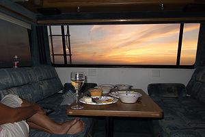 San Francisco RV Resort Sunset out of Lazy Daze Rear WindowI can’t believe I didn’t know about this place before. How did I not know that there was a campground only 15 miles from San Francisco with oceanfront sites? I was really starting to doubt myself as a trip planner. If Herb hadn't bought that book I have been raving about this entire trip -- West Coast RV Camping – I probably still wouldn't know. It gave this campground a scenic rating of 10.
Now I don’t think it will be a replacement for staying at the Petaluma KOA. That’s where we store the motorhome, and it is really a much nicer campground. This one was really just an asphalt parking lot, but a parking lot with an incredible view. The oceanfront sites are perched right at the edge of a 60-foot bluff overlooking the Pacific, perfect for watching a dramatic sunset each evening from your campsite. The oceanfront sites are, however, non-hookups.
This campground is not exactly cheap either - $61 per night for an oceanfront, non-hookup site, and $69 for a full-hookup. It wasn’t the $8 savings that made us take a non-hookup, but rather that incredible view out our back window.
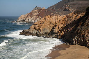 Beach ViewpointThere was, however, a fence separating the campground and the trail that led along the top of the bluff, so there wasn’t really any direct access to the beach.
As we often like to do when arriving in a new place for the first time, we set off on a run to explore the area. We ran along somewhat busy Palmetto Avenue for a bit before finding our way down to Beach Road and the Municipal Fishing Pier. From there, we ran alongside the beach until we came to a steep trail up to Mori Point, another one of those beautiful bluffs along the Northern California coast. However, we had already run about 2 ½ of our 5 mile run, so all we had time for now was a short run up to a viewpoint, before turning around and heading back to the campground. We would have to come back here another time by car so that we could do our entire run up on the bluffs.
Since we were so close to San Francisco, Andrew came down to visit us after work, and Celeste would be biking down later. Celeste is a very avid cycler, and she rides her bike to work at City Hall every day. She thinks nothing of a 30-mile ride up and down the hills of San Francisco and Marin after work, so riding down to Pacifica was no big deal. However, her GPS kept directing her onto busy, non-bicycle-friendly roads and it was starting to get dark, so Andrew went out with his car and rescued her along route. I felt bad because they missed a really beautiful sunset by 10 minutes.
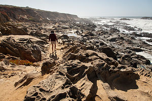 Lolo of Pebble Beach in PescaderoThe next day, we weren’t meeting the kids until after work, so we spent a good part of the day exploring the coast south of Pacifica. We found a great future camping destination called Pillar Point RV Park, right on Half Moon Bay. For some reason, this one was not in my book.
We continued driving south and stopped at a really pretty rocky cove at Pebble Beach in Pescadero, where the rocks are weathered to a honeycomb-like surface texture known as tafoni. They were absolutely beautiful. We could have stayed here all day photographing them.
It was a beautiful, warm day so on our way back north along Route 1, we looked for a nice beach to have lunch and sunbathe for awhile. Just north of Montaro and before the tunnel, we pulled into a parking lot for Gray Whale Cove State Beach, a beach that Herb had heard about before.
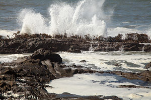 Pebble Beach SurfWe gathered beach chairs and a cooler and headed across busy Route 1 and down a series of steep stairs to a beautiful sheltered cover surrounded by towering cliffs. If you are uncomfortable with encountering nude sunbathers, you should head to the left at the bottom of the stairs.
The beach was lovely, and it was actually warm enough to get down to bathing suits. Its colorful cliffs reminded me a lot of Moshup Beach on Martha’s Vineyard, one of my all time favorites.
That evening we drove up to San Francisco and met Andrew and Celeste once again at Planet Granite, their climbing gym. We were back to where we started on this trip. As I mentioned in our first stop, I absolutely love this gym, both for its incredible views of the Golden Gate Bridge, Alcatraz, and the Mark di Suvero sculptures in Crissy Field, and its really fun climbing routes.
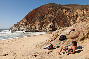 Lolo at Gray Whale Cove State BeachAfter a good and very fun workout on the climbing walls, it was once again time to eat – one of Andrew and Celeste’s favorite pastimes. As I also mentioned earlier, Andrew and Celeste live a neighborhood with a very ethnically-diverse selection of high-quality restaurants, so the choices seem practically limitless. This time we went to Pho Garden where I had my first taste of Vietnamese food. It was wonderful and amazingly reasonable.
This was the last time we would see Andrew and Celeste this trip, so we said our goodbyes and headed back to our campground in Pacifica. These goodbyes were getting a little easier each time, especially when we had a plan of seeing them again, which we did. We would be back in November to have a pre-Thanksgiving feast with Celeste’s family and then Thanksgiving in Yosemite with the boys. WOOHOO!!!
Description
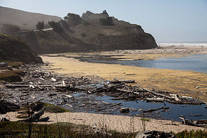 Beach LandscapeThe San Francisco RV Resort is located in the town of Pacifica, 15 miles south of Golden Gate Bridge. Besides being the closest RV camping to San Francisco, it is also one of the best RV parks in the Bay Area. Situated atop a 60-foot bluff, it is the only campground in the Bay area to offer oceanfront sites and daily dramatic sunsets.
There are 162 sites on paved, level asphalt. All sites, except the ocean sites, have full hookups and cable TV. Ocean sites have no hookups, but all campsites have free WiFi. Other amenities include a heated pool and spa, beach access, and a nearby fishing pier.
The sites range in price from $61 per night for an ocean, non hookup site, to $69 for full hookup. The campground is open all year round.
Auburn
Sunday, September 29, 2013 - 4:00pm by Lolo91 miles and 2 hours from our last stop - 2 night stay
Travelogue
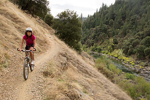 Lolo Biking the Lake Clementine TrailWe really had no plans from here, other than flying out of SF Airport in 5 days – very unlike my usual anal-retentive planning. Now that we weren’t racing back and forth across the country every vacation, our travels were taking on a different feel, more relaxed and spontaneous. Also, since we knew we would be coming out this way again and again to see the boys, missing something this time was not a big deal, as we would just hit it the next time. I think we are going to like this new toned down pace.
Herb came up with the idea for this stop. He loves river running, and the American River, which flows through the Auburn State Recreation Area, is supposed to be one of the best places in California to do that. This time of year was wrong for that, not enough water flowing, but we thought we could at least check it out for the future, and besides, Auburn had lots of other recreational opportunities that are good all year round, such as mountain biking and hiking.
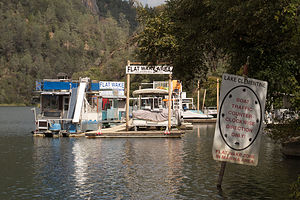 Lake Clementine MarinaWe found the Auburn Gold Country RV Campground through a search on Google Maps. The owner was extremely helpful in providing us with trail maps and mountain biking suggestions in the nearby Auburn State Recreation Area. That night we relaxed by the campground pool, reviewing the trails, and making our decision for the next day’s adventure.
The directions for the trailhead for the lake Clementine Trail were extremely detailed, but we still screwed up and found ourselves biking for a mile or so down the wrong trail. Finally realizing we had made a mistake, we rode back to the car, remounted our bikes on the rack, and started all over again. I think the mix-up was that there is both a Foresthhill and an Old Foresthill Road.
Anyway, we finally found the correct trailhead and spent the morning on a really nice ride atop the riverbank of the North Fork of the American River. There were a few places, however, where the trail narrowed and dropped off much too sharply for my comfort level, so I got off and walked the bike a few times to avoid plunging into the river.
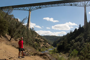 Herb Biking the North Fork of the American RiverThe trail map was very detailed and pointed out some nice stops we would have missed along the way, such as Clarks Hole. Without knowing that this stop would be in ¾ mile, we would have missed the short, steep side trail down to a pool and a sandy beach. The trail was much too steep for bikes, so we left them on top of the riverbank and walked down. It was a lovely spot, popular for swimming in the summer, but a bit too chilly now.
Continuing upriver, the trail transitioned from a narrow, bumpy dirt trail to a shaded, smoother dirt roadway, which was once the old stagecoach route connecting Auburn with other gold rush camp towns in the mid to late-1800s. The better surface would have made the ride easier except for the fact that now it began to climb quite steeply and continued to do so until we reached Lake Clementine Road, where the trail officially ends. From there we followed the paved roadway for about ¼ mile to an unmarked side trail on the left, which led to a great view of the water cascading over the North Fork Dam, on the southern end of the lake, and the reason this lake is here in the first place.
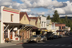 Broad Street Nevada CityThis is an out and back ride, so from there we turned around and went back from whence we came, enjoying it much more, as most of it in this direction was downhill.
There was still a lot of time left in the day, so we decided to take the 25-mile drive up Route 49 to Nevada City, another historic Gold Rush boom town, which was also a nominee for Outside Magazine’s 2012 ”The Best Town Ever” award.
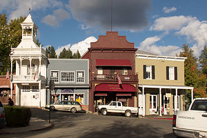
I do have a soft spot for quaint old historic towns and this one was a gem. We picked up a Walking Tour Map at the Chamber of Commerce and wandered up and down its quaint streets, which really do have the feel of an old mining town.
It’s hard to believe that this was once the third largest city in California and home to 10,000 boisterous souls --miners, saloon keepers, shopkeepers, prostitutes, and every other provider of necessities for men with new found riches in their pockets. Today it’s a quiet little town of 2,800 residents, who have had the smarts to recognize that their new source of wealth is the town’s remarkable history and charm, and they have done an excellent job at restoring and preserving that. Today the entire downtown area is listed as a national historic landmark.
Still, I would have to say that although it’s a nice place to visit, I wouldn’t want to live here. It's just a little too small and out of the way for me.
Description
 Main Street Nevada CityAuburn is located about 30 miles northeast of Sacramento via I80. Considered by many to be the adventure capital of California, it is home each year to the Western States Endurance Run/Ultra Marathon and the grueling Western States Endurance Ride. It is also rated one of the best places to live in Northern California.
Like many other cities in California, Auburn’s start was triggered by gold. However, unlike most of the other boom and bust Gold Rush towns, it survived by becoming a major supply and trading center. After a series of fires in the 1850s destroyed many of the wooden buildings in town, the townspeople rebuilt them in brick. You can see many of these restored buildings when visiting Historic Old Town.
While miners originally came to this area to pan for gold in the American River, today outdoor enthusiasts flock to the area to enjoy its recreational treasure – the Auburn State Recreation Area, which encompasses 35,000 acres along 40 miles of the North and Middle forks of the American River. The confluence of the North and Middle Forks is one of the most popular areas for swimming, fishing, and access to the many mountain biking and hiking trails in the Auburn SRA. Also, the American River is a premier river running destination with class II, III, and IV runs.
Bidwell Mansion State Historic Park
Sunday, September 29, 2013 - 10:00am by Lolo92 miles and 2 hours from our last stop
Travelogue
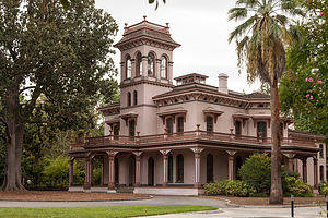 Bidwell MansionI love mansion tours and seeing how people lived in different times and places. We have been on our fair share of them over the years, our favorites being the grand “cottages” in Newport, Rhode Island. When Tommy was little he used to hate these tours. He called them “butt tours,” because he was eye level with the rest of the tour groups’ butts, and that was all he could see. Well, today we would go on a butt tour of the Bidwell Mansion in Chico, California.
A mansion tour is about so much more than just a structure. For me, it’s an intimate entry into someone’s past, and it is the details of that past that make the tour interesting. Before we got here, I had never even heard of John Bidwell or knew very much about the town of Chico. Nor for that matter, did I really know that much about the history of California, Now that we were going to be spending more of our time in this beautiful state, it was about time we did. The Bidwell Mansion was a good place to start, and I plan to drag my readers along with me.
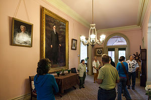 John and Annie Bidwell Portraits in Foyer with Tour GroupThis was the home of John Bidwell and his wife Annie from 1868 to 1918. Bidwell first came to California in 1841, when he was just 22 years old. He worked for John Sutter, the man who owned the mill where the California Gold Rush began, before venturing out and making his own gold strike near the Middle Fork of the Feather River. He used his new-found wealth to purchase more than 30,000 acres, which he called Rancho del Arroyo Chico, and became deeply involved in the development of the new state of California, its agriculture, and the city of Chico. In fact, it was he that gave Chico its name.
Right around the time the mansion was being completed, Bidwell went off to Washington to serve as California’s representative to Congress. It was there that he met Annie Ellicott Kennedy, who he married in 1868. They were very like-minded and both worked hard on causes to improve the lives of Californians, such as women’s voting rights, prohibition, and education. In fact, it was their original donation of eight acres of their cherry orchard to form a teachers’ college that was the beginning of what is today Chico State University.
 Bidwell Mansion Elephant Trunk ToiletThis beautiful three-story, Italianate-style Victorian mansion became the center of the town’s social and political life. Many distinguished guests were entertained here, such as President Rutherford B. Hayes, John Muir, Susan B. Anthony, and General William Tecumseh Sherman.
Today the mansion is a State Historic Park and a California Historic Landmark, where visitors like us can take a tour and step back in time to an interesting part of California’s past.
Description
 Bidwell Mansion ParlorThe Bidwell Mansion, located in Chico, California, was the home of John Bidwell and his wife Annie. This three-story, Italianate-style Victorian mansion, with a pink plaster finish, was built between 1865 and 1868.
John Bidwell first came to California in 1841, when he was just 22 years old. During his early years in California, he worked for John Sutter, of California Gold Rush fame. In 1848, Bidwell made his own gold discovery near the Middle Fork of the Feather River, and used his new-found wealth to purchase more than 30,000 acres, which he called Rancho del Arroyo Chico. He became deeply involved in the development of the new state of California, its agriculture, and the city of Chico, which he named.
From 1865 to 1866, Bidwell served as California’s representative in the U.S. Congress. It was here that he met Annie Ellicott Kennedy. They married in 1868. During their life-long, happy marriage, they worked together to support women’s voting rights and the prohibition movement. The home which they shared from 1868 to 1900 became the center of the town’s social and political life, where they entertained such distinguished guests as President Rutherford B. Hayes, John Muir, Susan B. Anthony, and General William T. Sherman.
Bidwell and his wife were proponents of higher education, so in the 1880s they donated eight acres of their cherry orchard to form a teachers’ college, which was called Chico State Normal School. It is now the California State University, at Chico.
Today the mansion is a State Historic Park and a California Historic Landmark. It is also listed on the National Register of Historic Places.
Guided one-hour tours are required to see the inside of the mansion.
Lassen Volcanic National Park
Saturday, September 28, 2013 - 3:45pm by Lolo171 miles and 4 hours from our last stop - 1 night stay
Travelogue
 Lassen PeakEvery since friends of ours had visited Lassen and raved about the hike to its peak, I have been determined to get there. Plus, it's probably the last of the major parks in the West that we haven’t checked off our list.
Last year on our trip out west in early-June, we were thwarted by park road closures. There is really a very limited time that you can visit this park, as the roads are typically snow covered from mid-October through mid-June.
This time the roads were open, but the trail to Lassen Peak was closed for a multi-year trail maintenance project. Since climbing to the summit was our major reason for going there, we toyed at first as to whether we should bother, or just wait for another year. However, since it wasn’t too far off route, we decided to go anyway and check it out for a future visit. Plus, there were other interesting things to see in the park.
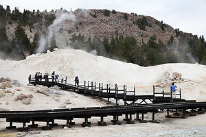 Bumpass Hell BoardwalkWe entered the park through the north entrance and booked a campsite at Manzanita Lake, not far from the Visitor Center. Although we thought we would stay 2 nights—really the minimum to really explore a park—something made us book only 1. We figured that since the park wasn’t crowded, we could easily add another day later if we chose to.
After stopping in the Visitor Center and confirming once again that we in fact could not hike up Lassen Peak, we drove the 30-mile scenic drive through the park towards Bumpass Hell, the park’s largest hydrothermal area.
We obviously were not the only ones that had the 1.3-mile hike to Bumpass Hell in mind, and the parking lot for the trailhead was quite full. For the first mile or so, the trail traversed the rocky slope of Bumpass Mountain. The trail was fairly level, but the 8,000 foot elevation could make things a little challenging if you are not acclimated to the altitude.
 Bumpass Hell PoolAt about 1.2 miles we arrived at the basin overlook, where we gazed out over the bubbling hot springs, boiling mud pots, and hissing steam vents below. A short descent of 100 vertical feet brought us onto a series of boardwalks that allowed us to get safely up close to these amazing geothermal features. It very much reminded me of a mini Yellowstone.
It obviously is very important to not stray off these boardwalks. If they had only been there in 1865 when Kendal Bumpass discovered this place, he would still have his leg. Well, actually he is long dead, but he would have enjoyed a full life with two legs. He made the mistake of walking on a thin crust which broke, plunging his leg into a boiling pool. Hence, the need for boardwalks.
The source of these hot springs and vents is an underground reservoir of boiling water that lies beneath the park. Bumpass Hell is the principle discharge area for that steam. Like Yellowstone, Lassen is still a very active geothermal region.
 Geothermal PoolEverything was so colorful. The waters were bright blue and emerald green, and the soil around them were a bright yellow and orange, all stained by sulphur and other minerals in the area. This place was beautiful. Not my idea of Hell at all. The trip to Lassen was worth it just for this.
On the drive back to the campground, we stopped at the Lassen Peak trailhead parking lot, just to look. For a brief moment we considered hiking halfway up, which you are allowed to do, but figured we would come back and do it right when the trail eventually reopened.
Once back at the campground, we took a walk down to Manzanita Lake with our Crazy Creek chairs and a cooler. After sitting by the edge of the lake awhile, I got a bit antsy and asked Herb if he wanted to walk around the lake with me. He was pretty set with his beer and a view of the lake, so I went off alone. I wasn’t more than a ¼ of a mile away before Lassen Peak appeared in the distance. I had no idea that it would be visible from here. I ran back to Herb and told him that he just had to come and see this. We put the cooler and chairs in the car and set off on the trail together, clockwise around the lake.
 Lassen Peak over Manzanita LakeThe views just kept getting better and better, especially on the other side of the lake where you could see the mountain reflected in its waters. I am so, so glad that I took that exploratory walk, because this was just too good to have missed.
That night bad weather moved in bringing light rain, strong winds, and a steep drop in temperatures. It was supposed to be like that the whole next day. The next morning when we looked out the window at our poor fellow tent campers, we thanked Lazy Daze for providing us such a warm and cozy shelter. I was also glad that I didn’t book a second night here, because with this weather we would just be huddled in the motorhome all day, which actually isn’t bad sometimes. However, today we decided to move on south, gradually making our way back to San Francisco.
Description
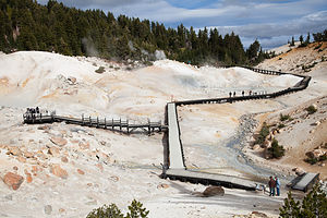 Overlook at Bumpass HellLassen Volcanic National Park in northern California contains Lassen Peak, the southernmost volcano in the Cascade Volcanic Arch, which extends for over 700 miles from British Columbia through Washington and Oregon to northern California. The Cascade Volcanoes are part of the Pacific Ring of Fire, the ring of volcanoes and associated mountains around the Pacific Ocean.
10,457 foot Lassen Peak is the largest plug dome volcano in the world. These types of plug or lava domes are formed when the ejected lava is too viscous to flow very far, and instead piles over and around its vent, creating a big dome over the volcano.
Although dormant now, Lassen Peak was the site of the most recent volcanic eruption in northern California. It began in 1914, spewing rock, gas, and hot ash billowing into the atmosphere. In 1915 it blew a cloud of ash almost 6 miles high and triggered a mudflow, known as a lahar, which wiped out a 5 square kilometer area now called the Devastated Area, which can still be seen today. It erupted for seven years before finally settling down in 1921.
The park is the only place in the world where all four types of volcano can be found: plug dome, shield, composite, and cinder cone. In addition, in Bumpass Hell in the southern part of the park there are bubbling hot springs, boiling mud pots, and fumaroles in six geothermal fields.
If you only have a day to visit the park, the best way to see it is to drive the 30-mile Lassen Volcanic National Park Highway, stopping at various highlights along the way. Starting from the northwest entrance, the following are some highlights along the way:
- Manzanita Lake – the iconic photo of the park is Lassen Peak reflected in this beautiful lake. It is also a good place to kayak, fish, or hike around its shores.
- Loomis Museum where one can view artifacts and photographs from the park’s 1914-1915 eruption
- Chaos Crags and Jumbles Scenic Pull-out – the site of an avalanche 350 years ago from the Chaos Crags lava domes, which scattered hundreds of thousands of large rocks over a couple of square miles
- Devastated Area – a ½-mile interpretative trail looks through the devastation caused by Lassen’s 1914 eruption
- Summit Lake – the midpoint between the northern and southern entrances, this is a great place to take a dip in Summit Lake or to stroll around it on the loop trail.
- Kings Creek picnic area – lovely spot to stop for lunch where the Kings Creeks flows through a meadow at the foot of Lassen Peak
- Lassen Peak Parking Area and Viewpoint – this is the highest point on the park road at 8,512 feet. From here you can just enjoy the view or, for the more adventurous, hike the strenuous 2 ½ mile to the summit, where you can look into the rim or out over the entire park. (This trail is currently closed for trail maintenance beyond the halfway point)
- Bumpass Hell – a 3 mile roundtrip hike brings you up close to bubbling hot springs, boiling mud pots, hissing steam vents (fumaroles)
- Sulphur Works Thermal Area – located near the southern entrance to the park, this is the most easily accessible hydrothermal area, where paved walks lead past boiling springs, burbling mudpots, and sulphur-emitting steam vents.
There are three campgrounds along the Lassen Volcanic National Park Highway that accommodate RVs:
- Manzanita Lake Campground – located near the northwest entrance to the park and adjacent to Manzanita Lake. The campground offers swimming, fishing, kayaking, and hiking. It is the largest of the Lassen campgrounds with 179 sites, some of which can be reserved. It is open from the end of May until it snows.
- Crags Campground – located five miles south of Manzanita Lake on the main park road. The campground offers easy access to the Lost Creek and Devastated Areas, in addition to Crags and Manzanita Lake. There are 45 RV sites, and operates on a first-come-first-served basis. It is open from mid-June to mid-September.
- Summit Lake Campgrounds - located 12 miles south of Manzanita Lake. The campground is comprised of a North and South section, each with access to the lake. There are 94 sites, some of which can be reserved. Summit Lake North is open from late June through mid-September and Summit Lake South is open from late June through late October.
Lava Beds National Monument
Friday, September 27, 2013 - 3:45pm by Lolo84 miles and 2.5 hours from our last stop - 1 night stay
Travelogue
 Lolo at Entrance of CaveAs much as I hate to, I am going to have to give Herb total credit for this stop. Although I do most of the research and trip planning, every once in a while Herb comes up with a destination that I never even thought of. What I hate to say even more is that usually he picks a winner. Lava Beds had not even been on my radar. In fact, to be honest, I’m not sure if I had even heard of it before he started bringing it up.
Perhaps, it was our new found interest in geology. After years of visiting the national parks and understanding very little regarding their geological formation, Herb and I discovered TTC (The Teaching Company) videos of various college courses. Every morning after breakfast, we dutifully sit down with a cup of coffee and watch a ½ hour lecture on a particular subject. We had just completed two entire courses on geology (18 hours each), and were anxious to go out and apply our new found knowledge. I really wish we had watched these years ago, because it is so much more interesting to visit a place when you understand how it came to be.
 Lolo in Sunshine CaveLava Beds National Monument is pretty small, so it can be covered pretty easily in a day. The park road is only about 15 miles long and most of the interesting sights are conveniently located along the way.
Although we entered the park from the north, we drove directly through it to the southern end, where the Visitor Center and campground were, avoiding the temptation of stopping along the way. We would come back once we had dropped the motorhome off at the campground. Plus, it’s always more useful to go to the Visitor Center first, so you know what the park has to offer.
The remoteness of this park makes is a little visited one, so we had no trouble getting a campsite in Indian Wells, the only campground in the park. After decoupling the Subaru, we set out for a full day of exploration.
 Lolo Leaving Skull CaveOur first stop was the Visitor Center, where we unexpectedly got cleared for White-Nose Bat Disease -- not unexpected that we didn't have it, but rather that such a disease even existed. This disease, named for the distinctive white fungal growth around infected bats’ noses, has been responsible for the death of millions of North American bats. To prevent the spread of this devastating disease, park rangers want to make sure that visitors are not wearing shoes or hiking boots that have been in other caves with bats, especially in the Northeast where the disease originated. Although we had been in many bat caves in recent years, we were sporting brand new hiking boots, so we were good to go.
I can understand why the park is so concerned about protecting their caves. These are their treasures. It is these lava tube caves that make the park unique among its volcanic peers, of which there are many along the Pacific Ring of Fire. They were formed thousands of years ago when the Medicine Lake shield volcano erupted, spewing hot molten lava. The outer edges of the lava cooled and hardened first, while the warmer inner core of lava continued to flow within, forming a giant underground tunnel system of tubes and caves.
 Hiking to Schonchin Butte LookoutWithin the park there are over 330 of these lava caves. About 15 of them have developed entrances and trails for visitors to explore. Some of them are easy with relatively high ceilings and smooth floors, others require you to stoop and have rougher floors, and the most challenging have portions where you have to crawl on your hands and knees through narrow openings. All you need are sturdy shoes, a good flashlight, and a helmet and kneepads (for the more challenging caves).
While Herb and I usually like to think we can handle a challenge, neither one of us had any desire to crawl along a damp, rough floor in the dark on our hands and knees. The Easy and Moderate caves hikes sounded like they would give us a sufficient cave experience.
 View from Schonchin ButteMost of the caves are located along the one-way Cave Loop Road, just southwest of the visitor center, so we drove and parked at our first victim, Sunshine. We liked the name. However, I don’t think we should have been caving if it was Sunshine we were after. I guess everything is relative. This one was called Sunshine because the roof of it had collapsed in two places allowing sunlight to enter. It was rated Moderately Challenging because stooping was required in several places and the floors in the back section were very steep, rough, and wet. The cave was only 466 feet long, but I would have to say that it felt a lot longer.
For our second cave, we chose an easier but longer one called Sentinel Cave. This is the only one that has two entrances, so you can through hike from Upper to Lower Sentinel Cave for a total distance of 3,280 feet. And, we didn’t have to stoop in this one, but could walk upright with dignity. Although it was rated as Least Challenging, it was still a bit disconcerting to be in such a dark place. Of course we had headlamps—you wouldn’t get 50 feet without them—but we turned them off at one point. It was unbelievably silent and scary. I don’t know what I would have done if the batteries went dead.
We picked one more cave because we liked the name: Skull Cave. This one was not on the Cave Loop but about 2.4 miles up the road from the Visitor Center. Although it was named for the bones of pronghorn sheep and two human skeletons found inside, we fortunately did not stumble across any. This cave, which was rated Least Challenging, is 580 feet long.
 Schonchin Butte Fire LookoutFiguring three caves had given us a sufficient sampling of a really cool geological feature, we devoted the rest of the day to activities out in the real sunshine. While the caves are the main draw to Lava Beds National Monument, there are many more interesting volcanic features, as well as a pretty exciting human historical past, to explore.
Continuing up the park road, our next stop, and probably my favorite of the day, was the 0.7 hike up Schonchin Butte, a cinder cone with a Fire Lookout on top. When we got to the top, the friendly fire ranger and his wife (who told us she liked coming along with her husband to work when she could) waved us to come on up. Wow. At the Black Butte Lookout in Sisters, we weren’t allowed to climb the tower or bother the fire rangers that lived in the tiny cabin nearby. I guess the difference was that this guy didn’t live up here, but commuted each day with his food and supplies. He was so friendly, and we learned a lot about detecting and fighting forest fires. He also pointed out Lassen Peak for us.
 Captain Jacks Stronghold HikeWe passed the turnoff for Fleener Chimneys—we would hit that on the way back—and stopped at the parking lot for Black Crater. While a longer 1.1 mile trail leads to the site of a Modoc Indian battle, we just took a short side trail from the parking lot to Black Crater, a large spatter cone.
Lava Beds was truly a geologist’s paradise, with such a variety of volcanic features to explore. Those TTC geology lectures were certainly coming in handy. Also, our younger son Tommy majored in Geology in college and took a field trip to Hawaii to study volcanoes. It was nice to finally understand a bit of what he had studied.
Most of the lava in Lava Beds National Monument is basaltic, which is thinner and flows faster than other types of lava, such as andesite. The two most common types of basaltic lava flows are pahoehoe and A’a. Pahoehoe is the most common type found in Lava Beds. It is smooth and ropy and forms when lava cools slowly and doesn’t move too fast. A’a is rough and sharp. It forms when lava cools quickly and moves fast, tearing it into jagged pieces.
 Native American Medicine PoleAn excellent place in Lava Beds to see a’a lava is the Devils Homestead Flow, just north of Black Crater. It's a vast expanse of black, jagged rocks with no vegetation in sight. It looked like another planet.
We got out of the car at the scenic overlook and, I must confess, I put a few samples of a’a in my pocket. I wanted to show Tommy that I learned something about geology. I would have to find some pahoehoe later to add to my new lava collection.
To understand the significance of the next two stops, you have to know a little about the human history that unfolded in Lava Beds.
Back in 1872, the Modoc Indians and the U.S. Army went to war over this territory. The U.S. Army outnumbered the Modoc 10 to 1, but the Modocs, under the leadership of Captain Jack, were able to fend them off for sometime by hiding out in an natural fortress now called Captain Jacks Stronghold. When we hiked through this area, we understood why they picked it as a fortification. It was an ancient lava flow of rough and jagged rock (must have been a’a!) that made it almost impossible for the U.S. Army to cross.
 Herb of Tule LakeFinally, President Grant called for a peace conference to be held between the Modoc and the U.S. Army at a location west of the Stronghold, now called Canby Cross. Unfortunately, this meeting did not go as planned. Two Modoc warriors managed to shame Captain Jack into shooting the U.S. General Canby in the face, killing him. Obviously, that did not help the peace negotiations and the war went on. Eventually the Modoc were defeated and Captain Jack was hung for his crime.
We made a stop at both of these places – Canby Cross to see the memorial to the unfortunate General Canby and Captain Jacks Stronghold, where we hiked the 1.5 mile trails through the amazing natural fortress of lava.
It’s a pretty somber place when you think about what happened here. Most of the Modoc survivors were exiled to the Quapaw Reservation in Oklahoma, but gradually a few of them have begun to return to the Lava Beds to reestablish their spiritual bonds to the land of their ancestors. I’m not sure, but I think we might have come across a place where that was being done – or maybe it was just tourists gone awry.
 Lolo of Fleener ChimneysAt the junction of the inner and outer trails at Captain Jacks Stronghold, we came across a medicine pole, or more correctly a medicine branch stuck in the ground, almost completely decorated with a miscellany of stuff—bandanas, flags, feathers, etc. It reminded me of one of those Dutch paintings that are so detailed that you can spend hours looking at it and still find something new. With closer scrutiny we found a baby shoe, a compass, and a Livestrong bracelet, just to name a few objects. I am not sure if these items were random or whether they had any spiritual significance. The Campbell Soup can had me pretty stumped.
After Captain Jack’s Stronghold, the road traced the southern shore of Tule Lake, where we stopped at one of the overlooks. I had had the foresight to pack some wine and cheese, so we sat for awhile by the lake and watched the sun go down.
On the way back to the campground, we stopped at the one stop we missed when driving north, the Fleener Chimneys, the source of all that lava in Devils Homestead. It was already almost dark so we had to be quick. This was another example of a spatter cone, which is created when erupting globs of molten lava get piled up on each other. When this one was created it left a 50-foot deep chimney behind in the center, hence the name, Fleener Chimneys.
It had been a very full day and we had covered a lot of ground through thousands of years of tumultuous history, both geological and man-made. Herb was right. This was a very worthwhile stop indeed.
Description
 Lolo Approaching Lava Tube Cave EntranceLava Beds National Monument in northeastern California comprises 46,000 acres of rugged landscape dotted with diverse volcanic features, such as lava tube caves, cinder cones, spatter cones, fumaroles, pit craters, and lava flows, which were created over the last half million years by volcanic eruptions on the Medicine Lake shield volcano.
What makes Lava Beds National Monument unique among its volcanic peers is its more than 330 lava tube caves. These tubes were formed when lava flowing from the erupting Medicine Lake volcano began to cool and harden on the outer edges, while hotter lava in the core continued to flow within, forming a giant underground tunnel system of tubes and caves.
Over two dozen of these lava caves, of varying difficulty, length, and complexity, have developed entrances and trails for visitors to explore. All you need are sturdy shoes, a good flashlight, and a helmet (for the more challenging caves). Most of the caves are located along the one-way Cave Loop Road, just southwest of the visitor center. The Visitor Center has a brochure describing each of the caves in terms of difficulty and length.
 Lolo Hiking Captain Jacks StrongholdBesides its tumultuous geological past, this area has also had its share of human violence. From 1872 to 1873, the Modoc Indians used this rugged terrain to defend their territory from the U.S. Army, which outnumbered them 10 to 1. Under the leadership of Captain Jack, about 50 Modoc warriors and their women and children hid out in a natural stronghold near the shores of Tule Lake, where ancient lava flows had formed a rugged, uneven terrain, difficult for the U.S. Army to cross. After an unsuccessful siege attempt, President Grant arranged for a peace conference to be held with the Modoc leaders at a location west of the Stronghold. However, two Modoc warriors shamed Captain Jack into shooting and killing General Canby at this peace meeting. The Modoc were eventually defeated and Captain Jack hung for his crime. The Modoc survivors were exiled to the Quapaw Agency in Oklahoma. In recent years, a few Modoc have begun to return to the Lava Beds to try to reestablish their spiritual bonds to the land of their ancestors.
The best way to explore the parks geological and cultural history is to drive the 15-mile road through the park. Starting from the Visitor Center near the southern entrance, the following are some highlights along the way:
- Cave Loop Road – best place to explore the lava caves. There are about a dozen of them here with varying degrees of length and difficulty
- Skull Cave – a short side road leads to a cave with a more wide open feel, better for those that do not like tight, closed-in spaces. It is named for the bones of pronghorn, bighorn sheep, and two human skeletons discovered inside.
- Schonchin Butte – a 1.5 mile roundtrip trail leads to the top of this cinder cone, where there is an historic Fire Lookout still in use
- Fleener Chimneys – a short side road leads to an interesting volcanic feature, known as a spatter cone. It was created when erupting globs of molten lava piled up on each other leaving a 50 foot deep chimney behind in the center
- Black Crater – 1.1 mile trail along the edge of a lava flow to the site of a Modoc ambush on the U.S. Army during the Modoc War.
- Devils Homestead Lava Flow – vast expanse of black, jagged lava from an eruption of Fleener Chimneys 12,000 years ago. It is an excellent example of an a’a lava flow.
- Canby Cross – memorial to General Canby, who during a peace gathering with the Modoc Indians, was shot in the face and killed by Captain Jack of the Modoc. The cross is registered as a California Historical Landmark
- Captain Jacks Stronghold – 1.5 mile trail through a natural fortress of lava, where the Modoc Indians hid out for the winter of 1872-1872 during their war with the U.S. Army.
- Wildlife Overlooks – along the southern shore of Tule Lake are the East and West Overlooks where one can view migratory and resident birds on the waters of Tule Lake
There is one campground in Lava Beds:
- Indian Well Campground - located at the southern end of the park just downhill from the Visitor Center. There are 43 sites, available on a first-come-first-served basis. It can accommodate RVs up to 35 feet in length. The campground is open year round.
Klamath Falls Walmart
Thursday, September 26, 2013 - 3:30pm by Lolo185 miles and 4 hours from our last stop - 1 night stay
Travelogue
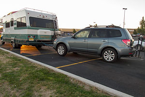 Camping at Klamath Falls WalmartWe had a few more hours of daylight after leaving Sisters, so we decided to make a dent in our driving time to Lava Beds National Monument. Since we didn't plan to do much else that day, other than food shop and sleep, we figured a Walmart parking lot would be our best bet. Also, the price was right.
This put us within a 2 1/2 hours striking distance of Lava Beds, which would allow us to get there pretty early in the morning and give us the whole day to explore
Description
Many Walmart Supercenters allow RVs to park in their parking lots over night since they are open 24 hours. It is a good idea, however, to call ahead and speak to a manager to confirm.
Sisters
Wednesday, September 25, 2013 - 1:30pm by Lolo251 miles and 3.5 hours from our last stop - 1 night stay
Travelogue
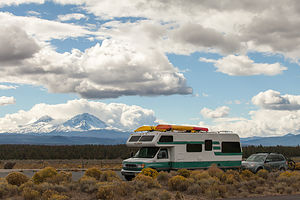 Lazy Daze at Three Sisters ViewpointDuring our visit to Bend and Smith Rock State Park earlier this summer, we had taken notice of the beautiful, snow-covered Three Sisters peaks looming majestically to the West. Also, a couple we met in the Crown Villa campground couldn’t stop raving about how great the Sisters area was. So, rather than repeat a visit to Bend on our drive south through the Oregon Cascades, which wouldn’t have been a bad idea either, we decided to stop in Sisters instead.
Since we wanted to hike the next day, we stopped at the National Forest office right in the heart of town to get trail maps and recommendations. I usually do some research first and then try to get confirmation on my choices, and that is exactly what happened. We all agreed that the 3.8 loop hike to the summit of Black Butte would be our best bet. Also, they told us that we could park the RV in their parking lot in the morning, which would allow us to not have to camp another night in Sisters if we wanted to continue driving south after the hike.
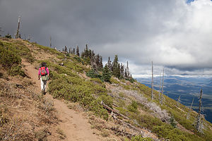 Black Butte TrailThe town was really cute. It had a real old Western Cow Town type of feel to it. Many of the buildings had old-fashioned facades and covered sidewalks. I made it quite clear to Herb that it would be a very good idea for us to come back here for dinner later.
The next order of business was finding a campground for the night. We toyed with staying at Tumelo State Park, because generally we prefer state parks over commercial campgrounds, but that one was 17 miles away in Bend. We even drove down there to look at it, but although it was nice enough, it wasn't nice enough for us to want to be so far from town and the start of our hike in the morning.
So we drove back up Route 20, taking note of the scenic viewpoint of the Three Sisters along the way, and camped instead at the Garden RV Park, just 4 miles south of town. It was a very nice campground and much more conveniently located to Sisters. This way me and my cowpoke could easily go to town later.
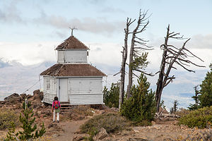 Lolo Approaching Black Butte Lookout CabinBut first, the lighting was getting low and the Three Sisters were strutting their stuff, so after checking in, we drove back down to the scenic viewpoint a few miles down Route 20 to photograph sunset over the Sisters. Unfortunately, clouds had moved in, obstructing the view.
Back at the campground, we used the Yelp app on the phone to look at restaurant reviews. We really find this very helpful when in a place we know little about, and it has rarely steered us wrong. The Open Door restaurant had by far the best reviews, so I called and made a reservation for 2. I felt kind of silly later about the reservation, because the restaurant was empty except for one other table. It was no reflection on the restaurant though. The whole town was like a ghost town. Where was everybody? When we asked our waitress, she told us that things are really busy on the weekends, but quiet during the week this time of year. Well, we got lots of attention and great service, and the Grilled Salmon was absolutely delicious.
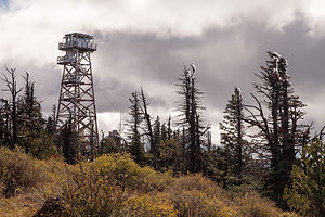 Black Butte Lookout TowerThe next morning was a chilly 28 degrees, so we dressed in layers hoping to discard most of them as the day went on. The drive to the Black Butte trailhead was not trivial – Highway 22 west of Sisters for 5 ½ miles to the Indian Ford Campground, then north on Green Ridge Road 11 for 3.8 miles, and then left on gravel road 1110 for another 5.1 miles to the road’s end. There were not many cars in the parking lot, so we would pretty much have the trail to ourselves.
The trail began climbing right from the very beginning, steadily up through of forest of ponderosa pine. After about a mile, we came out of the trees and crossed a treeless slope. Then the trail really began to climb even more steeply along the eastern ridge of the butte. The trees now were of the wind-stunted variety. Finally, after an elevation gain of about 900 feet, we reached the summit.
Black Butte is actually a volcano that erupted about 20,000 years ago (recent in geological terms), forming a 3,000-foot high symmetrical cinder cone, one of the tallest in the state.
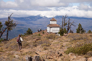 Black Butte Lookout CabinIts location and panoramic views of the surrounding forests make it a perfect place for a fire lookout site, and it has played that role in one capacity or another since 1910. The summit is also a perfect place for weary hikers, such as ourselves, to enjoy a rest and the tremendous views. However, you are not allowed to climb the 62-foot fire tower and are strongly discouraged from invading the privacy of the fire lookout staff, who live in the tiny, one-room log cabin, perched at the absolute best viewpoint on the summit. I guess there’s a reason for that, as it is, after all, their job to look for fires. The cabin looked so cute and cozy. There was even smoke coming out of its chimney. It definitely was very photogenic and served as an excellent subject in many of our photos. The whole time we were there, we never saw anyone come out of the cabin.
As we often do when exploring a new place, Herb checked the geocaching app on his phone to see if any were hidden nearby, and we struck gold. There were at least 10 of them we could hunt for, both on top of the summit and along the way down.
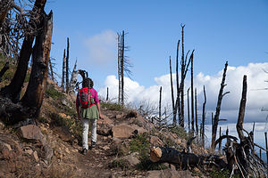 Lolo Hiking Black ButteFor those of you fellow travelers unfamiliar with geocaching, I seriously recommend learning more about it (see www.geocaching.com). It can be a life-changing event. No seriously, it is a very interesting concept that has brought us to some very interesting and out-of-the way places. Very briefly, geocaching is sort of a treasure hunt, sans the treasures. Geocaches are waterproof containers (ranging from tiny little containers to ammo boxes) that contain little trinkets for trading—items that you would just throw away if you found them in your house, but for some reason feel like treasures after having gone through so much trouble trying to find them. There are over a million geocaches hidden in over 100 countries throughout the world. People searching for them use a GPS to guide them to usually within 30 feet of the hidden cache. From there, clues help the seeker zero in on the find. I know it sounds a bit silly, but it is actually a lot of fun and has exposed us to a lot of great places that we would never have found on our own, or in this case, getting us to slow down and look a little deeper at a place we had already discovered.
Sometimes one person hides a series of geocaches with a unifying theme, in terms of the name of the cache, not its contents. In this case the theme was veggies, and we had a great time searching for Tomatoes, Corn, Kohlrabi, Lettuce, and Spinach.
Our next destination after Sisters was Lava Beds National Monument, about 220 miles away. Since it was already mid-afternoon, we knew we wouldn’t get there today, but at least if we started driving we could get closer, so we could spend a full day there tomorrow.
Description
Sisters is a small town in the Oregon Cascades with tremendous recreational opportunities, such as hiking, mountain biking rock climbing, fly fishing, and golf. Once just a stopover for people on their way to bigger and better known Bend, Sisters has become a destination in itself.
The town gets its name from the nearby majestic Three Sisters Mountains. Many of the buildings along the main drag through town have old-fashioned false fronts and covered sidewalks, giving the town a distinctive Western Cow Town feel.
Excellent hiking opportunities abound in the nearby Mount Washington, Mount Jefferson, and Three Sisters wilderness areas. Near Camp Sherman is the trail to the summit of Black Butte, where one is treated to a 360 degree view of the surrounding mountains.
Maryhill Museum of Art
Wednesday, September 25, 2013 - 12:00pm by Lolo15 miles and 0.5 hours from our last stop
Travelogue
 Lolo approaching Maryhill StonehengeThe Maryhill Museum of Art was a very pleasant surprise. Everything about it was just so unique and eccentric. You just don’t expect to come upon a huge, concrete, neo-classical mansion out in the middle of nowhere. I felt more like I was in Newport, Rhode Island than in a town with a population of 98. Its setting atop a remote bluff overlooking the river was absolutely gorgeous.
The parking lot was quite large, so I imagine they do get lots of visitors, but today, being a weekday, was pretty quiet. We took the trail along the bluff admiring the views along the way. Saving the outdoor sculpture garden for afterwards, we walked up the concrete, driveway-like ramp that served as the entrance to the museum. We later learned that this indeed did once serve as a driveway when it was still Sam Hill’s mansion. Mr. Hill would have cars bring his guests up the west ramp, through the house (where they would be dropped off), and then back out and down the east ramp. Talk about being a good host.
 Maryhill Museum of ArtTo understand this museum better, it is really helpful to know a little more about Sam Hill, who originally came to this area in 1907 with the intention of establishing a Quaker agricultural town. However, the lack of irrigation and the remoteness of the location caused his dream to fail, and construction on his mansion stopped in 1917.
As you will see, Sam Hill not only had an eclectic taste in art, but a rather eclectic one in friendships as well. One of his good friends was Loie Fuller, a pioneer of modern dance in Paris, who regularly performed at the Folies Bergere. In fact, the museum contains an old black and white, silent movie of her doing a Serpentine Dance. During this dance, she would hold her long skirt in her hands and wave it around, allowing the stage light behind to reveal her form inside. It was bizarre.
 Lolo with Chess Sets from Around the WorldAnyway, it was this friend who suggested he turn his mansion into an art museum when his dream of a Quaker town failed. She knew a lot of French artists, so she helped him acquire many works, including 80 sculptures by Auguste Rodin.
Oddly enough, another one of his very good friends was Queen Marie of Romania, the granddaughter of Britain’s Queen Victoria. She contributed Orthodox icons and various furnishings and objects from her palace.
A third friend of his was Alma de Bretteville Spreckels, the wife of a San Francisco sugar magnate. She became a member of the museum’s board of trustees and helped finish the museum after Hill’s death. Under her guidance the museum was opened to the public in 1940.
 Lolo with her Favorite Pine ConeIt was hard at first for us to figure out any unifying theme to the exhibits within the museum, because it really is a reflection of the eclectic taste and friendships of Sam Hill. Each room we entered was a total surprise.
Besides the Serpentine Dance motion picture, Rodin sculptures, and Romanian royal collection mentioned already, there was a room with miniature French fashion mannequins, which was adorable, another one with chess sets from around the world (my personal favorite exhibit), and still another with Native American baskets. Nothing would have surprised me.
I would have to say that one of my favorite ways of viewing art is in a beautiful natural setting, and the sculpture garden at Maryhill rivaled the best. There are only two other places, Storm King Art Center in New York State and Brookgreen Gardens in South Carolina, where I have so thoroughly enjoyed an outdoor sculpture garden.
 Maryhill Museum of Art and Quantum ManWhile there were dozens of works to view and enjoy, I had two particular favorites. The first was Quantum Man, a walking man comprised of over a hundred vertically oriented steel sheets. When approaching the sculpture from the front, it appeared as a sheet of solid steel, but when viewed from the side it practically disappeared as light shone through the spaces between the sheets. My second was a very large pine cone (bigger than me) bending over in the wind.
Three miles east of the museum is another bizarre example of Sam Hill’s unique artistic taste, a concrete, full-size replica of Stonehenge. As with everything regarding Sam Hill, there is always an interesting reason behind his art decisions. When traveling to England during World War I, Sam Hill visited the real Stonehenge where he was told that the site had been used for human sacrifices (one of many theories as to its purpose). Upon hearing this, he remarked: “After all our civilization, the flower of humanity is still being sacrificed to the god of war on fields of battle.”
When he returned home to Maryhill, he commissioned the construction of a full-size replica of Stonehenge as a memorial to the soldiers of Klickitat County, Washington, who had sacrificed their lives in the war. Hill chose a ledge below his Stonehenge replica for his own burial site.
It definitely had the feel of a solemn and sacred place.
Description
 Native American Basket Sculptures and ViewpointThe Maryhill Museum of Art is a small museum situated atop a remote bluff overlooking the Columbia River Gorge in the town of Maryhill, Washington.
Designed in 1914, the museum was originally the residence of eccentric millionaire Sam Hill, whose plan was to establish a Quaker agricultural town. Unfortunately, his dreams were unrealized, and in 1927 he decided to turn it into an art museum. Today it is one of the finest, most eclectic, and least visited museums in the Pacific Northwest.
It’s very eclectic collection includes: treasures from his good friend Queen Marie of Romania’s royal collection, sculptures and drawings by Auguste Rodin, chess sets from around the world, miniature French fashion mannequins, and Native American baskets.
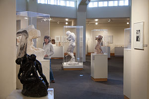 Room of Rodin SculpturesThe grounds also include an outdoor sculpture garden from which the views of the Columbia River Gorge are spectacular.
Three miles east of the museum is Sam Hill’s concrete, full-size replica of Stonehenge. It was built in 1918 as a memorial to the soldiers of Klickitat County, Washington, who had died in World War I. As with the original, the altar stone is placed to be aligned with sunrise on the Summer Solstice. Hill’s original selection of Stonehenge as a fitting memorial for dead soldiers was based on the theory that the original Stonehenge had been used as a sacrificial site. Being an anti-war Quaker, Hill felt that war was a senseless sacrifice of human life.
Columbia Hills State Park
Tuesday, September 24, 2013 - 8:30am by Lolo243 miles and 5 hours from our last stop - 1 night stay
Travelogue
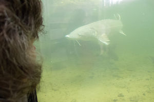 Herman, the 70 Year Old SturgeonWe woke up to our first rainy day of the trip. Not bad, considering we had been out on the west coast for over 5 weeks (counting this trip and last) and had not had one drop of rain the entire time.
Our plan for the day was to drive down to Portland and then east along the scenic Columbia River Gorge. It was a bit challenging at first to actually figure out our route, because both Washington and Oregon have competing Columbia River scenic drives. We decided to split the difference and do a little of both.
The Oregon scenic drive started in the town of Troutdale, about l6 miles east of Portland, right off I84. Before beginning the drive, we stopped in a Camping World so Herb could pick up some needed RV paraphernalia, and hopefully wait for the rain to stop. While Herb was shopping, I struck up a conversation with a store employee and told him that we were planning to drive the Historic Columbia River Highway in our motorhome. Luckily I did, because he told me that we would have to be crazy to do that road on a rainy day in a motorhome. Thank goodness for local knowledge, because there was nothing in the guide books that indicated that. Instead we would have to take I84 which parallels it instead. I was a bit disappointed that we would be on an interstate rather than a scenic drive, but the highway still traced the river and was scenic as well.
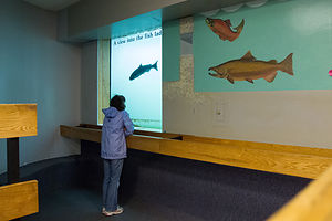
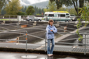 Rainy Day at the Fish HatcheryOur first stop was the Bonneville Lock and Dam, the nation’s largest hydroelectric plant, where there was a visitor center with exhibits on the history of the dam. What I really wanted to see, however, was Herman the Sturgeon, a somewhat famous 70-year-old, 10-foot long, 450 pound sturgeon that lived in the nearby Bonneville Fish Hatchery. Herman did not disappoint—he was huge. Funny how everything is relative. On a rainy day like this, Herman was a highlight.
The Hatchery, however, was so much more than just Herman. It’s really about the salmon, 80,000 of which return here each late summer/early fall to spawn. Once they arrive, they are sorted before the spawning begins. The hatchery raises 8 million Fall Chinook, 1.2 million Coho, 200 thousand Summer Steelhead, and 60 thousand Winter Steelhead each year. Unfortunately, for the salmon that is, it is a one-way trip, as they die soon after spawning.
At this point, we crossed the Bridge of the Gods over to the Washington State side and continued our drive along Washington Route 14. The drive truly was beautiful, regardless of which side of the river you were on.
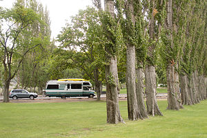 Columbia Hills State ParkFortunately, the rain had stopped and the skies were starting to clear. The next planned stop along the drive was the Maryhill Museum of Art, but since it was already mid-afternoon, we decided to find a place to camp for the night so that we could visit the museum in the morning.
Once again, our handy new Moon West Coast RV Camping guide pointed us to Columbia Hills State Park, with a scenic rating of 10. It was a little confusing at first because the GPS showed it as Horsethief Lake State Park, its previous name. The campground was quite small, just 12 RV sites, and empty except for one camper van. Although it was very pretty, I am not sure I would have ranked it a 10—maybe more like an 8 or a 9. However, it was conveniently located, right off Route 14, and 13 miles west of the Maryhill Museum.
Seattle / Tacoma KOA
Sunday, September 22, 2013 - 12:30pm by Lolo175 miles and 4 hours from our last stop - 2 night stay
Travelogue
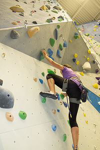 Lolo Climbing the Overhang at Stone GardensAlthough Tommy had to return to work Monday morning, we were not quite ready to leave him yet. Rather than starting our southward journey right away, we decided to camp in the Seattle/Tacoma KOA so that we could meet Tommy after work at his rock climbing gym in Bellevue. Also, we needed a little downtime to do laundry, so slowing down a bit and staying at the KOA for 2 nights would help us get recharged for the next leg of our journey.
Driving up I5 to Seattle during rush hour is not a pleasant event, so we left a bit earlier than we needed to and went to the Crossroads Bellevue Mall, where Tommy’s gym was, to kill some time. It was a very nice mall, and the comfy leather chairs between a Starbucks and a bookstore were just what we were looking for. I settled in happily with a decadent Iced Caffe Mocha and my Kindle to pass the time before Tommy’s arrival.
Ever since we purchased our Kindles, we have sadly moved away from real live books—that is, except for travel books. Electronic versions of travel books just don’t cut it for me. So, after awhile, we wandered into the nearby Barnes & Noble to check out their travel section.
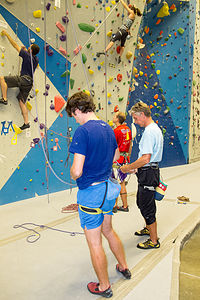 Tom and Herb at Stone GardensTo our surprise and delight we found a book that we always thought should have been written, but didn’t know existed—a campground guide with ratings based on scenic beauty rather than how many playgrounds or laundries it has. Not that there is anything wrong with the Woodall type of rating of campground facilities, but it just isn’t our main priority in finding a campground. The book (as you will see on the right under “Recommended Books”) is called Moon West Coast RV Camping. It contains more than 2,300 campgrounds (both privately-owned and state and national parks) and ranks them from 1 to 10 on scenic beauty. It also lists the 10 best campgrounds in certain categories, such as Best Fishing, Best Coastal sites, etc.). I am telling you, this book has been transformational for us. Ever since we bought it, we have referenced it for every campground we have stayed in.
About a half hour before Tommy was scheduled to arrive, we headed over to Stone Gardens (his rock climbing gym) to get certified for climbing. Every climbing gym, as it should, has a test you must pass before climbing to prove you know how to use the equipment. Having recently passed just such a test at Andrew’s gym in San Francisco, I was feeling pretty cocky that this would go just as smoothly. I quickly showed off my ability to make a figure eight knot and tie it into my harness, to the nodding approval of the staff member testing me. But then he pulled out a device that I had never before seen in my life and placed it in my hand. This was not the same belaying device used in Andrew’s gym. After fondling it for a bit, I glanced helplessly over at Herb. “Ah… Could I phone a friend?” I felt like asking. But no, the rules were strict. There was no getting help from anyone else. I had flunked. I was so disappointed, because I really wanted to climb with Tommy and Herb. But alas all was not lost. Although I had failed the belaying portion of the test, and therefore deemed to be a hazard at one end of the rope, I had passed the climbing part and was free to have someone belay me when I climbed. This was perfect. Herb and Tommy could belay each other and me.
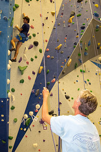 Herb Belaying Tom at Stone GardensWe spent the next few hours climbing. Like Andrew’s gym, this one also had a lot more climbs that I could do than our gym back home in New Jersey. Tommy’s frequent trips here were paying off. Herb was really impressed with how good he had gotten.
We stopped for a quick bite to eat afterwards at a nearby Thai restaurant. Before we went back to the campground, I really wanted to see Tommy’s new apartment in Seattle, which he had recently moved into with some friends from college that were now going to the University of Washington for their PhDs. He suggested that we just follow him and that it was only about 20 minutes away. Well, it was dark and we soon realized that the car we were following was not his, and we soon found ourselves going south on I405. We didn’t even have Tommy's address, so we called him and then put it into our GPS. By then, we were way off course and it probably took us about an hour, and one cop inquiring as to why we were pulled over on the side of the road looking confused, before we finally found his place. It was very nice, and I felt better for having seen it.
After thanking Tommy for showing us a great time in Leavenworth and Seattle, we headed back to our KOA in Kent. I hate goodbyes, but with this new spreading out of the family, I was going to have to get used to it.
Description
Popular urban 134-site campground located 17 miles south of Seattle in the town of Kent, Washington. During the summer times, tours of Seattle are offered from the campground.

