- Home
- About
- Map
- Trips
- Bringing Boat West
- Migration West
- Solo Motorcycle Ride
- Final Family XC Trip
- Colorado Rockies
- Graduates' XC Trip
- Yosemite & Nevada
- Colorado & Utah
- Best of Utah
- Southern Loop
- Pacific Northwest
- Northern Loop
- Los Angeles to NYC
- East Coast Trips
- Martha's Vineyard
- 1 Week in Quebec
- Southeast Coast
- NH Backpacking
- Martha's Vineyard
- Canadian Maritimes
- Ocracoke Island
- Edisto Island
- First Landing '02
- Hunting Island '02
- Stowe in Winter
- Hunting Island '01
- Lake Placid
- Chesapeake
- Provincetown
- Hunting Island '00
- Acadia in Winter
- Boston Suburbs
- Niagara Falls
- First Landing '99
- Cape Hatteras
- West Coast Trips
- Burning Man
- Utah Off-Roading
- Maui
- Mojave 4WD Course
- Colorado River Rafting
- Bishop & Death Valley
- Kauai
- Yosemite Fall
- Utah Off-Road
- Lost Coast
- Yosemite Valley
- Arizona and New Mexico
- Pescadero & Capitola
- Bishop & Death Valley
- San Diego, Anza Borrego, Joshua Tree
- Carmel
- Death Valley in Fall
- Yosemite in the Fall
- Pacific Northwest
- Utah Off-Roading
- Southern CA Deserts
- Yosemite & Covid
- Lake Powell Covid
- Eastern Sierra & Covid
- Bishop & Death Valley
- Central & SE Oregon
- Mojave Road
- Eastern Sierra
- Trinity Alps
- Tuolumne Meadows
- Lake Powell Boating
- Eastern Sierra
- Yosemite Winter
- Hawaii
- 4WD Eastern Sierra
- 4WD Death Valley +
- Southern CA Deserts
- Christmas in Tahoe
- Yosemite & Pinnacles
- Totality
- Yosemite & Sierra
- Yosemite Christmas
- Yosemite, San Diego
- Yosemite & North CA
- Seattle to Sierra
- Southwest Deserts
- Yosemite & Sierra
- Pacific Northwest
- Yosemite & South CA
- Pacific Northwest
- Northern California
- Southern Alaska
- Vancouver Island
- International Trips
- Index
- Tips
- Books
- Photos/Videos
- Search
- Contact
Leavenworth
Friday, September 20, 2013 - 7:30pm by Lolo350 miles and 7 hours from our last stop - 2 night stay
Travelogue
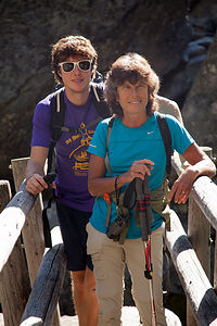 Lolo and Tom on route to Colchuk LakeAfter Astoria, it was pretty much a straight drive up I5 to Seattle and over to Microsoft Building 35, where we would pick Tommy up from work at 5:00 before heading out to Leavenworth in the Cascades for the weekend. The Microsoft Campus was huge and very impressive. There are more than 30,000 employees at this location alone. When he walked out of his office, I barely recognized him. He looked so professional and grownup. I wanted to cry.
I originally planned to take scenic Route 2 through the Cascades to get to Leavenworth, but the traffic on I405 North just to get to Route 2 was reportedly practically standing still, as it often is on Fridays after work. Instead we decided it was worth adding some extra miles to avoid traffic, so we headed a short distance south to get on I90 East, where we would then take Route 97 north into Leavenworth.
The drive was beautiful—and to think this wasn’t even considered the scenic route. By the time we got to the Pine Village KOA in Leavenworth it was dark and late. Thank goodness I had made reservations, because this place was hopping.
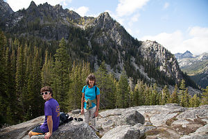 Viewpoint on Colchuk Lake HikeThe next morning we arose to sunny skies and the promise of an outstanding hiking day. Tommy and I had each done research on hiking trails in the area, but we thought it would be a good idea to stop at the Forest Ranger Station right in town to gain some local knowledge. When we told the ranger we were looking for a physically challenging 6 to 9 mile hike with excellent views, she immediately suggested the 8.4 mile round trip hike to Colchuk Lake along Icicle Ridge.
Getting to the trailhead was a bit of an adventure in itself – 8.4 miles along Icicle Creek Road, left on Eightmile Road, and then another 3.8 miles on a washboard dirt road to the trailhead. We were far, however, from being the only ones in the parking lot for this very popular hike.
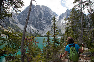 Final Approach to Colchuk LakeThe trail began easily enough, tracing Mountaineer Creek through a cool, dark forest before transitioning into an open lodgepole pine forest. After about 1 ¾ miles, we crossed a log bridge over the tumbling waters of the Creek to what appeared to be a giant boulder field with no trail in sight. However, the trail did go on and much more steeply now as we climbed up, around, and over this boulder field and around granite ledges before being getting our first view of the beautiful, snow-covered Enchantment peaks.
At about 2 ½ miles we came to a trail junction, and went left towards Colchuk Lake, continuing our steep ascent through more boulder fields and forests, crisscrossing the creek several times. I was getting a bit tired by now, but was spurred on by Tommy’s enthusiasm and the increasingly tremendous views of the surrounding peaks and valley below.
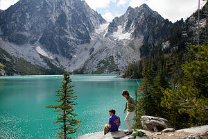 Lolo and Tom at Colchuck LakeFinally, we caught our first glimpse of the lake through the trees and descended the short 0.1 mile spur trail down to a rocky ledge above what had to be one of the most beautiful alpine lakes I have ever seen. Its glacial waters were the bluest of blues, and also probably the coldest of colds, as its name implies—“Colchuk” is Chinook for “cold water.” It was easy to see why this lake is considered to be one of the most beautiful alpine lakes in all of Washington, which is saying quite a lot.
Equally stunning is the lake’s surroundings. Along the northern shore, the Colchuk Glacier sits nestled between a pair of rocky spires, known as Dragontail and Colchuk peaks, gradually feeding this lake with its frigid ice melt.
We ate lunch out on the ledge enjoying the views, before retracing out steps through forests, across creeks, and over boulders back to the parking lot.
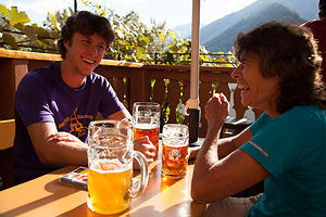 Tom and Lolo Enjoying Munchen Haus BeersWhat I was really looking forward to after the hike was spending time in the town of Leavenworth itself, which we had gotten a brief glimpse on our drive to the hike. The town was adorable. It was as if a Bavarian Village had been lifted out of the Alps and transported to the Cascades. Everything about the town was German, even down to the fonts on every building in town. We were especially amused by the giant Bavarian “M” rising above a McDonalds. There were nutcrackers, cuckoo clocks, and beer gardens as far as the eye could see. Ahhh…the beer gardens. The perfect place to relax after a long hike in the Alps—or Cascades I mean.
For all our traveling experiences, I am embarrassed to say that I have never been to Europe. So far I have pretended to be in France when visiting Quebec City, and now, as far as I was concerned, I was in Bavaria and it was Octoberfest. Bring on the oompah band.
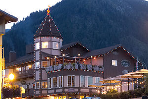 Visconti's at DuskWe found the perfect spot to enhance our Bavarian experience—the Munchen Haus Bavarian Grill and Beer Garden, where we sat on the outdoor patio overlooking the mountains. Herb and Tom ordered the largest mugs of beer I have ever seen in my life, while I ordered a more respectable mug. After we were done with them, we were even more convinced that we were in the Alps. It was wonderful—a definite trip highlight. I even bought a mug to keep in the RV. To this day, I smile every time I look at it.
After a brief stop at the campground to shower, we headed back to town to find a place to eat. I was still in full Bavarian mode—in fact, if I had a dirndl I would have worn it—so I was pushing for a place with live accordion music. Herb and Tom, however, were not interested in seeing someone in lederhosen playing oompah music. They won and we found ourselves back at the Munchen Haus outdoor patio, this time to try some of their mouthwatering sausages.
 Peshastin Pinnacles State ParkAfter dinner, we strolled around the town and were drawn to the sound of live music (not of the accordion variety) coming from the patio of the Leavenworth Sausage Garden. I had definitely had enough beer, so I got a coffee, and Herb and Tom got a token beer as we sat and listened to the music for awhile. I was practically glowing. It had been such an absolutely incredible day.
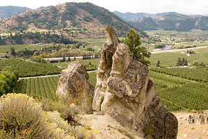
The next morning, before heading back to Seattle, we drove east on Route 2 for about 4 miles to Peshastin Pinnacles State Park, a park that is primarily a rock climbing destination. Although we had no time or intention of climbing that day, we thought it would be good to check out for the future, as Herb and the boys are very avid rock climbers.
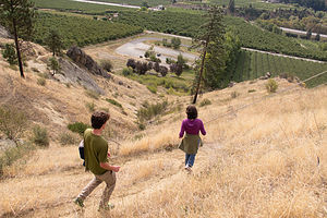 Hiking at Peshastin Pinnacles State ParkThe park was beautiful, with 34 acres of sandstone slabs and spires that could be climbed, some of them rising as high as 200 feet. We hiked for a bit along the trails at the base of the pinnacles, admiring the views of the surrounding fruit orchards below and the Enchantment Mountain Range in the distance.
Our visit to Leavenworth had been amazing, and it is definitely a place we will return to on our future visits to the Pacific Northwest. It has so much of what we look for in a destination – beautiful scenery, great hikes, rock climbing, and of course the sausage and beer gardens.
Description
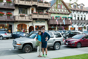 Leavenworth StorefrontsLeavenworth is a lovely Bavarian-themed village located along scenic Route 2, about 2 ½ hours east of Seattle.
Back in the 60s when this town was facing economic difficulties, someone got the idea of taking advantage of its beautiful mountain setting and transforming it into an imitation of a Bavarian Village in the Alps. Everything about the town is German. Nearly every commercial building has alpine architecture with their names displayed in Bavarian fonts. There are Bavarian souvenir shops where one can buy cuckoo clocks, Hummel figurines, and nutcrackers, as well as numerous Bavarian sausage and beer gardens.
And those beautiful mountains are not just for gazing at over a beer. The nearby Alpine Lakes Wilderness has some of the most spectacular mountain scenery in the state to hike and backpack through.
Leavenworth did it right and today it has become one of Washington State’s most popular tourist destinations.
Fort Stevens State Park
Thursday, September 19, 2013 - 7:30pm by Lolo182 miles and 4 hours from our last stop - 1 night stay
Travelogue
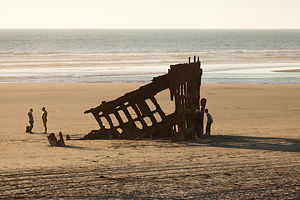 Wreck of the Peter IredaleOur chosen destination for the evening was Fort Stevens State Park, the northernmost of the State Parks along the Oregon Coast. Unfortunately, our stops at Oregon Dunes and Heceta Lighthouse had pushed our arrival back a bit more than planned, so we barely had time to see the park before sunset.
We went first to the Wreck of the Peter Iredale, the remains of an old steel sailing vessel that ran ashore in 1906 en route to the Columbia River. Since it was low tide, the wreck was completely stranded on the beach.
Even more interesting than the shipwreck, was a wreck of a different sort in the parking lot, in the form of a truck converted into what I guess you could call an RV. It made Cousin Eddie’s RV in Christmas Vacation look like a Prevost. It was totally painted over with Peace signs, and the words Love and JESUS in bubble letters across its entire length.
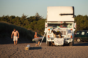 Fort Stevens State Park RVWe soon met its occupants, a very happy, but a bit dazed fellow that looked like he was still in the 60s, and his dog. Every time the dog walked away from the RV, its owner would yell, “Hey, get back up” and the dog would obediently jump up on the front bumper and pose like a hood ornament. This bizarre interaction between dog and owner went on and on at least 4 times while we were there.
We toyed with the idea of staying at this lovely beach to watch the sunset, but decided to try to get to the Observation Deck near the mouth of the Columbia River in time. I am glad we did. Not only because we were getting a little tired of the dog and hippy show, but because the observation deck provided a unique view of the Columbia River meeting the sea.
By the time we got back to our campsite, it was already quite dark, but at least we did get a chance to see a bit of the park.
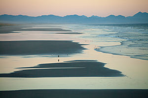 Sunset from Columbia River Observation DeckThe next morning I was very excited, because today we would see Tommy for the first time in 2 ½ months, the longest we have ever been apart.
We got on the road fairly early and made a quick stop at the nearby Astoria Column, a rather unique structure patterned after Trajan’s Column in Rome. Similar to the murals that spiral up the Roman column, this one’s exterior wall depicts the history of the area. Just as we pulled into the parking lot, several school buses unloaded dozens of children, who began to run noisily towards the column. Oh boy, we better hurry. We beat them to it, and were able to climb up to the top of the column, take photos of the wonderful view of the Columbia River, and get down just as they were starting up.
Now, no more stopping, but onto Seattle and Tommy!!
Description
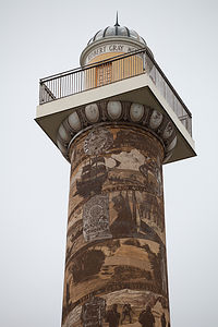 Top of Astoria ColumnFort Stevens, the northernmost park along the Oregon coastline, is located 10 miles west of Astoria at the mouth of the Columbia River. The Fort was in service for 84 years, from the Civil War through the end of World War today. Today its 4,200-acres of forests, wetlands, and beaches offers exploration of history, nature, and recreational opportunities, including:
• 9 miles of biking trails
• 6 miles of hiking trails,
• Fishing
• Kayaking
• Wildlife viewing
• Sandy beaches for ocean swimming
• Freshwater swimming in Coffenbury Lake
• An historic military fort
• An historic shipwreck, the Peter Iredale
There is also a campground with 476 sites, 15 yurts, and 11 deluxe cabins.
Heceta Head Lighthouse
Thursday, September 19, 2013 - 7:15pm by Lolo12 miles and 0.25 hours from our last stop
Travelogue
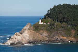 Heceta Head LighthouseContinuing our drive up the coast, we made our second must-see stop for the day at Milepost 178.3, the Heceta Head Lighthouse. There is actually a viewpoint at Milepost 179, where the iconic shots of this lighthouse are taken, but we kind of missed that. Instead we pulled into the originally planned parking lot for the trail up to the lighthouse.
It was easy to see why this is the most photographed lighthouse on the Oregon Coast. The lighthouse sits 200 feet above the ocean, perched on the western end of beautiful 1,000-foot high Heceta Head.
We took the short trail up the western end of the headland towards the lighthouse. We first came to the Lighthouse Keeper’s Quarters, a lovely white house, with a traditional red roof, and people happily mingling on the beautiful old porch that extended the length of the house. I love old houses and their porches and immediately wanted to figure out how I could be on it too. This was not to be, however, as I soon learned that the Keeper’s Quarters is a bed and breakfast, and these lucky people were paying customers. Mental note: add staying at Heceta Lighthouse Bed and Breakfast to Bucket List.
After gazing enviously over the white picket fence a little longer, Herb nudged me along to the lighthouse, where we took many photos of it and the beautiful headlands.
A very lovely stop indeed.
Description
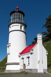 Lolo at Base of Heceta Head LighthouseHeceta Head Lighthouse is located at milepost 178.3, about 13 miles north of Florence. Perched on the western end of 1,000-foot high Heceta Head, 205 feet above the sea, this lighthouse is the most photographed one on the Oregon Coast. Its beacon can be seen 21 miles from land, making it the strongest light on the Oregon Coast.
In 1978, the lighthouse and keepers quarters was placed on the National Register of Historic Places for its architectural and engineering significance.
A short trail leads from the parking lot to the historic lighthouse and the assistant lighthouse keeper’s house. Today the lighthouse keeper’s house is a bed and breakfast operated by a concessionaire of the U.S. Forest Service.
Oregon Dunes National Recreation Area
Thursday, September 19, 2013 - 7:00pm by Lolo45 miles and 1 hour from our last stop
Travelogue
 Lolo Hiking the Oregon Dunes National Recreation AreaWe had two days and 440 miles to cover to get to Seattle to scoop up Tommy from work on Friday to begin our Washington State adventure. That didn’t exactly give us time to do justice to the Oregon Coast Highway, so we would have to be quite selective in our stops.
I had picked up a copy of the Oregon Coast Mile-by-Mile Guide at a visitor center and was finding it very useful in efficiently plotting our day. It gave an excessively detailed milepost by milepost breakdown of sights along the Highway. After quickly flipping through its pages, I selected two must sees: the Oregon Dunes National Recreation Area and Heceta Head Lighthouse.
Figuring out how to visit Oregon Dunes NRA was not as easy as it seemed, as there were only a few places where the dunes were accessible. These were serious dunes. In fact, they are the largest expanse of coastal dunes in all of North America, extending for more than 40 miles along the coast. However, the Milepost guide helped me find the Oregon Dunes Overlook at Milepost 200.8 – this guide was great! Its mileposts even went down to the decimal point.
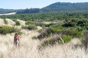
A short walk from the parking lot brought us to a platform that looked out over the dunes and to the Pacific. Usually we are not easily satisfied with just looking, so Herb and I decided to hike the down through the dunes and out to the ocean and back – 2.3 miles in total. It was very definitely worth the time and effort invested.
Description
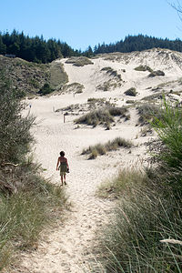 Oregon Dunes National Recreation AreaThe Oregon Dunes Overlook is located at milepost 200.8, about 40 miles north of Coos Bay and 10 miles south of Florence. A short walk from the parking lot are viewing platforms high atop a forested sand dune that overlook a portion of the vast expanse of dunes that comprises the Oregon Dunes National Recreation Area.
A 3 ½ mile loop trail leads from the Overlook through the dunes and out to the ocean.
These dunes, which were formed by millions of years of wind and rain erosion, are the largest expanse of coastal sand dunes in North America.
Sunset Bay State Park
Tuesday, September 17, 2013 - 7:00pm by Lolo156 miles and 3.5 hours from our last stop - 2 night stay
Travelogue
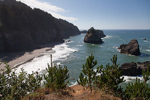 Samuel H. Boardman State Scenic Corridor Ocean ViewOregon is a state that we have neglected in our past travels – it was just too far to include in a 3 ½-week out and back trip from New Jersey. However, now that Tommy is living in Seattle, we will have many more opportunities to explore this beautiful state. On our last trip 2 months back, we visited Bend and Crater Lake, but this time we were going to drive the coastal route – all 363 breathtaking miles of it.
One great thing we have discovered about the Northern California and Oregon coast is that so much of it is publicly accessible through the state park systems. Along the Oregon Coast alone there are about 90 state parks, recreational areas, scenic viewpoints, etc., 18 of which have campgrounds. That is one for every four miles of road – not something you would find on the East Coast.
 Arch RockKnowing the multitude of camping choices beforehand, I did my research and reserved Sunset Bay State Park, in Coos Bay (about 120 miles north of the California border) for two nights. We find that two nights is the minimum to really get to experience a place. There were so many good parks to choose from, but this one kept coming up in the guidebooks as pretty spectacular.
One of the most beautiful stretches of the coastline is the 12-mile Samuel H. Boardman State Scenic Corridor, a forested linear park with tremendous views of rugged cliffs, secluded cove beaches, and forested sea stacks. The park was named for the first Oregon Parks superintendent, and a monument in his honor told how it was mostly due to his foresight and efforts that so much of the Oregon coastline has been set aside for current and future generations to enjoy.
We stopped at the viewpoint for one more of the Corridor’s gems, Arch Rock, an offshore monolith carved into an arch by the relentless waves of the sea.
 Shore Acres State Park Ocean ViewThere were so many beautiful viewpoints and parks along the Oregon Coast Highway, but we would never get to our campground if we stopped at all of them. You could literally spend days exploring this route. We would have to be discriminating in our choices.
Sunset Bay State Park certainly did not disappoint. The campground was located just across the road from a beautiful cove, surrounded by sandstone cliffs. I could already picture that evening's cocktail hour watching the sun dip below the horizon in this dramatic setting.
 Lolo Running Through JungleBeing a bit too early for cocktailing, we decided to go for a run on the hiking trails that connect Sunset Bay with its sister parks, Shore Acres and Cape Arago. We figured we would take a nice 5-mile run first, and then get back to the campground to shower and prepare for sunset on the beach. We took a camera along on our run in anticipation of some pretty awesome views.
According to the trail map, the trail ran along the top of the bluffs through Shore Acres State Park (in 2 miles) and onto Cape Arago State Park (in 4 miles). Unfortunately, we probably didn’t have time to do the entire 8-mile run and still get back in time for sunset. We decided to just head out and play it by ear.
 Cape Arago ViewpointThe trail left Sunset Beach and immediately climbed to the top of the bluffs, where the views were so good that we kept stopping to take pictures. At this rate, I figured we weren’t going to get in too much of a run. At about ¼ mile in, we must have made a wrong turn, because we wound up on a rocky cove beach that dead ended. A bit confused as to how we had missed the trail, we retraced our steps back up from the cove and continued on what we now thought to be the correct trail.
When we reached Shore Acres State Park, we began the negotiating phase of the run. I wanted to continue on and see Cape Arago, but Herb, seeing his sunset cocktail hour slipping away, wanted to turn back. I assured him that we could have it all, both the full run and making it back in time for sunset.
 1st Night at Sunset Bay BeachA bit further on, we came to a trail junction and decided to follow the white chalked arrows pointing towards the left. These arrows must obviously be pointing us in the correct way, we thought. As we began an extremely steep descent through a jungle, followed by an equally steep ascent, we began questioning whether we were actually on the right trail. This was supposed to be a pleasant family stroll, not an eco-challenge. This ridiculous up and down went on for 2 ¼ miles. I admit I was getting very concerned that we might be lost, and it didn’t help that the thick jungle-like flora was making it very dark in here.
Finally, we came out on the road near South Cove in Cape Arago. We were both a bit cranky at this point, totally focused on figuring out who was to blame for this very dysfunctional trail run. We had already run 6 miles, so rather than attempt to find the trail that we should have taken to get here, we decided to take the most direct route back, which meant running on the road back to Sunset Bay State Park. We barely stopped to see the sea lions barking on Shell Island just offshore and continued on with the thought of returning here another day—by car.
 Lolo in her Kayak at the South Slough National EstuaryI couldn’t believe how quickly we got from Cape Arago to Sunset Bay by road compared to what we had gone through in the other direction. Still, I didn’t regret it. It was an adventure, and we did get a much better workout in than originally planned.
Plus, we didn’t totally miss the sunset. With no time to shower, we hurried down to the beach just in time to chug down a glass of wine and take some photos. We would have to plan better for the next night.
The next day was our kayaking day, our first on the West Coast. When we moved the motorhome out west in June, we brought our kayaks, but had not as yet had the opportunity to use them. Now it was time for their maiden voyage into the Pacific—well not exactly the Pacific, but an estuary that connected to it.
 South Cove Beach at Cape AragoWhen researching kayaking in the Coos Bay area, everything seemed to point to the South Slough National Estuary as a premier kayaking destination. We had also read that it was important to time our trip with the tides, in order to paddle the incoming tide south from the ocean and the outgoing tide back north, as the water receded back to the ocean. Also, if you stayed south too long, you could run out of water and get caught up in the mudflats. Fortunately for us, the tides allowed for a late morning launch and a mid-afternoon return.
We launched the kayaks at the Port of Coos Bay Industrial Annex Landing just south of the bridge and the fishing boat traffic. The water was extremely calm and we were able to leisurely paddle along with the current enjoying the wildlife, especially the herons and egrets.
 Cape Arago LighthouseSince time and the tide were on our side, we decided to paddle into freshwater Elliot Creek where we ate out lunch. About this time, as always happens to us when kayaking, the wind began to pickup from the north, meaning that we would have to battle against it the whole way back, once again turning a leisurely event into a strenuous workout—just like yesterday’s run. The wind also made the water much rougher, very different from the glassy surface we cruised down in the morning.
After a total of 9 miles of paddling, we made it back to the boat launch, which I was very happy to see.
Back at the campground, we decided to drive the car to Shore Acre and Cape Arago State Parks to visit the places we didn’t have time to enjoy yesterday.
 Boaters at Sunset BayOur first stop was the Botanical Gardens in Shore Acre State Park. This park was once the estate of a timber baron. Although the manor house is long gone, the gardener’s cottage and 5 acres of formal gardens remain for visitors to enjoy. We arrived too late for the visitor center, but we were able to enjoy a stroll through both an English garden and a Japanese garden with a lily pond.
Our next stop was the Simpson Reef Wildlife Viewpoint to watch and listen to the seals and sea lions that live on Shell Island, a short distance offshore. The day before on our run, I would occasionally hear the barking of seals and had no idea where the sound was coming from. Now we had discovered its source, and there was a whole colony of them.
 Sunset Bay Beach AfterglowWhen we got to the end of the road in Cape Arago, we hiked down the South Cove Trail to the tide pools. Once again, the tides were in our favor, and we were able to see many starfish and anemones.
Satisfied with having seen what Shore Acre and Cape Arago State Parks had to offer, we headed back to Sunset Bay to enjoy a more leisurely sunset cocktail hour. It reminded me a bit of our sunset viewing on Caspar Beach in Mendocino, California on our earlier trip.
One thing the West Coast definitely has over the East is dramatic sunsets over the water. The East Coast does have its sunrises, but I sleep rather than cocktail through those—probably a good thing.
If this was just a taste of what the Oregon Coast has to offer, we would definitely be back to enjoy some of those 17 other state park campgrounds.
Description
 Starfish at South Cove Beach, Cape AragoSunset Bay State Park, in Coos Bay, Oregon, is located in one of the most scenic areas on the Oregon Coast. Its campground is located just across the road from a beautiful cove surrounded by sandstone cliffs, an excellent place to watch a dramatic sunset. A network of hiking trails connects Sunset Bay with nearby Shore Acres and Cape Arago State Parks, which sit atop rugged sandstone cliffs and headlands.
Shore Acres State Park, once the estate of a timber baron, has a beautiful formal English garden and a Japanese garden with a lily pond.
Cape Arago State Park is located at the end of the Cape Arago Highway, just 2.5 miles south of Sunset Bay, is a scenic headland that juts out into the ocean. There are two main trails here. The North CoveTrail leads to a view of an off-shore colony of seals and sea lions on Shell Island. The South Cove Trail leads down to a sandy beach and tide pools.
Klamath - Riverside RV Park
Monday, September 16, 2013 - 6:45pm by Lolo294 miles and 6 hours from our last stop - 1 night stay
Travelogue
 Lolo on Klamath RiverOur next campground reservation was for a two night stay in Sunset Bay State Park along the Oregon Coast, about 10 hours from Petaluma. I had planned it so that we had an extra night in between, so we wouldn’t have to drive the whole way in one day. We toyed with driving the coastal route along Route 1 from Petaluma, but decided instead to make some time on US 101 to Eureka. I felt a little guilty just driving through Redwood National and State Parks without stopping, but we had just been there two months ago on our previous trip out West, so I didn’t feel too bad. Besides, we had a lot of driving to do.
At first I thought Crescent City might be a good stopping point, but then Herb reminded me that the town and the campground we stayed in last year were a bit sketchy, so perhaps it would be a better idea to find someplace new.
 Klamath Riverside RV Park SunsetAs we drove along US 101 into the town of Klamath, about 20 miles south of Crescent City, we noticed several campgrounds right along the Klamath River that looked pretty nice. In fact, there were three right next to each other. We somewhat randomly chose Riverside RV Park, and selected a nice site along the river.
The owners of the campground told us that although the campground was quiet now, it had been hopping the week before during the steelhead salmon run up the river. That would have been exciting to see, but a bit of a Catch 22, because if they were running, we never would have been able to get a campsite . Now that we have a son living in the Pacific Northwest, we really have to learn more about where and when the salmon are running, because it really is a big deal out here.
We spent the remaining daylight enjoying a glass of wine and watching the sunset over the river.
Description
Lovely RV Park located near the mouth of the Klamath River on Highway 101 in Klamath, California.
San Francisco North / Petaluma KOA and Side Trips to San Francisco
Wednesday, September 11, 2013 - 4:00pm by Lolo55 miles and 1.5 hours from our last stop - 5 night stay
Travelogue
 Herb at Baker BeachThis flying stuff was great. After years of spending 5 grueling days crossing the country, it's still hard for us to get used to the novelty of waking up in New Jersey and going out to dinner in San Francisco that night.
Fortunately for us, Andrew was kind enough to take time off from work to pick us up from the airport, but the late afternoon traffic in the city was so bad that rather than go directly up to the Petaluma KOA to take the motorhome out of storage, we decided to go back to his apartment to visit while the traffic cleared. Also, he had plenty of chores for Herb to do, such as building an IKEA coffee table and TV stand. We (and by we, I mean Herb) were happy to do it. It was so fun seeing how nicely their apartment was coming along. Also, they live in a neighborhood with tons of really good and inexpensive Asian restaurants. They took us to one of their favorites.
Afterwards, Andrew drove us up to the Petaluma KOA to reunite with the motorhome and to move it out of storage and into a campsite. It felt good to be back.
Day 1 – Reorient and Errands
The next day was spent doing errands – food shopping, washing the car, etc. Petaluma was actually beginning to feel a little bit like home. The campground has a nice pool with lots of comfortable lounge chairs, so after getting resettled, we spent the greater part of the afternoon reading and swimming. Before dinner, however, we did go out on a run. Herb and I discovered a great 5-mile loop from the campground, along country roads through dairy farm country. Despite its proximity to US 101 and San Francisco (about 45 minutes), the Petaluma KOA is really quite rural. In fact, when the wind is right (or wrong, depending on your perspective), you can actually catch the occasional whiff of cattle from your campsite.
Day 2 – Coastal Trail, Planet Granite, and Toronados
 Herb at Planet GraniteOn Friday, we drove down to San Francisco in the afternoon. We were planning to meet Andrew and Celeste at Planet Granite, their climbing gym, after work. Herb has been an avid rock climber for literally decades, and it was very exciting for him to have his sons take up a love for the sport as well. Not only have Andrew and Tommy become very competent climbers, but Andrew’s girlfriend Celeste is on track to surpass them all.
Since we were in the city a bit early, Herb and I took a walk along the Coastal Trail in the Presidio to Baker Beach. It was quite cold, and Herb did his fair share of complaining about freezing in California, but the views of the Golden Gate Bridge were stupendous.
Around 5:00 we headed over to Planet Granite to meet up with Andrew and Celeste. Before being allowed to climb in the gym, Herb and I had to pass a belay test to prove our competence – a good idea in view of the fact that when belaying someone you are really the only thing between them and the ground. Luckily, Herb had given me a brief refresher course before we entered, so I passed with flying colors.
 Lolo and Herb Dining at Toronado PubPlanet Granite is an incredible climbing gym. Even if I wasn’t climbing, I would love it for its views alone. Floor to ceiling windows look out onto the Golden Gate Bridge, Alcatraz, and the Mark di Suvero sculptures in Crissy Fields. It was hard to keep my eyes on the climbing wall.
I have spent time in our own climbing gym in New Jersey, but this gym has so many more climbs that I can do. It was the best climbing experience I had ever had. It was also fun to see how much Andrew and Celeste have improved.
After climbing, Andrew took us to Toronados, their favorite post-climbing sausage and beer place in the Haight section of San Francisco. The bar was really crowded and a bit noisy, but the sausages were delicious and the beer very refreshing after our climbing workout. Herb and I were stuffed, but Andrew and Celeste somehow still managed to fit in some ice cream at the Toy Boat Dessert Cafe, their favorite ice cream place. It’s great how they have really gotten to learn this city and have their favorite places for every type of food imaginable – eating is their second favorite sport after climbing.
Stuffed and content, Herb and I drove back up to Petaluma with the promise of returning early the next morning to explore the city with them by bike.
Day 3 – Bike Tour of San Francisco
 Andrew, Celeste and Lolo at Arizmendi BakerySan Francisco is truly a very bicycle-friendly city, especially if you know your way around. Fortunately, Celeste did, so it was nice to not have to constantly stop and pull out a map and to let someone else be the tour guide for a change.
The first stop on what was to be a 26-mile hilly bike ride – after all it is San Francisco – was Arizmendi Bakery, Andrew and Celeste’s favorite bakery. I must say, they do know their food, because everywhere they take us is unbelievable. After a very large pastry and a cup of coffee, we remounted our bikes and rode into Golden Gate Park to see the buffalo herd that lives there. You could very easily spend an entire day in this amazing park, which is actually bigger than NYC’s Central Park. However, we had lots to see that day, so we kept on moving.
 Andrew and Celeste in Pelting Sand at Ocean BeachOur next stop was Ocean Beach, where our walk was cut somewhat short by the sand pelting us in the face. It was a very windy day, which we really hadn’t noticed when we were inland in the park. This beach was definitely worth a revisit on a less windy day.
Continuing on, we began a very steep ascent up the Great Highway, past the Cliff House Restaurant and Sutro Baths. I think Andrew and Celeste were quite impressed that I made it all the way up without having to dismount and walk my bike. I wanted to die.
After a very brief rest, we continued up even more hills until we got to the California Palace of the Legion of Honor in Lincoln Park. This very impressive building is part of the San Francisco Museum of Fine Arts. It was to this very museum that Jimmy Stewart followed Kim Novak in Alfred Hitchcock’s Vertigo, where she was compulsively drawn each day to sit for hours staring at a painting of a woman named Carlotta. But I digress. Back on the bikes we go.
 Sutro Baths OverlookFinally, our climbing was over and soon we were careening, probably much faster than I should have, down a steep hill to Crissy Field. I just love this part of San Francisco. The city of San Francisco is very progressive with their public space—a really good thing for residents, as there are so many beautiful places to enjoy on weekend day.
Crissy Field had undergone quite a transformation since the 1990s when it was taken over by the National Park Service. Prior to that, it had served as a U.S. Army airfield and was often used for the dumping of hazardous materials. In fact, when acquiring it, the NPS declared it to be, and I quote, “a derelict concrete wasteland.” Well, wasteland no more. As part of the Golden Gate National Recreation Area, it has been transformed into a very successful example of urban public space, with beaches, picnic areas, biking trails, historic buildings, and a restored tidal marsh. Today it is a premier recreation area for residents and visitors to San Francisco.
 Biking to the Palace of Fine ArtsAlso, since May of this year, eight of Mark di Suvero’s giant modern art sculptures have been on display here. These were the sculptures that I had spent my time at the climbing gym gazing out at, with the Golden Gate Bridge, Marin Headlands, and Alcatraz as a backdrop. It seemed almost too perfect to be real.
Crissy Field is also very bicycle friendly and has a trail leading all the way through it from Fort Point to Marina Green. I was definitely enjoying the reprieve from the hills, as well as the incredible views.
About this time, I was developing a strong craving for an Iced Caffe Mocha, as I have found myself doing since the boys first introduced me to them, so we stopped at the Beach Hut Café to take a break. Afterwards, we walked over to the beach to watch the America’s Cup trials, but unfortunately the wind was so strong that all the races for the day were canceled. We pretended for awhile to enjoy having our faces pelted once more with sand before Herb suggested that we move on to someplace a bit more inland and away from the wind.
 Beers at the Velo Rouge CafeWe found just what he was looking for a short distance away at the Palace of Fine Arts, probably one of the most beautiful settings in a very beautiful city. This Greek-style rotunda and colonnades with its surrounding lagoon were originally built for the 1915 Panama-Pacific Exposition. While most of the other buildings in the exposition were demolished when it ended, thanks to the efforts of William Randolph Hearst’s wife Phoebe, this iconic structure has been saved and lovingly restored. Its reflection in the lagoon is probably one of the most photographed spots in the city. We took our fair share of shots as well and enjoyed lying on the grass, not being covered with sand.
We ended our 26-mile bike tour of the city with another one of Andrew and Celeste’s “favorite” stops – beers at the Velo Rouge Café. I can’t describe how wonderful it was to just sit at an outdoor table, sipping a refreshing and well-earned beer.
It had been an extremely satisfying day in so many ways, and Herb and I really appreciated Andrew and Celeste’s very successful effort at showing us the city from a non-tourist point of view.
Day 4 – Hiking Marin Headlands
 Herb on Matt Davis TrailThe next day, and our last before heading north up the coast to Seattle, was spent hiking in Marin, probably one of the most beautiful counties in the U.S. Celeste’s mom Hilda, met us at the campground and we drove down to Stinson Beach together where we met up with Andrew and Celeste. Knowing the area very well, Hilda took us the scenic route rather than along U.S. 101. I have to say that I was very glad that we were driving a car rather than the motorhome, because the roads were incredibly steep and winding.
Andrew had spent a lot of time researching hikes in the area, of which there are so many wonderful ones to choose from. His choice, and a very good one indeed, was to link the Dipsea, Steep Ravine, and Matt Davis trails together for a spectacular 7-mile loop past waterfalls, through a redwood canyon, and up to expansive views of the coast, before descending once again to Stinson Beach. The 1,600 foot elevation gain made for a challenging and extremely satisfying hike.
 Coffee at Stinson BeachPost-hike, we bought coffee at a beach café and sat sunning ourselves on the beach, in the very same spot we had sat and froze last year. September is definitely the San Francisco Bay Area’s season – sunny skies and warm temps. May, June, and July are so much colder and foggier. We will have to time our visits to the boys accordingly because June and July are absolutely beautiful in Seattle.
That evening we met up with Celeste’s father in San Francisco, who had just finished a week-long, 500-mile Cycle Oregon event, and had dinner together at Troya Mediterranean Kitchen, a Turkish restaurant near Andrew and Celeste’s apartment. I had absolutely no idea what I was ordering, but whatever it was, it was delicious. They really are lucky to have such an ethnically-diverse selection of high-quality restaurants in walking distance from their home.
After dinner, it was goodbye for now, because tomorrow we would begin our drive north along the Northern California and Oregon coast to Seattle and our visit with Tommy.
Description
 Andrew and Lolo at Ocean BeachThe Petaluma KOA is an award winning camping resort located within an hour’s drive of San Francisco, Napa and Sonoma Valley Wineries, giant redwoods, and Sonoma County and California Coastal Beaches. It is considered to be the RV resort in the San Francisco Bay area.
On its 70 acres, there are 312 spacious RV sites, 32 camping cabins, and 10 Wine Country lodges.
Other amenities include:
• Guided tours of San Francisco (from May through October)
• Huge heated pool and spa
• Inflatable waterslide
• Rock climbing wall
• Huge playground
• Petting zoo
• Karaoke
• Hayrides and live weekend entertainment
The campground is open all year.
Flight Home
Saturday, July 20, 2013 - 4:15pm by Lolo55 miles and 1.5 hours from our last stop - 1 night stay
Travelogue
 High-Speed Flying RVThe next morning we called Petaluma Taxi to take us to the Petaluma Fairgrounds where the Sonoma County Airport Express ran shuttles to the airport.
Haven driven back and forth across the country so many times, it was weird to think that we would be home sleeping in our very own beds that night -- no Nebraska, no Iowa, no Ohio, just 6 hours and we would be home. I think I am going to learn to love this flying thing.
Description
The Sonoma County Airport Express runs shuttles to the airport every hour from several locations: the Park and Ride in Santa Rosa, the Doubletree Hotel in Rohnert Park, and the Petaluma Fairgrounds. Fares are $34 each way.
San Francisco North / Petaluma KOA and Side Trips to San Francisco
Sunday, July 14, 2013 - 4:00pm by Lolo117 miles and 2.5 hours from our last stop - 6 night stay
Travelogue
 Bacon and ProsciuttoThe remainder of the trip was more of a settling of the RV into its new home, and Andrew into his. We were fortunate to discover the San Francisco North / Petaluma KOA to use as our base camp for the next 6 days. It is a really wonderful campground in so many ways.
It has a great location – 45 minutes to the Golden Gate Bridge, a half hour to Marin County, and about an hour to Napa Valley.
There is a huge, heated pool and hot tub with dozens of comfortable lounge chairs around it, and tons of activities for kids – although sadly we were long past that stage. They also run guided tours to San Francisco and the Wine Country.
Also, the campground was extremely well maintained and run, so much so that we decided to entrust our beloved motorhome to their care. For $75 a month, we could store the motorhome in their secured, fenced-in storage area, and our Subaru in the overflow field.
 Hike at Annadel State ParkWe spent the next few days depressurizing from what had been a trip filled with so many emotions. Those lounge chairs at the pool certainly helped with the process.
Celeste’s (Andrew’s girlfriend) parents live about 20 minutes from Petaluma, so we had a chance to do a lot of fun, low-key activities with them and the kids. They are the most amazing hosts and chefs, so it was absolutely wonderful going over to their house for dinner a few times.
I spent one fun-filled day with Andrew at the California DMV, transferring the title for the Honda and getting a California driver’s license. We had no idea that California required a smog certification, so we lost time in the DMV line having to leave, get that done, and come back to wait on line again. It was quite a hoot.
Very appropriately after a day at the DMV, we met up with Celeste and her folks at the Lagunitas Brewery, right in Petaluma. The food choices were somewhat limited, but food is not the reason people come here. We sat at an outside table, ordered samplers of beer, and listened to live music. It was a very fun evening.
 Lolo with Pier 39 TouristsHerb and I also took a few trips into San Francisco. The first time we drove down and parked near the waterfront and walked over to Fisherman’s Wharf. We knew it was touristy, but I had never seen it and I wanted to. It was a bit crowded, as we suspected, but fun nonetheless.
However, I did embarrassingly fall victim to the notorious “Bushman” of Fisherman’s Wharf, who for the last 30 years has been frightening unsuspecting tourists, such as myself. I think I was probably the only one in the crowd that didn’t know that the bush on the edge of the sidewalk was not in reality a bush, but rather a madman who has too much time on his hands. I almost had a heart attack when he jumped out at me.
After my heart stopped pounding, we continued our walk, keeping an eye out for incongruous objects. I would not be so easily fooled again.
I wanted to figure out some good biking San Francisco options for later in the week, so I stopped at various bike rental vendors along the way, pretended I was interested in renting a bike the next day, and asked them for suggestions as to where I should go. By the time I was done, I had pretty much settled on parking in Marin, biking across the Golden Gate Bridge, down to Fort Point, and over to Crissy Field.
 Fisherman's Wharf Love LockAfter our brief tour of San Francisco, we met up with Andrew and Celeste to see the apartment they had just signed a lease on. It was located on Clement Street in the Inner Richmond. The place was amazing – three bedrooms (they would be sharing with friends from college), beautiful hardwood floors, a huge kitchen, living room, and dining room, and two bathrooms. It was in a nice, safe, Asian neighborhood with plenty of good restaurants and small grocery shops to walk to. It was the kind of place I knew they would be happy in, so I felt a tremendous sense of relief. Hunting for an apartment in San Francisco is not for the faint of heart. There is so much competition that apartment hunters practically bribe the realtors to get first dibs. They were very, very lucky to get this place.
A few days later we did take that bike ride across the Golden Gate Bridge. The main Vista Point parking lot for people walking or biking across the bridge is at the northern end of the Golden Gate Bridge and can only be reached coming from the south. Since we didn’t want to drive across the bridge, pay the southbound toll, and then just turn around and drive across again, we parked in the lesser known lot on the southbound side of 101, just north of the bridge. From there, we walked our bikes down a set of stairs and under the bridge to get to the Vista Point parking lot on the northbound side.
 Crissy Field from Bike RideWe were definitely not the only ones with the idea of biking across the bridge. It was packed with cyclists, many of whom looked like they were riding a bike for the first time. You had to go pretty slow and be constantly on the defensive. Also, despite the fact that it was mid-July, it was frigid out. Now mind you, Herb hates the cold, and he couldn’t understand why he should be spending his summertime in California wearing a parka. He told me of a Mark Twain quote that I had never heard before: “The coldest winter I ever spent was summer in San Francisco.” I suggested that he think more positively. I mean really, just look at the view!
After maneuvering our way across the Golden Gate, we rode down to Fort Point Historic Park, located right underneath the bridge. From there, we rode along the waterfront, past the giant outdoor sculptures, by such artists as Mark di Suvero, to the sandy beach at Crissy Field where we watched the America’s Cup boats practicing out in the Bay—and all this with Alcatraz and Sausolito in the background. What an amazing place! I definitely knew that Andrew and Celeste would be happy living here. I already knew Celeste would. She was from this area. It was my East Coast boy I was a bit more worried about.
 Paul Composing a Photo at Lagunitas BrewerySince we had plans for dinner in San Francisco that evening with Andrew and Celeste and her parents and their friends, we biked back across the Golden Gate to our car and then drove back into the city to their apartment.
Their neighborhood has so many restaurants in walking distance. We walked over to an Italian place called Mescolanza. The food was great and the company even better, so we had a really good time.
We spent the last day at the KOA prepping the motorhome for storage. It was going to be very weird flying home and leaving it behind.
Things were coming together though. Tommy was happily settled in Seattle, Andrew and Celeste had found a beautiful apartment in San Francisco, Andrew had nabbed a job in Mill Valley, which he would be starting the week after we left, and the RV had a nice, new home in Petaluma. We should be so lucky.
Description
 Petaluma KOA PoolThe Petaluma KOA is an award winning camping resort located within an hour’s drive of San Francisco, Napa and Sonoma Valley Wineries, giant redwoods, and Sonoma County and California Coastal Beaches. It is considered to be the RV resort in the San Francisco Bay area.
On its 70 acres, there are 312 spacious RV sites, 32 camping cabins, and 10 Wine Country lodges.
Other amenities include:
• Guided tours of San Francisco (from May through October)
• Huge heated pool and spa
• Inflatable waterslide
• Rock climbing wall
• Huge playground
• Petting zoo
• Karaoke
• Hayrides and live weekend entertainment
The campground is open all year.
Mendocino
Friday, July 12, 2013 - 3:30pm by Lolo221 miles and 6 hours from our last stop - 2 night stay
Travelogue
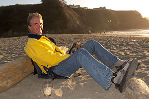 Herb at Caspar BeachOn our first trip to Northern California in 2012, we had visited and fallen in love with Mendocino. We just felt so at home there. Normally we spend two weeks every summer on the island of Martha’s Vineyard off the coast of Massachusetts, but because of the boys’ move west this summer, this would be the first time in 30 years that we wouldn’t be able to get there. Mendocino would have to give us our New England “fix,” with its saltbox houses, gingerbread mansions, white-picket fences, rose gardens, and water towers.
Although we had been to Mendocino before, this would be the first time with the motorhome, and after our harrowing drive down Route 1 from 101, I feared it might be our last. The steep switchbacks leading down to the coast were unbelievable, and there was no place to pull over. Herb could feel the brakes pressing a bit too far down to the floor, the same thing that had happened to us when our brakes failed coming out of Death Valley. Despite the lack of a spot to pullover, we just stopped as far right as we could on the road, took a deep breath, and waited for the brakes to cool off. We now knew that whenever there is a road sign warning “No King Pins,” we don’t want to be on that road. However, I don’t know if there is a better alternative. You have to get down to the coast somehow.
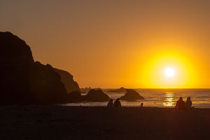 Caspar Beach SunsetHerb was toast by the time we reached Caspar Beach RV Park, where we would be spending the next two nights. Fortunately, I had made a reservation in advance, because it was the weekend, and the campground was absolutely packed. As far as RV parks go, this one was pretty bad. They packed you in so close to your neighbor that you could barely open the door. What it did have, however, is location location location. The campground is right across the street from beautiful Caspar Beach. For that, we were willing to put up with the close quarters. We could watch the sunset from the beach, and then just go inside and pull down the shades. And that is exactly what we did that first night.
The next morning we decided to get some exercise mountain biking the trail that runs along the Big River. The trail begins at the end of a dirt road just north of the Big River Bridge, and a short distance south of the village of Mendocino. Adjacent to the parking lot, there is a nice sandy beach that is a good place to swim or launch a kayak.
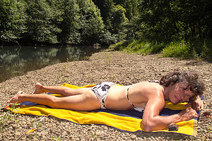 Lolo relaxing on the Big RiverA gate at the end of the parking lot marks the beginning of the Big River Trail, an old railroad right-of-way that now serves as a recreational trail for hikers, bikers, and joggers. Although the trail actually extends for over ten miles into the Mendocino Woodlands, most cyclists turn around at the fork at mile 6.5, making it a nice 13 mile ride.
The first 4 miles of so of the ride were quite level and scenic, with frequent views of the river. Since the river is tidal, this section is also great for kayaking, and if timed right, you can go up river on the rising tide and return on the ebb.
After about mile 4, the estuary ends at Dry Dock Gulch and the ride became a little hillier and the foliage along the river a bit thicker, obstructing the view of the river.
Around mile 5, we started looking for a way to get down to the river to have lunch and maybe even swim, hopefully on a sandy beach. It was a bit of a challenge, but we eventually found a nice spot to do just that, except the water was a bit too shallow at this point upstream to do much more than wet our ankles. Still, it was nice and peaceful.
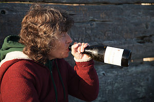 Lolo at the Headlands sans Red CupAfter our break, we continued riding another mile and a half or so before the trail came to a fork, and like most other riders, we turned around and headed back out to the mouth of the river.
While the river ride was nice, the real draw of Mendocino is its beautiful coastline, so once again, as in our last visit, we picked up a bottle of wine and some delicious sandwiches at the Mendocino Market Deli and headed out to our favorite bench on the Mendocino Headlands for a picnic. It’s nice to feel so familiar with a place that you actually have a favorite bench.
The evening was perfect, or at least it would have been if I had remembered to pack the red cups, and we didn’t have to swig surreptitiously out of our wine bottle. Hopefully, no one saw.
Actually there was one thing that Herb felt was a little less than perfect – the temperature. Last year, we were here in late May and it was warm. Tonight, however, it was quite chilly, and we had to be pretty well bundled up to stay warm.
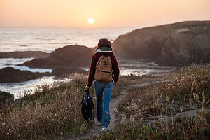 Hiking towards the Headlands SunsetWhile we sat on a bench enjoying the scenery, we noticed a young couple with a small child and a dog, romping playfully on the beach at the base of the bluff. It’s funny how two people (that have been married as long as Herb and I) can have such different perceptions of the same scene. While I thought the scene was idyllic – a happy, loving family enjoying each other’s company on a beautiful evening in a spectacular setting, Herb mumbled something about it being so sad. “What could you possibly mean?” I asked in surprise. My husband, who has learned to hate the cold and craves warmth and sunlight, responded, “That poor child is going to grow up thinking that it’s perfectly fine to be wearing a parka on the beach in mid-July.” I chose to ignore him and swig from my bottle of wine.
As if the scenery wasn’t beautiful enough, just after the sun set, we began to hear music off in the distance. This place was so magical. Last time we sat on this bench watching the sunset, we were serenaded by young woman who sat nearby playing a dulcimer. Now we were being treated to some lovely classical music.
Like moths drawn to a flame, we followed the sweet strains of Rachmaninoff’s Symphony #2 to its source: a large white tent a bit further in on the headlands. Unbeknownst us, we had fortuitously stumbled upon opening night of the annual Mendocino Classical Music Festival. Never ones to pass up a free entertainment opportunity, we set up our Crazy Creek chairs on the edge of the bluff, right behind the tent, and spent the next hour happily gazing out over the water and listening to the San Francisco Symphony Orchestra.
It just doesn’t get much better than this.
Description
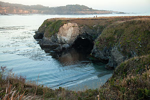 View from the Headlands BenchMendocino is a charming and picturesque hamlet of 1,100 residents along the Pacific Coast Highway (Route 1), about 170 miles north of San Francisco. Built by homesick New Englanders during the logging boom of the 1850s, the town resembles a New England village with Victorian gingerbread mansions, white picket fences, and rose gardens. The logging days are long gone, and today the town if full of upscale Bed and Breakfasts, shops, and restaurants.
The spectacular Mendocino Headlands State Park surrounds the village, with trails crisscrossing the bluffs and rocky coves.
