- Home
- About
- Map
- Trips
- Bringing Boat West
- Migration West
- Solo Motorcycle Ride
- Final Family XC Trip
- Colorado Rockies
- Graduates' XC Trip
- Yosemite & Nevada
- Colorado & Utah
- Best of Utah
- Southern Loop
- Pacific Northwest
- Northern Loop
- Los Angeles to NYC
- East Coast Trips
- Martha's Vineyard
- 1 Week in Quebec
- Southeast Coast
- NH Backpacking
- Martha's Vineyard
- Canadian Maritimes
- Ocracoke Island
- Edisto Island
- First Landing '02
- Hunting Island '02
- Stowe in Winter
- Hunting Island '01
- Lake Placid
- Chesapeake
- Provincetown
- Hunting Island '00
- Acadia in Winter
- Boston Suburbs
- Niagara Falls
- First Landing '99
- Cape Hatteras
- West Coast Trips
- Burning Man
- Utah Off-Roading
- Maui
- Mojave 4WD Course
- Colorado River Rafting
- Bishop & Death Valley
- Kauai
- Yosemite Fall
- Utah Off-Road
- Lost Coast
- Yosemite Valley
- Arizona and New Mexico
- Pescadero & Capitola
- Bishop & Death Valley
- San Diego, Anza Borrego, Joshua Tree
- Carmel
- Death Valley in Fall
- Yosemite in the Fall
- Pacific Northwest
- Utah Off-Roading
- Southern CA Deserts
- Yosemite & Covid
- Lake Powell Covid
- Eastern Sierra & Covid
- Bishop & Death Valley
- Central & SE Oregon
- Mojave Road
- Eastern Sierra
- Trinity Alps
- Tuolumne Meadows
- Lake Powell Boating
- Eastern Sierra
- Yosemite Winter
- Hawaii
- 4WD Eastern Sierra
- 4WD Death Valley +
- Southern CA Deserts
- Christmas in Tahoe
- Yosemite & Pinnacles
- Totality
- Yosemite & Sierra
- Yosemite Christmas
- Yosemite, San Diego
- Yosemite & North CA
- Seattle to Sierra
- Southwest Deserts
- Yosemite & Sierra
- Pacific Northwest
- Yosemite & South CA
- Pacific Northwest
- Northern California
- Southern Alaska
- Vancouver Island
- International Trips
- Index
- Tips
- Books
- Photos/Videos
- Search
- Contact
Hayward and flight Home
Monday, June 4, 2012 - 9:15am by Lolo172 miles and 3.5 hours from our last stop - 1 night stay
Travelogue
 Leaving Yosemite ValleyWe were barely outside the gates of Yosemite before it began to rain, making it a little bit easier to part. Our only objective for the remainder of the day was to find a place to stay in striking distance to San Francisco Airport, so as we got closer, I used Herb’s droid to search Kayak.com for hotels en route. I don’t know how people ever survived without smart phones.
We like the kayak app because it does all the searching of different travel sites for you and presents you with all the deals. Usually, I don’t book through the app, though I could, but just use it to get prices and phone numbers.
We found a good deal at a Days Inn in Hayward, about an hour from the airport. The neighborhood was a bit dicey, but the room was really great. We spent the evening sorting and packing for our early morning flight. The one problem with flying home is that you have to leave all the food, snacks, and wine behind. I am sure the maid was very happy the next morning to find all the goodies we left in the refrigerator.
Herb and I are still awed by the miracle of flight and the fact that we were back in New Jersey by early evening. Still, I did feel a bit guilty when I saw the RV sitting all alone in the backyard. Maybe next time.
Description
Quick stop on the eastern shore of San Francisco Bay within easy striking distance to the airport.
Yosemite Valley
Saturday, June 2, 2012 - 8:45am by Lolo75 miles and 2 hours from our last stop - 2 night stay
Travelogue
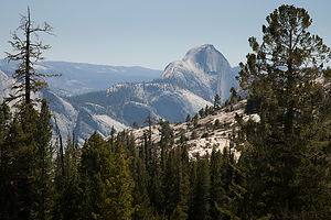 Back of Half Dome from Tioga Pass RoadNo matter how many times I visit Yosemite, I will never cease to be awed. This year, Herb wanted to enter the park from the east and drive the 45-mile Tioga Road up over the pass and through Tuolemne Meadows before gradually descending towards the Valley. This route allows for a more gradual assimilation to the park’s grandeur, as opposed to the heart-stopping visual overload you get when emerging from the Wawona Tunnel in the west.
The 56-mile Tioga Road from the East Gate through Tuolemne Meadows to Crane Flat is a drive full of superlatives with the largest subalpine meadow in the Sierra Nevada providing a lovely setting for the greatest concentration of granite domes in the world. Then there are the incredible vistas, my favorite being the panoramic view from Olmsted Point, where we got our first glimpse of our old friend Half Dome—not the familiar iconic image seen from the valley floor, but of its less familiar rounded derriere.
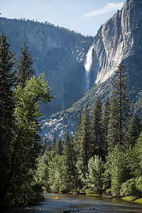 Yosemite Falls from Housekeeping Camp BridgeI was a little skeptical about our accommodations for the night. When we tried to book our stay a few days ago, the only thing available was Housekeeping Camp.
We have pretty much experienced every mode of habitation in Yosemite. From least to most luxurious – backpacking, tent camping, RV camping, Curry Village cabins, and my all time favorite, the Ahwahnee Hotel. Also, one hint: try to do them in this order, because once you are in the Ahwahnee, you are never going to want to leave.
So, this was going to be a new Yosemite experience. First let me say that the location of Housekeeping Camp is phenomenal – just a stone’s throw away from a nice sandy beach along the Merced River with terrific views of Yosemite Falls. The units (as they are romantically referred to) are pretty rustic. They consist of three concrete walls with the fourth wall being a canvas curtain that you can tie closed. The roof is canvas and extends out over a small patio area with a picnic table and a bear-proof food-storage box. Inside the “unit” is a bunk bed, double bed, small table, and a mirror. Linens for the bed are an extra $2.50 per night. Not exactly the Ahwahnee, but comfortable enough.
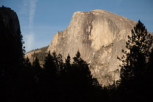 Half Dome from Ahwahnee MeadowI was a little jealous when we took a walk through the Camp. So many of the other units were so cozily decorated, with cute little outside lights, lamps from home, nice quilts, etc. – so warm and homey. Ours had more of a prison cell feel . But in all fairness, we were not prepared for this. My goal was to stay outside as much as possible.
That evening Herb and I got a bottle of wine and some cheese and crackers and settled ourselves in the Ahwahnee Meadow to watch the sun set on Half Dome. Being seasoned veterans of sunsets in Yosemite, we knew enough to hang around after the granite face was in shadow, because the best was yet to come – the beautiful alpenglow that casts a reddish light on the previous darkened dome. I could watch this every night.
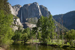 Yosemite Falls and Merced RiverI also developed a new photographic technique, quite by accident. While trying to take a picture of Half Dome while lying on a blanket in the meadow, my knees got in the way. It is absolutely uncanny how much bare knees pressed together can look like butt cheeks. When I showed Herb my masterpiece, we laughed so hard it hurt. Maybe I was on to something – the next Ansel Adams.
A lovely evening in the meadow and a few glasses of wine helped make our Housekeeping unit seem a bit cozier.
The next day was a big one – the hike up to the top of Yosemite Falls. We had done this hike 26 years ago when we first came to Yosemite, but I think they made it higher and steeper since then. It is 7.2 miles RT and climbs over 2,700 feet.
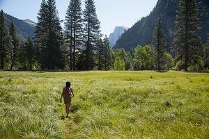 Lolo Hiking to Camp 4Yosemite Falls is the seventh highest waterfall in the world. If you count the lower falls as part of it, it would be the third largest. The falls drops 2,400 feet over the granite cliffs feeding the Merced River, which runs through the Valley. Late May is a particularly good time to do this hike because the snow melt is still keeping the falls roaring.
The trail begins next to Sunnyside Walk-in Campground (known to climbers as Camp 4), the rock climbers’ campground behind Yosemite Lodge. It’s interesting to just walk through this camp and see climbers from all over the world just hanging out or prepping to do some pretty incredible, or crazy depending on your viewpoint, stuff on the sheer rock walls. Every climber dreams of doing El Capitan or Half Dome, and Herb is one of them. He had been an avid climber in the 1980s, going to the Shawnagunks in New Paltz, NY, every Saturday for over 10 years. Then kids came along and that hobby got put on hold for awhile until they grew up to become his climbing partners. However today, all he had was me, and a pretty strenuous hike ahead of us.
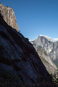 Half Dome from Yosemite Falls HikeThe first half mile of the hike climbs steeply along a series of over three dozen switchbacks through a dense pine forest. At the 1 mile point, there is a short spur trail to Columbia Rock, where there is a breathtaking, 180-degree view of Yosemite Valley from Half Dome in the east to the Cathedral Spires in the west. We met a nice couple here from North Carolina, who were in the process of negotiating whether to continue to the top or to call it a day. It really is a very strenuous hike, and Columbia Rock is a very noteworthy and respectable destination in itself.
In that one mile we had already climbed 1,000 feet in elevation. Herb had his altimeter watch on and I kept asking him every few minutes for our progress. I need constant reinforcement. We had still not gotten a glimpse of the waterfalls. In fact, our first indication that we were getting closer to the falls was by hearing it, before we rounded a bend and it finally came into view.
The last quarter mile before reaching the top is a serious of torturous, seemingly endless switchbacks. I was so happy to finally reach the top. My thighs were screaming. From the top, there was a short, but intimidating, series of steps cut into the rockface, which led down to the Yosemite Fall Overlook. This was a real white knuckler -- for me anyway -- as I clutched the guardrail and looked out over the steep drop below. From the overlook we looked down from above at the falls cascading over the edge.
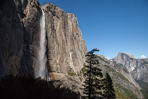 Yosemite Falls and Half DomeBack up the creepy stairs, we were on the surprisingly flat top of land above the falls. From there we crossed the footbridge over the creek and hiked another .8 miles to Yosemite Point (along the trail to North Dome). My 7.2 mile RT hike was quickly changing to an 8.8er. However, it was worth the extra steps, because besides another incredible panorama of the Valley, we had a great unobstructed view of the Lost Arrow Spire, a really unique rock spire rising from the valley floor. This too is another classic climbing route, but unfortunately we did not see any climbers on it today.
A well deserved break was needed, so we hiked back to the creek and then went upstream a bit to relax and have lunch. It would have been tempting to take a dip, but the thought of being swept over the edge of the falls kept me on dry land.
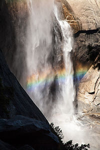 Rainbow at Base of Yosemite FallsAs always, the hike down a steep trail is almost worse than the way up—much tougher on the knees. After much groaning, and asking Herb every five minutes for our progress on his altimeter, we once again reached Camp 4 and limped our way back to our car, which was parked across the meadow at Swinging Bridge – technically making my total mileage closer to 10. I was very exhausted and expected to be in much pain tomorrow.
Back at Housekeeping Camp, we hung out on the beach for awhile and took a refreshing dip in the river, which washed away much of the trail dust accumulated over the day. After a real shower back in camp, we headed out, equipped once again with wine and cheese, to enjoy our last night in Yosemite. Rather than watch the sun set over Half Dome again, we chose to give El Capitan, the other great monolith in the park, our respect. So, we settled in El Cap Meadow and watched the sun go down on the tiny, tiny climbers on the wall. Much to Herb’s amusement, I continued trying to perfect my new photographic technique.
Another lovely evening in the Valley.
We really were in no particular hurry to leave the next morning. The only thing we needed to do that day was to get to a motel near enough to San Francisco Airport to catch a flight home very early the next morning. So, we hung by the beach in the morning and then went over to the Ahwahnee Hotel for lunch.
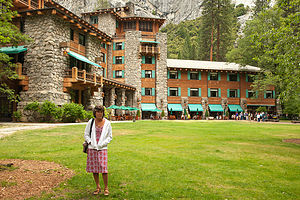 Lolo post lunch at the AhwahneeI love National Park Hotels, and the Ahwahnee is definitely one of its most beautiful. We have eaten here on each of our visits to Yosemite, so this would make 5. We usually like to have lunch here instead of dinner, because it is just as nice, but about half the price. The food is excellent, but quite honestly I wouldn’t care what they served me. I just love sitting in that beautiful dining room with its 34-foot-high floor-to-ceiling windows gazing out at the granite cliffs.
What a nice way to end another wonderful trip to Yosemite.
NOTE: About 8 weeks after we returned home, we received a letter from the Yosemite National Park Service informing us that we were one of the lucky visitors that had been staying in the park during an outbreak of the deadly rodent-borne hantavirus. Fortunately, for us, the cases were only linked to the tent cabins in Curry Village, not Housekeeping Camp. The CDC estimated that as many as 10,000 people could be at risk for the disease.
Description
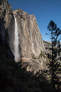 Yosemite FallsYosemite National Park lies near the eastern border of California in the heart of the Sierra Nevada Mountains. Its spectacular waterfalls, soaring granite cliffs, and lush meadows are just a few of the reasons it is considered by many to be nature’s ultimate masterpiece. In the words of John Muir, “it is surely the brightest and the best of all the Lord has built.”
This description will focus on Yosemite Valley, which is the section of the park we visited. Although the Yosemite Valley is just a small portion of Yosemite’s 761,268 acres, it is part receives 95% of its visitors. In fact, an estimated 4.1 million people visit the Valley each year, making it extremely crowded.
Two one-way roads traverse Yosemite Valley: the east-bound Southside Drive and the west-bound Northside Drive, which wind through woodlands and meadows along the base of the 3,000-foot-high granite cliffs. As of today, cars are still allowed to enter and drive through the valley, but visitors are highly encouraged to park their vehicles and use the park’s free shuttle bus, which stops at the major attractions in the valley.
Virtual Tour of Yosemite Valley Highlights
- As you enter the valley, the first sight you’ll see is the 620-foot Bridalveil Falls flowing down from a hanging valley to the valley floor. From the parking area, a short paved path leads to the base of the falls. This is one of the few falls in Yosemite that does not completely dry up in the summer.
- Just past the Bridalveil Fall parking area, the Southside Drive begins to trace the Merced River. Soon El Capitan comes fully into view. This 3,000 foot high granite cliff is the largest single piece of exposed granite in the world and one of the most famous landmarks in Yosemite. If you look closely, you might see small dots that are actually rock climbers along its face.
- Continuing east on the Southside Drive are two riverside picnic areas and beaches: Cathedral Beach and Sentinel Beach.
- Right after the Sentinel Beach parking area is the trailhead for the 4-Mile trail, which ascends more than 3,200 feet from the valley floor to Glacier Point and one of the most spectacular views of the valley.
- A short distance further is Swinging Bridge, another picnic and swimming area. This area is also the westernmost point of the 8-mile bicycle loop that goes through the eastern part of the valley. From this point on, the bike path parallels the road.
- Next stop is the picturesque tiny Yosemite Chapel where many outdoor enthusiasts choose to exchange wedding vows.
- Now you enter the congested and developed portion of the valley.
- Right past the chapel, you can either take a left onto Sentinel Bridge towards Yosemite Village and the park exit, or you can continue straight towards Curry Village, the campgrounds, and Happy Isles Nature Center. For now, let’s stop at Sentinel Bridge for what is probably the most spectacular Half Dome viewpoint in the park. It’s a great spot for a photograph of Half Dome with the Merced River in the foreground.
- Continuing east on the Southside Drive, you pass Housekeeping Camp and Curry Village. Curry Village has lodging, restaurants, bicycle and raft rentals, a grocery store, and other shops. Curry Village is also one of the main parking areas in the valley.
- From Curry Village you can either take Northside Drive across the Ahwahnee Bridge back to Yosemite Village and the park exit, or continue east to the campgrounds. The Happy Isles Nature Center is also this way, but only shuttle buses are allowed on the road to it.
- The Happy Isles Nature Center features exhibits on the natural history of the park. It also serves as the trailhead for some of the best hikes in Yosemite. 1.5 mile trail leads to the top of Vernal Falls and then continues another 1.5 miles to the top of Nevada Falls (two waterfalls that flow even in the summer time). From there you can continue even further into the backcountry of Yosemite, including the cable route up the back of Half Dome.
- From Curry Village, the Northside Drive crosses the Ahwahnee Meadow, a wonderful spot to gaze at Half Dome during sunset, and enters Yosemite Village, the main center of visitor services in the park. Here you’ll find the park’s main Visitor Center, restaurants, lodging, shops, a grocery store, a post office, a medical clinic, the Ansel Adams Gallery, an Indian Cultural Exhibit and more. It’s also a good place to park your car and jump on the shuttle.
- A short dead end road from Yosemite Village leads to the majestic old Ahwahnee Hotel, which has played host to Queen Elizabeth, President John F. Kennedy, and Clint Eastwood, to name a few. This beautiful six-story rock structure offers tremendous views from every room. Within the hotel is the elegant and quite expensive Ahwahnee Dining Room (jackets required for dinner).
- Back on the Northside Drive heading west from Yosemite Village, the next stop is the Yosemite Falls parking area. At 2,425 feet, Yosemite Falls is the highest waterfall in North America. It is actually three waterfalls in one, with an upper, middle and lower section. A short walk from the parking lot along a paved walk leads to the base of Lower Yosemite Falls. This is the most visited landmark in the valley. Except in summer when the fall temporarily dries up, you’ll be sure to be covered in spray.
- A little further west on the Northside Drive is Yosemite Lodge, which marks the end of the developed area of the park going west.
- Right after Yosemite Lodge is Sunnyside Campground/Camp 4, a place where most rock climbers choose to congregate. From this campground begins the popular and strenuous Yosemite Falls hike, which ascends 2,600 feet from the valley floor to the top of the Upper Falls. The views from the top are incredible.
- Continuing west, there is nothing but woods and meadows from which to enjoy the views. Along the road there are several pullouts where you can stop and walk down to the Merced River for a swim. Just after the El Capitan Bridge, you’ll come to the El Capitan Meadow where you’re sure to find people looking through binoculars at the miniscule rock climbers clinging to the granite face.
- Just to the west of El Capitan, Ribbon Falls plunges over 1,600 feet down to the valley floor. It is the seventh highest waterfall in the world. However, it too dries up in the summer time.
- Finally the road nears the end of the Northside Drive at Valley View where El Capitan, on the left, and Cathedral Rocks, on the right, frame a magnificent valley view.
Several guided bus tours are also available. The 2-hour Valley Floor Tour is a great way to get acclimated. Visitors ride through the valley in an open tram while a guide leads a informative discussion of Yosemite’s history and geology. There are many photo stops along the way. In addition, there are bus tours out of the valley to Glacier Point, the Mariposa Grove of sequoia trees, and Tuolumne Meadows.
Although much of Yosemite can be enjoyed from the comforts of your car or a shuttle, the best way to truly experience Yosemite is do get out and experience it more directly.
Things to do in Yosemite
- Hike one of the many trails around the valley, ranging from an easy walk to the base of Lower Yosemite Falls to the strenuous 16-mile round trip hike up the back of Half Dome via cables
- Take an overnight backpacking trip
- Bike along the 12 miles of bicycle paths that loop through the Valley. Rentals are available at Curry Village and Yosemite Lodge.
- Rock climb in one of the premier climbing places in the world
- Raft down the calm waters of the Merced River through the valley. Rentals are available at Curry Village.
- Swim or tube in the Merced River. Besides the designated beaches, there are many pullouts along the road from which you can walk down to the river.
- Join one of the many ranger walks, which are offered daily
- Take a free art class at the Yosemite Art and Education Center
- Photograph the amazing scenery of the valley and surrounding granite cliffs
- Browse the Ansel Adams Gallery and see some of the photographs that first made Yosemite famous
- Relax in the meadow while gazing up at Half Dome or El Capitan
- Dine at the 5-star Ahwahnee Hotel, where presidents and royalty have stayed
Although many try to see Yosemite in a day, it is best to devote several days to seeing all the park has to offer. Besides the numerous hotels, lodges, and cabins in the Valley, there are three RV campgrounds: Upper Pines (238 sites), Lower Pines (60 sites), and North Pines (81 sites). That’s less than 400 campsites to accommodate all the people that want to camp here.
Since these campgrounds usually fill-up within the first hour they become available, it is essential to make your reservations as soon as possible. Campground reservations are available in blocks of one month at a time, up to five months in advance, on the 15th of each month at 7 am Pacific time. For example, if your arrival date is July 15 through August 14, the first day you can make reservations is March 15. The National Park Reservation System can be found at www.recreation.gov. Good luck!
Mono Lake South Tufa State Reserve
Saturday, June 2, 2012 - 8:30am by Lolo109 miles and 2 hours from our last stop
Travelogue
 Mono Lake TufasAnyone visiting Yosemite, should definitely make the short side trip to see the surreal “tufa castles” of Mono Lake. We like them so much that we drove a lot of extra miles to enter Yosemite from the east entrance, just so we could visit them again.
One of the best places to see the tufas is at the Mono Lake Tufa State Reserve along the southern shoreline of the lake. You can get there by going south on 395 from the town of Lee Vining and then taking the turnoff for the State Reserve. From the parking lot, there is a mile-long loop trail that leads to a large concentration of tufa castles at Navy Beach.
 Lolo mit TufasAs I mentioned in an earlier stop, Mono Lake is in contention for being the oldest lake in North America, claiming to be over a million years old. The other lake in the running is Clear Lake. Whether it is the oldest or not, it is still extremely unique, because of the massive amounts of salt and minerals that flow into it from Sierra streams and have no way out except through evaporation—similar to the Great Salt lake in Utah. However, Mono Lake has something the Great Salt Lake doesn’t – “tufa castles,” which build up over thousands of years from the calcium-carbonate deposits accumulating in the lake. Normally they would just be hidden beneath the water, but as lake levels dropped, they became exposed, some of them rising as high as 30 feet above the surface—and they do look like castles.
Unlike our previous visit in 2007, I had absolutely no desire to swim with the tufas and get my body coated with salt and brine flies. There are some things in life that should be done once, and only once.
 Whoa Nellie’s Deli Buffalo Meatloaf & LoloOne of the reasons I had agreed to drive the extra 150 miles to enter Yosemite from the east rather than the west was that I wanted to eat at the Mobil gas station that Celeste’s father had recommended. I was intrigued. Technically, we were not exactly eating at a gas station, but at a deli called “Whoa Nellie’s Deli” that happened to be located inside the gas station’s main building, right near the East Gate into Yosemite. The place was packed. In addition to a few tables inside, there were several picnic tables outside overlooking Mono Lake.
The menu was quite exotic for a gas station. Herb had the Wild Buffalo Meatloaf, grilled cowboy style (how else would it be cooked??), and I had the “Legendary” Lobster Taquitos on a bed of Brazilian black beans. Very yummy and worth the extra miles.
Description
Mono Lake is located just off Highway 395 near the town of Lee Vining, California, 13 miles east of Yosemite National Park. Mono Lake is extremely unique. First of all, at over 1 million years of age, it is one of the oldest continuously existing lakes in the continent. Secondly, it is about 2 ½ times as salty as the sea and about 80 times as alkaline. This is because Sierra streams flow into Mono Lake bringing trace amounts of salts and minerals, but the lake has no outlet other than evaporation. As a result, the concentration levels of salts and minerals keeps growing each year. Thirdly, and the main reason Mono Lake is so popular, are the hundreds of spectacular “tufa towers” that rise from the lake. These intriguing calcium-carbonate sculptures were formed beneath the water when carbonates in the water combined with calcium from freshwater springs feeding into the lake. As lake levels dropped, these extraordinary-looking knobs, spires, and minarets became exposed. Most of the towers visible in the lake are from 200 to 900 years old and rise as high as 30 feet above the water.
A good place to start your visit is at the Mono Basin Scenic Area Visitor Center, located just off Highway 395, north of Lee Vining, where you will find exhibits about both the natural and human history of the Mono Basin.
One of the best places to view the tufas is at the Mono Lake Tufa State Reserve along the southern shoreline of the lake. The trailhead for the south tufa castles and Navy Beach is at the edge of the parking lot. During the summer, rangers lead walking tours 3 times a day (10am, 1pm, and 6pm), but if your not lucky enough to catch one of these, there are plenty of informative signboards along the trail. A short walk along the mile-long trail brings you to the strange and fanciful tufa castles at Navy Beach. A swim in the buoyant waters of Mono Lake is a memorable experience, as long as you are willing to step through the millions of harmless alkali flies that line the water’s edge. It’s fun to watch what at first looks like black sand part before you.
Surrounded by volcanic hills, Mono Lake is also a geologist's paradise. The two major islands in the lake are actually volcanic domes. The large black island, which the Kuzedika Indians named Negit, meaning “blue-winged goose,” erupted about 1700 years ago. The white island, which the Native Americans named Paoha, meaning “spirits of the mist,” erupted 250 years ago.
Bird watching and photography are other popular activities at Mono Lake.
Lake Tahoe
Friday, June 1, 2012 - 2:30pm by Lolo300 miles and 6 hours from our last stop - 1 night stay
Travelogue
Herb usually lets me make all the itinerary decisions, but this time he overruled me. I wanted to go directly towards Yosemite and stay somewhere nearby, so that we could have another full day there. Instead, Herb wanted to enter Yosemite via the eastern entrance, which meant a longer drive (by about 150 miles), but one that would include Lake Tahoe and Mono Lake. Since he usually asks for so little in terms of itinerary choices, I didn’t have the heart to fight him.
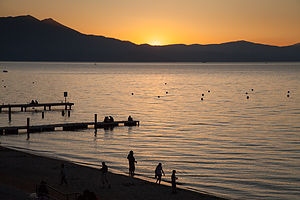 Sunset at Lake TahoeSo, we had a pretty long day of driving ahead of us – 300 miles, but it was scenic and this was new turf for us. Just as we were starting to get hungry, we found a nice park to picnic in alongside a very large lake. This was not just any large lake we learned, but Clear Lake, the largest natural freshwater lake that lies entirely in California – I guess Tahoe loses out because part of it is in Nevada. Not only is it the largest California lake, but it is also believed to be one of the oldest lakes in North America, at 480,000 years old. This claim does not go undisputed, however, as other experts believe the title goes to Mono Lake. In either case, it was a lovely spot for lunch, and if it wasn’t the oldest, we would be visiting Mono Lake tomorrow, so either way, we had it covered.
We rolled into south Tahoe near dinner time and began the search for accommodations. Now, I have to say that although the lake is stunningly beautiful, south Tahoe was not my cup of tea—a bit too like Vegas or Reno. Not that I didn’t have a great time when we were in Vegas, it’s just that I like my natural beauty separate from my neon lights. I think to really appreciate Lake Tahoe, and it really is beautiful, you have to be out in it in a boat, a kayak, a paddle board, or whatever, but just to be away from the commercialism along the south shore.
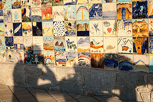 El Dorado Beach ArtworkWe found a Super 8 with a hot tub within walking distances to lots of restaurants and then headed down to El Dorado Beach, a nice public beach near the end of the strip where we could have a glass of wine and watch the sunset over the lake. Afterwards, we walked from our hotel to a brewpub called the Brewery at Lake Tahoe and had a nice dinner on the outdoor patio.
Back at the motel, I asked Herb for the keys to get something out of the trunk. A little while later, I asked him for the keys again because I had forgotten something else. By this time he was half asleep and beginning to get a little annoyed with me. “You never gave them back to me,” he mumbled, so I began searching the room to find where I had left them. That is when I had a vision flash through my mind of a set of keys lying on top of a cooler. Unfortunately, the cooler I was envisioning was locked inside the trunk of our rental car. “Uh oh.” Needless to say, Herb was not pleased.
I was in a total panic. I really, really wanted to get to Yosemite tomorrow. Every time we try to go there, something happens the day before. Last time in 2007, we lost our brakes coming out of Death Valley and Herb had to replace the brake lines in Lone Pine. Granted, this wasn’t as bad, but it definitely was not good.
In a panic, I ran down to the office, told the girl behind the desk what I had done, and asked for the number of the local police. She calmly told me that she had done the same thing a week ago, and had called AAA for help. Why didn’t I think of that? We were members of AAA. They were great. I called them and they were there within a half hour. I’m sure this guy’s previous job was car thief, because he got into that car in less than 5 minutes. I wanted to hug him.
I went back into our room, very proud that I solved the problem myself, but Herb was already asleep and just grunted.
Description
I am not even going to attempt to give a full description of what Lake Tahoe has to offer, as we only spent one evening along its southern shore.
However, briefly, Lake Tahoe is one of the highest elevation lakes (6,255 feet high) in the U.S., as well as the second deepest (1,645 feet deep) – Crater Lake is the deepest. It is located along the border between California and Nevada. The four shores of the lake are each quite different. The north is quiet and upscale, the west and east are more rugged and less developed, and the south shore is busy and tacky with neon-lit hotels and casinos. The 72-mile drive around the lake is very scenic.
Lake Tahoe is known for its clear blue and green waters and the panorama of mountains that surround it on all sides. It is a year-round destination with swimming, boating, kayaking, and various other kinds of water sports during the summer; hiking, backpacking, and camping all year round; and tremendous skiing and snowboarding in the winter.
Mendocino
Thursday, May 31, 2012 - 1:00pm by Lolo124 miles and 3 hours from our last stop - 1 night stay
Travelogue
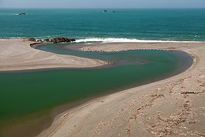 Russian River Harbor SealsAfter leaving Armstrong Redwoods, we continued west to the coastal town of Jenner, perched high on a hill overlooking the Pacific Ocean and the mouth of the Russian River. Right near the mouth of the river were dozens of adorable harbor-seal pups that were just born that spring.
The drive north from Jenner to Mendocino on the Pacific Coast Highway (Route 1) had to be one of the most beautiful stretches of highway I have ever been on. The only other stop we made before reaching Mendocino was the Point Arena Lighthouse, where once again the views from the headland were lovely. We even found a geocache there while enjoying the view. For a full explanation on what geocaching is, check out www.geocaching.com.
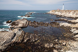 Point Arena LighthouseOur plan was to spend the night somewhere in the Mendocino / Fort Bragg area. Celeste’s parents had highly recommended Mendocino as a charming, romantic destination. We almost let our frugality guide us to finding a place in less-expensive Fort Bragg, but cooler and wiser heads prevailed and we found an absolutely fantastic (and reasonable) bed and breakfast called the Didjeridoo Dreamtime Inn.
It was definitely the right thing to do, even though I had no idea at the time what a didjeridoo actually was. I probably should have found out first before signing up, but Herb filled me in later. It’s an Aboriginal musical instrument made from a long hollowed out piece of wood -- like a very long tube. When you blow into it, it produces a drone of really deep resonant tones. Well that explained the “what,” but only the innkeeper could explain the “why” for the name of the inn, so we asked him. I felt bad that I did, because it was a break-up story. I shouldn’t have been so nosy. His ex-girlfriend and partner at the inn used to play one. She had left him, but the name remained. I guess we wouldn’t be hearing any didjeridoo playing that night.
 Mendocino TownWe felt so at home in Mendocino. Our normal stomping grounds are New England, and this charming village definitely had a New England feel with its saltbox houses, gingerbread mansions, white-picket fences, rose gardens, and water towers. We later learned that this similarity was not just a coincidence. Mendocino was originally settled in the 1850s by homesick New Englanders lured west by the logging boom. After the timber mills shut down in the 1930s, the town fell into disrepair for awhile before being rediscovered in the 1950s by artists and bohemians. Today, it is still a great escape where cell phone coverage is non-existent and fast food chains are nowhere to be found.
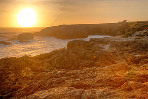 Mendocino Headlands SunsetThe evening was so lovely that we just couldn’t see ourselves spending it indoors in a restaurant, so despite the visitor center’s aggressive push to utilize their fine dining coupons, we instead chose to buy a bottle of wine and some delicious sandwiches and picnic out on the headlands, an easy walk from our inn. We couldn’t have made a better choice. Fortunately, we got there early enough before sunset to get the premier bench atop the cliffs, and were even fortunate enough to be serenaded by a young woman who sat nearby playing a stringed instrument in her lap—I think it might have been a dulcimer. It couldn’t get much better.
 Didjeridoo Dreamtime Inn at DuskBut better it did get. The next morning we awoke to the smells of breakfast wafting up the stairs. Now, we don’t stay in inns and motels much because of the RV, but my past experiences of “continental breakfasts” consisted of cheerios from a big plastic dispenser, supermarket bagels, and those little cream cheese and jelly packages. What we were about to experience was not of the same species.
This innkeeper was really something. That morning, we, and the other fortunate guests of the inn, were treated to one of the most delicious breakfasts I have ever had: scrambled eggs with bell peppers, candied pecan bacon, and Orange-Maple French Toast. I don’t know why his girlfriend ever left him.
Another walk out on the headlands, where the early morning sunlight was perfect, completed our wonderful stay in Mendocino.
Description
 Point Arena HeadlandsMendocino is a charming and picturesque hamlet of 1,100 residents along the Pacific Coast Highway (Route 1), about 170 miles north of San Francisco. Built by homesick New Englanders during the logging boom of the 1850s, the town resembles a New England village with Victorian gingerbread mansions, white picket fences, and rose gardens. The logging days are long gone, and today the town if full of upscale Bed and Breakfasts, shops, and restaurants.
The spectacular Mendocino Headlands State Park surrounds the village, with trails crisscrossing the bluffs and rocky coves.
Sebastopol and Side Trips through Sonoma and Marin County
Friday, May 25, 2012 - 2:45pm by Lolo332 miles and 6 hours from our last stop - 6 night stay
Travelogue
Today was pretty much a driving day. The GPS predicted about 5 ½ hours to get to Celeste’s house in Sebastopol, but since it was the Friday of Memorial Day weekend, we wanted to make sure we were nowhere near the city during rush hour. So, we took our time with the goal of waiting until after dinner to get through the congestion around San Francisco.
 Altamont Pass Windmills - AJGOur first stop after leaving Kings Canyon was at (according to the boys) a classic California fast food establishment – In-N-Out Burgers, known for their delicious and very high quality burgers. It lived up to its reputation, and we had some laughs comparing these burgers to the ones we had been begrudgingly served at the Kings Canyon Lodge just two days ago. Wow! Could it only have been two days. It felt like a week ago. Time certainly takes on a different dimension when it is filled with so many different experiences and activities.
The next form of family entertainment was trying to find the cheapest gas by using the Gas Buddy app on Herb’s phone. We successfully navigated ourselves off the highway to a station with prices that would have shocked us in New Jersey, but were inexpensive by California standards. However, I then forgot to reset the destination on the GPS to Sebastopol, so every time Herb got near the highway, it kept telling us to make a U- turn. By the third time we passed our gas station, with Herb getting more and more frustrated (to put it mildly), and the boys getting more and more amused, I finally realized my mistake. GPS’s are only as good as what you tell them—garbage in, garbage out—so I quickly reset our destination to Sebastopol, and it let us get on the highway without further squawking.
 Lolo and Herb at Annadel State ParkOut route along I-580 took us past a scene I always love on our trips to California – the seemingly endless landscape of windmills perched atop the rolling hills of Altamont Pass. I remember being impressed with this sight over 25 years ago when Herb and I made our first trip to Yosemite. With no place to pull over, Andrew, who had the best positioning in the car, was given the task of getting some highway speed photos. He did not disappoint.
As we approached Oakland, we decided to stop at a Trader Joe’s along route to find some goodies for a picnic as well as not to arrive at Celeste’s house empty handed. Hesitant to select wines for a family of wine connoisseurs living in Sonoma Valley, we shrewdly chose some interesting beers instead.
Just past the San Francisco Oakland Bay Bridge, we found a little park overlooking the Bay, called Point Emery--nothing much to it—just a piece of land jutting out into the Bay. Despite the chilly temperatures, we perched ourselves on a log on the small beach, enjoying our salads and sandwiches, and the great views of the Oakland Bay Bridge. Herb and I even managed to find a hidden geocache in the park.
Having successfully waited out the Memorial Day rush hour, we arrived in Sebastopol without any traffic hassles. The next five days were to give us a taste of what life is like Northern California. Let me give you a little preview: pretty darn good.
Day 1 – Annadel State Park and Willow Creek
 Willow Creek PicnicWe tend to think of our family as pretty active, but we definitely met our match with Celeste’s folks. Our first day together began with an early morning trip to nearby Annadel State Park, on the eastern edge of Santa Rosa, where there are miles of trails for hiking, mountain biking, horseback riding, and trail running. Andrew, Tommy, Celeste, and Paul set off for a run, while Herb, Hilda, and I hiked and enjoyed the lovely scenery.
To reward ourselves for our efforts, we stopped in town at Screaming Mimi’s, Sebastopol’s finest ice cream, and the place where Celeste had worked for several summers. Like everything in Sonoma Country, this place took its ice cream making seriously and we were treated to a decadent post-exercise treat. Food was definitely going to be an important part of this trip. Thankfully, we never sat still long enough for the calories to find a permanent home.
 Willow Creek MeadowAfter lunch and a brief rest back at the house, we set off for our second hike of the day at Willows Creek, a spectacular 3,373-acre “community-powered” park near Duncans Mill. What “community-powered” means is that stewardship and maintenance of the park is done by community volunteers, in conjunction with a non-profit organization called LandPaths. Without their efforts, this land would be neglected because of the State Parks budget crunch. In return, the land is accessible by permit only to those that work as stewards. Fortunately for us, Celeste’s dad was one of those stewards, which meant that we would get a chance to have this beautiful park practically to ourselves.
We left the house armed with wine and cheese – after all, this is California -- and made a stop to pick up what had to be the best bread I have ever had at Wild Flour Breads in the town of Freestone. All their breads are made in a wood-fired brick oven, which gives great flavoring and especially hard crusts. My palate was definitely being spoiled on this trip and would most likely mutiny when we returned home to my cooking.
 Hiking Willow CreekThe staff in Wild Flour had to be the happiest workers I have ever seen -- they danced, they smiled, they chatted with customers. They genuinely looked like they loved their jobs. There was such a variety of breads and scones that it was difficult making a choice. We deferred to Paul and Hilda, who selected a wonderful sampling. It was hard keeping the kids’ hands out of the bag—after all, this bread was meant to go with our wine and cheese picnic later.
Armed with wine, cheese, and now bread, we arrived at Willow Creek and set off on our hike up a fairly steep hill to a beautiful hilltop overlooking the sea. The wind was so strong that we tried to find a sheltered place to enjoy our feast. Since we basically had the whole place to ourselves, we finally decided to just set our picnic blanket down on the narrow path in a slightly protected section. Eventually some fellow hikers came our way and being quite amused by our selection of a picnic site, volunteered to take our picture. We remained until there was not a crumb or a sip left, and then headed back down the hill to return to Sebastopol.
It was a very full and rewarding day, culminating in the culinary magic that comes out of Celeste’s kitchen each night, followed by some very competitive Trivial Pursuits.
Day 2 – Sebastopol Farmers Market, Junk-Art Sculptures, and Run at Ragle Ranch Regional Park
 Sebastopol Farmers Market - TJGThe next morning we arose to another beautiful sunny day, something that is apparently a given during the summer time in Sebastopol. I would have been content to just lie in the sun on their lovely backyard patio, but alas, that was not to be. This was Sunday, and Sunday in Sebastopol means the Farmers Market in the Plaza, where the whole town congregates to enjoy delicious fresh regional food, live music, and dancing.
After lunch, Celeste took us for a walk to nearby Florence Street for a real treat. Practically every other house on the street had a whimsical, cartoon-like junk-art sculpture on their front lawn. They were hysterical. For example, there was a baseball player made from an aircraft fuel tank, air compressor, and painted scrap metal and a mermaid with applesauce can lids for scales.
 Mom with Florence Street Sculptures - TJGI later read the story behind these sculptures. They were all done by Patrick Amiot, who moved to Sebastopol about a decade ago. One of his first acts was to place a 14-foot-tall fisherman made of recycled metal on his front lawn. In case it wasn’t obvious enough, it was painted in vivid bright colors by his wife, Brigitte Laurent. Rather than the outraged complaints he expected from his neighbors, he received nothing but compliments and requests for his artwork. Today there are over 200 of his wacky, found-object works scattered throughout Sebastopol.
My only regret was that Herb missed out on the Farmers Market and the sculptures, but when we returned, it certainly didn’t seem like he had suffered very much.
We all went for a calorie-burning run at nearby Ragle Ranch Regional Park to make room for another delicious dinner that night.
Day 3 – Mill Valley, Stinson Beach, and Point Reyes Elk Refuge
 Ranch Buildings at Point Reyes National SeashoreThis morning’s activity was a drive to the beautiful Marin County town of Mill Valley to run and/or hike a portion of the famous Dipsea Trail -- the site of the oldest trail race in America, having first been run in 1905. As is probably obvious, running is a very important part of our day—coming in second only to fine dining. It’s a great counterbalance of activities—input calories, output calories, input calories, output calories, etc., etc.
The reason we chose this particular run for the day was that in just two weeks Paul (Celeste’s dad) would be running the famous Dipsea Race, a significant honor that must be earned through past performances, and he wanted to get some practice on the course. Celeste and the boys wanted to run a portion of this classic trail as well. The race course begins in Mill Valley and immediately climbs up a steep set of steps (676 in all) and trails over Mt. Tamalpais before eventually making the long descent to Stinson Beach, 7.4 miles away. It is one of the most grueling and treacherous races in the country, but also one of the most beautiful.
 Tomales Point Trail Ocean ViewHerb, Hilda, and I chose to hike instead. We too asscended the steep stairs, admiring the redwood trees and elegant homes perched like treehouses on the southern slope of Mt. Tamalpais. What a beautiful place to live. I am sure the prices must be reasonable. Having time to kill before the rest came back from their run, we went back to the center of town, watched a bit of the Memorial Day parade, and bought some very tasty sandwiches for a picnic later. Then we waited near the bottom of the trail for the runners’ return.
When they returned, they informed us of a slight mishap. The trail is a bit confusing, so at one point when they didn’t realize that Celeste was a bit behind, they turned one way and she turned the other, continuing along her merry way thinking they were just ahead. When they realized she was missing, Andrew went into a panic and frantically ran back to find her, which he did before she even realized she was lost. Happily reunited, they all returned together down the stepped trail. I must say they were very happy to learn that we had taken the initiative to buy lunch, which we planned to eat soon at Stinson Beach.
 Andrew and Celeste on TrailAfter Mill Valley, we drove the very winding, but highly scenic, Panoramic Highway through Mt. Tamalpais State Park and down to Stinson Beach. While the Dipsea Trail between Mill Valley and Stinson Beach is 7.4 miles, the drive was closer to 11.
By now the day had gotten quite overcast and cool, but regardless, the parking lot at Stinson Beach was still packed. Now I like the beach as much, if not more, than the next person, but these people romping around on the beach seemed to have no clue to the fact that it was really chilly and there was no sun! And, I know how California water temperatures compare to the Jersey shore too, and it’s not good. Not wanting to be weenies in a crowd of fun-loving, beach goers, we bundled up and squeezed next to each other (for body heat) on a log to have our picnic lunch.
 Horses on Tomales Point TrailBy now, we had already had what normal people would view as a full day, but ours was just getting warmed up. Our next stop was the breathtaking Point Reyes National Seashore, a bit further up the coast along Route 1. Our destination within the park was the Tomales Point Trail through the Tule Elk Reserve at the northern end of the park.
The trail begins at the western edge of the parking lot near a grouping of historic ranch buildings and then quickly veers north through a grove of cypress trees before giving way to a sparse mix of grass, coyote brush, and yellow bush lupine. From this point on, the trail is very open with expansive views in all directions. After about a mile of fairly level hiking, we began the descent to Windy Gap where the elk herds like to graze at a nearby a spring. Sure enough, they were there waiting for us. Fortunately, or unfortunately, depending on what you are looking for, this was not rutting season, so the elk appeared quite placid.
 Dad Photographing Point Reyes Seashore - TJGFrom here, the trail begins a moderate ascent to the wind-swept ridgeline overlooking Tomales Bay to the east, Bodega Bay to the north, and the Pacific Ocean to the west. The total distance to Tomales Point is 4.7 miles, but since it was already after 5:00, and we hadn’t even showered since our run on the Dipsea Trail that morning, which seemed like days rather than hours ago, we unanimously chose to turnaround at a rocky outcrop just ahead and retrace our steps back to the trailhead.
What a great day and an exhausting one. Dinner and a fine Sonoma Valley wine back at the house sounded like a really, really good idea.
Day 4 – Bodega Bay, Wineries, and Healdsburg
 Salmon Creek Beach - Bodega BayBefore we left for this trip, I purchased a Lonely Planet Guide to Northern California and made a list of places I would most like to see, not thinking that we would be able to cover them all in such a short timeframe. Well, thanks to Celeste’s parents, we were checking off the stops on my list as well as adding plenty more that we would never have known about without local knowledge.
This morning’s agenda included a drive to Bodega Bay and a hike along the headlands of Bodega Head. This is just one of a series of beaches that are part of the Sonoma Coast State Beach system, which stretches for 17 miles north along the coast. Most of the beaches are tucked away in rocky sandy coves separated by rocky headlands, but are connected by coastal hiking trails that wind along the top of the bluffs.
 Bodega Bay Whale Watching - AJGI must say, that California beaches are very different from those we are used to in New Jersey and New England. The east coast beaches are beautiful, but with their warm temperatures, the main attraction is playing in them. Not being warm enough to flop around in the surf, the northern California beaches have to rely on their good looks, and I have to say, they are absolutely stunning.
Our hike, which began at the Salmon Creek Beach parking lot, was a 2 to 3 mile loop atop a bluff. The terrain was mostly wind-swept grassland with sea fig, and purple and yellow bush lupine. The colors and textures of the vegetation were a perfect foreground for the dramatic pounding of the surf against the rocky shoreline below. It had to be one of the most beautiful places I have ever seen. We also saw lots of seals basking in the sun on a rock about a ½ mile off the coast.
 Bodega Bay Hike DescentBesides its stunning beauty, Bodega Bay has another claim to fame as being the location for the filming of Alfred Hitchcock’s 1963 thriller “The Birds.” As we drove through the village, we noticed a life-size statue of the man himself outside a store, and made sure to stop at the Bodega Bay Church, which is quite recognizable for anyone that has seen the move as the place where the school children sought refuge from the attacking birds.
Later that day we set off for the quintessential Sonoma Valley experience – wine tasting at one (or as it turned out, two) of its many wineries. Celeste’s parents had asked us if we would prefer to go to Napa Valley, but since they lived in Sonoma and the wineries there were more casual and less touristy, we chose to stay in Sonoma Valley.
The first winery we visited was Hop Kiln, located on Westside Road in Healdsburg. While I found the wines average, the grounds were beautiful and the historical old brewery served as a great background for family photos.
 Gang at Arista WineryOur next stop was Arista Winery, also on Westside Road in Healdsburg, which we found much better both in terms of quality of wine and the grounds. They allowed us to leave the tasting room with our final wine selection to stroll through their lovely Japanese Garden. It was a beautiful afternoon, and what I thought were tiny amounts of wine in very big wine glasses were beginning to take effect. I am embarrassed to say that one of the memorable highlights from this winery was their bathroom. The tiling and original artwork rivaled that of a country chateau.
I was feeling a little bad for Tommy at this point. It must have been quite boring for a 20-year-old (and hence the designated driver) watch his parents and older brother pretend they knew what they were doing at a wine tasting. However, as always, he was a very good sport.
 Photogenic Old Barn - TJGThe day just kept getting better and better. After the wineries, we stopped in the charming town of Healdsburg where we happened upon their Tuesday Concerts in the Plaza. It was quite the scene—lively music, people dancing in the plaza—very layback, very California. The west coast was definitely starting to grow on me.
We completed an absolutely wonderful day at Diavola Pizzeria and Salumeria in Geyserville where there was an amazing selection of wood-fired pizzas. We didn’t know where to start, but once we got going, we sure knew how to finish. We ordered a delicious selection of four different pizzas and appetizers, and it was so good that we could barely speak between bites.
We returned home fully stuffed and fully satisfied from another wonderful day with our wonderful hosts!
Day 5 – San Francisco
 Golden Gate Bridge with SurfersCeleste and her parents had some family obligations to take care of today, so left to our own devices, we decided to head into San Francisco to get a flavor for the city.
As if to confirm our preconceived image of San Francisco, our first viewing of the Golden Gate Bridge was cloaked in fog. I probably would have been disappointed if it wasn’t. We took note of a good viewpoint on the other side of the highway that we would try to hit on our way back out of the city—hopefully, after the fog had time to disperse.
Immediately after crossing the bridge, we exited 101 and looped back to Fort Point Historic Park, located right under the bridge. From here, Herb and the boys took photos of the bridge from every possible vantage point. Actually, the coolest sight was of five wetsuit-clad surfers on paddle boards rowing out to the beginning of the waves and riding them in dangerously close to the rocky shoreline.
 Golden Gate Bridge with SailboatHaving captured the bridge from every photographic angle, we drove across town to Coit Tower atop Telegraph Hill, an iconic emblem of San Francisco’s skyline—and a bit of a tourist trap. $28 dollars later, we were on the elevator to the top up the 210-foot, slender, white concrete tower for an incredible 360 degree view of the city and bay, Alcatraz, and both the Golden Gate and Bay bridges from its observation deck.
After navigating our way back through the gift shop, we spent some time enjoying the murals decorating the inner walls of the tower’s base. These murals, which depict life in California and the struggles of the working class during the Depression, were painted in 1934 by artists employed by the Public Works of Art Project. They have undergone quite a bit of controversy over the years due to what was considered radical Communist content. Today they are protected as historical treasures, and can be viewed for free on the first floor of the Coit Tower. The murals alone are well worth the visit to the Tower.
 Coit Tower ViewThe original plan was to have lunch in Chinatown, but so did half of San Francisco. After circling through the neighborhood three times without finding parking, we switched gears and decided to have a picnic in Golden Gate Park.
Oh, but first – being the tourists we are – we, of course, had to drive down Lombard Street. It definitely was steep, so steep that it was designed with eight switchbacks, because without them, it would have been a 27% grade, way too steep for most cars to deal with. In fact, we had been on an 18% grade road on the way to the Isle-aux-Coudres in Quebec and we thought that was ridiculous. Since we were in a rental car this time, rather than the RV, it was fun. I don’t know how the people that live on this street can stand all the tourists driving down all day long snapping pictures.
 Coit Tower Public Works MuralsHaving safely made it to the bottom, and taking our own photos along the way, we headed over to Golden Gate Park. But first, there was the matter of obtaining lunch for our picnic. Tommy—always the techy of the group—quickly used the Yelp App (see Tips) on his smartphone, and found reviews and price ranges for restaurants and delis in our geographic proximity. After finding a deli that looked good, his phone was even nice enough to navigate us to it. I love technology.
The park was lovely, and actually did remind me quite a bit of Central Park. A surprising fact is that it is even larger than Central Park. We really didn’t have enough time to do the park justice, but we did have a lovely picnic and then went to the top of the Hamon Observation Tower in the de Young Museum. Like the Coit Tower (except this one was free), there were fabulous panoramic views of San Francisco and the park, the Pacific Ocean, and the Marin headlands in the distance. The floor to ceiling glass walls of the tower made for a particularly impressive view and experience. There is so much to see and do in the park that we could easily have spent a day or two and not seen it all.
 Hamon Observation Tower ViewAs planned, on our way back across the Golden Gate Bridge, we pulled into the scenic viewpoint parking lot right across the bridge and this time were able to capture images of the bridge sans fog.
Back at Celeste’s house, we had a lovely last evening together, but Herb and I still had to figure out what we were going to do with our 5 remaining days. Our first choice was Lassen Volcanic National Park, which we had never seen; but winters end late there, and a quick search on the internet confirmed our fear that the roads through the park were still closed. The next obvious choice would have been to continue up Route 1 all the way to Oregon, exploring Redwoods National and State Parks, but we had already kind of done the “tree” thing in Sequoia and Kings Canyon, and as much as we like trees, we wanted something to do something a little more exciting.
 Happy Parents - TJGThat’s went it hit us. We couldn’t possibly come this close to Yosemite and pass up the opportunity to stop by. I quickly got onto the internet to see if any accommodations were available over the next few days. Not much—just two nights in the Housekeeping Cottages for the following Saturday and Sunday night. That would give us two nights to do something new, and two more to visit an old friend. We grabbed it.
We had had such a wonderful time together in Sebastopol that I don’t think any of us were ready to see it end. But end it must. Tomorrow, bright and early, the kids would catch a flight back to New York. From there, Andrew and Celeste would head to Cambridge, Massachusetts to start their summer internships, and poor Tommy would hop in his car to travel back 2/3 of the way across the country to Boulder, Colorado to start his. Boy, I missed them already.
A giant thanks goes to Celeste’s parents who had been the most incredible hosts and tour guides that anyone could have hoped for.
Day 6 – Armstrong Redwoods
 Lolo with Colonel ArmstrongNow, that the kids were on their flights back home, Herb and I had to switch gears to a more romantic mode of travel—just the two of us, armed with maps and dreams, and 5 days to do whatever we wanted in northern California.
We began our adventure by heading back towards the coast, with a quick side trip to Armstrong Redwoods State Natural Reserve to pay our last tribute to these remarkable trees that are so much a part of the northern California landscape. Although you can drive through the park, we chose to park at the entrance and walk the 1.5 mile Pioneer Nature Trail to get a more up-close and personal experience with these giants. It was quiet, peaceful, and serene---or at least until we ran into a class trip of preschoolers.
The trees in the Armstrong preserve are coast redwoods—their fancier Latin name is Sequoia sempavirens. Rising 200 to 250 feet above the forest floor, they are the tallest living things on Earth. Typically they live 500 to 1,000 years, with some trees surviving over 2,000 years and growing as high as 350 feet. With 55 inches of rain per year, the Armstrong preserve provides the wet and mild climate needed for these coast redwoods to thrive.
Ironically, this beautiful 750-acre virgin redwood forest was set aside in the 1870s by James Armstrong, a timber tycoon who made his living by harvesting these very same types of trees. Before the massive logging operations of the 19th century, redwood forests, such as this, covered much of this area. Today, this serene, majestic grove is a small but magnificent reminder of that primeval redwood forest. Fortunately, Armstrong admired these incredible trees enough to give him the foresight and good sense to preserve (at least some of) them for future generations to enjoy..
Description
 Bodega Bay Church - Hitchcock's "The Birds" - AJGSebastopol is a charming town in Sonoma County, 52 miles north of San Francisco and about a 20-minute drive to the coast. Sebastopol is known for its apples and hosts an annual Apple Blossom Festival in April and the Gravenstein Apple Fair in August. Today, however, the apple orchards are becoming vineyards as wine-making moves more and more into the region.
Every Sunday, from April to mid-December, there is a Farmers market in the downtown plaza,
where people congregate to enjoy delicious fresh regional food, live music, and dancing.
Sebastopol is home to the artist, Patrick Amiot, known for his whimsical, cartoon-like, junk-art sculptures. There are over 200 of his wacky, found-object works scattered throughout Sebastopol, especially on Florence Street.
Side Trips from Sebastopol
Mill Valley and the Dipsea Trail
Mill Valley is a picturesque town, nestled amongst redwoods on the southern slope of Mt. Tamalpais. It is located in Marin County, about 14 miles north of San Francisco. Mill Valley began as a logging town in the 1830s, but has since become a very upscale community, with exclusive boutiques and expensive homes.
Mill Valley is also the location for the start of the Dipsea Trail, the site of the oldest trail race in America, having first been run in 1905. The race course begins in Mill Valley and immediately climbs a steep set of steps (676 in all) and trails over Mt. Tamalpais before eventually making the long descent to Stinson Beach, 7.4 miles away. It is one of the most grueling and treacherous races in the country, but also one of the most beautiful.
For those not wanting to run the 7.4 miles over the mountain to Stinson Beach, the beautiful Panoramic Highway climbs from Mill Valley through Mt. Tamalpais State Park, before descending to Stinson Beach 11 miles later.
Stinson Beach
Stinson Beach is a 3-mile sandy beach located along Highway 1 about 20 miles northwest of San Francisco. Besides the beach, generally packed with surfers and swimmers on the weekends, there is a 51-acre park with more than 100 picnic tables. When not blanketed in fog, as it often is, there are tremendous views of San Francisco to the south and Point Reyes to the north. The town of Stinson Beach has plenty of restaurants, shops, and galleries to entertain on those foggy days.
Point Reyes National Seashore – Tule Elk Reserve
The Point Reyes National Seashore is a 71,000-acre park preserve located on the Point Reyes Peninsula, about 40 miles north of San Francisco. It has 110 square miles of sandy beaches and over 150 miles of hiking trails.
The Tule Elk Reserve is at the northern end of the peninsula at Tomales Point. Tule elk were nearly eliminated in the mid-1800s, due to hunting and displacement by cattle. In the 1970s, tule elk were reintroduced to the grasslands of Tomales Point. While population growth was slow at first, the introduced herd eventually began to show an exponential increase in population and is now at a sustainable level of 450 individuals. The Point Reyes National Seashore is the only National Park where tule elk can be found.
The Tomales Point Trail through the Reserve begins at the end of Pierce Point Road near the historic Pierce Point Ranch. The hike to Windy Gap, where the elk can be seen grazing, is about 2 miles. The open trail offers breathtaking views of Bodega Bay to the north, the Pacific Ocean to the west, and Tomales Bay to the east. Hikers can continue another 3.7 miles to the north tip of Tomales Point.
Bodega Bay
Bodega Bay is the first of a string of fishing hamlets that line the coast of Northern California. Its main claim to fame is that in was the setting for Alfred Hitchcock’s 1963 thriller, The Birds.
The Bay itself lies at the northern tip of the Point Reyes peninsula and is approximately 5 miles across. It is protected in the north by Bodega Head, which rises 265 feet above sea level. There are numerous hikes along the stunning headlands of Bodega Head. From the Salmon Creek Beach parking lot there is a 2 to 3 mile loop atop a bluff overlooking the dramatic pounding of the surf against the rocky shoreline below.
Sonoma Wineries
 Family at Hop Kiln WineryWhile Sonoma Valley is only a few miles apart from its more famous neighbor, Napa Valley, it is quite different – more casual, less pricey, and much less crowded. Sonoma takes great pride in not being Napa.
When people talk about Sonoma, they mean the whole country, whose 1,500 acres make it much larger than Napa. Sonoma County extends all the way from the coast on the west, up the Russian River Valley, into Sonoma Valley in the east, and San Pablo bay in the south to Healdsburg in the north. It is so large, that it is broken down into districts:
- Russian River Valley - west of Highway 101
- Sonoma Valley – stretches north-south along Highway 12
- Alexander Valley - east of Healdsburg
- Dry Creek Valley - north of Healdsburg
- Carneros – straddles the Sonoma-Napa border
The weather varies significantly between these districts and determines what types of grapes do best. The Russian River Valley and Carneros are nearer the coast and therefore cooler and foggier. Burgundy-style wines, such as chardonnay and pinot noir do best in this type of climate. Sonoma, Alexander, and Dry Creek Valley are further inland where Bordeaux-style wines, such as sauvignon blanc, merlot, and cabernet sauvignon do better in the warmer and less foggy climate. There are approximately 200 wineries in Sonoma County.
San Francisco – Fort Point, Coit Tower, and Golden Gate Park
Our stop in San Francisco was brief, so this in no way is an attempt to give a thorough description of what to see in San Francisco. However, the following three sites are what we chose to do during our all too short one day visit.
Fort Point is located below the southern end of the Golden Gate Bridge at the entrance to the Bay. It was this location that made it a perfect place for a fort to protect San Francisco Harbor from Confederates during the Civil War and foreign attack in later years. Its arched casements are considered an excellent example of brick masonry from the Civil War period. The fort is now a National Historic Site and is part of the Golden Gate National Recreation Area.
Its vantage point will be familiar to Alfred Hitchcock fans, for it was from here that he filmed the bridge in Vertigo. Surfers also flock to this spot to ride the waves in towards the rocky shoreline.
 Coit Tower StairwellThe 210-foot Coit Tower stands atop Telegraph Hill, between the Financial District and Fisherman’s Wharf. It was built in 1934 as a monument to San Francisco firefighters, financed by Lillie Hitchcock Coit. Lillie was quite a fan of the fire department and rarely missed a fire or a fireman’s funeral. She even had her bedsheets embroidered with the firehouse emblem. When she died, she left one third of her fortune for the building of this memorial. This art deco tower, built of unpainted concrete, was designed by Arthur Brown, Jr. and Henry Howard.
The interior walls of the tower are embellished with Diego Rivera-style fresco murals, most of them depicting life in California during the Great Depression. 25 artists worked on these murals as part of the WPA program of the New Deal. At the time the murals were quite controversial and denounced as Communist. Fortunately, they are now protected as national historic landmarks.
Visitors can pay $7 to ride the rickety elevator to the top of the tower for fantastic 360 views of the city, including the Golden Gate and Bay Bridges, Alcatraz, Lombard Street, Nob Hill, and more.
Golden Gate Park is to San Franciscans what Central Park is to New Yorkers. Its 1,017 acres make it 20% larger than Central Park. It is over three miles long (from east to west) and half a mile wide (north to south). The park design was the result of an 1870 competition, won by 24-year-old William Hammond Hall
Park highlights include:
- 7.5 miles of bike trails and 12 miles of equestrian trails
- Baseball fields, soccer fields, and tennis courts
- An archery range
- Fly-casting pools
- The De Young Museum
- The Academy of Sciences
- A Japanese Tea Garden
- The San Francisco Botanical Garden
- Kazar Stadium
- Golden Gate Park Stadium
- The Conservatory of Flowers
- The Aids Memorial Grove
- Stow Lake
- Spreckels Lake
- A bison paddock
Armstrong Redwoods State Natural Reserve
Armstrong Redwoods State Natural Reserve, located in Sonoma County just north of Guerneville, has preserved 805 acres of Coast redwood trees. Rising 200 to 250 feet above the forest floor, they are the tallest living things on Earth. Typically they live 500 to 1,000 years, with some trees surviving over 2,000 years and growing as high as 350 feet. With 55 inches of rain per year, the Armstrong preserve provides the wet and mild climate needed for these coast redwoods to thrive.
Although you can drive through the park, the 1.5 mile Pioneer Nature Trail provides a more up-close and personal experience with these giants..
Sequoia and Kings Canyon National Parks
Tuesday, May 22, 2012 - 2:15pm by Lolo400 miles and 7 hours from our last stop - 3 night stay
Travelogue
I had spent quite a bit of time researching Sequoia and Kings Canyon and determined that the best approach would be to spend one night at the John Muir Lodge, just inside the Big Stump Entrance to Kings Canyon, from which to explore the Sequoia section, and then move on to the Cedar Grove Lodge at the end of Kings Canyon for two nights to allow us to do a long day hike into the canyon.
The following is a description of how we spent a very wonderful three and a half days in Sequoia and Kings Canyon.
Day 1 – John Muir Lodge, Panoramic Point, and General Grant Tree
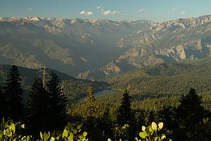 View from Panoramic Point - TJGThe drive from the airport to the John Muir Lodge took us about five hours, bringing us past the beautiful San Luis Reservoir and through the rich agricultural landscape of central California.
Although it was already 6:30 when we arrived, and probably time to think about feeding ourselves, we decided instead to take a quick run up to Panoramic Point, which the guide books described as having a breathtaking view of Kings Canyon. Herb was a bit skeptical about my plan and accused me once more of trying to “pack 10 pounds into a 5 pound bag.” After all, he had driven the whole way and wanted to just relax and have a beer. As usual, he lost the argument and we set off up the steep, winding 2.3 mile road to the Point. This was one time I was glad that we didn’t have the RV, because I’m not sure if it would have made it up this road; in fact, I don’t think it was even allowed. The boys decided they needed the exercise and hill training, so they chose to run (or more correctly race) to the top.
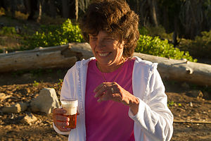 Lolo enjoying her IPA - TJGOnce on top, we took out our movie camera and awaited the boys’ arrival. Unfortunately, I wasn’t ready with the camera when Andrew appeared a few yards ahead of Tommy to declare victory in the grueling uphill race. I was so mad that I missed what would have been really good footage that I asked them to repeat the final stretch so I could get it on film. Andrew was so exhausted from his actual victory that Tommy cruised past him in the reenactment, immortalizing his victory at Panoramic Point. Andrew cried foul, but the tape is the tape.
The view of Kings Canyon and Hume Lake below was well worth the trip, and I rewarded Herb’s flexibility with a cold IPA (or two) from the cooler. At this point we had two choices: rush back down to have dinner before the only restaurant in the village closed at 8:00, or stay to watch the lighting change over the canyon as sunset approached. This time, we unanimously voted to stay, and I went and got what remained of the delicious sandwiches Celeste and her mother had made out of the trunk – definitely the right decision.
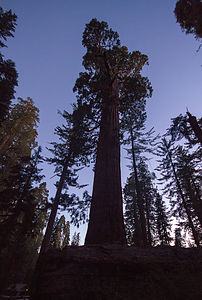 General Grant tree at dusk - TJGAlthough it was now 11:00 east coast time and we had been up since 3:00 this morning, we were on an irresponsible roll and decided to squeeze another 5 pounds into that already overstuffed 5 pound bag and hurry over to the General Grant tree while there was still a wee bit of daylight. So, it was back down the narrow, windy hill, past the John Muir Lodge where we were staying, and over to the General Grant Grove where we practically sprinted the ½-mile trail to find the Big Fella while we could still see it. As we gazed in awe as the 3rd largest living tree in the world faded into darkness, Andrew whispered, “It’s glowing…like an angel,” and in our collective delirium from lack of sleep (and a few IPAs) we burst into laughter. From that point on, “it’s like an angel” became our metaphor for any sight that impressed us.
Finally, at what was now midnight east coast time and 21 hours since we had awoken this morning, we decided to call it a day and return to our room at the John Muir Lodge. The lodge was actually quite cozy with that rustic national park feel that I have come to love, and a perfect base camp from which to explore both Sequoia and Kings Canyon. It would have been nice to have been able to spend a little time just relaxing in the rocking chairs on the porch, but alas that was not to be.
Day 2 – Sequoias and more sequoias, Moro Rock, Crescent Meadow, Hume Lake, Kings Canyon Scenic Byway, and Cedar Grove Lodge
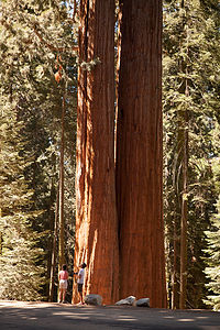 Siamese twin Sequoia treesMuch of Sequoia and Kings Canyon is inaccessible by road. There are two major roads in the park and they are shaped sort of like a backwards 7 with Grant Grove Village, where the John Muir Lodge is located, at the vertex. South of Grant Grove is the Generals Highway which takes you deep into Sequoia country with such notable stops as Giant Forest and Moro Rock (about a 2 hour drive from Grant Grove Village). North and then east of Grant Grove is the spectacular Kings Canyon Scenic Byway, a 31-mile rollercoaster road, which descends deep into the canyon, connecting Grant Grove and Cedar Grove. There are also a few additional out and back side roads off the two major roads.
Today, we would do them both: the Generals Highway to Giant Forest for the major part of the day and then later that afternoon the Kings Canyon Scenic Byway to get to our accommodations for the night at Cedar Grove. Since we only had about eight hours to explore the Sequoia part of the park, I had to be somewhat selective in our choice of stops. In an attempt to get an overall representative sampling of this amazing park, I chose a meadow, a rock, and, of course, lots of giant trees.
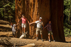 Sequoia Tree HuggersOur first stop along the Generals Highway was a pullout in the midst of a beautiful sequoia redwoods forest. I found my favorite sequoia tree here (actually it was two Siamese twin trees), because it wasn’t fenced in like a zoo exhibit or surrounded by throngs of people. It was just there for us to marvel at – “it was like an angel.” As we were doing this tree photographic justice, a gentleman from Texas suggested we do what his Aunt Clovis always had them do – hold hands and try to encircle the tree, kind of like group tree hugging. With arms fully outstretched, we still were only able to make it about halfway around – and this was not even one of the park’s designated giants, but just some old random tree along the highway.
Then it was on to the Lodgepole Visitor Center where we watched an interesting film about bears in the park. Once we were back on the Generals Highway, there was an anguished cry from the backseat as Andrew realized that he left his very expensive camera on the seat next to him in the dark Visitor Center theater. We frantically raced back to the Visitor Center and were delighted to find that a kind and honest fellow traveler had turned it in to the ranger at the desk. Crisis averted, we continued on down the Generals Highway.
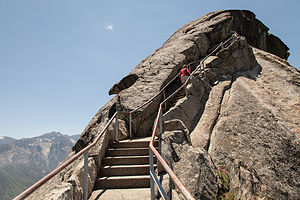 Moro Rock ApproachWe passed the parking lot for the landmark General Sherman Tree (we would hit that on the way back) and continued on to the turn off onto Crescent Meadow Road to get to both the Crescent Meadow and Moro Rock hikes.
We tend to be partial to rocks and expansive views, so the hike to the top of Moro Rock was a highlight. The trail was fun – 400 steps carved into the side of the dome. As promised, the 360 degree view of the surrounding snow-capped mountains of the Great Western Divide from the top was breathtaking.
The road to Crescent Meadow was awesome, with giant sequoias lining both sides of the road. There was even one spot where you could drive through a tunnel cut out of a fallen one, appropriately named Tunnel Log. However, since there was a backlog (no pun intended) of cars hogging it, we took the bypass road around it, hoping to get our chance on the way back out.
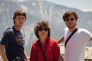 Lolo and Boys at Summit of Moro RockThis was bear country, so the parking lot for the Crescent Meadow hike had signs warning visitors to not leave any food in their cars, but to store them in one of the nearby bear boxes. Not wanting to risk the unlikely but unpleasant possibility of having the trunk lid of our rental car ripped off, we spent a bit of time emptying the very ample contents of our trunk into a bear box before hitting the trail.
The hike was an absolutely lovely stroll through a meadow surrounded by firs and giant sequoias. Here, one could get up close and personal with the trees, and even in some cases, enter their fire-hollowed trunks – much more intimate than viewing the more famous landmark trees from behind a fence. The lack of other hikers on the trail made the experience even more peaceful and serene.
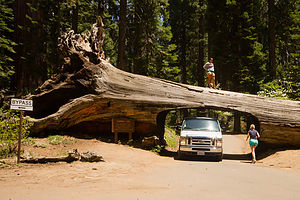 Tunnel Log - TJGAmidst all the natural wonders of the meadow, we came across was an interesting man-made landmark – a tiny cabin built from a fallen, fire-hollowed sequoia, complete with stone chimney. Named Tharp’s Log, it was built back in the 1860s by a cattle rancher named Hale Tharp. He was the first non-Native American settler to live in the area. John Muir, who was a frequent visitor to the area, referred to it as a “noble den.” It must have been quite peaceful living here in solitude amongst these silent giants.
After our hike, we collected our goodies from the bear boxes and made a picnic lunch before returning to the Generals Highway to begin retracing out route north. This time, we did get a chance to drive through Tunnel Log, and I must confess we jammed it up to with our need to get out and take a picture.
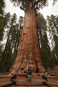 Tommy with General Sherman TreeOur final stop in Sequoia, and by far the biggest (both literally and figuratively) attraction in the park, was the General Sherman Tree, the largest living tree on earth--a distinction based on volume, as it is neither the tallest nor the widest tree, but the heftiest, producing the equivalent of another 60-foot tree each year. After our more intimate experiences with giant sequoias—the Aunt Clovis tree that we had hugged and the ones that had invited us in to gaze up through their hollowed-out trunks to the sky—the crowds and fenced in trees here really turned us off. After a brief paying of our respects to this truly awesome tree and the obligatory photo in front of it, we hit the road once again to head towards the Kings Canyon section of the park.
Rather than retrace our route back through Grant Grove, we took a shortcut towards Hume Lake to provide a little variety. Hume Lake was the lake we had gazed down on from Panoramic Point the first night, so we thought it would be nice to see it from eye level. The road was pretty winding and twisty, but nothing our little Toyota rental car couldn’t handle. The lake and sandy beach were too tempting to pass up, so the boys stripped down to their boxers and jumped in.
We were getting pretty hungry by now, and the National Park Map showed only one possibility along the way – the Kings Canyon Lodge about 12 miles further along the Kings Canyon Scenic Byway. I liked the sound of it. I love National Park lodges with their cozy décor, high beamed ceilings, and stone fireplaces. I only hoped we were dressed nicely enough. After all, the boys were still sitting on towels in their wet boxers in the back seat. Anticipation rose as the GPS showed us inching our way closer and closer to the Lodge. We had been living on sandwiches for the past two days, so the thought of a hearty meal in a lovely setting was very appealing.
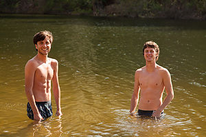 Boys in Hume LakeAs we pulled into the parking lot for Kings Canyon Lodge, a jaw-dropping silence fell over us. Rather than the grand park lodge I had visualized perched over an equally majestic canyon, we were greeted by a vision much less appealing: a few dilapidated cabins, a small office building, and a set of antique gas pumps posted with the very inviting welcome: “No Pictures Without Permission.” Despite my disappointment, I put on a brave face, turned to the others and said, “Okay, let’s go get something to eat.” I felt like Clark Griswold pulling into Wally World.
I think I started things off on the wrong foot when we walked into what I thought was the office and asked the somewhat surly-looking gentleman behind the counter where the restaurant was.
“You’re looking at it,” was his rather curt response.
Oh boy. I looked up and noticed a menu board behind him. “I’ll be right back,” I told him as I motioned the boys to follow me back outside. After a brief conference, and the realization that this was the only place to eat in about 25 miles, we collected Herb and bravely went back to give it a try. The owner looked on disinterestedly as we scanned the menu board. I have this tendency of asking too many questions, which drives the boys crazy, so they cringed when I asked the nice gentleman if the Santa Fe sandwich had chicken on it, especially since it clearly did not mention chicken as one of the ingredients listed on the board. I just really wanted it to have chicken on it.
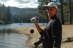 Herb the Videographer - LEG“We don’t have chicken.”
Another brief conference. “Okay. “We’ll have four cheeseburgers then.” I then continued with, “Do we eat at the counter or can we eat outside on the picnic table.”
“Doesn’t matter to me.”
This guy was a real gem. Not wanting to be in this man’s presence any longer than necessary, we went outside to await our burgers. I headed towards a small building behind the “restaurant” that was the restroom, but quickly exited when I saw how disgusting it was – and being a camper, I have a pretty high tolerance for bathrooms.
In a reasonable amount of time, our friend brought out our food and plopped it down in front of us without a word. If we weren’t so hungry, I think we would have been afraid to take a bite, but we did and it was actually pretty good.
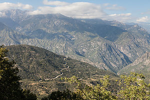 Road to Kings CanyonWhen we were done, my cowardly men voted to send me back in to pay. By now two of his equally surly friends had joined him at the counter. I quietly handed him the check and my credit card, and he brought our hospitable dining experience to a close with:
“You wanna add a tip to that?
“Not particularly,” I thought, but feeling quite intimidated, I tipped quite generously and then got out of their as fast as I could.
Just out of curiosity, when we had internet coverage later, I looked for reviews of the Kings Canyon Lodge and found that I was not the only one that had had a bizarre experience. The funny part was the gentleman that I dealt with was actually the charmer of the family. His wife actually cursed at a family and grabbed their food back because they had their own juice boxes at the picnic table. Sounds like we got off easy.
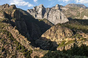 Kings Canyon Road ViewpointThe rest of the drive into Kings Canyon was spectacular. While the drama of the drive was the steep granite walls and the sheer drop offs into the canyon, one of my favorite sights were the yucca plants whose feathery fronds sprang incongruously from the near vertical canyon walls, where you would think no plant could take hold.
We intentionally passed the turnoff for the Cedar Grove Lodge and drove the remaining 5 miles to Roads End, where the Scenic Byway ends and pure wilderness begins. There was still a bit of daylight left, although not much, so we thought we would get a preview of what was in store for us tomorrow before checking into our motel for the night. We found the trailheads for tomorrow’s two hikes: Mist Falls and Zumwalt Meadow and then took the short, and very rewarding, hike to the Roaring River Falls.
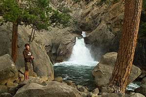 Andrew by Roaring River Falls - TJGIt was getting late, and we were tired from our long day of exploring so many wonderful and diverse sights, so we headed back to the Cedar Grove Lodge. As usual, I ran ahead to check in, while Herb organized stuff to bring in. When I got to the office, I became quite concerned to find that it was dark and closed up for the night. I pressed my nose against the glass, but saw no one inside. What were we going to do? We were out at the end of nowhere with the nearest civilization back 30 miles at the (dare I say it) Kings Canyon Lodge. Seeing lights on in the store/restaurant next to the office, I ran there and began tugging on the door, only to find that it too was locked for the night. Noticing a young man mopping the floor inside, I began pounding on the glass window and waving my arms to get his attention. He looked frightened. “What are you doing?’ Herb asked as he handed me an envelope with room keys left for us in the box by the office door. Oops.
A short while later, while sitting on the deck of the lodge overlooking the river, a frantic woman came running up to us with a look of total panic on her face – very similar to the one I had been sporting about an hour ago – and asked us if we knew how she could find someone to check in. Feeling her pain, we calmly told her to look in the box for an envelope with her name on it. She was so relieved and grateful I thought she was going to cry. They really need a more obvious system for late arrivals.
The next morning, however, all was forgiven when we wandered down to the store and found that they served Starbuck’s coffee.
Day 3 – Mist Fall Hike, Zumwalt Meadow Hike, and Cedar Grove Lodge
 Bubbs Creek - TJGThe next morning we set out early for our hike to Mist Falls, one of the most popular hikes in the park. We drove the 5 ½ miles back down to Road’s End to get to the trailhead. Since most of Kings Canyon is inaccessible by car, this is the starting point for the hundreds of miles of the wilderness backpacking trails in the park. In fact, if you are ambitious enough, you can even hike to Mt. Whitney from here. However, today our goals were much more modest - the 8 mile RT Mist Falls hike.
The hike was an instant all-time Gaidus favorite, and within ½ mile of the trailhead, Andrew had already declared, “at this moment in time, this is my favorite national park!” The trail was quite level for the first two miles or so, passing through a lovely meadow bounded by granite walls before reaching Bubbs Creeks at about 2.6 miles and beginning the uphill climb. From this point, the trail meandered along the south fork of the Kings River through forest and swamp areas before coming out on a big open rock slab with tremendous views out over the canyon. There was no question that this would be a spot for lunch on the way down as well as the annual Christmas photo—it was spectacular.
However, the hike was not yet complete, so we continued on and upward to Mist Falls. This part of the hike was a bit steeper and rockier, but we were pleasantly distracted by the numerous small cascades and clear, deep pools along the river. It would have been great to take a quick dip, but the water was much too chilly, and ample signs warned of the dangers of swimming in the fast current. However, we were soon treated to the refreshing spray of the aptly named Mist Falls, a series of cascades dropping 100 feet over a granite incline. Once refreshed, we continued a short distance past the falls to a series of flat granite boulders where there was a great view of the canyon and waterfall below. This was our turnaround point for the day, but the trail does continue on to Paradise Valley and eventually to meet up with the Pacific Crest Trail. It would be a wonderful place to backpack someday. I will have to add that to our ever growing bucket list.
 Mist Falls Hike Canyon ViewBack at our rock slab, the tripods came out, the family lined up and smiled, and we captured what I think is one of our best Christmas photos to date. Of note is that the boys coincidentally wore the same color shorts and t-shirts, just the way I used to dress them up in matching outfits for Christmas photos when they were little.
We also immortalized the first annual (and hopefully last) Gaidus “catching air” contest, in which we leaped as high as we could in the air, while doing some fancy moves. Mine looks like I just escaped from a mental hospital.
After a bit more lunching, lounging, and just taking in the expansive views of the canyon below, we retraced our steps back to the trailhead. Back at the homestead, we got take-out from the Cedar Grove Lodge and ate at a picnic table right on the banks of the south fork of the Kings River. The table was literally 10 feet from the river and the roar from the rapids was so loud that we had to practically shout just to hear each other. The food was just okay, but it was the only game in town and the scenery certainly made up for it. This was not exactly a culinary tour, but thankfully, we all think of food primarily as fuel to hike and have fun—except for Andrew, who is developing a taste for finer foods now that he is dating a culinary wonder.
 Mom Catching "Big Air" - AJGThe day was not over yet though. The sun was getting low, making it a perfect time to visit Zumwalt Meadows and walk the 1.5-mile loop around the meadow. The trailhead was back down the road towards Road’s End about 4 ½ miles from Cedar Grove Lodge.
This was one of those hikes that has a brochure you can purchase at the trailhead describing each of a series of numbered stops along the way. I was so used to reading these while the kids totally ignored me in years past, that I was pleasantly pleased to have Tommy take over my job and read each stop with interest—after all, he is a geoscience major and this valley has to be a geologist’s heaven. Despite Andrew’s major in environmental policy, he still felt it necessary to not give his brother the benefit of his full attention. One thing I did learn that I didn’t know before is that meadows are meadows and not forests, because they are too wet and frequently flooded to support much other than grasses and flowers. So, the brochure had already paid for itself.
 Zumwalt Meadows HikeAfter leaving the parking lot, we strolled along the banks of the Kings River before crossing a suspension bridge. At the junction for the loop, we chose to go left (clockwise), so that Tommy could do his brochure readings in the proper sequence. Unlike Yosemite, where one can wander freely across the meadows, this meadow was moister, and walkers are restricted to the path that traces its perimeter and the wooden boardwalks that cross it. We soon came to a wooden platform with a lovely view of the meadow and the granite walls of Grand Sentinel and North Dome rising from the right. Herb chose to remain here taking photographs during the sunset while the boys and I continued along the loop. As we rounded the halfway point of the meadow, our level forest path gave way to a section of large boulders at the foot of Grand Sentinel that required some rock scrambling to traverse. It was almost dark by the time we reunited with Herb sitting contentedly beside his tripod.
After a short drive back to Cedar Grove Lodge, we settled comfortably on the porch overlooking the Kings River, quite content with a very successful day of hiking.
Day 4 – Departure (with a quick stop at Muir Rock)
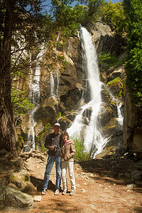 Mon and Dad by Waterfall - TJGWell, it was time to leave Kings Canyon, but before doing so we had one last stop to make. Yesterday, after we finished our Mist Falls hike, we had totally forgotten our plan to stop at Muir Rock afterwards. Being great admirers of John Muir and all he has done to help create the National Park System, we thought it worth the drive back down to Roads End to pay him some well-deserved homage.
The rock, which is just a short walk from the Roads End parking lot, is a large flat boulder jutting over the river from which John Muir used to give talks on Sierra Club field trips. The rock was a perfect place to sun and jump into the river, and if it had been a wee bit warmer, I’m sure we would have given it a try.
But alas, we had places to go and people to see (Andrew’s girlfriend and family), so it was back in the car for the drive out of the park along the beautiful Kings Canyon Scenic Byway.
Description
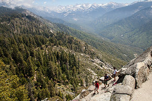 Descent from Moro RockSequoia and Kings Canyon are two very distinct parks administered as a single entity. Its combined 1,350 square miles make it larger than Yosemite, its more famous and visited neighbor a three-hour drive to the north. These two parks are home to the largest Giant Sequoia trees in the world, the largest mountain in California – 14,494-foot Mount Whitney, as well as one of the deepest canyons in the country.
Although John Muir made his first visit to the Kings Canyon in 1873, it took a bit longer for this area to be protected. Secretary of the Interior Harold Ickes recognized its uniqueness and fought to preserve it, even hiring Ansel Adams to photograph its beauty. Through their efforts, Kings Canyon was designated a National Park in 1940. The separate, tiny General Grant National Park was made part of Kings Canyon National Park.
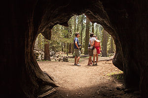 Family from Inside of a Burnt Out SequoiaThese two parks are well-kept secrets, with less than half the visitors that Yosemite receives each year. It is a place where one can find solitude from the crowds in a setting equally inspiring.
There are two main entrances to the parks, both located on the west side of the parks. There are no roads entering from the east. The Big Stump Entrance is reached via Highway 180 from Fresno and the Ash Mountain Entrance in the south is reached via Highway 198 near the town of Three Rivers.
Much of Sequoia and Kings Canyon is inaccessible by road. There are two major roads in the park. South of Grant Grove is the Generals Highway which takes you deep into Sequoia country with such notable stops as Giant Forest and Moro Rock (about a 2 hour drive from Grant Grove Village). North and then east of Grant Grove is the spectacular Kings Canyon Scenic Byway, a 31-mile rollercoaster road, which descends deep into the canyon, connecting Grant Grove and Cedar Grove. There are also a few additional out and back side roads off the two major roads.
The following is a list of highlights along the parks’ two major roads.
Generals Highway (from Grant Grove to Giant Forest)
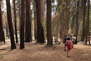 Hiking the Cresent Meadow trail
- Panoramic Point – at the end of a 2.3 mile steep and twisty spur road (no RVs allowed) is a overlook with incredible views of Kings Canyon below
- Grant Grove – paved ½ mile trail past a number of giant sequoias, including the General Grant Tree, the 3rd largest living tree in the world
- Giant Forest – the most famous grove of sequoias in the world. The General Sherman Tree, the largest living thing on the planet, stands at the northern edge of the grove. The 2-mile Congress Trail leads past the General Sherman Tree as well as several other well-known giants.
- Crescent Meadow – 3 miles off the Generals Highway on Crescent Meadow Road is this lovely meadow, ablaze with wildflowers in the spring. Another interesting stop along the trail is Tharp’s Log, a tiny cabin built from a fallen, fire-hollowed sequoia, complete with stone chimney. Named Tharp’s Log, it was built back in the 1860s by a cattle rancher named Hale Tharp. He was the first non-Native American settler to live in the area.
- Moro Rock – also along Crescent Meadow Road is Moro Rock, a large granite dome with 360 degree views of the surrounding snow-capped mountains of the Great Western Divide. The top of the rock is reached by climbing 400 steps carved into the side of the dome.
Kings Canyon Scenic Byway
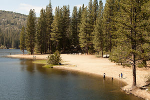 Hume Lake BeachThe Kings Canyon Scenic Byway is a 31-mile rollercoaster road connecting Grant Grove and Cedar Grove, which descends 2,000 feet deep into the canyon, It takes about an hour to drive and ranks among the most magnificent in any national park. The following are a few stops along the way:
- Cedar Grove Village – the only civilization in the wilderness – contains a small lodge and snack bar
- Roaring River Falls – a half-mile out and back walk to a magnificent view of the lower falls
- Zumwalt Meadow – a 1.5 mile loop hike around a lovely meadow with great views of Grand Sentinel and North Dome. The trailhead is 4.5 miles east of the turnoff for Cedar Grove Village and 1 mile before Road’s End.
- Road’s End – located at the very end of the Scenic Byway, Road’s End serves as the starting point for hundreds of miles of wilderness backpacking trails. A short walk from the parking lot is Muir Rock, a large flat boulder along the river from which John Muir delivered many of his Sierra Club talks. The trailhead for the very popular, 8-mile RT hike to Mist Falls is also here.
Although many try to see these two parks in just a day, it is best to stay a few nights to see all the parks have to offer.
For RVers, there are several campground choices.
Along the General Grant Highway:
- Azalea (114 sites) near Grant Grove
- Dorst (218 sites) 14 miles northwest of Giant Forest
- Lodgepole (250 sites) 5 miles northeast of Giant Forest Village
At the end of the Kings Canyon Scenic Byway near Cedar Grove:
- Sentinel – open whenever highway 180 is open
- Sheep Creek, Canyon View, and Moraine – open when overflow is needed
For those looking for lodging, there are also several choices
Along the General Grant Highway:
- John Muir Lodge – cozy 36-room lodge located near Grant Grove
- Grant Grove Cabins – 50 rustic cabins located near Grant Grove
- Wuksachi Lodge- modern 102-room lodge is located in the Giant Forest area
At the end of the Kings Canyon Scenic Driveway there is only one choice:
- Cedar Grove Lodge – lovely 21-room lodge on the bank of the roaring Kings River.
.
Home
Wednesday, August 3, 2011 - 9:30am by Herb118 miles and 2.5 hours from our last stop - 1 night stay
Travelogue
It was good to get back home and reacquainted with Lolo. It had been the best trip we could muster up to accommodate our off-springs' scheduling restrictions.
I guess I can consider this a transition trip. Instead of 3-4 weeks of family time camping with young boys, it was one week of camping with young men. As they grow up, and continue to develop independent lives of their own, Lolo and I will need to figure out the best balance going forward.
Description
Our home in Upper Saddle River, a suburb of New York City.
Hickory Run State Park
Tuesday, August 2, 2011 - 2:45pm by Herb457 miles and 9 hours from our last stop - 1 night stay
Travelogue
Hickory Run was one of those state parks that I always wanted to try out, but never really had a good chance. It's the closest park to the Lehigh River Gorge, which is a popular white water rafting river. The thought was that it might be a suitable base-camp for a future rafting trip. However, it's location is just far enough from NJ to make camping necessary for any activity, but close enough to home that we usually just bypass it in an effort to get back home a day early.
Anyhow, this time I decided to check it out. While the park was nice, I wasn't really in the best state of mind to appreciate it. It took me far too long to select a site,, return with the number,,, collect my pass,, and then set up camp at the sloping site adjacent to the site I reserved. When I figured out my mistake I had to move the rig over 50'. Trip fatique was definitely setting in, and solo travel wasn't as appealing when there weren't the distractions of the big sky, mountains, canyons, and rivers of the west. This felt like camping in my backyard, and I was missing Lolo.
I called it an night without even exploring the park and got ready for an early departure.
Description
This 15,990-acre park lies in the western foothills of the Pocono Mountains, just off Route 80 in the town of Kidder, PA. This large park has a sandy beach for swimming, excellent fishing for brook and brown trout, a 19-hole disc golfing course, two permanent orienteering courses, and 43 miles of hiking trails.
One of the more unique features of the park is a huge 16-acre boulder field, which seems to appear out of nowhere in the park’s dense woodlands. This unique geological landscape has been recognized as a National Natural Landmark.
There is also a 381-site campground with both a forested section and a grassy, more open section.
Brother's house in Columbus
Monday, August 1, 2011 - 1:45pm by Herb375 miles and 6.5 hours from our last stop - 1 night stay
Travelogue
It's always fun to stop over at my brother-in-laws on the way back from a west coast RV trip. Usually we have a full family, but this was the first time as a solo traveler. Jim and his wife Bev are always gracious hosts, and I knew I would feel comfortable as always in their home.
In previous trips, we have always had permission to park the RV in a nearby Krogers parking lot, and then Jim would shuttle us to his residence. This was done to avoid any issues with the zoning regulations that are pretty strict for the houses on the golf course.
This time, however, we were denied overnight parking at the Krogers. Undaunted, I suggested to Jim that I could safely navigate his circular driveway and tuck in on the side of his house. The RV would be hardly visible from the 9th green, and I assured him that I would be back on the road before 9:00 the next morning. To my surprise, he agreed to give it a shot. With his direction I was quickly parked in his driveway and able to shower and change in time for evening glass of wine.
Dinner and conversation were great as always, and it was good to sleep in a real bed after 2 weeks in the camper.
Description
My brother's home in a suburb of Columbus, Ohio
