- Home
- About
- Map
- Trips
- Bringing Boat West
- Migration West
- Solo Motorcycle Ride
- Final Family XC Trip
- Colorado Rockies
- Graduates' XC Trip
- Yosemite & Nevada
- Colorado & Utah
- Best of Utah
- Southern Loop
- Pacific Northwest
- Northern Loop
- Los Angeles to NYC
- East Coast Trips
- 1 Week in Quebec
- Southeast Coast
- NH Backpacking
- Martha's Vineyard
- Canadian Maritimes
- Ocracoke Island
- Edisto Island
- First Landing '02
- Hunting Island '02
- Stowe in Winter
- Hunting Island '01
- Lake Placid
- Chesapeake
- Provincetown
- Hunting Island '00
- Acadia in Winter
- Boston Suburbs
- Niagara Falls
- First Landing '99
- Cape Hatteras
- West Coast Trips
- Utah Off-Roading
- Maui
- Mojave 4WD Course
- Colorado River Rafting
- Bishop & Death Valley
- Kauai
- Yosemite Fall
- Utah Off-Road
- Lost Coast
- Yosemite Valley
- Arizona and New Mexico
- Pescadero & Capitola
- Bishop & Death Valley
- San Diego, Anza Borrego, Joshua Tree
- Carmel
- Death Valley in Fall
- Yosemite in the Fall
- Pacific Northwest
- Utah Off-Roading
- Southern CA Deserts
- Yosemite & Covid
- Lake Powell Covid
- Eastern Sierra & Covid
- Bishop & Death Valley
- Central & SE Oregon
- Mojave Road
- Eastern Sierra
- Trinity Alps
- Tuolumne Meadows
- Lake Powell Boating
- Eastern Sierra
- Yosemite Winter
- Hawaii
- 4WD Eastern Sierra
- 4WD Death Valley +
- Southern CA Deserts
- Christmas in Tahoe
- Yosemite & Pinnacles
- Totality
- Yosemite & Sierra
- Yosemite Christmas
- Yosemite, San Diego
- Yosemite & North CA
- Seattle to Sierra
- Southwest Deserts
- Yosemite & Sierra
- Pacific Northwest
- Yosemite & South CA
- Pacific Northwest
- Northern California
- Southern Alaska
- Vancouver Island
- International Trips
- Index
- Tips
- Books
- Photos/Videos
- Search
- Contact
Edgartown
Thursday, July 3, 2008 - 11:00am by Lolo0 miles and 0 hours from our last stop - 1 night stay
Travelogue
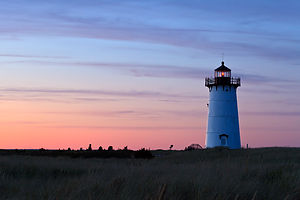 Edgartown Lighthouse at DuskIt’s funny how such a small island can have such a variety of distinctive histories - Aquinnah has it Native American roots, Oak Bluffs its religious revivalist meetings, Tisbury its commercial trade, and Edgartown its whaling. While centuries have passed, these beginnings are very much still a part of these island communities today, and as a result, each town has its own distinctive personality. I would have to say that Edgartown’s is classy and reserved, a bit better behaved than the more raucous Oak Bluffs, but not as reclusive as its more rural neighbors Up Island.
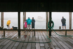 Fishing on Memorial WharfLike Oak Bluffs, Edgartown’s early history was rooted in religion – but in a different way. Rather than a gathering place for established religious movements, as in Oak Bluffs, Edgartown was settled in 1642 for the purpose of converting the Wampanoag Indians on the island to Christianity. Fortunately, unlike many examples of disastrous cultural clashes in the history of European settlements in North America, the relationship between the English settlers, under the leadership of the Reverend Thomas Mayhew, Jr., and the Wampanoags of Martha’s Vineyard was a peaceful one, characterized by mutual respect. In fact, when Mayhew was lost at sea 15 years after he had come to the island, the Wampanoag were so filled with grief that they made sacred the spot where he had said his last farewell to them. As a sign of their grief and respect, each time they passed this spot, they would place a stone on a cairn as a tribute to him. In 1901, the large cairn of stones was replaced by a single boulder with a bronze plaque, and a token small pile of stones cemented to its back. It is now known as “The Place on the Wayside” and it can be found along the airport road between Edgartown and West Tisbury.
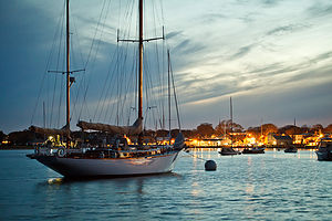 Edgartown Harbor at DuskI am embarrassed to say that after 30 years on the island, I have not seen this plaque, nor did I even know it existed until I began researching the history of Edgartown for this write-up. Once again, as with the story of “Boomer” in the State Forest, I have learned that research should happen before and not after travel to a place to get the most out of it.
A more obvious remnant of Edgartown’s past is the role it played in the whaling boom of the 1800s. You can’t walk very far in Edgartown without passing one of its many stately Captain’s Houses – always painted in white with black shutters – with their wraparound porches and oftentimes widow’s walk atop the roof. For years when the boys were little, our stroll along North Water Street always included gazing up at a lone female figure (stuffed I think) peering through a telescope, out across the Great Harbor in search of her man. Sadly, she is no longer there – maybe her Captain finally came home or maybe she just gave up trying. Sorry to be a spoil sport, but the real purpose of these “widow walks” was to allow residents to pour sand down their chimneys in the event of a chimney fire—much less romantic than the thought of anxious wives longing for the return of their loved one.
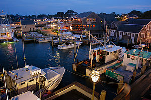 Night View from Memorial Wharf of Fishing BoatsI would have to say that one of the things I enjoy most about Martha’s Vineyard is just strolling along the narrow streets of Edgartown, enjoying its unique history, charm, and beauty. In addition to the fine views of the great harbor and lighthouse, there are dozens of elegant shops, art galleries, and restaurants to wile away a summer day – or better yet, a summer evening, the time of day that we generally like to come to town.
After an active day of beaching, fishing, or biking at one of the many prime locations around the island, we usually park the RV in the big lot by the Triangle and walk or bike the mile into town. We like this time of day because the lighting that occurs just before and right after sunset is really good for photography, another one of our favorite island pastimes.
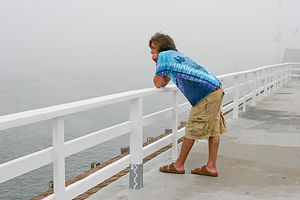 Andrew on Memorial Wharf DeckWe often start atop Memorial Wharf, where we can look out over the harbor and watch the boats return from a day of fishing – some for fun, and others to make a living. From here, one can watch the ever-faithful and ever-running On-Time Ferry, as it makes its way back and forth across the short distance to Chappaquiddick. When you get tired of looking out at the harbor, which is hard to do, you can just turn around and look out over the quaint and picturesque houses and shops of Edgartown. There is no bad direction to look.
Once we are done with the photography, and can afford to have sticky fingers, we head to one of Edgartown’s many ice cream shops to get a cone to accompany us on our walk through town. You need a couple of nights in Edgartown so that you can experience each of the three great ice cream establishments: Candy Bazaar, Scoops, and Mad Martha’s.
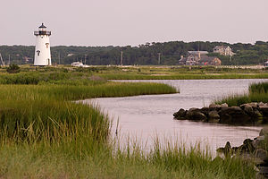 Edgartown Lighthouse from BeachOne of our favorite evening walks is to the Edgartown Lighthouse, which stands at the entrance to Edgartown Harbor and Katama Bay. The narrow path to get to it is located across from the Harbor View Hotel on North Water Street. There are no lights, so it is generally quite dark, and often a good place to immaturely scare your loved ones, which we have done on many occasions. My brother Jim had the misfortune of hiding in the bushes and jumping out on a group of strangers my mistake. They were not amused.
The original lighthouse was on a man-made granite island connected to the mainland by a wooden walkway, called the “Bridge of Sighs,” because it was often the place where men going off to sea on years-long whaling voyages parted with their families. Eventually the strong currents created a small barrier beach and sandy access strip that made the walkway unnecessary. The original lighthouse was destroyed by the Hurricane of 1938. In the following year, the white, cast-iron Essex Light in Ipswich, Massachusetts, was relocated to Edgartown to replace the one destroyed by the storm.
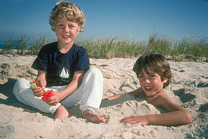 Boys on South BeachThe area around the lighthouse is called Lighthouse Beach, and it is a great place to come on a sunny day to just relax. It’s not as good for swimming as many of the other beaches on the island, but the views are hard to beat. You can just sit back and view the hustle and bustle of boats entering and leaving the harbor, the On-Time Ferry shuttling back and forth between Edgartown and Chappaquiddick, the captains’ houses along the Edgartown shoreline, the Chappy Beach Club, and “The Gut” at the tip of the Cape Poge Wildlife Refuge.
Although we usually have spent our time on the island in the RV or in a rental house, we have on occasion stayed at the Edgartown Inn, a wonderfully quaint and cozy inn on North Water Street with the most hospitable staff you ever want to meet. This Inn holds a very special place in our hearts because it is the site of two very important firsts for us. It was the place that we stayed on our very first trip to the island in 1980, and it was the place that we stayed on the first night of our honeymoon in 1985.
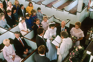 Lolo and Herb's Wedding at Federated ChurchThat brings me to the wedding. Herb and I loved the Vineyard so much that we thought it very appropriate that we begin our life-long journey together there – not to mention the fact that Herb realized the Striped Bass and Bluefish Derby would be going on the same time – ahh, romance.
The planning, even though most of it was done remotely, was quite easy. This was way before Martha’s Vineyard became “the” place to get married.” Nowadays, I am sure a Vineyard wedding requires years of planning, not the handful of phone calls I made (church, restaurant, florist, and band) that I did a few months in advance.
 Lolo the BrideHowever, no amount of planning can thwart the intentions of Mother Nature. As our wedding day (September 28) approached, we anxiously watched the Weather Channel track Hurricane Gloria’s progress up the East coast. Gloria was forecast to hit the island on Friday, the 27th. Knowing that there was a very strong possibility that the ferries would stop running, we made a quick decision. Herb and I, my parents, and Herb’s parents quickly threw our stuff together (including wedding gown) and started driving to Woods Hole Wednesday afternoon, fully knowing that the six of us might be the only attendees at the wedding. We literally caught the last ferry going over to the island that night – all ferries would possibly be canceled the next two days. The wind was already fiercely howling as we stepped out onto the deck. Hopefully, we were not making a foolish decision. But you have to keep in mind that Herb had struggled a bit with the “commitment” concept – we had already been dating 11 years – so I was not about to let a little Hurricane give him a way out.
The next day we went to the Navigator Restaurant in Edgartown to discuss the final plans for the reception, where we were told to come back the next morning if they were still standing. That was comforting. Workmen were boarding up the windows as we left. Okay, this was definitely going to be different than planned. Ironically, I actually found myself a lot less nervous about being a bride. Things were now totally out of our control.
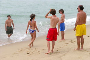 Lolo and Sons with Jim and Alex at South BeachWe went back to the condo we rented in the center of the island to weather out the storm. The wind howled all night and the rain came down, but the island was spared from any real damage – just a few trees down, but everything still standing. And an added bonus – the days following a hurricane are truly beautiful, as it seems to clear out everything and leave crystal clear blue skies behind.
Gloria wasn’t without its problems though and I give thanks and credit to our brave and determined friends, who had a difficult journey up I95 trying to find gas stations with power to pump gas. All but two of our guests made it to the wedding in time.
The wedding, if I must say so myself, was beautiful. The church service was held at the Federated Church on South Summer Street – a beautiful old whaling church with boxed pews and two aisles. I got to pick which one I walked down. The reception was held at the Navigator Restaurant at the end of Main Street, overlooking the harbor and the check-in point for the Bluefish Derby. Herb spent a good deal of the reception gazing down from the balcony at the fisherman bringing in their catch to be weighed. There was a beautiful Harvest Moon that night rising over the harbor. I would have to say that Gloria, who fortunately left early and did not attend the wedding, made the mood even more festive and celebratory.
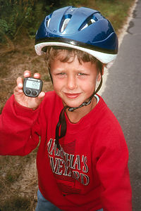 Tommy with first 100 bicycle mile Vineyard VacationOne other thing about holding a wedding in a beautiful place – you can’t get rid of your friends for the honeymoon, but that’s okay. Ours was spent with 11 of our closest friends, one of which got quite annoyed when her husband announced that this was the best honeymoon he had ever been on.
After our wedding, and right up until the time we bought the RV in 1999, each summer we rented a house for 2 weeks with my brother and his wife and other assorted friends – generally out by Katama (South Beach). Probably our favorite house, which we rented for about 7 years, was located on Katama Farm Road, adjacent to what was then Katama Farm (today it is the Farm Institute).
The island is actually very lucky to still have this huge piece of very prime real estate undeveloped. It almost wasn’t so. In the 70s, the farm was purchased by the Strock family, who planned to divide it into 700 buildable lots. Thankfully, Strock Enterprises went bankrupt and the development never took place. Eventually, conservation groups banded together to raise awareness and funds, resulting in the property being purchased by the town of Edgartown.
From the 1980s – 2005, the farm was leased to various tenant farmers, who attempted to make a profitable dairy farm. These were the years that we took the boys to see the cows and the pigs. Unfortunately, none of these farmers were able to make a go of it, and the farm became vacant and fell into disrepair. Fortunately, the farm is now run by the FARM Institute (TFI), who has lovingly restored barns, fields, and equipment.
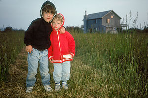 Boys on Farmland outside Tony's Rental HouseThe house at the edge of the farm, we affectionately called “Tony’s House,” because Tony was the gentleman that rented it to us each year, at what we later found out was a very good price. From there, we could walk to South Beach, although we generally drove because of too much beach paraphernalia. South Beach is probably the nicest public beach on the island for pure fun in the surf. Unlike the calm waters on the northern shore of the island, the waves here can be very fun. It does, however, get pretty crowded on a hot summer day.
Near the end of Katama Road, is the Edgartown Bay Road, where we also rented a house for several years. The views of Katama Bay along this road are very pretty. Over the years, we have used the scenic 2-mile loop as a place to run, bike, and even roller blade.
Along the Edgartown Bay Road is Town Launch, a public boat launch on Katama Bay, from which we have on many occasions launched a variety of watercraft – my brother’s Boston Whaler, our faithful blow-up boat, a windsurfer, and kayaks. From this point, you can cruise along Katama Bay, past some very beautiful homes, and into Edgartown Harbor, past the Chappy Ferry and onto the lighthouse. It’s one of my favorite cruises.
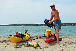 Herb loading Kayaks at Norton PointAs I mentioned in the Chappy write-up, 2012 was the first year that we had our new kayaks on the island, and we quickly found that it was really a great way to see new places or at least old places in a new way. We decided to launch our kayaks at Town Launch and paddle across Katama Bay to Norton Point to explore the breach that a 2007 storm made in the barrier beach that used to connect Edgartown to Chappy. The wave action in the opening between the bay and the ocean was definitely a bit intimidating – kind of like a washing machine – so we decided to stop just short of it and beach the kayaks and just lounge in the sun for awhile. There were some pretty strong currents, which we managed to ride a bit back into the main part of Katama Bay. It was a good maiden voyage for our kayaks – about 5 or 6 miles round trip, highly scenic, and not too strenuous. Probably the most strenuous part of the event was getting the kayaks back up onto the racks on top of the RV. I don’t know how Herb does it.
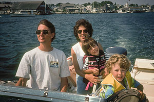 Family on Grady cruising Edgartown HarborDuring the years that we rented houses on the island, we often trailered our 20-foot Grady White to the island and kept it in a marina. The years we kept it at the Harborside Marina were fun, because we got to hang out at their pool and hot tub. We took so many wonderful expeditions on that boat: two circumnavigations of the island, numerous trips to Menemsha Pond and Lake Tashmoo, fishing trips out to “The Gut” and Wasque, and the lovely evening cocktail cruises around Katama Bay and Edgartown Harbor.
Our Katama houses were a perfect bike riding distance to town for the boys when they were growing up, and I can’t think of how many times we rode those 3 miles along the bike path with the promise of “Mrs. Miller’s muffins” or “ice cream” at the other end.
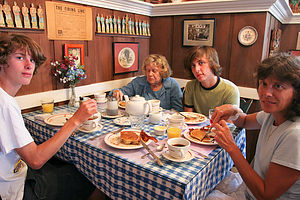 Family and Aggy at Edgartown Inn BreakfastOne of our favorite destinations was to have a classic Vineyard breakfast at the Edgartown Inn, where Herb and I spent our first honeymoon night and where my parents often stayed on their trips to the Vineyard. The best part of that breakfast for the boys was Henry, the waiter, who wore a bow tie and had plenty of tricks up his sleeve to entertain kids of all ages. Their personal favorite, which they never tired of, was the mustard trick. Henry would ask them if they wanted mustard – I am not sure why anyone would for breakfast. No matter how you answered, Henry would squeeze the bottle and mustard-colored yarn would shoot out dangerously close to your face. Henry was an icon at the Edgartown Inn up until the time he passed away a few years back.
Our bicycle trips to town often did not end in Edgartown. Charged up on food, we would ride our bikes onto the Chappy Ferry and peddle out to Dike Bridge or Wasque (see Chappaquiddick) – a pretty impressive distance for kids on heavy Toys R Us bikes. There were many vacations where they would put as much as 100 miles on their odometers.
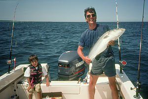 Herb with Boat Caught Striped BassAnother great bike ride that we have often enjoyed is the route from Edgartown, out past Cannonball Park and the Triangle, and onto the bike path along State Beach. The ride here is very pretty, with Sengekontacket Pond on one side and Nantucket Sound on the other. On summer days, the entire 2-mile strip is lined with cars parked bumper to bumper mostly with families to enjoy the calm waters of State Beach. There are two bridges along this road going over inlets connecting the Sound to the Pond. From one of these bridges, you will find dozens of kids of all ages perched atop the rail and then jumping off into the inlet. For movie buffs, this inlet might be familiar as the site of a shark attack in the movie Jaws.
Before the boys were in school, we usually came to the island in September or October, which was perfect – weather and water still warm, less crowds, and more fish. In fact, Fall is the best time of the year to catch blues and stripers, and timing of the annual Striped Bass and Bluefish Derby.
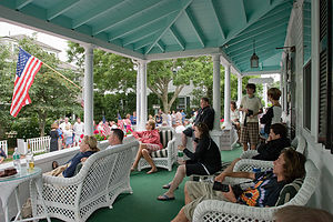 4th of July on Edgartown Inn PorchHowever, once the boys started school, we had to time our vacations with the rest of the crowds and come during the height of summer. There were some advantages to this as well – one of which was joining in on the 4th of July celebrations in Edgartown. I am usually not that big a fan of parades, but the Edgartown one is a classic Americana event. Since my parents often stayed at the Edgartown Inn during the celebration, we got to join them on the porch – one of the best vantage points in town – not to mention the warm chocolate chip cookies that Sandy, the host of the Inn, made for her guests.
There are the usual floats and marching bands, kilt-clad bagpipers, fire trucks, and veterans and flags as far as the eye can see. But this parade has one thing like no other – a giant inflatable rat, on par with Big Bird in the Macy’s Thanksgiving Day parade. Anyway, every year the same thing happens. Just as the rat inches its way past the cheering crowds on the Edgartown Inn porch, it gets caught in a low-hanging branch. This brings the entire parade to a halt. Then everyone cheers as the exterminator driving the float frantically tries to deflate it enough so that it can do a kind of limbo under the branch. It never gets old.
Neither does Edgartown. No matter how many times I come here, I will never tire of its charm.
Description
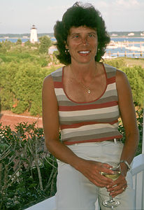 Lolo on Porch of Edgartown Rental HouseThe town of Edgartown is located on the eastern end of Martha’s Vineyard (referred to as “down island”), bordered by Nantucket Sound to the northeast and east and the Atlantic Ocean to the south. The small island of Chappaquiddick, which is technically part of the town of Edgartown, is separated from the town by Edgartown Harbor and Katama Bay. Transportation between the two is via the On-Time Ferry, which carries three cars across the harbor approximately every 5 minutes. Chappaquiddick will be described in more detail in a separate stop.
Like Oak Bluffs, Edgartown also has a very fascinating, but significantly different, history. Edgartown, which was originally named Great Harbor, was first settled by English settlers in 1642, when the Reverend Thomas Mayhew, Jr. brought a group of families to start a colony on the island after his father, Thomas Mayhew, purchased it for 40 pounds—significantly more than the Dutch paid for Manhattan. At the time, the island was inhabited by the Wampanoag Indians, a courteous and friendly tribe of Native Americans, who had lived on the island for centuries. Mayhew treated the Wampanoag with respect, even paying them for parcels of their land. He learned the Wampanoag language and traveled to Indian villages throughout the island, preaching Christianity. He opened the first school on the Island to teach English to the Wampanoags.
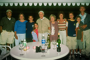 Kleins and Gaidus' on Porch of Edgartown RentalAfter 15 years of missionary work, Mayhew decided to visit England to report on his missionary progress and to bring back more teachers and books. He said farewell to his Wampanoag friends at a place near what is now the airport road between Edgartown and West Tisbury. His ship was lost at sea. As a sign of their grief and deep respect for Mayhew, his Wampanoag friends made the scene of his farewell a sacred place, known as “The Place on the Wayside,” where each passing Indian would place a stone on a cairn as a tribute to him. In 1901, the large cairn of stones was replaced by a single boulder with a bronze plaque, and a token small pile of stones cemented to its back. Today, there are still many Mayhews living on the island.
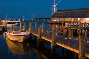 Edgartown Yacht Club at NightFor the following two centuries, Edgartown was primarily a place for farming, grazing, and fishing. Meanwhile, on the mainland and in Europe, the Industrial Revolution was creating a great demand for whale oil as a machine lubricant and a source of illumination. Edgartown’s location on a perfect harbor helped it become one of the primary ports for the whaling industry during the 1800s, and more than 100 Edgartown men were captains of whaling ships. The profits from successful whaling voyages were enormous, as can be seen by the elegant mansions these captains built. These Captains’ Houses are traditionally painted white, with black or very dark green shutters, and have long wraparound porches with sky-blue paint on the ceilings—which theoretically repelled the bugs. Many of these homes have ornate top floor rooms called widow’s walks, from which wives could look out over the harbor in search of their husbands returning from sea. While this might sound very romantic, the real purpose of these structures was to allow residents to pour sand down chimneys in the event of a chimney fire—much for mundane than the thought of anxious wives longing for the return of their loved one.
The thriving whaling industry came to an end in latter 1800s when oil and kerosene began replacing the need for whale oil.
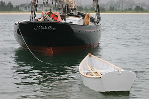 Dog on Sailboat Vela with DinghyToday, Edgartown’s source of livelihood is tourism, as thousands of mainlanders invade the island each summer to enjoy its unique history, charm, and beauty. One can wander for hours along the narrow streets of town enjoying the meticulously restored captains’ houses and views of the great harbor and lighthouse. In addition to the fine views, there are dozens of elegant shops, art galleries, and restaurants to occupy the crowds who flock to this up-scale town each summer. Or, just sit atop Memorial Wharf and watch the action, both in the town and out on the harbor.
Across the street from the Harbor View Hotel on North Water Street is a path leading to the Edgartown Lighthouse, marking the entrance to Edgartown Harbor and Katama Bay. The original lighthouse, which was built in 1828, was on a man-made granite island connected to the mainland by a wooden walkway. This walkway was called the “Bridge of Sighs,” because it was often the place where men going off to sea on years-long whaling voyages parted with their families.
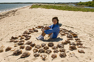 Horseshoe Crab Circle with LoloEventually the strong currents created a small barrier beach and sandy access strip that made the walkway unnecessary. The original lighthouse was destroyed by the Hurricane of 1938. In the following year, the white, cast-iron Essex Light in Ipswich, Massachusetts, was relocated to Edgartown to replace the one destroyed by the storm.
From the Lighthouse Beach, one can just sit back and view the hustle and bustle of boats entering and leaving the harbor, the On-Time Ferry’s shuttling back and forth between Edgartown and Chappaquiddick, the captains’ houses along the Edgartown shoreline, the Chappy Beach Club, and “The Gut” at the tip of the Cape Poge Wildlife Refuge.
Edgartown also shares a section of the Joseph A. Sylvia Beach (more commonly called State Beach) located along Nantucket Sound on the road connecting Oak Bluffs and Edgartown. This beach is described in a separate stop.
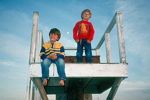 Boys on Lifeguard TowerFor a very different beach experience, head 3.5 miles south of town to South Beach at the end of Katama Road, either by car or along the paved bike path. Unlike many of the calmer beaches on the northern part of the island, Katama Beach is pounded by the crashing waves of the Atlantic Ocean. With the sun and the surf comes the crowds that you will be sure to find here on a sunny summer day.
Another way to explore Edgartown is by kayaking in Katama Bay. The boat launch is located on Edgartown Bay Road, a left turn off Katama Road, about 1.6 miles south of town. The bay is 3 miles long and 2.2 miles wide and generally quite shallow. Paddlers can weave in and out of the multitude of sailboats moored in the bay, while viewing the water-side of Edgartown’s grand mansions. The northern Chappaquiddick side is more bucolic. Norton Point Beach, the 2.5 mile barrier beach that sometimes connects Edgartown and Chappy, is located a short paddle across the bay. The only other way to reach this beach is by four-wheel drive (permit required) or a very long walk from South Beach. A storm in 2007 broke through this barrier beach making Chappy an Island again—at least for the time being.
There are 4 ½ public beaches (State Beach is shared with Oak Bluffs) in Edgartown:
- Katama (South Beach) – located 4 miles south of Edgartown at the end of Katama Road on the Atlantic Ocean
- Lighthouse Beach – located near the Edgartown lighthouse on Edgartown Harbor
- Fuller Street Beach – located at the end of Fuller Street near Lighthouse Beach
- Norton Point Beach – barrier beach between Katama Bay and the Atlantic Ocean, which was breached by a big storm. Accessible by four-wheel drive from South Beach.
- Joseph Sylvia State Beach (State Beach) – this beach is shared with Oak Bluffs (see Oak Bluffs description)
Kayaking opportunities:
- Katama Bay
- Eel Pond and Edgartown Outer Harbor
- lEdgartown Great Pond
Oak Bluffs
Wednesday, July 2, 2008 - 10:45am by Lolo0 miles and 0 hours from our last stop - 1 night stay
Travelogue
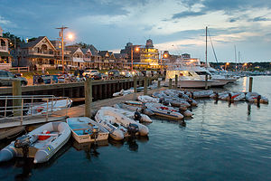 Oak Bluffs Marina WaterfrontLike Aquinnah with its Native American heritage and Edgartown with its heyday during the whaling days, Oak Bluffs also has a rich historical past, but one based on religion. I find this rather ironic, as today Oak Bluffs is the “party” town of the island.
Although Oak Bluffs was first settled in 1642, its rapid growth occurred after the summer of 1835 when Methodists began coming to the island to hold revivalist meetings. This was the period of the Second Great Awakening, a religious revival movement that preached personal salvation through highly emotional outdoor revival meetings. During that first summer in 1835, the Methodists pitched their tents under a large grove of oaks in what is now Trinity Park and established the Martha’s Vineyard Camp Meeting. Each summer they returned to do the same, with the groups getting gradually larger and larger, and the time spent on the island longer and longer. Gradually these tents were replaced with small Victorian-style cottages, which became known as “Gingerbread Cottages” because of their fanciful bright colors and ornate moldings. By 1880, 315 cottages had been built in a circular pattern around the original meeting area. A permanent structure called the Tabernacle, with seating for over 3,000 people, was built in the center to allow camp meetings to take place regardless of the weather. The town was incorporated as Cottage City.
 Andrew Photographing Gingerbread CottageI had been coming to the island – and Oak Bluffs -- for about 15 years before I first discovered this tiny city within a city. My excuse is that it is fairly well hidden and easily missed. The secret is to go through an alley between the stores on the western side of Circuit Avenue, or starting from the marina, go past the grand old Wesley Hotel into what is called the Martha’s Vineyard Camp Meeting Association, or just the “Campground”. It’s like you’ve entered a totally different world. But be careful not to get lost, because all the roads are in circles. I usually just pop out into the real world at random spots – sometimes Circuit Avenue, sometimes Lake Avenue near the marina.
These houses are adorable and can be rented as vacation homes. I keep telling Herb that I want to do that some day.
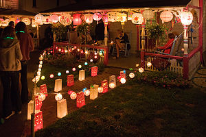 Cottage City Illumination NightDespite 30+ years of visiting the island, only once did our time here coincide with “The Grand Illumination,” the annual end-of-summer celebration held in the Campground each year on either the second or third Wednesday in August. This event has been taking place for over a century and is a definite must-do for anyone that loves this island. During the week leading up to the celebration, residents decorate their cottages with ornate Japanese and Chinese lanterns, each trying to outdo the next in their elaborateness. However, no one can light these lanterns until the appropriate time on Illumination Night. The evening begins with hundreds of people gathered in and around the Tabernacle for a very patriotic and inspiring sing-along band concert. At the end of the concert, anticipation builds as all the lights in the Tabernacle go out. Only then are the lanterns on the cottages dramatically “illuminated,” accompanied by the “oohs” and ahs” of an appreciative audience.
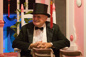 Man in Tux on Illumination NightThe celebration ends after visitors finish wandering through the Campground enjoying the magnificent display of lanterns. I am so envious of the people sitting in their rocking chairs on the porches of these adorable cottages. Renting one of these is now officially on my bucket list.
Before we discovered Cottage City, we came to Oak Bluffs with the boys when they were little primarily to let them ride the famous Flying Horses Carousel, the nation’s oldest continuously operating merry-go-round. The carousel was originally built in Coney Island, but moved to its current location in a red barn at the foot of Circuit Avenue in 1884. It really is a unique place and has even been designated a National Landmark. Each horse on the carousel is different and handcrafted with real horsehair and glass eyes.
 Andrew and Tommy riding Flying Horses CarouselWe have so many fond memories of this place. I think the boys rode these horses every year from their birth until they were in their teens. One time that particularly stands out in my mind occurred when Tommy was 2 years old. During this phase of his life, he had the odd habit of wanting to clutch an item in his hand – in a tiny death grip – and hold onto it for hours on end. One time, he chose to carry around a portable Latin dictionary for days – everyone thought he was gifted. On this particular vacation he chose a small children’s Tylenol bottle and carried it around for the entire week. We still have movies of him riding the carousel, stretching his little hand out to reach the brass ring, while simultaneously clutching his medication in the other. It was so embarrassing.
The other thing to dread is one of your children being lucky enough to grasp the brass ring and win a free ride, because “free” actually means having to pay for another ride for the other child who was not as fortunate. This can go on for quite a few “free” rides.
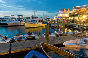 Oak Bluffs MarinaAs I mentioned before, Oak Bluffs is probably the liveliest town on the island. A walk along the docks by the harbor in summertime takes you past some pretty rowdy bars and restaurants. There are also numerous restaurants, shops, movie theaters, arcades, and bars along the main drag – Circuit Avenue.
Last summer, when Andrew and Celeste came to join us on the island for a weekend, we experienced another Vineyard first for us – which after 30 years is getting more and more difficult. We were having dinner at a microbrewery called the Offshore Ale Co. on Kennebec Avenue (one block over from Circuit Ave), when we began getting whiffs of some very incredible bakery smells. It was so good that we just had to ask our waitress where it was coming from. “Oh, Back Door Donuts has started their baking for tomorrow morning,” she said and pointed up the street.
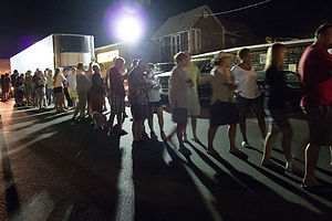 The Line for Back Door DonutsImmediately upon finishing our dinner, we followed the aroma of donuts up the street, only to find a line of people that stretched about a 100 yards through a parking lot and up to a small window in the back of a building. Without even thinking twice we got on the back of the line. Seeing that we were obvious newbies to this process, several people near us in line gave us some advice. We even ran into a neighbor from New Jersey about 6 people back, who comes and waits on this line each year when she comes to the island. I was a bit embarrassed that we had been coming to the island for so long, and never knew this was occurring each night in Oak Bluffs.
Apple fritters was the unanimous recommendation, so we decided that we would get four of them. As we slowly inched our way along the line, the continuous stream of tempting aromas did something to our brains that made us keep adding to our intended order. We were now up to four fritters and four donuts. Hopefully, this wouldn’t take too much longer or we would be adding cinnamon buns as well. When it was finally our turn, we were kind of nervous, fearing we would mess up our order and be denied our treats – “No fritter for you!” -- just like the “Soup Nazi” Seinfeld episode. But we managed to hold ourselves together and achieve the prize.
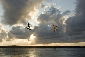 Kite Boarders on Sengekontacket PondWe didn’t even make it to the corner before diving in. While I must say, the donuts were really good, the apple fritters were incredible. A new Vineyard tradition had been born.
Oak Bluffs is also home to one of the two “Chops” on the northern part of the island. Many times we have parked in Oak Bluffs and gone for a run that includes circling the chop. The run is nice, gradually ascending from town to the top of a prominent bluff overlooking Nantucket Sound to the north and Vineyard Haven Harbor to the west. In fact, the bluff is the source of the name Oak Bluffs. There are no stores or businesses of any kind along the Chop, just very enviable, mid-1800 mansions with some really great views. At the very northern end of the Chop, atop Telegraph Hill, stands the East Chop Lighthouse, one of the island’s five.
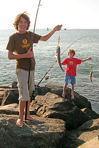 Boys catching fish from JettyThere are 3 (or more correctly 2 ½, as one is shared with Edgartown) public beaches in Oak Bluffs: Eastville Beach on the west side of East Chop, Town Beach to the east of the Steam Ship Authority dock, and Joseph Sylvia State Beach (or more popularly, just plain old State Beach) along the road to Edgartown. State Beach, by far, is the most popular one. It is very long and narrow, extending for two miles along the state highway that connects Oak Bluffs and Edgartown. The Nantucket Sound shoreline lies on one side of the road and Sengekontacket Pond on the other. During the summer, cars fill the parking lane that runs the length of the beach.
There is also a bike path that runs parallel to the road on the Pond side.
 Tommy jumping off Memorial BridgeThere are two bridges along this road going over inlets connecting the Sound to the Pond. On any summer day, you will find dozens of kids of all ages perched atop the rail of the American Legion Memorial Bridge, jumping off into the inlet. One summer we convinced the boys that doing so would make them true “islanders,” so they did. For movie buffs, this inlet might be familiar as the site of a shark attack in the movie Jaws.
Over the years, we have spent many days at State Beach. It is not necessarily my favorite beach in that it doesn’t have the surf that South Beach in Edgartown has, or the grandeur and beauty of Moshup Beach in Aquinnah, or the fishing to be found at Wasque on Chappaquiddick. However, it is a lovely beach and a good place for us to set up base camp with the RV. In the summer this means getting there early in the morning or waiting until late afternoon when most beachgoers have called it a day.
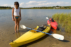 Lolo with boys kayaks on Sengekontacket PongAlthough we have parked along the road, we usually try to get a space in the small parking lot on the Oak Bluffs end of the beach. We back it in with our back window overlooking the Pond. There have been so many times that we have spent the evening here, cooking dinner and watching the sun set over the Pond.
There are a lot of things to do from here, besides just hanging on the beach. In past years, we have brought a windsurfer to the island and practiced in Sengekontacket Pond, where we couldn’t be blown off to Nantucket. The Pond is very pretty and shallow, and a perfect place to learn. It’s also a nice place to kayak, which we have also done on a few occasions.
This parking lot is also a perfect base camp to bike ride either into Edgartown or to Oak Bluffs. Edgartown is about a 4 mile ride from here and Oak Bluffs about 2. This way we can go to town in the evening and not worry about finding parking for the RV.
Description
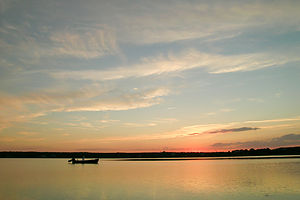 Sunset over Sengekontacket PondThe town of Oak Bluffs is located on the eastern chop on the northern shore of Martha’s Vineyard, with Nantucket Sound to its east and Vineyard Harbor to its west.
Its history is fascinating and probably the reason Martha’s Vineyard is such a popular vacation destination today. What is now Oak Bluffs was first settled in 1642 and functioned as a farming community for almost 200 years before Methodists came in the summer of 1835 to hold a revivalist meeting. This was the period of the Second Great Awakening, a religious revival movement that preached personal salvation through highly emotional outdoor revival meetings. During that first summer in 1835, the Methodists pitched their tents under a large grove of oaks in what is now Trinity Park and established the Martha’s Vineyard Camp Meeting. Each summer they returned to do the same, with the groups getting gradually larger and larger, and the time spent on the island longer and longer.
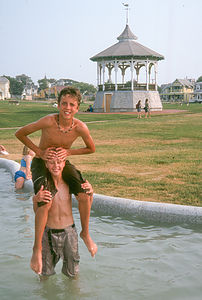 Boys playing in Ocean ParkBy the 1860s, the tents began being replaced by small Victorian-style cottages, built in a circular pattern around the meeting area and as close together as the tents they replaced. These cottages became known as Gingerbread Cottages because of their fanciful bright colors and ornate moldings, which made them appear as props in a fairytale. By 1880, 315 cottages had been built and the town was incorporated as Cottage City. A permanent structure called the Tabernacle, with seating for over 3,000 people, was built in the center to allow camp meetings to take place regardless of the weather. The Gingerbread Houses and Tabernacle are still there today, but as vacation homes and a community center.
 Andrew and Celeste dining in RV at State BeachAnother old tradition on the island dating back to 1868 is the Vineyard Haven Band, made up of a group of Civil War veterans (both Confederate and Union soldiers). In 1878, the Oak Bluffs gazebo in Ocean Park was built to serve as a bandstand for the Band. The gazebo is still used today for summer concerts.
In 1884, the Flying Horses Carousel was moved from Coney Island in New York to a red barn at the foot of Circuit Avenue in Cottage City. Constructed by Charles Dare, each horse is unique and handcrafted with real horsehair and glass eyes. Children (and adults) today still enjoy taking a ride on the carousel. It is the nation’s oldest continuously operating merry-go-round and has been designated a National Landmark.
 Circuit Ave CottagesIn 1907, to reflect the growing population and the changing face of the resort, the town’s name was changed from Cottage City to Oak Bluffs because the town was the site of an oak grove along the bluffs overlooking the Sound.
Today Oak Bluffs is a bustling resort town with lots of restaurants, inns, shops, movie theaters, arcades, and bars to enjoy live entertainment and dancing. Ironically, what once started as a place of prayer is now one of the liveliest towns on this otherwise very reserved island. Circuit Avenue is the main drag through town and where most of the action is.
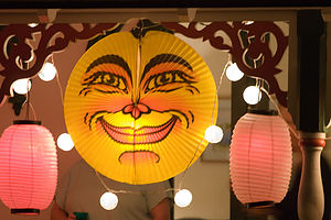 Illumination Night LanternOak Bluffs also operates the largest marina on the island. Situated in Oak Bluffs Harbor, this bustling marina is in walking distance to Circuit Avenue and the historical gingerbread houses in the Martha’s Vineyard Camp Meeting Association. There are also several pretty rowdy bars and restaurants located alongside the dock.
When in Oak Bluffs, be sure to take a stroll through the old Camp Meeting Grounds to see the gingerbread houses and the Tabernacle. Visitors to the Cottage Museum can view the interior of one of these cottages, complete with period furnishings, and learn more about the history of the Campground. In 2005, the grounds and buildings in the Campground were designated a National Historic Landmark.
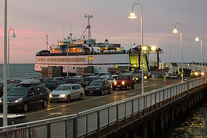 MV Ferry at Oak BluffsOn a Wednesday night in either the second or third week in August, the Campground is the site of “The Grand Illumination,” an annual end-of-summer celebration where residents decorate their cottages with ornate Japanese and Chinese lanterns, each trying to outdo the next in their elaborateness. The lanterns remain dark while people gather in the Tabernacle for a sing-along band concert. At the end of the concert, all the lights in the Tabernacle go out and then the lanterns on the cottages are dramatically “illuminated.” The celebration ends after visitors finish wandering through the Campground enjoying the magnificent display of lanterns. The Grand Illumination has been taking place for over a century. It was initially intended to mark the visit of the Governor of Massachusetts.
Another distinctive area in Oak Bluffs is East Chop, a residential area on a peninsula, surrounded by Nantucket Sound on the north and east and Vineyard Haven Harbor on the west. It features a high prominent bluff (hence the name Oak Bluffs), with mid-1800 mansions overlooking the Sound. East Chop Light, one of the island’s five lighthouses, stands on Telegraph Hill at the north end of the chop.
There are 2 ½ public beaches (State Beach is shared with Edgartown) in Oak Bluffs (all on the calm waters of Nantucket Sound):
- Eastville Beach – located at the bridge between Oak Bluffs and Vineyard Haven on the west side of East Chop
- Oak Bluffs Town Beach – located between the Steam Ship Authority dock and the first jetty towards Edgartown
- Joseph Sylvia State Beach (more often referred to as State Beach) - extends for two miles along the state highway connecting Oak Bluffs and Edgartown. The Nantucket Sound shoreline lies on one side of the road and Sengekontacket Pond on the other. The calm waters of the Sound and the Pond make this a very popular beach for families. Parking is available along the paved parking lane that runs the length of the beach. A paved bike path on the Pond side connects the towns of Edgartown and Oak Bluffs.
Kayaking opportunities:
- Sengekontacket Pond
- Lagoon Pond
Tisbury
Tuesday, July 1, 2008 - 10:45am by Lolo0 miles and 0 hours from our last stop - 1 night stay
Travelogue
 Lolo on early morning ferry from Woods HoleVineyard Haven (the name most people substitute for Tisbury) is the first place that most visitors to the island see. It is the major terminal for the Steamship Authority, which delivers thousands of visitors to the island each day on its fleet of large ferries. Ferries also run to Oak Bluffs and Edgartown, but most people come through this port.
Vineyard Haven is located on the northern shore of Martha’s Vineyard, with its harbor safely nestled between the West and East Chops. This deep protected harbor helped it become one of the busiest ports in early New England. In centuries past, it served as a popular port for vessels selling whale oil, candles, salt cod, and wool to customers in Europe and up and down the American coast. That deep maritime tradition is still readily apparent today by the wooden schooners anchored in the harbor. Vineyard Haven is home to one of the last wooden boat shipyards in America, where boats are still built with the tools used centuries ago.
 Small Craft on beach outside the Black Dog TavernThe opening of the Cape Cod Canal in 1914 and the increased usage of trains, trucks, and steamships to move cargo greatly reduced the number of ships using Vineyard Haven as a port. However, today the town is still hopping with activity as Vineyard Haven has shifted to importing a different kind of cargo – tourists.
My most vivid and personal memory of pulling into this wonderful harbor was 9:00 pm on the night of September 26, 1985, as we caught the last ferry from Woods Hole to the island before it shut down because of Hurricane Gloria. The reason we were so anxious to make the crossing was that Herb and I were getting married that Saturday in Edgartown. This was not the way I planned to arrive as a bride on the island. Instead of going up on Friday for our Saturday wedding as planned, we (meaning me and Herb, my parents, and his) raced up to get to Woods Hole on Thursday night before the ferries shut down. At this point we thought that the six of us might be the only attendees. The winds were already getting pretty fierce at 70 mph and the crossing was very rough, but we made it. Maybe we were foolish, but Herb and I had already been dating for 11 years, and I was not about to do anything that would jeopardize this long-awaited event. Well, we made it safely and so did many of our guests the following night, but that is a story to be told in the Edgartown stop.
 Herb holding up Black Dog Tavern Sign - LEGEnough wedding talk. Back to some of our memories and experiences in Vineyard Haven.
One of the sights you can see as your ferry arrives, if you know enough to look for it, is the iconic Black Dog Tavern, a restaurant probably more famous for its ubiquitous t-shirts than for its food – which by the way is wonderful. This is a place that we have been coming back to year after year for almost three decades. In the early days, we would come for dinner. The wait was always long, but that was okay. It was a BYO restaurant, and they would give you wine glasses while you waited outside by the beach. That became half the fun. In more recent years, we have discovered their wonderful breakfasts and lunches, which are a much better bargain compared to dinner.
We tend to spend most of our island time in Edgartown and Chappy, so I don’t know Vineyard Haven as well. However, we do have a few Vineyard Haven highlights from our annual trips.
 Murdick’s Run the Chop 5 Mile Race StartOne such highlight was our participation in our first island road race -- the Murdick’s Run the Chop 5 Mile Race in July of 2006. Murdick’s is the famous Fudge shop on the island. The boys were running track in high school at the time, and Herb and I have always been avid runners, so we thought it was about time we combined our love or running with our love of the Vineyard, plus my love of fudge. Unfortunately for Herb, his back was out, so he became the designated photographer. Also, Andrew had just gotten over a fever, but decided to run anyway, even though he was feeling a bit under the weather. It was great. I really felt like a local, gathering at the starting line with people that all seemed to know each other. And the run itself was a great way to see the Chop. There are some really beautiful houses overlooking the Sound. I run better when I am diverted and looking at nice scenery.
 Herring Creek Beach HousesWe had a very respectable finish – Andrew and Tommy took 1st and 2nd in their age class and I took first in the old lady category. At the awards ceremony, we were each handed a piece of paper that said “Congratulation - #1 Murdick’s Fudge.” Woopie, I thought. Murdick’s thinks we’re number 1. Then a light bulb went off in my head and I realized that # also meant pound, and we had just won 3 pounds of fudge. Now, we’re talking. Any weight I might have lost during the race was quickly replaced with our winnings.
Since that race, we have ridden our bikes around West Chop several times. It’s a very nice part of the island, but definitely feels more year-round than Edgartown and Oak Bluffs. It reminds me a bit of parts of the Cape. There is a great view out over the sound from the West Chop Lighthouse, which sits atop a 60-foot bluff overlooking the Sound.
 Lolo keeping Tommy's toes from Crabbies in Lake TashmooOn our route around the Chop, we often head west on Herring Creek Road to get to Lake Tashmoo. Herring Creek Road eventually turns to sand, but is still navigable by car or bike. At the very end of the road is a small channel, or I guess Herring Creek, where the ocean flows into the lake. One can choose to swim either on lifeguarded Herring Creek Beach on Vineyard Sound or in Lake Tashmoo.
In years past we used to cruise into Lake Tashmoo in our Grady White for an evening cocktail hour. It’s very shallow, so we used to anchor and walk to shore. When Tommy was little, he refused to even put his toe in this water because of the “crabbies.” I guess it is a good place for crabbing as are many of the other ponds on the island.
One time we even brought kayaks on top of our Suburban and paddled around the Lake to look at possible rental houses for the next summer. The problem was that we had two small kayaks and four people, or rather two adults and two small children. I definitely do not recommend paddling into the wind with a small, wiggling child in your lap. We were practically going backwards. Now that we have better kayaks and grown-up children, I would like to explore this lake a little more leisurely.
 Happy Campers at Martha's Vineyard Family CampgroundVineyard Haven is also home to the only campground on the island: the Martha’s Vineyard Family Campground located on the Edgartown-Vineyard Haven Road. It’s a pretty big campground and quite nice – very busy in the summer, so reservations are needed quite a bit in advance. Since we are kind of nomads on the island – moving the RV to a beach early in the morning and then returning late at night – we have spent very little time actually enjoying what really is a very lovely campground. At $58 a night for an RV site, it is not cheap, but it is still by far the biggest bargain on the island.
Description
 Family before Murdick's 5 Mile RaceTisbury, better known as Vineyard Haven, is the main port of entrance to Martha's Vineyard and often the first place that visitors to the island see. It is located on the northern shore of Martha’s Vineyard, bordered by Vineyard Sound to the north, Oak Bluffs to the east, and West Tisbury to the southwest. Its harbor, protected by the two headlands of West Chop and East Chop, serves as the major terminal for the Steamship Authority, which ferries visitors to the island from Woods Hole and New Bedford. It is the most year-round community on the island, with a population of about 3,700 people and a busy schedule of community events all year. Most of its stores and restaurants remain open during the winter.
Vineyard Haven has a deep maritime tradition. It served as a popular port for vessels selling whale oil, candles, salt cod, and wool to customers in Europe and up and down the American coast. It became one of early New England’s busiest ports, and sailors from around the world knew Martha’s Vineyard through the Seaman’s Bethel.
 Schooner sailing from deck of MV FerryAs a reminder of its maritime past, one of the first sights visitors to the island see as they approach Vineyard Haven are the schooners Shenandoah and Alabama anchored in the harbor. The village is also home to the Gannon and Benjamin Marine Railway, one of the few remaining wooden ship boatyards in America, where boats are still built with the tools used a century or two ago. Vineyard Haven Harbor is home to more wooden boats than any other harbor in America.
The town of Tisbury, which was first called Holmes Hole, was first incorporated within the Commonwealth of Massachusetts in 1671. In 1700 it was home to three families, but by 1780 it had already grown to a thriving port with 21 inns to welcome visitors to the island. By the mid 19th century, it was second only to the English Channel in number of ships stopping on their way to and from Europe, Africa, and the West Indies. However, in the 1900s, the number of vessels using Vineyard Haven as a port decreased as the usage of trains, trucks, and steamships to move cargo increased. Also, the opening of the Cape Cod Canal in 1914 provided a shortcut for ship traffic, diverting it away from Vineyard Sound.
 Lolo crossing road to Tisbury ShopsToday, tourism has replaced shipping as the island’s main industry, and Vineyard Haven has shifted to becoming a port for a different kind of cargo – tourists.
Today Main Street is lined with galleries, shops, restaurants, and coffee shops, and of course the famous Bunch of Grapes bookstore, where Bill and Hillary Clinton have done book signings and President Obama takes his family to purchase some summer reading. Two blocks away on Church Street, the Vineyard Playhouse provides a full calendar of live theater events throughout the year.
The Clintons and the Obamas are not the only famous visitors to Vineyard Haven, which has become a popular summer destination for the rich and famous, especially those with a literary or journalistic bent. Summer residents have included Carly Simon, Thornton Wilder, Dashiel Hammett, Lillian Hellman, William Styron, Mike Wallace, Art Buchwald, Diane Sawyer, and Mike Nichols.
 Lolo post breakfast at the Black Dog TavernEach July during the Tisbury Street Fair, Main Street is closed off and becomes a party scene, complete with bands, food, and bargains from the shops that line it.
Vineyard Haven is also home to the iconic Black Dog Tavern, famous for its good food and popular t-shirts sporting a black dog, which can be worn by people throughout the U.S.
The Main Street of Vineyard Haven lies at the base of West Chop, the Vineyard’s northernmost headlands, which juts out into Vineyard Sound with sweeping views of Cape Cod and the Elizabeth Islands. Atop a 60-foot bluff at the very tip of the headlands stands the West Chop lighthouse. The original wooden lighthouse built in 1817 was replaced by a brick structure in 1838. Due to erosion, it had to be moved back twice, once in 1848 and again in 1891.
 Lolo on pond off State RoadFor a different type of beach experience, head west on Herring Creek Road. After a bit, the road turns to sand but is still navigable by car or bike. Herring Creek Beach is the only spot on the island where ocean meets lake, and one can choose to swim in either the Vineyard Sound or Lake Tashmoo.
There are three public beaches in Vineyard Haven:
- Owen Park Beach – a harbor beach located just a short walk from downtown
- Vineyard Haven Harbor – narrow strip of land between the Black Dog Tavern and the Steamship Authority
- Herring Creek Beach – located on Lake Tashmoo and the Vineyard Sound at the end of Herring Creek Road
Kayaking opportunities:
- Lake Tashmoo
Tisbury is also home to the only campground on the island – the Martha’s Vineyard Family Campground, located just one and a half miles from the Vineyard Haven ferry terminal on the Edgartown-Vineyard Haven Road. The campground has spacious wooded sites as well as rustic cabins. Other amenities include modern restrooms with hot showers, laundromat, store, recreation hall and playground.
Hayward and flight Home
Monday, June 4, 2012 - 9:15am by Lolo172 miles and 3.5 hours from our last stop - 1 night stay
Travelogue
 Leaving Yosemite ValleyWe were barely outside the gates of Yosemite before it began to rain, making it a little bit easier to part. Our only objective for the remainder of the day was to find a place to stay in striking distance to San Francisco Airport, so as we got closer, I used Herb’s droid to search Kayak.com for hotels en route. I don’t know how people ever survived without smart phones.
We like the kayak app because it does all the searching of different travel sites for you and presents you with all the deals. Usually, I don’t book through the app, though I could, but just use it to get prices and phone numbers.
We found a good deal at a Days Inn in Hayward, about an hour from the airport. The neighborhood was a bit dicey, but the room was really great. We spent the evening sorting and packing for our early morning flight. The one problem with flying home is that you have to leave all the food, snacks, and wine behind. I am sure the maid was very happy the next morning to find all the goodies we left in the refrigerator.
Herb and I are still awed by the miracle of flight and the fact that we were back in New Jersey by early evening. Still, I did feel a bit guilty when I saw the RV sitting all alone in the backyard. Maybe next time.
Description
Quick stop on the eastern shore of San Francisco Bay within easy striking distance to the airport.
Yosemite Valley
Saturday, June 2, 2012 - 8:45am by Lolo75 miles and 2 hours from our last stop - 2 night stay
Travelogue
 Back of Half Dome from Tioga Pass RoadNo matter how many times I visit Yosemite, I will never cease to be awed. This year, Herb wanted to enter the park from the east and drive the 45-mile Tioga Road up over the pass and through Tuolemne Meadows before gradually descending towards the Valley. This route allows for a more gradual assimilation to the park’s grandeur, as opposed to the heart-stopping visual overload you get when emerging from the Wawona Tunnel in the west.
The 56-mile Tioga Road from the East Gate through Tuolemne Meadows to Crane Flat is a drive full of superlatives with the largest subalpine meadow in the Sierra Nevada providing a lovely setting for the greatest concentration of granite domes in the world. Then there are the incredible vistas, my favorite being the panoramic view from Olmsted Point, where we got our first glimpse of our old friend Half Dome—not the familiar iconic image seen from the valley floor, but of its less familiar rounded derriere.
 Yosemite Falls from Housekeeping Camp BridgeI was a little skeptical about our accommodations for the night. When we tried to book our stay a few days ago, the only thing available was Housekeeping Camp.
We have pretty much experienced every mode of habitation in Yosemite. From least to most luxurious – backpacking, tent camping, RV camping, Curry Village cabins, and my all time favorite, the Ahwahnee Hotel. Also, one hint: try to do them in this order, because once you are in the Ahwahnee, you are never going to want to leave.
So, this was going to be a new Yosemite experience. First let me say that the location of Housekeeping Camp is phenomenal – just a stone’s throw away from a nice sandy beach along the Merced River with terrific views of Yosemite Falls. The units (as they are romantically referred to) are pretty rustic. They consist of three concrete walls with the fourth wall being a canvas curtain that you can tie closed. The roof is canvas and extends out over a small patio area with a picnic table and a bear-proof food-storage box. Inside the “unit” is a bunk bed, double bed, small table, and a mirror. Linens for the bed are an extra $2.50 per night. Not exactly the Ahwahnee, but comfortable enough.
 Half Dome from Ahwahnee MeadowI was a little jealous when we took a walk through the Camp. So many of the other units were so cozily decorated, with cute little outside lights, lamps from home, nice quilts, etc. – so warm and homey. Ours had more of a prison cell feel . But in all fairness, we were not prepared for this. My goal was to stay outside as much as possible.
That evening Herb and I got a bottle of wine and some cheese and crackers and settled ourselves in the Ahwahnee Meadow to watch the sun set on Half Dome. Being seasoned veterans of sunsets in Yosemite, we knew enough to hang around after the granite face was in shadow, because the best was yet to come – the beautiful alpenglow that casts a reddish light on the previous darkened dome. I could watch this every night.
 Yosemite Falls and Merced RiverI also developed a new photographic technique, quite by accident. While trying to take a picture of Half Dome while lying on a blanket in the meadow, my knees got in the way. It is absolutely uncanny how much bare knees pressed together can look like butt cheeks. When I showed Herb my masterpiece, we laughed so hard it hurt. Maybe I was on to something – the next Ansel Adams.
A lovely evening in the meadow and a few glasses of wine helped make our Housekeeping unit seem a bit cozier.
The next day was a big one – the hike up to the top of Yosemite Falls. We had done this hike 26 years ago when we first came to Yosemite, but I think they made it higher and steeper since then. It is 7.2 miles RT and climbs over 2,700 feet.
 Lolo Hiking to Camp 4Yosemite Falls is the seventh highest waterfall in the world. If you count the lower falls as part of it, it would be the third largest. The falls drops 2,400 feet over the granite cliffs feeding the Merced River, which runs through the Valley. Late May is a particularly good time to do this hike because the snow melt is still keeping the falls roaring.
The trail begins next to Sunnyside Walk-in Campground (known to climbers as Camp 4), the rock climbers’ campground behind Yosemite Lodge. It’s interesting to just walk through this camp and see climbers from all over the world just hanging out or prepping to do some pretty incredible, or crazy depending on your viewpoint, stuff on the sheer rock walls. Every climber dreams of doing El Capitan or Half Dome, and Herb is one of them. He had been an avid climber in the 1980s, going to the Shawnagunks in New Paltz, NY, every Saturday for over 10 years. Then kids came along and that hobby got put on hold for awhile until they grew up to become his climbing partners. However today, all he had was me, and a pretty strenuous hike ahead of us.
 Half Dome from Yosemite Falls HikeThe first half mile of the hike climbs steeply along a series of over three dozen switchbacks through a dense pine forest. At the 1 mile point, there is a short spur trail to Columbia Rock, where there is a breathtaking, 180-degree view of Yosemite Valley from Half Dome in the east to the Cathedral Spires in the west. We met a nice couple here from North Carolina, who were in the process of negotiating whether to continue to the top or to call it a day. It really is a very strenuous hike, and Columbia Rock is a very noteworthy and respectable destination in itself.
In that one mile we had already climbed 1,000 feet in elevation. Herb had his altimeter watch on and I kept asking him every few minutes for our progress. I need constant reinforcement. We had still not gotten a glimpse of the waterfalls. In fact, our first indication that we were getting closer to the falls was by hearing it, before we rounded a bend and it finally came into view.
The last quarter mile before reaching the top is a serious of torturous, seemingly endless switchbacks. I was so happy to finally reach the top. My thighs were screaming. From the top, there was a short, but intimidating, series of steps cut into the rockface, which led down to the Yosemite Fall Overlook. This was a real white knuckler -- for me anyway -- as I clutched the guardrail and looked out over the steep drop below. From the overlook we looked down from above at the falls cascading over the edge.
 Yosemite Falls and Half DomeBack up the creepy stairs, we were on the surprisingly flat top of land above the falls. From there we crossed the footbridge over the creek and hiked another .8 miles to Yosemite Point (along the trail to North Dome). My 7.2 mile RT hike was quickly changing to an 8.8er. However, it was worth the extra steps, because besides another incredible panorama of the Valley, we had a great unobstructed view of the Lost Arrow Spire, a really unique rock spire rising from the valley floor. This too is another classic climbing route, but unfortunately we did not see any climbers on it today.
A well deserved break was needed, so we hiked back to the creek and then went upstream a bit to relax and have lunch. It would have been tempting to take a dip, but the thought of being swept over the edge of the falls kept me on dry land.
 Rainbow at Base of Yosemite FallsAs always, the hike down a steep trail is almost worse than the way up—much tougher on the knees. After much groaning, and asking Herb every five minutes for our progress on his altimeter, we once again reached Camp 4 and limped our way back to our car, which was parked across the meadow at Swinging Bridge – technically making my total mileage closer to 10. I was very exhausted and expected to be in much pain tomorrow.
Back at Housekeeping Camp, we hung out on the beach for awhile and took a refreshing dip in the river, which washed away much of the trail dust accumulated over the day. After a real shower back in camp, we headed out, equipped once again with wine and cheese, to enjoy our last night in Yosemite. Rather than watch the sun set over Half Dome again, we chose to give El Capitan, the other great monolith in the park, our respect. So, we settled in El Cap Meadow and watched the sun go down on the tiny, tiny climbers on the wall. Much to Herb’s amusement, I continued trying to perfect my new photographic technique.
Another lovely evening in the Valley.
We really were in no particular hurry to leave the next morning. The only thing we needed to do that day was to get to a motel near enough to San Francisco Airport to catch a flight home very early the next morning. So, we hung by the beach in the morning and then went over to the Ahwahnee Hotel for lunch.
 Lolo post lunch at the AhwahneeI love National Park Hotels, and the Ahwahnee is definitely one of its most beautiful. We have eaten here on each of our visits to Yosemite, so this would make 5. We usually like to have lunch here instead of dinner, because it is just as nice, but about half the price. The food is excellent, but quite honestly I wouldn’t care what they served me. I just love sitting in that beautiful dining room with its 34-foot-high floor-to-ceiling windows gazing out at the granite cliffs.
What a nice way to end another wonderful trip to Yosemite.
NOTE: About 8 weeks after we returned home, we received a letter from the Yosemite National Park Service informing us that we were one of the lucky visitors that had been staying in the park during an outbreak of the deadly rodent-borne hantavirus. Fortunately, for us, the cases were only linked to the tent cabins in Curry Village, not Housekeeping Camp. The CDC estimated that as many as 10,000 people could be at risk for the disease.
Description
 Yosemite FallsYosemite National Park lies near the eastern border of California in the heart of the Sierra Nevada Mountains. Its spectacular waterfalls, soaring granite cliffs, and lush meadows are just a few of the reasons it is considered by many to be nature’s ultimate masterpiece. In the words of John Muir, “it is surely the brightest and the best of all the Lord has built.”
This description will focus on Yosemite Valley, which is the section of the park we visited. Although the Yosemite Valley is just a small portion of Yosemite’s 761,268 acres, it is part receives 95% of its visitors. In fact, an estimated 4.1 million people visit the Valley each year, making it extremely crowded.
Two one-way roads traverse Yosemite Valley: the east-bound Southside Drive and the west-bound Northside Drive, which wind through woodlands and meadows along the base of the 3,000-foot-high granite cliffs. As of today, cars are still allowed to enter and drive through the valley, but visitors are highly encouraged to park their vehicles and use the park’s free shuttle bus, which stops at the major attractions in the valley.
Virtual Tour of Yosemite Valley Highlights
- As you enter the valley, the first sight you’ll see is the 620-foot Bridalveil Falls flowing down from a hanging valley to the valley floor. From the parking area, a short paved path leads to the base of the falls. This is one of the few falls in Yosemite that does not completely dry up in the summer.
- Just past the Bridalveil Fall parking area, the Southside Drive begins to trace the Merced River. Soon El Capitan comes fully into view. This 3,000 foot high granite cliff is the largest single piece of exposed granite in the world and one of the most famous landmarks in Yosemite. If you look closely, you might see small dots that are actually rock climbers along its face.
- Continuing east on the Southside Drive are two riverside picnic areas and beaches: Cathedral Beach and Sentinel Beach.
- Right after the Sentinel Beach parking area is the trailhead for the 4-Mile trail, which ascends more than 3,200 feet from the valley floor to Glacier Point and one of the most spectacular views of the valley.
- A short distance further is Swinging Bridge, another picnic and swimming area. This area is also the westernmost point of the 8-mile bicycle loop that goes through the eastern part of the valley. From this point on, the bike path parallels the road.
- Next stop is the picturesque tiny Yosemite Chapel where many outdoor enthusiasts choose to exchange wedding vows.
- Now you enter the congested and developed portion of the valley.
- Right past the chapel, you can either take a left onto Sentinel Bridge towards Yosemite Village and the park exit, or you can continue straight towards Curry Village, the campgrounds, and Happy Isles Nature Center. For now, let’s stop at Sentinel Bridge for what is probably the most spectacular Half Dome viewpoint in the park. It’s a great spot for a photograph of Half Dome with the Merced River in the foreground.
- Continuing east on the Southside Drive, you pass Housekeeping Camp and Curry Village. Curry Village has lodging, restaurants, bicycle and raft rentals, a grocery store, and other shops. Curry Village is also one of the main parking areas in the valley.
- From Curry Village you can either take Northside Drive across the Ahwahnee Bridge back to Yosemite Village and the park exit, or continue east to the campgrounds. The Happy Isles Nature Center is also this way, but only shuttle buses are allowed on the road to it.
- The Happy Isles Nature Center features exhibits on the natural history of the park. It also serves as the trailhead for some of the best hikes in Yosemite. 1.5 mile trail leads to the top of Vernal Falls and then continues another 1.5 miles to the top of Nevada Falls (two waterfalls that flow even in the summer time). From there you can continue even further into the backcountry of Yosemite, including the cable route up the back of Half Dome.
- From Curry Village, the Northside Drive crosses the Ahwahnee Meadow, a wonderful spot to gaze at Half Dome during sunset, and enters Yosemite Village, the main center of visitor services in the park. Here you’ll find the park’s main Visitor Center, restaurants, lodging, shops, a grocery store, a post office, a medical clinic, the Ansel Adams Gallery, an Indian Cultural Exhibit and more. It’s also a good place to park your car and jump on the shuttle.
- A short dead end road from Yosemite Village leads to the majestic old Ahwahnee Hotel, which has played host to Queen Elizabeth, President John F. Kennedy, and Clint Eastwood, to name a few. This beautiful six-story rock structure offers tremendous views from every room. Within the hotel is the elegant and quite expensive Ahwahnee Dining Room (jackets required for dinner).
- Back on the Northside Drive heading west from Yosemite Village, the next stop is the Yosemite Falls parking area. At 2,425 feet, Yosemite Falls is the highest waterfall in North America. It is actually three waterfalls in one, with an upper, middle and lower section. A short walk from the parking lot along a paved walk leads to the base of Lower Yosemite Falls. This is the most visited landmark in the valley. Except in summer when the fall temporarily dries up, you’ll be sure to be covered in spray.
- A little further west on the Northside Drive is Yosemite Lodge, which marks the end of the developed area of the park going west.
- Right after Yosemite Lodge is Sunnyside Campground/Camp 4, a place where most rock climbers choose to congregate. From this campground begins the popular and strenuous Yosemite Falls hike, which ascends 2,600 feet from the valley floor to the top of the Upper Falls. The views from the top are incredible.
- Continuing west, there is nothing but woods and meadows from which to enjoy the views. Along the road there are several pullouts where you can stop and walk down to the Merced River for a swim. Just after the El Capitan Bridge, you’ll come to the El Capitan Meadow where you’re sure to find people looking through binoculars at the miniscule rock climbers clinging to the granite face.
- Just to the west of El Capitan, Ribbon Falls plunges over 1,600 feet down to the valley floor. It is the seventh highest waterfall in the world. However, it too dries up in the summer time.
- Finally the road nears the end of the Northside Drive at Valley View where El Capitan, on the left, and Cathedral Rocks, on the right, frame a magnificent valley view.
Several guided bus tours are also available. The 2-hour Valley Floor Tour is a great way to get acclimated. Visitors ride through the valley in an open tram while a guide leads a informative discussion of Yosemite’s history and geology. There are many photo stops along the way. In addition, there are bus tours out of the valley to Glacier Point, the Mariposa Grove of sequoia trees, and Tuolumne Meadows.
Although much of Yosemite can be enjoyed from the comforts of your car or a shuttle, the best way to truly experience Yosemite is do get out and experience it more directly.
Things to do in Yosemite
- Hike one of the many trails around the valley, ranging from an easy walk to the base of Lower Yosemite Falls to the strenuous 16-mile round trip hike up the back of Half Dome via cables
- Take an overnight backpacking trip
- Bike along the 12 miles of bicycle paths that loop through the Valley. Rentals are available at Curry Village and Yosemite Lodge.
- Rock climb in one of the premier climbing places in the world
- Raft down the calm waters of the Merced River through the valley. Rentals are available at Curry Village.
- Swim or tube in the Merced River. Besides the designated beaches, there are many pullouts along the road from which you can walk down to the river.
- Join one of the many ranger walks, which are offered daily
- Take a free art class at the Yosemite Art and Education Center
- Photograph the amazing scenery of the valley and surrounding granite cliffs
- Browse the Ansel Adams Gallery and see some of the photographs that first made Yosemite famous
- Relax in the meadow while gazing up at Half Dome or El Capitan
- Dine at the 5-star Ahwahnee Hotel, where presidents and royalty have stayed
Although many try to see Yosemite in a day, it is best to devote several days to seeing all the park has to offer. Besides the numerous hotels, lodges, and cabins in the Valley, there are three RV campgrounds: Upper Pines (238 sites), Lower Pines (60 sites), and North Pines (81 sites). That’s less than 400 campsites to accommodate all the people that want to camp here.
Since these campgrounds usually fill-up within the first hour they become available, it is essential to make your reservations as soon as possible. Campground reservations are available in blocks of one month at a time, up to five months in advance, on the 15th of each month at 7 am Pacific time. For example, if your arrival date is July 15 through August 14, the first day you can make reservations is March 15. The National Park Reservation System can be found at www.recreation.gov. Good luck!
Mono Lake South Tufa State Reserve
Saturday, June 2, 2012 - 8:30am by Lolo109 miles and 2 hours from our last stop
Travelogue
 Mono Lake TufasAnyone visiting Yosemite, should definitely make the short side trip to see the surreal “tufa castles” of Mono Lake. We like them so much that we drove a lot of extra miles to enter Yosemite from the east entrance, just so we could visit them again.
One of the best places to see the tufas is at the Mono Lake Tufa State Reserve along the southern shoreline of the lake. You can get there by going south on 395 from the town of Lee Vining and then taking the turnoff for the State Reserve. From the parking lot, there is a mile-long loop trail that leads to a large concentration of tufa castles at Navy Beach.
 Lolo mit TufasAs I mentioned in an earlier stop, Mono Lake is in contention for being the oldest lake in North America, claiming to be over a million years old. The other lake in the running is Clear Lake. Whether it is the oldest or not, it is still extremely unique, because of the massive amounts of salt and minerals that flow into it from Sierra streams and have no way out except through evaporation—similar to the Great Salt lake in Utah. However, Mono Lake has something the Great Salt Lake doesn’t – “tufa castles,” which build up over thousands of years from the calcium-carbonate deposits accumulating in the lake. Normally they would just be hidden beneath the water, but as lake levels dropped, they became exposed, some of them rising as high as 30 feet above the surface—and they do look like castles.
Unlike our previous visit in 2007, I had absolutely no desire to swim with the tufas and get my body coated with salt and brine flies. There are some things in life that should be done once, and only once.
 Whoa Nellie’s Deli Buffalo Meatloaf & LoloOne of the reasons I had agreed to drive the extra 150 miles to enter Yosemite from the east rather than the west was that I wanted to eat at the Mobil gas station that Celeste’s father had recommended. I was intrigued. Technically, we were not exactly eating at a gas station, but at a deli called “Whoa Nellie’s Deli” that happened to be located inside the gas station’s main building, right near the East Gate into Yosemite. The place was packed. In addition to a few tables inside, there were several picnic tables outside overlooking Mono Lake.
The menu was quite exotic for a gas station. Herb had the Wild Buffalo Meatloaf, grilled cowboy style (how else would it be cooked??), and I had the “Legendary” Lobster Taquitos on a bed of Brazilian black beans. Very yummy and worth the extra miles.
Description
Mono Lake is located just off Highway 395 near the town of Lee Vining, California, 13 miles east of Yosemite National Park. Mono Lake is extremely unique. First of all, at over 1 million years of age, it is one of the oldest continuously existing lakes in the continent. Secondly, it is about 2 ½ times as salty as the sea and about 80 times as alkaline. This is because Sierra streams flow into Mono Lake bringing trace amounts of salts and minerals, but the lake has no outlet other than evaporation. As a result, the concentration levels of salts and minerals keeps growing each year. Thirdly, and the main reason Mono Lake is so popular, are the hundreds of spectacular “tufa towers” that rise from the lake. These intriguing calcium-carbonate sculptures were formed beneath the water when carbonates in the water combined with calcium from freshwater springs feeding into the lake. As lake levels dropped, these extraordinary-looking knobs, spires, and minarets became exposed. Most of the towers visible in the lake are from 200 to 900 years old and rise as high as 30 feet above the water.
A good place to start your visit is at the Mono Basin Scenic Area Visitor Center, located just off Highway 395, north of Lee Vining, where you will find exhibits about both the natural and human history of the Mono Basin.
One of the best places to view the tufas is at the Mono Lake Tufa State Reserve along the southern shoreline of the lake. The trailhead for the south tufa castles and Navy Beach is at the edge of the parking lot. During the summer, rangers lead walking tours 3 times a day (10am, 1pm, and 6pm), but if your not lucky enough to catch one of these, there are plenty of informative signboards along the trail. A short walk along the mile-long trail brings you to the strange and fanciful tufa castles at Navy Beach. A swim in the buoyant waters of Mono Lake is a memorable experience, as long as you are willing to step through the millions of harmless alkali flies that line the water’s edge. It’s fun to watch what at first looks like black sand part before you.
Surrounded by volcanic hills, Mono Lake is also a geologist's paradise. The two major islands in the lake are actually volcanic domes. The large black island, which the Kuzedika Indians named Negit, meaning “blue-winged goose,” erupted about 1700 years ago. The white island, which the Native Americans named Paoha, meaning “spirits of the mist,” erupted 250 years ago.
Bird watching and photography are other popular activities at Mono Lake.
Lake Tahoe
Friday, June 1, 2012 - 2:30pm by Lolo300 miles and 6 hours from our last stop - 1 night stay
Travelogue
Herb usually lets me make all the itinerary decisions, but this time he overruled me. I wanted to go directly towards Yosemite and stay somewhere nearby, so that we could have another full day there. Instead, Herb wanted to enter Yosemite via the eastern entrance, which meant a longer drive (by about 150 miles), but one that would include Lake Tahoe and Mono Lake. Since he usually asks for so little in terms of itinerary choices, I didn’t have the heart to fight him.
 Sunset at Lake TahoeSo, we had a pretty long day of driving ahead of us – 300 miles, but it was scenic and this was new turf for us. Just as we were starting to get hungry, we found a nice park to picnic in alongside a very large lake. This was not just any large lake we learned, but Clear Lake, the largest natural freshwater lake that lies entirely in California – I guess Tahoe loses out because part of it is in Nevada. Not only is it the largest California lake, but it is also believed to be one of the oldest lakes in North America, at 480,000 years old. This claim does not go undisputed, however, as other experts believe the title goes to Mono Lake. In either case, it was a lovely spot for lunch, and if it wasn’t the oldest, we would be visiting Mono Lake tomorrow, so either way, we had it covered.
We rolled into south Tahoe near dinner time and began the search for accommodations. Now, I have to say that although the lake is stunningly beautiful, south Tahoe was not my cup of tea—a bit too like Vegas or Reno. Not that I didn’t have a great time when we were in Vegas, it’s just that I like my natural beauty separate from my neon lights. I think to really appreciate Lake Tahoe, and it really is beautiful, you have to be out in it in a boat, a kayak, a paddle board, or whatever, but just to be away from the commercialism along the south shore.
 El Dorado Beach ArtworkWe found a Super 8 with a hot tub within walking distances to lots of restaurants and then headed down to El Dorado Beach, a nice public beach near the end of the strip where we could have a glass of wine and watch the sunset over the lake. Afterwards, we walked from our hotel to a brewpub called the Brewery at Lake Tahoe and had a nice dinner on the outdoor patio.
Back at the motel, I asked Herb for the keys to get something out of the trunk. A little while later, I asked him for the keys again because I had forgotten something else. By this time he was half asleep and beginning to get a little annoyed with me. “You never gave them back to me,” he mumbled, so I began searching the room to find where I had left them. That is when I had a vision flash through my mind of a set of keys lying on top of a cooler. Unfortunately, the cooler I was envisioning was locked inside the trunk of our rental car. “Uh oh.” Needless to say, Herb was not pleased.
I was in a total panic. I really, really wanted to get to Yosemite tomorrow. Every time we try to go there, something happens the day before. Last time in 2007, we lost our brakes coming out of Death Valley and Herb had to replace the brake lines in Lone Pine. Granted, this wasn’t as bad, but it definitely was not good.
In a panic, I ran down to the office, told the girl behind the desk what I had done, and asked for the number of the local police. She calmly told me that she had done the same thing a week ago, and had called AAA for help. Why didn’t I think of that? We were members of AAA. They were great. I called them and they were there within a half hour. I’m sure this guy’s previous job was car thief, because he got into that car in less than 5 minutes. I wanted to hug him.
I went back into our room, very proud that I solved the problem myself, but Herb was already asleep and just grunted.
Description
I am not even going to attempt to give a full description of what Lake Tahoe has to offer, as we only spent one evening along its southern shore.
However, briefly, Lake Tahoe is one of the highest elevation lakes (6,255 feet high) in the U.S., as well as the second deepest (1,645 feet deep) – Crater Lake is the deepest. It is located along the border between California and Nevada. The four shores of the lake are each quite different. The north is quiet and upscale, the west and east are more rugged and less developed, and the south shore is busy and tacky with neon-lit hotels and casinos. The 72-mile drive around the lake is very scenic.
Lake Tahoe is known for its clear blue and green waters and the panorama of mountains that surround it on all sides. It is a year-round destination with swimming, boating, kayaking, and various other kinds of water sports during the summer; hiking, backpacking, and camping all year round; and tremendous skiing and snowboarding in the winter.
Mendocino
Thursday, May 31, 2012 - 1:00pm by Lolo124 miles and 3 hours from our last stop - 1 night stay
Travelogue
 Russian River Harbor SealsAfter leaving Armstrong Redwoods, we continued west to the coastal town of Jenner, perched high on a hill overlooking the Pacific Ocean and the mouth of the Russian River. Right near the mouth of the river were dozens of adorable harbor-seal pups that were just born that spring.
The drive north from Jenner to Mendocino on the Pacific Coast Highway (Route 1) had to be one of the most beautiful stretches of highway I have ever been on. The only other stop we made before reaching Mendocino was the Point Arena Lighthouse, where once again the views from the headland were lovely. We even found a geocache there while enjoying the view. For a full explanation on what geocaching is, check out www.geocaching.com.
 Point Arena LighthouseOur plan was to spend the night somewhere in the Mendocino / Fort Bragg area. Celeste’s parents had highly recommended Mendocino as a charming, romantic destination. We almost let our frugality guide us to finding a place in less-expensive Fort Bragg, but cooler and wiser heads prevailed and we found an absolutely fantastic (and reasonable) bed and breakfast called the Didjeridoo Dreamtime Inn.
It was definitely the right thing to do, even though I had no idea at the time what a didjeridoo actually was. I probably should have found out first before signing up, but Herb filled me in later. It’s an Aboriginal musical instrument made from a long hollowed out piece of wood -- like a very long tube. When you blow into it, it produces a drone of really deep resonant tones. Well that explained the “what,” but only the innkeeper could explain the “why” for the name of the inn, so we asked him. I felt bad that I did, because it was a break-up story. I shouldn’t have been so nosy. His ex-girlfriend and partner at the inn used to play one. She had left him, but the name remained. I guess we wouldn’t be hearing any didjeridoo playing that night.
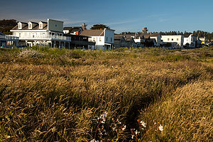 Mendocino TownWe felt so at home in Mendocino. Our normal stomping grounds are New England, and this charming village definitely had a New England feel with its saltbox houses, gingerbread mansions, white-picket fences, rose gardens, and water towers. We later learned that this similarity was not just a coincidence. Mendocino was originally settled in the 1850s by homesick New Englanders lured west by the logging boom. After the timber mills shut down in the 1930s, the town fell into disrepair for awhile before being rediscovered in the 1950s by artists and bohemians. Today, it is still a great escape where cell phone coverage is non-existent and fast food chains are nowhere to be found.
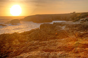 Mendocino Headlands SunsetThe evening was so lovely that we just couldn’t see ourselves spending it indoors in a restaurant, so despite the visitor center’s aggressive push to utilize their fine dining coupons, we instead chose to buy a bottle of wine and some delicious sandwiches and picnic out on the headlands, an easy walk from our inn. We couldn’t have made a better choice. Fortunately, we got there early enough before sunset to get the premier bench atop the cliffs, and were even fortunate enough to be serenaded by a young woman who sat nearby playing a stringed instrument in her lap—I think it might have been a dulcimer. It couldn’t get much better.
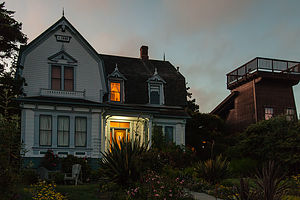 Didjeridoo Dreamtime Inn at DuskBut better it did get. The next morning we awoke to the smells of breakfast wafting up the stairs. Now, we don’t stay in inns and motels much because of the RV, but my past experiences of “continental breakfasts” consisted of cheerios from a big plastic dispenser, supermarket bagels, and those little cream cheese and jelly packages. What we were about to experience was not of the same species.
This innkeeper was really something. That morning, we, and the other fortunate guests of the inn, were treated to one of the most delicious breakfasts I have ever had: scrambled eggs with bell peppers, candied pecan bacon, and Orange-Maple French Toast. I don’t know why his girlfriend ever left him.
Another walk out on the headlands, where the early morning sunlight was perfect, completed our wonderful stay in Mendocino.
Description
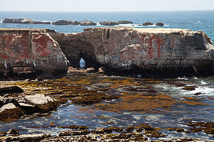 Point Arena HeadlandsMendocino is a charming and picturesque hamlet of 1,100 residents along the Pacific Coast Highway (Route 1), about 170 miles north of San Francisco. Built by homesick New Englanders during the logging boom of the 1850s, the town resembles a New England village with Victorian gingerbread mansions, white picket fences, and rose gardens. The logging days are long gone, and today the town if full of upscale Bed and Breakfasts, shops, and restaurants.
The spectacular Mendocino Headlands State Park surrounds the village, with trails crisscrossing the bluffs and rocky coves.
Sebastopol and Side Trips through Sonoma and Marin County
Friday, May 25, 2012 - 2:45pm by Lolo332 miles and 6 hours from our last stop - 6 night stay
Travelogue
Today was pretty much a driving day. The GPS predicted about 5 ½ hours to get to Celeste’s house in Sebastopol, but since it was the Friday of Memorial Day weekend, we wanted to make sure we were nowhere near the city during rush hour. So, we took our time with the goal of waiting until after dinner to get through the congestion around San Francisco.
 Altamont Pass Windmills - AJGOur first stop after leaving Kings Canyon was at (according to the boys) a classic California fast food establishment – In-N-Out Burgers, known for their delicious and very high quality burgers. It lived up to its reputation, and we had some laughs comparing these burgers to the ones we had been begrudgingly served at the Kings Canyon Lodge just two days ago. Wow! Could it only have been two days. It felt like a week ago. Time certainly takes on a different dimension when it is filled with so many different experiences and activities.
The next form of family entertainment was trying to find the cheapest gas by using the Gas Buddy app on Herb’s phone. We successfully navigated ourselves off the highway to a station with prices that would have shocked us in New Jersey, but were inexpensive by California standards. However, I then forgot to reset the destination on the GPS to Sebastopol, so every time Herb got near the highway, it kept telling us to make a U- turn. By the third time we passed our gas station, with Herb getting more and more frustrated (to put it mildly), and the boys getting more and more amused, I finally realized my mistake. GPS’s are only as good as what you tell them—garbage in, garbage out—so I quickly reset our destination to Sebastopol, and it let us get on the highway without further squawking.
 Lolo and Herb at Annadel State ParkOut route along I-580 took us past a scene I always love on our trips to California – the seemingly endless landscape of windmills perched atop the rolling hills of Altamont Pass. I remember being impressed with this sight over 25 years ago when Herb and I made our first trip to Yosemite. With no place to pull over, Andrew, who had the best positioning in the car, was given the task of getting some highway speed photos. He did not disappoint.
As we approached Oakland, we decided to stop at a Trader Joe’s along route to find some goodies for a picnic as well as not to arrive at Celeste’s house empty handed. Hesitant to select wines for a family of wine connoisseurs living in Sonoma Valley, we shrewdly chose some interesting beers instead.
Just past the San Francisco Oakland Bay Bridge, we found a little park overlooking the Bay, called Point Emery--nothing much to it—just a piece of land jutting out into the Bay. Despite the chilly temperatures, we perched ourselves on a log on the small beach, enjoying our salads and sandwiches, and the great views of the Oakland Bay Bridge. Herb and I even managed to find a hidden geocache in the park.
Having successfully waited out the Memorial Day rush hour, we arrived in Sebastopol without any traffic hassles. The next five days were to give us a taste of what life is like Northern California. Let me give you a little preview: pretty darn good.
Day 1 – Annadel State Park and Willow Creek
 Willow Creek PicnicWe tend to think of our family as pretty active, but we definitely met our match with Celeste’s folks. Our first day together began with an early morning trip to nearby Annadel State Park, on the eastern edge of Santa Rosa, where there are miles of trails for hiking, mountain biking, horseback riding, and trail running. Andrew, Tommy, Celeste, and Paul set off for a run, while Herb, Hilda, and I hiked and enjoyed the lovely scenery.
To reward ourselves for our efforts, we stopped in town at Screaming Mimi’s, Sebastopol’s finest ice cream, and the place where Celeste had worked for several summers. Like everything in Sonoma Country, this place took its ice cream making seriously and we were treated to a decadent post-exercise treat. Food was definitely going to be an important part of this trip. Thankfully, we never sat still long enough for the calories to find a permanent home.
 Willow Creek MeadowAfter lunch and a brief rest back at the house, we set off for our second hike of the day at Willows Creek, a spectacular 3,373-acre “community-powered” park near Duncans Mill. What “community-powered” means is that stewardship and maintenance of the park is done by community volunteers, in conjunction with a non-profit organization called LandPaths. Without their efforts, this land would be neglected because of the State Parks budget crunch. In return, the land is accessible by permit only to those that work as stewards. Fortunately for us, Celeste’s dad was one of those stewards, which meant that we would get a chance to have this beautiful park practically to ourselves.
We left the house armed with wine and cheese – after all, this is California -- and made a stop to pick up what had to be the best bread I have ever had at Wild Flour Breads in the town of Freestone. All their breads are made in a wood-fired brick oven, which gives great flavoring and especially hard crusts. My palate was definitely being spoiled on this trip and would most likely mutiny when we returned home to my cooking.
 Hiking Willow CreekThe staff in Wild Flour had to be the happiest workers I have ever seen -- they danced, they smiled, they chatted with customers. They genuinely looked like they loved their jobs. There was such a variety of breads and scones that it was difficult making a choice. We deferred to Paul and Hilda, who selected a wonderful sampling. It was hard keeping the kids’ hands out of the bag—after all, this bread was meant to go with our wine and cheese picnic later.
Armed with wine, cheese, and now bread, we arrived at Willow Creek and set off on our hike up a fairly steep hill to a beautiful hilltop overlooking the sea. The wind was so strong that we tried to find a sheltered place to enjoy our feast. Since we basically had the whole place to ourselves, we finally decided to just set our picnic blanket down on the narrow path in a slightly protected section. Eventually some fellow hikers came our way and being quite amused by our selection of a picnic site, volunteered to take our picture. We remained until there was not a crumb or a sip left, and then headed back down the hill to return to Sebastopol.
It was a very full and rewarding day, culminating in the culinary magic that comes out of Celeste’s kitchen each night, followed by some very competitive Trivial Pursuits.
Day 2 – Sebastopol Farmers Market, Junk-Art Sculptures, and Run at Ragle Ranch Regional Park
 Sebastopol Farmers Market - TJGThe next morning we arose to another beautiful sunny day, something that is apparently a given during the summer time in Sebastopol. I would have been content to just lie in the sun on their lovely backyard patio, but alas, that was not to be. This was Sunday, and Sunday in Sebastopol means the Farmers Market in the Plaza, where the whole town congregates to enjoy delicious fresh regional food, live music, and dancing.
After lunch, Celeste took us for a walk to nearby Florence Street for a real treat. Practically every other house on the street had a whimsical, cartoon-like junk-art sculpture on their front lawn. They were hysterical. For example, there was a baseball player made from an aircraft fuel tank, air compressor, and painted scrap metal and a mermaid with applesauce can lids for scales.
 Mom with Florence Street Sculptures - TJGI later read the story behind these sculptures. They were all done by Patrick Amiot, who moved to Sebastopol about a decade ago. One of his first acts was to place a 14-foot-tall fisherman made of recycled metal on his front lawn. In case it wasn’t obvious enough, it was painted in vivid bright colors by his wife, Brigitte Laurent. Rather than the outraged complaints he expected from his neighbors, he received nothing but compliments and requests for his artwork. Today there are over 200 of his wacky, found-object works scattered throughout Sebastopol.
My only regret was that Herb missed out on the Farmers Market and the sculptures, but when we returned, it certainly didn’t seem like he had suffered very much.
We all went for a calorie-burning run at nearby Ragle Ranch Regional Park to make room for another delicious dinner that night.
Day 3 – Mill Valley, Stinson Beach, and Point Reyes Elk Refuge
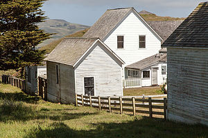 Ranch Buildings at Point Reyes National SeashoreThis morning’s activity was a drive to the beautiful Marin County town of Mill Valley to run and/or hike a portion of the famous Dipsea Trail -- the site of the oldest trail race in America, having first been run in 1905. As is probably obvious, running is a very important part of our day—coming in second only to fine dining. It’s a great counterbalance of activities—input calories, output calories, input calories, output calories, etc., etc.
The reason we chose this particular run for the day was that in just two weeks Paul (Celeste’s dad) would be running the famous Dipsea Race, a significant honor that must be earned through past performances, and he wanted to get some practice on the course. Celeste and the boys wanted to run a portion of this classic trail as well. The race course begins in Mill Valley and immediately climbs up a steep set of steps (676 in all) and trails over Mt. Tamalpais before eventually making the long descent to Stinson Beach, 7.4 miles away. It is one of the most grueling and treacherous races in the country, but also one of the most beautiful.
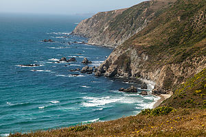 Tomales Point Trail Ocean ViewHerb, Hilda, and I chose to hike instead. We too asscended the steep stairs, admiring the redwood trees and elegant homes perched like treehouses on the southern slope of Mt. Tamalpais. What a beautiful place to live. I am sure the prices must be reasonable. Having time to kill before the rest came back from their run, we went back to the center of town, watched a bit of the Memorial Day parade, and bought some very tasty sandwiches for a picnic later. Then we waited near the bottom of the trail for the runners’ return.
When they returned, they informed us of a slight mishap. The trail is a bit confusing, so at one point when they didn’t realize that Celeste was a bit behind, they turned one way and she turned the other, continuing along her merry way thinking they were just ahead. When they realized she was missing, Andrew went into a panic and frantically ran back to find her, which he did before she even realized she was lost. Happily reunited, they all returned together down the stepped trail. I must say they were very happy to learn that we had taken the initiative to buy lunch, which we planned to eat soon at Stinson Beach.
 Andrew and Celeste on TrailAfter Mill Valley, we drove the very winding, but highly scenic, Panoramic Highway through Mt. Tamalpais State Park and down to Stinson Beach. While the Dipsea Trail between Mill Valley and Stinson Beach is 7.4 miles, the drive was closer to 11.
By now the day had gotten quite overcast and cool, but regardless, the parking lot at Stinson Beach was still packed. Now I like the beach as much, if not more, than the next person, but these people romping around on the beach seemed to have no clue to the fact that it was really chilly and there was no sun! And, I know how California water temperatures compare to the Jersey shore too, and it’s not good. Not wanting to be weenies in a crowd of fun-loving, beach goers, we bundled up and squeezed next to each other (for body heat) on a log to have our picnic lunch.
 Horses on Tomales Point TrailBy now, we had already had what normal people would view as a full day, but ours was just getting warmed up. Our next stop was the breathtaking Point Reyes National Seashore, a bit further up the coast along Route 1. Our destination within the park was the Tomales Point Trail through the Tule Elk Reserve at the northern end of the park.
The trail begins at the western edge of the parking lot near a grouping of historic ranch buildings and then quickly veers north through a grove of cypress trees before giving way to a sparse mix of grass, coyote brush, and yellow bush lupine. From this point on, the trail is very open with expansive views in all directions. After about a mile of fairly level hiking, we began the descent to Windy Gap where the elk herds like to graze at a nearby a spring. Sure enough, they were there waiting for us. Fortunately, or unfortunately, depending on what you are looking for, this was not rutting season, so the elk appeared quite placid.
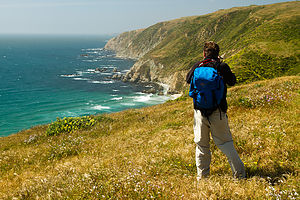 Dad Photographing Point Reyes Seashore - TJGFrom here, the trail begins a moderate ascent to the wind-swept ridgeline overlooking Tomales Bay to the east, Bodega Bay to the north, and the Pacific Ocean to the west. The total distance to Tomales Point is 4.7 miles, but since it was already after 5:00, and we hadn’t even showered since our run on the Dipsea Trail that morning, which seemed like days rather than hours ago, we unanimously chose to turnaround at a rocky outcrop just ahead and retrace our steps back to the trailhead.
What a great day and an exhausting one. Dinner and a fine Sonoma Valley wine back at the house sounded like a really, really good idea.
Day 4 – Bodega Bay, Wineries, and Healdsburg
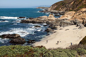 Salmon Creek Beach - Bodega BayBefore we left for this trip, I purchased a Lonely Planet Guide to Northern California and made a list of places I would most like to see, not thinking that we would be able to cover them all in such a short timeframe. Well, thanks to Celeste’s parents, we were checking off the stops on my list as well as adding plenty more that we would never have known about without local knowledge.
This morning’s agenda included a drive to Bodega Bay and a hike along the headlands of Bodega Head. This is just one of a series of beaches that are part of the Sonoma Coast State Beach system, which stretches for 17 miles north along the coast. Most of the beaches are tucked away in rocky sandy coves separated by rocky headlands, but are connected by coastal hiking trails that wind along the top of the bluffs.
 Bodega Bay Whale Watching - AJGI must say, that California beaches are very different from those we are used to in New Jersey and New England. The east coast beaches are beautiful, but with their warm temperatures, the main attraction is playing in them. Not being warm enough to flop around in the surf, the northern California beaches have to rely on their good looks, and I have to say, they are absolutely stunning.
Our hike, which began at the Salmon Creek Beach parking lot, was a 2 to 3 mile loop atop a bluff. The terrain was mostly wind-swept grassland with sea fig, and purple and yellow bush lupine. The colors and textures of the vegetation were a perfect foreground for the dramatic pounding of the surf against the rocky shoreline below. It had to be one of the most beautiful places I have ever seen. We also saw lots of seals basking in the sun on a rock about a ½ mile off the coast.
 Bodega Bay Hike DescentBesides its stunning beauty, Bodega Bay has another claim to fame as being the location for the filming of Alfred Hitchcock’s 1963 thriller “The Birds.” As we drove through the village, we noticed a life-size statue of the man himself outside a store, and made sure to stop at the Bodega Bay Church, which is quite recognizable for anyone that has seen the move as the place where the school children sought refuge from the attacking birds.
Later that day we set off for the quintessential Sonoma Valley experience – wine tasting at one (or as it turned out, two) of its many wineries. Celeste’s parents had asked us if we would prefer to go to Napa Valley, but since they lived in Sonoma and the wineries there were more casual and less touristy, we chose to stay in Sonoma Valley.
The first winery we visited was Hop Kiln, located on Westside Road in Healdsburg. While I found the wines average, the grounds were beautiful and the historical old brewery served as a great background for family photos.
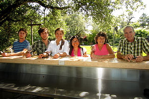 Gang at Arista WineryOur next stop was Arista Winery, also on Westside Road in Healdsburg, which we found much better both in terms of quality of wine and the grounds. They allowed us to leave the tasting room with our final wine selection to stroll through their lovely Japanese Garden. It was a beautiful afternoon, and what I thought were tiny amounts of wine in very big wine glasses were beginning to take effect. I am embarrassed to say that one of the memorable highlights from this winery was their bathroom. The tiling and original artwork rivaled that of a country chateau.
I was feeling a little bad for Tommy at this point. It must have been quite boring for a 20-year-old (and hence the designated driver) watch his parents and older brother pretend they knew what they were doing at a wine tasting. However, as always, he was a very good sport.
 Photogenic Old Barn - TJGThe day just kept getting better and better. After the wineries, we stopped in the charming town of Healdsburg where we happened upon their Tuesday Concerts in the Plaza. It was quite the scene—lively music, people dancing in the plaza—very layback, very California. The west coast was definitely starting to grow on me.
We completed an absolutely wonderful day at Diavola Pizzeria and Salumeria in Geyserville where there was an amazing selection of wood-fired pizzas. We didn’t know where to start, but once we got going, we sure knew how to finish. We ordered a delicious selection of four different pizzas and appetizers, and it was so good that we could barely speak between bites.
We returned home fully stuffed and fully satisfied from another wonderful day with our wonderful hosts!
Day 5 – San Francisco
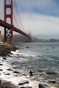 Golden Gate Bridge with SurfersCeleste and her parents had some family obligations to take care of today, so left to our own devices, we decided to head into San Francisco to get a flavor for the city.
As if to confirm our preconceived image of San Francisco, our first viewing of the Golden Gate Bridge was cloaked in fog. I probably would have been disappointed if it wasn’t. We took note of a good viewpoint on the other side of the highway that we would try to hit on our way back out of the city—hopefully, after the fog had time to disperse.
Immediately after crossing the bridge, we exited 101 and looped back to Fort Point Historic Park, located right under the bridge. From here, Herb and the boys took photos of the bridge from every possible vantage point. Actually, the coolest sight was of five wetsuit-clad surfers on paddle boards rowing out to the beginning of the waves and riding them in dangerously close to the rocky shoreline.
 Golden Gate Bridge with SailboatHaving captured the bridge from every photographic angle, we drove across town to Coit Tower atop Telegraph Hill, an iconic emblem of San Francisco’s skyline—and a bit of a tourist trap. $28 dollars later, we were on the elevator to the top up the 210-foot, slender, white concrete tower for an incredible 360 degree view of the city and bay, Alcatraz, and both the Golden Gate and Bay bridges from its observation deck.
After navigating our way back through the gift shop, we spent some time enjoying the murals decorating the inner walls of the tower’s base. These murals, which depict life in California and the struggles of the working class during the Depression, were painted in 1934 by artists employed by the Public Works of Art Project. They have undergone quite a bit of controversy over the years due to what was considered radical Communist content. Today they are protected as historical treasures, and can be viewed for free on the first floor of the Coit Tower. The murals alone are well worth the visit to the Tower.
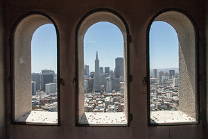 Coit Tower ViewThe original plan was to have lunch in Chinatown, but so did half of San Francisco. After circling through the neighborhood three times without finding parking, we switched gears and decided to have a picnic in Golden Gate Park.
Oh, but first – being the tourists we are – we, of course, had to drive down Lombard Street. It definitely was steep, so steep that it was designed with eight switchbacks, because without them, it would have been a 27% grade, way too steep for most cars to deal with. In fact, we had been on an 18% grade road on the way to the Isle-aux-Coudres in Quebec and we thought that was ridiculous. Since we were in a rental car this time, rather than the RV, it was fun. I don’t know how the people that live on this street can stand all the tourists driving down all day long snapping pictures.
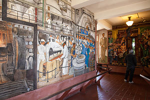 Coit Tower Public Works MuralsHaving safely made it to the bottom, and taking our own photos along the way, we headed over to Golden Gate Park. But first, there was the matter of obtaining lunch for our picnic. Tommy—always the techy of the group—quickly used the Yelp App (see Tips) on his smartphone, and found reviews and price ranges for restaurants and delis in our geographic proximity. After finding a deli that looked good, his phone was even nice enough to navigate us to it. I love technology.
The park was lovely, and actually did remind me quite a bit of Central Park. A surprising fact is that it is even larger than Central Park. We really didn’t have enough time to do the park justice, but we did have a lovely picnic and then went to the top of the Hamon Observation Tower in the de Young Museum. Like the Coit Tower (except this one was free), there were fabulous panoramic views of San Francisco and the park, the Pacific Ocean, and the Marin headlands in the distance. The floor to ceiling glass walls of the tower made for a particularly impressive view and experience. There is so much to see and do in the park that we could easily have spent a day or two and not seen it all.
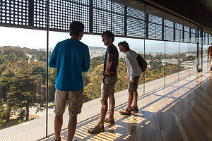 Hamon Observation Tower ViewAs planned, on our way back across the Golden Gate Bridge, we pulled into the scenic viewpoint parking lot right across the bridge and this time were able to capture images of the bridge sans fog.
Back at Celeste’s house, we had a lovely last evening together, but Herb and I still had to figure out what we were going to do with our 5 remaining days. Our first choice was Lassen Volcanic National Park, which we had never seen; but winters end late there, and a quick search on the internet confirmed our fear that the roads through the park were still closed. The next obvious choice would have been to continue up Route 1 all the way to Oregon, exploring Redwoods National and State Parks, but we had already kind of done the “tree” thing in Sequoia and Kings Canyon, and as much as we like trees, we wanted something to do something a little more exciting.
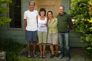 Happy Parents - TJGThat’s went it hit us. We couldn’t possibly come this close to Yosemite and pass up the opportunity to stop by. I quickly got onto the internet to see if any accommodations were available over the next few days. Not much—just two nights in the Housekeeping Cottages for the following Saturday and Sunday night. That would give us two nights to do something new, and two more to visit an old friend. We grabbed it.
We had had such a wonderful time together in Sebastopol that I don’t think any of us were ready to see it end. But end it must. Tomorrow, bright and early, the kids would catch a flight back to New York. From there, Andrew and Celeste would head to Cambridge, Massachusetts to start their summer internships, and poor Tommy would hop in his car to travel back 2/3 of the way across the country to Boulder, Colorado to start his. Boy, I missed them already.
A giant thanks goes to Celeste’s parents who had been the most incredible hosts and tour guides that anyone could have hoped for.
Day 6 – Armstrong Redwoods
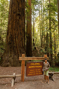 Lolo with Colonel ArmstrongNow, that the kids were on their flights back home, Herb and I had to switch gears to a more romantic mode of travel—just the two of us, armed with maps and dreams, and 5 days to do whatever we wanted in northern California.
We began our adventure by heading back towards the coast, with a quick side trip to Armstrong Redwoods State Natural Reserve to pay our last tribute to these remarkable trees that are so much a part of the northern California landscape. Although you can drive through the park, we chose to park at the entrance and walk the 1.5 mile Pioneer Nature Trail to get a more up-close and personal experience with these giants. It was quiet, peaceful, and serene---or at least until we ran into a class trip of preschoolers.
The trees in the Armstrong preserve are coast redwoods—their fancier Latin name is Sequoia sempavirens. Rising 200 to 250 feet above the forest floor, they are the tallest living things on Earth. Typically they live 500 to 1,000 years, with some trees surviving over 2,000 years and growing as high as 350 feet. With 55 inches of rain per year, the Armstrong preserve provides the wet and mild climate needed for these coast redwoods to thrive.
Ironically, this beautiful 750-acre virgin redwood forest was set aside in the 1870s by James Armstrong, a timber tycoon who made his living by harvesting these very same types of trees. Before the massive logging operations of the 19th century, redwood forests, such as this, covered much of this area. Today, this serene, majestic grove is a small but magnificent reminder of that primeval redwood forest. Fortunately, Armstrong admired these incredible trees enough to give him the foresight and good sense to preserve (at least some of) them for future generations to enjoy..
Description
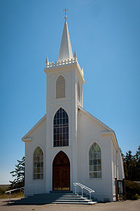 Bodega Bay Church - Hitchcock's "The Birds" - AJGSebastopol is a charming town in Sonoma County, 52 miles north of San Francisco and about a 20-minute drive to the coast. Sebastopol is known for its apples and hosts an annual Apple Blossom Festival in April and the Gravenstein Apple Fair in August. Today, however, the apple orchards are becoming vineyards as wine-making moves more and more into the region.
Every Sunday, from April to mid-December, there is a Farmers market in the downtown plaza,
where people congregate to enjoy delicious fresh regional food, live music, and dancing.
Sebastopol is home to the artist, Patrick Amiot, known for his whimsical, cartoon-like, junk-art sculptures. There are over 200 of his wacky, found-object works scattered throughout Sebastopol, especially on Florence Street.
Side Trips from Sebastopol
Mill Valley and the Dipsea Trail
Mill Valley is a picturesque town, nestled amongst redwoods on the southern slope of Mt. Tamalpais. It is located in Marin County, about 14 miles north of San Francisco. Mill Valley began as a logging town in the 1830s, but has since become a very upscale community, with exclusive boutiques and expensive homes.
Mill Valley is also the location for the start of the Dipsea Trail, the site of the oldest trail race in America, having first been run in 1905. The race course begins in Mill Valley and immediately climbs a steep set of steps (676 in all) and trails over Mt. Tamalpais before eventually making the long descent to Stinson Beach, 7.4 miles away. It is one of the most grueling and treacherous races in the country, but also one of the most beautiful.
For those not wanting to run the 7.4 miles over the mountain to Stinson Beach, the beautiful Panoramic Highway climbs from Mill Valley through Mt. Tamalpais State Park, before descending to Stinson Beach 11 miles later.
Stinson Beach
Stinson Beach is a 3-mile sandy beach located along Highway 1 about 20 miles northwest of San Francisco. Besides the beach, generally packed with surfers and swimmers on the weekends, there is a 51-acre park with more than 100 picnic tables. When not blanketed in fog, as it often is, there are tremendous views of San Francisco to the south and Point Reyes to the north. The town of Stinson Beach has plenty of restaurants, shops, and galleries to entertain on those foggy days.
Point Reyes National Seashore – Tule Elk Reserve
The Point Reyes National Seashore is a 71,000-acre park preserve located on the Point Reyes Peninsula, about 40 miles north of San Francisco. It has 110 square miles of sandy beaches and over 150 miles of hiking trails.
The Tule Elk Reserve is at the northern end of the peninsula at Tomales Point. Tule elk were nearly eliminated in the mid-1800s, due to hunting and displacement by cattle. In the 1970s, tule elk were reintroduced to the grasslands of Tomales Point. While population growth was slow at first, the introduced herd eventually began to show an exponential increase in population and is now at a sustainable level of 450 individuals. The Point Reyes National Seashore is the only National Park where tule elk can be found.
The Tomales Point Trail through the Reserve begins at the end of Pierce Point Road near the historic Pierce Point Ranch. The hike to Windy Gap, where the elk can be seen grazing, is about 2 miles. The open trail offers breathtaking views of Bodega Bay to the north, the Pacific Ocean to the west, and Tomales Bay to the east. Hikers can continue another 3.7 miles to the north tip of Tomales Point.
Bodega Bay
Bodega Bay is the first of a string of fishing hamlets that line the coast of Northern California. Its main claim to fame is that in was the setting for Alfred Hitchcock’s 1963 thriller, The Birds.
The Bay itself lies at the northern tip of the Point Reyes peninsula and is approximately 5 miles across. It is protected in the north by Bodega Head, which rises 265 feet above sea level. There are numerous hikes along the stunning headlands of Bodega Head. From the Salmon Creek Beach parking lot there is a 2 to 3 mile loop atop a bluff overlooking the dramatic pounding of the surf against the rocky shoreline below.
Sonoma Wineries
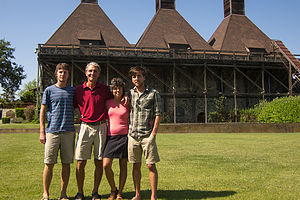 Family at Hop Kiln WineryWhile Sonoma Valley is only a few miles apart from its more famous neighbor, Napa Valley, it is quite different – more casual, less pricey, and much less crowded. Sonoma takes great pride in not being Napa.
When people talk about Sonoma, they mean the whole country, whose 1,500 acres make it much larger than Napa. Sonoma County extends all the way from the coast on the west, up the Russian River Valley, into Sonoma Valley in the east, and San Pablo bay in the south to Healdsburg in the north. It is so large, that it is broken down into districts:
- Russian River Valley - west of Highway 101
- Sonoma Valley – stretches north-south along Highway 12
- Alexander Valley - east of Healdsburg
- Dry Creek Valley - north of Healdsburg
- Carneros – straddles the Sonoma-Napa border
The weather varies significantly between these districts and determines what types of grapes do best. The Russian River Valley and Carneros are nearer the coast and therefore cooler and foggier. Burgundy-style wines, such as chardonnay and pinot noir do best in this type of climate. Sonoma, Alexander, and Dry Creek Valley are further inland where Bordeaux-style wines, such as sauvignon blanc, merlot, and cabernet sauvignon do better in the warmer and less foggy climate. There are approximately 200 wineries in Sonoma County.
San Francisco – Fort Point, Coit Tower, and Golden Gate Park
Our stop in San Francisco was brief, so this in no way is an attempt to give a thorough description of what to see in San Francisco. However, the following three sites are what we chose to do during our all too short one day visit.
Fort Point is located below the southern end of the Golden Gate Bridge at the entrance to the Bay. It was this location that made it a perfect place for a fort to protect San Francisco Harbor from Confederates during the Civil War and foreign attack in later years. Its arched casements are considered an excellent example of brick masonry from the Civil War period. The fort is now a National Historic Site and is part of the Golden Gate National Recreation Area.
Its vantage point will be familiar to Alfred Hitchcock fans, for it was from here that he filmed the bridge in Vertigo. Surfers also flock to this spot to ride the waves in towards the rocky shoreline.
 Coit Tower StairwellThe 210-foot Coit Tower stands atop Telegraph Hill, between the Financial District and Fisherman’s Wharf. It was built in 1934 as a monument to San Francisco firefighters, financed by Lillie Hitchcock Coit. Lillie was quite a fan of the fire department and rarely missed a fire or a fireman’s funeral. She even had her bedsheets embroidered with the firehouse emblem. When she died, she left one third of her fortune for the building of this memorial. This art deco tower, built of unpainted concrete, was designed by Arthur Brown, Jr. and Henry Howard.
The interior walls of the tower are embellished with Diego Rivera-style fresco murals, most of them depicting life in California during the Great Depression. 25 artists worked on these murals as part of the WPA program of the New Deal. At the time the murals were quite controversial and denounced as Communist. Fortunately, they are now protected as national historic landmarks.
Visitors can pay $7 to ride the rickety elevator to the top of the tower for fantastic 360 views of the city, including the Golden Gate and Bay Bridges, Alcatraz, Lombard Street, Nob Hill, and more.
Golden Gate Park is to San Franciscans what Central Park is to New Yorkers. Its 1,017 acres make it 20% larger than Central Park. It is over three miles long (from east to west) and half a mile wide (north to south). The park design was the result of an 1870 competition, won by 24-year-old William Hammond Hall
Park highlights include:
- 7.5 miles of bike trails and 12 miles of equestrian trails
- Baseball fields, soccer fields, and tennis courts
- An archery range
- Fly-casting pools
- The De Young Museum
- The Academy of Sciences
- A Japanese Tea Garden
- The San Francisco Botanical Garden
- Kazar Stadium
- Golden Gate Park Stadium
- The Conservatory of Flowers
- The Aids Memorial Grove
- Stow Lake
- Spreckels Lake
- A bison paddock
Armstrong Redwoods State Natural Reserve
Armstrong Redwoods State Natural Reserve, located in Sonoma County just north of Guerneville, has preserved 805 acres of Coast redwood trees. Rising 200 to 250 feet above the forest floor, they are the tallest living things on Earth. Typically they live 500 to 1,000 years, with some trees surviving over 2,000 years and growing as high as 350 feet. With 55 inches of rain per year, the Armstrong preserve provides the wet and mild climate needed for these coast redwoods to thrive.
Although you can drive through the park, the 1.5 mile Pioneer Nature Trail provides a more up-close and personal experience with these giants..
Sequoia and Kings Canyon National Parks
Tuesday, May 22, 2012 - 2:15pm by Lolo400 miles and 7 hours from our last stop - 3 night stay
Travelogue
I had spent quite a bit of time researching Sequoia and Kings Canyon and determined that the best approach would be to spend one night at the John Muir Lodge, just inside the Big Stump Entrance to Kings Canyon, from which to explore the Sequoia section, and then move on to the Cedar Grove Lodge at the end of Kings Canyon for two nights to allow us to do a long day hike into the canyon.
The following is a description of how we spent a very wonderful three and a half days in Sequoia and Kings Canyon.
Day 1 – John Muir Lodge, Panoramic Point, and General Grant Tree
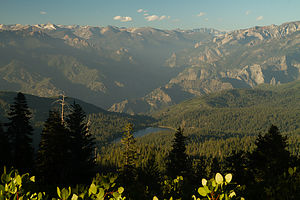 View from Panoramic Point - TJGThe drive from the airport to the John Muir Lodge took us about five hours, bringing us past the beautiful San Luis Reservoir and through the rich agricultural landscape of central California.
Although it was already 6:30 when we arrived, and probably time to think about feeding ourselves, we decided instead to take a quick run up to Panoramic Point, which the guide books described as having a breathtaking view of Kings Canyon. Herb was a bit skeptical about my plan and accused me once more of trying to “pack 10 pounds into a 5 pound bag.” After all, he had driven the whole way and wanted to just relax and have a beer. As usual, he lost the argument and we set off up the steep, winding 2.3 mile road to the Point. This was one time I was glad that we didn’t have the RV, because I’m not sure if it would have made it up this road; in fact, I don’t think it was even allowed. The boys decided they needed the exercise and hill training, so they chose to run (or more correctly race) to the top.
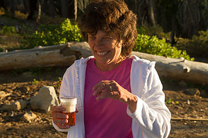 Lolo enjoying her IPA - TJGOnce on top, we took out our movie camera and awaited the boys’ arrival. Unfortunately, I wasn’t ready with the camera when Andrew appeared a few yards ahead of Tommy to declare victory in the grueling uphill race. I was so mad that I missed what would have been really good footage that I asked them to repeat the final stretch so I could get it on film. Andrew was so exhausted from his actual victory that Tommy cruised past him in the reenactment, immortalizing his victory at Panoramic Point. Andrew cried foul, but the tape is the tape.
The view of Kings Canyon and Hume Lake below was well worth the trip, and I rewarded Herb’s flexibility with a cold IPA (or two) from the cooler. At this point we had two choices: rush back down to have dinner before the only restaurant in the village closed at 8:00, or stay to watch the lighting change over the canyon as sunset approached. This time, we unanimously voted to stay, and I went and got what remained of the delicious sandwiches Celeste and her mother had made out of the trunk – definitely the right decision.
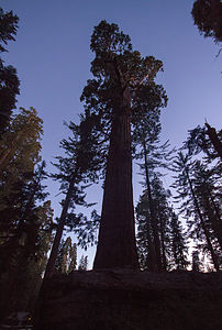 General Grant tree at dusk - TJGAlthough it was now 11:00 east coast time and we had been up since 3:00 this morning, we were on an irresponsible roll and decided to squeeze another 5 pounds into that already overstuffed 5 pound bag and hurry over to the General Grant tree while there was still a wee bit of daylight. So, it was back down the narrow, windy hill, past the John Muir Lodge where we were staying, and over to the General Grant Grove where we practically sprinted the ½-mile trail to find the Big Fella while we could still see it. As we gazed in awe as the 3rd largest living tree in the world faded into darkness, Andrew whispered, “It’s glowing…like an angel,” and in our collective delirium from lack of sleep (and a few IPAs) we burst into laughter. From that point on, “it’s like an angel” became our metaphor for any sight that impressed us.
Finally, at what was now midnight east coast time and 21 hours since we had awoken this morning, we decided to call it a day and return to our room at the John Muir Lodge. The lodge was actually quite cozy with that rustic national park feel that I have come to love, and a perfect base camp from which to explore both Sequoia and Kings Canyon. It would have been nice to have been able to spend a little time just relaxing in the rocking chairs on the porch, but alas that was not to be.
Day 2 – Sequoias and more sequoias, Moro Rock, Crescent Meadow, Hume Lake, Kings Canyon Scenic Byway, and Cedar Grove Lodge
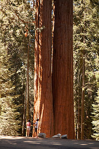 Siamese twin Sequoia treesMuch of Sequoia and Kings Canyon is inaccessible by road. There are two major roads in the park and they are shaped sort of like a backwards 7 with Grant Grove Village, where the John Muir Lodge is located, at the vertex. South of Grant Grove is the Generals Highway which takes you deep into Sequoia country with such notable stops as Giant Forest and Moro Rock (about a 2 hour drive from Grant Grove Village). North and then east of Grant Grove is the spectacular Kings Canyon Scenic Byway, a 31-mile rollercoaster road, which descends deep into the canyon, connecting Grant Grove and Cedar Grove. There are also a few additional out and back side roads off the two major roads.
Today, we would do them both: the Generals Highway to Giant Forest for the major part of the day and then later that afternoon the Kings Canyon Scenic Byway to get to our accommodations for the night at Cedar Grove. Since we only had about eight hours to explore the Sequoia part of the park, I had to be somewhat selective in our choice of stops. In an attempt to get an overall representative sampling of this amazing park, I chose a meadow, a rock, and, of course, lots of giant trees.
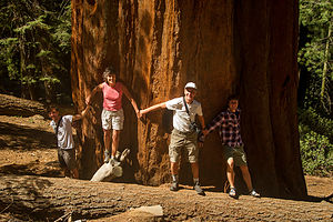 Sequoia Tree HuggersOur first stop along the Generals Highway was a pullout in the midst of a beautiful sequoia redwoods forest. I found my favorite sequoia tree here (actually it was two Siamese twin trees), because it wasn’t fenced in like a zoo exhibit or surrounded by throngs of people. It was just there for us to marvel at – “it was like an angel.” As we were doing this tree photographic justice, a gentleman from Texas suggested we do what his Aunt Clovis always had them do – hold hands and try to encircle the tree, kind of like group tree hugging. With arms fully outstretched, we still were only able to make it about halfway around – and this was not even one of the park’s designated giants, but just some old random tree along the highway.
Then it was on to the Lodgepole Visitor Center where we watched an interesting film about bears in the park. Once we were back on the Generals Highway, there was an anguished cry from the backseat as Andrew realized that he left his very expensive camera on the seat next to him in the dark Visitor Center theater. We frantically raced back to the Visitor Center and were delighted to find that a kind and honest fellow traveler had turned it in to the ranger at the desk. Crisis averted, we continued on down the Generals Highway.
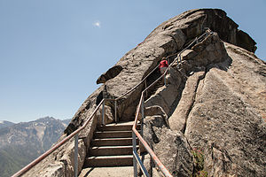 Moro Rock ApproachWe passed the parking lot for the landmark General Sherman Tree (we would hit that on the way back) and continued on to the turn off onto Crescent Meadow Road to get to both the Crescent Meadow and Moro Rock hikes.
We tend to be partial to rocks and expansive views, so the hike to the top of Moro Rock was a highlight. The trail was fun – 400 steps carved into the side of the dome. As promised, the 360 degree view of the surrounding snow-capped mountains of the Great Western Divide from the top was breathtaking.
The road to Crescent Meadow was awesome, with giant sequoias lining both sides of the road. There was even one spot where you could drive through a tunnel cut out of a fallen one, appropriately named Tunnel Log. However, since there was a backlog (no pun intended) of cars hogging it, we took the bypass road around it, hoping to get our chance on the way back out.
 Lolo and Boys at Summit of Moro RockThis was bear country, so the parking lot for the Crescent Meadow hike had signs warning visitors to not leave any food in their cars, but to store them in one of the nearby bear boxes. Not wanting to risk the unlikely but unpleasant possibility of having the trunk lid of our rental car ripped off, we spent a bit of time emptying the very ample contents of our trunk into a bear box before hitting the trail.
The hike was an absolutely lovely stroll through a meadow surrounded by firs and giant sequoias. Here, one could get up close and personal with the trees, and even in some cases, enter their fire-hollowed trunks – much more intimate than viewing the more famous landmark trees from behind a fence. The lack of other hikers on the trail made the experience even more peaceful and serene.
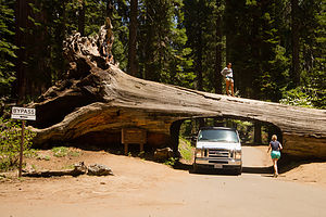 Tunnel Log - TJGAmidst all the natural wonders of the meadow, we came across was an interesting man-made landmark – a tiny cabin built from a fallen, fire-hollowed sequoia, complete with stone chimney. Named Tharp’s Log, it was built back in the 1860s by a cattle rancher named Hale Tharp. He was the first non-Native American settler to live in the area. John Muir, who was a frequent visitor to the area, referred to it as a “noble den.” It must have been quite peaceful living here in solitude amongst these silent giants.
After our hike, we collected our goodies from the bear boxes and made a picnic lunch before returning to the Generals Highway to begin retracing out route north. This time, we did get a chance to drive through Tunnel Log, and I must confess we jammed it up to with our need to get out and take a picture.
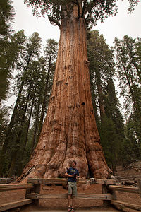 Tommy with General Sherman TreeOur final stop in Sequoia, and by far the biggest (both literally and figuratively) attraction in the park, was the General Sherman Tree, the largest living tree on earth--a distinction based on volume, as it is neither the tallest nor the widest tree, but the heftiest, producing the equivalent of another 60-foot tree each year. After our more intimate experiences with giant sequoias—the Aunt Clovis tree that we had hugged and the ones that had invited us in to gaze up through their hollowed-out trunks to the sky—the crowds and fenced in trees here really turned us off. After a brief paying of our respects to this truly awesome tree and the obligatory photo in front of it, we hit the road once again to head towards the Kings Canyon section of the park.
Rather than retrace our route back through Grant Grove, we took a shortcut towards Hume Lake to provide a little variety. Hume Lake was the lake we had gazed down on from Panoramic Point the first night, so we thought it would be nice to see it from eye level. The road was pretty winding and twisty, but nothing our little Toyota rental car couldn’t handle. The lake and sandy beach were too tempting to pass up, so the boys stripped down to their boxers and jumped in.
We were getting pretty hungry by now, and the National Park Map showed only one possibility along the way – the Kings Canyon Lodge about 12 miles further along the Kings Canyon Scenic Byway. I liked the sound of it. I love National Park lodges with their cozy décor, high beamed ceilings, and stone fireplaces. I only hoped we were dressed nicely enough. After all, the boys were still sitting on towels in their wet boxers in the back seat. Anticipation rose as the GPS showed us inching our way closer and closer to the Lodge. We had been living on sandwiches for the past two days, so the thought of a hearty meal in a lovely setting was very appealing.
 Boys in Hume LakeAs we pulled into the parking lot for Kings Canyon Lodge, a jaw-dropping silence fell over us. Rather than the grand park lodge I had visualized perched over an equally majestic canyon, we were greeted by a vision much less appealing: a few dilapidated cabins, a small office building, and a set of antique gas pumps posted with the very inviting welcome: “No Pictures Without Permission.” Despite my disappointment, I put on a brave face, turned to the others and said, “Okay, let’s go get something to eat.” I felt like Clark Griswold pulling into Wally World.
I think I started things off on the wrong foot when we walked into what I thought was the office and asked the somewhat surly-looking gentleman behind the counter where the restaurant was.
“You’re looking at it,” was his rather curt response.
Oh boy. I looked up and noticed a menu board behind him. “I’ll be right back,” I told him as I motioned the boys to follow me back outside. After a brief conference, and the realization that this was the only place to eat in about 25 miles, we collected Herb and bravely went back to give it a try. The owner looked on disinterestedly as we scanned the menu board. I have this tendency of asking too many questions, which drives the boys crazy, so they cringed when I asked the nice gentleman if the Santa Fe sandwich had chicken on it, especially since it clearly did not mention chicken as one of the ingredients listed on the board. I just really wanted it to have chicken on it.
 Herb the Videographer - LEG“We don’t have chicken.”
Another brief conference. “Okay. “We’ll have four cheeseburgers then.” I then continued with, “Do we eat at the counter or can we eat outside on the picnic table.”
“Doesn’t matter to me.”
This guy was a real gem. Not wanting to be in this man’s presence any longer than necessary, we went outside to await our burgers. I headed towards a small building behind the “restaurant” that was the restroom, but quickly exited when I saw how disgusting it was – and being a camper, I have a pretty high tolerance for bathrooms.
In a reasonable amount of time, our friend brought out our food and plopped it down in front of us without a word. If we weren’t so hungry, I think we would have been afraid to take a bite, but we did and it was actually pretty good.
 Road to Kings CanyonWhen we were done, my cowardly men voted to send me back in to pay. By now two of his equally surly friends had joined him at the counter. I quietly handed him the check and my credit card, and he brought our hospitable dining experience to a close with:
“You wanna add a tip to that?
“Not particularly,” I thought, but feeling quite intimidated, I tipped quite generously and then got out of their as fast as I could.
Just out of curiosity, when we had internet coverage later, I looked for reviews of the Kings Canyon Lodge and found that I was not the only one that had had a bizarre experience. The funny part was the gentleman that I dealt with was actually the charmer of the family. His wife actually cursed at a family and grabbed their food back because they had their own juice boxes at the picnic table. Sounds like we got off easy.
 Kings Canyon Road ViewpointThe rest of the drive into Kings Canyon was spectacular. While the drama of the drive was the steep granite walls and the sheer drop offs into the canyon, one of my favorite sights were the yucca plants whose feathery fronds sprang incongruously from the near vertical canyon walls, where you would think no plant could take hold.
We intentionally passed the turnoff for the Cedar Grove Lodge and drove the remaining 5 miles to Roads End, where the Scenic Byway ends and pure wilderness begins. There was still a bit of daylight left, although not much, so we thought we would get a preview of what was in store for us tomorrow before checking into our motel for the night. We found the trailheads for tomorrow’s two hikes: Mist Falls and Zumwalt Meadow and then took the short, and very rewarding, hike to the Roaring River Falls.
 Andrew by Roaring River Falls - TJGIt was getting late, and we were tired from our long day of exploring so many wonderful and diverse sights, so we headed back to the Cedar Grove Lodge. As usual, I ran ahead to check in, while Herb organized stuff to bring in. When I got to the office, I became quite concerned to find that it was dark and closed up for the night. I pressed my nose against the glass, but saw no one inside. What were we going to do? We were out at the end of nowhere with the nearest civilization back 30 miles at the (dare I say it) Kings Canyon Lodge. Seeing lights on in the store/restaurant next to the office, I ran there and began tugging on the door, only to find that it too was locked for the night. Noticing a young man mopping the floor inside, I began pounding on the glass window and waving my arms to get his attention. He looked frightened. “What are you doing?’ Herb asked as he handed me an envelope with room keys left for us in the box by the office door. Oops.
A short while later, while sitting on the deck of the lodge overlooking the river, a frantic woman came running up to us with a look of total panic on her face – very similar to the one I had been sporting about an hour ago – and asked us if we knew how she could find someone to check in. Feeling her pain, we calmly told her to look in the box for an envelope with her name on it. She was so relieved and grateful I thought she was going to cry. They really need a more obvious system for late arrivals.
The next morning, however, all was forgiven when we wandered down to the store and found that they served Starbuck’s coffee.
Day 3 – Mist Fall Hike, Zumwalt Meadow Hike, and Cedar Grove Lodge
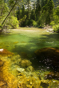 Bubbs Creek - TJGThe next morning we set out early for our hike to Mist Falls, one of the most popular hikes in the park. We drove the 5 ½ miles back down to Road’s End to get to the trailhead. Since most of Kings Canyon is inaccessible by car, this is the starting point for the hundreds of miles of the wilderness backpacking trails in the park. In fact, if you are ambitious enough, you can even hike to Mt. Whitney from here. However, today our goals were much more modest - the 8 mile RT Mist Falls hike.
The hike was an instant all-time Gaidus favorite, and within ½ mile of the trailhead, Andrew had already declared, “at this moment in time, this is my favorite national park!” The trail was quite level for the first two miles or so, passing through a lovely meadow bounded by granite walls before reaching Bubbs Creeks at about 2.6 miles and beginning the uphill climb. From this point, the trail meandered along the south fork of the Kings River through forest and swamp areas before coming out on a big open rock slab with tremendous views out over the canyon. There was no question that this would be a spot for lunch on the way down as well as the annual Christmas photo—it was spectacular.
However, the hike was not yet complete, so we continued on and upward to Mist Falls. This part of the hike was a bit steeper and rockier, but we were pleasantly distracted by the numerous small cascades and clear, deep pools along the river. It would have been great to take a quick dip, but the water was much too chilly, and ample signs warned of the dangers of swimming in the fast current. However, we were soon treated to the refreshing spray of the aptly named Mist Falls, a series of cascades dropping 100 feet over a granite incline. Once refreshed, we continued a short distance past the falls to a series of flat granite boulders where there was a great view of the canyon and waterfall below. This was our turnaround point for the day, but the trail does continue on to Paradise Valley and eventually to meet up with the Pacific Crest Trail. It would be a wonderful place to backpack someday. I will have to add that to our ever growing bucket list.
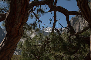 Mist Falls Hike Canyon ViewBack at our rock slab, the tripods came out, the family lined up and smiled, and we captured what I think is one of our best Christmas photos to date. Of note is that the boys coincidentally wore the same color shorts and t-shirts, just the way I used to dress them up in matching outfits for Christmas photos when they were little.
We also immortalized the first annual (and hopefully last) Gaidus “catching air” contest, in which we leaped as high as we could in the air, while doing some fancy moves. Mine looks like I just escaped from a mental hospital.
After a bit more lunching, lounging, and just taking in the expansive views of the canyon below, we retraced our steps back to the trailhead. Back at the homestead, we got take-out from the Cedar Grove Lodge and ate at a picnic table right on the banks of the south fork of the Kings River. The table was literally 10 feet from the river and the roar from the rapids was so loud that we had to practically shout just to hear each other. The food was just okay, but it was the only game in town and the scenery certainly made up for it. This was not exactly a culinary tour, but thankfully, we all think of food primarily as fuel to hike and have fun—except for Andrew, who is developing a taste for finer foods now that he is dating a culinary wonder.
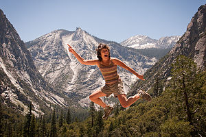 Mom Catching "Big Air" - AJGThe day was not over yet though. The sun was getting low, making it a perfect time to visit Zumwalt Meadows and walk the 1.5-mile loop around the meadow. The trailhead was back down the road towards Road’s End about 4 ½ miles from Cedar Grove Lodge.
This was one of those hikes that has a brochure you can purchase at the trailhead describing each of a series of numbered stops along the way. I was so used to reading these while the kids totally ignored me in years past, that I was pleasantly pleased to have Tommy take over my job and read each stop with interest—after all, he is a geoscience major and this valley has to be a geologist’s heaven. Despite Andrew’s major in environmental policy, he still felt it necessary to not give his brother the benefit of his full attention. One thing I did learn that I didn’t know before is that meadows are meadows and not forests, because they are too wet and frequently flooded to support much other than grasses and flowers. So, the brochure had already paid for itself.
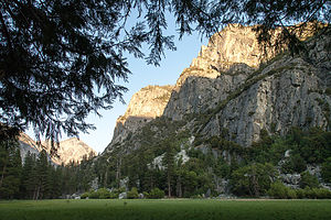 Zumwalt Meadows HikeAfter leaving the parking lot, we strolled along the banks of the Kings River before crossing a suspension bridge. At the junction for the loop, we chose to go left (clockwise), so that Tommy could do his brochure readings in the proper sequence. Unlike Yosemite, where one can wander freely across the meadows, this meadow was moister, and walkers are restricted to the path that traces its perimeter and the wooden boardwalks that cross it. We soon came to a wooden platform with a lovely view of the meadow and the granite walls of Grand Sentinel and North Dome rising from the right. Herb chose to remain here taking photographs during the sunset while the boys and I continued along the loop. As we rounded the halfway point of the meadow, our level forest path gave way to a section of large boulders at the foot of Grand Sentinel that required some rock scrambling to traverse. It was almost dark by the time we reunited with Herb sitting contentedly beside his tripod.
After a short drive back to Cedar Grove Lodge, we settled comfortably on the porch overlooking the Kings River, quite content with a very successful day of hiking.
Day 4 – Departure (with a quick stop at Muir Rock)
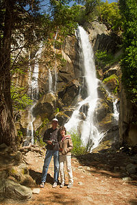 Mon and Dad by Waterfall - TJGWell, it was time to leave Kings Canyon, but before doing so we had one last stop to make. Yesterday, after we finished our Mist Falls hike, we had totally forgotten our plan to stop at Muir Rock afterwards. Being great admirers of John Muir and all he has done to help create the National Park System, we thought it worth the drive back down to Roads End to pay him some well-deserved homage.
The rock, which is just a short walk from the Roads End parking lot, is a large flat boulder jutting over the river from which John Muir used to give talks on Sierra Club field trips. The rock was a perfect place to sun and jump into the river, and if it had been a wee bit warmer, I’m sure we would have given it a try.
But alas, we had places to go and people to see (Andrew’s girlfriend and family), so it was back in the car for the drive out of the park along the beautiful Kings Canyon Scenic Byway.
Description
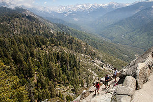 Descent from Moro RockSequoia and Kings Canyon are two very distinct parks administered as a single entity. Its combined 1,350 square miles make it larger than Yosemite, its more famous and visited neighbor a three-hour drive to the north. These two parks are home to the largest Giant Sequoia trees in the world, the largest mountain in California – 14,494-foot Mount Whitney, as well as one of the deepest canyons in the country.
Although John Muir made his first visit to the Kings Canyon in 1873, it took a bit longer for this area to be protected. Secretary of the Interior Harold Ickes recognized its uniqueness and fought to preserve it, even hiring Ansel Adams to photograph its beauty. Through their efforts, Kings Canyon was designated a National Park in 1940. The separate, tiny General Grant National Park was made part of Kings Canyon National Park.
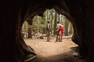 Family from Inside of a Burnt Out SequoiaThese two parks are well-kept secrets, with less than half the visitors that Yosemite receives each year. It is a place where one can find solitude from the crowds in a setting equally inspiring.
There are two main entrances to the parks, both located on the west side of the parks. There are no roads entering from the east. The Big Stump Entrance is reached via Highway 180 from Fresno and the Ash Mountain Entrance in the south is reached via Highway 198 near the town of Three Rivers.
Much of Sequoia and Kings Canyon is inaccessible by road. There are two major roads in the park. South of Grant Grove is the Generals Highway which takes you deep into Sequoia country with such notable stops as Giant Forest and Moro Rock (about a 2 hour drive from Grant Grove Village). North and then east of Grant Grove is the spectacular Kings Canyon Scenic Byway, a 31-mile rollercoaster road, which descends deep into the canyon, connecting Grant Grove and Cedar Grove. There are also a few additional out and back side roads off the two major roads.
The following is a list of highlights along the parks’ two major roads.
Generals Highway (from Grant Grove to Giant Forest)
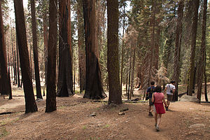 Hiking the Cresent Meadow trail
- Panoramic Point – at the end of a 2.3 mile steep and twisty spur road (no RVs allowed) is a overlook with incredible views of Kings Canyon below
- Grant Grove – paved ½ mile trail past a number of giant sequoias, including the General Grant Tree, the 3rd largest living tree in the world
- Giant Forest – the most famous grove of sequoias in the world. The General Sherman Tree, the largest living thing on the planet, stands at the northern edge of the grove. The 2-mile Congress Trail leads past the General Sherman Tree as well as several other well-known giants.
- Crescent Meadow – 3 miles off the Generals Highway on Crescent Meadow Road is this lovely meadow, ablaze with wildflowers in the spring. Another interesting stop along the trail is Tharp’s Log, a tiny cabin built from a fallen, fire-hollowed sequoia, complete with stone chimney. Named Tharp’s Log, it was built back in the 1860s by a cattle rancher named Hale Tharp. He was the first non-Native American settler to live in the area.
- Moro Rock – also along Crescent Meadow Road is Moro Rock, a large granite dome with 360 degree views of the surrounding snow-capped mountains of the Great Western Divide. The top of the rock is reached by climbing 400 steps carved into the side of the dome.
Kings Canyon Scenic Byway
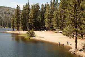 Hume Lake BeachThe Kings Canyon Scenic Byway is a 31-mile rollercoaster road connecting Grant Grove and Cedar Grove, which descends 2,000 feet deep into the canyon, It takes about an hour to drive and ranks among the most magnificent in any national park. The following are a few stops along the way:
- Cedar Grove Village – the only civilization in the wilderness – contains a small lodge and snack bar
- Roaring River Falls – a half-mile out and back walk to a magnificent view of the lower falls
- Zumwalt Meadow – a 1.5 mile loop hike around a lovely meadow with great views of Grand Sentinel and North Dome. The trailhead is 4.5 miles east of the turnoff for Cedar Grove Village and 1 mile before Road’s End.
- Road’s End – located at the very end of the Scenic Byway, Road’s End serves as the starting point for hundreds of miles of wilderness backpacking trails. A short walk from the parking lot is Muir Rock, a large flat boulder along the river from which John Muir delivered many of his Sierra Club talks. The trailhead for the very popular, 8-mile RT hike to Mist Falls is also here.
Although many try to see these two parks in just a day, it is best to stay a few nights to see all the parks have to offer.
For RVers, there are several campground choices.
Along the General Grant Highway:
- Azalea (114 sites) near Grant Grove
- Dorst (218 sites) 14 miles northwest of Giant Forest
- Lodgepole (250 sites) 5 miles northeast of Giant Forest Village
At the end of the Kings Canyon Scenic Byway near Cedar Grove:
- Sentinel – open whenever highway 180 is open
- Sheep Creek, Canyon View, and Moraine – open when overflow is needed
For those looking for lodging, there are also several choices
Along the General Grant Highway:
- John Muir Lodge – cozy 36-room lodge located near Grant Grove
- Grant Grove Cabins – 50 rustic cabins located near Grant Grove
- Wuksachi Lodge- modern 102-room lodge is located in the Giant Forest area
At the end of the Kings Canyon Scenic Driveway there is only one choice:
- Cedar Grove Lodge – lovely 21-room lodge on the bank of the roaring Kings River.
.
