- Home
- About
- Map
- Trips
- Bringing Boat West
- Migration West
- Solo Motorcycle Ride
- Final Family XC Trip
- Colorado Rockies
- Graduates' XC Trip
- Yosemite & Nevada
- Colorado & Utah
- Best of Utah
- Southern Loop
- Pacific Northwest
- Northern Loop
- Los Angeles to NYC
- East Coast Trips
- Martha's Vineyard
- 1 Week in Quebec
- Southeast Coast
- NH Backpacking
- Martha's Vineyard
- Canadian Maritimes
- Ocracoke Island
- Edisto Island
- First Landing '02
- Hunting Island '02
- Stowe in Winter
- Hunting Island '01
- Lake Placid
- Chesapeake
- Provincetown
- Hunting Island '00
- Acadia in Winter
- Boston Suburbs
- Niagara Falls
- First Landing '99
- Cape Hatteras
- West Coast Trips
- Burning Man
- Utah Off-Roading
- Maui
- Mojave 4WD Course
- Colorado River Rafting
- Bishop & Death Valley
- Kauai
- Yosemite Fall
- Utah Off-Road
- Lost Coast
- Yosemite Valley
- Arizona and New Mexico
- Pescadero & Capitola
- Bishop & Death Valley
- San Diego, Anza Borrego, Joshua Tree
- Carmel
- Death Valley in Fall
- Yosemite in the Fall
- Pacific Northwest
- Utah Off-Roading
- Southern CA Deserts
- Yosemite & Covid
- Lake Powell Covid
- Eastern Sierra & Covid
- Bishop & Death Valley
- Central & SE Oregon
- Mojave Road
- Eastern Sierra
- Trinity Alps
- Tuolumne Meadows
- Lake Powell Boating
- Eastern Sierra
- Yosemite Winter
- Hawaii
- 4WD Eastern Sierra
- 4WD Death Valley +
- Southern CA Deserts
- Christmas in Tahoe
- Yosemite & Pinnacles
- Totality
- Yosemite & Sierra
- Yosemite Christmas
- Yosemite, San Diego
- Yosemite & North CA
- Seattle to Sierra
- Southwest Deserts
- Yosemite & Sierra
- Pacific Northwest
- Yosemite & South CA
- Pacific Northwest
- Northern California
- Southern Alaska
- Vancouver Island
- International Trips
- Index
- Tips
- Books
- Photos/Videos
- Search
- Contact
Peak to Peak Highway, CO
Friday, July 22, 2011 - 7:15am by Lolo
85 miles and 2.5 hours from our last stop
Travelogue
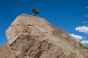
 Determined Pine TreeToday our objective was to all converge at Marys Lake Campground in Estes Park, right outside the eastern entrance to Rocky Mountain National Park, where I had reserved a campsite for two nights. Tommy and Andrew had to go back to Boulder to pick up John, Tommy’s friend who would be joining us for the weekend, and they would head up together in the evening. Herb and I would take the more scenic Peak to Peak Highway up to Estes Park.
Since Tommy didn’t have to be in Boulder until John finished work, we thought we would try to do something together before taking our different paths to Estes Park. We all thought a run would do us some good, so Tommy, who had spent the summer training on the trails around Boulder, suggested the Betasso Preserve in Boulder. Going back to Boulder was a bit out of the way for me and Herb, but we felt it would be worth the extra miles. Maneuvering and parking an RV in Boulder is not necessarily an easy thing. Fortunately, I had called the Chamber of Commerce while planning the trip and found that the best place to park an RV would be at the Target at 2800 Pearl Street (28th + Pearl).
After depositing the RV at Target, we jumped in Tommy’s car and headed back out of town to the Betasso Preserve. We retraced our steps on Boulder Canyon Drive (Highway 119) for about 6 miles before Tommy turned onto Sugarloaf Road and drove up to the Preserve, which overlooked the town of Boulder. I must say I was pretty impressed with Tommy’s local knowledge of the area. We would never have known that this beautiful place existed. While mostly a mountain biker’s heaven, the trails in the preserve were also great for running.
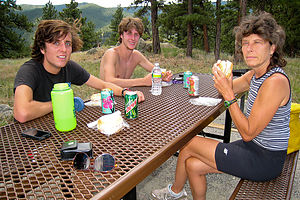
 Picnic lunch at Betasso PreserveWe chose to run the popular 3.2-mile Canyon Loop Trail which leads through a lovely pine and fir forest and grassy meadows. Also, by Boulder standards, it was considered relatively flat. Since we are usually accustomed to running 5 to 10 miles, I figured we would do the loop twice. Once again, I was humbled by the high altitude. The boys took off at a much brisker pace than Herb and I could emulate for more than 10 feet and soon disappeared from view in the forest, while Herb and I plodded along at a more reasonable and enjoyable pace. I felt pretty good at first, but then the legs got heavier and the slight headache returned. This was my third full day at high altitude, which apparently wasn’t enough. I began to do what the boys refer to as “Eatin’ it.” Herb seemed to be faring much better. Perhaps, his additional days out West before my arrival had given him an altitude adjustment advantage. I finally succumbed to what I hate to do on a run – walk. I just couldn’t run anymore. The sun was beating down on me and my legs felt like lead. Tommy, who had been out in Colorado for 6 weeks already, was the only one of us that took that second loop. Andrew and I looked like we had just run a marathon.
We had a nice picnic lunch on a table overlooking a nice view of Boulder. I can understand why outdoor enthusiasts flock to this area. Plus, training at this area must make you feel like superman when you get back to sea level. Before separating from the boys for our drive up to Estes Park, we stopped at Tommy’s favorite store: REI, which sold every conceivable toy to be used in the outdoors. It was a very tempting experience.
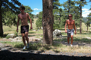
 Herb and Tom after running Canyon Loop TrailWe said goodbye to the boys for now and headed back out on Boulder Creek Canyon road towards Nederland where we would meet up with the Peak to Peak Scenic Highway, this time heading north on Route 72 and eventually Route 7 towards Estes Park.
Since it was just the two of us, we decided to spend the day doing something we like to do, but which the boys have not yet developed the same level of enthusiasm for – geocaching. For a full explanation on what geocaching is, see the description in our last stop or check out www.geocaching.com. Real briefly, geocaching is kind of like treasure hunting or orienteering. It involves using a GPS and a series of hints to search for hidden containers (ranging from tiny micro-size ones to large ammo boxes) that have been hidden by fellow geocachers. Some geocaches have little “treasures” in them (mostly little junky trinkets that you would normally throw out), but the real attraction is the journey towards finding them. There are over a million of them hidden throughout the world, and the people hiding them are usually locals that know about interesting places to visit that you would never come across otherwise. We think it’s fun. The boys think it’s embarrassing.
We “bagged” six of them along the way—a fairly productive day—and in the process discovered a lovely swimming beach along Boulder Creek, a great view of the Barker Reservoir Dam, and several awesome views of babbling brooks and snow-capped peaks. We were so absorbed that we didn’t realize the time until the boys called us from Estes Park wondering where we were. They were hoping to find us all settled in with dinner cooking. No wonder they hate geocaching. It makes us such neglectful parents.
Description
The Peak to Peak highway (Colorado Highways 119, 72, and 7) is a 55-mile scenic drive with spectacular snow-capped mountain vistas of the Continental Divide. Going from south to north, the drive begins in Central City and passes through Blackhawk, Nederland, the old mining towns of Ward and Allenspark, and Meeker Park, before arriving at Estes Park near the eastern gateway to Rocky Mountain National Park. Map: Map: http://www.byways.org/explore/byways/2114/travel.html
Although there are quicker routes to Estes Park from the Denver area, this is by far the most scenic. Peak to Peak Magazine's calls it “one of the most beautiful mountain roads in the country."
- ‹ previous
- 7 of 17
- next ›
Peak to Peak Highway location map in "high definition"
Javascript is required to view this map.
