- Home
- About
- Map
- Trips
- Bringing Boat West
- Migration West
- Solo Motorcycle Ride
- Final Family XC Trip
- Colorado Rockies
- Graduates' XC Trip
- Yosemite & Nevada
- Colorado & Utah
- Best of Utah
- Southern Loop
- Pacific Northwest
- Northern Loop
- Los Angeles to NYC
- East Coast Trips
- Martha's Vineyard
- 1 Week in Quebec
- Southeast Coast
- NH Backpacking
- Martha's Vineyard
- Canadian Maritimes
- Ocracoke Island
- Edisto Island
- First Landing '02
- Hunting Island '02
- Stowe in Winter
- Hunting Island '01
- Lake Placid
- Chesapeake
- Provincetown
- Hunting Island '00
- Acadia in Winter
- Boston Suburbs
- Niagara Falls
- First Landing '99
- Cape Hatteras
- West Coast Trips
- Burning Man
- Utah Off-Roading
- Maui
- Mojave 4WD Course
- Colorado River Rafting
- Bishop & Death Valley
- Kauai
- Yosemite Fall
- Utah Off-Road
- Lost Coast
- Yosemite Valley
- Arizona and New Mexico
- Pescadero & Capitola
- Bishop & Death Valley
- San Diego, Anza Borrego, Joshua Tree
- Carmel
- Death Valley in Fall
- Yosemite in the Fall
- Pacific Northwest
- Utah Off-Roading
- Southern CA Deserts
- Yosemite & Covid
- Lake Powell Covid
- Eastern Sierra & Covid
- Bishop & Death Valley
- Central & SE Oregon
- Mojave Road
- Eastern Sierra
- Trinity Alps
- Tuolumne Meadows
- Lake Powell Boating
- Eastern Sierra
- Yosemite Winter
- Hawaii
- 4WD Eastern Sierra
- 4WD Death Valley +
- Southern CA Deserts
- Christmas in Tahoe
- Yosemite & Pinnacles
- Totality
- Yosemite & Sierra
- Yosemite Christmas
- Yosemite, San Diego
- Yosemite & North CA
- Seattle to Sierra
- Southwest Deserts
- Yosemite & Sierra
- Pacific Northwest
- Yosemite & South CA
- Pacific Northwest
- Northern California
- Southern Alaska
- Vancouver Island
- International Trips
- Index
- Tips
- Books
- Photos/Videos
- Search
- Contact
Yosemite Valley, CA
Saturday, July 21, 2007 - 3:00pm by Lolo
200 miles and 4.5 hours from our last stop - 7 night stay
Travelogue
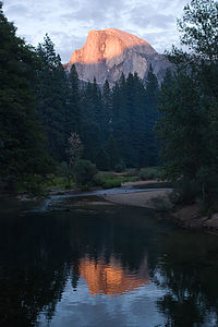 Half Dome alpenglow reflectionYosemite Valley has unanimously bumped Lake Powell from its prominent position as our all-time favorite spot on Earth. Then why, I wondered, did so many people tell me of their negative experiences at Yosemite? When I dug a little deeper, I found that the common thread to their stories was their approach, which was to stay somewhere outside the Park and then drive in and try to “do the Valley” in a day. All they remembered were traffic jams and hordes of tourists on the trails.
However, there is an art to doing Yosemite right. First of all, you really have to stay in the Valley itself and allow yourself at least 3 days to do it justice. This does require planning your trip months in advance, because everyone wants to stay in the Valley. Secondly, you have find ways to get away from the crowds, which really isn’t that difficult once you know your way around. There are plenty of pullouts along the drives from which you can find a totally private spot on the river to float around and gaze up at the cliffs, and at night, the various meadows are a great place to get away by yourselves to watch the sunset or the stars. Also, if you are willing to hike more than a mile, you can leave most of the crowd behind you on the trails.
With that being said, the following is a description of how we spent a very wonderful and relatively crowd-free week in Yosemite Valley.
Day 0: Late Night Arrival
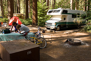 North Pine campsite with Lazy DazeThe family mood soared as we entered the Park through the Tioga Pass. I really didn’t think we were going to make it here today (see brakeline fiasco in Lone Pine). I couldn’t believe the change in the our enthusiasm level. We had definitely begun to drag from too many 100 degree plus days in the desert. Now it was evening, the air was crisp and fresh, the mountain lakes were sparkling, and there were big, beautiful pine trees as far as the eye could see—this was going to be so great!
By the time we finally arrived at the North Pines Campground in the Valley it was well after 10 o’clock. As we pulled into our campsite, we quickly turned off our headlights to avoid blinding the family gathered around a fire literally ten feet away from our front bumper. They certainly do pack you in tight here, much tighter than most National Parks, but it’s kind of a necessary evil. There are only about 400 campsites in the entire Yosemite Valley to accommodate the thousands and thousands of people who, like us, dream of camping in such an incredible place. Since we were one of the fortunate few to be able to reserve a site, I wasn’t about to complain about the tight accommodations.
Although we were exhausted, we were far too excited about being in Yosemite to just go to bed, so we went for a little stroll around the campground. The air was so fresh and the sky was so full of stars—the kind of sky you only see miles and miles away from the cities. Best of all, it was cool and green. I do love the desert, but it certainly does makes you appreciate trees.
Day 1: Valley Exploration by Bike
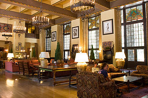 Boys in Ahwahnee Hotel "Great Lounge"The next morning, we decided to explore the Valley by bike. Yosemite Valley is a wonderful place to bike because it is flat and there are 8 miles of paved bike trails that cover the entire eastern section of the Valley, where most of the action is. Besides, the traffic can be pretty congested in the Valley, so we figured it would be better to just leave the RV parked at the campsite.
With backpacks loaded with cameras and spirits running high, we set off on our bikes to conquer the Valley. We crossed the bridge over the Merced River and got onto the bike path near Curry Village. At the intersection of the Northside and Southside Drives, we headed north towards Yosemite Village with the intention of doing the loop counter-clockwise.
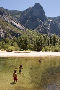 Lolo and boys wading the MercedHowever, before going to Yosemite Village, we made a side trip to the historic Ahwahnee Hotel, which I think is one of the most beautiful in the National Park System. We had actually stayed here once when the kids were 7 and 5 years old, and it was an unforgettable experience. I remember that Herb had asked for a Half Dome view. When we checked into our room and opened the curtains, Herb almost fainted when Half Dome opened up before him. It was hard to get him away from that window. Well now we were campers, but that didn’t mean that we couldn’t enjoy the facilities. I planned to make the Ahwahnee lobby my extended living room and to talk Herb into a few meals here. Speaking of which, it was Tom’s 16th birthday the following day, so we made reservations for lunch in the elegant Ahwahnee dining room. Tom has had some pretty fantastic settings to celebrate his on-the-road birthdays, and I was sure this one would live up to what he had come to expect.
Back on our bikes, we headed over to Yosemite Village, which is the main center for visitor services in the park. As a result, it is pretty crowded throughout the day. However, if you need something during your stay in Yosemite, you’re bound to find it here. There are restaurants, lodging, a grocery store, post office, and even a medical clinic. Our goal in the Village was the Ansel Adams Gallery, which is run by his son Michael Adams. Over the years of travel, photography has become more of a passion than a mere hobby in our household, so the same way that kids have basketball or baseball players as their heroes, our boys pretty much have Ansel Adams. After viewing some of the wonderful prints on exhibit, both by Adams as well as several contemporary photographers, we signed up for a ranger-led Photography Walk later that week.
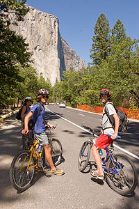 Lolo and boys on bikes approaching El CapitanFrom Yosemite Village, we continued on the bike path west towards El Capitan. We cruised right on by the Yosemite Falls Vista, since the roaring falls in mid-summer is reduced to a mere trickle.
However, there was plenty of water in the Merced River to have some fun, so we locked our bikes to a tree and spent a good part of the afternoon sunbathing on a sandy beach and swimming in the river. This was the life. The water was refreshing and the views were incredible. I only wished we had our tubes along, but they were back at the RV.
Once we were ready to move on, we followed the bike path south across Swinging Bridge and back alongside the Southside Drive towards the campground. Along the way we stopped at the tiny and often photographed Yosemite Chapel, hands down the cutest church I have ever seen. A bit further along, we came to Sentinel Bridge which we found was the place where Ansel Adams took some of his classic Half Dome shots. We would definitely have to come back here in the evenings when the sun was getting low.
Continuing on past the hustle and bustle of Curry Village, the other major center for visitor services in the park, we crossed back over the river and into the North Pines Campground, our home for the week.
We had seven nights reserved in North Pines. Originally, I thought we might choose to stay only five nights and then move on to something new, but after our first day in the Valley, we unanimously decided to spend every day we could in this Paradise.
Day 2: Tommy’s Birthday Lunch at the Ahwahnee and Hike to Glacier Point
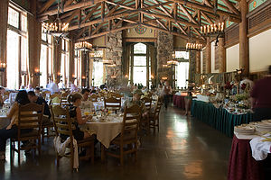 Ahwahnee Hotel dining roomWhen we were planning our stay in Yosemite, the one hike that we all agreed just had to be done was the one up the cable route on the back of Half Dome. Herb and I had done this hike 20 years ago (in our previous lives) and remembered it as the most challenging and rewarding hike that we had ever done.
The hike, however, is a serious one—16 miles out and back with an elevation gain of 4800 feet. Although we all are in pretty good shape, especially the boys, we thought it would be a good idea to do a warm-up hike first to make sure everything was working properly, like hiking boots, 50-year-old legs, etc.
As our warm-up, we chose to do the hike up to Glacier Point from the Valley via the 4-Mile Trail as it would give us some good elevation gain (3200 feet) and distance (9.2 miles round-trip) as well as some great views along the way.
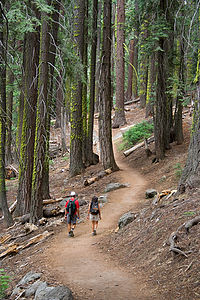 Mom and Dad on Four Mile trail to Glacier Point - TJGHowever, before setting out on our hike, we had Tommy’s birthday lunch at the Ahwahnee to enjoy. This would work out great, because we would be so nice and full from lunch that we wouldn’t have to worry about packing food for the hike. When we got to the Ahwahnee, we requested the Queen’s Table, which is where Queen Elizabeth ate during one of her visits here. However, since it was already occupied, we were seated at the table next to it in a lovely little alcove at the back of the dining room. Quite honestly, I don’t remember what we ate that day, probably because the views from the floor-to-ceiling windows are so spectacular that I was too overwhelmed to even notice or care what I was eating. However, based on the list of dignitaries and celebrities that have dined here, I’m sure the food was wonderful.
After lunch, we changed into our hiking clothes and rode our bikes over to the trailhead for the Four Mile Trail to Glacier Point, located along the Southside Drive. There were no bike racks, so we walked out bikes off the trail and locked them up to a tree behind a large boulder. Hopefully, we would remember where they were when we returned later that evening.
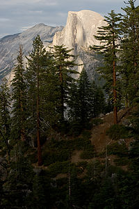 Half Dome and pine trees from Four Mile TrailThe hike was fairly strenuous with dozens of switchbacks to conquer, but the views of the Valley from some of the more exposed areas were well worth the effort. While we saw no other hikers along the entire four miles up, Glacier Point itself was full of tourists drinking lattes and eating ice cream, as most people arrive at Glacier Point by tour bus. Some of the hardier ones do choose to do the hike one-way back down to the Valley, but I think to really earn it you should climb it as well. Once on top, we fought our way through the throngs to a rock ledge with the best view of Half Dome and the Valley floor, set up a tripod, and took a potential Gaidus Family Christmas picture. Then we too had some ice cream before heading back down the trail to the Valley.
Although the way down was much less strenuous, it was also a lot harder on the knees, so we took lots of photo breaks along the way. Also, I had only packed my trail running shoes and they didn’t have nearly as good traction as my hiking boots, so I kept slipping and sliding on the loose gravel. Andrew and Tommy were kind enough to hold my hand on the steep parts, so that I wouldn’t fall. This slowed us down a bit. By the time we got back down, it had gotten pretty dark, and we were all a little spooked about running into a bear in the woods while trying to find our bikes, so we clapped our hands and made some noise to scare any lurking bears away. We found our bikes without incident and wearily rode them back to the campground to make dinner.
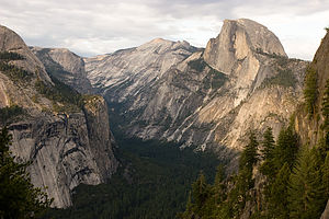 Half Dome and Royal Arches from Four Mile TrailThat night I was awoken from my peaceful slumber by what sounded like a mule screaming in pain. Since we were camping right next to the Yosemite Stables, this was not as implausible as it sounds. In my half-awakened state, I envisioned bears running amuck through the stables terrorizing the horses and mules. When I looked out the back window, I saw utter mayhem. People were running around like crazy, shining flashlights up trees, while a ranger’s truck kept circling the campground. I couldn’t believe that Herb and the boys were sleeping through this. They probably wouldn’t believe me in the morning and think that I had dreamt it all. Most of the people were now congregated around a tall pine tree in the campsite across the way, shining their flashlights up into the branches. I figured it must be an animal of some sort, most likely a bear. Gradually the group disbanded and I fell back asleep.
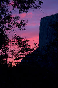 El Capitan Alpenglow - TJGThe next morning I was determined to find out what all the commotion had been about. When I told Herb and the boys about the mule noise, Andrew’s sleepy response was, “How does Mom know what a mule in pain sounds like?” That was not exactly the question I had expected. When I noticed that the guy in the campsite where the action had occurred was packing up his tent, I quickly ran out to conduct what Herb refers to as a “Lolo Extreme interview.” I call it being nosy.
Our neighbor told me that the previous evening while lying in his tent, he had watched the silhouette of two bear cubs pass by his tent. As if that wasn’t disconcerting enough, it was soon followed by the silhouette of the mama. I guess other campers saw the bears and that’s when the commotion began. The two little cubs ran up the pine tree on his campsite, which I guess got the mother bear pretty upset. I’m not sure who was more scared of who, the bears or the campers. Eventually, the cubs came down and ran off with their mama. I still have no idea what the source of the screaming mule sound was.
Apparently, these bear episodes are not uncommon in the campgrounds, so every night rangers ride through the campgrounds persuading them to leave. I spent the rest of my nights in Yosemite gazing out my back window waiting for some more bear excitement, but it never reoccurred while we were there.
Day 3: Floating on the Merced and Photographing Half Dome from Sentinel Bridge
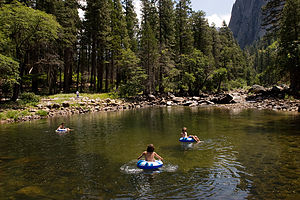 Lolo and boys tubing the MercedDay 3 was to be our rest day between the Glacier Point hike and the trek up the back of Half Dome, so we decided to spend it floating around the Merced River. Now that we knew our way around the Valley a lot better, we realized that we could pretty easily take the RV and find a pullout along either the Northside or Southside Drives from which we could access the river. This way we would have all the conveniences of home along with us, including our tubes, and could use that spot as a base camp for the day. We could run or bike from there, make lunch, shower, etc. It turned out to be a great idea, and one that we would repeat several times that week.
Fortunately, there were enough choices of pullouts to allow us to be quite fussy in our selection. We chose one along the Northside Drive where there wasn’t much room for other cars, so that as Herb put it “we could have a little piece of paradise to ourselves.” 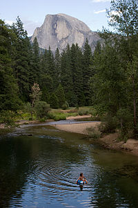 Half Dome from Sentinel Bridge with Andrew tubingUnlike the sandy beach we had been at the other day, this section had a rocky shoreline, but our Crazy Creek chairs worked just fine on the rocks. Also, the river was narrower and rockier here, so the current was much faster and more fun for tubing. The boys found a section a little bit downstream that was pretty fast and required some maneuvering between rocks. They suckered me into being part of a human chain, placing me on the tube in the middle so that I couldn’t escape. Not noticing that the nozzle of my tube was open, I bounced my butt along the rocks on uninflated vinyl. The boys were quite amused when I picked up my flaccid tube at the end of our ride. Herb tried it next, but he did it the wimpy way—on an inflated tube.
Later that afternoon we moved the RV to a parking area near Sentinel Bridge where we intended to photograph Half Dome when the lighting got low. We were definitely not the only ones with this idea. The bridge was already full of photographers with some very impressive tripods and camera gear, but we managed to stake out some territory of our own. The reason this spot is so popular with photographers is the way the light hits Half Dome at this time of day and the way the Merced River, which flows through the foreground of the picture, creates a second image of Half Dome in its reflection. 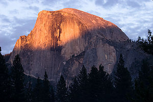 Half Dome alpenglowWe wanted to personalize our photos, so we sent Andrew out as our stunt tuber to float down the river. After a few passes under the bridge, he decided he had had enough and came up to take some pictures of his own. Meanwhile I went back to the RV and cooked up a chicken marsala dinner.
After dinner, we walked out on the bridge once more to take one last look at Half Dome before calling it a night. To our surprise, it was no longer completely in shadow, but lit by a beautiful reddish glow. We later learned that this phenomenon, known as alpenglow, occurs as the scattered light from the setting sun hits the mountains. Whatever it was called, it was stunning. We ran back to the RV for our cameras, and just got in a few shots before the lights went out on Half Dome for good that night.
Day 4: Half Dome Hike
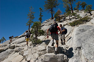 Lolo and boys hiking up Half Dome's shoulderThe next day (Day 4) was the one we had all been anxiously anticipating – the 16-mile round-trip hike from the Valley up the steep back of Half Dome via a precarious cable route, with a total elevation gain of 4800 feet. We awoke at 5:30, very early for us, to get an early start on what was estimated to be a 10-12 hour hike.
After packing our backpacks full of camera gear, snacks, and plenty of water, we rode our bikes over to the Happy Isles Nature Center to start our trek up to Half Dome. From Happy Isles we followed the Mist Trail through a lovely forest of ponderosa pines and black oaks. The trail was rough asphalt and pretty flat at first, but it soon steepened and became much rockier. At .8 miles we came to Vernal Bridge and a great view of Vernal Falls rushing towards us. Vernal Falls is one of the few falls in Yosemite that don’t dry up in the summer, so the hike to it is very popular this time of year. There are flush toilets and drinking fountains near Vernal Bridge. In fact, this is the only place to get water along the entire hike, unless you choose to treat water from the Merced.
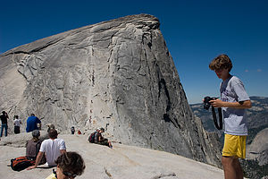 Half Dome cable view from top of shoulderA little bit past the bridge we came to a junction with the John Muir Trail, but continued upriver on the Mist Trail, which was not really a trail anymore but rather a steep granite stairway of seemingly endless rocky steps. With each step we became more and more aware of the approaching falls as it got louder and louder and began to spray us with a fine mist. Finally we reached the brink of the falls and gazed down its thundering cascade from behind the safety of a guard rail.
Herb looked at his altimeter watch and informed us that we had climbed 1,000 feet so far. I felt like choking him. That meant we had 3,800 more feet to go. This was going to be a very long day.
Just beyond the top of the falls, the trail led past the Emerald Pool, full of happy swimmers ignoring the Danger No Swimming signs. I must admit that the thought of hanging here in the sun for the day was tempting—which was what most of these people were doing—but onward to Half Dome we must go. Then, I suggested a quick swim to cool off, but the more practical part of the family didn’t want to hike all wet. So, we decided to swim on the way back down. It would give me something to look forward to.
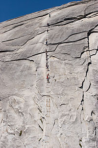 Half Dome cables with climbing touristsOn a more practical note, there are outhouses near Emerald Pool. The next bathroom stop wouldn’t be until Little Yosemite Valley.
Right past the Emerald Pool, we crossed a bridge back over the Merced and began the steep climb up a series of endless switchbacks with Liberty Cap to our left and Nevada Falls slipping in and out of view ahead. At mile 2.8 the Mist Trail came to an end and joined up with the John Muir trail. You can take the John Muir trail a short distance to the right to a bridge over the Nevada Falls, but we took a left and kept plodding onward following the signs towards Half Dome. I checked Herb’s altimeter watch. We had gained 2,000 feet in elevation, less than half of what we had to do that day. This was going to be a humbling experience.
We continued on through Little Yosemite Valley, where Herb and I had backpacked 20 years ago. There was a very nice restroom to stop at there—the last one we would encounter on our way up. Unfortunately, there was no water and we were going through ours pretty quickly. We were going to have to start rationing.
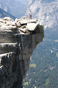 Dad on Half Dome ledge - TJGEventually we came to a trail junction signed for Half Dome, 2.5 miles away. Another check of the altimeter watch showed that we were at 7,000 feet, just 1,800 more to go. We continued our ascent through a lovely forest of Jeffrey Pines and red firs. The boys were now in the lead and I was dragging a bit behind. About this time, a black bear ran full speed across the trail, just a few yards in front of the boys. I, however, must have been staring down at my weary feet and missed it. After that, the boys stuck a lot closer to Herb and me.
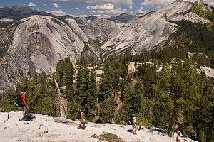
Finally, after what seemed like a week, the back of Half Dome came into view. The trail continued up the shoulder of Half Dome in a series of very steep and rocky switchbacks. I wasn’t looking forward to coming back down these in my poorly tractioned trail running shoes, but I wouldn’t worry about that ‘til later. I had plenty enough to worry about for now. This part of Half Dome was hairy enough, and we hadn’t even gotten to the cables yet. For some reason I don’t remember this being so bad when we did it 20 years ago. They must have made it steeper. There were lots of signs warning hikers to turn back if a storm was approaching, but we had no excuse—the sky was perfectly clear.
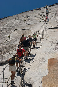
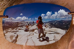 Half Dome summit view in sunglasses - AJGWe made it to the big rock slab at the base of the cables, where we found dozens of other hikers just sitting there, staring in awe at the cables and contemplating their next move. We joined them and started staring as well. It really was very intimidating. The route was about 400 feet up the back side of the dome, and so steep that hikers need to hold onto cables to make the ascent. The steel cables are about 3 feet apart and are suspended at arm’s height from pipes set in the rock. About every 10 feet or so there are wooden boards attached to the rock to serve as a place to place your feet and rest.
Fortunately, we didn’t know at the time that a hiker had fallen to his death from these cables a month ago, or we probably would have talked ourselves out of it. Rationally, I knew if I just held on tight to the cables, I would be fine. The trouble was that the cables were really crowded with people going both up and down, so that as you passed each other, you had to let go with one hand and hold onto the cable on one side with both your hands as the people went by. That was going to be the tough part. When Herb and I did this 20 years ago, I don’t remember there being anybody else but us on the cables, but today there must have been at least 50 people at a time on the route
 Lolo cautiously descending Half Dome cablesIt was interesting to watch and listen to the other hikers’ discussions about whether or not to go up. You couldn’t predict their decision by looking at them. There were two couples near us that came up with a split decision. The girls decided to go up while the guys remained behind. Fear of heights was not a matter of machismo.
I knew there was no way we weren’t all going to do it, but Andrew and I were definitely more apprehensive about it than Herb and Tommy. In a crevasse of a rock at the base of the cables we found a bunch of rubber gloves which people had left behind for other hikers to use while gripping the cables. I selected a hot pink pair.
At this point I just wanted to get it over with, so we started our ascent. Tommy was worried that I would be the weak link, so he very kindly went behind me, I guess with the intention of catching me if I slipped. With sweaty palms inside my hot pink gloves, I gripped those cables, pulling myself further and further up the Dome. My arms actually hurt later from the pulling, but Herb told me that if I had used my legs more, I wouldn’t have had to pull so hard. The entire 15 minutes or so it took to get to the top, I never took my eyes away from the granite face in front of me, knowing full well I was missing out on an awesome view of Clouds Rest behind me. That view could wait until I got to the top. The final part of the ascent gets a lot less steep and before I knew it I was standing on the large flat summit of Half Dome (elevation 8,842 feet). All of Yosemite Valley and Tenaya Canyon spread out before us. It was absolutely breathtaking!
 Lolo and boys descending Half Dome shoulderNear the dome’s highest point, there is a slab of rock that protrudes out beyond the cliff face, kind of like a diving board. I remember looking up at Half Dome from the Valley Floor and thinking that it looked like Half Dome’s eyebrow. Some of the braver hikers on top walked out onto this slab to get their pictures taken. Some even sat on its edge with their legs dangling over. It made my palm sweats just watching them. 20 years ago, when Half Dome was less high, Herb had walked out on this slab so I could take his picture. I too had followed, sort of. Herb has a very embarrassing picture of me crawling like a worm out onto the ledge.
Herb, who was an avid rock climber for over 10 years before the kids were born, felt the need to walk out on the overhang once again. However, he did admit to feeling a bit of vertigo that he hadn’t experienced the last time. Tommy walked out next and had no problem, except for the embarrassment of his mother yelling for him to get back from the edge. Andrew and I decided to just enjoy the view from the safety of a broader and flatter surface.
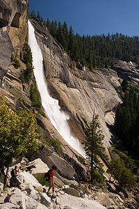 Andrew and Nevada FallsI could never completely relax on top because I knew that I had to get down the cables again, and I had a feeling that going down was going to be a lot worse than going up. There are two different approaches to going down. One is walking forward while looking out at the expansive view before you, and the other is going backwards while pretending you’re really interested in the geological make-up of the granite you have your face pressed against. While Herb and the boys were okay with either, I chose the latter method, which is a bit slower. I think I caused a little gridlock at one point, but frankly I didn’t care. What was everybody’s rush?
I think that probably the worst part of the entire hike for me was climbing down the steep rocky switchbacks on Half Dome’s shoulder below the cable route. The gravel was so loose that I kept slipping and sliding the whole way. Fortunately, my butt only made contact with the ground once.
It was a long way back and we were almost out of water. I really thought we had packed more than enough, but it was so hot and the hike was so strenuous that I guess we drank a lot more than we anticipated. We should have brought along a water filter or iodine tablets so that we could have drank the water from the Merced River. It looked so tempting, but we knew how sick we could get if we drank it unpurified.
Near Nevada Falls, there is a choice of ways down to the Valley. The John Muir Trail is slightly longer and less steep. Many people use this trail to make the hike to Vernal and Nevada Falls a loop with the Mist Trail. We, however, chose to retrace our steps on the Mist Trail because we wanted to swim in the Emerald Pool.
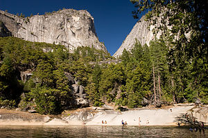 Lolo and Andrew at the Emerald PoolHowever, when we finally got back to the Emerald Pool, we were so thirsty that we didn’t know whether we should stop to swim or just continue on for water. We knew that there were water fountains about 1 ½ miles ahead at the Vernal Falls Footbridge, but I really wanted to swim. Luckily, Andrew found an unopened bottle of Gatorade in the bottom of his backpack, and solved the problem.
The Pool was still quite full of people ignoring the Danger No Swimming signs. I think the real danger is in the springtime when the water flows so swiftly that there is a real chance of being swept downstream over the falls, but in mid-summer the current just isn’t strong enough. The water was very refreshing and it certainly felt good to wash away the layers of dirt that had accumulated from 10 hours on the trail.
Feeling reinvigorated, we continued down the steep rocky steps past Vernal Falls and back to our bikes at Happy Isles. It had been a very challenging but extremely rewarding day. I think we should do this hike every 20 years.
Day 5: Ranger-led Photography Walk, Sentinel Beach, and Ahwahnee Meadow
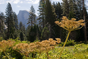 Half Dome with flowersThe next morning we rode our bikes to Yosemite Village for our scheduled Photography Walk with a park ranger. When I saw that the group gathered in front of the Ansel Adams Gallery included several young children, I was concerned that the talk would be too basic and that Herb and the boys would be bored, but I worried for naught, because our ranger was amazing. She was able to connect with group members of all abilities, from kids with point-and-shoot cameras to the most sophisticated of photographers. I think that every one of us learned something new that day.
For the next hour or so, she took us on a stroll through a meadow we hadn’t been to before and taught us to focus on some of the more intimate details of nature that one rarely takes notice of in a place surrounded by such overwhelming icons as Half Dome and El Capitan.
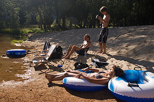 Lolo and boys relaxing at Sentinel BeachWe were all pretty sore from our Half Dome hike the day before, so the most activity we wanted for the rest of the day was relaxing and floating on the river. We rode our bikes back to the RV and went on a quest to find the perfect river spot. After missing a few opportunities to pull over, we decided to pull into the Sentinel Beach Picnic Area along the Southside Drive. Since this was a parking area, we didn’t have it all to ourselves like our spot along the Northside Drive the other day, but by wading across the river to the beach on the other side, we pretty much did. Also, from this side of the river, we could just sit back and gaze at Sentinel Rock. The river was a bit wider and slower here than our spot the other day, so the tubing was more leisurely than exciting. The boys took the tubes up the river to Swinging Bridge a few times where the water was a bit faster and then drifted back down to us.
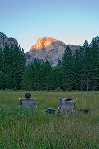 Mom and Dad at Ahwahnee Meadow - AJGIn the evenings, we usually tried to find a scenic spot to park the RV where we could have dinner and take some photographs. On this particular evening, we parked on the road south of the Ahwahnee and set up our beach chairs in the Ahwahnee Meadow facing Half Dome. The amazing thing was that despite the thousands of visitors who were running around the Valley, we were the only living souls that had come to spend an evening in this beautiful meadow. The boys went for a run while Herb and I sat in our chairs sipping wine, and as Herb said, “wait for the Big Fella to turn colors.” We got a bit nostalgic—perhaps it was the wine—as we reminisced about sitting in this same meadow as newlyweds over 20 years ago. Things had changed a bit since then. We were a bit more seasoned now, and rather than just being by ourselves, we had two wonderful happy and healthy boys running laps around this very meadow, waving to us on each pass. Oh, and one other thing had changed—Half Dome had gotten bigger and the cables steeper since I last climbed it.
When the boys got back, we set up the tripods in the meadow and just hung out there while Half Dome did its “alpenglow” thing. It was so peaceful and serene that none of us wanted to leave, so we just stayed on and waited for the stars to come out. As it got darker and darker, I got to thinking more and more about bears and whether they liked meadows as much as they did campgrounds. While Herb and the boys took time-lapsed exposures of the surrounding cliffs and stars, I protected the family by keeping watch for any suspicious movements in the field. I’m not sure what I would have done if there was, but thankfully I didn’t have to find out.
It was well after 10 o’clock before we left the meadow that night. I think we were all becoming aware of how little time we had left in Yosemite and didn’t want to waste one precious moment of it.
Day 6: El Capitan Vista, More Floating on the Merced, and the Ahwahnee
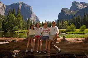 Gaidus family on log with El CapitanWell, it had finally arrived—our last full day in Yosemite. I think for all of us the significance of this was bigger than just Yosemite. It symbolized the end of an era and probably the happiest week we had ever spent together as a family—and believe me we’ve had many. Soon after our return home Andrew would be heading off to college, and life as we knew it would be forever changed. Or maybe it was just me thinking these mushy thoughts while the Gaidus men were just worrying about where to float on the river that day.
For our farewell tour of the Valley, we decided to take the RV out for the day and drive the 12 or so miles of the Valley Loop once again, stopping wherever and whenever we felt like it. Also, we thought it was time we paid a little more attention to Yosemite’s other famous landmark in the western end of the Valley—El Capitan.
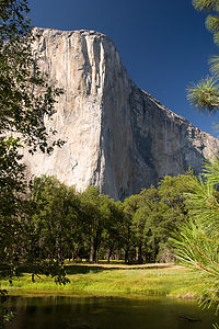 El Capitan "Nose"We drove along the Northside Drive and pulled into a parking area with a great view of El Cap. It really is an impressive sight—3,000 feet of the largest piece of exposed granite in the world. Since there was no one else there, we thought it would be a good place to compose another family Christmas picture. There was even a conveniently placed log with El Capitan looming behind it that we could all squeeze onto. With the aid of tripod and self-timer, we managed to get off a few good shots just before a tour bus pulled into the parking area. Soon there were dozens of people scurrying around trying to get their own perfect shot of El Cap. We decided to hide in the RV until the crowd left.
It actually was pretty entertaining. After they were done photographing El Cap, many of the people became interested in peeking into the RV, not realizing that we were in there and that although they couldn’t see in through the tinted windows in the back, we could see them perfectly. I felt like I was in an aquarium.
We continued on, making the turn near the exit onto the Southside Drive to head back towards the eastern end of the Valley. It was another hot day in the upper 90s, so we began our search for a pullout with river access. This time we stopped at one that required a little further walk through the forest to get down to the river, but that was okay. I think it was called El Capitan Vista, but if it wasn’t, it should have been.
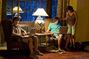 Boy's getting "wi-fi" at the AhwahneeFor pure swimming and beaching, this wasn’t as good a spot as some of our other stops this week, but it was by far the best in terms of views and solitude—two very important Gaidus criteria. We were directly across the river from El Capitan and could even see little tiny climbers on its face. In fact, except for those climbers, there was no one else in sight. After spending the rest of the afternoon floating and gazing at El Capitan, we unanimously dubbed this our favorite river spot.
Later that afternoon, we moved the RV to our spot near the Ahwahnee Meadow and walked across the meadow to the Ahwahnee to have dinner on the outdoor patio. The boys had another motive for wanting to go to the Ahwahnee—WIFI. It had been 8 days since they last had Internet access and they were beginning to show signs of withdrawal. So they brought their laptops along and made themselves quite at home in one of the lovely sitting rooms of the hotel; and just like at home, they wouldn’t come to dinner when I called them. So Herb and I enjoyed a glass of wine alone, which was quite nice, before they finally decided to join us. Dinner was great—much more casual and affordable than the elegant dining room inside. However, I still think everyone should experience eating in the Ahwahnee dining room at least once during a visit to the Valley.
After dinner it was back to the sitting room for more laptopping before finally returning home across the meadow.
Day 7: Departure
All good things must come to an end, so we said farewell to the Valley and drove back out along Tioga Road and through the East Entrance. Yosemite had been a real vacation for me. Now I had to get back to work, plotting interesting and exciting stops for our journey home. Yosemite would be a hard act to follow.
Description
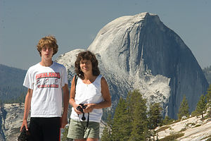 Tom, Lolo, and Half Dome from Olmsted PointYosemite National Park lies near the eastern border of California in the heart of the Sierra Nevada Mountains. Its spectacular waterfalls, soaring granite cliffs, and lush meadows are just a few of the reasons it is considered by many to be nature’s ultimate masterpiece. In the words of John Muir, “it is surely the brightest and the best of all the Lord has built.”
This description will focus on Yosemite Valley, which is the section of the park we visited. Although the Yosemite Valley is just a small portion of Yosemite’s 761,268 acres, it is part receives 95% of its visitors. In fact, an estimated 4.1 million people visit the Valley each year, making it extremely crowded.
Two one-way roads traverse Yosemite Valley: the east-bound Southside Drive and the west-bound Northside Drive, which wind through woodlands and meadows along the base of the 3,000-foot-high granite cliffs. As of today, cars are still allowed to enter and drive through the valley, but visitors are highly encouraged to park their vehicles and use the park’s free shuttle bus, which stops at the major attractions in the valley.
Virtual Tour of Yosemite Valley Highlights
- As you enter the valley, the first sight you’ll see is the 620-foot Bridalveil Falls flowing down from a hanging valley to the valley floor. From the parking area, a short paved path leads to the base of the falls. This is one of the few falls in Yosemite that does not completely dry up in the summer.
- Just past the Bridalveil Fall parking area, the Southside Drive begins to trace the Merced River. Soon El Capitan comes fully into view. This 3,000 foot high granite cliff is the largest single piece of exposed granite in the world and one of the most famous landmarks in Yosemite. If you look closely, you might see small dots that are actually rock climbers along its face.
- Continuing east on the Southside Drive are two riverside picnic areas and beaches: Cathedral Beach and Sentinel Beach.
- Right after the Sentinel Beach parking area is the trailhead for the 4-Mile trail, which ascends more than 3,200 feet from the valley floor to Glacier Point and one of the most spectacular views of the valley.
- A short distance further is Swinging Bridge, another picnic and swimming area. This area is also the westernmost point of the 8-mile bicycle loop that goes through the eastern part of the valley. From this point on, the bike path parallels the road.
- Next stop is the picturesque tiny Yosemite Chapel where many outdoor enthusiasts choose to exchange wedding vows.
- Now you enter the congested and developed portion of the valley.
- Right past the chapel, you can either take a left onto Sentinel Bridge towards Yosemite Village and the park exit, or you can continue straight towards Curry Village, the campgrounds, and Happy Isles Nature Center. For now, let’s stop at Sentinel Bridge for what is probably the most spectacular Half Dome viewpoint in the park. It’s a great spot for a photograph of Half Dome with the Merced River in the foreground.
- Continuing east on the Southside Drive, you pass Housekeeping Camp and Curry Village. Curry Village has lodging, restaurants, bicycle and raft rentals, a grocery store, and other shops. Curry Village is also one of the main parking areas in the valley.
- From Curry Village you can either take Northside Drive across the Ahwahnee Bridge back to Yosemite Village and the park exit, or continue east to the campgrounds. The Happy Isles Nature Center is also this way, but only shuttle buses are allowed on the road to it.
- The Happy Isles Nature Center features exhibits on the natural history of the park. It also serves as the trailhead for some of the best hikes in Yosemite. 1.5 mile trail leads to the top of Vernal Falls and then continues another 1.5 miles to the top of Nevada Falls (two waterfalls that flow even in the summer time). From there you can continue even further into the backcountry of Yosemite, including the cable route up the back of Half Dome.
- From Curry Village, the Northside Drive crosses the Ahwahnee Meadow, a wonderful spot to gaze at Half Dome during sunset, and enters Yosemite Village, the main center of visitor services in the park. Here you’ll find the park’s main Visitor Center, restaurants, lodging, shops, a grocery store, a post office, a medical clinic, the Ansel Adams Gallery, an Indian Cultural Exhibit and more. It’s also a good place to park your car and jump on the shuttle.
- A short dead end road from Yosemite Village leads to the majestic old Ahwahnee Hotel, which has played host to Queen Elizabeth, President John F. Kennedy, and Clint Eastwood, to name a few. This beautiful six-story rock structure offers tremendous views from every room. Within the hotel is the elegant and quite expensive Ahwahnee Dining Room (jackets required for dinner).
- Back on the Northside Drive heading west from Yosemite Village, the next stop is the Yosemite Falls parking area. At 2,425 feet, Yosemite Falls is the highest waterfall in North America. It is actually three waterfalls in one, with an upper, middle and lower section. A short walk from the parking lot along a paved walk leads to the base of Lower Yosemite Falls. This is the most visited landmark in the valley. Except in summer when the fall temporarily dries up, you’ll be sure to be covered in spray.
- A little further west on the Northside Drive is Yosemite Lodge, which marks the end of the developed area of the park going west.
- Right after Yosemite Lodge is Sunnyside Campground/Camp 4, a place where most rock climbers choose to congregate. From this campground begins the popular and strenuous Yosemite Falls hike, which ascends 2,600 feet from the valley floor to the top of the Upper Falls. The views from the top are incredible.
- Continuing west, there is nothing but woods and meadows from which to enjoy the views. Along the road there are several pullouts where you can stop and walk down to the Merced River for a swim. Just after the El Capitan Bridge, you’ll come to the El Capitan Meadow where you’re sure to find people looking through binoculars at the miniscule rock climbers clinging to the granite face.
- Just to the west of El Capitan, Ribbon Falls plunges over 1,600 feet down to the valley floor. It is the seventh highest waterfall in the world. However, it too dries up in the summer time.
- Finally the road nears the end of the Northside Drive at Valley View where El Capitan, on the left, and Cathedral Rocks, on the right, frame a magnificent valley view.
Several guided bus tours are also available. The 2-hour Valley Floor Tour is a great way to get acclimated. Visitors ride through the valley in an open tram while a guide leads a informative discussion of Yosemite’s history and geology. There are many photo stops along the way. In addition, there are bus tours out of the valley to Glacier Point, the Mariposa Grove of sequoia trees, and Tuolumne Meadows.
Although much of Yosemite can be enjoyed from the comforts of your car or a shuttle, the best way to truly experience Yosemite is do get out and experience it more directly.
Things to do in Yosemite
- Hike one of the many trails around the valley, ranging from an easy walk to the base of Lower Yosemite Falls to the strenuous 16-mile round trip hike up the back of Half Dome via cables
- Take an overnight backpacking trip
- Bike along the 12 miles of bicycle paths that loop through the Valley. Rentals are available at Curry Village and Yosemite Lodge.
- Rock climb in one of the premier climbing places in the world
- Raft down the calm waters of the Merced River through the valley. Rentals are available at Curry Village.
- Swim or tube in the Merced River. Besides the designated beaches, there are many pullouts along the road from which you can walk down to the river.
- Join one of the many ranger walks, which are offered daily
- Take a free art class at the Yosemite Art and Education Center
- Photograph the amazing scenery of the valley and surrounding granite cliffs
- Browse the Ansel Adams Gallery and see some of the photographs that first made Yosemite famous
- Relax in the meadow while gazing up at Half Dome or El Capitan
- Dine at the 5-star Ahwahnee Hotel, where presidents and royalty have stayed
Although many try to see Yosemite in a day, it is best to devote several days to seeing all the park has to offer. Besides the numerous hotels, lodges, and cabins in the Valley, there are three RV campgrounds: Upper Pines (238 sites), Lower Pines (60 sites), and North Pines (81 sites). That’s less than 400 campsites to accommodate all the people that want to camp here.
Since these campgrounds usually fill-up within the first hour they become available, it is essential to make your reservations as soon as possible. Campground reservations are available in blocks of one month at a time, up to five months in advance, on the 15th of each month at 7 am Pacific time. For example, if your arrival date is July 15 through August 14, the first day you can make reservations is March 15. The National Park Reservation System can be found at www.recreation.gov. Good luck!
- ‹ previous
- 9 of 19
- next ›
Yosemite Valley location map in "high definition"
Javascript is required to view this map.

This site is wonderful. Thanks for the great info. I'm planing my our cross country trip and this a great resource. Keep up the good work.
Thanks for the encouraging words Mikey. It's always good to hear that our website is helping others plan their own cross country trips
Thanks so much for all your hard work on this site. It is inspiring and very helpful! I am trying to convince my husband to buy an RV so we can travel the country - reading your stories has been such an inspiration!
Where are you headed THIS summer?
I'm glad our efforts are appreciated! Unfortunately, this summer will be our first without a major RV travel vacation due to Andrew's work commitments. Maybe next summer?
Just found your sight. We have never made an RV trip, but love National Parks. Yosemite is my favorite as well. My wife would rank it as #2 behind yellowstone. My daughter would r go rank it #3 behind Yellowstone and Arches. Your trips remind me of ours. When you do it, you do it right and stay at each place for a few days. I just don't get it, people who spend an average of 4 hours a national park. Nice site!!!
Hi John,
Thanks for the comment. I agree completely that you need to spend some time inside the National Parks to get to fully appreciate them. Especially the big ones. Glad to see that even though you've seen some of the major parks, you still managed to find something of worth in our site. Safe Travels
I 1st found your site in 2007 when I was preparing to take an RV trip to Alaska with my parents - we pretty much did exactly what you guys did ("What did Herb and Lolo do?" became our phrase of the trip!) and since then you've become our "go-to" family when planning our summer RV adventures! My parents have a 36 ft Country Coach and I always rent my own little RV - something under 25 ft. This summer we are heading to Yosemite and Sequoia/Kings Canyon so naturally as I'm procrastinating from packing I had to come over and check out what you guys did! Great suggestions! My dad and I aren't attempting Half Dome but we plan to hike it up elsewhere in the park! Definitively looking forward to checking out the Alpineglow and hiking up to Glacier Point (my mom doesn't hike so she can pick us up at the top and we can avoid the dreaded hike downhill! :-) You can read about our family RV trips on my blog - linked above ...the 1st one was Alaska in July/Aug 2007, then I took a solo RV trip to Maine in July 2009, and last July we spent 3 weeks in Washington State! Thanks for all the great tips! Looking forward to your next adventure!
Hi Melissa,
It's great to hear that our Alaska trip itinerary helped you to plan a trip of your own.
A hike we couldn't do in Yosemite in 2007 was the hike to the top of Yosemite Falls. Depending upon the water flow, it is highly recommended and isn't the full day commitment that the Half Dome hike is. Also check out the Giant Sequoias at Mariposa Grove. We had seen these already in previous trips to the Valley so we didn't visit them again in 2007. Yosemite should be a great trip, and you must have had great timing and a bit of luck if you got camping reservations in the valley.
Our next adventures will be an evolving challenge. Both boys are in college now, (in fact Andrew is going on to graduate school), so it's a bit tough to get everyone together at the same time. Nevertheless, since Tommy is working in Boulder, CO this summer, I plan on driving the RV out there and meeting up with Lorry and Andrew when they fly in a week later. Lolo is planning some quality family time as I type this.
Have a great trip, and please leave a comment with updated information on any trip stops that you visit.
Herb,
thanks for all of your invaluable experiences that you have shared with the public! I am planning a road trip out west (starting in Louisiana) this summer with my wife and 4 children. we will spend 3 nights in Yosemite before we hit the road again towards Zion. If you had 2 full days at Yosemite, what would you recommend our activities be? My children are 7,8,9, and 10. thanks again!
Hi Scott. Hopefully, you already have your camping reservations because they are extremely difficult to get. With two days in the Valley with kids your age, I would spend one day hiking to Vernal and Nevada Falls and the other exploring the Valley -- renting bikes and bicycling the Valley Floor loop, swimming in the Merced River from one of its sandy beaches, attending a Ranger Talk, etc.
You are going to love Yosemite!