Mono Lake, CA
The kids left in the morning to head back to the city. Since snow in the Sierra was no longer a threat, they took the Tioga Pass Road through Yosemite, the shortest, and also the most scenic, route back to the Bay Area.
Not having jobs to get back to, Herb and I had the luxury of not having to drive home on Memorial Day. Instead we could take our time cruising north on 395 before heading west towards home - retirement is so great!
Herb loves Mono Lake, and never seems to get enough of its otherworldly landscape of “tufa castles” that rim the lake. So, we got a campsite at nearby Mono Vista RV Park, a campground we have stayed at on numerous occasions while exploring up and down Highway 395.
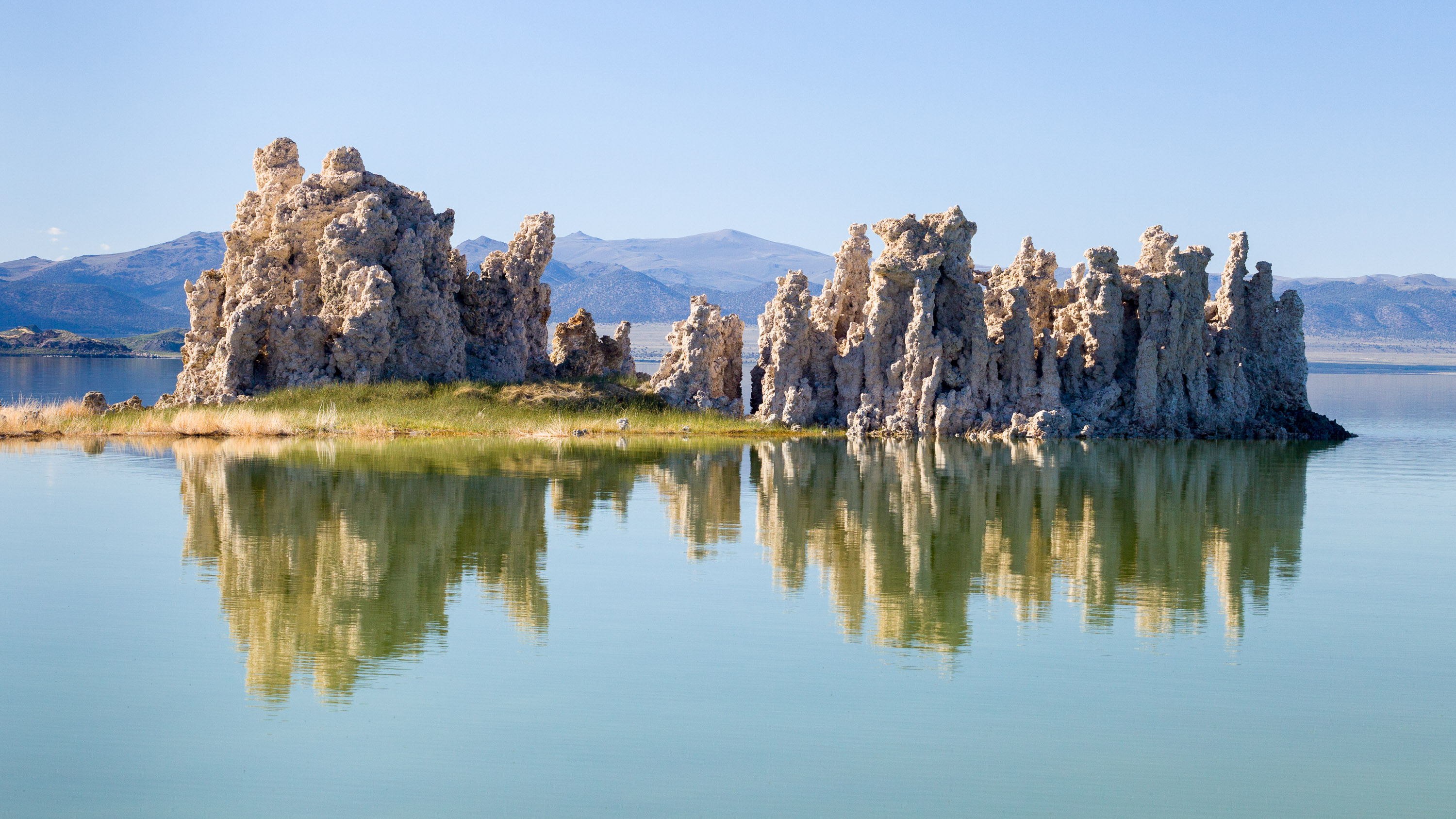
Besides being the oldest lake in North America, Mono Lake is extremely unique, because of the massive amounts of salt and minerals that flow into it from Sierra streams and have no way out except through evaporation—similar to the Great Salt lake in Utah. However, Mono Lake has something the Great Salt Lake doesn’t – “tufa castles,” which built up over thousands of years from the calcium-carbonate deposits accumulating in the lake. Normally they would just be hidden beneath the water, but as lake levels dropped, these extraordinary-looking knobs, spires, and minarets became exposed, some of them rising as high as 30 feet above the surface—and they do look like castles.
The largest concentration of them can be found along the southern shore of the lake at the South Tufa State Reserve, just ½ mile west of Navy Beach.
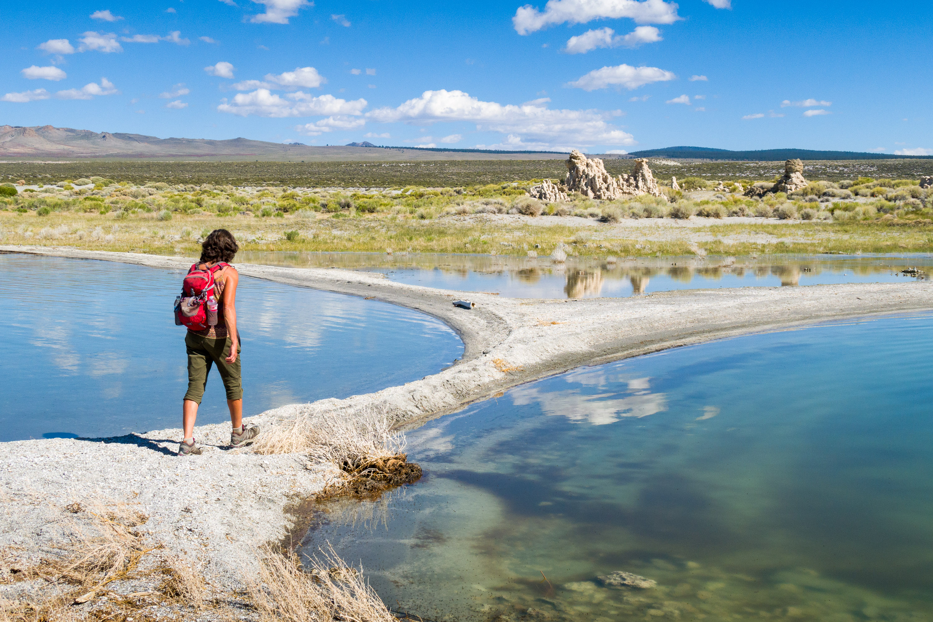
We’ve pretty much seen the main tufa areas, both by kayak and by hiking, but Herb still wanted to find the “sand tufas” which he had seen in the movie about Mono Lake played at the Visitor Center. We asked a ranger where we could find them, and he told us to drive towards Navy Beach, hanging a right on a dirt road to a small parking lot. From there we should just walk east along the lakeshore.
We did as told and soon found ourselves in a small parking lot with just one other car. From there we walked along the beach. There were always more tufas in the distance, so we kept forging on, hoping these would be the elusive sand ones. But alas, they were just your everyday tufas, still spectacular, but nothing different from what we had seen on our past visits.
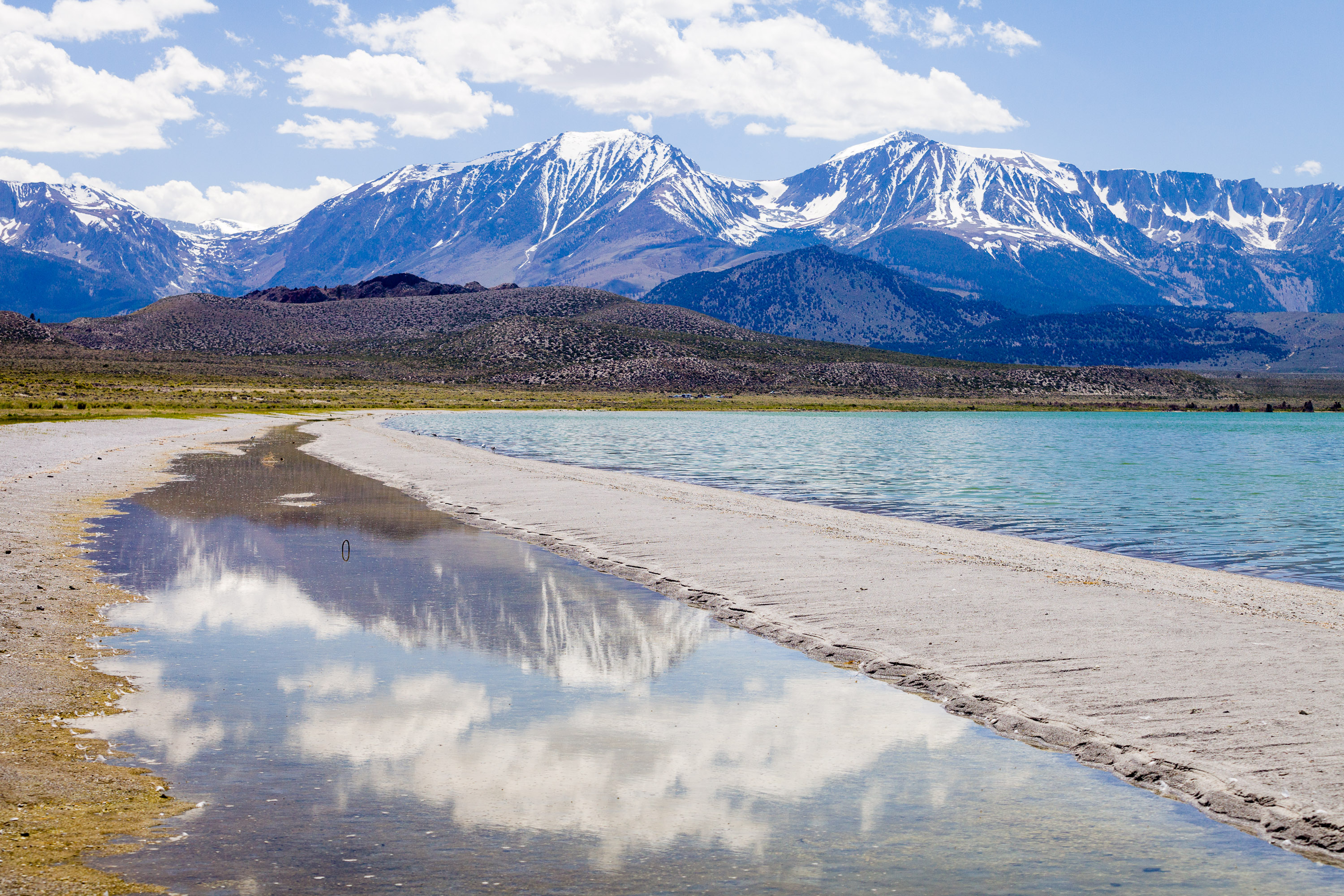
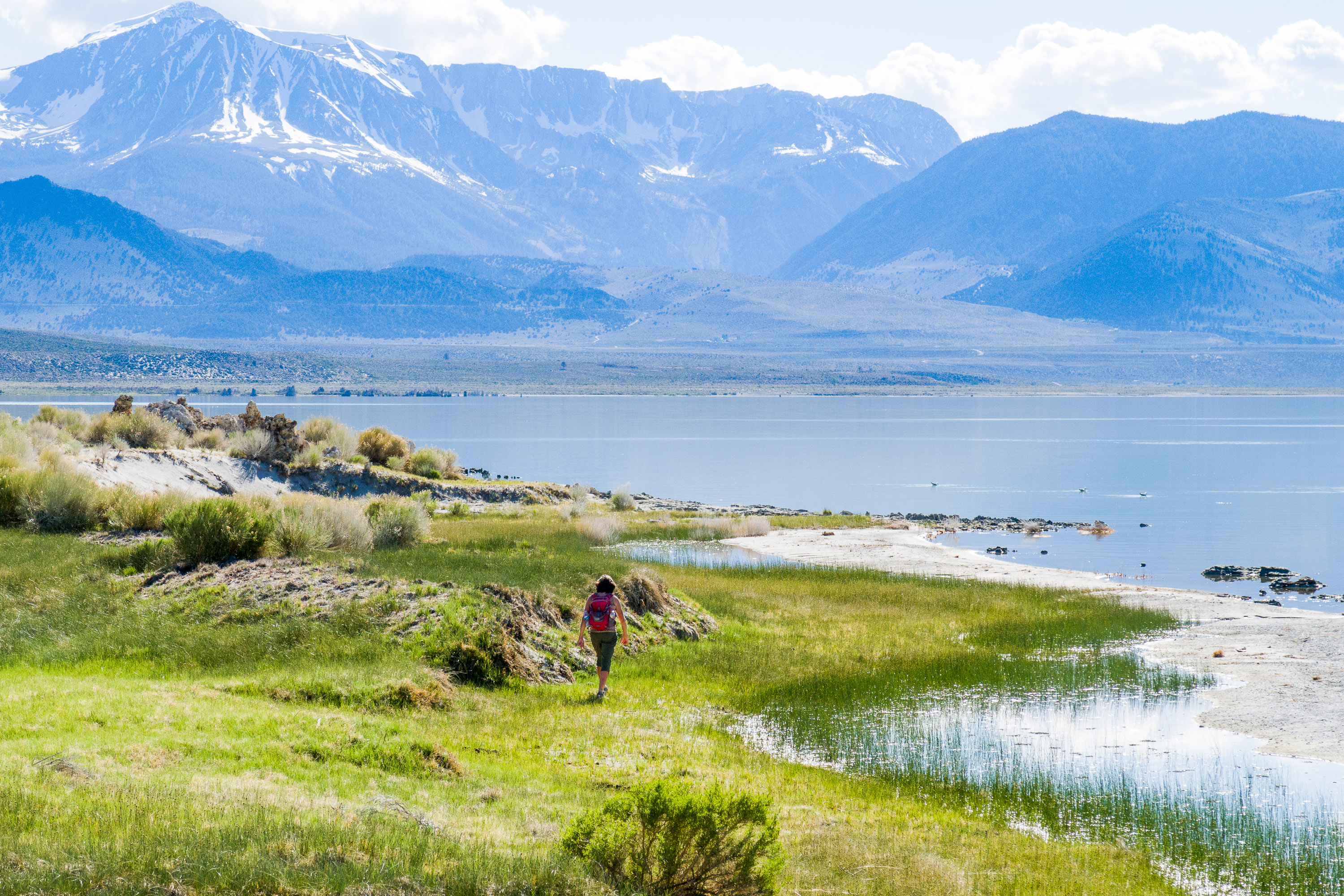
At the 2 ½ mile point, we decided to turn around and head back. Rather than walk on the harder sand further from the lake, we decided to walk along a sand spit between the lake and a small stream of water. Herb had me go ahead because he likes to use me in his photos to give some sense of scale.
Or, was that the real reason? Before long my feet began to sink a little, but stupidly I plowed on, only to sink even further. Soon I found myself sunk up to my knees in quicksand. As I started to sink, I put out my left hand to stop myself, but it sunk into the sand as well. Unfortunately, that hand was clutching my cell phone which was now wet and covered with sand.
Herb jumped to my rescue, and by that I mean he started taking pictures of me struggling to extricate myself. Big help! I eventually got myself to firmer ground and tried getting the sand off my phone. Herb made me immediately turn it off to hopefully save it from getting its inner workings water damaged. Since the phone was my only camera, that was the end of my picture taking for the day.
Surprisingly I wasn’t muddy at all. It wasn’t really mud at all, but just really soft, wet sand. We made it back to the car without any further calamities.
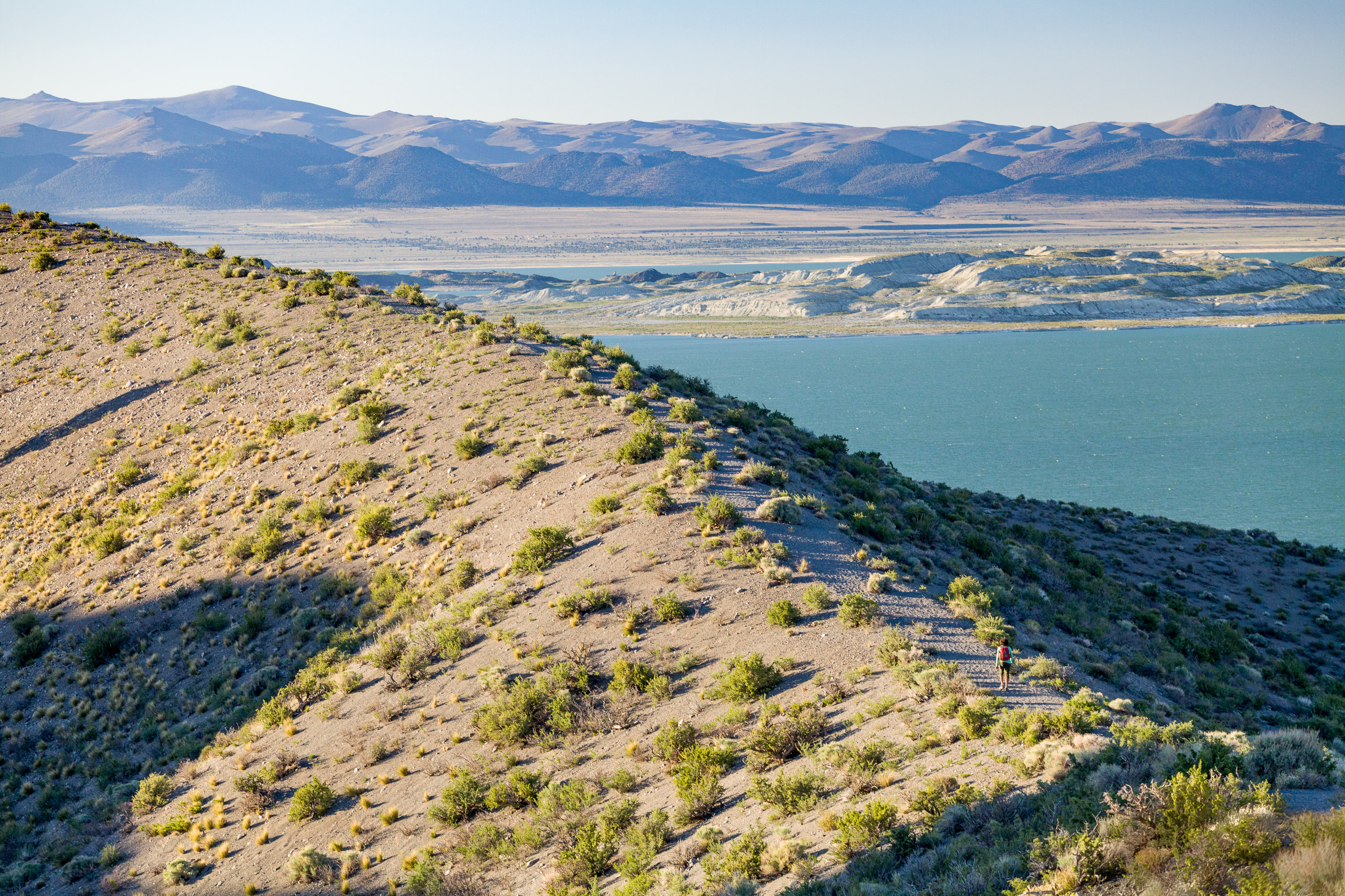
While driving back to the campground, we decided stop and do a hike which we had done on a previous visit - the trail up to and along the rim of Panum Crater, a perfect example of a rhyolitic plug-dome volcano. Panum Crater is pretty small by volcanic standards – 220 feet high and 2,000 feet across. It last erupted in 1325 AD.
The entire hike around the rim is about 2 miles, and the views along the way of Mono Lake and the snow-covered Sierra are really beautiful.
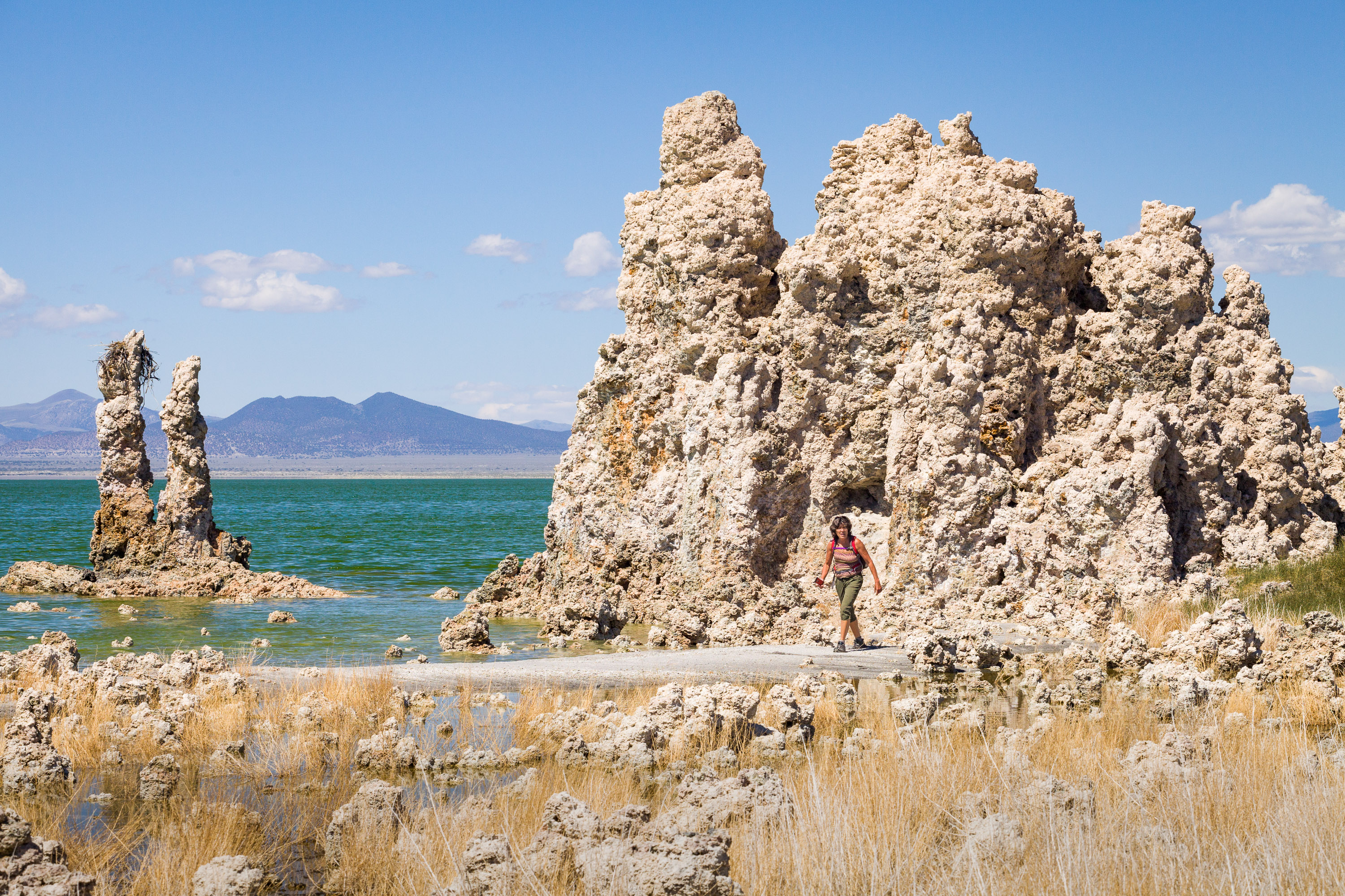
Mono Lake is located just off Highway 395 near the town of Lee Vining, California, 13 miles east of Yosemite National Park. Mono Lake is extremely unique. First of all, at over 1 million years of age, it is one of the oldest continuously existing lakes in the continent. Secondly, it is about 2 ½ times as salty as the sea and about 80 times as alkaline. This is because Sierra streams flow into Mono Lake bringing trace amounts of salts and minerals, but the lake has no outlet other than evaporation. As a result, the concentration levels of salts and minerals keeps growing each year. Thirdly, and the main reason Mono Lake is so popular, are the hundreds of spectacular “tufa towers” that rise from the lake. These intriguing calcium-carbonate sculptures were formed beneath the water when carbonates in the water combined with calcium from freshwater springs feeding into the lake. As lake levels dropped, these extraordinary-looking knobs, spires, and minarets became exposed. Most of the towers visible in the lake are from 200 to 900 years old and rise as high as 30 feet above the water.
A good place to start your visit is at the Mono Basin Scenic Area Visitor Center, located just off Highway 395, north of Lee Vining, where you will find exhibits about both the natural and human history of the Mono Basin.
One of the best places to view the tufas is at the Mono Lake Tufa State Reserve along the southern shoreline of the lake. The trailhead for the south tufa castles and Navy Beach is at the edge of the parking lot. During the summer, rangers lead walking tours 3 times a day (10am, 1pm, and 6pm), but if your not lucky enough to catch one of these, there are plenty of informative signboards along the trail. A short walk along the mile-long trail brings you to the strange and fanciful tufa castles at Navy Beach. A swim in the buoyant waters of Mono Lake is a memorable experience, as long as you are willing to step through the millions of harmless alkali flies that line the water’s edge. It’s fun to watch what at first looks like black sand part before you.
Surrounded by volcanic hills, Mono Lake is also a geologist's paradise. The two major islands in the lake are actually volcanic domes. The large black island, which the Kuzedika Indians named Negit, meaning “blue-winged goose,” erupted about 1700 years ago. The white island, which the Native Americans named Paoha, meaning “spirits of the mist,” erupted 250 years ago.
Bird watching and photography are other popular activities at Mono Lake.