- Home
- About
- Map
- Trips
- Bringing Boat West
- Migration West
- Solo Motorcycle Ride
- Final Family XC Trip
- Colorado Rockies
- Graduates' XC Trip
- Yosemite & Nevada
- Colorado & Utah
- Best of Utah
- Southern Loop
- Pacific Northwest
- Northern Loop
- Los Angeles to NYC
- East Coast Trips
- Martha's Vineyard
- 1 Week in Quebec
- Southeast Coast
- NH Backpacking
- Martha's Vineyard
- Canadian Maritimes
- Ocracoke Island
- Edisto Island
- First Landing '02
- Hunting Island '02
- Stowe in Winter
- Hunting Island '01
- Lake Placid
- Chesapeake
- Provincetown
- Hunting Island '00
- Acadia in Winter
- Boston Suburbs
- Niagara Falls
- First Landing '99
- Cape Hatteras
- West Coast Trips
- Burning Man
- Utah Off-Roading
- Maui
- Mojave 4WD Course
- Colorado River Rafting
- Bishop & Death Valley
- Kauai
- Yosemite Fall
- Utah Off-Road
- Lost Coast
- Yosemite Valley
- Arizona and New Mexico
- Pescadero & Capitola
- Bishop & Death Valley
- San Diego, Anza Borrego, Joshua Tree
- Carmel
- Death Valley in Fall
- Yosemite in the Fall
- Pacific Northwest
- Utah Off-Roading
- Southern CA Deserts
- Yosemite & Covid
- Lake Powell Covid
- Eastern Sierra & Covid
- Bishop & Death Valley
- Central & SE Oregon
- Mojave Road
- Eastern Sierra
- Trinity Alps
- Tuolumne Meadows
- Lake Powell Boating
- Eastern Sierra
- Yosemite Winter
- Hawaii
- 4WD Eastern Sierra
- 4WD Death Valley +
- Southern CA Deserts
- Christmas in Tahoe
- Yosemite & Pinnacles
- Totality
- Yosemite & Sierra
- Yosemite Christmas
- Yosemite, San Diego
- Yosemite & North CA
- Seattle to Sierra
- Southwest Deserts
- Yosemite & Sierra
- Pacific Northwest
- Yosemite & South CA
- Pacific Northwest
- Northern California
- Southern Alaska
- Vancouver Island
- International Trips
- Index
- Tips
- Books
- Photos/Videos
- Search
- Contact
Carmel and Side Trips
Monday, December 13, 2021 - 11:15am by Lolo180 miles and 3.25 hours from our last stop - 3 night stay
Travelogue
Day 1 - Drive to Monterey Peninsula, Pacific Grove Monarch Butterfly Sanctuary, and Point Lobos Perimeter Hike
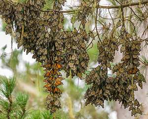 Cluster of monarch butterflies on eucalyptus branchI had done my homework and pretty much had a list of sights and activities to cover over our three-day visit. Herb always gets a little anxious when I pull out a few printed pages of a proposed itinerary I put together.
Since I had two events scheduled for the day, I suggested we get an early start so that we could get to the Pacific Grove Butterfly Sanctuary in time for their usual wake up at noon. They like to sleep in until it gets warm (usually at least 55 degrees).
Not wanting to view butterflies on an empty stomach, we stopped at the Alta Bakery and Cafe in Monterey, which we had seen as a recommendation on a YouTube video we had watched about Monterey. We actually find YouTube to be a useful resource for interesting places, good restaurants, etc. for any destination you can think of.
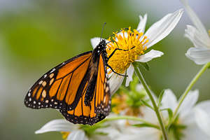 Brave little monarch leaves the clusterWe had tried once before to visit a Monarch Butterfly Grove when we were in Pismo Beach last March, only to find that all but a few had already flown away. Apparently Monarch Butterflies hang out, or more correctly “overwinter,” on the California Coast only between the months of October and February, with the best time to see the greatest numbers being mid-November to mid-December. Perfect.
We got to the sanctuary around noon as planned to time with their active part of the day. There were probably already about 50 people or so, with tripods and long lenses aimed at the grove of eucalyptus trees along the paved path.
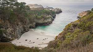 China Cove - Point Lobos Perimeter TrailFor the first 5 minutes, there wasn’t a butterfly to be seen. We got so excited when a single one landed in a flowering bush. Now Herb and I knew absolutely nothing about monarch butterfly behavior, so we just figured there were none to be seen.
Fortunately, we overheard someone, who was pointing up towards the top of a eucalyptus tree, explain to their less-learned companion that what looked like a clump of dead leaves hanging from a branch was actually a cluster of butterflies huddled together for warmth. We learned that as many as tens of thousands of them can cluster on a single tree.
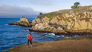 Along the Point Lobos Perimeter TrailGradually a few of them braved the cold and fluttered around the grove. We looked at our phones and it was 54 degrees. Come on sun. Just one more degree.
Herb joined the line of tripods and pointed his big lens up at one of the clusters. You couldn’t see much happening with the bare eye, but through the telephoto lens you could see layers and layers of butterfly wings, most of them brown (the one that were still closed), but a scattering of their characteristic bright orange on those getting ready for flight. It was quite beautiful.
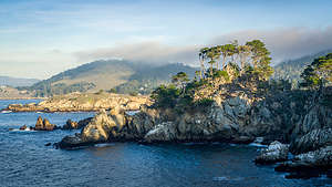 Along the Point Lobos Perimeter TrailI checked the hourly forecast and saw that it wasn’t going to get much warmer today, so we decided to leave for our second activity of the day - a hike around the Point Lobos State Natural Reserve, located just 4 miles south of Carmel-by-the-Sea.
Point Lobos is short for Punta de los Lobos Marinos, which means Point of the Sea Wolves, referring to the sea lions you can find resting on its rocky points and nearby islands.
The reserve contains 550-acres of dramatic rocky coastline, coves, and rolling meadows. The offshore area forms one of the richest underwater habitats in the world, with seals, sea lions, sea otters and migrating gray whales from December to May.
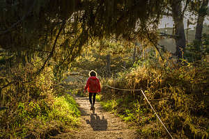 Along the Point Lobos Perimeter TrailToday our plan was to hike the 6-mile loop trail around its entirety, ending at Weston Beach for sunset. We paid our $9 at the gate ($1 discount for being old) and found parking near Sea Lion Point. We were lucky to catch the last spot that someone was just pulling out of.
From there we set off in a counter-clockwise direction along the South Shore Trail, which went along the beautiful rocky coast.
We took a side loop along the Sand Hill Trail which led us out to a rocky point on the south side of Sea Lion Cove called Puna de los Lobos Marinos. From here we looked down at the churning waves known as the Devil’s Cauldron.
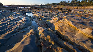 Weston Beach - Point LobosBack on the South Shore Trail, we reached Weston Beach in just under a mile. This was my planned place to spend the sunset, so I will hold off on describing it until later.
At 1.3 miles we arrived at Hidden Beach, a small cove with a gray pebbled beach. The mouth of the cove was very narrow with rocks encroaching on both sides. It looked very inviting, but we didn’t see a way down, so we continued on along the South Shore Trail.
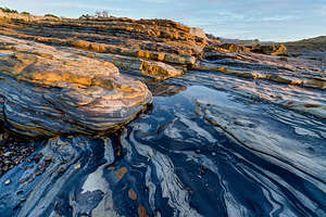 Weston Beach - Point LobosAt 1.5 miles, we came to a viewpoint that looked down on lovely China Cove, a sandy beach famous for its emerald-colored water. During the spring, this beach becomes home to harbor seals, nursing their newborn pups. We were a bit early for that, but we did see a handful of harbor seals relaxing on the beach, enjoying their free time before the arrival of their pups.
After another 0.1 mile we came to the end of the South Shore Trail, and the junction of the Bird Island Loop Trail to the right, and the inland South Plateau Trail to the left, which was part of the loop.
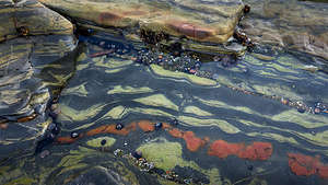 Weston Beach - Point LobosWe decided to take the short loop on the Bird Island Trail, where we passed between Monterey pine woods and the ocean. At the end, we were treated to another perspective of China Cove, as well as views down onto the larger, white-sand Gibson Beach. Gibson Beach is accessible via a staircase, but China Beach has been closed off since 2015.
The sea pounds the cliffs along this section, enlarging the cracks and faults in the granite cliffs, creating caves, which slowly become arches, and eventually isolated rock croppings such as Bird Island. Spring and summer is definitely the best time to do this hike, because that’s when the harbor seals are pupping on China Cove Beach, and a large seabird colony of cormorants, Western gull, and black-crowned night herons take over Bird Island.
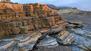 Weston Beach - Point LobosBack at the junction, we hiked northward along the South Plateau Trail through a lovely pine forest for about a mile, before arriving at Whale Cove. Rather than turn left to complete our loop, we decided to turn right and take the 1.2-mile side trip to Granite and Coal Chute Points.
The Granite Point Trail followed a bluff above Whalers Cove with beautiful rocky outcrops jutting out to the sea. From the top of the hill at Granite Point there are great views of Carmel to the north.
On the way back to the main trail, we took the short Coal Chute Point loop, which got its name from the fact that it was the place where over 100 years ago, coal was loaded onto ships in Whalers Cove.
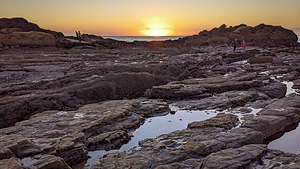 Weston Beach Sunset - Point LobosFrom the end of the Granite Point side trip, we took the North Shore Trail back to our car. It was already 4:00 and very near to sunset, so we drove our car immediately over to Weston Beach. Our only regret was not having time to do the Cypress Grove Trail.
Weston Beach is named for Edward Weston, the famous early to mid-20th century photographer, best known for his beautiful landscapes. He was a friend of Ansel Adams and with him, one of the founders of the f/64 club, a group of 11 San Francisco Bay Area-based photographers that shared a common photographic style, based on precisely exposed, sharply detailed, un-manipulated images of natural forms.
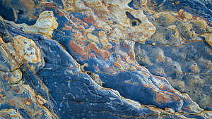
Ed Weston lived (and died) in Carmel and spent much time photographing this beach. While not as dramatically beautiful as sandy, emerald-green China Cove, it has lots of texture and plenty of opportunities for the sharply detailed images of natural forms that Edward Weston loved. There is no sand on this beach, but rather very unique rock textures that provide for very interesting foregrounds. It is also known for its tide pools.
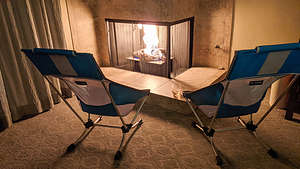 Our cozy fireplace at the Carmel Bay View InnWe spent the rest of the remaining daylight scampering around its rocks looking for interesting compositions.
It had been a very long day, so we were very happy when we checked into our room at the Carmel Bay View Inn to find that it was even cozier than I expected. There was a beautiful gas fireplace in the corner of the room, in front of which we set up our camping chairs, and sipped a glass of well-deserved wine. Not wanting to move from the fireplace, we decided to eat the salads I had brought along rather than venturing out to a restaurant.
It was perfect!
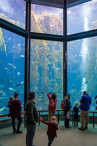 Monterey Bay Aquarium - Kelp Forest
Day 2 - Monterey Aquarium, Fisherman’s Wharf and Cannery Row, 17-Mile Drive
Today was going to theoretically be the worst weather day of our mini-vacation, so we decided to go to the Monterey Aquarium, which we hadn’t been to in 25 years.
Because of Covid, tickets have to be purchased in advance and you have to be vaccinated. Yay! I always feel so much better knowing that those around me are responsible and less likely to spread any infected particles on me - or the fish!
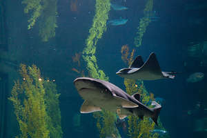 Kelp Forest residentsWe purchased tickets for 10:00 am, when doors opened, because we felt that would have the least crowds, because later times would have overlap from previous time slots.
The first exhibit we visited was the Kelp forest where there was a 28-foot high tank (one of the tallest aquarium tanks in the world). In the actual ocean, they can tower up to 175 feet over the ocean floor. The habitat is called a kelp forest because they grow in dense groupings much like a land forest.
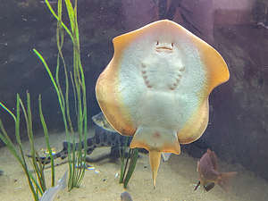 Friendly flounderKelp are brown algae that live in cool, relatively shallow waters all along the west coast of North America. In fact, it is what you would find on the Monterey Bay floor just outside the aquarium.
I never thought of kelp being beautiful, but I was mesmerized watching them swaying rhythmically in the tank, with fish weaving in and out of them, at all levels - some swimming in the canopy, while others lived on the fronds, and still others at the base of the frond.
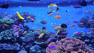 Wish I had this fish tankKelp forests provide food and shelter for a diverse community of plants and animals. Some of my favorites include the leopard shark, the bright orange garibaldi, the giant sea bass and California sheephead. There were also several volunteer scuba divers working in the tank.
Our next stop was the touch pools, where you get to roll up your sleeves and pet bat rays. They are really cool and swim by flapping a pair of batlike wings, which are actually their pectoral fins.
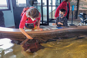 Lolo playing with the Bat RaysAfter being assured that they were harmless (I think the venomous spine in its tail has been removed), I plunged my arm almost up to my shoulder to reach and touch one. It surprisingly felt like velvet. It didn’t hang around long, as I am sure that it got pretty sick of arms reaching out at it all day.
Next we went to the Jellyfish exhibit, where you could literally stand mesmerized for an hour in front of a beautifully-lit tank, watching orange sea nettles drift up and down like bubbles in a lava lamp. Actually, they propel themselves by contracting and relaxing a ring of muscles around its bell. The muscles open and close the bell, drawing in water and then forcing it out again to push the jellyfish forwards. It’s like a beautiful ballet.
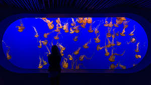 Jellyfish Tank - orange sea nettlesAlthough there are a great many different kinds of jellyfish, they all have gelatinous bodies and live in the water column. They are made up of more than 95% water and can range in size from miniscule to enormous. They have no bones, brains, teeth, blood or fins.
From that commonality, the diversity is astounding. There were the Pacific sea nettles in the big tank, with their long tentacles and frilly mouth-arms, covered with stinging cells that paralyze small prey.
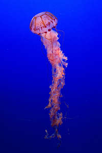 Purple-striped jellyThen there was one all alone in a tank. I think it was a purple-striped jellyfish, known for its painful sting. No wonder no one wanted to play with it. Its tentacles were long and trailed behind it as it moved, creating all kinds of interesting shapes.
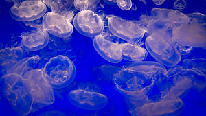
More compact was the moon jelly, an alien-looking creature named for its translucent, moonlike bell. Instead of long trailing tentacles, it has short ones that sweek food toward the mucous layer on the edge of its bell.
Watching these beautiful, amazing creatures, I forgot for a while that I hated jellyfish and avoided them at all costs.
 Moon JelliesThe last major exhibit we saw was the Open Seas, the main part of the ocean, beyond territorial waters.
Life in the open seas is divided into two groups: drifters (plankton, jellyfish, and octopus) and swimmers (nekton, such as fishes, whales, sea turtles, and squid).
The Open Seas exhibit is a million-gallon tank full of small sharks, bluefin and yellowfin tuna, sunfish, various jellyfish and rays, sea tortoises, Pacific sardines, and much more.
It’s like one big smorgasbord out there and many of its residents must find ways to avoid predators. For example, sardines and anchovies work together by schooling to make themselves look like an intimidating large creature, rather than the little hors d'oeuvres they are. We saw this in real time as we watched a giant sea turtle swim towards them in hopes of a meal.
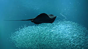 Clever anchovies (or sardines) pretending they are one big fishAfter having seen all the exhibits, we decided to take a walk along the waterfront towards Fisherman’s Wharf.
Our first stop was Steinbeck Plaza, where there is a monument that pays tribute to the many people who played a role in the development of Cannery Row and the growing fishing industry in Monterey Bay.
At the top of the rock is John Steinbeck, who wrote the novel Cannery Row. He is definitely one of my favorite authors. Below him are characters (some real and some fictional) from the novel. Directly below him is Dr. Ed Ricketts, a marine biologist and lifelong friend of Steinbeck’s, who is memorized as the character Doc Ricketts in the novel.
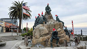 John Steinbeck PlazaThe two women statues are characters from the novel and the four men are the owners of a sardine factory that eventually became the Cannery Row Company.
The last statue is that of a Chinese fisherman, representing the people who lived in the Chinese fishing village established in the mid 1800’s on the beach surrounding this area.
It was an interesting mix of the real and the fictional. They all looked so festive in their Santa hats.
Next, we walked through Cannery Row, which was a real place, not just the setting for a Steinbeck novel. In the early 20th century, this area was home to 16 canning plants that produced thousands of tons of sardines per year. The fishing industry collapsed in the 1950s, but the area has found a new profitable industry - tourism.
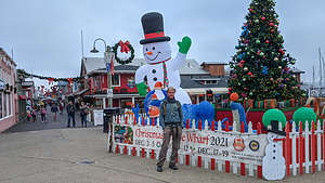 Herb at Fisherman's WharfBefore proceeding to Fisherman’s wharf, we decided to have lunch at Crepes of Brittany, which we had seen on a YouTube video about Monterey. The owners’ passion is to bring the authentic taste of Brittany-style crepes to Monterey Bay.
I hadn’t had a crepe in years, so I wouldn’t know a Brittany-style crepe from an ordinary crepe, but in either case, the salmon, brie, and spinach crepe I had was delicious. Herb’s ham and eggs crepe was good as well, but I think I made the better choice.
We couldn’t leave Monterey without the obligatory walk out onto Fisherman’s Wharf, which reminded me a lot of San Francisco’s Fisherman’s Wharf in its touristy kitsch - the kind of place where you never find a local.
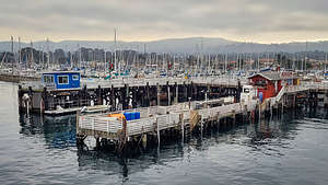 Fisherman's WharfThe day wasn’t over yet. Herb always likes to say that I always try to pack 10 pounds in a 5 pound bag. I think of it as living life to its fullest.
Anyway, before returning to our hotel, we took a drive along 17-Mile Drive, a private toll road through a ritzy neighborhood that includes the famous Pebble Beach golf course and some incredible scenery. At the gate,we paid our $10.75 per vehicle.
It was pretty cloudy and damp, but we pretty much stopped anyway at every one of the marked scenic viewpoints. There was some pretty nice real estate along the way as well.
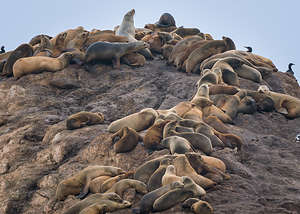 Seal Rock along 17-Mile DriveSeal Rock didn't disappoint. There were dozens of harbor seals, in various shades of white to silver-gray to dark brown, basking on a large rock just off the shoreline. They were so well camouflaged that I hardly noticed them. I guess that's the point. Thank goodness for telephoto lenses.
The most beautiful stop was Lone Cypress, a Monterey Cypress tree standing atop a granite headland overlooking Carmel Bay - one of the most photographed trees in North America.
It is believed to be about 250 years old, which means it began its life when this area was part of New Spain, grew up as part of Mexico, and finally became part of the United States in 1850.
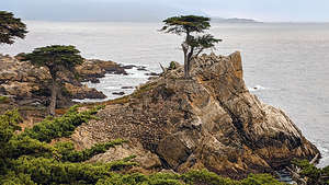 Lone CypressIt was still stunning, but it had taken a bit of a hit since we had been here about 25 years ago. In 2019, the iconic tree lost one of its limbs (accounting for about a third of the tree) during a severe storm known as a Pineapple Express. The before and after photos illustrate just how much its appearance was altered.
When we got back to the hotel, we had a glass of wine before our cozy fireplace before going out to dinner at the Treehouse Cafe, another restaurant that we had seen on our YouTube research of Carmel. It was also very highly rated on Yelp and Tripadvisor.
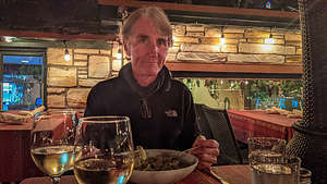 Dinner at the Treehouse CafeThe forecast was for rain later this evening, but so far so good, so we decided to venture out in the hopes of eating on their lovely outdoor patio. So far so good, so we asked to be seated outdoors, where we had the whole patio to ourselves. There are definitely advantages to traveling mid-week.
The setting was lovely, the heaters were warm (even enough for Herb), and the food was delicious. I had the Prawn Pasta and Herb had the Chicken Alfredo Pasta. We also had a very generous pour of Chardonnay.
Just as we were finishing up, we felt a few drops of rain. Fortunately, it held off and we made it back to our cozy room just in time.
Day 3 - Drive to Big Sur, McWay Waterfall, Nepenthe Restaurant, Pfeiffer Beach, and sunset at Weston Beach (Point Lobos)
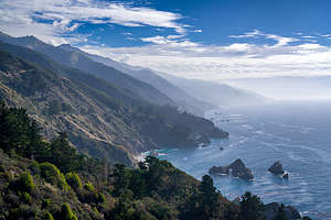 Big SurToday we would head out on a road trip down Big Sur, the rugged stretch of California’s central coast, bordered by the Santa Lucia Mountains and the Pacific Ocean.
The non-stop beautiful scenery along narrow, winding Route 1 (also known as the Pacific Coast Highway) is breathtaking, making it hard to keep your eyes on the road. Fortunately, there are dozens of pull-outs to safely enjoy the scenery.
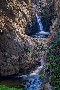 Soberanes Canyon Trail waterfallYou could spend days, if not weeks, exploring this section of the coast, but since we had one day, we had to be selective in our stops. Our plan was to drive as far as McWay Falls, 38 miles south of Carmel, making stops along the way, most of them selected from our trusty “Photographing California (South)” guide.
Our first stop was in Garrapata State Park, or at least a tiny piece of it. The entire park is nearly 3,000 acres of rocky coastal cliffs, beach, redwood canyons, and part of the Santa Lucia Range, but we just explored a tiny, but very pretty, piece of it along Highway 1 - Soberanes Cove.
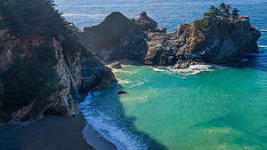 McWay WaterfallsFrom a pull-out along the road, just south of Soberanes Creek. From there, we took a short walk along a path overlooking the rocky outcrops and sea stacks of Soberanes Cove. Eventually, we came to a picturesque wooden bridge over the Creek, with a lovely two-tiered waterfall beneath it.
Continuing on, we stopped at several more pull-outs, obviously placed for their scenic vantage point above jagged cliffs and rocky beaches.
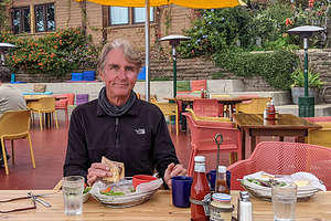 Nepenthe RestaurantThe turnaround point for a drive (we had things planned for the way back) was McWay Falls in Julia Pfeiffer Burns State Park.
McWay Falls has the distinction of being one of only two named waterfalls in California that are also tidefalls, meaning that they fall directly into the sea, or in this case, into the lapping aquamarine water of a pristine sandy cove (at least at high tide). It is extremely picturesque, so much so that it is one of the most photographed landmarks in California.
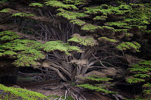 Cypress tree on the path to Pfeiffer BeachWe paid our $10 fee to park our car, and the ranger assured us that our receipt would allow us entry that day into any California State Park. Oh good, we could amortize this when we went to Pfeiffer Beach later today.
After parking the car, we took the Overlook Trail which led us through a tunnel beneath Highway 1. From there it was just a short distance along a trail that followed cliffs to an overlook that faced the Falls.
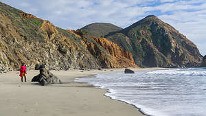 Pfeiffer BeachAt the end, there was a fence strongly suggesting that we go no further. A rockfall had made the trail unsafe. So what used to be a 0.6-mile walk to a second overlook, was not restricted to a 0.2 one to the first.
We also learned why that sandy cove was so pristine and free of footprints. There was no public access allowed.
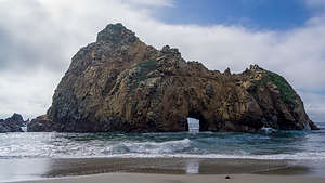 Pfeiffer Beach - Keyhole ArchStill, it was very pretty from the first overlook.
Unfortunately, we were here at high noon, the absolute worst time of the day for photography, when there is no light at all on the falls. We knew that would be the case beforehand though. You can’t be everywhere at sunset, so you can’t see everything at it’s best.
On our drive back up north along the Pacific Highway, we stopped at Nepenthe, an extremely popular and well-known restaurant, perched high above the sea, with a lovely outdoor patio overlooking the Pacific.
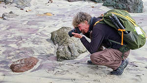 Herb stalking purple sand on Pfeiffer BeahUnfortunately for us, we just had to imagine those views, because a fog had moved in obscuring that beautiful coast below us. Still, it was nice knowing it was there.
I found the name interesting, so I looked it up. Nepenthe is a drug described in Homer's Odyssey as banishing grief or trouble from a person's mind. Just like the food, drink, and views here could do - erase your cares, if even only for the duration of a lunch.
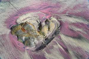 Purple sand of Pfeiffer BeachIn fitting with the Greek theme, I ordered the Ambrosiaburger, remembering that in Greek mythology, ambrosia was the food of the gods, conferring longevity or immortality on all that consumed it.
Herb had the more mundane and mortal French Dip. I gave him a few bites of my Ambrosiaburger to keep him around a bit longer.
I was very much looking forward to our next stop, which came highly recommended in our “Photographing California” guide - Pfeiffer Beach.
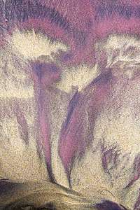 Images in the purple sand - Pfeiffer BeachTo get there, we turned onto Sycamore Canyon Road, which twisted its way for 2 miles down to a ranger station and parking lot. We showed the ranger our California State Park receipt, and he informed us that this section of the coast was not part of the state park system, but rather it was part of the Los Padres National Forest. $12 please. Oh well, so much for amortizing.
There are two rather unique natural phenomena that occur on Pfeiffer Beach:.
Phenomenon 1: For a few days surrounding the winter solstice, the sunset is lined up with the opening in Keyhole Arch, an opening on a sea stack just a short distance from the shore. This is the big event of the year here and literally brings hundreds of photographers who line up elbow to elbow to catch the nearly identical shot to the guy next to him. This is Herb’s nightmare. He likes solitude and creating his own compositions. Fortunately, we were here too early in December for this event anyway.
 Sunset Weston Beach - Point LobosPhenomenon 2: Purple sand. That’s right, purple sand, especially right after a rain, which as luck would have it was now.
As we strolled along the beach, I kept my eyes peeled to the ground in search of purple sand. There was some darker sand that I thought might be it, but I wasn’t particularly impressed. As we continued further down the beach, we finally came across it, and it was amazing! Much brighter and more distinctive than I imagined it would be.
Every time we came across some patches, I noticed that there was a fairly steep hill above them, with some sprinkles of purple mixed in. I later read that these are manganese garnet deposits, and they wash down onto the beach after a rain.
 The rocks come alive on Weston Beach at sunsetWe found these patterns extremely intriguing and could have spent our entire time on the beach just photographing them.
Originally, I had thought we might stay here to watch the sunset, but that would require us driving back up narrow, winding Route 1 in the dark. Instead we decided to go back to Weston Beach in Point Lobos, which was much closer to home.
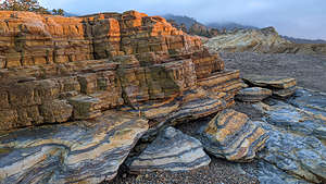
We had spent sunset at Weston Beach on our first night in Carmel and had enjoyed watching the sunset. There was no purple sand on this beach. In fact, there was no sand at all, but rather just very interesting textured rocks and tide pools in between.
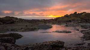 Sunset Weston Beach - Point LobosI think you could spend hours here always discovering something new. This time I found some rocks that actually lit up with blue and orange layers during golden hour. So, we spent the last minutes of daylight scampering over the rocks looking for interesting compositions.
It had been a very full day, and we had had a big lunch, so I just wanted to get something light for dinner. I pushed for the Hog’s Breath Inn, Carmel’s most famous establishment because it used to be owned by Clint Eastwood. Herb objected at first, because he felt that it was more of a tourist trap than a fine dining experience. Still, I knew the setting was nice, and everyone was going to ask me if I went to the Hog’s Breath Inn while in Carmel.
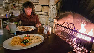 Dinner at the Hog's Breath InnThere were very few people there, as it was a weeknight in the week after Thanksgiving, so we were able to get a great table next to one of their fireplaces.
I just had a quesadilla with chicken, which was very good, and Herb had an “okay” chicken piccata. I got a fancy margarita thinking Herb was getting one too, but he ordered a beer, making me feel a bit decadent.
Still, the experience was very nice and I was happy.
Then it was back to our room and our last night in our beach chairs before our cozy fireplace at the Carmel Bay View Inn.
Day 4 - Morning walk around Carmel (Carmel Beach and Carmel Mission) and drive home
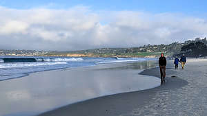 Herb strolling along Carmel BeachTime to go home, but I realized that we hadn’t really explored Carmel itself that much. That just wasn’t right, so we set off on foot to see this charming seaside town.
We left the car at the hotel and set off down Ocean Avenue, past the many quaint homes ranging from Spanish colonial homes to Tudor-like cottages to fairy-tale gingerbread houses with stone chimneys and pitched roofs.
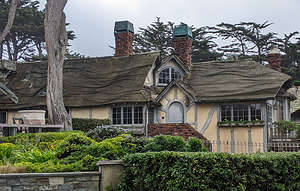 Fairy-tale gingerbread houses with stone chimneys and wavy pitched roofs.In less than a mile we arrived at Carmel Beach and the 3.5-mile Scenic Bluff Path that runs along scenic drive, starting at Carmel Beach’s northern end and winding along the ocean around Carmel Point all the way to Carmel River State Beach.
We walked along the sand for a while before realizing that the houses along Scenic Drive were the real points of interest, including one near Carmel Point that was designed by Frank Lloyd Wright in the 1950s.
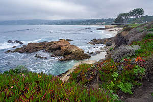 Along Carmel's Scenic Bluff PathAfter rounding Carmel Point, we headed inland past the Tor House, the historic house and tower built of sea-tossed granite of the famous poet Robinson Jeffers, known for his work about the central California coast as well as being an icon of the environmental movement. Unfortunately, it is only open to the public on weekends, so we could only look at it from outside the gate.
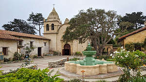 Carmel MissionWe continued walking away from the beach up 15th Street and Deloros towards the Carmel Mission, passing Clint Eastwood’s Mission Ranch Hotel and Restaurant, which he bought and rescued from condo developers, along the way.
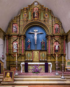 Carmel Mission Altar with portrait of Juniper SerraI never know quite what to feel when visiting one of the Spanish missions - and we have been to many. I love their serenity and aesthetic beauty, but have a problem with their treatment of the Native American population. However, I am a history buff, warts and all, and feel that it is important to be aware of our past and to learn from it.
The Carmel Mission is the second of the Alta (Upper) California Spanish missions. It was originally established in Monterey in 1770 by the Spanish priest Junipero Serra, but was moved the following year to Carmel, near the mouth of the Carmel River, because of lack of good agricultural land.
Serra went on to create seven more missions before he died in 1784. He is interred in the Carmel Mission chapel.
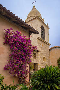 Carmel Mission GardenIn 2015, Juniper Serra was canonized and made a Saint. There was much controversy over this as critics questioned the Spanish missions’ sometimes brutal treatment of the Native Americans, their mandatory conversion to Catholicism, and denial of allowing them to keep their traditional culture and beliefs. It’s always difficult judging past actions in terms of current standards.
There did seem to be an attempt at reconciliation with their past “less-than-benevolent” treatment of the Native Americans. A section of the Mission’s cemetery is dedicated to unnamed graves marked by abalone shells, representing the hundreds of indigenous people who died at and near the Mission.
A sign reads:
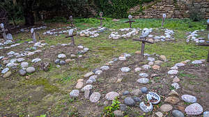 Unnamed graves marked by abalone shells, representing the indigenous people who died here“These symbolic grave sites, adorned with abalone shells, represent the many hundreds of indigenous people buried in the graveyard and beyond. May they be honored, and may we be reminded of their long term presence, their rich culture and humanity, and the importance that they still hold for their descendants today.”
Wow! A little late, but better than never at all. Or, as Martin Luther King, Jr., once said, “the arc of the moral universe is long, but it bends toward justice.”
In our mini 3-day vacation, we had seen a lot - incredible natural beauty, lovely sunsets, a bit of Cannery Row and Spanish Mission history, much animal life from butterflies to jellyfish to sharks and more, and last, but not least, some great food and wine.
Bishop
Thursday, November 18, 2021 - 6:15pm by Lolo150 miles and 3.5 hours from our last stop - 4 night stay
Travelogue
As I mentioned in the past, our son Andrew and his wife Celeste, moved from San Francisco to Bishop in 2019 to try out a less-urban lifestyle in what is a world-class rock climbing destination. They were fortunate enough to be able to take their San Francisco jobs with them - and this was before Covid.
Bishop and all of the Eastern Sierra is stunningly beautiful, so even though they are 6 ½ hours away from us now, it is not a hardship to go over the mountains to visit them. Their home is often the last stop on one of our road trips.
I’m not going to go into any great detail about our family time together, but for my own purposes and desire to remember where the heck I have been this year, I added this as a stop on our Death Valley trip.
This is what we did over those 4 days:
- Herb and Andrew spent much time father-son bonding over home maintenance
- Drinks at dinner at the Owens Valley Distillery in Bishop
- Trip out to the Buttermilks to watch Andrew and Celeste boulder
- Go for a run on the lovely Bishop Creek canal near their house
- Herb gets up every morning before sunrise and drives out on the dirt roads past the canal to photograph
- More father-son bonding
- Drive up to Mammoth Lakes and meet some of their friends for dinner at the Mammoth Tavern
- Play support team for Andrew and Celeste on their off-road motorcycles on a drive up Silver Canyon 4WD road
- Celeste tries to teach me how to ride her motorcycle - doesn’t turn out well; or as my other son Tommy said when reviewing the video, “That ended just as I expected”
- Have dinner at home and sitting by the wood burning stove just enjoying each other’s company
- Drive home to Sonoma County
Death Valley National Park
Sunday, November 14, 2021 - 7:15pm by Lolo40 miles and 3 hours from our last stop - 4 night stay
Travelogue
Day 1 - Titus Canyon and sunset at Zabriskie Point
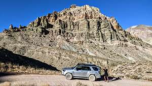 Titus Canyon RoadHerb loves Death Valley, and I do too, as long as I don’t have to go in the summer when 108 degrees is considered a cool day. Since moving to the West Coast, we have pretty much gravitated to visiting during the late fall, when we can get in some hikes without fear of heat stroke.
Death Valley is a huge park, the largest outside of Alaska. The valley itself is over 130 miles long, but only 12 miles wide, flanked on both sides by unvegetated reddish mountains.
The park is criss-crossed by a network of roads, ranging from washboard dirt ones to paved, well-maintained highways, making the most popular destinations quite accessible. Other, more remote areas of the park are only accessible with off-road vehicles on some pretty, long bumpy roads.
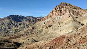 Red Pass along Titus Canyon RoadToday, we were to enter the park via one of those long bumpy roads - Titus Canyon. When coming from Beatty, Nevada, which we were, most people enter Death Valley via the Daylight Pass Road. We have done that several times in the past.
However, this time, we wanted to come in via the more dramatic and scenic Titus Canyon Road, a rough and steep road that is 27 miles long and takes about 2 to 3 hours to drive. To get to it from Beatty, we took 374 South for about 6 miles before turning right onto Titus Canyon Road.
While a 2WD may work under good weather conditions, a 4WD is recommended, and, in either case, the vehicle must have high clearance. Also, the road is one-way. You can only go from Beatty into the park, not the other way. The last 3 miles are two-way and can be driven by 2WD, standard clearance vehicles.
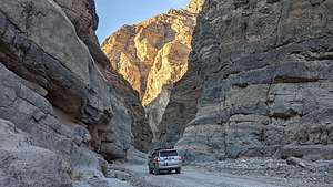 The Narrows of Titus CanyonThe road winds 27 breathtaking miles through the Death Valley backcountry, twisting sharply around steep colorful rock walls.
After about 9 miles the road descends into Titanothere Canyon and then begins to climb up and over Red Pass, which is a mile high with great views.
After 16 miles we entered Titus Canyon, where if you look high up on the walls, you can see petroglyphs.
.thumbnail.jpg) Herb at Zabriskie Point sunsetThe most exciting part was near the end (mile 23.5), where the canyon narrowed so much that we could practically reach our hands out our windows and touch both walls. This was by far our favorite part.
Herb at Zabriskie Point sunsetThe most exciting part was near the end (mile 23.5), where the canyon narrowed so much that we could practically reach our hands out our windows and touch both walls. This was by far our favorite part.
I kept jumping out of the truck at various points to take its picture. Sometimes I even let Herb get in the photo.
At mile 26.6 we were back on asphalt. It was an awesome drive and a great way to enter Death Valley.
We took a left on Scotty’s Castle Road, and at the junction, continued on 190 to the Furnace Creek Ranch, where we would be spending the next two nights.
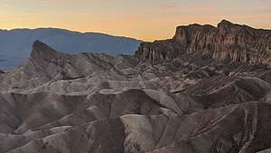 Sunset at Zabriskie PointWe were getting soft this trip. Rather than camping in our Toyota 4Runner as we usually do, we decided to live it up and stay in a pretty luxurious hotel. In late November, the days are just too short, and there is nothing else to do but sit in the truck after 4:00 pm when the sun dips behind the mountains.
After checking into our hotel, we continued on to Zabriskie Point to catch the sunset. This is one of the most spectacular overlooks in the park. From the parking lot, it was just a short wall uphill to a panoramic view of Golden Canyon and the surrounding vibrantly colored badlands.
We were a little too late for the best part of sunset, but it was still quite stunning.
Wow! Sunrise at Mono Lake and sunset at Zabriskie Point in one day - not bad.
Day 2 - Sunrise at Zabriskie Point, 20 Mule Canyon Road, and Golden Canyon Hike
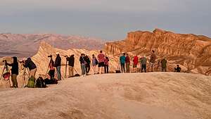 Sunrise Zabriskie PointThe next morning (my second in a row) we were up at 5:00 am to catch another beautiful sunrise, this time at Zabriskie Point, the fabulous viewpoint we had rushed to last night and just missed sunset.
Not being an early morning riser, I was surprised to see how many cars were already in the parking lot. We hiked up the hill to the overlook and saw a sea of tripods at the edge. Apparently, we weren’t the only ones with this idea.
Herb found his vantage point amongst his camera-wielding brethren and patiently waited for the sun to rise above the mountains across the Valley and begin to paint the canyon in vibrant colors - pastel pink and blue sky, and earthy brown and golden canyon. It was absolutely breathtaking.
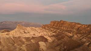 Sunrise Zabriskie PointMany of the photographers there were part of a photo workshop group, and we could see the leader running back and forth from tripod to tripod, like a mother hen, encouraging and advising each of the members of her group. This would not be the only time we would run into this particular group, which pretty much confirmed to us that we were going to the right places at the right times.
The spectacular colorful landscape doesn’t just stop at Zabriskie Point, but extends several miles to the southeast and can be experienced up close and personal along the Twenty Mule Team Canyon Road, an unpaved, one-way road that winds for 2.5 miles through colorful, eroded badlands - black and dark brown to the west; tan, yellow, and white to the east.
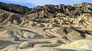 Twenty Mule Team Canyon RoadThe road is named for the teams of eighteen mules and two horses that pulled wagons loaded with borax out of this canyon from 1883 to 1889.
Death Valley would have had minimal human history if it wasn’t for the discovery of Borax (or “white gold” as the prospectors called it) near what is now the Furnace Creek Ranch. Twenty Mule Teams would haul the borax over the long overland route to Mojave. From there it was shipped throughout the United States, where it became a household staple, used in medicines, food additives and household cleaners.
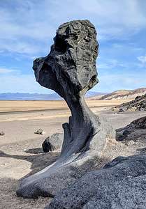 Lava Rock near Artists DriveDuring one particularly interesting bend in the road, we got out and climbed a steep trail to the top of a ridge where we could look out across the badlands and gaze down at our tiny truck.
By now the sun was high and the lighting was becoming harsh and contrasty, unlike the soft pastels and golds of the morning. The good thing about traveling in the Fall is the the sun is so low in the sky that the golden hours on either end of the day last longer.
We took a quick drive along the one-way Artist’s Drive and stopped at the Artist’s Palette, where when the lighting is right, the rock turns multi-colored, hence the name palette. It is one of the most photographed spots in Death Valley. Unfortunately, we were there at the wrong time of day - you can’t be everywhere at sunrise and sunset - so the colors were pretty drab and flat. Oh well.
However, because we went there, we were able to stumble upon a fascinating lava rock alongside the road that we had read about in one of our photography books. We almost missed it. It’s not that big - perhaps just 6 feet or so, and it looks very different from each angle.
It was very cute - in an E.T. sort of way.
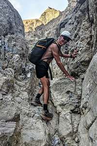 Gower Gulch along the Golden Canyon LoopIt was getting pretty near time for a swim in that lovely pool we were paying for back at Furnace Creek Ranch, but before returning to the hotel, Herb wanted to make one more quick stop to try to find an interesting place he had read about - Cottonball Basin.
The directions to get to it were not very specific - drive 6 miles north of Furnace Creek Ranch, and pull out on the side of the road. Then cross the road and walk 0.6 miles. It was supposed to be a less crowded version of the Badwater Basin, where people love to photograph the bright white salt polygons in the morning light.
We scouted it out and thought we found it, but being mid-day, the lighting was not good. We would have to come back sometime either at sunrise or sunset. I don’t think we were going to have enough sunrises and sunsets in our four days here to cover everything we wanted to photograph.
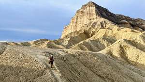 Golden CanyonWe headed back to the Ranch for a quick lunch, nap (we were up well before sunrise), and a dip in the lovely Furnace Ranch pool, we headed out for our main event of the day - the Golden Canyon hike, probably Death Valley’s most popular. We had done this hike before, but it was definitely worth a repeat.
Since it was already almost 2:00 pm and the days were so short, we weren’t sure if we would have the time or inclination to go all the way up to Zabriskie Point, but that was okay as we had already been there for both sunset last night and sunrise this morning.
Since the Golden Canyon section of the hike is the most spectacular section of the hike, we decided to do it in reverse, so we would hit it in the golden hour right before sunset. This meant starting off along the trail that ran parallel to Badwater Road for a while before climbing up through a canyon along gravel-filled wash, which is Gowers Gulch.
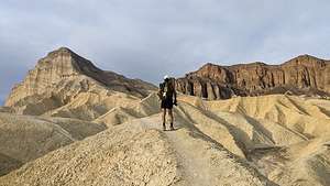 Golden CanyonThis time when we got to the junction at 2.3 miles, rather than continuing straight up to Zabriskie point, we took a left at the Badlands Loop Trail, which would bring us back over and down into Golden Canyon for a 4.5-mile loop, ensuring we would get back before dark.
The section over to the top of the Golden Canyon Trail was probably the most dramatic, with its colorful rock formations - Red Cathedral, Manly Peak, and other ones that I didn’t know the names of.
It was hard to keep our eyes on the trail because the scenery was so beautiful, but we had to as there were parts of the way down that were a bit sketchy, with loose scree and steep drop-offs, but nothing too precarious.
.thumbnail.jpg) Golden CanyonWe made good time covering the just under 5 mile loop in just a little over two hours, allowing us to get back to the car while there was still some daylight
Golden CanyonWe made good time covering the just under 5 mile loop in just a little over two hours, allowing us to get back to the car while there was still some daylight
Before heading back to the Ranch, we drove to the Desolation Canyon Trailhead, just off Badlands Road to watch the sunset over the mountains.
Back at the Ranch, we had dinner for a second time at the Last Kind Words Saloon, which had a very nice decor, but mediocre food - I think because of limited choices during Covid.
Last night we had a pepperoni pizza that I was convinced was a reheated DiGiornio and tonight we had a less than inspiring pulled pork sandwich. Let’s just say that we didn’t have many Kind Words for the Last Kind Words Saloon. The outdoor area where we dined, however, was very nice.
Day 3 - Emigrant Canyon Road (Aguereberry Camp and Point) and Mesquite Flat Sand Dunes for sunset
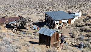 Aguereberry Mining CampLast night while we were watching the sunset from the Desolation Canyon Trailhead parking area, we noticed a little tiny light flashing up atop the Panamint Range on the other side of the Valley.
Curious to see what it was, I pulled out the Death Valley map and saw that we were directly across from something called 6,433-foot high Aguereberry Point, something I had never heard of before.
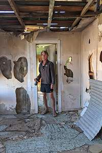 Home Sweet HomeIt sounded like a worthy destination for the day. It was also nearer to Stovepipe Wells, where we would be spending the next two nights.
No sunrise this morning, as we decided it would be nice to sleep in for a change, so after a leisurely morning, we left Furnace Ranch, headed north on 190, drove right past Stovepipe Wells, as it was too early to check in, and made the turn onto Emigrant Canyon Road. After driving 11.6 miles, we turned left onto the dirt Aguereberry Canyon Road.
Just a few miles in, we noticed some structures to our right. Although we couldn’t drive to them, there was a small pull-out on the right. We’ve been to a lot of ghost towns and old mining camps, but this one looked pretty interesting.
It was a very short walk, down a dirt road to what we learned was the Aguereberry Mining Camp and Eureka Mine, established by old-time prospector Shorty Harris and his greenhorn partner Pete Aguereberry in 1905 in order to mine the gold out of the hills behind it.
.thumbnail.jpg) Aguereberry Camp kitchenHerb thought he recognized the name Shorty Harris, and soon enough he eventually remembered that the sculpture at the Goldwell Open Air Museum in Rhyolite with the large prospector wielding a picaxe down on where I had positioned Herb for a photo was called “Tribute to Shorty Harris.” However, Shorty was not the axe-wielding prospector, but the tiny penguin-like figure next to him.
Aguereberry Camp kitchenHerb thought he recognized the name Shorty Harris, and soon enough he eventually remembered that the sculpture at the Goldwell Open Air Museum in Rhyolite with the large prospector wielding a picaxe down on where I had positioned Herb for a photo was called “Tribute to Shorty Harris.” However, Shorty was not the axe-wielding prospector, but the tiny penguin-like figure next to him.
An information board gave us a brief history of Shorty’s and Aguereberry's stay here. When gold was discovered by Harris and Aguereberry in these hills in 1905, they planned a town named Harrisberry, where during its heyday, some 300 miners lived, most in a tent city that sprang up across the road from the house.
Later, as the tale goes, Shorty tried to take credit for the claim, and renamed the town Harrisburg. However, their boom was rather short-lived, and when the mine’s output decreased, Shorty left and most of the rest of the miners left.
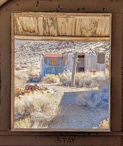 Living room view of other cottageHowever, Pete Aguereberry remained, and worked the mine for some 40 more years until his death in 1945. While all those tents the miners lived in are long gone, the original cabin that he built and lived in is still on the site. The buildings in the front were built in the 1940's as guest houses.
What was so fun about this deserted mining camp was that so many of the structures were still fairly intact, enough to give an idea of what it must have been like to live in them. Plus, you were allowed to wander around in them, which is often not the case. I never would have expected this to be one of my favorite stops in Death Valley, but it was. I love human history mixed in with some natural beauty.
Some of the structures had water heaters, sinks, refrigerators, and stove tops. There was even a two seater outhouse a little ways up on the ridge. I guess he was pretty lonely and wanted to make things nice for his guests so that they would visit.
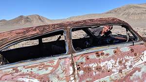 Aguereberry carThink of all the history that went on during his lonely, remote stay from 1905 to 1945 - two World Wars, the Great Depression, the expansion of travel by automobile, etc. Hopefully, his guests filled him in as to what was going on in the world.
To the left of the camp, we saw what looked like a rusted old car. We wandered up that way and sure enough there was an old pretty large car, completely riddled with bullet holes.
The old Eureka Mine was also nearby, but blocked to prevent entry.
Having explored every nook and cranny, we continued up the Aguereberry Point Road, which got a bit rougher, with some narrow sections and blind turns. The last half mile is barely wider than one lane and there is a steep, 1000-foot drop-off, which could get you pretty quickly back to the Valley.
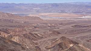 View from Aguereberry PointPete Aguereberry actually built this road so that his guests could enjoy the wonderful view of the Valley below.
There is a small parking lot at the end of the road, but the view is partially blocked by a ridge. The more panoramic view is reached via a short walk left around the rock formations and then along an informal trail down the ridge to your right. I stopped short before things got scary.
The point overlooked the southern half of Badwater Basin and the area of Death Valley from Furnace Creek north all the way to Salt Creek. It was lovely, but, of course, like everything else, the view would be better at sunrise or sunset. The drive on the windy road, however, wouldn’t, so back we went.
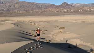 Hiking up the backside of the Mesquite Flat Sand DunesOur room at Stovepipe Wells was still not ready for check-in, so we decided to go straight to the Mesquite Flat Sand Dunes for a sunset hike.
The lighting on the dunes is dependent on the season. In the winter time, which we were now closest to, sunrise is best on the front side of the dunes (by the main parking lot), but sunset is best on the back side, reached via a longer walk from the Historic Stovepipe Well, just off Scotty’s Castle Road, a few miles north of the junction with 190.
So to the back side we would go. After parking near the Historic Stovepipe well, we started walking out towards the dunes which were much lower than the ones seen from the main parking lot.
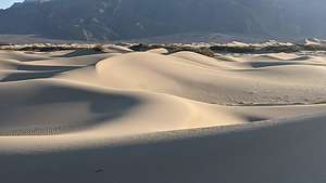 Backside of the Mesquite Flat Sand DunesThe sand dunes stretch over 7 miles, so we knew we were not going to get to the main dune area and the tallest “Star Dune.” That would have to wait for sunrise tomorrow when we would hike in from the main parking lot.
It was close to a one mile walk just to get to the beginning of them. Walking was easy however, as much of the surface was hard packed dirt rather than deep sand. We could pick and choose whenever we wanted to go up and over a small dune.
These smaller dunes were beautiful in their own way - less dramatic, but more intimate and peaceful. There wasn’t another soul to be seen for miles. I think very few people explore this section of the dunes.
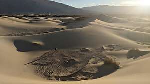 Mysterious crater-like features in Mesquite DunesOne of the most interesting features we stumbled upon was a rocky section at the base of several small dunes with two crater-like circles, about 8 feet in diameter. Herb was so intrigued that when we returned home, he sent a photo to the National Park Service to see if he could get an explanation as to what created them. They were unable to do so. It looked to us very much like small meteorites.
Initially, I thought that we might be able to make it to the main dunes and return before sunset, but distances are deceiving in this type of landscape. So, after about 2 miles and an hour of hiking, we decided it was time to return to the car.
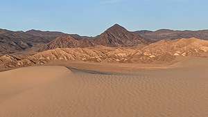 The mountains start to put on their evening showAnother thing about hiking in dunes is that it is easy to get lost if you don’t have a specific landmark in mind to head for. We were also assisted by Strava and Gaia, which we were using to record our hike. Both of these apps provide tracks which allow you to sort of follow the breadcrumbs back home.
Our timing was pretty perfect. We got to watch the sky turn a beautiful pastel pink and blue and the mountains we were heading for take on a golden glow.
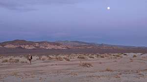 Back to the car just in timeGreat hike. We felt like we were the only people in the world, or at least our small part of it.
Back at Stovepipe Wells, we checked into our room and headed for dinner at the Badwater Saloon, hoping for a better experience than the Last Kind Words Saloon in Furnace Creek. It was. We both had the Toll Road Mushroom Pasta, a tasty dish with mushrooms, of course, roasted sun dried tomatoes, and broccoli, sauteed in a Chardonnay Lemon Cream Reduction topped with Parmesan. It was so nice to see a vegetable again.
Once again, we chose to sit by ourselves outside rather than in the bar - not just because of Covid, but because it was nicer. Plus we could drink our own wine!
Early night. Had to get to the dunes before sunrise!
Day 4 - Sunrise on Mesquite Flat Sand Dunes, Ubehebe Crater hike, and Cottonball Basin at sunset
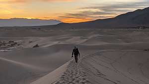 Herb "kicking it in"We were up at 5:00 am and in the main parking lot for the Mesquite Flat Sand Dunes to start our hike by 6:00, well positioned to be on top of the tallest “Star Dune” for 6:30 sunrise.
Their easy accessibility - it’s only one mile from the parking lot to the Star Dune - making it the most highly visited dune in the park, if not in all of California.
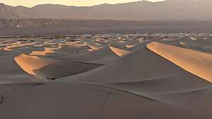 View from the Star DuneOnly problem was that there were three parties in front of us, and we wanted to get there first to avoid having people in our photos. Our boys ran cross country in high school and college, so I turned to Herb and pulled out an old commonly used motivational cry: “kick it in Herb!”
Somewhat unsure of whether I was serious or not, he did indeed kick it in, and we did arrive first on top. We acted quickly, as we didn’t have much time before the others would join us.
We got to the top of 130 foot Star Dune, a much easier climb than to the top of Death Valley’s Eureka Dune, which rises 680 feet above the valley floor. We had it to ourselves - well, at least for the next 20 minutes or so.
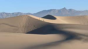 Star DuneFrom there we looked down on a series of pyramid-shaped dunes that changed in color from beige to gold as the sun rose. They were absolutely stunning.
Although much smaller than Eureka Dunes, these had their own unique beauty. Hollywood must agree because they have been the setting for several movies, including Star Wars.
We continued on along the ridge, which can be a little disconcerting, as the sides drop off so steeply. However, it is thick sand, so even if we fell, we didn’t think we would roll that far.
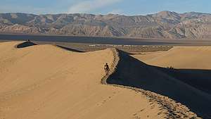 Mesquite Flat Sand DunesYou could walk for hours and hours on this 7-mile long dune system, formed at the convergence of several prevailing winds in the valley. I was glad we got to see the other end of them last night for sunset, as they had quite a different feel to them, being so much smaller.
There is a certain formula needed for creating and maintaining a sand dune. The first ingredient is a source of sand, in this case, the eroding Cottonwood Mountains to the north. Next, you need wind to move the sand and a barrier of some sort to catch it and prevent it from blowing further, in this case, the Panamint Mountains to the south. The conditions at Mesquite Flat Sand Dunes are perfect.
Sun fully up, we returned to the car and then back to the Stovepipe Wells Village Hotel for a nap before our next adventure of the day, which we didn’t know what that would be yet.
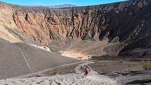 Lolo descending into Ubehebe CrateDespite it being an hour away, we decided to take the drive up to Ubehebe Crater to catch the late afternoon light and to hike down to the bottom, which we had done before about 7 years ago.
At a half-mile wide and 600-feet deep, it is quite impressive. It was formed by volcanic explosions several thousand years ago.
To experience it, you actually don’t have to venture too far from your car, because you actually pull right up to its rim (or about 20 feet back) from the parking lot. You don’t even have to leave y our car, but of course that was not our plan.
A very steep trail down into the crater starts right in front of the parking lot. A slightly longer and more gradual trail (but still very steep) starts about 500 feet to the left when facing the crater.
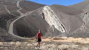 Herb inside the CraterIt is very gravelly. Last time Herb made the mistake of wearing sandals and had to turn back after about 100 feet because there was so much gravel shoved under his toes.
Even with proper foot gear, we slipped and slid for about a quarter of a mile before arriving at the bottom, which was 600-feet lower than the rim.
It really was pretty awesome standing on the flat floor of the crater looking up at its steep, multicolored walls. As with so many other places in this park, it was eerily silent. Quiet is good around a volcano.
We spent some time at the bottom, even climbing up onto a white rock protruding out of the gravel on one of its sides.
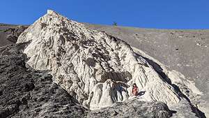 Inside the Ubehebe CraterWhen it was time to leave, we selected the longer path that had a slightly shallower incline. Still, it was a pretty tough hike, made all the more difficult by the loose cinder surface - two steps forward, one step back. It was not for the feint of heart.
Before heading out on the round-the-rim hike, we decided to set up our chairs at the edge of the rim and eat our lunch. The sandwiches were good, the setting was even better.
After lunch, we set out on the other hiking option at Ubehebe Crater - the 2.25-mile hike around the rim of Ubehebe Crater, including a short side trip to Little Hebe Crater. Nice, but I think descending down into the crater was more fun.
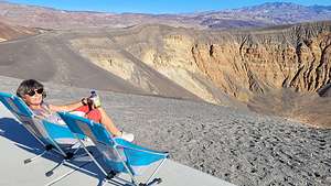 Lunch at the RimAll in all we hiked about 3.1 mile down, up, and around the Crater.
When we got back to the car we saw that there was a photo workshop going on, and it was the same group that we saw a few days back at Zabriskie Point sunrise. We spoke to the group leader and found that she also lived in Santa Rosa, where we lived. She seemed familiar and soon we made the connection. She was one of the judges in Herb’s photography club competitions. Small world, or maybe not so small, as good photographers tend to visit the same places.
She did confirm that Cottonball Basin, which we visited during mid-day yesterday, can be a very interesting photographic spot at sunrise and sunset. So, on our way back to Stovepipe Wells, we followed the directions she gave us as to where to pull-out on the road, including the mile marker, which I can’t remember now, but it was about 6 miles north of Furnace Creek Ranch.
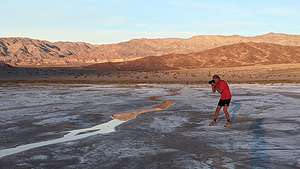 Cottonball BasinAfter parking at the designated spot, we walked out onto the flats, which was sort of a less crowded version of the Badwater Basin, where people love to photograph the bright white salt polygons in low light.
It was much nicer than when we had been there in mid-day, as now the mountains had taken on a golden hue and were reflected in the rivulets running through the salt flats.
It had been another full day. Time to get back to our home for the night at the Stovepipe Wells Village Hotel and dinner at the Badwater Saloon. This time we both had Angus Burgers, which were tasty, and ate once again at our outdoor table with our own bottle of wine.
Day 5 - Mosaic Canyon hike, Father Crowley Viewpoint, and departure
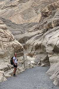 Mosaic CanyonThis was our last day in Death Valley before heading onto Bishop where we would spend a few days with our son and daughter-in-law. Since they were working until 5:00, that gave us time for one more hike.
The obvious choice was nearby Mosaic Canyon, considered by many to be Death Valley’s best hike, or at least a close contender to Golden Canyon. Mosaic is more of a slot canyon compared to Golden with much narrower passageways and rocks to scramble over.
The trailhead is at the end of Mosaic Canyon Road, a 2-mile dirt road (navigable by most passenger cars) just across the street from the Stovepipe Wells Campground.
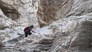 Mosaic CanyonAfter parking, we headed into the mouth of Lower Mosaic Canyon, a narrow slot that weaves its way between wavy white walls of water-polished white marble and blue-gray conglomerate rocks.
The reason the marble is so polished in this canyon, as opposed to other canyons in Death Valley, is that the ground is much more gravely. During flash floods, the fast moving water mixes with the gravel, scouring the sides of the canyon walls, or “polishing” it. As a result, this rock is very slippery, so we had to be careful when scrambling over it.
The conglomerate rocks get water polished as well, giving them the appearance of mosaic tiles grouted into the canyon wall, hence the name Mosaic Canyon.
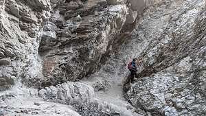 Mosaic Canyon - end of the roadThe best examples of polished marble occur in the first quarter mile into the hike, so you could turn around here and still consider it a wonderful hike.
At about a half mile, the canyon opened up to an expansive gravel wash, marking the top of the lower canyon, and the place where many people turn around, making it a very rewarding, short 1-mile hike.
The last time we hiked this trail, we did turn around, but this time we decided to continue on, and we are so glad we did.
From this point on, the canyon narrowed again and there were more examples of the “mosaic” conglomerate rocks on the canyon walls. Also, there were more and more boulders providing obstacles to climb over.
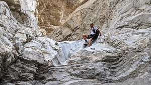 Mosaic Canyon - what goes up, must come downEventually, we came to a 20-foot dry falls totally blocking our passage. We thought we were done until we noticed a bypass around it that was still pretty sketchy but doable. With a little boost from Herb, I was up and around the obstacle. I think many people do (and should) turn around at this point.
Whenever I climb up something precarious, I always try to think about whether I can come back down, as that is always more difficult than up.
At the two mile point, we really came to the end of the road at a 30-foot dry falls. Time to turn around, this time maneuvering down the slippery boulders.
.thumbnail.jpg) Father Crowley View PointWhat a fantastic hike - just a little over 4 miles with a 937-foot elevation gain. Great ending to a truly wonderful trip to Death Valley, with some new sights as well as some old favorites.
Father Crowley View PointWhat a fantastic hike - just a little over 4 miles with a 937-foot elevation gain. Great ending to a truly wonderful trip to Death Valley, with some new sights as well as some old favorites.
We left the park via Highway 190 West, through Panamint Springs, towards the town of Lone Pine, but first a quick stop at the Father Crowley View Point.
Father Crowley is a well-known and admired man, who recognized the beauty of the Eastern Sierra and Death Valley and did so much to promote it in the early 1900s. His name has been memorialized in such places as Crowley Lake in Bishop and this viewpoint to name a few.
In the 1930s, Father Crowley, a catholic priest, was responsible for ministering to the people of Inyo County, which included Death Valley. Nicknamed the Desert Padre, we would often stop at this point to admire the view when returning to his home in Lone Pine after visiting his parishioners in Death Valley.
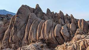 Bulbous formations in the Alabama HillsFrom the viewpoint, there is a stunning view into the colorfully-striped Rainbow Canyon and out across the Panamint Valley.
Seemed as good a place as any to have a late picnic lunch.
When we got to Lone Pine, we still had some time to kill before getting to Andrew and Celeste’s so we decided to take a drive along Movie Road through the Alabama Hills, one of our favorite places in the Eastern Sierra.
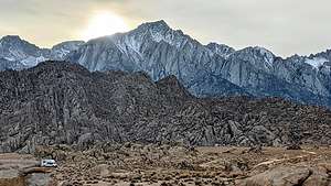 Sun sinking behind Mt. WhitneyIt’s a truly beautiful place with oddly-shaped boulders and towers set against the backdrop of Mount Whitney (the tallest mountain in the continental U.S.). For people our age, some of the scenery in the Hills might even be familiar from watching old Westerns. Hollywood filmmakers discovered this dramatic scenery back in the 1920s and filmed hundreds of movies (particularly westerns), TV shows, and commercials here, such as “How the West was Won,” “Rawhide,” and “Gunga Din.” And, it’s not just about old westerns. Plenty of current day movies, such as “Gladiator,” “Django Unchained,” and the new Lone Ranger have used the surrounding hills as a set as well.
Mt. Whitney, the tallest mountain in the continental United States, was already starting to block the sun by 3:30, so we didn’t have much light left by the time we got there.
Okay, enough stalling. Time to get on to Bishop for some big hugs and fun with Andrew and Celeste.
Rhyolite
Sunday, November 14, 2021 - 4:00pm by Lolo222 miles and 4 hours from our last stop
Travelogue
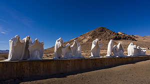 Goldwell Open Air MuseumAfter the magical sunrise at Mono Lake, we drove east on 120, a beautiful road that brought us into Nevada, and then south to the town of Beatty, near the eastern entrance to Death Valley.
However, we couldn’t just breeze through Beatty without a stop at one of our favorite outdoor sculpture museums – the Goldwell Open Air Museum in Rhyolite. This place is literally in the middle of nowhere.
The museum, which is open to the public 24 hours a day 7 days a week, has seven monumental outdoor sculptures that are colossal not only in their scale, but in their dramatic setting amongst mountains and the Mojave Desert. It was precisely this stark setting that attracted a group of Belgian artists in the 1980s to choose this location to create their art.
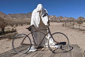 "Ghost Rider"My two favorites sculptures were by Albert Szukalski, and they both involve an unusual technique he developed in which a live model is draped in plaster-soaked burlap and has to remain still until the plaster dries enough to stand on its own. I can’t even begin to imagine how uncomfortable this must have been for the models. It gets really, really hot here.
.thumbnail.jpg) Tribute to Shorty HarrisSzukalski’s largest work is entitled “The Last Supper,” and it consists of 12 white ghostly shapes arranged as in Leonardo da Vinci’s painting of the same name. The shapes have no faces or bodies – just drapes hanging on an invisible form.
Tribute to Shorty HarrisSzukalski’s largest work is entitled “The Last Supper,” and it consists of 12 white ghostly shapes arranged as in Leonardo da Vinci’s painting of the same name. The shapes have no faces or bodies – just drapes hanging on an invisible form.
My second favorite was aptly called “Ghost Rider.” As in Szukalski’s other works, a ghostly draped figure – minus the body inside – stood beside an actual real bicycle, as if it was getting ready to go for a ride.
However, I also love the sculpture of the giant prospector wielding a large pickaxe Unbeknownst to Herb, I always place him under that axe - just for fun.
For anyone passing through this area, the Goldwell Open Air Museum is truly worth a visit. Plus, just up the road is the Rhyolite Ghost Town, the remnants of a mining town that sprung up in 1904, grew to a population of over 5,000 people, and then went bust by 1911. Now it is just a tourist attraction and a setting for motion pictures, where you can still see some remnants of the town’s glory days: the railway depot, the Bottle House, and the ruins of the 3 story bank and old jail.
However, since we had seen the ghost town on previous trips and wanted to get through Titus Canyon in daylight, we skipped it and continued on.
Mono Lake
Saturday, November 13, 2021 - 3:30pm by Lolo295 miles and 6 hours from our last stop - 1 night stay
Travelogue
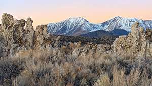 Tufas and SierraDeath Valley was a pretty long drive for one day, so we decided to break it up by spending the night in Lee Vining, near Mono Lake.
We absolutely love Mono Lake. It is such a unique and otherworldly place with its mystical “tufa castles” rising from the lake, formed over thousands of years when carbonates in the water combined with calcium from freshwater springs feeding into the lake.
Normally they would just be hidden beneath the water, but as lake levels dropped, these extraordinary-looking knobs, spires, and minarets became exposed, some of them rising as high as 30 feet above the surface—and they do look like castles. Most of the towers visible in the lake are from 200 to 900 years old.
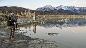 Herb awaiting sunriseThe largest concentration of them can be found along the southern shore of the lake at the South Tufa State Reserve, just ½ mile west of Navy Beach.
We got to Lee Vining too late to enjoy the sunset over the lake, so we decided to set our alarm clocks for 5:00 to catch the sunrise in the morning. I’m not a morning person, so this was a big deal for me.
While it was still dark we drove down 395, turned east on Highway 120, and made another left on the turnoff for the South Tufa State Reserve. I was surprised to see that we were not the first ones there.
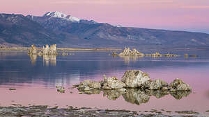 Sunrise Mono LakeAs we got our stuff together to hike the short distance to the tufas, several more cars arrived. As They began unloading lots of camera and video equipment, we realized that they were all together and some kind of filming was going to be done. I asked them and they said that they were filming a nature documentary for the BBC.
Looks like we were in the right place for some pretty spectacular scenery.
The trail to the lake is only a mile-long, but there were plenty of interesting stops along the way. Because of the drop in lake levels over the years, there are quite a few land-based tufas along the trail. That, combined with the snow-capped Sierras in the background, made for a very lovely scene.
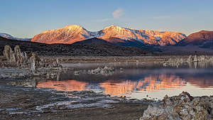 Sunrise Mono LakeIt was a frigid 37 degrees and my fingers, despite a pair of gloves, were freezing, making it difficult to hit the shutter on my camera phone.
Meanwhile more and more members of the film crew went by rolling suitcases filled with equipment. I hoped we wouldn't get in each other’s way. I didn't get up this early to have dozens of people in my photos. I'm sure they felt the same about us.
We got to a small beach on the lake and waited for the sun to make its appearance, right over the peaks of those beautiful snow-capped Sierras. What a difference some snow makes. The Sierra is always beautiful, but when it's covered in a blanket of snow, it is striking.
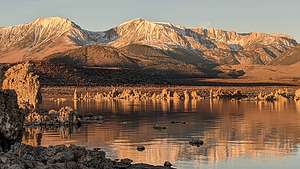 Sunrise Mono LakeFinally, at 6:35, right on time, the tops of the peaks took on an orange glow, as if a painter was starting his work. By 6:50 the show was in full force, with the mountains and the tufas all aglow - both in reality and in their reflections in Mono Lake. It was absolutely stunning.
We wandered a bit further along the lake trying to stay out of the way of the BBC crew, who were now flying drones over the entire area, capturing the Sierra, lake, and tufas from above. I wish I had asked when this documentary would be aired. I didn't even know what it would b e called.
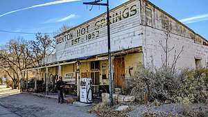 Historic Benton Hot SpringsOnce the sun had risen and completed its light show, with frozen hands we went back to the car to continue on our way to Death Valley.
Although the shortest route was down 395 to the town of Lone Pine and then east on 190 towards Stovepipe Wells, we decided to take another more scenic and interesting route.
From the South Tufa Reserve, we continued east on 120 to the town of Benton, famous for its historic natural hot springs. No time for soaking now, so we continued on to the town of Tonopah, an historic Nevada mining town, before heading south of 95 towards Rhyolite and the Titus Canyon 4WD entrance into Death Valley.
See next stop
Yosemite Valley
Tuesday, October 26, 2021 - 3:15pm by Lolo245 miles and 5 hours from our last stop - 8 night stay
Travelogue
Day 1 - Firefall in October!
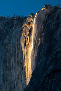 October Firefall begins with a golden shieldAs I mentioned in the overview, we were arriving in Yosemite Valley the day after 9 to 12 inches of rain had fallen. The Merced River was raging, cascading over rocks and fallen trees, in a way we hadn’t seen it in years. This could be really good.
Also, the word on the street (or more correctly FB pages of Yosemite photographers) was that this atmospheric river might bring Horsetail Falls back to life, creating the natural firefall phenomena that normally only occurs during two weeks in February when this seasonal fall is running and the angle of light at sunset is just right.
Well, as luck would have it, Horsetail Falls was running again, and the lighting at the end of October is nearly identical to that of the February window of the Firefall.
In the old days, visitors to Yosemite did not have to wait for these perfect conditions of water and light to align. Why do that, when you can use real fire?
Starting in 1872, and continuing for almost 100 years, the owners of the Glacier Point Hotel (ironically destroyed by fire in 1969) pushed coals from a huge bonfire over the edge of Glacier Point, creating a “waterfall” of glowing red embers, which cascaded over the edge of the cliffs, like a lava flow, to the Valley 3,000 feet below.
Thousands of enthusiastic tourists gathered each summer night in the meadows of the Valley to watch this spectacle. They knew it was coming when David Curry, the founder of Curry Camp, would yell from the Valley floor, “Let the fire fall.”
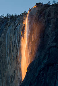 October Firefall progresses to a fiery redThis went on until 1968 when the director of the National Park Service finally questioned the wisdom of throwing burning embers down into the Valley. Also, the thousands of enthusiastic spectators were trampling through and destroying the meadows as they jockeyed for a good vantage point. The decision was made to preserve the valley and return it to its natural state.
Fortunately, Horsetail Falls stepped up and created a natural “firefall,” although not every night and only under very specific conditions, which usually occurred for a two week period in February.
Well, as they say, every cloud has a silver lining, and ours was being present in the Valley when the torrential rains which reanimated Horsetail Falls and the late October light came together to put on a spectacular show - probably made even better by the fall foliage. Oh, and you also need a third ingredient - no clouds blocking the sunset hitting the falls. Boy, were we lucky!
While the February event brings hundreds of photographers, jockeying for position, to capture the event, it was just us and one other photographer in one of the best places to view the Horsetail Falls “firefall,” which is located on the far eastern edge of the North American Wall of El Cap.
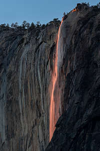 October Fallfall closes its show with pastelsWe parked in a pull-out on the right on Northside Drive where there was a view of El Cap and strained our eyes to determine if the shiny part on the cliff face was a waterfall. We thought so, but we would just have to wait and see. There was one other photographer who joined us with some serious camera equipment so that was a good sign that we were in the right place.
There were some low lying clouds, so we were a bit worried whether the sunset light would hit the falls. However, there did appear to be some blue sky beneath the clouds, so we kept our fingers crossed.
Sure enough, the sun dipped below the clouds, and at 5:32 pm, the shiny place on the rock transformed into a golden shield with an obvious thin, but ample, waterfall running down its center.
We began running around like nuts trying to find the best place to photograph it. Since I was using my phone camera, I couldn’t really get closeups, so I focused on getting the firefall with some foliage in the foreground, while Herb took the more classic shot of what looked like a lava flow.
After about 20 minutes of golden light, the color changed to a fiery red as the sun got lower in the sky - the classic shot of the falls and the reason for its name.
In another 10 minutes, the colors changed once again, this time to a lovely pastel pink and blue. By 6:10, the show was over.
What an incredible experience, and we had only arrived in the Valley 2 hours ago. We could go home now and the trip would have been a success.
Day 2 - Drive the Valley Loop, Run to Mirror Lake, Hike Four Mile Trail
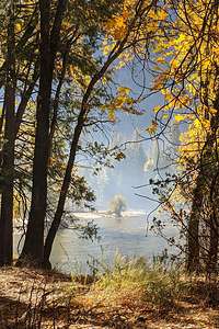 Morning MistThe next morning we arose early (at least for us) to do what would pretty much become our morning ritual during our stay. We would drive the motorhome to the Church Bowl picnic area by the Ahwahnee Meadow for two reasons:
First, since we had pieced together our campsite reservations based on cancellations, we had to move to a different site pretty much every day, so we had to get it out of our site by 11:00.
Secondly, Church Bowl is one of the few spots in the Valley that get early morning sun, so it was a good place to charge up our solar panels. We weren’t the only ones with this idea, so we pretty much had to get there by 8:30 to nail a parking space. Most of the other occupants of the spot were twenty- or thirty-something climbers in white vans (like both of our sons) prepping for a big wall climb the following day. In fact, one out of five vehicles in the Valley were white Promaster vans.
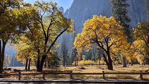 Fall foliage in El Cap MeadowOnce the motorhome was tucked into a spot, we set off in the Subaru to drive the Valley Floor Loop in hopes of finding mist weaving among the trees decked out in the autumn yellows and oranges and/or other interesting atmospherics or reflections in the river.
We usually start off by parking before the El Cap crossover road (between the Southside and Northside Drives) and then wander along the Merced River before eventually crossing over into the lovely El Cap Meadow.
The skies were already a striking, cloudless blue, something I wouldn’t usually complain about when on vacation, but are a bit boring in a photograph. In any case, it was fun to just wander around scouting out interesting places.
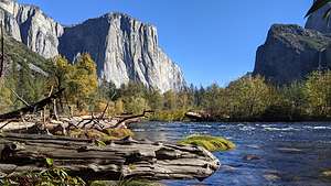 Lovely Valley ViewAfter coming to the Valley dozens of times, we try to not get jaded and take the incredible scenery for granted, but rather to remind ourselves just how breathtakingly beautiful it is. Even after 35 years, that still isn’t a problem and each visit we are awed and inspired anew.
Wanting to get some exercise, we drove back to our home base at the Church Bowl Picnic area, changed into running clothes and set out on a run along the Valley Floor bike path and trail to Mirror Lake, where we were to have a second “first” in Yosemite Valley (the first “first” being the October natural firefall).
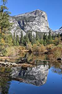 Mirror Lake finally being a mirrorMost people don’t realize that Mirror Lake usually has no water in it, so it usually doesn’t mirror anything, but this time because of that bountiful atmospheric river of rain that had hit the Valley a few days ago, we were greeted to a reflection of North Dome in what was now truly a lake. It was absolutely lovely.
Although we did manage to run 5 miles that morning, I had a weird problem across two of my toes on my left foot - sort of painful and tingly feeling. After much googling, I ruled out a broken toe (I had 0 out of 10 of the symptoms) and determined it was most likely peripheral neuropathy caused by trauma, the trauma most likely being the pretty bad stubbing I had done in the motorhome the day before. It only seems to hurt when a push off on my toes, which is basically running (and ballet dancing, which won't be an issue , so I am switching to hiking, biking, etc., until it hopefully goes away. Herb is getting a little tired of “toe talk” so he is very much rooting for a speedy recovery as well.
.thumbnail.jpg) View of Horsetail Falls Firefall from Four Mile TrailOur final activity of the day was to be a partial hike up the Four Mile Trail to a spot where there was an excellent place to view El Cap without being totally obstructed by trees. We weren’t sure if Horsetail Falls would still have enough water to put on its Firefall showe, but we figured worse case, we would get a lovely view of sunset over El Cap.
View of Horsetail Falls Firefall from Four Mile TrailOur final activity of the day was to be a partial hike up the Four Mile Trail to a spot where there was an excellent place to view El Cap without being totally obstructed by trees. We weren’t sure if Horsetail Falls would still have enough water to put on its Firefall showe, but we figured worse case, we would get a lovely view of sunset over El Cap.
Four Mile Trail is one of my favorite hikes from the Valley. It climbs steadily from the Valley Floor up 3,200 feet to Glacier Point over 4.8 strenuous miles (not 4 miles like the trail name would imply). We have done this hike several times in the past, but tonight was to be a shortened version - just a mile and a half or so up to where we hoped to capture the Firefall from a different perspective.
This is an extremely popular trail, and we passed dozens of people coming down, probably wondering why these old people were setting out on the trail so late in the day, as there was no way we would make it to Glacier Point before dark.’
‘
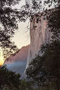 Here come those blues againFeeling a need to explain ourselves, I told several passing hikers about the surprise October Firefall, and that we were not trying to go to the top, but just about a third of the way up to hopefully photograph it. I don't think they really cared, but I hoped that my sharing of this information got at least a few of them to try to find a place from where they could experience it themselves.
It was a little difficult finding enough of a clearing in the trees to get a full view of Horsetail Falls, but there were a few spots that worked. Then we waited, unsure whether the water and the sunset would cooperate. Oh, and the clouds too. Everything would have to be perfect.
Finally around 5:24, we got our first glimpse of the golden shield on El Cap - not quite as dramatic as last night, perhaps due to less water or our vantage point, but still a pretty good show. We knew its routine now. Soon the golden shield transformed into a narrower fiery red waterfall before ending with that incredible blue again. By 6:05 it was all over.
Another magical day in the Valley!
Day 3 - Drive the Valley Loop (morning commute), Bike Ride around the Valley, and Half Dome Reflections
.thumbnail.jpg) Smoke conditions from prescribed butnAfter dropping the motorhome off at the Church Bowl picnic area for the solar panel's daily dose of sunshine, we once again set off on Northside Drive for our morning loop around the Valley Floor, hoping to be early enough to catch some mist lurking around the colorful trees.
Smoke conditions from prescribed butnAfter dropping the motorhome off at the Church Bowl picnic area for the solar panel's daily dose of sunshine, we once again set off on Northside Drive for our morning loop around the Valley Floor, hoping to be early enough to catch some mist lurking around the colorful trees.
When we got to El Cap meadow, there was certainly some interesting atmospherics going, but it didn't take us long to realize that rather than mist, this was smoke from the prescribed burn just on the other side of the Valley where the El Cap crossover road meets Southside Drive. I know these prescribed burns are important - just wish it wasn't happening while we were here.
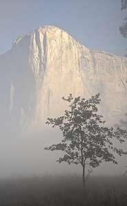 El Cap, I know you're in there somewhereTommy and Erin are actually coming to the Valley on Saturday for the wedding photographer to meet them and take the photos that he wasn't able to take of them in the Valley because of the smoky conditions from actual non-prescribed fires - I think the one in Sequoia National Park. Hope this wouldn't ruin it for them. They were bringing their wedding attire so that they could be bride and groom again.
We wandered around the meadow for about a half hour, but the smoke was pretty intense. Even with our dual purpose N95 mask (great for dealing with both Covid and smoke), we were only able to last about a half hour before leaving to find clearer air.
Luckily, everything east of the El Cap Crossover road seemed to be fine.
We returned to the motorhome at Church Bowl, made lunch and then set up our chairs in the sun where we could read and/or just gaze out at the Ahwahnee Meadow and Half Dome. Having been to Yosemite Valley so many times, it's nice not feel compelled to run around frantically seeing every beautiful sight, but rather to kick back and take the time to savor them leisurely one at a time.
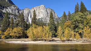 Along our Valley bike rideSince my weird toe ailment was not ready for a run, I suggested that we take a bike ride, my absolute favorite way of getting around the valley. The bike paths make for a very pleasant ride.
Although we have really nice mountain bikes, Herb was worried about theft and/or them being rained on, so we resurrected our old ones out of the attic. Of course, they all had flat tires to be dealt with. One thing that I would later learn, much to my dismay, is that in a very hot attic, over the summer the rubber on the gear shifters can melt, resulting in the unsuspecting rider’s (me) hands being covered with a sticky grease-like substance. It didn't happen to Herb's bike, just mine.
.thumbnail.jpg) Along our Valley bike rideFrom Church Bowl we headed out towards Sentinel Drive where we left the pavement and rode along paths through the meadow before coming out by Camp 4 on Northside Drive, the famous rock climbers' camp located near the base of Lower Yosemite Falls. Some of the world’s most renowned climbers have used it as their base when climbing in Yosemite.
Along our Valley bike rideFrom Church Bowl we headed out towards Sentinel Drive where we left the pavement and rode along paths through the meadow before coming out by Camp 4 on Northside Drive, the famous rock climbers' camp located near the base of Lower Yosemite Falls. Some of the world’s most renowned climbers have used it as their base when climbing in Yosemite.
So important was this site to the climbing community, that when its removal was threatened in the late 1990s, a campaign was started to save it. It worked, and today it is listed on the National Register of Historic Places for "its significant association with the growth and development of rock climbing in the Yosemite Valley during the 'golden years' of pioneer mountaineering.”
.thumbnail.jpg) The real source of our misty conditionsSo here we were, biking through hallowed climbing ground. Even if you don’t climb, it’s fun to just walk through this camp and watch the bouldering that goes on here. In fact, we would be doing that this weekend when Tommy and Erin arrived - spoiler alert: maybe even in wedding garb.
The real source of our misty conditionsSo here we were, biking through hallowed climbing ground. Even if you don’t climb, it’s fun to just walk through this camp and watch the bouldering that goes on here. In fact, we would be doing that this weekend when Tommy and Erin arrived - spoiler alert: maybe even in wedding garb.
After peddling through Camp 4, the path led us to Northside Drive, where we crossed onto a sandy trail that paralleled the road and eventually brought us to a beautiful spot on the Merced River. This is my absolute favorite part of the Valley Loop bike ride.
From there, we took the El Cap crossover road to Southside Drive and stopped to check out the prescribed burn, which had obscured our views and filled our lungs this morning.
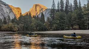 Spending cocktail hour with Half DomeAlthough there is an unpaved Valley Loop trail that parallels Southside Drive, we had noticed that much of the Valley Loop trail was unmaintained and required frequent lifting of bikes over pretty large logs. Instead we decided to carefully bike along Southside Drive stopping at various viewpoints along the way before arriving back at the motorhome in the Church Bowl picnic area.
Fortunately, Herb had some WD40 that worked wonders on removing the sticky, rubbery grease from my hands. To prevent any future messes, he taped up the handles with climbing tape.
That evening we found a secluded beach on the Merced near Sentinel Bridge where we could watch Half Dome do its alpenglow thing without being surrounded by dozens of tripods.
Day 4 - Vernal Falls Hike and Cocktail Hour in Cook’s Meadow
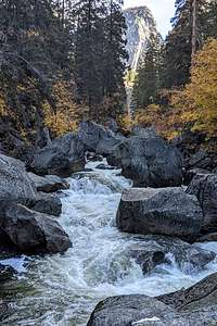 Vernal Falls FootbridgeWhile the Valley Floor loop trails lead past innumerable breathtaking Yosemite icons without the need to strenuously gain elevation, there are three not-to-be-missed trails that require a bit more work, aka elevation gain.
The hike to the top of Yosemite Falls gains 2,700 over 3.6 miles (9.6-mile RT hike). I think this is probably the most strenuous hike out of the Valley, but well worth the reward at the end.
The hike from the Valley to Glacier Point via the Four Mile Trail gains 3,200 feet over 4.8 miles (9.6-mile RT hike). Another terrific hike that feels a bit less strenuous than the Yosemite Falls hike even though it has a greater elevation gain, because it is done over a longer distance.
.thumbnail.jpg) Vernal Falls from the Mist TrailThe hike to the top of Vernal Falls is 2.1 miles with a 1,551-foot elevation gain (4.2-mile RT). If you continue on to Nevada Falls it is a total of 5.8 miles RT with a 2,000-foot elevation gain. This is by far the most popular hike out of the Valley because it has a lot of bang for the buck and is the least strenuous.
Vernal Falls from the Mist TrailThe hike to the top of Vernal Falls is 2.1 miles with a 1,551-foot elevation gain (4.2-mile RT). If you continue on to Nevada Falls it is a total of 5.8 miles RT with a 2,000-foot elevation gain. This is by far the most popular hike out of the Valley because it has a lot of bang for the buck and is the least strenuous.
Mainly because of my injured toe, we decided to do the Vernal Falls hike, going up the Mist Trail and returning via the John Muir trail in order to make it a loop.
Because of Covid, no shuttles were running in the park, so we rode our bikes to Happy Isles where the Mist Trail begins.
This is one of the most popular hikes in the Valley, so we had no expectations of finding solitude on the trail, but even we were surprised by the steady stream of people of all ages, shapes, sizes, and foot gear.
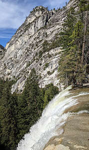 Vernal Fallsl going over the edgeThe first mile of the trail is partially paved and almost entirely uphill. After 0.8 miles and about a 500-foot elevation gain, we came to the Vernal Falls footbridge where there is a good view looking up at the falls.
After crossing the bridge, in about 0.2 miles we came to a junction in the trail, with the Mist Trail continuing to the left and the John Muir Trail to the right. We planned to do a loop, so we followed the Mist Trail up a steep granite staircase with over 600 steps to the top of Vernal Falls. There’s nothing like strenuous physical activity to thin a crowd, so already we were finding ourselves with a bit more peace and solitude.
The trail is named the Mist Trail, because the mist from the falls normally sprays hikers and the trail itself, often making it quite slippery. In times of drought or in late summer, there is often no mist on the Mist Trail, but fortunately for us, the torrential rains a few days ago, which brought us our October surprise firefall, were also delivering us mist.
From the top of Vernal Falls, we took our turn to get to the metal railings where we watched the river flow over the edge and down the length of the 317-foot waterfall.
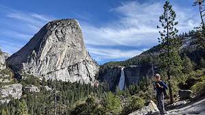 Nevada Falls from the John Muir TrailJust beyond the top of the falls, we stopped to eat lunch by the Emerald Pool, a small shallow lake named for its deep green color. At the far end of the lake is the Silver Apron, a smooth granite mass, tilted in such a way to invite its use as a water slide in the summer when the river flows over this. There are numerous signs warning people not to do this, or enter the Emerald Pool for any reason, as you risk being swept over the Vernal Falls by currents that are much stronger than they appear. People have been killed here before.
Rather than go back the way we came, which would require us going down the steep, slippery 600 steps through the mist, we decided to continue on another 0.2 miles where we came to the junction with the John Muir Trail.
.thumbnail.jpg) Cook's Meadow cocktailingThe hike down the John Muir Trail was a little less scenic than the Mist Trail, but it still had a nice view of Nevada Falls and Liberty Cap in the background.
Cook's Meadow cocktailingThe hike down the John Muir Trail was a little less scenic than the Mist Trail, but it still had a nice view of Nevada Falls and Liberty Cap in the background.
Once back at Happy Isles, we reconnected with our bikes and rode the 2 and ½ miles back to our motorhome at Church Bowl, stopping to admire Half Dome along the way.
As we did every day, we moved the motorhome back to our campsite (the 4th one in 4 days since I pieced this trip together on cancellations) before it got dark.
We filled the cooler with wine and cheese and headed over to Sentinel Bridge where we parked, took our chairs and cooler, and sat at the edge of Cook’s Meadow admiring Yosemite Falls cascading above the lovely fall foliage.
Another day in Paradise comes to a close.
Day 5 and 6- Weekend with Tommy and Erin - Wedding Photography, Bouldering in Camp 4, and Cocktail Hour in Cook’s Meadow
 Tommy and Erin at Wawona Tunnel ViewTommy and Erin arrived late last night -- too late to actually see them, but when I awoke in the middle of the night, I did peek to see that they were tucked in safely and soundly. That was after I had left some pillows in their bear box because they called earlier to tell me that forgot theirs.
They are very frequent weekend visitors to Yosemite, as they both love to rock climb, they have a built-out Promaster camper van, and San Francisco is just 4 hours away, making it a viable weekend trip.
 Tommy and Erin at Wawona TunnelHowever, this particular visit was a bit unique, because besides packing their normal climbing gear, they had also brought along Erin’s wedding dress and Tommy’s suit.
Just three weeks ago, they had gotten married at the Evergreen Lodge, a beautiful rustic lodge and cabins near the northwest entrance to the park, near Hetch Hetchy. Their wedding was absolutely sensational and so much fun. Destination weddings are so much more relaxed and fun because you get to spend several days with your guests.
The only glitch in an otherwise perfect event was that the smoke from the Sequoia fire decided to attend the wedding as well. Although the Air Quality Index (AQI) was around 170, which isn’t great, everybody was having too much fun to even notice. I think the dancing and the open bar probably helped a bit.
 God rays bless the happy coupleTheir photographer had planned to take them down to the Valley the day after the wedding to take photos of them in a place that was very special to them. One of their earliest dates had been a 3-day ascent up the Nose route of El Cap, basically testing the fabric of their young relationship. Their relationship not only survived, but it thrived and now four years later, they tied the knot - not a literal knot like in climbing, but the metaphorical one representing their lifelong commitment to each other.
Well, since that originally intended photo session the day after their wedding didn’t work out because the smoke was so thick in the Valley that you couldn’t even see El Cap, their photographer was nice enough to agree to come back to Yosemite on another weekend of their choosing. He lived relatively close by in Mariposa.
 Behind the scenes of the photo shootSo, this was the big weekend. Erin had had her dress dry cleaned and repaired from too much dancing and partying, so she was ready to be a bride again. At least she was getting two uses out of it.
None of the photos I am posting on this page were taken by the Patrick, their professional wedding photographer. Those still have to be sorted through and edited before Tommy and Erin receive them. Instead, the photos on this page were were taken by either me or Herb stealthily standing behind or to the side of Patrick. Tommy made me swear beforehand that I wouldn't get in his way. Who me?
We met Patrick at the Wawona Tunnel viewpoint, where there is an iconic and breathtaking view of El Capitan, Half Dome, and Yosemite Valley in between.
This is always an extremely crowded place, so Erin was a bit embarrassed stepping out of their camper van wearing a wedding dress, but I think people are pretty used to seeing brides in the Valley as it has become a very popular place to get married. Patrick said a big part of his business is photographing Yosemite elopements. It is such a beautiful and spiritual place.
 Erin in her new climbing outfitBeing a local, Patrick knew lots of beautiful, yet still secluded places to go. He also had a really good eye to capture things spontaneously based on conditions. At one point, when driving on the El Cap crossover road, near the prescribed burn, he just pulled over to the side of the road and asked Tommy and Erin to walk down the road a bit. Fortunately, no cars were coming. What he had seen from his rear view mirror was the way the sun coming through the smoke was creating what photographers call “god rays.” It made for a very magical, fairytale-like setting.
 Tommy making it a bit more formal than usualA few more stops and then Tommy and Erin wanted to get down to the business of the day - bouldering at Camp 4. Although Patrick had already far exceeded the hour he had promised him, I think he was very professionally motivated to get some shots of Erin climbing in a wedding dress. So, the good news was, he came with us. The bad news was, Tommy and Erin couldn’t take their fancy clothes off just yet. The pictures, however, were absolutely worth it.
After saying our thank yous and goodbyes to Patrick, Tommy and Erin immediately took off their wedding attire and put on something a bit more appropriate for climbing. Starved from all that posing, we went over to Yosemite Lodge for a quick lunch at the Base Camp Eatery, a cafeteria-style restaurant with burgers and pizza.
Relaxed and more comfortable, we stopped to pick up the crash pads in the van and then wandered through Camp 4 looking for potential boulders to climb (Tommy and Erin that is, not me and Herb).
As usual, there was a group of climbers gathered around “Midnight Lightning,” the most famous bouldering problem in the world and an iconic part of the history of Yosemite rock climbing. We’ve never been there when there wasn’t at least a dozen climbers and an equal number of crash pads at its base to soften the falls from failed attempts - and with bouldering, there is a very high percentage of failed attempts, as it often takes weeks or even months for a climber to work out the moves on a difficult boulder problem and successfully “send it.”
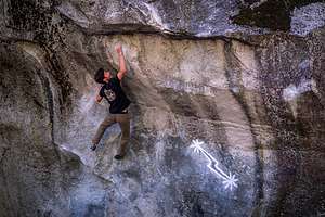 Tommy "sending" Midnight LightningMidnight Lightning is easily identified by a chalk lightning bolt, which was originally drawn on it in 1978 by John Bachar, the second climber to complete it (Ron Kauk was first). Since that time, the bolt has been erased by those that consider it graffiti and redrawn by those that think it an essential part of the history and spirit of Yosemite climbing. I liked it - it reminded me of a petroglyph.
Having been on it several times in the past, Tommy decided to take a go at it again. They added their crash pads to the pile and Tommy took his turn in between the other climbers. Taking turns was very civilized, Those waiting spotted the active climber, and the next climber stepped up after the previous climber had either fallen or sent the climb. On Tommy's third attempt, looking very strong and smooth, he “sent’ it, to the cheers of the very supportive group of climbers below. Nice way to cap the day!
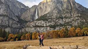 Tommy and Erin a bit less formalSomewhat fortuitously, one of the other climbers that was spotting him had left his camera video running and captured Tommy's successful attempt. Even more fortuitously, they had met him before when climbing in Tahoe, so he said he would send it to them. The climbing world is a surprising small one and every where they go they usually run into people they have climbed with before.
After they had gotten their fill of bouldering for the day, we brought them to our new favorite new cocktail hour spot in Cook’s Meadow near Sentinel Bridge, where we set up our chairs and sat for a while sipping wine and munching on cheese and crackers, just taking in the scenery.
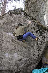 Erin bouldering without a wedding dressAlthough Tommy and Erin were pretty done posing for the day, I did get them to pose one more time on a giant log with the fall foliage and Yosemite Falls in the background. The combination of fall foliage and enough water to make Yosemite Falls flow is not something you always get this time of year, as the water often dries up by the end of summer. This trip was just overflowing with fortuitous events.
What a wonderful day!
We spent the next morning following Tommy and Erin around Camp 4, watching them attempt various different boulder problems. Although Herb and I like rock climbing, we prefer the rope kind rather than bouldering as our older bones don’t like the impact of even short falls onto crash pads. So, we were very happy just spectating and hanging out with them.
After they left, I decided to test the sore toe out on a run, but it didn’t go too well. Although I did manage to go 3 and ½ miles, I was in a bit of pain the entire time. Even the incredible scenery couldn’t distract me enough.
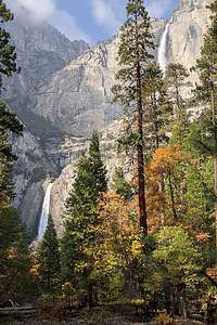 View of the falls along my runI headed off from Church Bowl along the Valley Floor loop to Yosemite Village, where I made a quick stop to go into the Ansel Adams Gallery, which I love. Obviously, this wasn’t going to be a very serious run if I was stopping to shop. Too bad I didn't have my wallet.
From there I continued on through Yosemite Village, past the Visitor Center, which is still closed because of Covid, and then through the Yosemite Cemetery, where many of Yosemite’s early residents, including Native Americans and well-known figures in the history of the park, are buried. This is a spot definitely worth coming back to explore more when I am not theoretically running.
Next stop, the lovely Lower Yosemite Falls, which is pretty much always crowded as it is so highly scenic and so easily accessible. I waited my turn to get in the best position for a photo - sort of the way the climbers on Midnight Lightning yesterday knew when it was their turn to step up. The tough part was finding a spot where both the Upper Falls and the Lower Falls were in the photo. It really is an incredibly beautiful spot.
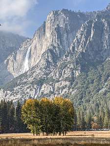 More waterfall views along my runThe foot wasn’t exactly getting any better, so I reluctantly decided to head back, even though I had only gone 3 miles, rather than my usual 5 miles. I drive Herb crazy when I obsessive compulsively continue running around parking lots if we get back to our car when my watch shows we are only at 4.9 miles. Now I was concerned. This foot thing must be more serious than I thought.
However, rather than go directly back to the motorhome, I made one quick side trip to the other side of the Ahwahnee Meadow from Church Bowl (and our motorhome), to take a photo of Yosemite Falls with my favorite group of trees in the foreground. They were just beginning to show their fall colors - yellow on the leaves on top. When we got here a few days ago, the trees were completely green. Oh, and of course I had to take a photo of good old Half Dome, which we had been neglecting this trip, spending much more time with El Cap.
The extra diversion brought my distance to 3 and 1/2 miles.
Rather than spend the whole evening back in the motorhome in the campground, we drove over to the Ahwahnee Lounge to hang out with our books and a bottle of wine. I love historic national park lodges, and in my opinion, the Ahwahnee, with its rustic wooden-beamed ceiling, giant fireplace, and plenty of cozy nooks to hide away in, is one of its finest. I have so many fond memories of spending time here in the evenings with the boys reading, playing cards, or just chatting. It’s my happy place.
Day 7 - Lazy rainy morning, morning commute around Valley, and dinner at the Mountain Room Lounge
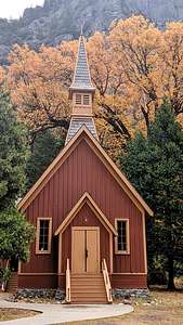 Yosemite Valley ChapelWe awoke to the pitter patter of rain on our roof. The first day of rain in a string of six gorgeous Indian Summer days. The change was actually a welcome one in that it opened up the opportunity so see the Valley under different conditions - same location with different conditions equals a different photo.
We had been getting out early every morning chasing morning light photos around the Valley, so we decided to take it easy this morning and sleep in, or at least read in. After all, we are retirees.
So, we did one of my favorite things - opened the blinds of our expansive windows in the back of the motorhome, grabbed a good book, and alternated between reading and watching the activity in the campground around us. I always appreciate the motorhome so much more when watching tent campers deal with the rain. It’s just so darn cozy in here.
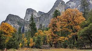 Bridalveil FallsEventually, we dragged ourselves out of the motorhome, leaving it for once in its campsite, as we actually now had one for more than one night, and headed out in the Subaru to do our circle around the Valley.
Everything did look different, especially the lack of smoke from the prescribed burn over by El Cap. And we could breath again. Apparently, the rain had brought the smoke particles down along with it, and now rather than flames, the burn was just a bit of steam.
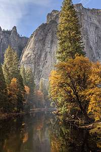 From El Cap BridgeWe wandered around taking photos of some old favorites and also some new ones. Bridalveil Falls was looking pretty good. It is generally a year-round fall, but it was particularly feisty with all the recent rain.
After completing our circuit of the Valley, we returned to the motorhome, which we had actually left behind in the campground today. Finally, we were staying in the same campsite for more than one night.
We decided to have date night and go out for dinner. Because of Covid, the options were fairly limited. The Ahwahnee dining room was only taking reservations for hotel guests and the Mountain Room at Yosemite Lodge was closed.
However, the Mountain Room Lounge was open and serving pizza and craft beers. Sounded perfect. The setting was actually quite nice - large windows and a Swedish-style fireplace to add to the ambiance. The vegetarian pizza we had was quite good and they had a nice selection of craft beers. It was a great alternative to cooking in the motorhome.
Despite being a negative, the rain today was actually a nice change.
.
Day 8 - Grand Finale - Morning Commute, 17-mile bike ride around Valley, Dinner at the Ahwahnee Bar
.thumbnail.jpg) My favorite secret spot I hate being repetitive, but we got up in the morning, parked the motorhome on Southside Drive, near the Yosemite Valley Chapel where there was that wonderful view of Yosemite Falls with foliage in the foreground, and then did one last drive around the Valley stopping wherever the scenery looked look - so, in other words, we stopped a lot.
My favorite secret spot I hate being repetitive, but we got up in the morning, parked the motorhome on Southside Drive, near the Yosemite Valley Chapel where there was that wonderful view of Yosemite Falls with foliage in the foreground, and then did one last drive around the Valley stopping wherever the scenery looked look - so, in other words, we stopped a lot.
We did return to what I consider to be the most photogenic spot in the entire Valley, because the day before a photographer with a tripod had situated himself in the absolutely best vantage point and had no intention of moving for some time.
To get to it, you have to park along Southside Drive about ½ mile west of the turnoff for Wawona Road. From there, you just walk a short distance to the river looking for an opening with red foliage on the right, and a lovely bend in the Merced River flowing directly towards El Cap in the background.
.thumbnail.jpg) Time for a bike rideAfter lunch back in the motorhome, we decided we needed some exercise so hopped on our bikes for another loop around the Valley. As I have mentioned before, bikes are my absolute favorite mode of transportation. It’s so nice to just cruise along with the scenery rushing by -- actually the scenery was standing still and we were doing the rushing.
Time for a bike rideAfter lunch back in the motorhome, we decided we needed some exercise so hopped on our bikes for another loop around the Valley. As I have mentioned before, bikes are my absolute favorite mode of transportation. It’s so nice to just cruise along with the scenery rushing by -- actually the scenery was standing still and we were doing the rushing.
We set off east on Southside Drive past the cute little Chapel, made a left on a path that went along a bridge over the Merced and brought us to the Northside Drive near the path to Little Yosemite Falls.
Skipping that for now, we crossed Northside Drive to get on the bike path that brought us through Camp 4 before crossing the road again to a dirt path that eventually brought us to one of our beaches along the river.
Continuing on, we got back to the Northside Drive, right near El Cap, but rather than take the road we continued straight on a dirt trail between El Cap and the road. It was also the way that climbers setting out to climb it reached its base.
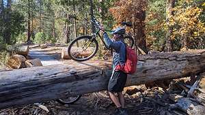 Another log to deal withThe trail was really nice, but obviously not maintained. Every 1/2 mile or so we would come upon a huge tree which had fallen across the path, requiring us to do some he avy lifting of our bikes over it. After the fourth time we had to do this, we decided to get back out onto Northside Drive for a smoother ride.
We stopped at a pullout, where there were at least half a dozen people with tripods set up, to see what they were looking at. It turned out to be a very good view of Bridalveil Falls that we hadn’t seen before.
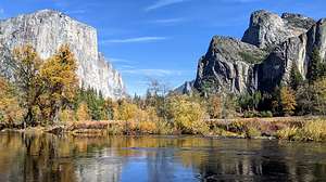 Valley ViewNext stop was the popular Valley View pullout where there is an iconic view of El Capitan on the left and Cathedral Rocks on the right, framing a magnificent valley view - hence, the name.
On the way back along Southside Drive, we made a few more stops: the official Bridalveil Falls Viewpoint, and a spot along the river opposite the Four Mile Trailhead.
As we passed the motorhome, Herb said he had one more stop he wanted to make, to a place he remembered from years ago when we stayed at Housekeeping Camp about 9 years ago. Hey, I was game. I was trying to get to 20 miles and this would help.
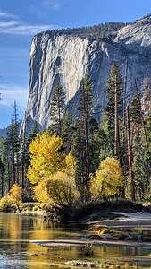 Just one more El CapFirst let me explain a little bit about Housekeeping Camp, as it is a rather unusual place to stay, straddling the line between camping and hotel accomodations. The units (as they are romantically referred to) are pretty rustic. They consist of three concrete walls with the fourth wall being a canvas curtain that you can tie closed. The roof is canvas and extends out over a small patio area with a picnic table and a bear-proof food-storage box. Inside the “unit” is a bunk bed, double bed, small table, and a mirror. Linens for the bed are an extra $2.50 per night. Not exactly the Ahwahnee, but comfortable enough.
When we stayed here in 2012, I was a little jealous when I saw how many of the other units were so cozily decorated, with cute little outside lights, lamps from home, nice quilts, etc. – so warm and homey. Ours had more of a prison cell feel. We hadn’t known what to expect.
The location is absolutely phenomenal – just a stone’s throw away from a nice sandy beach along the Merced River with terrific views of Yosemite Falls. To get to that nice sandy beach you have to walk across a wood and stone bridge with one of the best views of the Falls in Yosemite Valley.
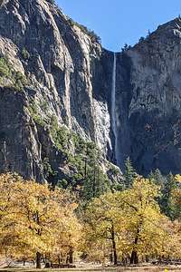 Bridalveil FallsIt was this bridge Herb wanted to find. So, he pedaled into Housekeeping Camp, which is really big (there are 266 units) and proceeded to get lost. Giving up on finding the bridge, we went back out to Southside Drive, turned left, and after the last unit, found a path on the left leading to the river. We took it and sure enough, we came to the bridge.
Herb was right. It did have a tremendous view of the River and the Falls.
We continued on past the bridge, going through what I think used to be either Lower or Upper Pines campground, which were destroyed in the 1997 Merced River Flood. These two campgrounds no longer exist, leaving only three others (Upper, North, and Lower Pines) to accommodate the thousands of people that desperately try to get a reservation.
Surprisingly, we popped out back on Northside Drive in the exact spot I wanted to be - by the Ahwahnee Meadow where in one direction you can see Half Dome and in the other, Yosemite Falls with a lovely stand of trees in the foreground. I acted like I knew this is where we were headed all the time.
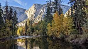 View from Housekeeping Camp bridgeAfter stopping for a few more photos, we biked back to our motorhome by the Yosemite Chapel. It had been a great ride, even if it fell short by a few miles of my 20-mile goal.
That evening, we had another date night, this time at the Ahwahnee Hotel Bar, where I had New England Clam Chowder and an Artichoke Salad and Herb had a Pulled-Pork Sandwich.
Not a bad way to end what had been a really fun trip - filled with many old favorites and some incredible firsts.
I’m sure we will be back!
Home
Saturday, August 21, 2021 - 9:15am by Lolo388 miles and 6.5 hours from our last stop - 1 night stay
Travelogue
Home Sweet Home
Grants Pass
Friday, August 20, 2021 - 9:15am by Lolo515 miles and 9 hours from our last stop - 1 night stay
Travelogue
 Grants Pass Historic DistrictHome was over 15 hours away, which meant we weren’t going to make it in one day. Smoke was making most inland destinations unpleasant, so we would just have to look for a place to stop when we started getting tired.
We decided 9 hours was a good enough chunk of driving, so we found a place to stay in Grants Pass, Oregon, which is actually a destination in itself, especially for those wishing to raft the Rogue River.
After checking into a Knights Inn, we set out to walk up the main drag, which has been designated a National Historic District because of its historic buildings. A big banner proclaiming “It’s the Climate” greets visitors upon entry.
 Tap Rock Restaurant gardensWe had two dinner places in mind. One, very popular one was called Tap Rock, and it is located right on the Rogue River with a lovely outdoor dining patio. The other one, the Twisted Cork, was supposed to have the best food in town.
Since we were passing the Twisted Cork first, we decided to stop in to look at the menu. Looked great, but the wait for an outdoor table was 45 minutes. Although we could sit inside right away, because of Covid, we decided to put our name in for an outdoor table. So glad we did, because we later learned that Grants Pass is in the county with the worst outbreak of Covid right now.
 Dinner at the Twisted CorkWe continued walking through town to the riverfront and stopped in Tap Rock only to find that their wait would be an hour and a half. While we were mulling over our decision, which was a tough one because their location was truly spectacular, the Twisted Cork called me to tell me that they were ready to seat us outdoor now.
Not wanting to eat at 9:30, we headed back to the Twisted Cork, where we had the best dinner of our entire trip. We both had the Creamy Alfredo Linguini - me with Shrimp and Herb with chicken. It was absolutely delicious.
It was a nice way to end a wonderful road trip
Olympic National Park
Monday, August 16, 2021 - 7:15pm by Lolo150 miles and 3 hours from our last stop - 4 night stay
Travelogue
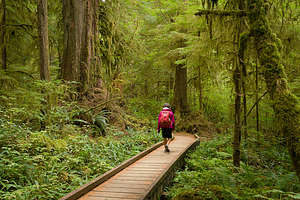 Quinault RainforestOlympic National Park encompasses over 1,400 square miles of the Olympic Peninsula in northwest Washington State. It is a land of tremendous variety with several distinct ecosystems: glacier-covered mountains, 60 miles of rugged Pacific coastline, a lush temperate rain forest, and subalpine meadows full of wildflowers. The western slopes of the mountains receive more than 200 inches a year of precipitation, giving it the distinction of being the wettest climate in the Continental U.S.
There is no road that runs through the entire park. While US 101 goes through a few sections of the park, access is mostly from spur roads that lead from US 101 into such areas as Hurricane Ridge, Sole Duc, the Hoh Rain Forest, and Rialto Beach.
Lake Quinault and the Quinault Rainforest
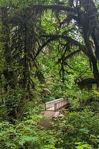 Quinault RainforestSince we were approaching the Park on US 101 from the south, the first section of the National Park we came to was Lake Quinault and the Quinault Rainforest - one of the few parts of the park we hadn’t seen on previous visits.
The lake was lovely, surrounded by steep mountains and a rainforest near its southern shore. The Quinault Rainforest is one of the three major rainforests on the Olympic Peninsula, receiving 167 inches of rain a year. Today was the only rainy day forecasted so far on our trip, but what better place to spend it than in a rainforest.
There is a popular 0.6-mile Rainforest Trail, but we wanted to do the more ambitious 5-mile Quinault Loop National Recreation Trail, which started up the road a bit across from the USFS Ranger Station.
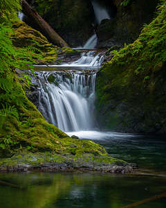 Willaby FallsFrom there we entered a lush forest of huge Douglas firs, Sitka spruce, western hemlock and red-cedar, with lots of ferns and mosses. There were interpretive signs along the way explaining the ecology of the forest. We saw only 2 or 3 people the whole way.
Eventually we came to a junction, which allowed us to continue onto the shorter and therefore more popular Rainforest Trail which led us through a stand of 500-year-old Douglas Firs.
We continued through a tunnel which went under the road towards Willaby Campground and a view of Willaby Falls from a wooden bridge. However, to really see the falls you had to clamber a few yards off trail by the bridge to get a full, unobstructed view of the falls.
From there we walked along the shore of Lake Quinault, eventually coming to the lawn of the historic rustic Lake Quinault Lodge, a very impressive structure that would have been an awesome place to stay. Not exactly cheap though. When I was researching places to stay in the area, I saw that their rooms were around $400 a night and they weren’t even available. Instead we would be lodging at site D011 in the Kalaloch Campground for $13.
The irony was, it didn’t rain a drop our entire time in the Rainforest.
Kalaloch
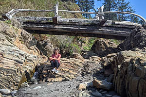 Beach 4However, as we continued our drive up US 101 to Kalaloch, it did start to rain, and not just a drizzle, but a good steady rain. Camping in the back of a 4Runner in the rain is not the greatest experience, so I certainly hoped that the forecast was correct and that it would clear up by mid-afternoon.
The rain did pretty much stop when forecasted, but since there was no real need to check into our campground except to sleep, we decided to explore some of the beaches recommended for their tremendous scenery..
Over the next few days we would try to explore the most beautiful beaches along the Olympic coast. Each of them shared the classic Olympic Peninsula traits - broad and sandy with much driftwood washed ashore, and rock outcroppings, called seas stacks, eerily rising from the sea. Despite that, each of them had their own distinct feel and beauty.
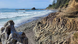 Beach 4We got most of our ideas from our Photographing Washington book, a series that shows the most stunning natural scenery in each of the western states. You don’t have to be a photographer to enjoy spending time on a beautiful beach.
Today, we found time to stroll along three of them.
First up, the rather uncreatively-named Beach 4, just a 3-mile drive north of the Kalaloch Campground. The parking lot was practically full, which was something we would encounter at every beach and trailhead in the park. Since Covid and the discovery by so many Americans that nature is really pretty cool, the national parks have exploded in terms of number of visitors.
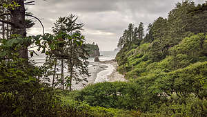 Ruby BeachWe had been to this beach before, in another lifetime back in 2001 when we had gone on a ranger-led guided tour of the tide pools, with our then 10-and 12-year old sons.
This beach, which has been designated a marine wildlife preserve, is known as being one of the best locations in Olympic National Park for exploring the pools..
When we got to the trailhead, we checked the tide chart and found out that unfortunately this week the negative low tides, when the pools are exposed and best visited, occurred at ungodly hours in the middle of the night. So no tide pools for us this visit.
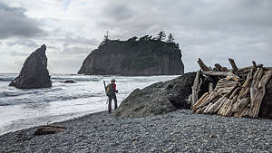 Ruby BeachYou can’t have it all. After all, we did hit Bandon Beach earlier this week at the absolute best timing in terms of tides.
Still, the beach was very beautiful and very much worth the stroll along its rocky shores.
We continued another 5 miles up US 101 to another one of Olympic’s gems, Ruby Beach. This one was so crowded that we had to wait for a parking space.
The 1/4-mile trail down to the beach was steep with good view points of the beach and their signature sea stacks along the way. Unlike some of the other beaches, this one was mostly cobblestones rather than sand.
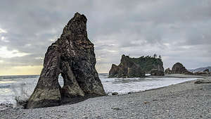 Ruby BeachThere were several interesting sea stacks to admire, including one with two holes that served up all kinds of photographic opportunities. I imagine there is a line up of people during the evening to capture sunset through it.
Also, Cedar Creek ran alongside the beach a bit before flowing into the Ocean providing kids with a fun, safe place to play in the water. Herb and I set our backpacks up against a large driftwood log near the Creek and sat for awhile just enjoying the surroundings.
Our final beach of the day was Kalaloch Beach right from our campground - not too shabby either.
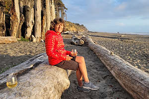 Cocktail hour on Kalaloch BeachWe didn’t go far that night as our main goal was to sit on a driftwood log, sipping wine, and watch the sun set. It didn't disappoint.
There was a cute little cairn on our log, which made for interesting photos of sun rays seeping through the gaps between its individual stones.
Tomorrow we would be moving for 2 nights into one of the rustic cabins atop the bluff further down the beach. I was very excited.
 Cairn sunsetSince we couldn’t check into our cabin until 4:00, we had the whole day to explore. After another walk on “our” beach, we headed north with the intention of visiting the Hoh Rainforest. After driving about 20 miles north on US 101, we turned onto the Upper Hoh Road where it was another 18 miles to the Hoh Rainforest Visitor Center.
Still quite a bit before the Olympic National Park Entrance kiosk, traffic came to a stop and we noticed a sign that said 45 minute wait. Cars would only be allowed in as other cars left. You’ve got to be kidding me. This was the same thing we encountered in Utah when trying to get into Arches National Park. Since Covid, the national park are being overrun with visitors in numbers they have never seen before.
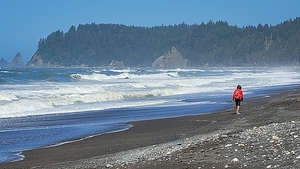 Rialto BeachOh well. We had been to the Hoh Rainforest before and we had just hike in the Quinault Rainforest yesterday, so we decided to make a U-Turn and visit another beach on our list instead..
After returning to US 101, we continued north through the town of Forks where we then made a left and headed west on WA-110. When we came to the fork with Mora Road, we had to make the decision - Rialto Beach to the right, 2nd Beach to the left. They both were on our list of most beautiful beaches.
Maybe we can do both today, I said. Well, we had to start with one, so we sort of randomly chose Rialto Beach maybe because 2nd Beach wasn’t as inspiringly named.
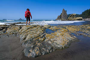 Rialto BeachAt the end of Mora Road, we came to yet another full trailhead parking lot, but fortunately we didn’t have to wait long for someone to pull out.
I think this was my favorite of the sea stack beaches on the Olympic Peninsula - my overall favorite has to be Bandon Beach in Oregon. Everything seemed a bit more dramatic - the crashing waves, the interesting, upright dead tree that looked like it was reaching out to the sea, and the sea stacks themselves.
The best part of all was that there is a natural arch on a rocky outcropping 1.5 miles down the beach called Hole-In-The-Wall. It looked a bit precarious to get to as you had to clamber over rocks to get to it. The high road was drier but required a bit of minor rock climbing and the lower route was slippery and you were sure to get your feet wet.
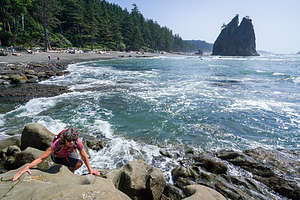 Rialto Beach - rock scrambling to Hole-in-the-WallWe watched people do this for awhile to make sure we wanted to do this, but when I saw enough people a lot less athletic than me, I told Herb let’s go for it. I did take the lower route where I couldn’t fall very far, but did get my sneakers soaked. Herb took the lower route as well, but somehow managed to stay drive.
Safely around the corner, we walked through the arch to an area that would be really cool in terms of tide pools if the tide was lower. Still, we did get to see several anemones.
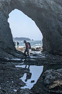 Rialto Beach - Hole-in-the-WallThe tide was coming in, so we didn’t want to wait too long to make our way back from whence we came. It was easier on the way back, because my sneakers were already so wet that I didn't care about stepping in the water.
It was already 3:00, and I was pretty excited about checking into our cozy rustic cabin, so we decided to save 2nd Beach for another day.
We had stayed in these cabins in 1990, when we brought Andrew here as a one-year-old, so these cabins had a very nostalgic place in our hearts. However, this time would be a lot more quiet and peaceful.
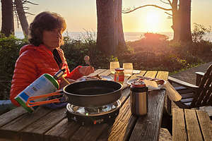 Kalaloch - dinner at our cabinI was a little disappointed that we got the cabin on the very end, where there were trees obstructing our view of the ocean a bit, but it was still very nice. Rather than getting take-out food tonight at the Lodge, we decided to cook one of our backpacking meals on the patio, watching a lovely sunset through the trees.
After sunset, I convinced Herb that he really wanted to make a fire in the cabin’s wood burning stove. All the fixings were there - logs, kindling, and even a starter block. So, we set up our camping chairs in front of the stove and spent a cozy evening sipping wine before the fire.
Since we had the cabin for two nights, we decided to spend the entire day in the Kalaloch area.
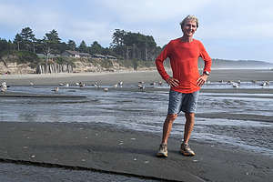 Post-run along Kalaloch BeachWe started off the morning with an invigorating 5-mile run along the beach. I usually hate running on sand, but the sand on this beach was hard enough to make it fun. We did have to take our sneakers off to cross the Kalaloch Creek which flows into the ocean right by the lodge. It was so much fun.
After that we went over to the Kalaloch Lodge to enjoy lunch on their outdoor patio overlooking the Kalaloch Creek we had crossed earlier that morning. The food was good and the view was wonderful.
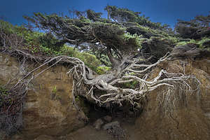 Tree of LifeLater that afternoon, we went for another stroll (and stream crossing) along the Kalaloch Beach. One of the most interesting features we discovered along the way was the Tree of Life (aka Tree Root Cave), a large sitka spruce on the edge of the bluff with its roots totally exposed, hanging onto nothing but air.
Somehow this amazing tree has managed to survive, despite having no soil or roots to anchor it in place. The tree seems to defy nature and the frequent storms that topple trees more firmly anchored in the soil.
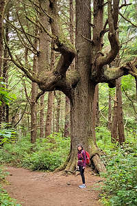 2nd BeachMagic? Probably not, but that doesn’t stop beach strollers from paying homage to it - taking photos standing beneath its exposed roots. Of course, we had to do the same.
Another evening, another beautiful sunset and a cozy fire in our cabin.
It had been a lovely stop in Kalaloch, but we weren’t quite done with Olympic National Park yet. I had managed to get a campsite in the Sol Duc Hot Springs Campground, a section of the Park that we had never been to before.
On the way to Sol Duc, we decided to do a side trip to 2nd Beach, the last on my list of best beaches in Olympic National Park. So, when we got to Forks, rather than continuing on US 101, we once again made the turn onto WA-110, but this time we took it all the ways to its end rather than turning right on Mora Road towards Rialto Beach.
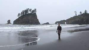 2nd BeachWe headed out on the 2nd Beach trail which took us through a lush, dense forest before leading us out onto another sandy beach with a rocky headland to the north and a large,tree-topped sea stack just offshore.
It was quite overcast as we strolled up the beach, but with the exception of 2 hours of drizzle a few days ago, we had managed to avoid being rained on during our entire trip.
Sol Duc Hot Springs
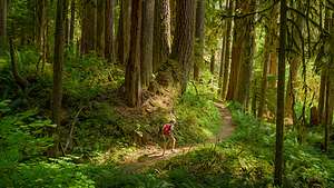 Hike to Sol Duc FallsBack in the car we continued on US 101 towards the Sol Duc Hot Springs resort where we had a campground reservation for that night. This resort is the most commercially developed area in Olympic National Park. Since 1912, tourists have been coming here to experience the medicinal healing of the hot springs.
Although we planned to partake in a hot spring soak later in the day, our first order of business was a hike to Sol Duc Falls. Conveniently, the trailhead for the hike was right from our campground.
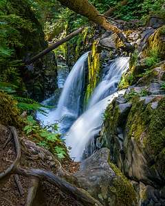 Sol Duc FallsWe left the campground and entered a lovely forest of towering conifers and maples draped in Spanish moss. Not another soul was to be seen until our campground trail converged with the one starting at the major trailhead.
At a little over 2 miles we came to a wooden footbridge over a deep gorge, just 50 yards downstream from where the Sol Duc Falls cascades 50 feet before rushing through the narrow chasm under the bridge.
Wow! With the terrible drought in California this summer, we weren’t used to seeing and hearing water rushing anywhere. It was so refreshingly beautiful and all the vegetation around it was so green and lush..
Although the view from the bridge was good, we found a much better vantage point beyond the bridge by scrambling over some rocks to get down lower to the pool below the falls.
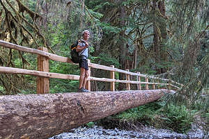 Hike to Sol Duc FallsWhile most people headed back along the trail we hiked in on, we continued on to the recommended Lover’s Lane trail. At first I didn’t like the trail, as it was rocky, unlike the soft pine needle covered trail on the way in. However, it got easier and more interesting and we crossed three footbridges made from huge cut logs, with wooden rails on only one side.
After about 5.5 miles we reached the Sol Duc Hot Springs Resort, where we planned to take a soak, but first we needed to get back to the campground, which was one mile further, to retrieve our bathing suits and towels.
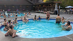 Sol Duc Hot SpringsWe drove back to the resort for the 6:00 - 7:30 soaking session. Prices for adults (12+) are $15, but only $12 for Seniors (62+).
There are three mineral hot spring soaking pools to choose from and one freshwater pool. The small mineral pool is 99°, the medium 104°, and the large one 101°.
We choses to spend an enjoyable hour in the 101 degree one. Even that one was hot enough to make us switch back and forth between soaking and sitting along the pool’s edge, and a dip in the 85° freshwater one.
 Lolo enjoying Sol Duc Hot SpringsThe next morning we left Sol Duc Hot Springs with the intention of hiking along Hurricane Ridge, the mountainous part of Olympic, but the clouds and threat of rain were definitely not going to be conducive to a hike known for its spectacular view.
Still we had had a wonderful time in Olympic - visiting some old favorites and seeing some new.
Time to head towards home, but a quick look at the smoky conditions in the West pretty much shut down any thoughts of further outdoor activity. We hopped on I5 and headed south.
Aberdeen
Sunday, August 15, 2021 - 7:15pm by Lolo200 miles and 4 hours from our last stop - 1 night stay
Travelogue
 Herb hitting the town in AberdeenWe were able to stay at the beach on Sauvie Island until mid-afternoon, because we didn’t have to drive too far today. All we needed to do was find a place to spend the night somewhere along the way to Kalaloch in Olympic National Park where we would be staying for three nights.
Aberdeen, Washington, was the right distance in that we would arrive in time to go out to dinner, and we would only have another hour to drive tomorrow to get to Olympic National Park. We found an Econo Lodge in walking distance to the 8th Street Ale House, which sounded perfect.
 Aberdeen waterfrontWe had great burgers and beers at the 8th Street Ale House, an establishment obviously frequented by locals, which is always a good sign.
After dinner we took a stroll along the Chehalis River waterfront looking at the fishing boats before returning to our room. Tomorrow we would head to Olympic National Park where we had camping reservations in Kalaloch for one night and then a rustic cabin on the bluff for 2 more.
